Aubrey Falls Provincial Park Management Statement
This document provides policy direction for the protection, development and management of Aubrey Falls Provincial Park and its resources.
Approval statement
This Interim Management Statement will provide direction for the management of Aubrey Falls Provincial Park until a comprehensive Park Management Plan is prepared. Management of the Park will be under the jurisdiction of the Superintendent of Mississagi Provincial Park.
This statement will provide the basis for the subsequent preparation of the Park Management Plan.
I am pleased to approve this Interim Management Statement for Aubrey Falls Provincial Park.
Al Stewart
Regional Director
Central Region
Background information
Name: Aubrey Falls Provincial Park
Classification: Natural-Environment
Site Region/Site District: Great Lakes Southern Boreal Transition Forest/4E3
OMNR Administrative Region/District: Central Region/Sault Ste Marie
Total Area (ha): 4705
Regulation Date: 1985
Targets
Earth science representation
surficial geology:
provincially significant glacial spilway lag deposits (c. 6000 yrs BP)
Life science representation
landscape unit:
- warmer / dry mesic / sand: jack pine
- warmer / mesic/loam: sugar maple / yellow birch
- warmer / dry / sand: white birch / red pine / jack pine / trembling aspen
- normal / dry mesic / sand: white birch / jack pine
- normal / wet mesic/organic: white cedar / white spruce / white birch / alder
- colder / very wet / sand: alder
Cultural resources representation
no research as of this date, no documented cultural heritage
Recreation opportunities
viewing; walking; photography; camping is available on adjacent land
Inventories
| Survey Level | Earth Science | Life Science | Cultural | Recreational | Other |
|---|---|---|---|---|---|
| Reconnaissance | 1980 | 1983/1993 | Needed | needed | N/A |
| Detailed | N/A | 1991 | N/A | N/A | N/A |
| Requirement | theme study | site district report | N/A | N/A | N/A |
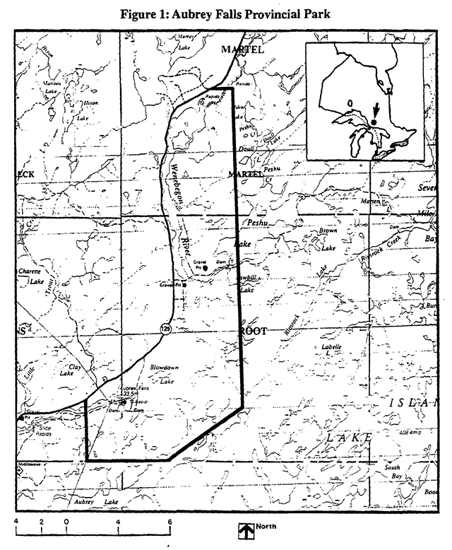
Enlarge Figure 1: Aubrey Falls Provincial Park map (PDF).
Management guidelines
Interim management statements identify: park values; guidelines to protect those values; and restrictions on use.
Lands
Aubrey Falls Provincial Park was designated in 1985. The Park includes 4 705 ha (Figure 1). Ontario Hydro holds a water power lease agreement and two licenses of occupation within the Park. The balance of the Park is Crown land.
Guidelines
All Crown land will be retained within the Park. The power lease agreement and licenses of occupation will remain. Ontario Hydro’s use of access roads to service their facilities will continue. A candidate Area of Natural and Scientific Interest has been identified on the north east side of the park. This small feature contains both geological and biological values that could add to the , representation and diversity of the park. Approaches to the conservation of these features will be developed.
Existing/proposed development
The Park is located 80 kilometers north of Thessalon on the east side of Highway 129.
Aubrey Falls viewing area, associated trail and parking are accessed from Highway 129.
The Park contains one additional developed access point on the Wenebegon River, south of the Peshu Lake Road. The Ministry of Natural Resources operates a project base at the south end of Peshu Lake. Associated with this operation is an air strip which is used for resource management purposes.
Guidelines
Maintenance of the Aubrey Falls viewing area and associated facilities will continue as funds and priorities permit. The Peshu Lake project base is a seasonal operation and is not open to the public. Any new development proposals will be reviewed with the public in the management planning process.
Recreation activities
The Park is the end point of two canoe routes and is the starting point of one other. Hiking, fishing, hunting, boating, picnicking, and snowmobiling opportunities are all available. Camping is presently permitted at one access point.
Guidelines
Recreational activities will be permitted to continue in as much as they do not affect Park values. Camping use will be reviewed.
Commercial activities
Bait fishing and trapping are the only commercial activities presently taking place in the Park.
Guidelines
Bait fishing will be phased out in the future when the present licensee no longer requires the area. The license is not transferrable. Consistent with Provincial Parks Policy Implementation Details released in 1989 the existing trapping will be phased out in 2010 or before this date should the existing trapper retire the line. The trapline is not transferrable.
Other commercial activities including forestry, mining, aggregate extraction, and commercial tourism will not be permitted.
Natural and cultural resources
There are no existing natural or cultural resource management plans affecting the area with the exception of a district fire management plan.
Some earth science features and archaeological sites have been reported including an area adjacent to but outside the park. Life science values were identified for this same feature.
Forest management seed collections have occurred in the past within Red Pine plantations that were established in the area prior to park establishment.
Guidelines
Fire management will continue under the district fire management plan. Natural and cultural resources information will be collected as part of future management planning work.
Seed collection and plantation tending needs will not occur in the Park.
Visitor services
A display board and a trail guide exist for the Aubrey Falls viewing area. A fact sheet describes the location, access, natural features, recreational opportunities and facilities, and cautions about use.
Guidelines
The above services will continue to be provided.
Research
Life science and earth science studies will be conducted at a future date as background information is collected for Park management planning.
Marketing
Aubrey Falls trail is promoted in a variety of area tourism brochures and commercial tourism publications. The last portage on the Mississagi River canoe route also identifies this impressive site.
Guidelines
The Ontario Ministry of Natural Resources will not actively promote this Park until management and development plans have been completed.
References
The following lists all material cited in the Interim Management Statement, as well as other relevant sources of information on the Park such as District Land Use Guidelines, inventory reports, checksheets, etc.
Forest Resource Inventory Maps - Rolins, Root and Martel
Frey, E. 1980. Preliminary Geological Nature Reserve Candidates for the Northeastern Region for the Ontario Ministry of Natural Resources.
Frey, E. 1991. Earth Science Systems Plan, 1991. Geomatics International, 1992. Assessment of Representation Needs of Natural Areas and Features in the Southern Boreal Forest Site Region 4E, Site District 4E3 for Ontario Ministry of Natural Resources, Sudbury 79 pp.
Macdonald, I. D. 1979. Aubrey Falls Park Reserve Life Science Check Sheet for the Ontario Ministry of Natural Resources.
Noble, T.W. 1983. Reconnaissance Inventory of Site Region 4E, unpublished report to OMNR. Sudbury.
Ontario Ministry of Natural Resources, 1982. Park System Planning in Ontario.
Ontario Ministry of Natural Resources, 1989. Provincial Parks Policy Implementation Details. 9 pp.
Provincial Parks and Natural Heritage Policy Branch, 1992. Provincial Parks: Planning and Management Policies (update). 90 pp.
Ontario Ministry of Natural Resources, Backgrounder. Land Use Guidelines, 1983.
Ontario Ministry of Natural Resources, Blind River District Land Use Guidelines, 1983.