North Driftwood River Provincial Park Management Statement
This document provides policy direction for the protection, development and management of North Driftwood River Provincial Park and its resources.
March, 1985
Regional Director’s approval statement
I am pleased to approve this Interim Management Statement for North Driftwood River Provincial Park.
This Statement will provide direction for the management of North Driftwood River Provincial Park until a Park Management Plan is completed. It will also set the general direction for the preparation of the more detailed management policies that the Management Plan will contain.
Signed,
R.A. Riley
Regional Director
Northern Region
Background
Name: North Driftwood River Provincial Park
Proposed class: Nature Reserve
M.N.R. District: Cochrane
M.N.R. Region: Northern
Area (ha.): 2.88
Site region: [no information provided]
Site district: [no information provided]
Date in regulation: [no information provided]
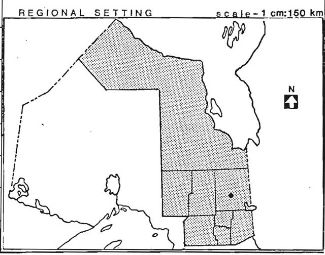
Figure 1: Regional setting
Life science target
- Site type/landscape unit: [no information provided]
- Species/communities: [no information provided]
Earth science target
- Geological theme:
- Quaternary — Late Wisconsinan Cochrane Till member of North Driftwood
- Feature:
- Cochrane Till member of North Driftwood Formation
Cultural resource target
- Theme: [no information provided]
- Theme segment: [no information provided]
Recreation opportunities target
- Day use: [no information provided]
- Car camping: [no information provided]
- Wilderness back country: [no information provided]
Inventories
| level type | earth science | life science | cultural | recreational |
|---|---|---|---|---|
| Reconnaissance completed | yes | no | no | no |
| detailed completed | yes | no | no | no |
| required | no | no | no | no |
Potential resource use conflict
Licenced to Ontario Paper
Material appended
D.L.U.G. extract ☑
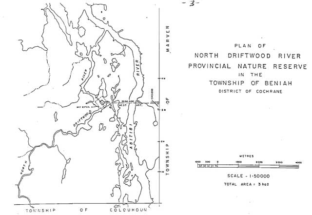
Map 1: Plan of North Driftwood River Provincial Nature Reserve in the Township of Beniah District of Cochrane
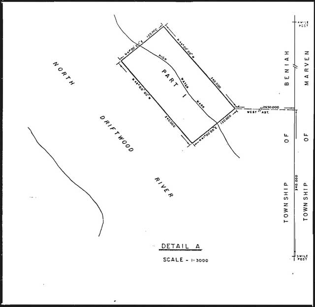
Map 2: Detail A
Management statement
1.0 Issues
There are no relevant management issues for this park.
2.0 Resource management guidelines
2.1 Mineral resources management
Analysis
The nature reserve status of the park protects it from any form of degrading land use/activity including such forms of surface exploration/mining as open pit mining.
Guidelines
Geological research may be authorized by the district manager provided that such activity enhances knowledge/understanding of the geological features, and that the results of such work are made available to mineral exploration/ extraction will not be permitted.
Recommendation
That the guidelines be implemented with the approval of the plan.
2.2 Wildlife management
Analysis
The park falls within trapline CC-89.
Guidelines
As hunting and trapping pose no threat, to the resource these activities will be permitted.
Recommendation
That the guidelines be implemented with the approval of the plan and following appropriate changes to regulations under the Game and Fish Act.
2.3 Vegetation management
Analysis
The park contains no known significant vegetation sites.
Guidelines
Silviculture which enhances the park’s geological features will be permitted.
Recommendation
That the guidelines be implemented with the approval of the plan.
3.0 Client services management guidelines
3.1 Information
Basic information about North Driftwood River Provincial Park will be produced for geologists and students. Specifically, a small leaflet providing information about access, the park’s significance, references, and so forth, using photos, access and geological maps, and text should be adequate.
3.2 Education
Prospective visitors should be warned of the resource’s vulnerability to damage from collectors; for example in any publication which is produced for the park.
3.3 Development
At present, the site is undeveloped and access is restricted to the use of watercraft. This situation facilitates protection of the site from human impact, and will be maintained.
4.0 Research
The Ontario Provincial Parks Planning and Management Policies describe scientific research policy in nature reserves as follows (NR-IV-10)
Scientific research by qualified individuals, which contributes to knowledge of natural history and to environmental management, will be encouraged in Nature Reserves.
All research programmes will require the approval of the Ministry of Natural Resources and must also meet all requirements under applicable provincial and federal legislation. The Ministry may approve the removal of geological samples by qualified researchers. Approved research activities and facilities will be compatible with protection values in individual Reserves, and will be subject to development and management policies for Nature Reserves unless special permission is given. Sites altered by research activities will be rehabilitated as closely to their previous condition as possible.
Appendix 1: Natural resources background information
Frey (1980) appraises the park’s earth science features as being of national significance according to the following rationale.
This section is the internationally recognized reference to the Cochrane Till (INQUA, 1977, p. 24-26) and displays clearly the transitional boundaries between the glacially deposited Cochrane Till, the underlying glaciolacustrine sediments of the Barlow-ojibway Formation, and the overlying North Driftwood Formation glaciolacustrine sediments (Hughes, 1965, p. 544-546).
Appendix 2: District land use guidelines
17 a-h Earth science nature reserve features
- Area description
Earth science nature reserves are relatively small significant or representative areas that are identified to achieve part of the Ministry’s protection heritage appreciation objectives. Across the Cochrane District, eight such sites have been identified outside of provincial parks and park candidates. These areas are:
Site Township Area (ha.) Significance Site a Hobson 4.0 Provincial b Hobson 0.7 Provincial c Valentine 1.5 Provincial d Valentine 2.44 National e Valentine 2.44 Provincial f Pitt 2.44 Provincial g Beniah 1.22 National h Wilkie 1.22 National These various geological features cover an area of 15.96 hectares in total. Six of these areas have reserved flooding rights that are held by Ontario Hydro.
Three of these sites are nationally recognized standard reference sections for various earth science formations. The other five are provincially recognized.
- Land use intent
These areas are being recommended for park status.
Due to the size of the areas, and given the variety of uses that are ongoing within them, it is further recommended that most of the ongoing activities within the areas be permitted to continue. The exception to this would be commercial logging which is not recommended as a continuing use. An outline of these ongoing activities which are recommended for continuation is given in the Land Use Activity section, however it must be realized that in some instances further refinement may be required.
- Land use activity for area No. 17a-h — Earth Science Nature Reserve features
Activity Acceptable
YesAcceptable
NoRecommended guidelines Aggregate extraction x Agriculture x Bait fishing x Not applicable Commercial fishing x Cottaging x Crown Land Recreation x Hunting x It is recommended that hunting be permitted to continue. Mining x Provincial Parks x Recommended for park status Beach x Beach Residential x Sport fishing x Trapping x It is recommended that existing trapping activity be permitted to continue. Wildlife viewing x Wild rice harvesting x Urban development x Other x The Ministry will continue to work closely with Ontario Hydra concerning the planning and design of any future hydraulic proposals in the area.
References
Frey, E. “Candidate Earth Science Nature Reserves”, Northern Region (unpublished), 1980.
Hughes, O.L. “Surficial Geology of Part of the Cochrane District, Ontario, Canada” in International Studies on the Quaternary (H.E. Wright, Jr. and D.G. Frey), Geological Society of American, Special Paper 84, 1986.
INQUA. Quaternary Stratotypes of North American, Volume 1. Sub-commission on North American Quaternary Stratigraphy, International Union for Quaternary Research, 1977.
Ontario Ministry of Natural Resources. Cochrane District Land Use Plan, Background Information. 1981.
Ontario Ministry of Natural Resources. Cochrane District Land Use Plan, Proposed Policy and Planning Options, 1983.
Ontario Ministry of Natural Resources. Ontario Provincial Parks Planning and Management Policies, 1978.
Ontario Ministry of Natural Resources. Report of the Task Force on Parks System Planning, Volume 1, 1981.
Ontario Ministry of Natural Resources. Land Use Guidelines, Cochrane District, 1983.