Opeongo River Provincial Park Management Statement
This document provides policy direction for the protection, development and management of Opeongo River Provincial Park and its resources.
Regional Director’s approval statement
This interim Management Statement will provide interim direction for the Management of Opeongo River Provincial Park until a comprehensive Management Plan is prepared.
This statement will provide the basis for the subsequent preparation of the Park Management Plan.
I am pleased to approve this interim Management Statement for Opeongo River Provincial park.
R. M. Christie
Regional Director
Algonquin Region
Background information
- Name: Opeongo River
- Class: Waterway
- M.N.R. district: Algonquin Park
- M.N.R. region: Algonquin
- Total area (ha): 955
- Land: [no information provided]
- Water: [no information provided]
- Site region: 5E
- Site district: 9
- Date in regulation: March 4 1985
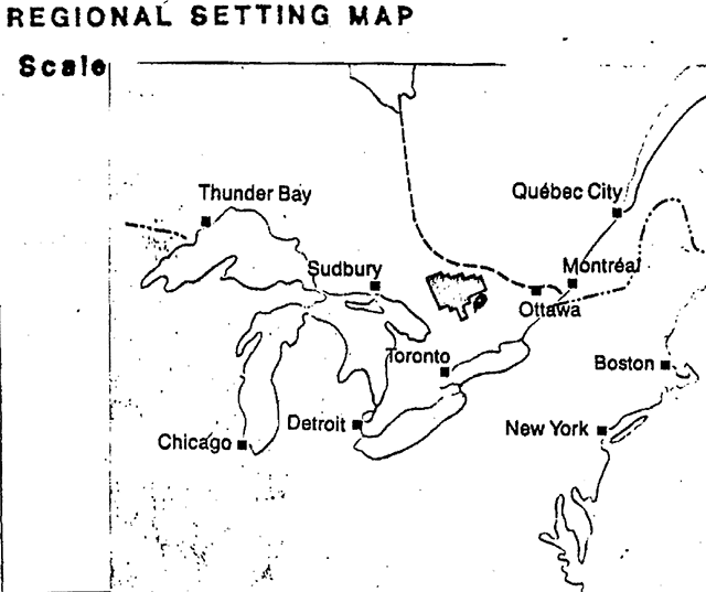
Regional setting map
Targets
1. Life science representation
Site type/landscape unit
River Valley Complex: Bare bedrock, steep slopes
Species/communities
No known significant features associated vegetation communities
2. Earth science representation
Geological theme
Outwash, monzonitic rocks
Feature
Late Wisconsin: Spillway system, outwash sand and gravel
3. Cultural resource representation
Theme
Lumbering: Further study to determine extent of Resource
Theme segment
- Ottawa Valley Square Timber
- Ottawa Valley Lumber
4. Recreation opportunities
- Day use: Nil
- Car camping: Nil
- Wilderness/back country: 1,000
Inventories
| level/type | earth science | life science | cultural | recreational | other |
|---|---|---|---|---|---|
| reconnaissance/completion date | 1978 | 1978 | N/A | ||
| detailed completion date | 1979 | N/A | |||
| required? | Yes |
Date: Aug. 14/85
Map of plan of Opeongo River Provincial Park in the Townships of Clancy, Dickens and Murchison, District of Nipissing
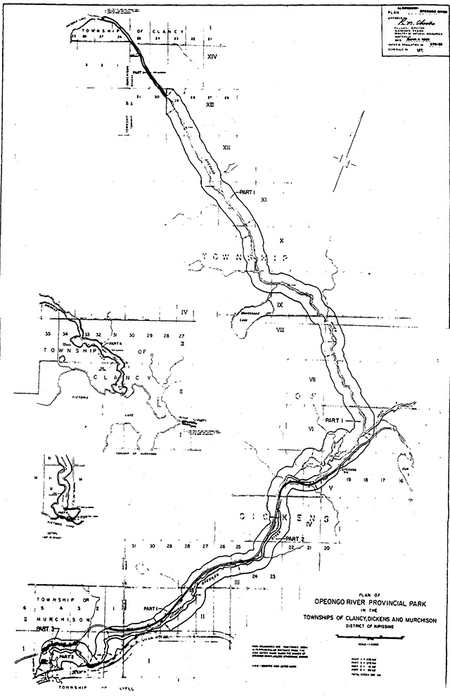
Opeongo River
Land tenure
Presently there are four hunt camps (LUPs), and one trapping cabin within the park boundary.
Guideline
Present form of land tenure will remain. No further disposition of Crown land.
Existing and proposed development
Presently no developments or improvements exist. Approximately 10 campsites along the shore of Victoria Lake are maintained by the Salvation Army.
Guideline
Development should primarily deal with:
- provision of low intensity campsites and privies, along the river,
- improvement to and/or development of portages
footnote 1 . - removal of refuse.
- maintenance of any campsites on Victoria Lake should be carried out by Ministry staff.
Recreational activities
Present activities are limited to small numbers of users undertaking canoeing, kayaking, fishing and camping. Sport hunting occurs from organized camps. Waterway recreation is limited to spring and early summer due to extremely low water levels the remainder of the season.
Guideline
Existing recreational activities will be allowed to continue.
Regulation to permit hunting once the park area is regulated under the Provincial Parks Act will be implemented.
Commercial activities
Trapping presently takes place. There is a current Order-in-Council timber licence with Murray Bros. Lumber Co. which runs to 1990 with no renewal clause.
Guideline
Trapping will be allowed to continue as an interim activity and should be considered as long term activity.
Interim forestry activities will be carried out under the terms of the existinq licence. Theere is a 100 meter no cut zone (MDZ) on each side of the river, and a further 100 meters on each side modified cut (MMA) to the park boundary. Upon expiry in 1990, the area within the park boundary should be removed from any future logging activity.
Natural resources
Deer yard management occurs at present.
Guideline
Deer yard management to continue.
Cultural resources
Numerous remains of logging activity structures (i.e. glance piers) exist along the river.
Guideline
Existing structures should not be modified.
Client services
Management of the waterway park requires control of access and provision of information to users.
Guideline
Access should be controlled through the Shall Lake Access Point of Algonquin Park where the existing facilities will allow the provision of user information and control of the number of users.
Information should be provided on the basic aspects of river use, e.g. access, type and location of facilities such as campsites and portages, water levels, and hazards. A publication and map denailing this type of information should be provided.
Research
Guideline
Further study is required of the historical resources found along the river.
Marketing
There is a need to identify and promote the specific recreational opportunities available on this waterway park.
Guideline
The Algonquin Park canoe Route map should be modified to provide appropriate identification and description of the waterway park.
An interim publication may be required detailing information on the park.
Sources/references
Bancroft District Land Use Guidelines.
Backgrounder: Land Use Guidelines (1983)
H. Simpson: Life Science Inventory Check-Sheet
Loney Dickson: Life Science Inventory Checklist (1978)
Park Impact Assessment Sheet.
Ontario nature reserves program - Life science inventory check-sheet: Opeongo River
- Name: Opeongo River
- Map name: Round Lake
- Map number: 31F/12
- UTM ref.: 747508
- County, district or regional municipality: Nipissing District
- Lat: 45°34'N
- Long.: 77°54'W
- Alt. min: 1,050 ft.
- Alt. max.: 1,250 ft.
- Locality: Victoria Lake to Hwy. 60 (20 mi.)
- Township:
- Dickens
- Murchison
- Lots: [no information provided]
- Concessions: [no information provided]
- Area: [no information provided]
- Ownership: Ministry of Natural Resources
- Administration: Ministry of Natural Resources
- Forest region and district: [no information provided]
- Site district: 5E-9
- Map region and district: ALG. Algonquin
- Conservation Authority: [no information provided]
Aerial photographs
- Base map: [no information provided]
- Year: [no information provided]
- Roll: [no information provided]
- Flight line: [no information provided]
- Numbers: [no information provided]
Significant representative features
- no known significant features
- some representative communities: white pine, sugar maple, poplar, and white birch forests, wet-meadows and shoreline habitats.
Functional & management considerations
[no information provided]
Data sheets attached
- Vegetation summary
Major information sources
A Brief Life Science Inventory of the Opeong River, 1978 - A. L. Dickson - MNR unpublished report.
Evaluation and priorities
- low life science value
- Date compiled [no information provided]
- Compiler: H. Simpson
Earth science inventory checklist: Opeongo River Proposal
- Name of the area: Opeongo River Proposal
- Feature: Outwash, Monzonitic rocks
- Map name: Round Lake, West half
- Map number: 31F/12
- UTM ref.: 745500
- County: Nipissing District
- Township: Dickens
- Crown: Ownership and patented land use
- Location: Access via Highway 60 to Victoria Lake, take Shall Lake access road into Algonquin Park to north end of reserve.
- Air photos:: [no information provided]
- Docket:: [no information provided]
- Year: 1969
- Flight line: See [table] below
- Roll #: See [table] below
- Numbers: See [table] below
- Significance: Low. Rock types are common
- Sensitivity: Outwash gravel is being extracted close to the reserve.
- Compiler: C. M. Spek
- Field work: August 14-16, 1978
Flight line Roll # Numbers 4522 40 109-112 4523 61 27-30 4524 53 226-229 4525 59 59-63 4526 29 139-141
Bedrock geology
According to O.D.M. Map 2197 (1970) and Lumbers (1976) the river is underlain by Middle to Late Precambrian gneisses and quartz monzonite. The river valley is fault controlled by a major northwest trending fault and a minor intersetting northeast fault (Trusler, 1975).
The best bedrock exposure occurs along the upper middle section of the reserve which is also the least accessible area. The river is underlain in part by garnetbearing monzonitic rocks. Small outcrops were encountered upstream from a cabin at UTM 728531. Minor faulting was evident in the river bed due to low-water conditions.
At 719532 an outcrop of augen rich biotite gneiss was visible. Several small areas of deeply weathered gneiss were also visible.
Minor faulting was also evident in the river bed at low water. The bedrock has been broken into rectangular blocks.
About ¾ of a mile north of the ford at Aylen Creek a small road branches off to the right. Half a mile down the road is a small quarry known as the Five Mile Quarry (Sabina, 1970). This is a pegmatite occurrence. Allanite, pink garnet, chlorite pryroxene and titanite occur here. The quarry is partly overgrown.
Surficial geology
The present channel of the Opeongo River carried glacial meltwaters during the Late [text unavailable].
Footnotes
- footnote[1] Back to paragraph The identification and development of portages should be an immediate priority for user safety