Rawhide Lake Conservation Reserve Management Statement
This document provides policy direction for the protection, development and management of the Rawhide Lake Conservation Reserve and its resources.
Statement of Conservation Interest (C244)
Ministry of Natural Resources
Sault Ste. Marie District
Northshore Area
Ministry of Natural Resources
Ce document est seulement disponsible en anglais.
February, 2005
Sault Ste. Marie District
Ministry of Natural Resources
Approval statement
I am pleased to approve this Statement of Conservation Interest (SCI) for Rawhide Lake Conservation Reserve (C244).
Rawhide Lake Conservation Reserve was established to protect old-growth red and white pine stands, as well as a system of clean and clear, coldwater lakes. Thunder Mountain, a spiritual site for Aboriginal peoples, is also protected within the conservation reserve. Regulated on April 6, 2001, this 4,633 hectare conservation reserve is located approximately 28 kilometres north of the City of Elliot Lake. It is situated mainly in Sagard and Viel townships with small portions extending into Raimbault and Piche townships. Two small areas with a combined area of 139 hectares, adjacent to the conservation reserve in Sagard Township, remain designated as Rawhide Lake Forest Reserve. The intent is to include these lands in the conservation reserve if/when the existing mining tenure lapses and the lands become available for regulation under the Public Lands Act.
Direction for establishing, planning and managing conservation reserves is defined under the Public Lands Act, the Ontario’s Living Legacy Land Use Strategy, and other applicable policies. The specific direction for managing this conservation reserve is in the form of a Statement of Conservation Interest, which defines the area to which the plan applies, provides the purpose for which the conservation reserve has been proposed, and outlines the Ministry of Natural Resources' management intent for the protected area. This SCI has been created with input from program specialists within Sault Ste. Marie District. It will provide both the foundation for the continued monitoring of activities and guidance for the management of the conservation reserve. More detailed direction at this time is not anticipated. However, should significant facility development be considered or complex issues arise requiring additional studies, more detailed management direction in the form of special protection measures, or a detailed Resource Management Plan, will be prepared with full public consultation.
Public and Aboriginal comments were solicited prior to the regulation of this conservation reserve. An additional 15-day review period took place in December, 2004 that provided stakeholders with an opportunity to comment on the draft SCI. Some Aboriginal communities chose not to participate in either of these comment periods. Comments from the SCI review period have been considered in the completion of this document.
The management guidelines outlined in this SCI will be implemented by the Northshore Area Supervisor, and will be reviewed every five years and amended as required by the District Planner, Sault Ste. Marie District, Ministry of Natural Resources.
Written by:
Sheila Walsh, OLL Planner
Date: February 22, 2005
Submitted by:
Erin Nixon, District Planner
Date: February 23, 2005
Recommended for approval by:
Dick Hagman
Northshore Area Supervisor
Date: March 02, 2005
Recommended for approval by:
Trevor Woods
District Manager, Sault Ste. Marie
Date: March 21, 2005
Approved by:
Rob Galloway
Regional Director, Northeast Region
Date: April 05, 2005
1.0 Introduction
The following document is a Statement of Conservation Interest (SCI) for Rawhide Lake Conservation Reserve (C244). The purpose of this SCI is to identify and describe the natural, recreational, and cultural values of Rawhide Lake Conservation Reserve and the adjoining Rawhide Lake Forest Reserve, and to outline the Ministry of Natural Resources' management intent for these areas. Sections 1 to 3 of this document highlight the provincial context in which it was produced, state its goal and objectives, and summarize the planning process for conservation reserves. Sections 4 through 7 are specific to Rawhide Lake Conservation Reserve, including the adjoining Rawhide Lake Forest Reserve (F244), and provide background information and management direction for the site. Section 8 outlines the requirements for continued implementation and review of this document.
Management direction specified in this SCI will serve to protect the conservation reserve and associated forest reserve for the benefit of all Ontario residents. This direction will comply with the land use intent stated in the Ontario’s Living Legacy Land Use Strategy (LUS; OMNR 1999) and associated policy clarification statements. Additionally, this conservation reserve will be managed under the Public Lands Act (OMNR 1997a), and will comply with all legal requirements as specified under the Environmental Assessment Act (R.S.O. 1990, Chapter E.18).
1.1 Provincial context
Ontario’s network of natural heritage areas has been established to protect and conserve areas representative of the diversity of the natural regions of the province, including the species, habitats, features, and ecological systems which comprise that natural diversity. Protected natural heritage areas are a key component in the sustainable management of natural resources. They ensure that representative sites within the larger managed landscape are retained in as natural a state as possible.
On July 16, 1999, the Ontario’s Living Legacy Land Use Strategy was released to guide the planning and management of much of Ontario’s Crown lands. Extensive consultation was conducted during the development of the LUS. The objectives of the LUS are to complete Ontario’s system of parks and protected areas; recognize the land use needs of the resourcebased tourism industry; provide forestry, mining and other resource industries with greater certainty around land and resource use; and, enhance hunting, angling and other Crown land recreational opportunities (OMNR 1999).
The LUS (OMNR 1999) contributes to Ontario’s system of protected natural heritage areas by designating 378 new areas to be protected. These areas are considered to be significant and require protection from incompatible activities in order for their values to endure over time. Rawhide Lake Conservation Reserve now forms part of Ontario’s network of natural heritage areas. It protects a spectacular, rugged landscape with large, clear lakes surrounded by steep cliffs. Extensive talus slopes have formed at the base of north-facing cliffs on Rawhide and Grey Trout lakes. There are a range of forest communities, many of which are dominated by old-growth red pine (Pinus resinosa Ait.) and white pine (Pinus strobus L.). Also protected within the conservation reserve is an important cultural site which has spiritual significance for local Aboriginal peoples.
The Ministry of Natural Resources has established conservation reserves as a tool to protect natural heritage areas on public lands, while permitting most traditional public land uses to continue. These uses include recreational activities, such as hunting and fishing, and the traditional activities of Aboriginal communities, as defined under applicable Aboriginal treaties. Lands designated as conservation reserves in the LUS (OMNR 1999) are removed from the Sustainable Forest License area, and mining and surface rights are withdrawn from staking under the Mining Act (RSO 1990 Chapter M.14).
The LUS (OMNR 1999) and subsequent policy clarification statements outline the general land use policy and management direction for new conservation reserves. Each new conservation reserve will have a planning document, either a SCI or, in more complex situations, a Resource Management Plan, that details site-specific management direction.
2.0 Goal and objectives of the SCI
2.1 Goal
The goal of this SCI is to provide the framework and direction to guide management decisions affecting Rawhide Lake Conservation Reserve (including the adjoining Rawhide Lake Forest Reserve (F244).
2.2 Objectives
The following objectives are identified as the means to achieve the above stated goal:
- To describe the site’s current state of the resource In terms of its values and existing uses and activities
- To outline the Ministry of Natural Resources' management intent for the protected area
- To determine the land use compatibility of current land uses, and to develop specific guidelines and prescriptions to manage these uses
- To create public awareness of the values within this conservation reserve by providing information on the resources it contains and protects, and to support responsible stewardship through partnerships with local stakeholders
- To identify research, client services, and/or marketing strategies that may contribute to sound long-term management of the conservation reserve
- To identify the monitoring and/or research necessary to maintain the integrity of protected values
- To provide direction for the evaluation of proposed new uses or economic ventures through the application of the Test of Compatibility (see Appendix C) and applicable Environmental Assessment Act legislation. This test will evaluate the impact of suggested use(s), either positive or negative, on the protected values of the conservation reserve.
3.0 Management planning
3.1 Planning for a Conservation Reserve
The planning process for a conservation reserve consists of regulating the site and preparing a site specific management plan. Consultation with the public, Aboriginal communities and industry occur during site identification, boundary finalization, and management planning; however, it is noted that some Aboriginal communities do not wish to participate in these consultation efforts. Regulation of a conservation reserve involves preparing a legal description of site boundaries, removing the site from the Sustainable Forest License area, and withdrawing the site from staking under the Mining Act (RSO 1990 Chapter M.14). Once a conservation reserve is regulated, the level of management planning required to fulfill the protection targets is determined, and either a basic or enhanced SCI or a Resource Management Plan is prepared.
A basic SCI is prepared when there is no deviation from the land use direction provided in the LUS (OMNR 1999) and there are few to no issues that require resolution. An enhanced SCI is an intermediary document which is used when a site requires more detailed management direction than would be provided by a basic SCI, but does not have issues significant enough to warrant the preparation of a Resource Management Plan (RMP). A RMP is prepared in situations where one or more complex issues have to be addressed, or where there is widespread public interest in a site. Whichever the determination, the plan must be completed within three years of the conservation reserve’s regulation date. The guidelines for the preparation of these documents are provided in Procedural Guidelines A- Resource Management Planning (Conservation Reserves Procedure PL3.03.05, Public Lands Act) and the Northeastern Region Guidelines on the Planning Process for Conservation Reserves: Statement of Conservation Interest and Resource Management Plan (Thompson 2001).
A SCI is essentially a management plan, which receives its direction from the LUS (OMNR 1999). The purpose of a SCI is to identify the state of the resource in terms of the site’s values and its current land use activities, and to outline the Ministry of Natural Resources' management intent for the conservation reserve. Basic SCI is typically have a 15-day public consultation period, whereas enhanced SCI is and RMPs have a longer consultation period. Upon completion of this public review, the SCI, or RMP, is revised as necessary and approved by the appropriate Regional Director.
Existing permitted uses within conservation reserves may continue, unless they are shown to have a significant negative impact on the values protected by the site. A review/evaluation mechanism is in place to address proposed new permitted uses or land use proposals. The Test of Compatibility (see Appendix C) as outlined in the Public Lands Act Policy PL 3.03.05 (OMNR 1997a), and/or other standard Ministry of Natural Resources' environmental screening processes, are used to screen future proposals. Where cultural resources may be impacted, proposals may be screened through Conserving a Future for our Past: Archaeology, Land Use Planning & Development in Ontario, Section 3 (Ministry of Culture 1998).
Public comment may be solicited during a review of any future land use proposals that require new decisions to be made. Appropriate Environmental Assessment Act (R.S.O. 1990, Chapter E.18) requirements and amendment processes will apply to any future proposal and/or any significant change in management direction being considered for a site.
3.2 Planning process for Rawhide Lake Conservation Reserve
Rawhide Lake Conservation Reserve was proposed as a conservation reserve in the LUS (OMNR 1999). Consultation has occurred with the public, Aboriginal communities, and industry, although some Aboriginal communities did not wish to participate in the consultation efforts. The boundary of the site was regulated through an amendment to Ontario Regulation 805/94 of the Public Lands Act on April 6, 2001, by Ontario Regulation 86/01. A copy of public consultation information can be found in Appendix E.
A number of land use interests have been identified within the conservation reserve, including Aboriginal spiritual and cultural values, a number of commercial outposts, water control structures (dams), an existing hiking trail, and active mining leases immediately outside of, but adjacent to, the conservation reserve. These are all recognized as pre-existing uses, and as no significant conflict is anticipated, it has been determined that a basic Statement of Conservation Interest is appropriate for this site. It should be noted that this document addresses only those issues or land use proposals currently known to the District Manager. The direction provided by this SCI, and future management decisions, will work to resolve any potential land use conflicts and to ensure that identified values continue to be adequately protected.
3.2.1 Planning area
The planning area for this SCI consists of the regulated boundary for Rawhide Lake Conservation Reserve as well as the two small parcels of land designated as Rawhide Lake Forest Reserve that are adjacent to the regulated boundary (see Figure 2). Because the intent is to include the forest reserve parcels within the conservation reserve’s regulated boundary when/if their mining leases are surrendered, the lands in the interim are subject to protection measures. Mining-related activities are permitted to continue within the forest reserves, but the lands will be protected from other industrial activities (ie. forestry, hydro developments) until such time as they can be incorporated into the regulated conservation reserve. The content of this SCI pertains to both the Rawhide Lake Conservation Reserve and Rawhide Lake Forest Reserve, unless otherwise specified.
To fully protect values within the conservation reserve and adjoining forest reserve, the area beyond the regulated boundary may require additional consideration when larger land use planning initiatives pose potential negative impacts on the conservation reserve. The forest management planning process is an example of when adjacent land management activities may consider sensitive features within the conservation reserve boundary.
4.0 Background information
4.1 Location and site description
Rawhide Lake Conservation Reserve is located mainly in Sagard and Viel townships, but small portions also extend into Raimbault and Piche townships. It can be found approximately 28 km north of the City of Elliot Lake and about 55 km northeast of the Town of Blind River (see Figure 2). The site was regulated on April 6, 2001 and is 4,633 ha in size. Rawhide Lake Forest Reserve is comprised of two parcels of land, both situated in Sagard Township. One area is located on the eastern edge of the conservation reserve between Blue Sky Lake and White Pine Lake, and is approximately 3 ha in size. The larger parcel (136 ha) is immediately east of Highway 639 extending across the lower half of Cobre Lake. Table 1 summarizes the administrative details of the site.
Whenever possible, recognizable natural and cultural features, such as creeks, shorelines or old roads, have been used to delineate conservation reserve boundaries to facilitate on-theground identification. A combination of lakes, creeks, roads and vectors has been used to define the boundaries of Rawhide Lake Conservation Reserve (including forest reserve parcels). Highway 639 forms the western boundary. Vectors and portions of the Boland Road define the southern western boundary. Abandoned roads, including portions of Tenfish Road, form the boundary from the Boland Road north to Bevans Lake. A number of vectored segments define the boundary south of Mount, Grey Trout and Rawhide lakes. Near the eastern end of Rawhide Lake, the boundary is measured as 120 m from the water’s edge around the eastern arm of Rawhide Lake, along the entire length of the north shore of Rawhide to Rattier Lake. The remainder of the site’s northern boundary follows the water’s edge along the shore of Rattier Lake (ie. entire waterbody is within conservation reserve), and the south shores of McElrea and Mount lakes. At the western end of Mount Lake, the boundary follows the Sister River for a distance, and then veers southwest along a vectored line and a small unnamed creek to Hwy 639, north of Cobre Lake (see Map 1, Appendix A).
Table 1. Location and administrative details for Rawhide Lake Conservation Reserve.
| Name | Rawhide Lake Conservation Reserve (C244) |
|---|---|
| Site Region- Site District (Hills 1959) | 4E-3 Mississagi |
| Eco Region- Eco District (Crins and Uhlig 2000) | 4E-3 |
| OMNR Administrative Region/ District/ Area | Northeast Region/Sault Ste. Marie District/Northshore Area |
| UTM co-ordinates | 365784E, 5169241N (Zone 17 NAD83) |
| OBM Numbers | 2017360051700,2017360051600,2017370051600, 2017380051600 |
| Topographical Map Number/ Name | 41 J/10 Rawhide Lake |
| Nearest City/ Town | Approximately 28 km north of the City of Elliot Lake; approximately 55 km northeast of the Town of Blind River |
| Township(s) | Sagard, Viel, Raimbault, Piche |
| Area | 4,633 ha |
| Adjoining Forest Reserve | Rawhide Lake Forest Reserve (F244); comprised of two parcels (approximately 139 ha combined); Sagard Township |
| Forest Management Unit | Northshore Forest |
| Wildlife Management Unit | 38 |
| Regulated | April 6, 2001 |
| SCI Completed | February, 2005 |
The west end of Rawhide Lake Conservation Reserve is readily accessible from Highway 639, as well as from the Boland River Road (see Figure 1). On the north side, Hwy 546 provides access into the conservation reserve via Mount Lake and McElrea Lake. A non-maintained access point is also located on the north shore of Mount Lake, just off Highway 546. Rawhide Lake Road is accessible from Hwy 546 (from northeast side of McElrea Lake) and approaches the north shore of Rawhide Lake, but does not provide direct access to it. The road is gated, but is available for snowmobile and ATV traffic from December 15 to March 31. The series of lakes on the north side of the conservation reserve are part of a documented canoe route (see details in Section 5.4, Recreational Values). The route is not maintained on a regular basis, so clear passage cannot be guaranteed.
Rawhide Lake Conservation Reserve is located within Site District
Figure 1. Looking southward from conservation reserve over forest plantations along Boland River Road.
(Photo by J. Young; September 2003)
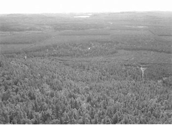
Figure 2: Location of Rawhide Lake Conservation Reserve.
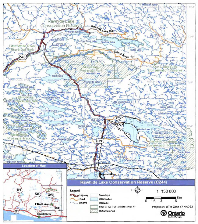
Enlarge Figure 2: Location of Rawhide Lake Conservation Reserve.
4.2 History of the Site
The area now protected within Rawhide Lake Conservation Reserve has a long and varied history of resource utilization and recreational activities. These include mining, forestry, commercial outpost facilities, hydro power generation, hiking and canoeing.
In the early 1800s, the Mississagi watershed supplied furs to several trading posts established along the north shore of Lake Huron and on the upper Mississagi River. The Northwest and Hudson Bay Company trading posts operated until the late 1800s. By that time, forestry activities were increasing. From about 1880, declining forest conditions in Michigan resulted in increased timber harvesting north of Lake Huron (OMNR 1996).
In the late 1800s, various transportation routes developed as efforts were made to access waterways to move harvested wood. Primitive roads along the Little White River, a short rail line built near Matinenda Lake, and other routes that combined travel across waterbodies and along trails on intervening lands, all improved access between the Mississagi and Serpent rivers. The current outfitting lodges on Mount and McElrea lakes on the north side of the conservation reserve, were originally logging camps established about 1919. These logging camps were converted to tourism establishments In the 1930s (OMNR 1996). While harvesting has occurred in areas immediately beyond the conservation reserve, steep terrain within the site, such as along Rawhide and Grey Trout lakes and south of Mount Lake, has limited harvesting within most parts of its boundary. The Boland River Road was constructed in the early 1970s. Until that time, there had been no commercial logging in the area between Rawhide Lake and Mississagi Provincial Park, which was protected from access development due to its location within the Mississagi Provincial Forest Reserve. This protection was removed in the late 1960s and the area’s mature white pine forests then became available for harvest. The areas where most intensive forest management activities occur (ie. plantations), have been excluded from the conservation reserve in recognition of management expenditures invested to date.
Figure 3. Mine location on Cobre Lake, August 1956.
(Source unknown)
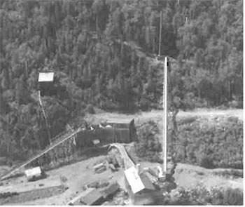
Survey records exist for mining locations in the vicinity of Cobre Lake as early as 1899, and records suggest that staking and mining precede that date. A copper mine was established on Cobre Lake in 1929, and different companies operated it until the 1940s. Although most of these mining interests are no longer active, their remains (ie. mine shafts, rail tracks) can be observed within the conservation reserve today. In the southwestern portion of the conservation reserve, a few mining leases remain active, so these areas have not yet been incorporated into the site through regulation. These two areas are designated as Rawhide Lake Forest Reserve.
Wildfire has burned through a portion of the conservation reserve, northward from a line between Bevans and Rawhide lakes. This is thought to have originally burned in 1923, and portions were reburned in 1955. Subsequent wildfires of much smaller proportions have burned at various locations within and adjacent to the conservation reserve, as recently as 1992. These fires have been caused by lightning and recreational activities.
A number of dams have been constructed on waterways within and adjacent to the conservation reserve. A dam at the outlet of Mount Lake, just north of the conservation reserve, was constructed in 1952 in an effort to control water flows and levels on the lake. Another dam was constructed at the outlet of Rawhide Lake, also as a means of controlling water flows and levels. Stoplogs on the dam were removed in 1979 by the Ministry,but the concrete foundation remained. A stoplog has since been re-established by local outfitters to control water flows out of Rawhide Lake to the system below.
A dam between Rottler and McElrea Jakes was constructed in the 1980s in order to generate power for Frontier Lodge. This dam was eventually approved In 1984, but subsequent modifications were not. Recent reconstruction work (December 2003) has been carried out in order to bring the structure into conformity with current engineering standards. The dam continues to be an integral component of a hydro generating system that provides electricity for private consumption at Frontier Lodge.
The Ministry of Natural Resources has established operating guidelines for all three dams affecting waterways within/adjacent to the conservation reserve in order to protect lake trout spawning habitat and shoreline conditions.
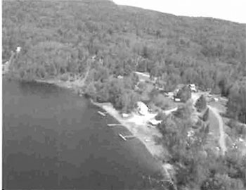
Commercial outfitting operations have been established on Mount Lake (Wilderness Lodge) and McElrea Lake (Frontier Lodge) since the 1930s. The main base lodges are situated outside of the conservation reserve; however, Frontier Lodge holds a commercial land use permit (LUP) for a remote outpost camp on Rawhide Lake within the conservation reserve. These operations have generated traffic into the conservation reserve and surrounding area from clients pursuing fishing and hunting opportunities.
Figure 4. Commercial outfitting lodge on McElrea Lake.
(Photo by J. Young; September, 2003)
Mississagi Provincial Park is located immediately south of Rawhide Lake Conservation Reserve. The park was established in 1964, and has been actively promoted along with the surrounding area now included in the conservation reserve. The Cobre Lake Hiking Trail, in particular, is featured in pamphlets produced by the park. Although the trail was reportedly established by park staff with assistance from a "Friends of" group, it is currently maintained by the Voyageur Trail Association’s Coureur de Bois in Elliot Lake.
Thunder Mountain has been identified by local First Nation communities as a site of spiritual significance that has been visited by their peoples for generations. This site has been a destination for Aboriginal spiritual events. Individuals would travel alone, or in groups, from their home community to the mountain to participate in these traditions. It has also been reported that Aboriginal peoples originally accessed Thunder Mountain from the north side (off Rawhide Lake). Currently, access by Aboriginal peoples to the mountain top is obtained solely from the south side.
4.3 Inventories
Below, in Table 2, the current status of natural heritage inventories is summarized for Rawhide Lake Conservation Reserve. Recommendations for future inventory needs are located in Table 3, Section 7.2.
Table 2. Existing inventory and survey information for Rawhide Lake Conservation Reserve.
| Type of Inventory | Inventory Method | Date(s) of Inventory | Report |
|---|---|---|---|
| Life Science | Aerial reconnaissance | September 9. 2003 | Burkhardt, B., King,L. and Longyear, S. 2004. Rawhide Lake Conservation Reserve, Life Science Checksheet- Step 4 (Draft). Unpublished Information. Ontario Ministry of Natural Resources. |
| Earth Science | Aerial reconnaissance | September 9. 2003 | Kristjansson, R., 2004. Earth Science Inventory Checklist for Rawhide Lake Conservation Reserve. (In prep.) |
| Recreation | Ground and aerial reconnaissance | Ground: June 11, 2003 July 3, 25, 2003 Aug. 20, 2003 Aug. 16-17, 2004 Aerial: Sept. 9 2003 |
Young, J., 2004. Rawhide Lake Conservation Reserve (C244) -Recreation Resource Inventory Report. Unpublished Information. Ontario Ministry of Natural Resources. |
5.0 State of the resource
5.1 Key values
Key values are those values that make this site unique and have led to its designation as a conservation reserve. Their protection is paramount. The key values found within Rawhide Lake Conservation Reserve include the following:
- Talus slopes and cliffs
- Old-growth white and red pine stands
- Thunder Mountain (First Nation spiritual site)
- Cobre Lake Hiking Trail
- Mining history
Additional values as listed in Section 5.2 through Section 5.6 are also important. Descriptions in this section (5.1) are not necessarily complete. When new values, key or otherwise, are identified, they will be added to this section. If any new value is considered to be significant, management guidelines may be modified, if required, to ensure its protection.
5.2 Earth sciences values
Rawhide Lake Conservation Reserve is located in a broad geologic area known as the Abitibi Uplands, which are characterized by an undulating, rocky landscape of uplands and valleys with an abundance of lakes, folds and faults. The Abitibi Uplands are largely underlain by gneiss and granite rocks. This bedrock is covered generally by stony, sandy tills with frequent flats and ridges of water-laid sand (Crins 1996).
Within the conservation reserve, the topography varies from dramatic cliffs to more level plateaus. Overall, the terrain is rugged, with clear lakes perched in the bedrock-controlled landscape. According to Kristjansson (pers. comm. 2004), the entire site is controlled by bedrock. Extensive areas are characterized by outcropping bedrock or bedrock overlain by thin till materials. Deeper till deposits occupy areas south of Mount Lake, and north of Cobre Lake. Glaciolacustrine deposits can be found along the north shore of Rawhide Lake. The talus deposits at the bases of north-facing cliffs on Rawhide and Grey Trout lakes are one of the site’s most unique features. Also of Interest are outcrops of a rock formation known locally as puddingstone, which is a conglomerate rock comprised of red jasper, dark chert, and white quartz cobbles in a quartzite matrix.
While the regulated boundary does capture part of the deep bedrock valley and Thunder Mountain, it does not include several features that were listed in the LUS (OMNR 1999). For example, Rawhide Moraine has been identified approximately 7 km south of the conservation reserve (Kristjansson 2004), and the small bird’s foot delta at Mikel Lake is less than 1 km south of the conservation reserve’s southwest corner. These features have been captured within the addition to Mississagi Provincial Park.
Kristjansson (in prep.) describes in more detail the bedrock and surficial geology of the site in the Earth Science Inventory Checklist.
Figure 5. Talus slopes along south shore of Rawhide Lake.
(Photo by J. Young; September 2003)
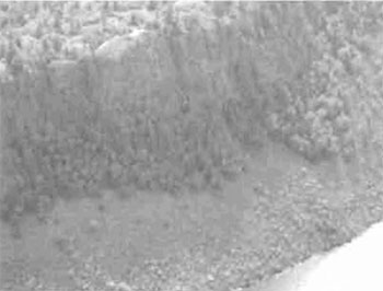
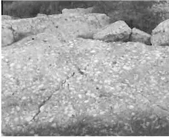
Figure 6. Puddingstone outcrop on Rawhide Lake.
(Photo by T. Evoy; August 2004)
5.3 Life sciences values
Almost one third of this conservation reserve is comprised of water. The remainder is dominated by mixed forest communities consisting of various combinations of red pine, white pine, balsam fir (Abies balsamea L.), jack pine (Pinus banksiana Lamb.), yellow birch (Betula alleghaniensis Britton), white birch (Betula papyrifera Marsh.), sugar maple (Acer saccharum Marsh.), trembling aspen (Populus tremuloides Michx.), white cedar (Thuja occidentalis L.), and black spruce (Picea mariana (Mill.) BSP.). White pine-dominated stands tend to be associated with the bedrock-controlled landscapes, especially on the ridge tops. Cedar is associated with the south shores of many of the site’s lakes, and in the cooler climates such as at the base of north facing slopes. Jack pine stands have developed in the sandy deposits around Vasseau and Tenfish lakes (see Map 3, Appendix A).
Stocking
Forest stand ages range from approximately 10 years to about 150 years. According to forest resource inventory (FRI) information, the majority of stands within the conservation reserve are 60 to 89 years of age. Old-growth pine stands, aged between 120 and 149 years, are located on the southwest side of Mount Lake, the east side of Bevans Lake, the east side of Tenfish Lake, and just south of Blue Sky Lake. Stands of similar age also occur on the north side of Rawhide Lake, in its northeast corner. The youngest stands (0 to 29 years) tend to occur along the southern boundary of the conservation reserve, and extend into the actively managed areas north of the Boland Road that have been excluded from the site’s regulated boundary (Burkhardt et.al. 2004).
Figure 7. White birch stand near Cobre Lake.
(Photo by M. Hall; July 2003)
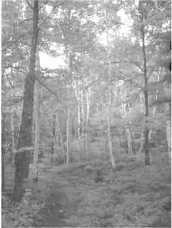
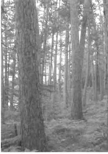
Figure 8. Old-growth red pine stand near Cobre Lake.
(Photo by M. Hall; July 2003)
Overall, this site has a low to medium level of diversity
The conservation reserve has several important fish and wildlife values. The site’s lakes are primarily coldwater lakes, and all lakes within the conservation reserve, except Bhynmine and No Peer lakes, are designated lake trout (Salvelinus namaycush) lakes. As such, they are managed to protect the lake trout fishery, and additional development and/or access are not permitted (OMNR 2004a). Cobre Lake was stocked with lake trout throughout the 1980s. While Tenfish and Vasseau lakes are popular ice fishing lakes, Rawhide Lake is a fish sanctuary during the winter months (October to May). In addition to the lake trout fishery, some of the site’s lakes also contain smallmouth bass (Micropterus dolomieu), brook trout (Salvelinus fontinafis), northern pike (Esox lucius), round whitefish (Psosopium cylindraceum) and suckers (Catostomus spp.). Outfitting lodges on Mount and McElrea lakes rely year-round on the area’s popular fishing opportunities.
Black bear (Ursus americanus), moose (Aices alces),and white-tailed deer (Odocoileus virginianus) are the most common big game species within the vicinity of Rawhide Lake Conservation Reserve. Grouse (Bonasa umbellus; Canachites canadensis) and waterfowl are also common to the site. Osprey nests have been reported along the shorelines of some lakes on the site’s northern boundary. As well, the conservation reserve provides habitat for one of the province’s endangered species. The species and the exact location of its habitat is managed sensitive information that is not publicly available. The conservation reserve includes portions of three bear management areas (BMA) and three registered traplines (see Appendix A, Map 2). The townships encompassing the protected area have been allocated for baitfish harvest operations. More detailed analysis of life science values is available in the Rawhide Lake Conservation Reserve, Life Science Checksheet- Step 4 (Burkhardt et.al. 2004)
5.4 Recreational values
Rawhide Lake Conservation Reserve currently supports a variety of well-established recreational pursuits, and offers potential opportunities for a number of others. Several recreational features have been identified including trails (both hiking and portage), historical/cultural sites, interesting landform and vegetation features, and numerous large, clear lakes offering sport fishing opportunities (Young 2004).
Figure 9. Sign at trailhead of Cobre Lake Hiking Trail.
(Photo by M. Hall; July 2003)
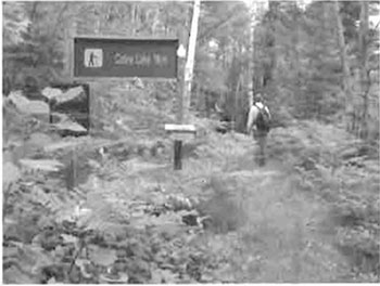
The 11-km Cobre Lake Hiking Trail provides access to the western end of the conservation reserve. It was established In the early 1970s and allows pedestrian access to a number of lakes, passing through stands of old-growth red and white pine, areas that once supported mining operations, and heights of land that offer spectacular views of the surrounding area. The trail accesses Cobre Lake Lookout (aka. Penikett Peak, Belvedere Mountain), a height of land offering a view of the Boland River Valley to the south, the Little White River Valley to the north, and the broader conservation reserve area, including No Peer Lake immediately below the lookout.
Additional trails exist between lakes on the north side of the conservation reserve; these originated as portage trails along an established canoe route. Although the canoe route is no longer maintained by MNR, most of its portage trails remain passable as a result of maintenance and traffic from the local outfitters and their clients.
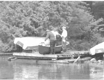
The Boland River Canoe Route (Canadian Canoe Routes 2004) starts from Mount Lake and runs through the northern chain of lakes (McElrea, Rottier, Grey Trout) to Rawhide Lake, and then beyond the conservation reserve’s eastern boundary into the Sister lakes and ultimately to the Boland River. Local commercial outfitters maintain the trails, at least into Rawhide Lake, and provide motor boats, for use by their clients, at each trailhead. There are no formal campsites within the conservation reserve, but a number of locations have been identified as suitable for camping. These include an island on Grey Trout Lake, the north shore of Rawhide Lake, the north shore of Tenfish Lake, and the access point at Cobre Lake.
Figure 10. Boats cached at portage trail’s end on Grey Trout Lake.
(Photo by J. Cywink; August 2004)
Fishing is another popular recreational activity in Rawhide Lake Conservation Reserve, as are boating, camping, and general nature appreciation. Commercial outfitters have generated considerable traffic into the north side of the conservation reserve, primarily for fishing and hunting. The northern lakes are readily accessible by vehicle and boat. Floatplanes have also been used to access Rawhide Lake. Cobre Lake is accessible directly from Highway 639. The Cobre Lake Hiking Trail facilitates pedestrian access to Cobre, Blue Sky, Tenfish, and Vasseau lakes. Tenfish Road is closed to motorized vehicles, except during the winter months (December 15 to March 31) when snowmobiles and ATVs can be used to access Tenfish and Bevans lakes. All lakes within the conservation reserve support a lake trout fishery and the northern chain of lakes also contains smallmouth bass. Cobre Lake was stocked with lake trout in the 1980s; stocking of brook trout in Rawhide, Grey Trout and Rottier lakes was attempted in the 1960s and 1970s, but was unsuccessful. Bhynmine Lake, located immediately south of Cobre Lake, is regularly stocked with brook trout to provide a put-grow-take fishery.
Figure 11. Rawhide Lake vista.
(Photo by M. Hall; June 2003)
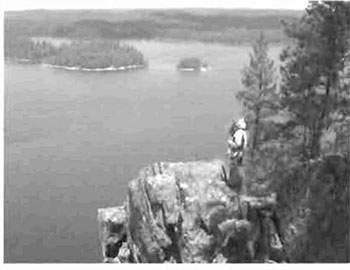
The conservation reserve possesses a number of dramatic landscape features. These, along with a variety of vegetation communities, provide for interesting nature observations and appreciation. Steep hills and cliffs, some of which are lined with extensive talus slopes, characterize the landscape. The talus deposits along the south shores of Rawhide and Grey Trout lakes are very high and extend for considerable distance along the shorelines. Potential exists for unique vegetation communities to be observed on these talus slopes.
At the top of numerous cliffs and hills, natural lookouts have developed offering tremendous viewing opportunities. Belvedere Mountain (also referred to as Penikett Peak and Cobre Lookout), just north of Cobre Lake, permits viewing in all directions: southward over the Boland River Valley, north and westward to the Little White River Valley, and eastward over the conservation reserve. Thunder Mountain also provides a spectacular view over Rawhide and Grey Trout lakes.
The proximity of other protected areas also enhances this site’s recreational potential. From Rawhide Lake Conservation Reserve, one may also access Mississagi Provincial Park, Little White River Provincial Park and Our Colleagues Conservation Reserve. An Ontario Parks campground is located in Mississagi Provincial Park just 10 km south of the conservation reserve.
A more detailed analysis of the recreational values associated with Rawhide Lake Conservation Reserve is presented in Recreational Inventory Report for Rawhide Lake Conservation Reserve (Young 2004).
5.5 Cultural and heritage values
This site falls within the Robinson-Huron Treaty area. Thunder Mountain, located on Rawhide Lake, in the eastern half of the conservation reserve, has been identified by local First Nation communities as a location of spiritual significance; other values within/in the vicinity of the site have yet to be identified. The mountain has long been a destination for Aboriginal peoples pursuing traditional spiritual activities.
The Cobre Lake area in the western part of the conservation reserve was an active mining location in the first half of the 20th Century. Copper was extracted from mines on the south shore of Cobre Lake and from a location between Cobre and Blue Sky Jakes. Remnants of these mining operations are still visible in the conservation reserve. Artifacts include steel rails and pipes, and an old shaft, all which are visible along the hiking trail.
5.6 Research values
The population and habitat characteristics of one of the province’s endangered species is being monitored on an ongoing basis within this conservation reserve. Due to the sensitivity of information related to endangered species, further information will not be provided here. No other research activities are known to be taking place in the site.
5.7 Site condition
This conservation reserve is said to be moderately disturbed based on estimates that only 10 to 20% of the site has been disturbed by human or natural activities in recent years (Burkhardt et.al. 2004). A number of human disturbances are reported, including construction of dam structures at Rattier and Rawhide lakes; pedestrian traffic along portage trails; maintenance efforts along portage trails; boat caches, including cleared areas at each trailhead from McElrea to Rawhide Lake; trail clearing and subsequent pedestrian traffic on the Cobre Lake Hiking Trail; old mining locations; and timber harvesting along the southern boundary in the early 1970s.
Natural disturbances within the conservation reserve are less apparent. Wildfires have burned through the northwestern portion, but forests have recovered and are developing into mixed pine stands. No other significant natural disturbances are evident in the site.
6.0 Management guidelines
All management guidelines in this SCI are based on direction contained in the LUS (OMNR 1999) and associated policy clarification statements. The management guidelines outlined in this section are specific to both Rawhide Lake Conservation Reserve and the adjoining Rawhide Lake Forest Reserve, and are intended to protect the site’s unique values as a whole. Where policies for the conservation reserve and forest reserve are dissimilar, this will be reflected in the following guidelines. The guidelines in this document may be subject to change and may be amended as necessary. If a conflict between management guidelines exists, the conservation reserve will be managed to protect the integrity of its natural values, while permitting compatible land use activities (Public Lands Act, PL 3.03.05).
Proposed new uses and/or development, as well as research and education activities, will be reviewed on a case-by-case basis. Before new proposals can be permitted, the Test of Compatibility (see Appendix C) must be passed as well as consideration of cultural values according to Conserving a Future for our Past: Archaeology, Land Use Planning & Development in Ontario, Section 3 (Ministry of Culture 1998). In addition, all new proposals are subject to applicable Environmental Assessment Act (R.S.O. 1990, Chapter E.18) requirements.
The following management strategies have been devised to achieve the goal and objectives of the SCI for Rawhide Lake Conservation Reserve. A summary table of the management guidelines for this site can be found in Appendix D. For the most up-to-date version of this summary table, please refer to the Crown Land Use Policy Atlas, located on the Internet at /page/crown-land-use-policy-atlas, or contact the local Ministry of Natural Resources office. The Crown Land Use Policy Atlas is a consolidation of existing local land use policies for Crown lands within the OLL planning area, an area that covers 45% of the province, extending from Lake Simcoe in the south to the Albany River in the north.
6.1 Industrial activities
6.1.1 Commercial timber harvest
The area contained within Rawhide Lake Conservation Reserve (4,633 ha) has been withdrawn from the Northshore Sustainable Forest License (SFL) area and no commercial timber harvesting will be permitted. Although the lands within Rawhide Lake Forest Reserve have not been withdrawn from the Northshore SFL area (as they have not yet been regulated), they are subject to interim protection, and as such, are also not available for commercial forest management activities. Please refer to Section 6.4.3 for information regarding non-commercial wood harvesting.
6.1.2 Mining and exploration
Mining and surface rights within the conservation reserve have been withdrawn from staking under the Mining Act (RSO 1990 Chapter M.14). Mineral exploration is not permitted within Rawhide Lake Conservation Reserve.
Pre-existing mining claims remain active within two parcels which comprise the Rawhide Lake Forest Reserve, adjacent to the conservation reserve in the southwest portion of the site. Although identified for eventual inclusion in the conservation reserve, these lands remain unregulated. They have been identified as forest reserve parcels (see Map 1, Appendix A) and as such, mining activities are permitted to continue. Whenever the mining tenure lapses through normal processes, these areas will be added to the conservation reserve through a formal regulation process.
6.1.3 Extraction of peat, soil, aggregate and other material
Within Rawhide Lake Conservation Reserve, extraction of peat, soil, aggregate and other material is not permitted.
Aggregate extraction will not be permitted within Rawhide Lake Forest Reserve, except where: there is an existing aggregate permit; aggregate is required in support of mineral exploration or mining within the forest reserve and there are no feasible sources outside of the reserve; or an aggregate permit is required under the Aggregate Resources Act for the production of industrial material and building stone. Extraction of sand, gravel, clay and other unconsolidated materials is not permitted, except where it is required in support of mineral exploration and mining within the forest reserve. Peat extraction is also prohibited (Crown Land Use Policy Atlas- Policy Report for Rawhide Lake Forest Reserve (F244) 2004).
6.1.4 Energy generation
New hydropower developments are not permitted within Rawhide Lake Conservation Reserve, and should be avoided within the forest reserve. Wind power developments are prohibited under the Public Lands Act, Procedure PL 4.10.04 "Wind Power Development on Crown Land" (OMNR 2004c).
Two dams were established within the conservation reserve before it was regulated. One is located between Rattier and McElrea lakes; the second is located between Rawhide and Grey Trout lakes. The Rattier dam provides flows through an existing turbine at McElrea Lake that generates electricity for Frontier Lodge. The power is conveyed via underwater transmission lines. The Rawhide Lake dam was originally constructed to provide water storage in the lake that could then be directed to the Little White River to facilitate log drives on the river. This function ceased in the late 1960s and all that remained of the dam was its concrete foundation. A stop log was placed on this foundation by Frontier Lodge to re-establish the storage function of Rawhide Lake. This stop log has been used without authorization since the 1980s. Currently, the MNR is reviewing a proposal for maintenance improvements on this dam structure at Rawhide Lake to consider flood mitigation and the protection of downstream hydro generation facilities (Hagman, pers.comm.). Approval of proposed improvements will be contingent upon a number of factors, including: no increase in the height of the dam over the existing levels, no new roads or trails constructed to facilitate the improvements, continued protection of the conservation reserve’s values, compliance with conservation reserve policy, and successful completion of applicable Environmental Assessment (EA) processes.
A third dam, on Mount Lake, is situated just outside the boundary of the conservation reserve. Hydroelectricity is generated at this location by Wilderness Lodge and is transmitted to the Lodge and to other patented properties on the south shore of Mount Lake, via power lines that pass through the conservation reserve (see Section 6.2.2).
6.2 Existing and proposed development
6.2.1 Transportation corridors
6.2.1.1 Roads
According to the LUS (OMNR 1999), new roads for resource extraction will not be permitted in conservation reserves except for those identified in Forest Management Plans prior to March 31, 1999. No new or existing roads for resource extraction were identified within the conservation reserve. A number of provincial highways and a primary forest access road exist along the border of the site (ie. Hwy 546, 639, and the Boland River Road); these roads are expected to continue indefinitely.
Within forest reserves, existing roads can continue to be maintained. New roads for resource extraction will not be permitted, with the exception of necessary access for mineral exploration and development, which will be permitted with appropriate consideration for the protection of forest reserve values (Crown Land Use Policy Atlas- Policy Report for Rawhide Lake Forest Reserve (C244) 2004).
6.2.1.2 Trails
The Cobre Lake Hiking Trail exists at the western end of the conservation reserve. Access to it is achieved from Hwy 639. The trail offers hiking through rugged terrain, past crystal clear lakes, through stands of old-growth pine, and to spectacular lookouts.
Snowmobile trails pass through the conservation reserve in two locations: at the western boundary near Cobre Lake and in the northwest corner, at the west end of Mount Lake. The trail along the western boundary is part of the main trail network of the Ontario Federation of Snowmobile Clubs (OFSC). The trail passing south of Sister River toward the west end of Mount Lake is an OFSC connector trail, servicing the lodges on Mount and McElrea lakes.
Other trails within the conservation reserve include portage trails between Rottler and Grey Trout lakes, Grey Trout and Mount lakes, Grey Trout and Rawhide lakes, and from Rawhide to Little Sister and Rosemarie lakes. A portage trail between Rottler and McElrea lakes exists west of the creek, but most trippers obtain permission to cross private land and use the road that passes along the east side of the creek from Frontier Lodge to Rottler Lake. Although documented as part of the Boland River Canoe Route (Canadian Canoe Routes 2004), most of these portage trails are not maintained on a regular basis. The trail between Mount Lake and Grey Trout Lake was essentially non-existent when attempts were made to find it in August, 2004. The trailhead can be detected on Mount Lake, but the portage trail to Grey Trout Lake has not been maintained. The outfitter on McElrea Lake maintains trails up to Rawhide Lake. These trails are well used by clients of the area’s outfitting establishments, and boat caches exist at all trail heads. Portage trails from the east end of Rawhide Lake are reported to be used by outdoor enthusiasts, but trail conditions are unknown at this time.
Other informal trails continue to be used to access Tenfish and Bevans lakes from the Boland River Road. These trails are mainly on abandoned roads, which have been closed to motorized traffic except during the winter months. Hunters and fishermen are the primary users of these trails. An informal trail also exists from the foot of Thunder Mountain to its peak. This trail is not marked and has been developed and used mainly by First Nations peoples.
All existing trails documented above are permitted to continue. However, should the impact of activities on these trails degrade the landscape, the Ministry of Natural Resources will reevaluate these permitted uses and decide upon a new strategy for this site. Any proposed new trails will be subject to the Test of Compatibility (see Appendix C) and applicable Ministry of Natural Resources' policies and procedures. Trail development in low-lying areas and wetlands will be discouraged, as will new trail development over shallow soils on rock outcrops. All new and existing trail heads and trail routes must be recorded using new technologies (ie. global positioning systems) to ensure an accurate record of the location of the feature. This location information must be provided to the Sault Ste. Marie District, Ministry of Natural Resources.
6.2.2 Other corridor development/maintenance
Hydro transmission lines already exist within this conservation reserve. At the west end of Mount Lake, a short power line transmits electricity from the Mount Lake Dam to private properties on the south shore of Mount Lake. The power lines are strung on wooden poles that are inside the conservation reserve. Between Rottier and McElrea lakes, the power lines run through a pipe in the creek and under water in McElrea Lake. These existing transmission lines are permitted to continue.
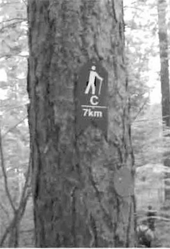
Figure 12. Trail marker on Cobre Lake Hiking Trail.
(Photo by M. Hall; July 2003)
No other communication or non-road corridors are located within this conservation reserve. New corridor developments will be actively discouraged within both the conservation reserve and forest reserve. Proposals for new corridors will be subject to the Test of Compatibility (see Appendix C) and applicable Ministry of Natural Resources' policies and procedures.
6.2.3 Natural heritage appreciation facilities/recreational structures
The Cobre Lake Hiking Trail has been described in literature distributed by Mississagi Provincial Park, and interpretive signs have been erected near the trailhead. The kilometric distance is marked along the trail’s route (see Figure 11) and directional symbols have been painted on the rock through a sparsely treed section northwest of Tenfish Lake. No viewing platform structures have been constructed along the trail, although there are a number of locations where natural lookouts exist.
New natural heritage appreciation facilities and recreation structures are permitted, subject to the Test of Compatibility (see Appendix C) and applicable Ministry of Natural Resources' policies and procedures. No such structures are being considered at this time.
6.2.4 Land disposition
Sale of Crown lands is not permitted, except for those situations described in the policy clarification tables (OMNR 2000).
Presently, one commercial land use permit (LUP) has been issued to Frontier Lodge for an outpost camp on the north shore of Rawhide Lake. In the western part of the conservation reserve, southwest of Cobre Lake, there is an LUP for a maple sugar bush harvesting operation, located mainly within the forest reserve. A private recreation camp on Rawhide Lake is under a license of occupation (LO). The dam constructed between Rattier and McElrea lakes is under lease to Frontier Lodge. New leases or LUPs may be issued for approved public uses (ie. not for private recreation camps), subject to the Test of Compatibility (see Appendix C) and applicable Ministry of Natural Resources' policies and procedures. These leases/permits will not be sold but may be eligible for enhanced tenure or transfer.
Enhanced tenure is defined as anything beyond the term and form of current tenure. All requests for transfer or enhanced tenure will be subject to the following screening criteria:
- Is the transfer or enhanced tenure consistent with the conservation reserve’s land use intent, which is the protection and enhancement of the site’s natural, recreational and cultural values?
- Is it consistent with the land disposition policies outlined in the District Land Use Guidelines, the Crown Land Use Policy Atlas, this SCI and any other applicable document?
- Does it adversely affect the values as identified in Section 5.0, and/or conflict with other uses?
- Is land needed by the Crown to protect significant natural or recreational values outlined In this SCI?
- Does the transfer or enhanced tenure clash with traditional Aboriginal uses, land claims or agreements?
- Are all rents, taxes, fees, rates or charges paid up for the existing LUP or lease?
6.3 Commercial activities
6.3.1 Commercial bait harvesting
Sagard, Viel, Piche and Raimbault townships, which encompass the conservation reserve and forest reserve, have been allocated to bait harvest operators. New operations can be considered subject to the Test of Compatibility (see Appendix C) and applicable Ministry of Natural Resources' policies and procedures.
Under Public Lands Act PL 3.03.08 "Buildings for Bait Harvesting Management" (OMNR 2002), cabins for the purposes of bait harvesting may be constructed on Crown land. However, such buildings should be avoided within this conservation reserve wherever possible, and be established on Crown land outside of the protected area.
6.3.2 Commercial fishing
There are currently no commercial fisheries. New operations may be considered subject to the Test of Compatibility (see Appendix C) and applicable Ministry of Natural Resources' policies and procedures.
6.3.3 Commercial fur trapping
Portions of three registered trapline areas are located within Rawhide Lake Conservation Reserve (see Appendix A, Map 2). BL075 lies within the western portion of the site; BL076 is found in the eastern half of the site; minor portions of BL078 are within the southwestern part of the site. Each of these trapline areas is currently allocated to a head trapper. If a head trapper surrenders a registered trapline, or the head trapper’s privileges are revoked, the registered trapline may be transferred to another trapper following established allocation procedures. If the registered trapline is not transferred in due course, or remains unallocated for a significant period of time, reallocation of the trapline may occur following applicable district screening processes.
The establishment of new trapline trails will be considered following the procedure and criteria for new trails as outlined in Section 6.2.1.2. No trap cabins currently exist within Rawhide Lake Conservation Reserve. The establishment of new trap cabins will not be permitted.
6.3.4 Bear Management Areas
Portions of three bear management areas (BMAs) are located within the conservation reserve (see Appendix A, Map 2). BMA BL-38-063 occurs in the eastern part of the site; BL-38-071 dominates the western parts of the conservation reserve; and a small portion of BL-38-070 lies within the western part of the site, south of Mount Lake and west of Vasseau Lake. Each of these BMAs has been allocated and guided hunting activities associated with them may continue. Transfers of the BMAs within this conservation reserve may be permitted in cases where the current operator sells their bear hunting business to another operator and the BMA transfer is approved. If an operator surrenders the BMA or the BMA is revoked, reallocation of the BMA may occur following applicable district screening processes.
6.3.5 Commercial food collection
In the western part of the conservation reserve, southwest of Cobre Lake located mainly within the forest reserve, there is an LUP for a maple sugar bush harvesting operation. This maple syrup production area is permitted to continue subject to appropriate Ministry of Natural Resources' policies and procedures.
Any new commercial food harvesting ventures, requiring permits from the Ministry of Natural Resources, will be subject to the Test of Compatibility (see Appendix C) and applicable Ministry of Natural Resources' policies and procedures.
6.3.6 Commercial non-timber forest products
Commercial harvesting of non-timber forest products is not consistent with the Intent of conservation reserves and forest reserves and will not be permitted.
6.3.7 Outpost camps/main base lodges
Currently there is one authorized commercial outpost camp within the conservation reserve, and two main base lodges on lakes just outside the northern boundary of the conservation reserve. In keeping with the lake trout lake designation for the lakes within this conservation reserve, new outpost camps and main base lodges will not be considered.
6.4 Non-commercial activities
6.4.1 Nature appreciation/recreation activities
Off-trail hiking, cross-country skiing, snowshoeing, and other non-motorized activities will be permitted within this conservation reserve. However, should the impact of these activities degrade the landscape, the Ministry of Natural Resources will re-evaluate these permitted uses and decide upon a new strategy for this site. New trails to support these activities may be considered. Please refer to Section 6.2.1.2 for more details related to trail development.
6.4.2 Camping
There are no maintained campsites or campgrounds within this site. Informal camping locations exist within the site, including the east shore of Tenfish Lake and the north shore of Rawhide Lake, as well as on the island in Grey Trout Lake. These campsites are not maintained and no facilities are provided. Crown land camping policies apply, unless significant adverse effects on protected values necessitate further planning and management for this activity. Existing campsites should be used wherever possible and campers should avoid sensitive areas (ie. shallow soil areas).
6.4.3 Non-commercial Consumptive Resource use
Cutting of trees for non-commercial purposes may be authorized via a permit issued by the local Ministry of Natural Resources office, subject to review and determination of the impact that such cutting would have on the values identified in Section 5.0. However, because such permits are intended only for leaseholders or land use permit holders within the conservation reserve who do not have road access to their property and have no alternate wood source outside of the conservation and/or forest reserve, it is not appropriate to issue such permits within this site. The LUP and LO holders within this site may acquire permission by the Ministry to use trees that have blown down over trails inside the boundary, for such things as fuelwood, dock stringers, and other occasional small scale uses.
Non-commercial harvesting of non-timber forest products such as berries, mushrooms, sphagnum moss (Sphagnum spp.), and wild rice (Zizania sp.) can occur provided the values of the site, identified in Section 5.0, are not jeopardized.
6.4.4 Hunting and fishing
Hunting and fishing are traditional activities within this site. In conjunction with current hunting and/or fishing regulations and conservation reserve policy, both hunting and recreational fishing are permitted to continue.
6.4.5 ATV and snowmobile Use
Two Ontario Federation of Snowmobile Clubs (OFSC) trails pass through the conservation and at two locations in the western portion of the site (one within the forest reserve). As well, snowmobiles and ATVs are permitted to use Tenfish Road during winter months to access Tenfish Lake. Use of these existing snowmobile trails is permitted to continue.
In general, off-trail use of ATVs and snowmobiles is not permitted. However, off-trail use is permitted for licensed trappers to access their traplines and for licensed bait harvest operators to conduct bait harvest operations. Off-trail ATV and snowmobile use is also permitted for the direct retrieval of big game by hunters. In all these cases, off-trail use is only permitted provided the protection of the site’s values is not compromised. Should the impact of off-trail ATV or snowmobile use degrade the landscape, the Ministry of Natural Resources will re-evaluate these permitted uses and determine a new strategy.
6.4.6 Watercraft usage
Motorized boats, canoes and kayaks are used on Cobre Lake, and on Rattier, Grey Trout and Rawhide lakes. Watercraft usage is permitted to continue unless the impact of this activity is degrading the landscape. At that time, the Ministry of Natural Resources will re-evaluate this permitted use and determine a new strategy.
6.5 Resource management activities
Resource management activities refer to those tools used to protect and enhance the values of this conservation reserve. Some management activities may require the use of intrusive techniques. Under normal circumstances, some of these techniques would not be permitted to occur in the conservation reserve; however, if they are found to be necessary, they may be applied under controlled conditions, to achieve a desired result. Infrastructure such as roads, trails and buildings may need to be constructed to support activities such as prescribed burns, forest regeneration, wildfire control, and insect and disease control. Activities described in this section will be deemed acceptable if the ultimate outcome is in compliance with the management intent for this conservation reserve and adjoining forest reserve.
6.5.1 Insect and disease control
This conservation reserve (including the adjoining forest reserve) will be maintained in as natural a state as possible. Insect and disease control measures should only be considered if the identified values are significantly threatened.
6.5.2 Fire management
The Ministry of Natural Resources recognizes fire as an essential process fundamental to the ecological integrity of conservation reserves. In accordance with existing conservation reserve policy and the Forest Fire Management Strategy for Ontario (MNR 2004b), forest fire protection will be carried out as on surrounding lands.
Whenever feasible, the Ministry of Natural Resources' fire program will endeavor to use "light on the land" techniques, which do not unduly disturb the landscape, in this conservation reserve (including adjacent forest reserve parcels). Examples of light on the land techniques may include limiting the use of heavy equipment or limiting the number of trees felled during the fire response efforts.
Opportunities for prescribed burning to achieve ecological or resource management objectives may be considered. These management objectives will be developed with public consultation prior to any prescribed burning, and will be reflected in the document that provides fire management direction for this conservation reserve. Plans for any prescribed burning will be developed in accordance with the Ontario Ministry of Natural Resources Prescribed Burn Planning Manual (1997b) and the Environmental Assessment Act (R.S.O. 1990, Chapter E.18).
6.5.3 Fish and wildlife management
Established fish stocking activities within the conservation reserve (ie. Bhynmine Lake, No Peer Lake, Cobre Lake) will continue as long as required. New fish and wildlife management activities may be considered, but will require the approval of either a separate fish/wildlife management plan which must be referenced in this SCI, or an amendment to this SCI to include specific management prescriptions. New fish and wildlife management activities are also subject to the Test of Compatibility (see Appendix C) and applicable Ministry of Natural Resources' policies and procedures.
6.5.4 Vegetation management
New vegetation management activities may be considered, but will require the approval of a separate vegetation management plan which must be referenced in this SCI and/or an amendment to this SCI to include specific management prescriptions. New vegetation management activities are also subject to the Test of Compatibility (see Appendix C) and applicable Ministry of Natural Resources' policies and procedures.
6.5.5 Forest renewal
Preference will be given to natural regeneration following any disturbance in the conservation reserve. In some cases, regeneration may be artificially assisted when it is deemed appropriate to mitigate against human disturbances (ie. illegal occupation and trespass).
6.6 Research
Scientific research is encouraged, by qualified individuals or institutions, that contributes to a better understanding of the natural and cultural values protected by this conservation reserve, or that advances the protection, planning and management of these values. The Sault Ste. Marie District Planner should be contacted for information on research and/or monitoring opportunities within this conservation reserve. Proposals to conduct research should be directed to the Northshore Area Supervisor, Ministry of Natural Resources, Sault Ste. Marie District, Blind River Area Office, and will be subject to the Test of Compatibility (see Appendix C) and applicable Ministry of Natural Resources' policies and procedures. Any site that is disturbed during research activities is to be rehabilitated as closely as possible to its original condition. Collecting may only be permitted as part of an authorized research project and may be subject to appropriate permits and conditions. Existing Forest Resource Inventory surveys and approved resource monitoring activities are permitted to continue.
6.7 Marketing
No active marketing of this conservation reserve by Sault Ste Marie District, Ministry of Natural Resources is anticipated. The Cobre Lake Hiking Trail is included in Ontario Parks' Mississagi Hiking Trails brochure available at Mississagi Provincial Park. Local outfitters have not, as yet, identified the conservation reserve in their promotional materials.
6.8 First Nations
Traditional activities and Aboriginal rights, as defined in the Robinson-Huron Treaty and other applicable legislation, will not be affected within or by the boundaries of this conservation reserve and/or forest reserve.
Any First Nation land claims within this area will be addressed according to appropriate Ministry of Natural Resources' procedures. When possible, the Ministry of Natural Resources will continue to work with the Ontario Ministry of Culture and/or any First Nation community within the Robinson-Huron Treaty area to identify archaeological sites to be protected.
Several local First Nation communities have identified Thunder Mountain as a site of spiritual significance to Aboriginal peoples. These communities can continue to conduct traditional activities at Thunder Mountain. However, if significant adverse effects on the conservation reserve’s protected values are encountered, the Ministry of Natural Resources will undertake additional planning and determine a new management strategy for this location.
7.0 Recommendations
7.1 Additions to the reserve
The boundary for Rawhide Lake Conservation Reserve captures some representative values for this area, including old pine forests, topographic features such as steep cliffs and talus slopes, as well as interesting cultural features including old copper mine locations and a popular hiking trail.
The area immediately surrounding the conservation reserve encompasses intensively managed forest lands. Adjustments to the site boundary would require careful consideration of the adjacent land uses. However, if the opportunity arose, it would be beneficial to modify the southern boundary to replace the vectored lines. Options include using natural features (ie. ridge-tops) or cultural features (ie. current and/or abandoned roads). In addition to assisting with boundary recognition, the replacement of vectors could prevent biological features from becoming artificially truncated (ie. pine stands on the south side of the site). Additionally, the boundary around Rawhide Lake is achieving minimal protection at 120 m from water’s edge; the conservation reserve would benefit by increasing the buffer to at least 200 m around this large waterbody.
7.2 Future needs and considerations
The values protected by the site should be considered in land use management activities on adjacent properties to ensure sufficient protection of the site’s core values. Table 3 (on the following page) highlights future needs and considerations for Rawhide Lake Conservation Reserve.
7.3 Monitoring
Periodic monitoring of human activities and/or their impacts within this conservation reserve will be conducted. A schedule for cursory field monitoring will be identified within the District’s annual compliance plan and an IFM (Integrated Field Monitoring) inspection report will be filed at the Sault Ste. Marie District Office. The Northshore Area Supervisor will oversee these activities. In addition, Conservation Officers will complete periodic compliance monitoring to ensure the protection mandate is maintained. If at any time human activities are deemed to be negatively impacting the protected features, the activities will be reviewed and measures taken to mitigate any disturbance.
Approved inventory, monitoring, assessment, or research activities that are compatible with protection objectives are encouraged. Any area that is disturbed during research activities is to be rehabilitated as closely as possible to its original condition. The Northshore Area Supervisor may apply additional conditions.
Table 3. Future needs and considerations for Rawhide Lake Conservation Reserve.
| Future Needs/Considerations | Details |
|---|---|
| Detailed Life Science Inventory | A more detailed life science inventory report (to Step 5) should be prepared, including gap analysis of the current site to determine its significance based on what has been captured within the regulated boundary. Analysis should use provincial data sets to determine the site’s contribution to the parks and protected areas program. |
| Boundary Marking | Vectored boundaries should be clearly marked for longterm recognition, so that the site’s values are protected from surrounding land use activities (ie. the vectors should be replaced by boundaries that follow natural or cultural features). |
| Partnership Development | Efforts should be made to work with partners (such as local First Nation communities, Ontario Forest Research Institute (OFRI), Sault College of Applied Arts and Technology) to gather baseline data on this site to assist with future monitoring and inspection activities. |
| Education | Efforts should be made to educate those who use Crown lands in/around this conservation reserve (ie. Commercial outfitters, fishermen to gather baseline data on this site to assist with future monitoring and inspection activities) about the site’s natural heritage, the protection intent of the conservation reserve, permitted uses, etc. |
| Funding | Efforts should be made to obtain funding to support the above listed items, including monitoring, assessment, and inspection requirements for this site. |
8.0 Implementation, review and revisions
8.1 Responsibility
The Sault Ste. Marie District will be responsible for implementing the management policies and guidelines for Rawhide Lake Conservation Reserve and the adjoining Rawhide Lake Forest Reserve. The primary role will be to provide public information and compliance monitoring to ensure adherence to current policies and guidelines.
8.2 Review and revisions
The SCI for Rawhide Lake Conservation Reserve will be reviewed every five years by the District Planner to confirm and update the information in this document. Revisions to this document will be subject to requirements as specified in the Environmental Assessment Act (R.S.O. 1990, Chapter E.18). If changes in management direction are needed at any time, the significance of the changes will be evaluated. Minor amendments to the plan that do not alter the overall protection objectives may be considered and approved by the Area Supervisor without further public consultation. All minor amendments to the SCI will be documented in Appendix F. In assessing major amendments, the need for a more detailed Resource Management Plan (RMP) will first be considered. Where a RMP is not considered necessary or feasible, a major amendment to management direction may be considered with public consultation. Major amendments will be recommended by the District Manager and approved by the Regional Director, and will follow the appropriate guidelines (OMNR 2001b).
Literature cited
Burkhardt, B., King, L., and Longyear, S. 2004. Rawhide Lake Conservation Reserve (C244), Life Science Checksheet- Step 4 (Draft). Unpublished information. Ontario Ministry of Natural Resources.
Canadian Canoe Routes. 2004. Boland River Canoe Route. [Accessed October 26, 2004]. http://www.myccr.com/canoedb/routeDetails.php?routeid=138
Crins, W.J. 1996. Life Science Gap Analysis for Site District 4E-3. Unpublished information. Ontario Ministry of Natural Resources.
Crins, W.J. and Uhlig, P.W.C. 2000. Ecoregions of Ontario: Modification to Angus Hills' Site Regions and Site Districts- Revisions and Rationale.
Hagman, D. Area Supervisor, Ministry of Natural Resources. Personal Communication. January, 2005.
Hills, G.A. 1959. A Ready Reference for the Description of the Land of Ontario and its Productivity. Preliminary Report. Ontario Department of Lands and Forests. Maple. Ontario.
Kristjansson, F.J. 2004. Draft Earth Science Inventory Checklist for Rawhide Lake Conservation Reserve (C244). Ontario Ministry of Natural Resources. In Prep.
Kristjansson, F.J. Consulting Geoscientist. Personal Communication. July, 2004.
Ministry of Culture. 1998. Conserving a Future for Our Past: Archeology Land Use Planning and Development in Ontario. Ministry of Culture, Heritage and Libraries Branch- Heritage Operations Unit.
Ontario Ministry of Natural Resources. 1996. Mississagi Provincial Park- Background Information.
Ontario Ministry of Natural Resources. 1997a. Conservation Reserves. Lands and Waters Branch Policy. Public Lands Act, PL 3.03.05. Date Issued: February 11, 1997.
Ontario Ministry of Natural Resources. 1997b. Prescribed Burn Planning Manual. AFFMB Publication No. 313. Ontario Ministry of Natural Resources.
Ontario Ministry of Natural Resources. 1999. Ontario’s Living Legacy Land Use Strategy. Queen’s Printer for Ontario: Ontario, Canada.
Ontario Ministry of Natural Resources. 2000. Conservation Reserve Policy as Amended by the Ontario Living Legacy Land Use Strategy. Policy clarification tables, dated September 26, 2000. Unpublished information.
Ontario Ministry of Natural Resources. 2001a. Forest Information Manual. Queen’s Printer for Ontario: Toronto, Ontario.
Ontario Ministry of Natural Resources. 2001b. Procedures for the Amendment of Ministry of Natural Resources Land Use Direction. Ontario Ministry of Natural Resources.
Ontario Ministry of Natural Resources. 2002. Buildings for Bait Harvesting Management. Public Lands Act, PL 3.03.08.
Ontario Ministry of Natural Resources. 2004a. Crown Land Use Policy Atlas. [Accessed October 26, 2004] /page/crown-land-use-policy-atlas [Accessed February 2, 2005] /page/crown-land-use-policy-atlas
Ontario Ministry of Natural Resources. 2004b. Forest Fire Management Strategy for Ontario. Ontario Ministry of Natural Resources. Queen’s Printer for Ontario, Toronto. 64p.
Ontario Ministry of Natural Resources. 2004c. Wind Power Development on Crown Land. Lands and Waters Policy Branch. Public Lands Act, PL 4.10.04. Date Issued: January 27, 2004.
R.S.O. 1990, Chapter E.18. Environmental Assessment Act. [Accessed: September 15, 2003] http://www.e-laws.gov.on.ca/DBLaws/Statutes/English/90el8_e.htm.
R.S.O. 1990, Chapter M.14. Mining Act. [Accessed: September 15, 2003] http://www.elaws.gov.on.ca/DBLaws/Statutes/English/90m14_e.htm. (link no longer active)
Thompson, J. 2001. Northeast Region Guidelines on the Planning Process for Conservation Reserves: Statements of Conservation Interest and Resource Management Plan. Unpublished information. Ontario Ministry of Natural Resources.
Young, J. 2004. Recreation Inventory Report for Rawhide Lake Conservation Reserve (C244). Unpublished information. Ontario Ministry of Natural Resources.
Appendix A: Supplementary maps
Map 1: Recreational Values of Rawhide Lake Conservation Reserve
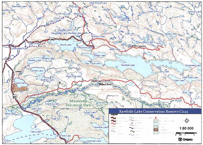
Enlarge Map 1: Recreational Values of Rawhide Lake Conservation Reserve
Map 2: Bear Management & Trapline Areas of Rawhide Lake Conservation Reserve
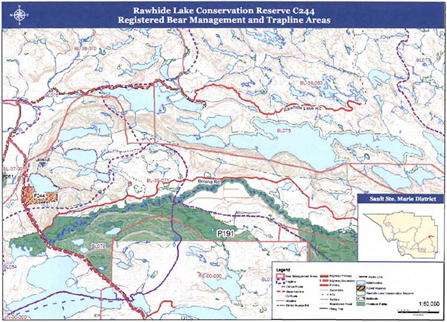
Enlarge Map 2: Bear Management & Trapline Areas of Rawhide Lake Conservation Reserve
Map 3. Surficial Geology of Rawhide Lake Conservation Reserve
(Source: Life Science Checksheet (Burkhardt, et.al. 2004))
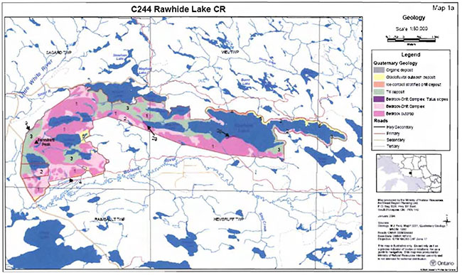
Map 4. Forest Communities of Rawhide Lake Conservation Reserve
(Source: Life Science Checksheet (Burkhardt et.al. 2004))
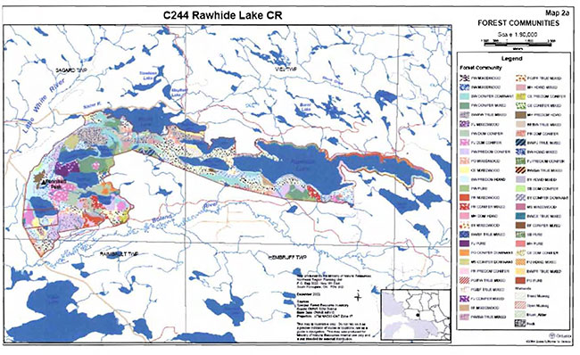
Appendix B: Supplementary photos
Photo 1. Pink Lady’s Slipper.
(Photo by M. Hall; June 2003)
Photo 2. Steel pipes from past mining activities.
(Photo by M. Hall; July 2003)
Photo 3. Looking southward from conservation reserve over forest plantations along Boland River Road.
(Photo by J. Young; September 2003)
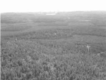
Photo 4. Looking southwest from conservation reserve toward Tenfish Lake.
(Photo by J. Young; September 2003)
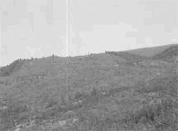
Photo 5. Looking west down Grey Trout Lake.
(Photo by J. Cywink; August 2004)
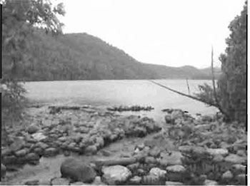
Photo 6. Modified dam at Rawhide Lake outlet.
(Photo by S. Walsh; August 2004)
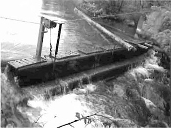
Photo 7. Burned tree stump in western part of conservation reserve.
(Photo by M. Hall; July 2003)
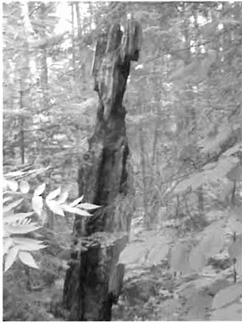
Photo 8. Sparsely stocked jack pine stand near Tenfish Lake.
(Photo by M. Hall; July 2003)
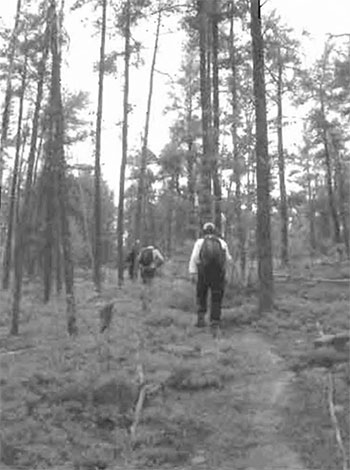
Photo 9. North shore of Tenfish Lake.
(Photo by M. Hall; July 2003)
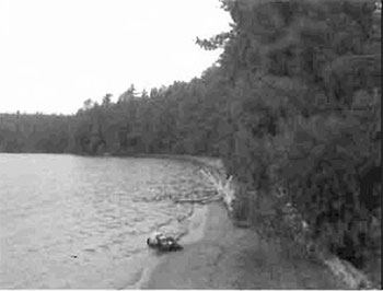
Photo 10. Large erratic rock on Cobre Lake Hiking Trail.
(Photo by M. Hall; July 2003)
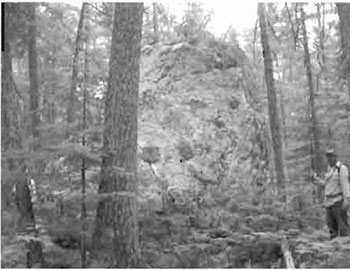
Photo 11. Blue Sky Lake, looking southwest.
(Photo by M. Hall; July 2003)
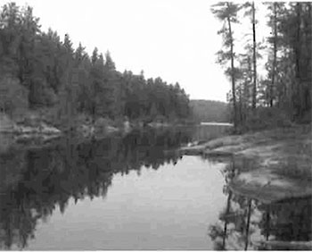
Photo 12. Dam at Rottier Lake, and parking area on access road.
(Photo by S. Walsh; August 2004)
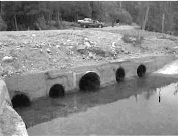
Appendix C: Test of Compatibility
Test of Compatibility
The Conservation Reserve policy provides broad direction with regard to the permitted uses. The policy provides only an indication of the variety of uses that will be considered acceptable in conservation reserves. Any new uses, and commercial activities associated with them, will be considered on a case by case basis, and, subject to the following test of compatibility. To ensure a standard screening process is followed, reviews of all current and new activities will be subject to the screening criteria as specified by the Environmental Assessment Act (R.S.O. 1900, Chapter E.18).
The following outlines the two steps involved in performing a Test of Compatibility. An assessment of current activities would only follow step two, which focuses on the impacts. An assessment of any new activity would consider the impact of the activity and its conformity to the SCI/RMP.
-
Conformity to SCI/RMP: SCI describe values for which an area has been set aside and the range of appropriate uses that will be permitted in the area. SCI may also speak to the acceptability of other 'new' uses currently not occurring in the area.
The first 'test' is: "do proposed new land uses and/or commercial activities conform to the direction of the SCI/RMP for the conservation reserve? Would the new use(s) depart from the spirit of appropriate indicator land uses in the SCI/RMP?"
- Impact Assessment: If the proposed use(s) pass test 1 it is important to determine their impact on the area before they are approved. This should include the following:
- Impact on natural heritage values: "will the new use(s) impact any natural values in the area? If so how and to what degree? Is it tolerable?"
- Impact on cultural values: "will the new use(s) impact an historical or archaeological values in the area?"
- Impact on research activities: "will the new use(s) affect research activities in the area?"
- Impact on current uses: "will the new use(s) have any negative impact on the array of current uses?"
- Impact on area administration: "will the new use(s) increase administrative costs and/or complexity?" (For example, the cost of area monitoring, security and enforcement).
- Impact on accommodating the use outside the conservation reserve: "Could the use(s) be accommodated as well or better outside the conservation reserve?"
- Impact on socio-economics of the area: "will the new use(s) affect the community(ies) surrounding the area in a positive or negative way?" (For example, will the new use make an area less remote thereby affecting a local tourism industry that is dependent on the area’s remoteness for its appeal?"
- Impact on area accessibility: "does the new use(s) give someone exclusive rights to the area or a portion of the area to the exclusion of other existing uses?"
Appendix D: Summary of permitted uses for Rawhide Lake Conservation Reserve and Rawhide Lake Forest Reserve
The following Policy Report was obtained from the Crown Land Use Policy Atlas website during completion of this SCI (February, 2005). Changes may have been made to this policy report since that time. For the most recent version of this policy report, please refer to the Crown Land Use Policy Atlas on the Internet at /page/crown-land-use-policy-atlas or contact your local Ministry of Natural Resources office.
Crown Land Use Policy Atlas - Policy Report
C244
Rawhide Lake
Updated: June 29, 2004
Identification:
ID: C244
Area Name: Rawhide Lake
Area (ha): 4,633
Designation: Conservation Reserve (Ontario’s Living Legacy)
MNR District(s): Sault Ste. Marie
Description:
This deep bedrock valley is rich in glacial history including the deposition of the Rawhide Moraine. Extensive deposits of sand and gravel take the shape of valley-Side moraines, cross-valley moraines, perched deltas, outwash flats, channels and a small "bird’s foot" delta in Mikel Lake. The very high. north facing bedrock cliffs have extensive talus slopes.
Rawhide Lake was regulated as a conservation Reserve on April 6, 2001. The area includes an important cultural site (Thunder Mountain). which has spiritual significance for aboriginal peoples. Rawhide Lake conservation reserve is in Site District 4E-3.
Land Use intent:
This area includes an important cultural site (Thunder Mountain). thereby representing a possible co-management opportunity with local First Nations.
Management of this area is also governed by the general policies contained in the Land Use Strategy (1999)
Management direction:
Those uses and management activities not listed in the following table are governed by existing conservation reserve policy. Over time the management direction will be elaborated in a Statement of Conservation Interest or Resource Management Plan Any new uses. and commercial activities associated with conservation reserves will be considered on a case by case basis. and they must pass a test of compatibility to be acceptable Compatibility is normally determined through a planning process.
Commercial activities
| Activity | Permitted | Guidelines |
|---|---|---|
| Aggregate Extraction: | No | |
| Bait Fishing Existing: | Yes | Existing use permitted to continue, unless there are significant demonstrated conflicts. |
| Bait Fishing New: | Maybe | New operations can be considered, subject to the "test of compatibility" |
| Commercial Fishing Existing: | Yes | Existing use permitted to continue, unless there are significant demonstrated conflicts. |
| Commercial Fishing New: | Maybe | New operations can be considered, subject to the "test of compatibility" |
| Commercial Fur Harvesting Existing: |
Yes | |
| Commercial Fur Harvesting New: |
Maybe | |
| Commercial Hydro Development: | No | |
| Commercial Timber Harvest: |
No | |
| Commercial Tourism Existing: | Yes | Existing authorized facilities can continue unless there are significant demonstrated conflicts. |
| Commercial Tourism New: | Maybe | New tourism facilities can be considered during the planning for an individual reserve. |
| Bear Hunting by Non residents (guided) Existing: | Yes | Existing authorized operations permitted to continue. |
| Bear Hunting by Non residents (guided) New: | No | New operations not permitted. |
| Outfitting Services Existing: | Yes | Existing authorized operations permitted to continue. |
| Outfitting Services New: | Maybe | New operations can be considered during the planning for an individual reserve. |
| Outpost Camps Existing: | Yes | Existing authorized facilities permitted to continue. |
| Outpost Camps New: | Maybe | New facilities can be considered during the planning for an individual reserve. |
| Resorts/lodges Existing: | Yes | Existing authorized facilities permitted to continue. |
| Resorts/lodges New: | Maybe | New facilities can be considered during the planning for an individual reserve. |
| Energy Transmission and Communications Corridors Existing: | Yes | These facilities should avoid conservation reserve and wherever possible. |
| Energy Transmission and Communications Corridors New: | No | |
| Food Harvesting (Commercial) Existing: | Maybe | |
| Food Harvesting (Commercial) New: | Maybe | |
| Mineral Exploration and Development: | No | |
| Peat Extraction: | No | |
| Wild Rice Harvesting Existing: | Yes | |
| Wild Rice Harvesting New: | Maybe |
Land and resource management activities
| Activity | Permitted | Guidelines |
|---|---|---|
| Crown Land Disposition Private Use: | Maybe | |
| Crown Land Disposition Commercial Use: | Maybe | Sale of lands is not permitted, except for minor dispositions in support of existing uses (e.g. reconstruction of a septic system). Renewals of existing leases and land use permits are permitted. Requests for transfer of tenure will be considered in the context of the Statement of Conservation Interest or Resource Management Plan. New leases or land use permits permitted for approved activities. Tourism facilities can apply to upgrade tenure from LUP to lease. |
| Fire Suppression: | Yes | Fire suppression policies are similar to adjacent Crown lands, unless alternative fire policies have been developed through a planning process. |
| Fish Habitat Management: | Maybe | |
| Fish Stocking: | Maybe | Conservation Reserves policy indicates that "featured species management" may be permitted. |
| Insect/disease Suppression: | Maybe | |
| Inventory/Monitoring: | Yes | |
| Prescribed Burning: | Maybe | |
| Roads (Resource Access) Existing: | Yes | Existing roads can continue to be used. Continued use will include maintenance and may include future upgrading. |
| Roads (Resource Access) New: | Maybe | New roads for resource extraction will not be permitted, with the exception of necessary access to existing forest reserves for mineral exploration and development. |
| Vegetation Management: | Maybe | Conservation Reserves policy indicates that Featured Species Management and Natural Systems Management may be permitted. Vegetation management can be considered in a planning process. |
| Wildlife Population Management: | Maybe |
Science, education and heritage appreciation
| Activity | Permitted | Guidelines |
|---|---|---|
| Collecting: | No | |
| Historical Appreciation: | Yes | |
| Nature Appreciation: | Yes | |
| Photography and Painting: | Yes | |
| Research: | Yes | |
| Wildlife Viewing: | Yes |
Recreation activities and facilities
| Activity | Permitted | Guidelines |
|---|---|---|
| All Terrain Vehicle Use On Trails: | Yes | Existing use permitted to continue where it does not adversely affect the values being protected. ATV use off trails is not permitted except for direct retrieval of game. |
| All Terrain Vehicle Use Off Trails: | No | |
| Campgrounds: | Maybe | |
| Food Gathering: | Yes | |
| Horseback Riding (trail): | Yes | Existing use on trails permitted. |
| Hunting: | Yes | |
| Mountain Bike Use: | Yes | Existing use on trails permitted. |
| Motor Boat Use Commercial: | Yes | |
| Motor Boat Use Private: | Yes | |
| Non-motorized Recreation Travel: | Yes | |
| Private Recreation Camps (Hunt Camps) Existing: | Yes | |
| Private Recreation Camps (Hunt Camps) New: | No | Existing camps permitted to continue, and may be eligible for enhanced tenure, but not purchase of land. |
| Rock Climbing: | Maybe | |
| Snowmobiling On Trails: | Yes | Existing use permitted to continue where it does not adversely affect the values being protected. |
| Snowmobiling Off Trails: | Maybe | Snowmobile use off trails is not permitted, except that snowmobiles may be used for direct retrieval of game. |
| Sport Fishing | Yes | |
| Trail Development Existing: | Yes | Development of trails for a variety of activities (e.g. hiking, cross-country skiing, cycling, horseback riding, snowmobiling) can be considered as part of planning for an Individual reserve. |
| Trail Development New: | Maybe |
Note: The policies outlined in this table do not supersede any Aboriginal or treaty rights that may exist, or other legal obligations.
Source: Ontario’s Living Legacy Land Use Strategy, Table 4, and Conservation Reserves Policy.
Lake Trout Lakes
The following are designated A1 or 81 lake trout lakes Rawhide, Vasseau, Bevans, Tenfish, Grey Trout. Rottler. In addition to provincial and regional policies, the following local policies will apply to the management of these lakes.
These lakes will be managed exclusively for lake trout. No additional access or development will be permitted.
Management of this conservation reserve is carried out within the context of Conservation Reserve policy as amended by the policies for new conservation reserves outlined in the Ontario’s Living Legacy Land Use Strategy.
Source of direction:
Ontario’s Living Legacy Land Use Strategy (1999)
Conservation Reserves Policy (1997)
Blind River District Land Use Guidelines (1983)
Explanation of edits:
Crown Land Use Policy Atlas - Policy Report
F244
Rawhide Lake
Updated: June 29, 2004
Identification:
ID: F244
Area Name: Rawhide Lake
Area (ha): 139
Designation: Forest Reserve
MNR District(s): Sault Ste. Marie
Description:
Two forest reserves are located at the southern end of Rawhide Lake Conservation Reserve in Sagard Township. One area is located on the lower eastern edge of the reserve between Blue Sky Lake and White Pine Lakes. while the second site is situated on the western boundary and includes portions of Highway 639 and the lower half of Cobre Lake.
Land Use intent:
Forest reserves are areas where protection of natural heritage and special landscapes is a priority. but some resource use can take place with appropriate conditions. This forest reserve was originally Identified for inclusion in the Ontario’s Living Legacy Land Use Strategy as part of the recommended Rawhide Lake Conservation Reserve. During the preparation of the Ontario’s Living Legacy Land Use Strategy and through subsequent boundary refinement and inventory processes, it was determined that this area contained mining claims or leases and thus it has been designated as a forest reserve. The intention is that this forest reserve will become part of Rawhide Lake conservation Reserve if the mining tenure is retired through normal processes in the interim. the area will be managed consistent with the protection of natural heritage values.
Management of this area is also governed by the general policies contained in the Land Use Strategy (1999).
Management direction:
Policies for forest reserves are similar to the policies for conservation reserves established through the Ontario’s Living Legacy Land Use Strategy, except that mining and related access will be allowed in a forest reserve. Most non-industrial uses (e.g., fur harvesting, commercial fishing and bait harvesting) are permitted if they are compatible with the values of individual reserves. Similarly, most recreational and non-commercial activities that have been traditionally enjoyed in an area can continue provided they pose little threat to the natural ecosystems and features protected by the forest reserve.
Commercial activities
| Activity | Permitted | Guidelines |
|---|---|---|
| Aggregate Extraction: | Maybe | Will not be permitted, except where:
|
| Bait Fishing: | Yes | Existing use permitted to continue unless there are significant demonstrated conflicts. New operations can be considered, subject to a 'test of compatibility". |
| Commercial Fishing: | Yes | Existing use permitted to continue unless there are significant demonstrated conflicts. New operations can be considered, subject to a 'test of compatibility". |
| Commercial Fur Harvesting | Yes | Existing use permitted to continue unless there are significant demonstrated conflicts. New operations can be considered, subject to a 'test of compatibility". |
| Commercial Hydro Development | No | |
| Commercial Timber Harvest | No | |
| Commercial Tourism Existing: | Yes | Provided it is consistent with the values being protected. |
| Commercial Tourism New: | Yes | |
| Energy Transmission and Communications Corridors Existing: | Yes | These facilities should avoid forest reserves wherever possible. |
| Energy Transmission and Communications Corridors New: | Maybe | |
| Mineral Exploration and Development: | Yes | Forest reserves have existing mining tenure. Mineral exploration mining and related access will be permitted. |
| Peat Extraction: | No | |
| Wild Rice Harvesting: | Yes | Existing use permitted to continue unless there are significant demonstrated conflicts. New operations can be considered, subject to a 'test of compatibility". |
Land and resource management activities
| Activity | Permitted | Guidelines |
|---|---|---|
| Crown Land Disposition (CLD) | Maybe | Sale of lands is not permitted, except for minor dispositions in support of existing uses (e.g. reconstruction of a septic system). Renewals of existing leases and land use permits are permitted. Requests for transfer of tenure will be considered in the context of the Statement of Conservation Interest or Resource Management Plan. New leases or land use permits permitted for approved activities. Tourism facilities can apply to upgrade tenure from LUP to lease. |
| CLD Agriculture: | No | |
| CLD Cottaging: | No | |
| CLD Rural Residential: | No | |
| CLD Urban Development: | No | |
| Road Development and Maintenance Existing: | Yes | Existing roads can continue to be maintained. |
| Road Development and Maintenance New: | Maybe | New roads for resource extraction will not be permitted, with the exception of necessary access for mineral exploration and development, which will be permitted with appropriate consideration for the protection of forest reserve values. |
Recreation activities and facilities
| Activity | Permitted | Guidelines |
|---|---|---|
| Crown Land Recreation: | Yes | Provided it is consistent with the values being protected. |
| Hunting: | Yes | |
| Road Use (public) Existing: | Yes | |
| Road Use (public) New: | No | |
| Sport Fishing | Yes |
Note: The policies outlined in this table do not supersede any Aboriginal or treaty rights that may exist, or other legal obligations.
Source of direction:
Ontario’s Living Legacy Land Use Strategy (1999)
Explanation of edits:
Appendix E: Regulation public consultation materials
Note that some information in these materials is no longer current - the documents are provided here as a matter of historical record.
September 1, 2000
To: Ontario Living Legacy Stakeholders
Dear Sir/Madam:
On July 16, 1999, the Ontario Government released the Ontario’s Living Legacy Land Use Strategy, a broad land use approach to the planning and management of much of the Crown lands in central and parts of northern Ontario. A major part of the Ontario’s Living Legacy Land Use Strategy was a government commitment to the biggest expansion of provincial parks and conservation reserves in Ontario’s history. Ontario intends to add 378 new areas to its protected areas system. Ontario’s Living Legacy is a momentous achievement that will be recognized around the world as a significant contribution to sustaining our natural environment. A copy of the Land Use Strategy is available from our office upon request.
In accordance with the recommendations in the Land Use Strategy, the Ministry of Natural Resources is now implementing the process of establishing these 378 new protected areas. The first step in this process is for the Ministry to consult on the boundaries of these areas. In November 1999, MNR held boundary consultations on 64 sites across the OLL Planning Area. Eight of these sites were within Sault Ste. Marie District. At this time, Sault Ste. Marie District has prepared 19 more sites for boundary refinement consultation. Adjacent Districts are consulting an additional two sites, which are also partially contained within Sault Ste. Marie District, on. In future years, the remaining recommended protected areas from the Land Use Strategy will be put forward for similar consultations. As stated in the Land Use Strategy, the boundary refinement process will consider local ecological information and will attempt to establish regulated boundaries along features that can be identified on the ground. The boundary refinement process may result in modest increases or decreases in the sizes of the protected areas. Any existing commitments for the areas, which were considered during the land use planning process, will be considered in defining the final boundary.
Following is a list of the 21 sites in SSM District scheduled for boundary consultation this year. These sites include both provincial parks and conservation reserves. The Land Use Strategy established the Ministry’s intent to add these Crown lands to Ontario’s protected areas system, following the extensive public consultation associated with Ontario’s Living Legacy and the Lands for Life land use planning initiatives between 1997 and 1999. The Ministry is inviting public comment on the proposed boundaries of these protected areas prior to their finalization and ultimate regulation under the Provincial Parks Act or the Public Lands Act.
- C227 - Glen Crombie Conservation Reserve
- P238 - Mississagi River Provincial Park Additions
- C243 - Wagong Lake Forest Conservation Reserve
- C244 - Rawhide Lake Conservation Reserve
- C246 - Echo River Hardwoods Conservation Reserve
- C247 - Byrnes Lake White Birch Conservation Reserve
- P253 - Goulais River Provincial Park
- C256 - Basswood Lake Hemlock Conservation Reserve
- C258 - Thessalon River Delta I Rock Lake Red Oak Conservation Reserve
- C260 - Rose Lake Dune Peatland Complex Conservation Reserve
- C262 - Stuart Lake Wetland Conservation Reserve
- P273 - Algoma Headwaters Provincial Park
- P274 - Wenebegon River Provincial Park
- P277 - Aubinadong- Nushatogaini Rivers Provincial Park
- P278 - Pancake Bay Provincial Park Additions
- P282 - Batchawana River Provincial Park
- P285 - Sandy Islands Provincial Nature Reserve
- C289 - Searchmont South Forest Conservation Reserve
- C291 - Goulais River Beach Ridges Conservation Reserve
- P292 - Lake Superior Provincial Park Additions
- C307 - Iie Parisienne Conservation Reserve
Your name and address have been included within a Ministry mailing list of persons potentially interested in these boundary consultations. The mailing list includes a range of individuals and groups, such as nearby landowners, resource users, persons with other rights or tenure (e.g. land use permit, Mining Act rights), municipalities, and others who may have an interest in the area. Accompanying this letter, you will find background information (factsheets, maps) for the site(s) we have determined to be of interest to you. More detailed maps and information about the proposed boundaries for all 21 sites are available from this office, or from the Blind River Area Office, 62 Queen Ave., Blind River.
In the future and subject to the intended regulation of these areas as provincial parks and conservation reserves, Ontario Parks and the Ministry of Natural Resources will undertake a management planning process to determine the long-term management of these protected areas. Depending upon the complexity of issues related to the provincial parks, management planning may take the form of a simple Interim Management Statement or a more detailed Park Management Plan. In the case of planning for conservation reserves, a simple Statement of Conservation Interest or a more detailed Resource Management Plan will result. Please let us know if you would like to be notified when planning begins.
Planning, management and permitted uses within these provincial parks and conservation reserves would be consistent with the commitments of the Ontario’s Living Legacy Land Use Strategy.
The Ministry is collecting comments and information regarding these proposed provincial park and conservation reserve boundary reviews under the authority of the Provincial Parks Act and the Public Lands Act respectively. These comments will assist the Ministry in making decisions and determining further public consultation needs. Comments and opinions will be kept on file and may be included in study documentation that is made available for public review. Under the Freedom of Information and Protection of Privacy Act (1987), personal information will remain confidential unless prior consent is obtained. However, the Ministry may use this information as public input on other resource management surveys or projects. For further information regarding this Act, please contact Paul Glassford, A/Information Management Supervisor, Ministry of Natural Resources, Sault Ste. Marie District 705-949-1231.
If you would like to discuss the proposed boundaries and the protection of these areas under the Provincial Parks Act and/or the Public Lands Act, please contact Erin Nixon, District Planner, Ministry of Natural Resources, 64 Church Street, Sault Ste. Marie, Ontario, P6A 3H3; telephone 705-949-1231 ext. 247, fax 705-949-6450, by October 6, 2000. Further information on Ontario’s Living Legacy is available in our office or by visiting the Ministry’s internet website at /page/ministry-natural-resources-and-forestry.
Thank you for your interest.
Yours sincerely,
Dick Hagman
A/District Manager
Sault Ste. Marie District
DH/sw
Attachments- Provincial Park and/or Conservation Reserve Factsheet(s)
Proposed Site Boundary Map(s)
Key Map
Permitted Uses Table(s) for Provincial Parks and/or Conservation Reserves
On peut obtenir la version francaise de la presente lettre en s'adressant au bureau du MRN le plus proche, a l'adresse ou au numero de telephone ci-dessous.
Rawhide Lake Conservation Reserve (C244) Fact sheet
August, 2000
Background
On July 16, 1999, the Ontario Government released the Ontario’s Living Legacy Land Use Strategy to guide the planning and management of Crown lands in central and parts of northern Ontario. A major part of the Ontario’s Living Legacy Land Use Strategy was a government intent to establish 378 new protected areas. This commitment marks the biggest expansion of provincial parks and conservation reserves in Ontario’s history.
The proposed Rawhide Lake Conservation Reserve is part of this significant expansion of Ontario’s protected areas system. Following public and First Nations consultation in late 2000 and early 2001 on refining the boundary on this protected area, Ontario Regulation 805/94 of the Public Lands Act was amended on April 6, 2001 by Ontario Regulation 86/01, to formally establish this conservation reserve.
Size and location
The Rawhide Lake Conservation Reserve is located about 30 km north of Elliot Lake, just north of the existing Mississagi Provincial Park. It falls within Sagard, Viel and Piche townships, and comprises approximately 4814 ha of forested land in the northern portion of the Boland River valley. The proposed Mississagi Park Additions (P191) are adjacent to this conservation reserve, and incorporate the southern portion of the Boland River valley.
Area highlights
The Rawhide Lake Conservation Reserve is located within ecological site district 4E-3, an ecological unit extending roughly from Gogama and Chapleau in the north to Sudbury and Elliot Lake in the south. Located on the Canadian Shield, site district 4E-3 is characterized by a rocky landscape dissected by numerous folds and faults.
The Rawhide Lake Conservation Reserve, incorporates the northern portion of the Boland River valley. This deep bedrock valley is rich in glacial history, including the deposition of the Rawhide Moraine. Extensive deposits of sand and gravel take the shape of valley-side moraines, cross-valley moraines, perched deltas, outwash flats, and channels. Very high, north-facing bedrock cliffs along the south shore of Rawhide Lake have extensive talus slopes. Thunder Mountain, a site having spiritual significance to aboriginal peoples, is located in the rugged terrain south of Rawhide Lake.
In the western portion of this conservation reserve, in the vicinity of Cobre Lake, a number of old pine associations including stands of nearly pure white pine are protected. This portion of the conservation reserve has been designated as a Regionally Significant Area. The old pine stands are interspersed with stands dominated by mixtures of mature sugar maple and medium-aged jack pine. Jack pine and red pine plantations have been established south of this conservation reserve, but have been excluded from it.
Land Use intent
Conservation reserves are areas of Crown land set aside by regulation under the Public Lands Act.
Conservation reserves complement provincial parks in protecting representative natural areas and special landscapes. Most recreational (e.g. hiking, skiing, tourism related uses, nature appreciation) and non-industrial (e.g. fur harvesting, commercial fishing and bait harvesting) activities that have traditionally been enjoyed in the area will continue, provided that these uses do not impact on the natural features needing protection. Hunting and fishing are also permitted within all new conservation reserves recommended through Ontario’s Living Legacy.
Commercial timber harvesting, mining, aggregate extraction and commercial hydroelectric development are prohibited in conservation reserves. Careful mineral exploration may occur in specific new conservation reserves proposed through Ontario’s Living Legacy, in areas that have provincially significant mineral potential. If a portion of a new conservation reserve is to be developed for a mine, it would be removed from the reserve, and appropriate replacement lands would be placed in regulation. Please refer to Table 4 from the Land Use Strategy for a detailed summary of permitted uses in conservation reserves.
Next steps
The Land Use Strategy established the Ministry’s intent to add these Crown lands to Ontario’s protected areas system, following the extensive public consultation associated with the Ontario 's Living Legacy and Lands for Life land use planning initiatives between 1997 and 1999. Prior to the finalization of the boundary of this conservation reserve proposed for regulation under the Public Lands Act, the Ministry is inviting public comment on the proposed boundary from all potentially affected stakeholders and First Nations from August 15 to September 15, 2000.
In the interim, the area has been withdrawn and protected from resource extraction activities such as timber harvesting, hydroelectric development, aggregate extraction and new mineral exploration.
In the future and subject to the intended regulation of the area as a conservation reserve, the Ministry of Natural Resources will prepare a long term management plan for this area. Depending upon the complexity of issues within this conservation reserve, management planning may take the form of a simple Statement of Conservation Interest or a more detailed Resource Management Plan. Please let us know if you would like to be notified when planning begins.
Planning, management and the uses permitted within this conservation reserve will be consistent with the commitments of the Ontario’s Living Legacy Land Use Strategy.
For more information
For further information on the proposed, Rawhide Lake Conservation Reserve please contact Erin Nixon, District Planner, Ministry of Natural Resources, Sault Ste. Marie District (705-949-1231 ext. 247). You may also visit the Ministry’s Internet website at /page/ministry-natural-resources-and-forestry for information about Ontario’s Living Legacy.
64 Church Street
Sault Ste. Marie, ON P6A 3H3
August 22, 2001
Regulation of Ontario’s Living Legacy protected areas in Sault Ste. Marie District
In July 1999, the Ontario Government released the Ontario’s Living Legacy Land Use Strategy, a broad land use approach to the planning and management of Crown lands in central and parts of northern Ontario. A large component of the Ontario’s Living Legacy Land Use Strategy was a government commitment to add 378 new provincial parks and conservation reserves to Ontario’s protected areas system.
In November 1999 and again in September 2000, we provided you with the opportunity to comment on the proposed boundaries for the park and the conservation reserves in Sault Ste. Marie District. I am pleased to inform you that, as of January 2001, the park and fifteen of these conservation reserves have been regulated. The new park and conservation reserves in the District are:
- P285 Sandy Islands Provincial Nature Reserve
- C243 Wagong Lake Forest Conservation Reserve
- C244 Rawhide Lake Conservation Reserve
- C245 Jollineau Conservation Reserve Conservation Reserve
- C246 Echo River Hardwoods Conservation Reserve
- C258 Thessa/on River Delta/Rock Lake Red Oak Conservation Reserve
- C260 Rose Lake Dune Peat/and Complex Conservation Reserve
- C262 Stuart Lake Wetland Conservation Reserve
- C263 Garden Lake Forest Conservation Reserve
- C281Tilley Creek West Conservation Reserve
- C284 Wabos North Conservation Reserve
- C286 Wabos South Conservation Reserve
- C289 Searchmont South Forest Conservation Reserve
- C294 O'Connor Conservation Reserve
- C298 Harmony Forest Conservation Reserve
- C307 Iie Parisienne Conservation Reserve
Regulation means the park and conservation reserves are now legally mapped and recognized as protected areas of crown land under the jurisdiction of the provincial government. As such, these areas will be protected from industrial activities, including commercial forestry, hydroelectric development, mining, and aggregate and peat extraction. Traditional recreational and resource uses such as hunting, fishing, hiking, canoeing, boating, and fur trapping, will generally be permitted to continue within the conservation reserves. In nature reserve class provincial parks (eg. P285, Sandy Islands), hunting and fur trapping are not permitted; other traditional recreational uses (fishing, hiking, canoeing, boating) may continue.
Ontario Parks staff is responsible for the planning and management of Sandy Islands Provincial Nature Reserve and they will prepare an Interim Management Statement to guide the management of this property. Sault Ste. Marie District is responsible for the management of the conservation reserves and will develop Statements of Conservation Interest (SCI) to guide the management of each new conservation reserve. There will be opportunity for the public to review and comment on draft SCI is for each conservation reserve. Depending upon the complexity of issues related to the sites and their management, more detailed Management Plans may, in due course, be required.
Detailed maps of the regulated boundaries for these new protected areas are available for viewing in the Sault Ste. Marie District office and the Blind River Area office of the Ministry of Natural Resources.
If you have any questions or concerns about the management of Sandy Islands Provincial Nature Reserve, please contact Chris Caldwell, Ontario Parks at the Sault Ste. Marie District Office. Concerns regarding any of the conservation reserves, should be addressed to Sheila Walsh (OLL Resource Planner) also at the Sault Ste. Marie District Office.
Thank you for your interest in Ontario’s Living Legacy.
Yours truly,
Tom Mispel-Beyer
A/District Manager
Sault Ste. Marie District
Telephone: 705-949-1231
Facsimilie: 705-949-6450
E-mail: tom.mispelbeyer@mnr.gov.on.ca
TMB/gm
Appendix F: Amendments to the SCI
Footnotes
- footnote[1] Back to paragraph Ecological site districts are areas characterized by physiographic similarities, and by the successional trends exhibited by the predominant vegetation types on those physiographic features (Hills 1959). See section 5.0 for more details.
- footnote[2] Back to paragraph Mixed woods are defined as follows: bardwood mixewoods are stands dominated by hardwoods with less than 30 percent cover conifer in the main canopy; similarly conifer mixedwoods contain less that 30% hardwoods in the canopy. Mixedwoods contain approximately equal percentages of conifer and hardwood trees, and true mi.xedwoods contain a 50:50 split between conifers and hardwoods (Burkhardt et.al. 2004)
- footnote[3] Back to paragraph is defined as a qualitative measure of the density of tree cover in a forest stand. Stocking represents the density of forest stems based on average age, height, and the working group (the dominant tree species) in a forest stand (OMNR 200la).
- footnote[4] Back to paragraph is a measure of the site’s life and earth science heterogeneity. It is based on the number and range (variety) of the natural landscape features and landforms of earth science values, the richness and evenness of the life science component, and the size of the conservation reserve versus the number of landforms:vegetation combinations (Burkhardt et.al. 2004).