Severn River Provincial Park Management Statement
This document provides policy direction for the protection, development and management of Severn River Provincial Park and its resources.
June, 1989
Regional Director’s approval statement
This Interim Management Statement will provide interim direction for the management of the Severn River Provincial park until a comprehensive Park Management Plan is prepared.
This statement will provide the basis for the subsequent preparation of the Park Management Plan.
I am pleased to approve this Interim Management Statement for the Severn River Provincial Park.
D. R. Johnston
Regional Director
Northwestern Region
Introduction
The purpose of this Interim Management Statement is to identify:
- park values which are to be protected;
- resource management prescriptions necessary to protect these values; and
- restrictions on use of natural resources within the park.
This Interim Management Statement is not intended to replace a Park Management Plan. Rather it is intended to guide the use of natural resources and related activities within the park until such time as a Park Management Plan is prepared.
Background information
Name: Severn River
Class: Waterway
M.N.R. district: Sioux Lookout
M.N.R. region: Northwestern
Total area (ha): 82,960
Land: [no information provided]
Water: [no information provided]
Site region: 2W
Site district: 2W-2, 2W-3
Date in regulation: 89.05.24
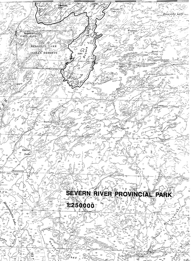
Enlarge regional setting map of Severn River Provincial Park (PDF)
Targets
Life science representation
Site type/landscape unit
- L.U. 5 - Bearskin Drumlin Field
- L.U. 8 - Big Trout – Kingfisher Ground Moraine
Species/communities
- Northern Boreal Forest Region and associated vegetation complexes.
Earth science representation
Geological theme
- Late Archean Tectonic
- Timiskaming Interstadial
Feature
- Sachigo Subprovince - intrusive plutonic rocks, metasediments, metavolcanics
- Big Beaver House Moraine-kame, drumlins, Lake Agassiz
Cultural resource representation
Theme
- Unknown
Theme segment
- Unknown
Recreation opportunities
Day use
- N/A
Car camping
- N/A
Wilderness/back country
- 3,500
Inventories
| Level/type | Earth science | Life science | Cultural | Recreational | Other |
|---|---|---|---|---|---|
| Reconnaissance completion date | 1980 | N/A | N/A | 1980 | N/A |
| Detailed completion date | N/A | N/A | N/A | N/A | N/A |
| Required? | Yes | Yes | Yes | Yes | Fisheries Yes |
Date 89.06.01
Management guidelines
I. Land tenure
No alienated forms of land tenure presently exist within the park and none will be considered pending the completion of the park management plan.
II. Land acquisition/disposition
There are no patented lands within the park area at this time. The disposition of land within the park will not occur pending the completion of the park management plan.
III. Existing/proposed development
There is no existing development within the park area and none will be permitted pending the completion of the park management plan.
IV. Recreation activities
Existing recreational activities include fishing, hunting, canoeing, camping and snowmobiling.
Guideline
The above recreational activities will be permitted to continue and will be further addressed during the development of the park management plan. Sport hunting will be permitted to continue on an interim basis by regulation under the Game and Fish Act, and will be further addressed during the preparation of the park management plan. The Severn River Provincial Park will be considered to be a park until such time as a management plan is completed for the waterway. In the interim, normal park fees will not apply. Non-residents of Canada are subject to the conditions of the Crown land camping program and the camping permit requirement.
V. Commercial activities
Commercial fishing for yellow pickerel, northern pike and whitefish occurs on Severn Lake and along the Severn River.
Portions of five Status Indian operated traplines occur within the park.
Small scale timber harvesting operations occur along the waterway to meet the demand for Muskrat Dam Indian Band housing projects.
At the present time, no commercial tourist outpost camps or boat caches are located within the park. The Muskrat Indian Band has however, expressed an interest in establishing outpost camps within this area. The development of new commercial tourism activities will be further addressed during the preparation of the park management plan.
Guidelines
Commercial fishing will continue to be permitted in the interim until addressed in the park management plan. No new licences will be issued and where licences lapse, they will not be renewed. Commercial bait fishing and the use of live bait is not permitted north of the 11th baseline.
Commercial trapping within the park is undertaken only by Status Indian trappers. Such trapping activity will be permitted to continue. No new traplines will be permitted and the transfer of traplines must be approved by the Ministry of Natural Resources. Transfers of traplines from Status Indian people to other than Status Indian people will not be permitted. Only Status Indian trapper helpers are permitted to assist Status Indian trappers. Existing trapline cabins will be permitted to continue in their present locations. No additional cabins or the relocation of existing cabins will be considered pending the completion of the park management plan.
Other forms of commercial activities such as mineral exploration/extraction, hydro development and aggregate extraction will not be permitted.
VI. Native interests
The park lies within the Treaty #9 area. It borders the Angling Lake Indian Reserve and is located in close proximity to the Big Trout Lake Indian Reserve. Status Indians enjoying treaty rights to carry on traditional natural resource harvesting activities will be permitted to carry on those activities in accordance with the terms of their treaty within the Severn River Waterway Park. Accordingly, such Status Indians will be permitted to carry on those activities in certain circumstances. The details of those circumstances will be the subject of further discussion and review.
VII. Natural resources
A number of earth science values have been documented for the park as detailed in the attached check sheet. Interim management efforts will be directed towards the protection of these earth science values.
Natural or man-caused fires within the park will be managed according to the Regional Fire Management Policy.
VIII. Cultural resources
This portion of the Severn River did not receive a cultural inventory during the West Patricia Land Use Planning Exercise. As such, very little is presently known about the cultural resources within the park. Should cultural sites of significant importance become identified, appropriate action will be taken to protect these sites.
IX. Client services
Information on the Severn River Provincial Waterway Park is minimal at this time. It may be appropriate to produce an information brochure on the natural and cultural value is some time in the future.
X. Research
More detailed earth and life science, historical/archaeological, and recreational inventories will be required prior to the initiation of the park management plan. Other research activities which enhance our scientific knowledge of the park will be encouraged.
XI. Marketing
A marketing strategy for this waterway class provincial park will be addressed during the preparation of the park management plan.
References/sources
Buss, E., Waterway Parks Evaluation Report - West Patricia Land Use Plan, O.M.N.R., May, 1980.
Gray, S. L., Life Science Systems Planning Report - West Patricia Land Use Plan, O.M.N.R., May, 1980.
Harvey, T., Earth Science Systems Planning In The West Patricia Planning Area - Final Report, O.M.N.R., April, 1980.
Harvey, T., Earth Science Inventory Checklist for the Severn River Waterway Candidate, O.M.N.R., February, 1980.
Ministry of Natural Resources, Regional Parks System Plan Northwestern Region, May, 1982.
Ministry of Natural Resources, West Patricia Land Use Plan Background Information, November, 1981.
Ministry of Natural Resources, West Patricia Land Use Plan Proposed Policy and Optional Plans, June, 1982
Plan of Severn River Provincial Park in the District of Nipigon
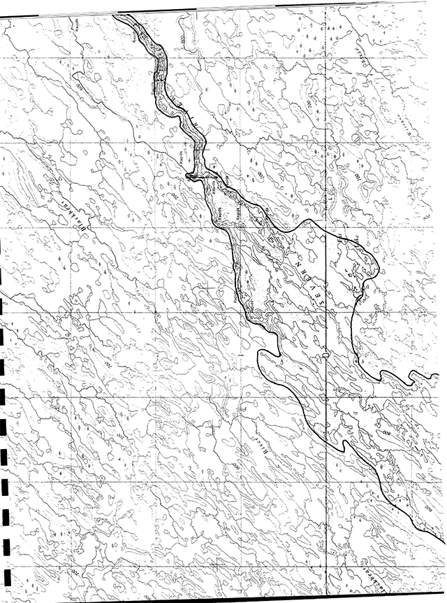
Enlarge Severn River Provincial Park map (PDF)
Earth science inventory checklist
Name: Severn River
Map name: [no information provided]
Map number: 53D,E,F,G,I,J
UTM ref.: [no information provided]
County, district or regional municipality: District of Kenora
Lat: [no information provided]
Long.: [no information provided]
Alt. min: [no information provided]
Alt. max.: [no information provided]
Township: Patricia Portion
Lots: [no information provided]
Concessions: [no information provided]
Area: [no information provided]
Ownership: Crown
Administration: [no information provided]
MNR region and district: NWR - Red Lake
Conservation Authority: [no information provided]
Aerial photographs - Base maps
Year, roll, flight line, numbers: [no information provided]
1:50,000 NTS map showing area boundaries: [no information provided]
Earth science features
- A wide variety of bedrock elements
- six major landscape units
- a 3200 year period of glacial retreat over the late Timiscaming Interstadial and Driftwood Stadial
Sensitivity
- unknown and undocumented.
Significance
- a provincially significant waterway containing an outstanding cross-section of bedrock and terrain elements in the West Patricia Planning Area
Major references
[no information provided]
Date compiled
February, 1980
Compiler
E. Harvey, Box 89, Cochenour, Ontario
Bedrock geology
The Severn River headwaters arise in an Early Precambrian (Archean) complex of the Superior Province of the Canadian Shield called the Berens River Plutonic Block. North of Favourable Lake, it traverses from southwest to northeast another subprovince called the Sachigo or God’s Lake belt (Riley et al., 1971). This belt is cnaracterized by smaller belts of supracrustal rocks (predominantly metavolcanic) oriented westerly or southeasterly, surrounded by oval-shaped batholiths.
Bedrock mapping of this area has generally concentrated upon greenstone belts. Helicopter reconnaissance surveying has been carried out in the Deer Lake-Favourable Lake area (Ayres et al. 1972) and in the Sandy Lake-Severn Lake area by Bennett and Riley (1969, called Operation Lingman Lake). The following description summarizes information presented in the above references since time and financial constraints prevented field evaluation. In addition, more detailed mapping of the Sandy Lake belt, Muskrat Dam Lake belt and Big Trout Lake belt have been completed by Satterly (1938), Ayres (1969) and Huder (1964) respectively.
The Severn River traverses from Deer Lake to Favourable Lake, a part of the Berens River Plutonic Block, which is composed of gneissic granodiorites and composite granitoid batholiths. In this part of the river, outcrop of granitic crystalline rocks is extensive and fractures and minor faults control the shape and direction of the Severn River channel. The river crosses into the Sachigo subprovince at the Bearhead Lake fault, which strikes northwest-southeast through Favourable and Borland Lakes. A minor limb of the Favourable Lake belt exposing mafic metavolcanics crosses the river just north of Favourable Lake. Between this point and Sandy Lake, outcrop frequency is very low, but all recorded exposures are felsic intrusives.
The Sandy Lake belt has metamorphosed mafic to intermediate volcanics with its major fold axis stretching in a fifty mile (eighty km) direction about Sandy Lake. The isoclinally folded belt contains a central anticline flanked on either side by synclines. Outcrop frequency is common usually at the shore’s edge. Metasediments are also noted in Sandborn Bay and on the many small islands in the central part of the lake, intruded by felsic and mafic intrusives. As the river enters the western end of the Muskrat Dam Lake belt, it jogs around a gabbro intrusion, presumably a more resistant obstacle in its course.
The Muskrat Dam Lake belt is a one hundred and five kilometre (65 mile) long, east trending belt, isoclinally folded with marked facies changes common. The synclinal axis trends northeast through the centre of Muskrat Dam Lake exhibiting evidence of at least two volcanic cycles (mafic metavolcanics to metasediments to felsic metavolcanics). A variety of lithologies outcrop on the Severn River, but are best exposed at low water levels during the late summer and early fall. Good examples of felsic metavolcanics, metasediments (pebble metaconglomerate and brecciated marble) have been described by Ayres (1969) by way of photographs from the Severn River shoreline, especially in the vicinity of Sandhill Crane Island.
North of the Muskrat Dam Lake belt, outcrop along the river is generally poor although bedrock thresholds are the sole cause for rapids and falls. Felsic intrusives and associated migmatites are the lithologies most frequently exposed. Evidence of the river crossing several small southeasterly trending greenstone belts is found as small outcrop and low rapids. Two limbs of the Swan Lake belt (an extension of the Big Trout Lake belt) are exposed north of Severn Lake. These are largely mafic-intermediate metavolcanics, but most often are migmatites or derived amphibolites. North of Jackfish Lake, the river crosses four narrow fingers of lit-par-lit migmatite and amphibolite separated by granitic intrusions, related to the Witegoo River belt.
Mapping of the Paleozoic-Archean contact indicates an exposed angular unconformity but this was not observed during a field stop in August, 1979. Water levels are usually required to be low in order to observe the contact with the Silurian limestone.
Although limited occurrences of post-granitic diabase dikes have been mapped, none have been shown outcropping within the waterway.
Surficial geology
The Severn River waterway begins at Deer Lake and flows northeastward through Sandy Lake, Muskrat Dam Lake, Severn Lake towards Hudson Bay. The river’s head waters were probably first uncovered from beneath glacial ice about 11,000 years B.P. (early Algonquin Stadial; Saarnisto, 1974; Harvey, 1979b) although so little surficial material remains in the area that glacial events are very poorly known. Final post-glacial events in the West Patricia Planning area are recorded by marine sediments and the marine limit of the Tyrrell Sea which first came into existence about 7800 years B.P. (Driftwood Stadial, Prest, 1970). The marine limit is believed to occur just where the Severn River enters the Hudson Bay Lowlands. The waterway therefore contains features formed during this 3200 year interval.
The direction of retreat of glacial ice is indicated by several long end moraines oriented roughly northwest-southeasterly. The Severn River crosses through parts of the Agutua Moraine at the east end of Sandy Lake which is believed to have formed about 9,000 years B.P. (Prest, 1970; Harvey, 1979c) and to be approximately correlative with the Opasquia Moraine, an east-west morainal ridge north of Sandy Lake, representing a separate lobe of the retreating ice. Another halt in the retreating ice is recorded by a subdued, partially buried feature called the Big Beaverhouse Moraine which the river cuts through near Asipiquobah Lake (Prest, 1963, 1970; Harvey, 1979d). To the north, a pale brown sandy silt till forms the drumlinized ground moraine surface in the Two River Lake area. A pink clay till of unknown relationship was noted near the marine limit during field investigations in 1979 (it could be correlative of the Cochrane Advance which is dated at approximately 7800 years B.P.).
Throughout the first two-thirds of the above time period, a large glacial lake (Lake Agassiz) was ponded against the ice front. The effect of Lake Agassiz was so substantial in the Deer Lake area that little glacial material, save immature sandy lags and boulder lags, remains by which early glacial events can be deciphered. A fining upward sequence of lacustrine deep water sediments was deposited in the Deer Lake area. In the Sandy Lake basin, a chocolate-coloured series of varved clays were deposited to considerable depths (up to 24 metres). The summer layer is usually a silt, grey in colour, weathering to buff while the winter portion of the couplet is a deep chocolate colour (Prest, 1963). The same varved clays are found in the Muskrat Dam Lake area (Ayres, 1969) but usually only in lowland areas. Upland areas have been modified by the lake but retain original characteristics. The lake had outlets initially in South Dakota, and then as lower land became free east of Sioux Lookout and later in the Echoing and Nelson River valleys to the north (Elson, 1967 and Zoltai, 1967). It appears that Lake Agassiz did not stretch north and east of the Big Beaverhouse Moraine to any degree but a red, sticky, unlaminated clay in the area, overlying the chocolate varves, is evidence of ponded water.
Surficial mapping of the area has only been conducted at a reconnaissance level first by a team from the Ontario Centre for Remote Sensing whose preliminary mapping is only recently available (scale 1:250,000). In the delineation of significant earth science features for Park Planning purposes, the author has conducted surficial mapping in the Deer Lake, Opasquia and Makoop map sheet areas (Harvey, 1979b, c, d). Because of time and logistical constraints, field surveying was conducted only near the marine limit not previously traversed by the parks reconnaissance surveying. To summarize and simplify the complex area traversed by the Severn River, a series of physiographic segments have been delineated. These are largely based upon a series of landscape units which have been described for the West Patricia Planning area for Park Planning purposes (Harvey and Gray, 1979). A longitudinal profile is also presented to further outline the river’s characteristics.
Segment I. - Berens River Bedrock Plateau
This segment is characterized by moderately broken bedrock knolls and ridges with till veneers on the protected sides and lower slopes while thin organics fill enclosed basins. Intervening valleys and river sections are usually underlain by fine-textured lacustrine sediments. The Deer Lake to Favourable Lake segment has a course controlled by the fracture pattern of the bedrock. Steep-sided and narrow in places, the channel cascades over a series of rapid drops.
Segment II. - North Spirit Lake Clays
This segment in the Favourable Lake area marks the transition from the Berens River Bedrock Plateau and the Sandy Lake Basin. Thin silts, clays and boulder lags cover the upland bedrock drift complex while varved clays are prevalent in the lowlying area.
Segment III. - Sandy Lake Basin
The Sandy Lake Basin is dominated by the chocolate series of varved clays related to glacial Lake Agassiz where thick deposits are exposed on the shoreline. The upland bedrock drift complex is a very small portion of the landscape although it becomes more prominent east of Rottenfish River. In this segment, the waterway is almost entirely a lake environment (Finger Lake, Opasquia Lake, Sandy Lake) with a very small drop in elevation. The lakes have typically an elongate to oval shape with steep east-facing banks up to five metres in height and occasional bedrock promontories.
Segment IV. - Muskrat Dam Lake Clays
The segment has also been modified extensively by glacial Lake Agassiz but whose upland areas retain original characteristics. The river has a series of rapid drops between Muskrat Dam and Asipiquobah Lakes and the northern part of the segment is marked by extensive wetland and some minor permafrost features. Lacustrine varved clays similar to the Sandy Lake Basin, and in places red sticky unlaminated clay, variably overly a brown calcareous sandy silt till. Several esker trunk systems traverse or parallel the river’s course in this segment. Bedrock outcrop, while frequently at the shore’s edge, is not common in an upland setting close to the river.
Segment V. - Bearskin Drumlin Field
The river traverses an uncharacteristic section of the Bearskin Drumlin Field and it is here that evidence is first seen that suggests that the river is creating its own environment. The channel has many small islands with many rapid drops over bedrock thresholds. Evidence of ice scour and flood action from the Big Beaverhouse Moraine is present and it appears that normal flow levels have little effect upon channel forms. The bank characteristics are created by ice scour during spring flood and are almost U-shaped. The lakes tend to be very shallow. The lowland component of the landscape unit (wave washed sandy calcareous till and bedrock drift complex) is present well back from the river’s edge but the upland drumlin component is not well represented along the river.
Segment VI. - Big Trout-Kingfisher Ground Moraine
Similar comments as the previous segment can be made about the channel form of the river. Bedrock thresholds mark numerous rapids in the gradual drop to the Hudson Bay Lowlands. The channel contains many islands and has a wide sinous U-shaped form. Both components of the landscape unit can be found in close proximity to the channel. Near the Hudson Bay Lowlands, the side banks increase in height and expose a pink clay till (Cochrane?) overlying glacial fluvial material. The terrain, however, is generally very flat, vaguely fluted and covered by extensive bog veneer with discontinuous permafrost.
Significance
This waterway has tremendous potential to provide representation of earth science elements characteristic of the West Patricia Planning Area. By virtue of its length, it can present a cross-section of the geology and geomorphology of the area with the only limitation that the river’s size is such that it creates its own environment. Nodes, containing more extensive land segments, can be incorporated into the waterway to counteract the problem. In more detail, the following points present the waterway’s potential to represent earth science elements:
- Representation not sufficient alone to adequately represent the Berens River subprovince but contains part of the Bearhead Fault (subprovince contact), some northwest trending granitic gneissis and a variety of granitic textures and compositions. Possible representation of the primitive crust environment.
- Representation sufficient to adequately represent the Sachigo subprovince (assuming nodes are included). Shoreline outcrops of the Sandy Lake Belt, the Muskrat Dam Lake Belt and a number of the northern belts should provide a diverse and interesting story of the subprovince. In particular, Sandhill Crane Island has a number of well-documented outcrops.
- Representation not significant alone to represent the late Timiscaming Interstadial but important and significant contributions are made - namely Lake Agassiz wave-washed terrain, chocolate series of varved clays, red sticky unlaminated clays; Big Beaverhouse Moraine and several other minor moraines, a variety of ground moraine surfaces and textures. As a further analysis of representation, the following Landscape Unit segments are well represented (assuming the inclusion of recommended nodes):
Segments Components Representation I. Berens River Bedrock
Plateaubedrock drift complex well-good I. Berens River Bedrock
Plateauvarved clays - fining upward good I. Berens River Bedrock
Plateau
sandy non-calcareous ablation till
not present?II. North Spirit Lake Clays bedrock drift complex moderate II. North Spirit Lake Clays varved clay - chocolate series good III. Sandy Lake Basin thick lacustrine varved clays good III. Sandy Lake Basin bedrock drift complex moderate IV. Muskrat Dam Lake Clays lacustrine varved clays good IV. Muskrat Dam Lake Clays bedrock drift complex good IV. Muskrat Dam Lake Clays ground moraine - Big Beaverhouse M. good IV. Muskrat Dam Lake Clays esker trunk systems good V. Bearskin Drumlin Field calcareous sandy silt till good V. Bearskin Drumlin Field bedrock drift complex, lowland good VI. Big Trout-Kingfisher Ground Moraine sandy silt ground moraine moderate VI. Big Trout-Kingfisher Ground Moraine bedrock outcrop - upland and lowland moderate - Significant contribution to the glacial process/landform theme and the lacustrine process/landform theme with interesting examples of buried morainic topography, an ice contact delta and other esker-kame systems. A wide variety of ground moraine textures and terrains, both modified and unmodified are presented. Some of the best examples of notched drumlinoids can be found in the Bearskin Drumlin Field.
- Investigation during the summer of 1979 revealed good and outstanding examples of periglacial features such as palsas, collapse scars, peat mounds, etc., which are evidence of the zone of discontinuous permafrost. These features are unique to this region of northern Ontario and could make an important contribution to the representation of Ontario earth science history.
- Although poorly documented, the Severn River, being one of the largest and longest rivers in Ontario, contains a diverse collection of fluvial processes and landforms. Although not well documented, the channel scouring during spring flooding is probably a characteristic feature of rivers which flow northward toward Hudson Bay. This aspect of the Severn River must be given provincial significance.
Recommendations
- That the Severn River, with the attached boundaries, be designated as a Waterway Class Provincial Park. The following nodes or expanded areas are recommended in order to represent more completely the terrain through which the river traverses. Other areas such as Sandy Lake would require very little land area in order to represent the bedrock features:
- an expansion between Angekum and Finger Lakes to gain representation of the upland bedrock drift complex;
- expansion of river area to include Sandhill Crane Island to provide representation of possible bedrock outcrops;
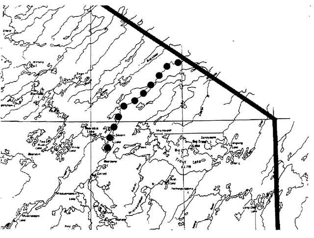
- a major wilderness node about the Big Beaverflouse Moraine to provide representation of the wide variety of terrains present and the excellent examples of permafrost landforms north of Bearskin Lake - see additional checksheet - Makoop-Two River Wilderness Candidate;
- an expansion near Jackfish Lake to include both river channels and to provide better representation of upland portions of the Big Trout Kingfisher Ground Moraine, and of boulder block fields;
- an expansion at the marine limit to represent this fascinating transitional environment, to represent the stratigraphy recorded in the banks and to provide a contrasting area of permafrost landforms.
- Bedrock outcrops are usually confined to the river edge and are only viable at low water level. Fluvial action keeps the outcrops clean and visible. Therefore, in areas where an enlarged waterway corridors not needed for representation of other earth science elements, the corridor only needs to be confined to the river’s edge. This could become particularly important in greenstone belts where as much land as possible should be available for staking.