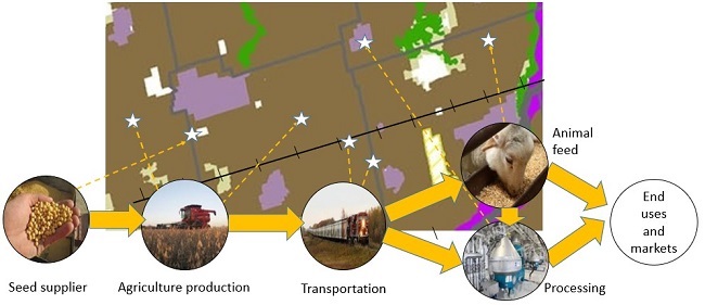
Agri-food network and supply chain as part of the agricultural system
Learn about Ontario’s agri-food network including infrastructure, services and other agri-food assets and how it supports a thriving agri-food sector.
Agri-Food Network

- The agri-food network includes the infrastructure, services and other agri-food assets needed to sustain and enhance the prosperity of the agri-food sector. For example, this includes transportation systems, agricultural services, farm markets, distributors and primary food processors.
- The functional agri-food network often extends into adjoining municipalities.
- Provincial plans for the Greater Golden Horseshoe encourage municipalities to plan for the success of the agri-food sector.
- Information on the agri-food network can inform economic development strategies, investment decisions, local food initiatives and Agricultural Impact Assessments.
- When Agricultural Impact Assessments are undertaken for settlement area boundary expansions, infrastructure, mineral aggregate applications and other non-agricultural uses, it is important to consider the impacts to the agri-food network.
- The Implementation Procedures for the Agricultural System in Ontario's Greater Golden Horseshoe discusses the agri-food network in detail.
- Data sources on the agri-food network:
- Agricultural System Portal
- ConnectON (for partners with data sharing agreements)
- Business directories
- Agricultural advisory committees
- Local agricultural organizations (for example, chapters of Ontario Federation of Agriculture, Christian Farmers Federation of Ontario, National Farmers Union)
- Local food initiatives
- Business Retention and Expansion projects
Updated: March 11, 2025
Published: May 25, 2022