Albany River Provincial Park Management Statement
This document provides direction on the management of Albany River Provincial Park.
March, 1985
Regional Directors Approval Statement
This Interim Management Statement will provide interim direction for the management of the Albany River until a comprehensive Park Management Plan is prepared.
This statement will provide the basis for the subsequent preparation of the Park Management Plan.
I am pleased to approve this Interim Management. Statement for the Albany River.
Signed by:
G.P. Elliott
Regional Director
North Central Region
D.R. Johnston
Regional Director
Northwestern Region
Background Information
| Name | Albany River |
|---|---|
| Proposed Class | Waterway |
| M.N.R. District | Sioux Lookout Portion |
| M.N.R. Region | Northwestern |
| Total Area (ha) | 65,360 |
| Land | |
| Water | |
| Site Region | 3S Lake St. Joseph 3W Lake Nipigon |
| Site District | 1 |
| Date in Regulation |
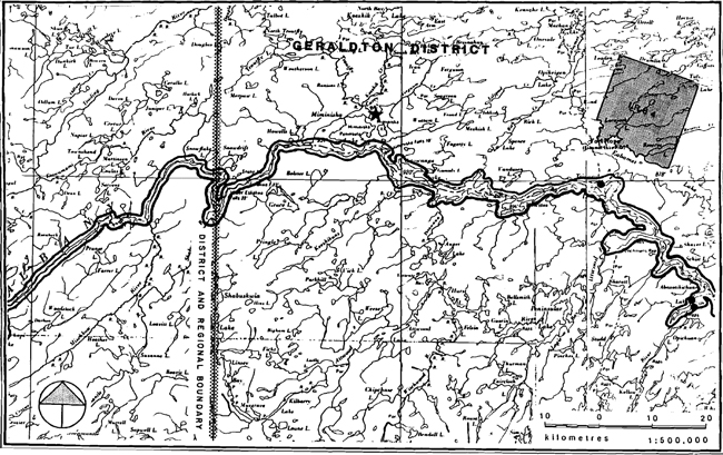
Regional setting map
Regional setting map of Albany River - Northwestern region
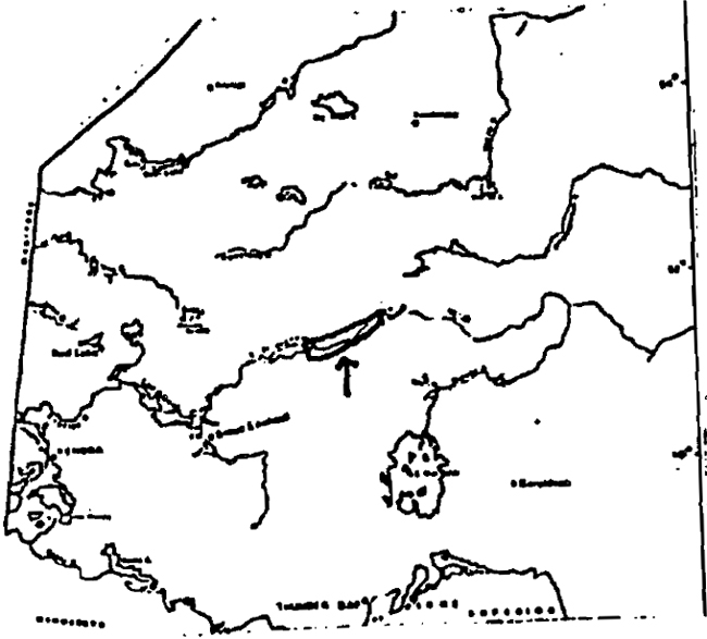
Enlarge regional setting map of Albany River - Northwestern region
Targets
1. Life Science Representation
| Site Type/Landscape Unit | Species/Communities |
|---|---|
| L.U. 21- Agutua Moraine-Southern Portion. L.U. 22- Lac Seul Moraine-Lake St. Joseph Portion | Centeral Boreal Forest Region: lacustrine modified lowland, morainic upland, lake modified, drumlinized till plain |
2. Earth Science Representation
| Geological Theme | Feature |
|---|---|
| Late Archean Tectonic Driftwood Stadial |
Uchi Subprovince (intrusive plutonic rocks, met-avolcanic belts, metasediments) Agutua Moraine, Miminiska Advance, Lake Agassiz, Lac Seul Moraine; Cochrane Advance |
3. Cultural Resource Representation
| Theme | Theme Segment |
|---|---|
| Fur trade | Albany River Drainage Area |
4. Recreation Opportunities
| Day Use | Car Camping | Wilderness/Back Country |
|---|---|---|
| N/A | N/A | 13,000 |
Inventories
| Level/Type | Earth Science | Life Science | Cultural | Recreational | Other |
|---|---|---|---|---|---|
| Reconnaissance completion date | 1979 | Site record form | |||
| Detailed completion date | See bibliography | ||||
| Required? | Detailed inventory | Detailed inventory | Detailed inventory | Mineral potential inventory |
Date: January 15, 1985
Background Information
| Name | Albany River |
|---|---|
| Proposed Class | WA |
| M.N.R. District | Geraldton Portion |
| M.N.R. Region | NCR |
| Total Area (ha) | 62,723 |
| Land | |
| Water | |
| Site Region | 2W; 2E |
| Site District | 2, 3; 1 |
| Date in Regulation |
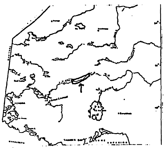
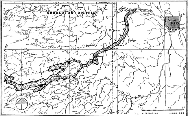
Regional Setting Map
Regional setting map of of Albany River - North central region
Enlarge regional setting map of Albany River - North central region
Targets
1. Life Science Representation
| Site Type/Landscape Unit | Species/Communities |
|---|---|
| Undocumented |
2. Earth Science Representation
| Geological Theme | Feature |
|---|---|
| Timiskaming Interstadial Driftwood stadial Others undocumented |
Aguta Moraine (southern portion) Cochrane Advance (Fort Hope Ground Moraine) |
3. Cultural Resource Representation
| Theme | Theme Segment |
|---|---|
| Numerous: see references in bibliography |
4. Recreation Opportunities
| Day Use | Car Camping | Wilderness/Back Country |
|---|---|---|
| N/A | N/A | 11,000 (NCR only) |
Inventories
| Level/Type | Earth Science | Life Science | Cultural | Recreational | Other |
|---|---|---|---|---|---|
| Reconnaissance completion date | 1979 | ||||
| Detailed completion data | See bibliography | ||||
| Required? | Detailed inventory | Detailed inventory | Detailed inventory | Mineral potential inventory |
Date: March 5, 1984
Management Guidelines
I Land Tenure
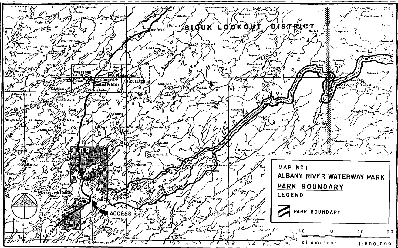
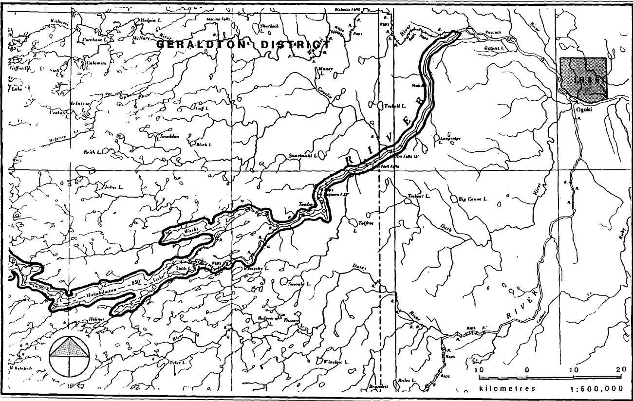
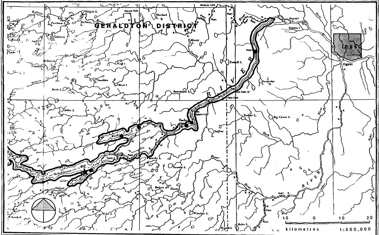
The recommended park boundary is generally defined as the area 200 meters either side of the waterway, originating in Sioux Lookout District at Highway 599 and including both the North and South channels of the river and the land in between (see Map No. 1). The exception to this is in the Miminiska Lake area where the northern portion of the lake has been excluded in order to avoid a commercial tourist lodge and a group of leased and patented mining claims.
Staking has occurred in the area west of Howells Lake (see Map No. 2) At the same time, the park area has been withdrawn from staking. All, or part, of 44 mining claims fall within the recommended park boundary.
In addition, 11 land use permits have been issued for commercial outpost camp sites. Each site occupies about 0.4 hectares. There is also one tourist lodge under Crown lease on Makokibatan Lake (1.52 ha.) and a Crown reserve on Washi Lake. The Crown reserve is intended to protect the historic site of Gloucester House, a former Hudson Bay post.
Guidelines:
- If, for any reason, the staked mining claims lapse, the area within the recommended park will not be available for restaking;
- Annual renewal of the land use permits will occur;
- The Crown lease is an acceptable land tenure and the presence of the recommended park will not prejudice its renewal;
- The Crown reserve will remain in place;
- No other land alienation of any type will occur within the recommended park.
Map 1-1: Albany River Waterway Park - Park Boundary

Enlarge Map 1-1: Albany River Waterway Park - Park Boundary
Map 1-2: Albany River Waterway Park - Park Boundary

Enlarge Map 1-2: Albany River Waterway Park - Park Boundary
Map 1-3: Albany River Waterway Park - Park Boundary

Enlarge Map 1-3: Albany River Waterway Park - Park Boundary
Map 2-1: Albany River Waterway Park - Howells Lake Area
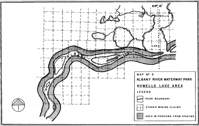
Enlarge Map 2-1: Albany River Waterway Park - Howells Lake Area
II Existing/Proposed Development
Access may be gained to the recommended Albany River Waterway Park via Highway 599 at Osnaburgh Lake (in Sioux Lookout District). Canoeists may also fly to Fort Hope on one of the regularly scheduled flights or by float plane to any of the suitable points along the waterway. There is no road access in the Geraldton District.
There are numerous campsites and portages along the waterway which are fairly well documented. The present condition of the facilities with respect to cleanliness, maintenance and passability is not known.
The Ogoki Road is a DREE-funded road that is being built to access the Ogoki Working Circle in the Kimberly-clark licence area. It is projected to reach as far as Thurman Lake, about 30 miles south of the Albany River (although the road’s completion is now in doubt). The Band Council of the Fort Hope Indian Reserve is studying the socio-economic costs of linking their community to this road system. This would mean that the Albany River would have to be crossed. There is an old winter road that runs from Armstrong to Fort Hope. It was used by tractor trains to haul freight to the community.
Guidelines:
- The Geraldton District will carry out a survey of the waterway to determine the condition of the facilities. Various options will be explored in order that the most cost-effective means of operation is determined;
- If a road is built to Fort Hope, a crossing of the recommended park is permissible. However, careful planning of the crossing will ensure that minimal disturbance and maximum benefit accrues to the recommended park;
- Should the winter road be re-activated, the crossing of the waterway by tractor trains is permissible;
- An access point may be developed adjacent to Highway 599 in order to accommodate park users. Alternatively, the Ministry may approach private landowners adjacent to the recommended park to determine if they are interested in developing an access point to service the users.
III Recreational Activities
The primary recreational uses of the waterway are sport fishing, hunting, canoeing and camping. No survey of park users has been carried out but it is expected that the area receives at least a moderate level of use since it is a well-known waterway among back-country recreation enthusiasts.
The residents of Osnaburgh, Fort Hope and Marten Falls reserves also use the waterway for recreational activities like camping, boating, swimming and snowmobiling. There are numerous cabins and campsites along the waterway (not well documented) which are used by the native people for summer residences. Boating includes the use of outboard motors. There is a winter snowmobile trail between Marten Falls and Fort Hope which crosses the park at several locations.
Guidelines:
- Sport fishing will continue to be a permitted use in this recommended waterway park;
- Hunting will be a permitted use in this recommended park;
- Geraldton, Sioux Lookout and Moosonee districts will attempt to establish a system to monitor use of the waterway;
- Recreational activities carried out by the native people will continue to be permitted.
IV Commercial Activities
1. Commercial Tourism
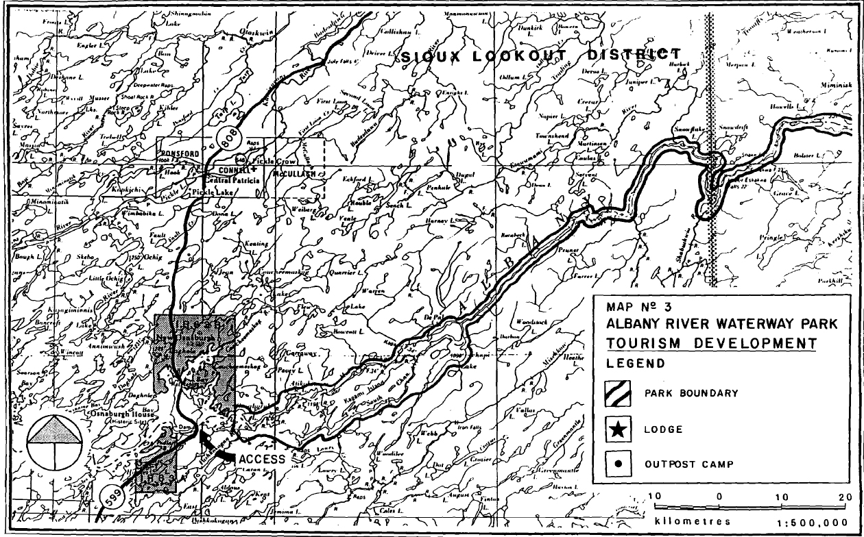
There are eleven outpost camps and one commercial lodge located within the recommended park area (see Map No. 3). In addition, there is a lodge on Miminiska Lake (outside of the park boundary) whose guests utilize the waterway. These establishments cater to sport fishermen and hunters and all are fly-in operations.
Guidelines:
- Sport fishing will continue to be a permitted use in this recommended waterway park;
- Hunting will be a permitted use in this recommended waterway park;
- The operation of motorized boats will be permitted;
- Commercial tourism will be a permitted use in this recommended waterway park. outpost camps or the lodge may be transferred from one operator to another providing all other Ministry requirements are met. However, if any site is given up, it will be cleaned to the satisfaction of the Ministry, and not be reallocated until assessed in the management planning process;
- Reconstruction of existing facilities is permitted as long as there is no increase in capacity;
- The entire recommended park area will be designated for aircraft landing;
- No additional tourism development will occur pending completion of a management plan. This includes boat caches and outpost camp development.
Map 3-1: Albany River Waterway Park-Tourism Development
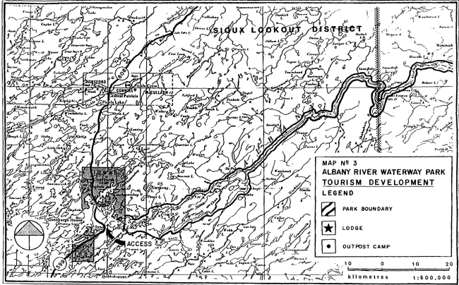
Enlarge Map 3-1: Albany River Waterway Park-Tourism Development
Map 3-2: Albany River Waterway Park-Tourism Development
Enlarge Map 3-2: Albany River Waterway Park-Tourism Development
Map 3-3: Albany River Waterway Park-Tourism Development
Enlarge Map 3-3: Albany River Waterway Park-Tourism Development
2. Trapping
There are portions of fourteen traplines within the recommended park area. All traplines are run by native trappers. There is no inventory of trapline cabins.
Guidelines:
- Trapping is a permitted use in this recommended waterway park;
- Existing trapline cabins will be permitted to remain. Existing cabins may be rebuilt at their present locations;
- Cabins at new locations must be approved by the District Manager and are subject to his review of identified park values.
3. Commercial Fishing
Commercial fishing has taken place on nine lakes along the waterway (Abazotikichuan, Achapi, Atikokiwan, Makikobatan, Miminiska, Osnaburgh, Petawanga, Triangular, Washi). The most important species are yellow pickerel, northern pike, whitefish, and sturgeon.
All fishing has been carried out by native fishermen from Osnaburgh, Fort Hope or Marten Falls Indian Reserves.
Portions of eight bait fishing blocks are found within the recommended park.
Guidelines:
- Commercial fishing by native communities will be a permitted use in this recommended waterway park;
- Quotas will be based on the best biological information available;
- Where fisheries management purposes warrant, greater utilization of the fisheries resource will be encouraged by native communities. Licencees will be encouraged to fish up to existing quotas;
- New licences and/or quotas are subject to the District Manager’s approval;
- If, for fisheries management purposes, it is deemed advisable to cancel a particular licence, it will be done in accordance with Ministry policy and guidelines;
- Existing bait fishing licences are permitted to continue. No new licences will be issue until the management planning process is completed.
4. Mineral Resources
The recommended Albany River Waterway Park has been withdrawn from staking. As stated in Section I, some recent staking (prior to the withdraw) has occurred.
Deposits with good aggregate potential have been identified along the shore of the Albany River near Fort Hope. However, restricted access (and closer deposits) have curtailed any interest in these areas.
Guidelines:
- No new staking will occur within this area. Mineral exploration is a permitted use under an exploratory licence of occupation.
- In the area which has already been staked (see Map No. 2), the Ministry will try to ensure that further exploration activities are managed in such a way as to protect park resources. If these claims lapse, no restaking will be permitted within the recommended park;
- No aggregate extraction will occur within the recommended park boundary;
- Companies that wish to use the waterway only for access to their properties will require the approval of the District Manager and his decision will be based on the locations of identified park values
5. Forest Management
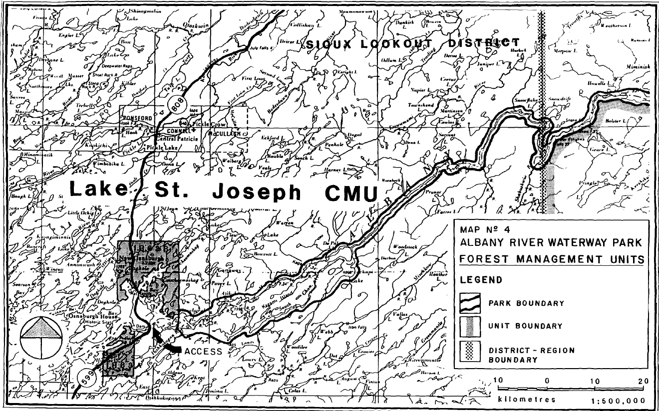
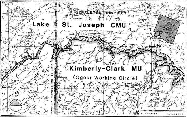
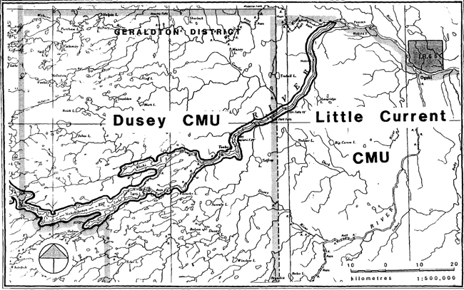
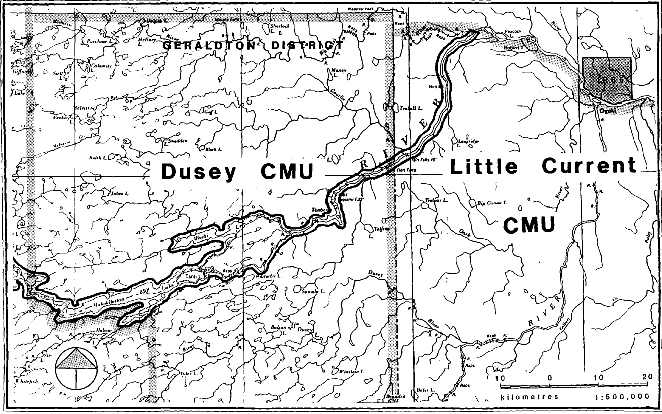
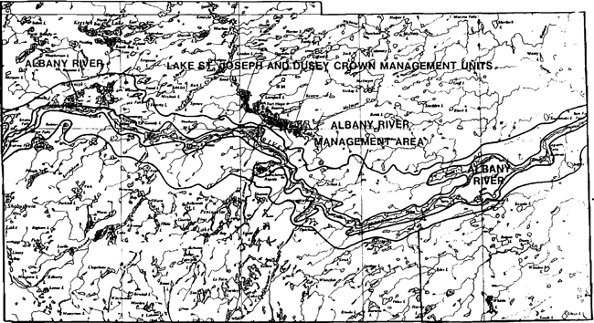
The Albany River waterway includes portions of four forest management units, the Lake St. Joseph, Dusey and Little current Crown Management units and the Kimberly-Clark of Canada Management Unit (see Map No. 4).
An area on either side of the recommended park boundary in the Geraldton district, has been designated as the Albany River Management Area (see Appendix A). It comprises the original area proposed for the waterway park, which was rejected because of its potential conflicts. However, the intent of this area is that it be managed to protect identified park values.
Guidelines:
- No harvesting of timber will occur within this recommended park, other than for use as firewood;
- No road construction other than that mentioned in Section II will be permitted within the recommended park;
- An integrated resource management plan will be prepared for the Albany River Management Area reflecting the intent of this area.
V Natural and Cultural Resources
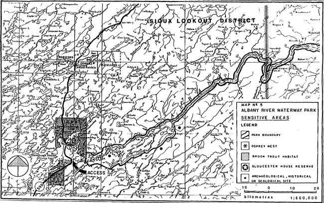
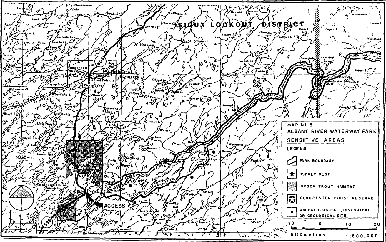
One osprey nesting site has been identified on the Albany River near Snake Falls (see Map No. 5). In addition, many portions of the waterway have sensitive speckled trout populations.
Map 4-1: Albany River Waterway Park - Forest Management Units

Enlarge Map 4-1: Albany River Waterway Park - Forest Management Units
Map 4-2: Albany River Waterway Park - Forest Management Units
Enlarge Map 4-2: Albany River Waterway Park - Forest Management Units
Map 4-3: Albany River Waterway Park - Forest Management Units
Enlarge Map 4-3: Albany River Waterway Park - Forest Management Units
In 1978 and 1979, a preliminary archaeological survey of the waterway was carried out. Numerous archaeological and historic sites were identified (see Map No. 6). The site of Gloucester House on Washi Lake has been set aside as a Crown reserve.
Guidelines:
- Sensitive areas will be recorded and appropriately managed as they are identified;
- Personnel of the appropriate branch of the Ministry of Citizenship and Culture will be consulted whenever issues relating to the management of cultural resources arise;
- Special fisheries management techniques may be implemented in order to protect and improve the status of the speckled trout populations.
VI Fire
Guidelines:
- Fires occurring within the recommended park will be managed according to the Regional Fire Management Policy;
- Use of the waterway for access to a fire will require the approval of the District Manager.
VII Native Interests
Osnaburgh, Fort Hope and Marten Falls Indian reserves all have a special interest in the waterway. It is heavily utilized by natives for transportation, recreation, and subsistence hunting and fishing.
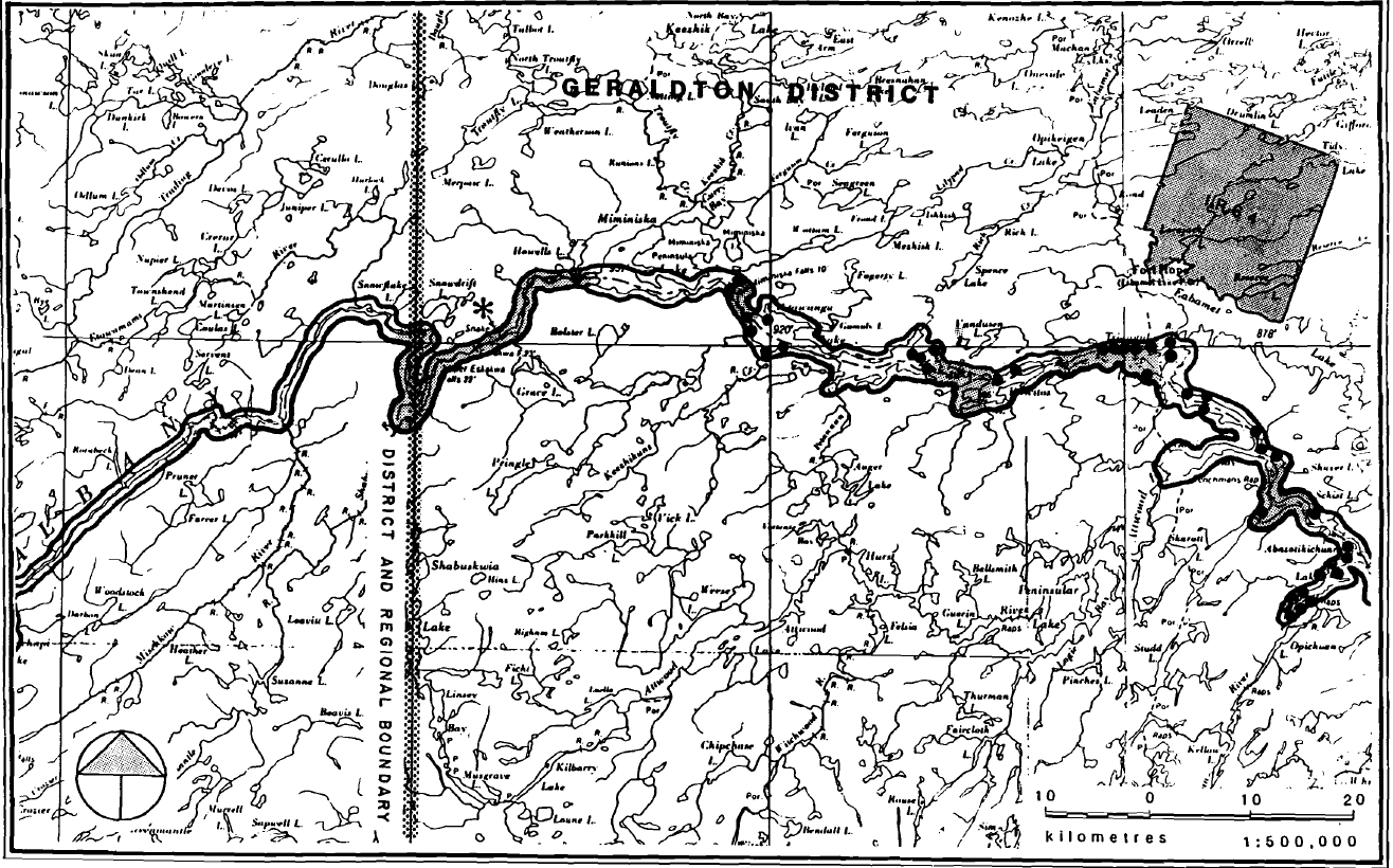
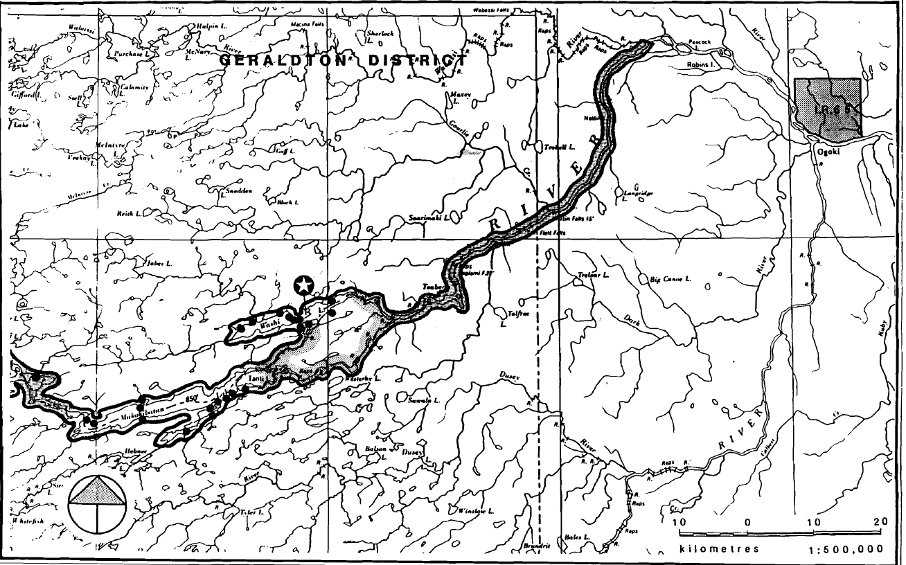
Map 5-1: Albany River Waterway Park - Sensitive Areas
Enlarge Map 5-1: Albany River Waterway Park - Sensitive Areas
Map 5-2: Albany River Waterway Park - Sensitive Areas

Enlarge Map 5-2: Albany River Waterway Park - Sensitive Areas
Map 5-3: Albany River Waterway Park - Sensitive Areas

Enlarge Map 5-3: Albany River Waterway Park - Sensitive Areas
Guidelines:
- Traditional uses will continue to be permitted;
- Timber harvesting for personal use will be permitted, however, written approval must be obtained from the District Manager before any harvesting takes place;
- The Ministry will discuss any concerns the native communities may have regarding the park.
VIII Client Services and Marketing
The Geraldton District has a pamphlet which describes the canoe route from its origin at Osnaburgh Lake (in Sioux Lookout District) to its terminus at James Bay.
In addition, a series of maps at a scale of one inch equals one mile are available for the portion of the waterway from Fort Hope to the coast. This route is also listed in the Ministry publication 'Canoe Routes of Ontario'.
Guidelines:
- The information on the Albany River canoe route will be updated and a new brochure will be prepared;
- The Districts will continue to respond to requests for information;
- An inventory of park resources will be conducted. Geraldton and Sioux Lookout Districts will co-operate in this venture.
IX Research
There are no plans to carry out any special research studies in the recommended park in the near future.
Guidelines:
- Research for scientific purposes and to supplement earth and life science information will be permitted. The objectives of this research must enhance park values.
Sources/References
- Albany River Waterway Park, Impact Assessment sheet.
- Biophysical Inventory and Analysis of the Fort Hope Indian Reserve No. 64, prepared by the Fort Hope Band Council in association with the Department of Indian Affairs, Nakina District; Hough, Stansbury + Michalski Limited; Nov. 1980.
- Dawson, K.C.A., 1976. Albany River Survey, Patricia District, Ontario. National Museum of Man, Archaeological Survey of Canada, Mercury Series, Paper 51; p. 52-106.
- Gray, S.L., May 1980, Ministry of Natural Resources, Life Science Systems Planning Report West Patricia Land Use Plan.
- Harvey T., April 1980, Ministry of Natural Resources, Earth Science Systems Planning In the West Patricia Planning Area-Final Report.
- Newton, B. and J.Mountain, 1980. Gloucester House: A Hudson’s Bay Company Inland Post (1777-1818). In: Northern Ontario Fur Trade Archaeology: Recent Research; C.S.Reid (Ed.); Ontario Ministry of Cultural Rec., Hist. Plan. Res. Br., Arch. Res. Pap. 12; p. 51-94.
- Prest, V.K., 1963. Northwestern Ontario. Red Lake-Lansdowne House Area, Surficial Geology. Geol. Surv. Can., Paper 63-6, p. 23.
- Ontario Ministry of Natural Resources; Geraldton and Sioux Lookout District Office Files, 1984.
- Ontario Ministry of Natural Resources; Map Nos. G-259, G-402, G-332, G-289, G-252, G-378, G-388, G-287, G-386, G-435, G-197, G-395, G-314, G-412, G-236, G-448, G-240, G-422, G-282, G-393, G-2498, G-2487, G-256, Scale 1"=40 chains; 1981.
- Ontario Ministry of Natural Resources; Forest Resource Inventory Base Maps 512872, 512873, 513872, 513873, 513874, 514874, 514883, 514884, 814881, 514882, 515874, 515883, 515884; Scale 1:15840; 1974.
- Ontario Ministry of Natural Resources; commercial Fishing Map, Commercial Tourism Map, Trapline Map; Scale 1:250,000; 1984.
- Ontario Ministry of Natural Resources; Geraldton District Fisheries Management Plan (draft); Geraldton, 1983.
- Ontario Ministry of Natural Resources; Canoe Routes of Ontario; Published by Parks and Recreation Areas Branch in co-operation with McClelland and Stewart, 1981.
- Ontario Ministry of Natural Resources; Geraldton District Land Use Guidelines (unreleased); 1983.
- Ontario Ministry of Natural Resources; West Patricia Land Use Guidelines (Draft); 1984.
- Ontario Ministry of Natural Resources; Candidate Park Assessment Sheets.
- Ontario Ministry of Natural Resources; Impact Assessment Sheets; 1982.
- Ontario Ministry of Natural Resources; West Patricia Land use Plan, Background Information; 1981.
- Ontario Ministry of Natural Resources; Regional Parks System Plan, Northwestern Region; 1982.
- Parks for Tomorrow, 1982, Response to: Ministry of Natural Resources, District Land Use Plan, Sioux Lookout District.
- Riddle, D., 1980. Archaeological Survey of the Upper Albany River. In: Studies in West Patricia Archaeology No. 1: 1978-1979, C.S.Reid (Ed.); Min. Cult. Rec., Hist. Plan Res. Br.; p.l53-213.
- Riddle, D., 1981. Archaeological Survey of the Albany River, Year 2: Triangular Lake to washi Lake. In: Studies in West Patricia Archaeology No. 2: 1979-1980; C.S. Reid and W.A.Ross (Editors); Min. Cult. Rec., Hist. Plan. Res. Br.; p. 207-279.
- Vyvyan, R.P., 1980; An Analysis of Artefacts from Marten Falls Hudson’s Bay Company Post, Ejip-1. In: Northern Ontario Fur Trade Archaeology: Recent Research; C.s. Reid (Ed.); Ont. Min. Cult. Rec., Hist. Plan. Res. Br., Arch. Res. Paper 12; p. 139-188.
Appendix A
Albany River Management Area
Enlarge Albany River Management Area
Appendix B
Excerpt from 'Canoe Routes of Ontario'
| Route (18) | Upper Albany Air |
|---|---|
| Type | Lake and river route |
| Rating | A A B A |
| Length | 470km/ 20 to 30 days |
| Portages | 39 |
| Main bodies of water | Marchington Rivers, Miniss Lake, Albany River |
| Start | Sioux Lookout by road (Hwy 72) or rail (VIA) |
| Finish | Fort Hope by air |
| Intermediate access | Osnaburgh Lake by road (Hwy 599) or Pickle Lake by road (Hwy 599) |
This isolated route offers an impressive variety of canoeing conditions including slow, swampy rivers, thundering white water and quiet lakes. The topography ranges from sandy beaches to rocky cliffs. Once a major link in the fur trade route connecting Manitoba and northwestern Ontario to Hudson Bay, these waters flow through virtually untouched wilderness.
Supplies are limited to the population clusters at Sioux Lookout, Osnaburgh House and Fort Hope. The trip can be extended to James Bay. (See Route 25.) Fishing: pike, pickerel.
Detailed Information: Albany River: Sioux Lookout to Fort Hope
Source:
Ministry of Natural Resources
Box 309
Sioux Lookout, Ontario
P0V 2T0
| Route (25) | Lower Albany Air |
|---|---|
| Type | River route |
| Rating | A A B A |
| Length | 610km/ 18 to 20 days |
| Portages | 14/200m (slippery rocks). 75m (sharp rocks) |
| Main bodies of water | Eabamet Lake, Albany River |
| Start | Fort Hope by air |
| Finish | Fort Albany by air |
Recommended for only the most experienced canoeists, this isolated route crosses rolling rock and muskeg country to James Bay. The first half of the trip churns over long stretches of violent rapids and numerous falls. Gradually the river widens, leaving behind its rocky shores and carves its way through high clay banks on the Hudson Bay Lowlands. Limestone Rapids, on the approach to James Bay offers a final rush of white water. Islands, tall white cliffs and ice-sculpted piles of gravel mark these final reaches. Winter camps of native trappers are evident along the route. It is imperative that none of their equipment be disturbed.
Although some expert canoeists do travel this route unaided, a guide is recommended. Raingear and winter clothing are essential. The last stretch of the trip will be affected by coastal winds and tides. Fishing: pike, pickerel, brook trout at the bottom of rapids and falls.
Detailed information: The Albany River Canoe Route
Source:
Ministry of Natural Resources
Box 190
Moosonee, Ontario
P0L 1Y0
or
Ministry of Natural Resources
Box 640
Geraldton, Ontario
P0T 1M0