Guideline to Management Planning for Protected Areas in the Context of Ecological Integrity
This guideline provides direction to ministry staff on developing new provincial park and conservation reserve management direction. This includes direction on the management planning process and describes the stages, steps and practical tools available to develop management direction.
Cette publication hautement spécialisée, Ontario Protected Areas Planning Manual 2014 Edition n’est disponible qu’en anglais en vertu du Règlement 671/92 qui en exempte l’application de la Loi sur les services en français. Pour obtenir de l’aide en français, veuillez communiquer avec le ministère des Richesses naturelles au
The purpose of this guideline is to provide direction to Ministry of Natural Resources staff for developing new (including replacement) management direction for provincial parks and conservation reserves. This guideline provides direction on the management planning process and describes the stages, steps and practical tools available to develop management direction.
This guideline is one of a number of guidelines, templates and supplementary tools which have been prepared to provide technical support for implementing the Ontario Protected Areas Planning Manual (2014 Edition).
Introduction
Protected area management planning must be done in the context of the Ministry of Natural Resources (MNR) legislated priority to maintain and restore ecological integrity, while also considering the objectives specified in the Provincial Parks and Conservation Reserves Act, 2006 (PPCRA). The Ontario Protected Areas Planning Manual 2014 Edition (Planning Manual) outlines the broad policies to develop management direction for Ontario’s provincial parks and conservation reserves (collectively referred to as protected areas). A series of guidelines, templates and supplementary tools have been developed to support the Planning Manual and assist staff through all aspects of protected area management planning.
This guideline supports the Planning Manual by providing guidance and procedural detail on the stages and steps to develop new (including replacement) management direction. The process presented in this guideline of identifying and analyzing values and pressures to determine management priorities and actions reinforces and expands upon the approach to addressing ecological integrity during management planning, that is presented in the Planning Manual.
Staff undertaking management planning should have an understanding of a range of legislation and policies including the PPCRA, A Class Environmental Assessment for Provincial Parks and Conservation Reserves (Class EA-PPCR), and either Ontario Provincial Parks: Planning and Management Policies, 1992 Update or the conservation reserve policy.
Definitions
In this guideline:
- Action:
- Any management activity identified in the management direction. These include activities (other actions) related to operations and development, resource use, stewardship and monitoring (e.g. the management direction identifies the need to develop a new campground, create a new access point, or conduct shoreline stabilization). An action can be developed internally within MNR or can be proposed by an external party.
- Adaptive management:
- A process for continually improving management policies and practices by learning from the outcomes of their application.
- Cumulative effects:
- Changes to the environment that are caused by an action in combination with other past, present and future actions. Incremental effects may be significant even though the effects of each action, when independently assessed, are not considered significant.
- Direct use values:
- Values acquired through visiting a protected area and may be consumptive (e.g. fishing) or non-consumptive (e.g. bird watching).
- Ecosystem services:
- The aspects of ecosystems utilized directly or indirectly to produce human well-being (Fisher et al., 2009).
- Extent:
- The amount of a value (i.e. area) in percentage, affected by a pressure.
- Indirect use values:
- Values derived from non-market ecosystem regulating services provided by a protected area (e.g. water purification by headwater areas, flood control and climate regulation).
- Involvement strategy:
- Outlines the minimum requirements for involvement, anticipated audience interests and concerns and how and when Aboriginal communities, and the public and stakeholders will be involved throughout the management planning process. The involvement strategy becomes an appendix in the terms of reference. Refer to Guideline to Involvement during Protected Area Management Planning (Involvement Guideline) for more information.
- Magnitude:
- The overall impact or threat that a pressure poses to a value. Reflects a combination of the extent and severity of a pressure.
- Management direction:
- May include a management statement or a management plan for a provincial park(s) and/or conservation reserve(s). Includes statements of conservation interest (for conservation reserves) and interim management statements (for provincial parks) that have been grandparented. Management direction provides policy for the management of protected areas.
- Management planning cycle:
- Includes the development and implementation of management direction, monitoring, and examination and potential adjustments to management direction. The management planning cycle applies the adaptive management principle.
- Management planning process:
- A term to describe the portion of the management planning cycle that includes the scoping, information analysis, developing management options, developing preferred management direction and finalizing management direction stages.
- Non-use values:
- Represents a person’s willingness to pay for protected areas even though no use value is present. Non-use values apply to protected area visitors and non-visitors.
- Planning complexity:
- Refers to whether a planning project is considered non-complex, moderately complex, or very complex. The level of complexity depends on the amount and type of resource management, issues, proposals, and capital infrastructure. The level of complexity influences the type of management direction (statement versus plan), level of resources required (e.g. staff), amount of information needed and the number of involvement opportunities provided.
- Planning process:
- Refers to the various processes under protected area management planning that make up the management planning cycle. This includes the management planning process, examination process and adjustment processes (administrative update and amendment).
- Planning stage:
- Refers to the discrete stages within the management planning cycle according to Figure 1 of this guideline.
- Pressure:
- Any natural disturbance or anthropogenic (human) activity or facility (including associated activities) that has an impact on a value, including any ecological process associated with a protected area.
- Secondary plan:
- A plan prepared, generally for complex topics (e.g. management of fire, vegetation, wildlife, ecosystems, etc.), where approved management direction does not provide sufficient policy direction to address those complex topic(s). Secondary plans are considered amendments to management direction.
- Severity:
- An indicator of the intensity of the impact of the pressure on the value.
- Situational analysis:
- Refers to the process used to identify actions to address management priorities specific to a protected area.
- Value:
- A specific attribute or feature (Aboriginal, cultural, ecological or recreational), or ecological function within a protected area that may require additional/ special consideration during the management planning process and subsequent management.
- Value of conservation interest (VCI):
- Values that should not be compromised by development or use of any kind. Includes values that are protected under legislation or policy.
- Values and Pressures Analysis Tool (VPAT):
- An analytical tool used to help identify, map and analyze values and pressures.
- Zone of influence:
- A term used to describe an area beyond the physical location of a pressure which can be affected by that pressure.
- Zone of exclusion:
- A term used to describe an area beyond the physical location of a value in which pressures may need to be prohibited or limited in order to protect that value.
Purpose of the management planning process
The purpose of the management planning process is to use a systematic and accountable process to identify and address management priorities for a protected area and present this information in a management direction document.
This guideline addresses the management planning process, which comprises stages one (scoping) to five (finalizing management direction) of the management planning cycle, and sets the foundation for the remainder of the cycle (Figure 1). Within each stage are several steps which further break down the management planning process and lead to an associated document as an outcome (Table 1).
This guideline should be used in conjunction with the Planning Manual and other supporting guidelines and tools which provide additional direction and information about values and pressures analysis, involvement approaches and the development of planning documents.
Management planning process flexibility
The intent of the management planning process is to provide a consistent approach to protected area management planning, however there is room for flexibility. While the planning manual presents a linear approach and the minimum requirements for the management planning process, a number of factors (e.g. new information, issues or proposals) may require staff to revisit certain steps. This guideline describes several opportunities to tailor the management planning process to the wide range of circumstances across Ontario. For example, Stage 2 describes various approaches to analyzing values and pressures. Part of the intent of the management planning process is to realize greater efficiency and effectiveness while maintaining ecological integrity and meeting the requirements and objectives of the PPCRA. The Parks and Protected Areas Policy Section (PPAPS) can work with staff to help identify further potential efficiencies beyond those outlined in this guideline.
Figure 1: Protected area management planning cycle showing the eight stages of the cycle and highlighting the five stages of the management planning process
- Pre-planning
- Stage 1: Scoping
- Stage 2: Information analysis
- Stage 3: Developing management options
- Stage 4: Developing prefered management direction
- Stage 5: Finalizing management direction
- Stage 6: Implementation
- Stage 7: Monitoring and assessment
- Stage 8: Examining and adjusting management direction
- Return to stage 1
- Stage 8: Examining and adjusting management direction
- Stage 7: Monitoring and assessment
- Stage 6: Implementation
- Stage 5: Finalizing management direction
- Stage 4: Developing prefered management direction
- Stage 3: Developing management options
- Stage 2: Information analysis
- Stage 1: Scoping
Purpose of management direction
The purpose of management direction is to guide protection, development and management of protected area values and resources over a 20-year time-horizon. Management direction describes the contribution(s) that a protected area makes to the achievement of the objectives and principles as set out in the PPCRA, and identifies site-specific management policies intended to maintain or where possible, restore ecological integrity.
Notes on using this guideline
The following provides a description on how to use this guideline:
- the guideline is written in a step-by-step approach.
- general tips are provided throughout the guideline in tip boxes.
- information on the management planning process is followed by an outlined shaded step box that reiterates the outcome of the step.
- at the end of each stage, a process check-in box provides an opportunity to ensure all steps have been undertaken.
Early involvement
Early involvement can occur prior to initiating the planning project (pre-planning; Figure 1) and/or any time during the scoping stage. Early involvement can assist with:
- gathering information pertinent to the protected area(s),
- identifying information and/or knowledge gaps,
- identifying audiences that should be provided involvement opportunities,
- building relationships with Aboriginal communities and/or with key stakeholders, and
- completing certain aspects of Stage 1 once the management planning process has commenced.
As part of early involvement, initiating contact with an Aboriginal community is required. The community and their interests will determine the extent or nature of early involvement. Early involvement is required where an Aboriginal community has expressed an interest in becoming involved.
Early involvement may be appropriate for public and stakeholder audiences, depending on the planning project. It is very likely that early involvement will be warranted for very complex planning projects. See the Involvement Guideline for more information on early involvement.
Information management
This guideline refers to use of the Protected Areas Planning Information Repository (PAPIR) for recording various components of a planning process. PAPIR is an electronic file storage system for use by MNR staff to manage and share information during a planning process. PAPIR is also intended to archive planning information for future reference. Refer to the Protected Areas Planning and Information Repository User Guide for more information.
Wherever possible, planning teams are encouraged to replace paper-based information with updated digital information. For example, hand drawn maps can be replaced with new Geographic Information Systems (GIS) map products. At a minimum, information should be scanned. Digital information should be stored in PAPIR.
Tools and templates
There are several tools and templates available in PAPIR to support this guideline, including:
- Terms of Reference Template
- Background Information File or Document Template
- Management Direction Template
- Management Planning Process Checklist
- Manual Analysis Template
- Situational Analysis Template
The templates are associated with various documents that result from each stage in the management planning process (Table 1). Use of the templates is required where noted in the guideline. It is recommended that staff complete the templates as they are undertaking each stage in the process. For example, the Terms of Reference Template should be completed as the various steps associated with stage 1 are completed. Each version or draft of a document should be stored in PAPIR.
The checklist can be used to help track progress while working through the management planning process. Use of the checklist is discretionary.
| Management Planning Process Stage | Planning complexity: non-complex - document | Planning complexity: non-complex - involvement | Planning complexity: moderately complex - document | Planning complexity: moderately complex - involvement | Planning complexity: very complex - document | Planning complexity: very complex - involvement |
|---|---|---|---|---|---|---|
| Pre-planning collect information undertake early involvement | Not applicable (N/A) | Early involvement of Aboriginal communities and/or key stakeholders | N/A | Early involvement of Aboriginal communities and/or key stakeholders | N/A | Early involvement of Aboriginal communities and/ or key stakeholders |
Stage 1: Scoping
|
Terms of reference | N/A | Terms of reference | N/A | Terms of reference | N/A |
|
Stage 2: Information analysis
|
Background information file developed but not released for involvement until stage 4. | N/A | 1st opportunity | Background information document | 1st opportunity | |
|
Stage 3: Developing management options
|
N/A |
N/A |
Management options document | 2nd opportunity | ||
|
Stage 4: Developing preferred management direction
|
Background information file and preliminary management statement | 1st opportunity | Preliminary management plan | 2nd opportunity | Preliminary management plan | 3rd opportunity |
|
Stage 5: Finalizing management direction
|
Approved management statement | Notice | Approved management plan | Notice | Approved management plan | Notice |
Stage 1 – Scoping: Defining the planning project
The purpose of this stage is to determine the limits and needs of a planning project and define what the project will and will not deliver (i.e. what is in or out of scope). Scoping influences the project’s overall success.
Table 2 outlines the steps involved in the scoping stage based on the complexity of the planning project.
| Steps | Management Statement (non-complex) | Management Plan (moderately complex) | Management Plan (very complex) |
|---|---|---|---|
|
1.1 Initiate planning project 1.1.1 Identify planning team planning 1.1.2 Review protected area project information |
minimum required step | minimum required step | minimum required step |
|
1.2 Define planning project 1.2.1.Determine planning area 1.2.2.Determine whether grouping applies 1.2 Define 1.2.3 Confirm planning complexity planning 1.2.4 Develop basis for purpose project and visions statements 1.2.5 Consider planning topics and potential secondary plans 1.2.6 Consider alignment with other planning processes |
minimum required step | minimum required step | minimum required step |
| 1.3 Develop an approach to involvement | minimum required step | minimum required step | minimum required step |
| 1.4 Finalize and approve terms of reference | minimum required step | minimum required step | minimum required step |
1.1 Initiate planning project
1.1.1 Identify the planning team
A planning team should be identified for all planning projects. The planning team is responsible for completing the work associated with the management planning process.
The planning team brings skills and expertise, such as:
- knowledge of and ability to navigate through the management planning process,
- ability to coordinate the completion of required documentation and associated approval processes,
- specific knowledge of the protected area, such as values and pressures,
- technical skills, such as analytical and GIS skills,
- knowledge of ecological processes and functions, and
- knowledge of the operation of the protected area and associated issues.
Using an integrated approach, the planning team is typically comprised of MNR staff such as the:
- planner
- biologist or ecologist
- GIS technician
- conservation reserve manager or park superintendent
One of these members must be identified as the team lead, as determined by the zone or district manager. While all team members may not be involved in every step of the process, the above composition is recommended as a minimum to ensure that various perspectives, skills and expertise are adequately represented throughout the management planning process and can be engaged as needed.
For some management planning processes, there may be a need to bring in additional expertise (internal or external) to provide specific knowledge (e.g. species at risk (SAR), to address specific issues (e.g. water level control) or to provide insight into the protected area or the surrounding landscape (e.g. Aboriginal communities, municipalities, Niagara Escarpment Commission). In many cases, these experts will provide advice on discrete topics; however, in some limited circumstances, it may be appropriate to include external experts on the planning team. In this case, consider the role of this expert as well as the costs associated with including them on the team. The Involvement Guideline provides additional direction on the involvement of Aboriginal communities, and the public and stakeholders. Alternatively, a decision may be made to exclude certain individuals from the planning team. In either case (including or excluding individuals), record the rationale for this decision in the terms of reference.
1.1.2 Review of information
Early in the management planning process, review basic information about the protected area to help inform the remaining steps in this stage. Where available this information may include:
- existing management direction and any subsequent adjustments
- reports and inventories
- applicable monitoring and/or research
- maps of the area
- best available aerial photography or imagery
- information from best informed people
- custodial management and operational issues
- projects under the Class EA-PPCR
- external development/resource management activities
- other relevant information
Site visits provide on-the-ground familiarity with the protected area, but may not always be practical or possible.
The formal assembly of background information begins in stage 2 and continues throughout the management planning process.
1.2 Define the planning project
1.2.1 Determine the planning area
Determine which protected areas are included in the planning project. The planning area is the extent of the boundary/boundaries of the regulated protected area(s), including recommended additions and/or deletions.
1.2.2 Determine whether grouping applies
As part of defining the planning project, planning teams must look at whether grouping is appropriate. Grouping may take one or two approaches:
- Single management direction document: development of one management direction document, as part of one planning project that applies to more than one protected area.
- Multiple management direction documents: development of separate management direction documents, as part of one or multiple planning projects that applies to each protected area.
Grouping can help build efficiencies in the management planning process by streamlining involvement, lowering project costs, reducing redundancy and work efforts and potentially facilitating landscape level planning. Considerations for grouping or not grouping are outlined in Table 3.
When grouping, it may be prudent to develop separate planning documentation (including distinct management direction documents) in the following situations:
- Potential for issues to arise which may delay the planning process for one protected area. In this case, consider separate postings on the Environmental Registry so projects can proceed independently.
- Where differences in protected areas are substantial enough that separate documentation is warranted.
| Grouping protected areas | Not grouping protected areas |
|---|---|
|
|
1.2.3 Determine planning complexity
The planning team must determine the complexity of the planning project. Projects may be non-complex, moderately complex, or very complex depending on the number and type of issues, proposals, and the potential for impacts on values from new capital infrastructure. Generally, non-complex planning projects are those with limited resource management, proposals, issues and new capital infrastructure with low potential for impact to values; moderately or very complex planning projects are those with substantial resource management, proposals, issues and new capital infrastructure with medium or high potential for impacts to values. The level of planning complexity influences the number of involvement opportunities and the type of management direction document developed (management statement or management plan).
There are no specific rules to determine which level of complexity is the most suitable for a planning project. Planning teams will need to use their discretion in determining a suitable complexity. Table 4 provides details on some of the factors that influence the level of planning complexity. Projects do not have to meet all factors listed in the table in order to fall into a specific level of planning complexity. In addition to the factors identified in the table, practical considerations that may also influence planning complexity include:
- Grouping protected areas or alignment of other applicable planning processes.
- Change to land use designation or classification.
At the beginning of each stage in this guideline, a table will outline which steps apply to the planning project according to planning complexity. Planning teams are encouraged to determine the complexity of the planning project as accurately as possible at this time, given the available information. This ensures that the resources and involvement opportunities required for a particular planning project are understood, and reduces the likelihood that the level of complexity may need to be changed in the future.
| Factor | Non-complex level of planning | Moderately complex level of planning | Very complex level of planning |
|---|---|---|---|
| Resource management |
|
|
|
| Topics, proposals and/ or issues |
|
|
|
| New capital infrastructure |
|
|
|
1.2.4 Develop the basis for the purpose and vision statements
At this point in the process, the planning team should identify the key components of the purpose and vision statements. The purpose and vision statements will be fully developed during stage 4 of the management planning process using these components and any information gathered up to stage 4. Developing the basis for the purpose and vision at this stage helps to focus information collection, analysis and discussion during subsequent stages towards the most important values and pressures in a protected area.
Purpose statement
The purpose statement describes why the protected area was established and how it contributes to the protected areas system.
When developing a basis for the purpose statement, consider the following:
- Does a purpose statement already exist?
- If so, does it reflect the intent of the PPCRA purpose statement?
- Is it still relevant?
- Why was the protected area created and what is its role in the protected areas system?
- What earth science features, ecosystems, landform-vegetation associations, natural, cultural, recreational or Aboriginal site values contributed to the creation of, or are present in the protected area?
- What ecosystem functions exist in the protected area that may contribute to the integrity of the ecosystems at various scales (landscape, community and species)?
- What direct use, indirect use and non-use valuesdoes the protected area provide?
- Were partners involved in the creation of the protected area? If so, do they have specific reasons for its protection?
- Is there anything unique or distinctive about this protected area (e.g. species at risk or rare communities)?
- If grouping, what do all of the protected areas have in common (e.g. why were they grouped – ecological, social, economic or administrative reasons)?
The components to be included in the purpose statement should be specific to the protected area. The purpose statement should demonstrate how the protected area addresses the intent of the purpose statement in the PPCRA and should include the following components, where relevant:
- representation of earth and/or life science features
- protection of significant elements of Ontario’s natural and cultural heritage
- maintenance of biodiversity
- opportunities for compatible ecologically sustainable recreation
An example of components that may form part of a purpose statement (for Clear Lake Conservation Reserve):
- representation of old growth hemlock forest
- established long term ecological research site
- excellent condition, undisturbed and remote character
- provides ecologically sustainable traditional outdoor heritage activities
- suitable habitat for species at risk
Vision statement
The vision statement is an extension of the purpose statement and provides a perspective on the protected area and its desired state in 20 years. Developing the basis for a vision statement involves identifying the components to be included in the vision statement specific to the protected area.
When developing a basis for the vision statement, consider the following:
- Does a vision statement already exist from previous planning exercises?
- If so, is it still relevant?
- What is the current condition of the protected area and its values and have values been affected under previous or current management direction?
- Are there any advisory groups and/or partners that have a vision of the desired state for the protected area?
- Are there any interested Aboriginal communities or key stakeholders or people who may have an interest and should be involved in developing the vision statement?
- What ecological, cultural, social, economic perspectives may be relevant?
- What are the anticipated impacts from climate change?
An example of the components that may form part of a vision statement:
- conservation of the remote character of the area
- long term protection of ecological integrity
- opportunities for and management of existing activities, land uses and traditional uses of the area in a sustainable manner
1.2.5 Planning topics and secondary plans
The planning team should consider the scope of topics to be included in the management direction. The list of in scope topics should include the main topics, issues and proposals being contemplated (Table 5). At this time it may not be known exactly what topics will be included, therefore this exercise should be considered a broad preliminary assessment that will be more fully contemplated during stage 4. Considering topics that are out of scope is also important in focusing the planning project and managing expectations (Table 5). Some out of scope topics may belong in an implementation or operating plan (e.g. operational and maintenance schedules).
| In scope topics | Out of scope topics |
|---|---|
|
|
Secondary plans
In considering the scope of topics, it is important to think about what topics may become part of a secondary plan. The management direction should provide enough policy direction to enable management activities from a policy perspective. A secondary plan is considered an amendment to the approved management direction, and therefore requires opportunities for Aboriginal community and public and stakeholder involvement.
The planning team should consider all potential future management activities relevant to the protected area and include this information in the management direction. Whenever possible, direction should not be deferred to a secondary plan. For example, if it is anticipated that vegetation management, including fire management, will be an activity for a protected area, the approved management direction should provide enough enabling policy so that a secondary plan would not be needed later on.
A secondary plan would be appropriate in the following circumstances:
- to address complex or technical topics (e.g. wildlife, fisheries, fire and/or ecosystem management),
- the approved management direction does not provide sufficient policy direction to address certain topics,
- there is potential that if the topic was addressed in the management direction document it would unduly delay the planning project (e.g. additional monitoring is required),
- unforeseen circumstances result in the need for a secondary plan, or
- an examination of management direction identifies the need for a secondary plan.
Staff in PPAPS can provide advice regarding whether and how to coordinate secondary plans with requirements under the Class EA-PPCR.
1.2.6 Consider aligning with other planning processes
Alignment means meeting the requirements of the protected area management planning process and other applicable planning processes through different planning mechanisms, at the same time. Consider whether there are other process requirements that could be aligned with the management planning process, such as:
- Class EA-PPCR projects or other environmental assessment mechanisms,
- amendments to area-specific Crown land use policy
footnote 2 , - boundary regulation amendment(s), or
- other planning processes (e.g. Niagara Escarpment planning).
The alignment of processes can have many benefits, including streamlining Aboriginal community and public and stakeholder involvement, ensuring appropriate decisions are made simultaneously, lowering project costs and expediting the management planning process
Two key principles apply when aligning processes:
- planning material (e.g. notices, advertisements) must state if alignment of processes is occurring.
- the content and involvement requirements of the processes being aligned must be met.
In some cases, it may not be beneficial to align planning processes, for example, substantive increases to project complexity, or potential for one of the processes to be delayed. Processes that will be clear and easy for the public to understand should be used.
1.3 Develop an approach to involvement
Developing an approach to involving Aboriginal communities and the public and stakeholders is an important part of the scoping stage. Information on the approach to involvement is documented in an involvement strategy. The strategy is appended to the terms of reference document.
An involvement strategy outlines:
- intended audiences and projected schedule of involvement,
- anticipated audience interests and concerns,
- the approaches and tools to reach Aboriginal communities and the public and stakeholders,
- potential partnerships and opportunities for collaboration,
- opportunities for alignment with other planning processes, and
- milestones and associated timelines.
A standard involvement strategy is likely sufficient for non-complex planning projects; whereas an enhanced involvement strategy may be needed for moderately or very complex planning projects. See the Involvement Guideline for templates and direction on developing a strategy.
1.4 Finalize and approve the terms of reference
The terms of reference serves as a record of the outcome of the scoping exercise and will provide guidance to the planning team throughout the management planning process. Typically, the terms of reference is developed as stage 1 progresses using the Terms of Reference Template. At this point, ensure the document is complete and finalized.
The finalized terms of reference will require appropriate review and approvals. Staff in PPAPS can advise regarding up-to-date procedures on approvals. The approved terms of reference should be stored in the PAPIR. If change(s) are made after the terms of reference has been approved (e.g. change to the level of planning complexity), it should be revised to reflect these change(s) and approved accordingly.
- project schedule
- costs and resourcing associated with the project
- specific tasks and detailed timelines for staff
Otherwise consider including these items in a project charter or plan.
Process check-in:
At this point, the following should have been completed:
- initiated the planning project by:
- identifying planning team members
- looking at basic protected area information
- defined the planning project by:
- determining planning area and complexity
- developing a basis for the purpose and vision statements
- identifying where secondary plans may be appropriate
- considering alignment with other planning processes
- developed the involvement strategy
- completed and approved the terms of reference
Stage 2 – Information analysis
Information forms the basis for effective planning and management of protected areas. The purpose of this stage is to assist planning teams in their efforts to identify, analyze and prioritize values, pressures and actions. The identification and analysis of values and pressures helps to determine the priorities for management action; further, it forms the basis of addressing ecological integrity in management planning.
Table 6 outlines the steps associated with stage 2 of the management planning process, based on the complexity of the planning project.
2.1 Determine information requirements
The information initially identified during stage 1 is used to help with formal information assembly and analysis during stage 2. Information can serve to:
- identify gaps and needs around data collection,
- identify what will be included in the values and pressures analysis (step 2.3),
- support the determination of management priorities (step 2.3) and associated actions (step 2.5),
- form a basis for informing Aboriginal communities and the public and stakeholders through a background information file or document (step 2.4),
- serve as a benchmark for future assessments (e.g. 20-year examination) and planning initiatives, and/or
- define baseline conditions against which protected area managers can monitor and evaluate the effectiveness of management actions and make adaptations as required.
2.1.1 Assemble information sources
It is important to assemble the best information available to support the planning project. Engaging a variety of team members in assembling all potentially available and applicable information sources is essential. Planning teams need to consider information at varying scales (e.g. spatial and temporal), and from a variety of sources (e.g. provincial and local sources).
Management planning for protected areas should be based on defensible, reliable and verifiable evidence or information.
| Steps | Management Statement (non-complex) | Management Plan (moderately complex) | Management Plan (very complex) |
|---|---|---|---|
|
2.1 Determine information requirements 2.1.1 Assemble information sources |
minimum required step | minimum required step | minimum required step |
|
2.2 Identify values and pressures 2.2.1 Identify values |
minimum required step |
minimum required step |
minimum required step |
|
2.3 Analyze values and pressures a) basic approach |
minimum required step | N/A | N/A |
|
2.3 Analyze values and pressures b) manual approach |
Discretionary | minimum required step | minimum required step |
|
2.3 Analyze values and pressures c) automated approach |
Discretionary | Discretionary | Discretionary |
| 2.4 Finalize and approve the background information file or document | minimum required step | minimum required step | minimum required step |
|
2.5 Determine actions through situational analysis 2.5.1 Record value |
minimum required step | minimum required step | minimum required step |
| 2.6 Effectiveness monitoring | Discretionary | Discretionary | Discretionary |
|
2.7 Zoning 2.7.1 Determine whether zoning is required |
minimum required step | minimum required step | minimum required step |
Focusing information needs
Focusing information needs will help to identify what information is most relevant and will best support the planning project. In focusing the information sources, consider the following:
- the role that the protected area plays in the protected areas system,
- the earth science and life science selection criteria (Appendix I),
- cultural resource representation criteria (Appendix I),
- attributes of ecological integrity that a protected area may possess (Appendix II),
- adjacent land use and/or land tenure, including external pressures,
- main recreational or traditional uses of the protected area, including those that are potential pressures,
- ease of access, including road, water and aircraft access to provide insight into the level of pressure for a protected area,
- level of use of a protected area (including projections of future use),
- social and economic benefits of the protected area and how that may impact management of the protected area, and
- impacts of climate change on the protected area and how this may affect the ability of to achieve the purpose, vision and objectives of the protected area.
Scale of information
Spatial
While the focus of the planning effort is on the protected area, consider the broader landscape within which the protected area is situated. Some information may apply across the landscape, independent of administrative boundaries. This information can be used to describe activities on adjacent lands that may have impacts (positive or negative) on protected areas or that can be affected by activities within a protected area.
Temporal
Protected area management planning should always be conducted with a 20-year time horizon in mind. Since many ecological and social processes occur over time it is often important to consider these aspects beyond a 20- year period. Consider the age of the information source and the likelihood that the information would change to reflect ecological and social processes. Also consider that information related to climate change is typically collected with a 50-year time horizon in mind.
Information sources
Although basic information sources were reviewed as part of step 1.1.2, additional information sources should also be considered, depending on the complexity of the planning project. As planning complexity increases, the depth and rigour of information used to support and inform planning decisions should also increase. Table 7 provides a list of various information sources.
| Source | Description/Example |
|---|---|
| Basic |
|
| Provincial |
|
| Local |
|
| Best Informed People |
|
2.1.2 Assess information quality
Using the list of information sources, determine what the limitations of the information may be. While there is a broad array of information available for planning, not all information might be required or appropriate in all cases. The appropriateness of the available information will depend on the quality of that information.
Assessing the quality of the information will help the planning team determine if they are confident to proceed with the existing information or if additional information is required. Assessing information is important in understanding how well it supports management decisions. In evaluating the need for further data collection, it is worthwhile to investigate whether efforts are already underway to update the data, possibly through an alternative source. The planning team needs to ask a series of questions to determine if the information is relevant, current and accurate for the purposes of planning. While the focus of this evaluation should primarily be local information sources, these questions may also help to decide what provincial level information to include.
- Why was the information collected? Using information for purposes for which it was not intended can result in misleading conclusions and inappropriate or incorrect decisions.
- When was the information collected? Some information is less likely to be affected by its age (e.g. earth science) than others (e.g. species lists and status). While up-to-date information is preferred, in some cases older information might be all that is available.
- How was the information collected? Considerations include whether the data was collected digitally or digitized from existing information; Geographic Positioning System (GPS) methods and accuracy; is it a product derived from other information; etc.
- At what scale was the information captured? A mismatch between the scale of the data collected and the scale of planning needs can lead to misleading conclusions and inappropriate or incorrect decisions.
2.2 Identify values and pressures
The process of identifying values and pressures will likely go hand-in-hand. During this step in the management planning process, it is important to engage planning team members who have in-depth knowledge of the protected area.
2.2.1 Identify protected area values
The planning team must identify the values for the protected area. A protected area can have dozens or even hundreds of natural and cultural values, and values associated with outdoor recreational or traditional outdoor heritage activities that are important to society.
There are two types of values:
- Tangible: Any discrete attribute or feature within a protected area that can be physically described and defined on the ground as a point, line or polygon (e.g. an occurrence of a rare species, a unique geological feature, a cultural feature or a site of interest to an Aboriginal community).
- Intangible: A conceptual or a functional perspective that can be described but cannot be easily defined on the ground (e.g. a scenic vista, a backcountry or wilderness experience, specific functional aspects of ecosystems).
Values can be broken down into four categories (Table 8). These categories are associated with the objectives
| Value categories | Examples |
|---|---|
| Natural Heritage |
|
| Cultural Heritage |
|
| Outdoor Recreation (provincial park) |
|
| Traditional Outdoor Heritage (conservation reserve) |
|
Hunting, fishing, trapping: While bear management areas and traplines are considered valuable to those who participate in activities associated with them and they may have local economic value, they are not considered discrete values. However, the resources upon which these activities are based (e.g. wildlife) may be considered values.
Research and monitoring: While research can assist in gathering information about a protected area and/or the broader landscape, the activity of research is not in itself considered a value. However, the attribute, feature, concept or function subject to the research or monitoring itself (e.g. research plot) may be considered a protected area value.
Values of conservation interest
Values considered most significant are called values of conservation interest (VCI). VCI are often associated with the reason a protected area was established and/or how the protected area contributes to the protected areas system and the maintenance of ecological integrity. VCI are those values that are most significant in contributing to the maintenance and restoration of ecological integrity for a protected area. A VCI should also directly reflect the purpose and objectives in the PPCRA (e.g. representation values) and include those values that are often characterized by, or rely upon, ecological processes. A VCI may be reflected in the purpose and vision statements for a protected area and are the primary focus of management. Because of the nature of VCI, they are afforded specific consideration in the risk analysis (step 2.3).
Table 9 provides a number of considerations for identifying VCI. These considerations should be reviewed and applied in the context of each protected area. Additional values not described in the table can be considered as VCI depending on the protected area and how those values contribute to the protected area objectives and purpose.
Additional considerations for values
Entire protected area
The suite of values should be viewed within the context of managing the wholeness or naturalness of the entire protected area. In this context, the protected area boundary and the protected area as a whole can be considered values. The entire protected area (or group of protected areas) should be considered within the context of the larger landscape.
Competing values
Planning teams should also consider that some values may compete or conflict with one another. In such cases, one value may be a pressure on another value. For example, a beach may have both natural value (e.g. piping plover nest site) and recreational value (e.g. swimming), in which case recreational use of the beach may conflict at times with the habitat value of the beach. In the case of competing values, planning teams will need to consider the specific value from the perspective of both the value and the pressure. A VCI will likely always out-compete another value, whereas other values and pressures will need to be reviewed from the perspective of the protected area.
Table 9: Considerations for identifying values of conservation interest
Landscape-scale considerations
Representation:
- What are the landform-vegetation associations that are represented in the protected area? Are there any naturally occurring landform-vegetation associations that are the best examples in the ecodistrict (e.g. largest, most intact)?
- Are there naturally occurring landform-vegetation associations that are under-represented within the ecodistrict, or are critical to achieving minimum levels of ecological representation?
- What are the earth science features that are represented in the protected area?
- Are there any earth science features that are the best or critical examples of an earth science theme (see A Framework for the Conservation of Ontario’s Earth Science Features)?
Condition:
- What is the extent and severity of human disturbances in the protected area? How does human disturbance affect the quality and function of earth science features, ecosystems or ecological features that are being considered as VCI (i.e. is a value degraded or relatively intact)?
Local-scale considerations
Diversity:
- Landscape diversity
- How many earth science features or landform-vegetation associations are there in the protected area?
- How does this compare with other protected areas in the same ecodistrict?
- Are there areas within the protected area that have a higher diversity of earth science features or landform-vegetation associations than others?
- Species diversity
- Does the protected area have a high number of species of one or more taxa, relative to other protected areas, or the surrounding landscape, within the same ecodistrict?
- Are there biodiversity “hot spots” within the protected area with a high diversity of species (e.g. wetlands (bogs, fens, marshes), ecotones, riparian zones)?
Ecological functions
- What is the ecological role of the protected area within the broader landscape and watershed and what are the ecosystem services it provides?
- What are the hydrological functions of the protected area (e.g. headwaters, lakes, streams, wetlands, groundwater recharge or discharge areas, flood buffering capacity)?
- How do the size, shape and connectivity of the protected area contribute to maintaining the ecological integrity of the entire site and/or specific features and functions (e.g. provision of interior forest habitat or natural corridors, buffering from impacts of adjacent land uses)?
- Are there areas within the protected area where natural disturbances and processes are unimpeded (e.g. areas large enough to allow for a natural fire regime, unmanaged waterways)?
- Are there important habitats present for species not at risk (e.g. moose aquatic feeding areas, colonial bird nesting sites, fish spawning areas, cold water lakes)?
- Are there any other significant ecological functions provided by the protected area (e.g. old growth forest)?
Special features
- Are there any species at risk or their habitats present?
- Are there any areas within the protected area that have been identified as necessary or beneficial for the recovery of a species at risk (i.e. in a recovery strategy or government response statement)?
- Are there any provincially (S1 to S3 rank) or globally (G1 to G3 rank) rare species or vegetation communities present? Are there any species or vegetation communities that have been identified as regionally or locally rare?
- Has any portion of the protected area been recognized for its ecological significance through other designations (e.g. provincially significant wetlands, Areas of Natural and Scientific Interest, Important Bird Areas)?
- Are there any earth science type sections or type morphologies in the protected area?
Ecosystem functions and surrogates
Ecosystem functions (processes) such as fire, insect outbreaks, succession, carbon storage and sequestration, and hydrology must also be considered as values since they are essential elements in maintaining the integrity of ecosystems at various scales (i.e. ecological systems, communities and species). Where appropriate, surrogates can be used to represent ecological functions (e.g. headwater areas and associated hydrological functions) or complex associations of values associated with specific areas (ecosystem or landscape) within a protected area or areas important to the management of the protected area as a whole (e.g. interior forest). Planning teams should consider what ecosystem functions exist in a protected area and whether surrogates are appropriate to represent these values. Delineate these areas on a map, determine why these areas (surrogates) are important as values and what they represent, and record the rationale in PAPIR.
Social and economic benefits
Consider the social and economic benefits of a protected area that are valuable to society/people/communities including:
- monetary value of the protected area land and its capital assets,
- local economic impact as a result of visitation to a protected area, and
- non-use values that look at the role protected areas play in conserving biodiversity, maintaining healthy ecosystems and sustainable living.
Although social and ecomonic benefits are not considered values in the context of the values and pressure analysis presented in this guideline, information on social and economic aspects can help to understand the role of a protected area in the system as well as inform uses within the protected area.
Climate change adaptation and mitigation
Planning teams should consider the role of the protected area in climate change adaptation and mitigation. Protected areas play a part in climate change adaptation by protecting species, ecosystems and ecosystem services, maintaining ecological processes, and providing linkages to other natural areas. Values of protected areas contribute to the resilience of the landscape in a changing climate and help reduce the impacts to society from extreme events, such as flooding, fire and drought.
Many values of protected areas will be identified independently from their role in climate change adaptation. Consider if those values that are significant to reducing the effects of climate change should be designated as VCI. For example, a linkage to other natural areas could facilitate dispersal of plants or animals, or a wetland upstream of a community may be important for reducing flooding from severe storms. Consideration should also be given to features that contribute to diverse and varying landscapes, such as topographic variation or areas of high geologic diversity. Protecting a variety of environmental conditions may provide micro-habitat where the effects of climate change are moderated or improve the chance of colonization by new species as ranges shift.
Protected areas can also help to store and sequester carbon in living organisms and soil, thereby reducing greenhouse gas emissions. Some types of ecosystems, such as forests and peatlands, store and sequester more carbon than others. Identify carbon storage and sequestration as a value, if this information is available. Recreational values should also be considered in relation to climate change adaptation. Depending on regional climate projections, opportunities for some recreational activities may be enhanced (e.g. increased beach area due to lower water levels), or reduced (e.g. shorter ice fishing season), or new recreational opportunities may be created.
2.2.2 Identify protected area pressures
Once a list of values has been compiled, it is time to identify what pressures might have an impact on the protected area. This includes existing pressures and those that have a high likelihood of occurrence (e.g. future forest harvesting, urban development or road building adjacent to a protected area). In identifying pressures, consider the same sources of information used for identifying protected area values.
Pressures may fit into one or more of the following categories:
- Legacy: no longer occurring but still having an impact
- Current: known to exist and having an impact
- Future: anticipated to occur
Additional considerations for pressures
Entire protected area
Ecosystem functions and processes often operate at a landscape scale. These functions and processes may be larger than the protected area, originate outside of the protected area or cross protected area boundaries. For this reason, it is important to maintain a broad geographic perspective when identifying pressures. Consider pressures that may be impairing ecological processes, particularly processes associated with specific values that have been identified.
Impacts from pressures
The impact of a pressure, and therefore the risk to protected area values and other resources, depends on the:
- footprint of the pressure (e.g. road development versus a hiking trail),
- nature of the pressure (e.g. a parking lot versus a campsite), and
- type and intensity of activity associated with the pressure (e.g. a little used hiking trail versus a trail used intensively by ATVs).
A pressure may vary in its impact depending on the resilience of the value (i.e. not all values respond the same way to a given pressure). As a result, consider identifying a zone of influence during the interpretation of the values and pressures.
Disturbance events
While some natural disturbance events may remove some values (e.g. a fire destroys a red-shouldered hawk nesting site and its habitat), the condition resulting from natural disturbance events (e.g. burned area, native insect defoliation) does not pose a negative ecological impact. Some anthropogenic disturbance events, such as low intensity prescribed burns in oak or pine forests, may enhance ecological values. However, a disturbance event may be a pressure on non-ecological values (e.g. recreational or intangible values) and/or protected area infrastructure (i.e. built capital).
Cumulative effects
It is important to consider future pressures when identifying and analyzing values and pressures (section 2.3). Cumulative effects deal with the long- term effects that may occur to a value, not only as a result of a single pressure, but the combined effects of successive pressures. These incremental effects may be significant even though the effects of each action, when independently assessed, are considered insignificant. For example, a species at risk population may be under multiple pressures including infectious disease, predators, invasive species and habitat loss. An additional pressure, such as the development of a road, could potentially result in the loss of the entire population. Consider that some values may be at increased risk from new pressures due to the cumulative effects of past and/or current pressures.
Anticipated impacts of climate change
Although climate change affects the entire protected area, the impacts of changes in climate should be assessed with respect to individual values. Projected changes in temperature and precipitation will result in additional pressures on some protected area values. Conversely, some changes in climate may benefit some protected area values.
Assessing the vulnerability of species and ecosystems to climate change can be complex
Recreational and cultural heritage values may also be at risk to the effects of climate change. For example, archaeological artefacts may become exposed due to erosion caused by severe storm events, and campground infrastructure may be at greater risk of loss or damage due to increased occurrence of fire.
- increased winter temperature
- decreased period of ice cover
- probability of extreme rainfall
- probability of drought
- changes in water levels
2.3 Analyze values and pressures
After lists of values, VCI and pressures have been identified for a protected area, it is important to analyze this information to determine which values and pressures are considered priorities for management action. The analysis of values and pressures can be undertaken using one of three approaches:
- basic (output is descriptive)
- manual (tables are produced manually)
- automated (tables and maps are produced using the VPAT)
All three approaches use risk analysis to determine priorities for management action. Risk analysis is an approach that separates values under pressure from those not under pressure. Values under pressure are then evaluated to determine which are under the greatest threat and are considered priorities for further management action. At the end of the values and pressures analysis, planning teams should have developed a list of priorities to bring forward to situational analysis. Non-complex planning projects typically have a limited number of priorities; moderately and very complex planning projects will likely have a greater number of priorities.
Details on each of the values and pressures approaches and when it is appropriate to use them is described below. Table 6 directs how each approach applies, depending on the level of planning complexity of the planning project. Only one approach is used for each project.
A. Basic analysis approach
The basic analysis approach can be used for non-complex planning projects where the volume of information is relatively small and any activities or proposals are limited or straightforward. These are most likely to be conservation reserves and non-operating provincial parks that are remote and/or have low levels of use. This approach is not intended for use with moderately or very complex planning projects.
The basic analysis approach does not involve using tabular forms or automated tools to analyze values and pressures. Rather, this approach uses existing information, maps, aerial photographs and GIS displays of the protected area, consultation with those familiar with the protected area and planning team discussions to identify the values that are most at risk (under pressure) and that require management action.
In using the basic analysis approach, consider the following questions to help guide discussions and analysis:
- Are there any known current pressures on values?
- Are there any anticipated pressures on values (e.g. as a result of a proposed new use or activity)?
- Of current or anticipated pressures, what are the nature, scale, scope and intensity of those pressures?
- short term (temporary) versus long term (permanent) (e.g. trail versus road)
- seasonally occurring versus continually occurring (e.g. visitor day use of a beach versus year round trail system)
- extent or footprint of the pressure (how much of the value is under pressure) (e.g. trail trampling vs. climate change)
- how intense or severe the pressure impact on the value is (e.g. all-terrain vehicle use versus hiking)
- Have impacts to a value been observed, measured or demonstrated?
Planning teams are encouraged to use available information along with knowledge of the site and best judgement in identifying risk. Those values most at risk are identified as priorities to take forward to situational analysis (step 2.5). Since the basic analysis approach only applies to non-complex planning projects, there may only be a few management priorities identified.
B. Manual analysis approach
For moderately complex planning projects, planning teams should use the manual analysis approach to investigate the relationships between protected area values and pressures and determine the priorities for management action. The manual analysis approach can also be used for some non-complex and very complex planning projects. The manual analysis approach includes the following aspects:
- distinguishing between values with and without pressures
- determining the extent, severity and magnitude of pressure impacts on values
- calculating the overall magnitude of impacts on values
- determining the level of risk
This approach requires the completion of a series of tables to determine extent, severity and magnitude of the impact of pressures on each value. Those values identified most at risk become priorities for management and are brought forward to situational analysis. To complete the manual analysis approach, use the Manual Analysis Templates (Extent, Severity and Magnitude Template and Overall Magnitude Template). The Extent, Severity and Magnitude Template is used to document the extent, severity and magnitude of pressure impacts on values.
The format of the manual analysis approach is similar to the output of the automated analysis approach (step 2.3 C) using the VPAT. In either case, the same criteria and guidance are used.
B.1 Distinguish between values with and without pressures
Start with the list of values, VCI and pressures identified in step 2.2. Using these lists, determine which values have associated pressures and which do not. Generally, VCI are a higher priority than other values; and values under pressure are a higher priority than those not under pressure.
Mapping the locations of values and pressures can clarify their locations relative to other values and pressures, and indicate where they overlap (i.e. where pressures are affecting values). Values without pressures will be brought back later in the management planning process (step 2.5). Some VCI may be without pressures, but because of their status and nature (current condition, sensitivity) they may be candidates for surveillance monitoring to keep track of their condition (Appendix IV).
B.2 Determine extent, severity, magnitude of pressure impacts on values
Using the list of values under pressure generated in the last step, determine which values with pressures are most at risk and therefore most important to concentrate on for further management response. Risk is assessed as a matter of the extent, severity and magnitude of the impact of a pressure(s) on a value. Table 14 provides an example of how to complete the Extent, Severity and Magnitude Template.
Determine the extent of pressure impacts on values
Consider that some pressures can have impacts beyond their physical locations (i.e. zone of influence) and that some values have areas beyond their actual locations within which they can be affected (i.e. zone of exclusion). If a value exists in multiple locations, then the extent is based on the total area of all locations of the value and all locations where the value is under pressure. If a value is under pressure from multiple pressures (including multiple value locations), the extent of each pressure should be evaluated separately. Information on the extent of the pressure is not expected to be available in all cases.
In such circumstances, it is up to the planning team to provide an estimate based on the best information available. If the extent and/or severity cannot be assigned for a particular value and pressure, provide a rationale. Guidance on determining the extent of pressure impacts on values is provided in Table 10 and refer to the example in Table 14.
| Rank | Over the next 10 years, the pressure is expected to be … |
|---|---|
| Very High | Very widespread or pervasive for most of the value’s area (>50% of the value’s area) |
| High | Widespread (25-50% of the value’s area) |
| Medium | Localized (10-25% of the value’s area) |
| Low | Very localized (<10% of the value’s area) |
Determine severity of pressure impacts on values
If a value exists in multiple locations, then the severityis based on the impact over all locations of the value. If there are distinct differences in the impact of a pressure on a value based on location (e.g. pressure impact in one location and not in another), consider treating the two locations separately. This will avoid diluting the impact of the pressure in one location. If a value is under pressure from multiple pressures (including multiple value locations), the severity of each pressure should be evaluated separately. Information on the exact severity of the pressure is not expected to be available in many cases. In these circumstances, it is up to the planning team to provide an estimate based on the best available information. Table 11 provides guidance on determining the severity of the impact of the pressure and refer to the example in Table 14.
| Rank | Over the next 10 years, the pressure is likely to … |
|---|---|
| Very High | Eliminate the value |
| High | Seriously degrade the value |
| Medium | Moderately degrade the value |
| Low | Slightly impair the value |
If the sustainability of a use is uncertain or unknown, steps should be taken to learn more about the potential effects of that particular use (e.g. through involvement, monitoring, applied research). Also, consider whether a pressure is decreasing, remaining stable or increasing.
Determine magnitude of pressure impacts on values
Once the extent and severity are determined, the magnitude of the threat is assigned using the matrix in Table 12. This table defaults to the lower input (either extent or severity) to assign magnitude. This may not be reasonable in all cases (e.g. species at risk) and therefore planning teams need to evaluate each outcome to determine if acceptable. If not acceptable, assign the magnitude ranking that is appropriate. Refer to the example in Table 14.
| Severity | Low Extent | Medium Extent | High Extent | Very High Extent |
|---|---|---|---|---|
| Very High | Low | Medium | High | Very high |
| High | Low | Medium | High | High |
| Medium | Low | Medium | Medium | Medium |
| Low | Low | Low | Low | Low |
B.3 Calculating the overall magnitude of impacts on values
Assemble pressures
Some values can have more than one pressure and some pressures can affect more than one value. These multiple pressures must be assembled to estimate their combined impact on a single value and to demonstrate their impacts across multiple values. Assembling pressures looks at the cumulative effect of multiple pressures on multiple values. Consideration should be given as to whether a value impacted by a pressure is also being impacted as a result of other pressures. In assessing cumulative effects, legacy, current and future pressures should be considered. Many values will have a threshold or limit of impact against which any further impact would be considered unacceptable (Appendix IV).
The Overall Magnitude Template is used to summarize the information on magnitude to gain a more complete idea of the overall magnitude. Table 15 provides an example of how to complete the Overall Magnitude Template. Through this procedure, the pressures are summarized to reveal which values have more pressures and which pressures are affecting more values. The summaries per value can be used to identify values that are a priority for management action, while summaries per pressure identify those pressures that, if addressed, can benefit more than one value.
To facilitate averaging of the magnitude for multiple pressures on a single value, the letter codes need to be converted to numbers, as follows:
L (low) = 1; M (medium) = 2; H (high) = 3; VH (very high) = 4
Each average is calculated based only on the number of pressures affecting a particular value. Fractional averages (e.g. 2.3 or 3.5) are rounded to the nearest whole number (i.e. 2 and 4, respectively). Average magnitude is then converted back to a letter code. See the example in Table 15.
B.4 Determine the level of risk
The preceding steps guide planning teams in systematically focussing their efforts, based on the nature of the values (VCI vs. other) and the nature of the pressures. At this step, planning teams will determine the level of risk associated with each value-pressure(s) combination.
The averaged magnitude for each value (from the Overall Magnitude Template) and the value type (VCI or other value) are used along with the risk identification matrix (Table 13) to assign management priorities. Place values (and VCI) from the Overall Magnitude Template in the risk identification matrix based on the overall magnitude determined in the previous step to identify the level of risk (low, moderate, high or very high). Refer to the example in Table 15.
| Value Classification | Overall Magnitude: Low | Overall Magnitude: Medium | Overall Magnitude: High | Overall Magnitude: Very High |
|---|---|---|---|---|
| Values of conservation interest | Moderate Risk Low need for intervention Moderate need for monitoring |
Moderate Risk Low need for intervention Moderate need for monitoring |
Very High Risk High need for intervention and monitoring |
Very High Risk High need for intervention and monitoring |
| Other Values | Low Risk Low need for intervention or monitoring |
Low Risk Low need for intervention or monitoring |
High Risk Moderate to high need for intervention and monitoring |
High Risk Moderate to high need for intervention and monitoring |
Assign priorities
Since the level of risk determines the priorities for management action, review the level of risk associated with each value to confirm that the results appear reasonable. VCI under pressure will be categorized as either moderate or very high risk. All other values under pressure are categorized as either low or high risk. Values and VCI that fall into the high and very high risk categories are the highest priorities for management action and/or monitoring. If none of the values fall within the high or very high risk categories, then values with moderate risk become the priority, followed by values within the low risk category.
C. Automated analysis approach
The automated analysis approach uses VPAT, a GIS-based decision support tool, to analyze a wide range and large volume of geographic information to help understand the relationship between values and pressures and determine priorities for a protected area. VPAT does not make decisions for planning teams. Rather, it helps to determine where the values and pressures occur within the protected area and where they intersect. It is the responsibility of the planning team to determine if the pressures are actually impacting the values.
Where spatial and non-spatial information exists, the team must consider both. This can be done by using VPAT to analyze the spatial information, using the manual analysis approach to analyze the non-spatial information, and then comparing the results of both approaches to determine priorities. To determine priorities, consider which values are most important to the protected area. In some circumstances, a non-spatial value and pressure may be of a higher priority than a spatial value and pressure.
VPAT is useful for all planning projects, ranging from non- complex to moderately or very complex planning projects. However, planning teams undertaking a very complex planning project are particularly encouraged to use VPAT.
For planning projects using the automated analysis approach, refer to the Values and Pressures Analysis Tool User Guide for additional information and step-by-step instructions.
| Value | Indicate VCI | Pressure | Extent (L, M, H, VH) per Table 9 | Severity (L, M, H, VH) per Table 10 | Magnitude (L, M, H, VH) per Table 11 | Comments |
|---|---|---|---|---|---|---|
| critical landform- vegetation association | 3 | campground | M | H | M | campground established before site identified as critical landform-vegetation association |
| campground | trampling and soil erosion due to over-use | H | H | H | causing root exposure and possibly damage | |
| campground | litter | H | L | L | minor problem compared to trampling and erosion | |
| downed woody debris (surrogate for skink habitat) | 3 | fuel wood collection | L | L | L | occurs near an interior campsite – serious where it occurs, but affects a small portion of overall skink habitat range |
| brook trout stream | 3 | stream crossing - hikers | L | H | L M | over-ride magnitude to M since impact on spawning extends downstream from crossing – impact less than mountain bikes |
| brook trout stream | 3 | stream crossing – mountain biking | L | H | L H | over-ride magnitude to H since impact on spawning extends downstream from crossing – impact greater than hiking |
| portage | level of use | H | M | M | evidence of trail braiding – use of portage increases annually | |
| hiking trail | hillside erosion | L | L | L | erosion on hillside due to poor trail location – overall impact minimal |
| Value | VCI | Pressure: Camp ground | Pressure: overuse of site | Pressure: litter | Pressure: fuel wood collection | Pressure: stream crossing hikers | Pressure: stream crossing mountain bikes | Pressure: level of use | Pressure: hillside erosion | Overall Magnitude for Each Value (averaged) | Risk |
|---|---|---|---|---|---|---|---|---|---|---|---|
| critical landform- vegetation association | 3 | M - 2 | 2 = M | moderate | |||||||
| campground | H - 3 | L - 1 | (3+1)/2= 2=M | low | |||||||
| downed woody debris (surrogate for skink habitat) | 3 | L - 1 | 1 = L | moderate | |||||||
| brook trout stream | 3 | M - 2 | H - 3 | (2+3)/2=2.5~3=H | very high | ||||||
| portage | M - 2 | 2 = M | low | ||||||||
| hiking trail | L - 1 | 1 = L | low | ||||||||
| Overall pressure for all values (averaged) | – | 2 = M | 3 = H | 1 = L | 1 = L | 2 = M | 3 = H | 2 = M | 1 = L | – | – |
2.4 Finalize and approve background information file or document
The background information file or document serves as a means of consolidating information gathered and results of any analysis conducted thus far. Whether a file or document will be needed depends largely on the complexity of the planning project. A file is likely sufficient for non-complex planning projects; a file or document could be used for moderately complex planning projects; and a document is required for very complex planning projects. Situations in which there is a high level of interest and/or there are contentious issues may warrant the development of a document.
Typically the background information file or document is developed as stage 2 progresses using the Background Information File or Document Template. At this point, ensure that the file or document is complete and finalized. The completed file or document will require appropriate review and approvals. Contact appropriate staff in PPAPS for up-to-date procedures on approvals. The approved background information file or document should be stored in PAPIR.
Opportunities for involvement should be provided as outlined in the involvement strategy. In most cases, the background information file or document is the first opportunity for the public to view and consider the information being used as the basis for planning decisions and to review the management priorities as identified by MNR. The stage in the management planning process at which this involvement opportunity takes place is dependent on the complexity of the planning project (Table 1).
After finalizing and approving the background information file or document, stage 2 continues and further analysis of information (e.g. situational analysis) takes place. The information resulting from the remaining steps in stage 2 is not documented in the background information file or document; however, it is used to inform components of the management planning process later on including the management options document (where applicable) and the preliminary management direction document.
2.5 Determine actions through situational analysis
Through the previous steps, planning teams identified a list of priorities for management action based on the risk to values. For moderately and very complex planning projects value, and pressure information, as well as management priorities, were presented in the background information file or document for public comment. Consider input received from involvement thus far to inform the next steps in stage 2.The next step is to determine what actions will address those management priorities. Actions are identified through a process called situational analysis. Situational analysis helps to:
- visualize relationships among values and pressures (e.g. cause and effect),
- demonstrate transparency in decision-making,
- rationalize decisions by documenting the thinking and logic behind management decisions,
- communicate complex topics,
- support the development of zoning (stage 2), and
- support the development of management options (stage 3) and development of preferred management direction (stage 4).
Situational analysis works to identify the underlying causes associated with a pressure on a value. Management actions should change the underlying cause of a pressure(s), thereby reducing, mitigating or removing negative impacts, protecting values and restoring natural ecological processes. Management actions may also benefit other values beyond the intended value. Situational analysis also looks at other actions related to the maintenance or development of the protected area.
Situational analysis includes the following aspects:
- recording values and associated pressures (for values under pressure only)
- determining underlying causes (for values under pressure only)
- brainstorming possible actions (for values under pressure, values not under pressure (e.g. condition or surveillance monitoring), internal and external proposals)
- recording other actions associated with the development and maintenance of the protected area (internal and external proposals)
- evaluating actions and documenting rationale (for all)
- categorizing actions (for all)
- identifying effectiveness monitoring needs for actions (if applicable)
- identifying if enabling policy is required (for all)
Situational analysis can also be a useful tool at meetings and workshops to demonstrate the rationale behind management actions and to initiate discussion. The Situational Analysis Template provides a place to document the analysis. Table 16 provides an example of situational analysis for values under pressure and other actions (e.g. development).
2.5.1 Record the value(s)
Based on the values and pressures analysis, record those values which were identified as the highest priority, in the situational analysis template. The list of priority values brought forward may be brief for non-complex planning projects, or more extensive for moderately and very complex planning projects. The planning team might need to reduce the list of priorities to those values at very high or perhaps high risk due to resource limitations.
Planning teams should also review the list of values at lower risk and those not under pressure to determine if any values should be considered for condition or surveillance monitoring to help recognize changing conditions (Appendix IV). It is at the discretion of the planning team to include such values as part of the situational analysis.
2.5.2 Record the pressure(s)
For each value recorded, record the associated pressure(s). Values may have multiple pressures; however, initially each pressure will be dealt with individually. While the planning team has the flexibility to determine in what order values should be evaluated, it is recommended to begin with the highest priority values under pressure followed by other values under pressure. Not all pressures will require the same level of analysis and response actions. Those protected areas or values with low risk may not require specific actions or perhaps only limited surveillance monitoring, while other areas with high risk may require specific actions.
2.5.3 Determine underlying cause(s)
For each pressure recorded, record the associated underlying cause(s). To determine underlying causes think about what is causing the pressure. An underlying cause is usually a specific, definable (often measurable) aspect that might be causing the detrimental effect on a value.
The number of underlying causes can vary depending on the nature of the value and/or the pressure. To help identify underlying causes, consider the following:
- the source of the pressure,
- the specific impact on the value(s) – think about impacts associated with composition, structure and/ or functional aspects, and
- other values also affected.
2.5.4 Identify possible actions
For each underlying cause recorded, brainstorm and record the possible actions. It is important at this point to identify a range of ideas without evaluating them. For values under pressure consider actions to mitigate each underlying cause that may ultimately become actions that could address the pressure(s). For values not under pressure, the action may be surveillance monitoring or specific research.
Actions are influenced by a variety of factors, such as:
- perspectives of others as obtained through early and ongoing involvement
- best practices
- experiences and expertise of MNR staff and/or partners
- protected area agency environmental scans
A full range of possible actions should be considered including the “do nothing” approach. Actions may be undertaken by MNR or through partnerships with other agencies or stakeholders. Some techniques to consider in developing actions include (but are not limited to):
- ecosystem and resource management (e.g. fire, wildlife population control)
- recreation management methods (e.g. managing visitor use conflicts, limiting permitted uses, developing or maintaining recreational facilities such as trails)
- visitor services (e.g. providing washroom facilities, outdoor theatres)
- enforcement (e.g. patrolling and enforcing rules/ laws)
- education/interpretation (e.g. visitor awareness of pressures and values, heritage appreciation)
- applied science (e.g. inventories, monitoring to assess condition and/or changes, research, adaptive management approach)
- development of zoning (can be an effective tool to focus use or achieve in certain areas to address the protection of values)
- condition monitoring to:
- learn more about a value or pressure (e.g. research)
- keep an eye on things
- assess the condition of a value or the status of a pressure
- cost/benefit analysis
2.5.5 Other Actions
Actions associated with the development and maintenance of the protected area will also need to be recorded. These are known as other actions and may be proposed either by MNR or by an external party.
Examples of other actions include (but are not limited to):
- land tenure
- development – access and control facilities, roads, campgrounds, comfort stations, trails, etc.
- recreational activities – motorized use, trail systems, motorboat use, etc.
- commercial activities – harvesting, lodges, etc.
- natural resource stewardship – landforms, vegetation, fire, fisheries, water and wildlife management
- cultural resource stewardship – protection and interpretation of Aboriginal archaeological and historic sites
- client services – interpretive facilities and natural heritage education programs
- research – identification of needs and facilitation of opportunities
2.5.6 Evaluate all actions
Evaluating the range of possible actions identified thus far will assist in prioritizing them to ensure they are efficient and support sound management practices. In evaluating actions, consider the following principles:
- Actions are efficient and effective.
- Actions optimize positive effects on values.
- Actions result in no impacts (or acceptable impacts) to other values.
- Impacts of actions can be monitored (i.e. effectiveness monitoring) (step 2.6).
- Actions are SMART:
- specific – can be clearly defined and unambiguous
- measurable - in qualitative or quantitative terms; simple to measure, manage and analyze; not requiring specific or difficult skill sets
- achievable – within available resources (funding and/or staff)
- relevant – to the issue(s) at hand and target audience(s); linked to management practices; scientifically credible; of demonstrated value elsewhere
- time-bound – sensitive to changes within the appropriate time-frame (feasible within the 20-year horizon of the management direction)
There are four perspectives to consider when evaluating actions:
- applicability
- feasibility
- environmental implications
- social and economic considerations
Applicability
Consider how applicable the action is to mitigating the pressure. Consider that the action is:
- consistent with policy and legislation,
- consistent with the components of the purpose and vision, and
- likely to enable or leverage the implementation of other actions.
Feasibility
This involves determining whether the actions are feasible given the staff and financial resources available for implementation. In particular, look at feasibility when evaluating actions related to monitoring.
Environmental
Environmental implications of the action now and into the future must be considered. Consider the following:
- What are the ecological impacts (both positive and negative) of implementing the action?
- Does the action prevent negative environmental impacts on values within the protected area (e.g. composition, structure, function/processes)?
- Does the action repair and/or initiate the rehabilitation of values and restoration of ecological integrity where appropriate and feasible?
- Correcting environmental problems after the fact is less effective and more costly than preventing negative effects.
Social and Economic
Consider the degree to which the proposed action can be implemented, given human and financial resources. A general sense of the cost of implementing the action is helpful in estimating the relative costs and benefits (e.g. one time vs. annual operating costs). Consider the following:
- What changes will result from implementing the action?
- Who will be affected by this change? (e.g. Aboriginal communities, protected area users)
- How will they be affected and to what degree? This can be a qualitative assessment, not necessarily a quantitative calculation.
2.5.7 Categorize actions
Based on the evaluation, categorize each possible action as either: deny, defer, option, carry forward or implement. Descriptions of each category are provided below:
Deny
The action should not or cannot be implemented. This may be because the action is:
- not feasible
- out of scope for the planning project
- not a valid approach for addressing the management concern
- not consistent with legislation, regulation and/or policy
- less efficient or effective than an alternative action
Example – there is demand for greater recreational access to a nature reserve class provincial park. In particular, there is interest in developing roofed accommodations in the park. Extensive development is not consistent with policies for nature reserve class parks because it would conflict with ecological functions of the area. For these reasons, the action to develop roofed accommodations would be denied.
Defer
The planning team recognizes the validity of the action; however, due to resource limitations the action is not reasonably achievable within the term of the management direction. The team may defer actions for later consideration, such as during a subsequent amendment, replacement or secondary plan. However, where actions are feasible at this time, do not defer to a secondary plan.
Example – the team would defer the proposal for roofed accommodation in a natural environmental class provincial park where it is likely that: (a) the projected use levels will not be adequate to recover development and operating costs; and/or (b) funding to complete the development and staff the operation will not be attainable within the next 20 years.
Option
If there are two or more valid, feasible actions that require further input prior to determining preferred direction, categorize these as options and bring forward to stage 3 for further consideration. In cases where MNR is contemplating two or more options but does not require public input, categorize these as carry forward. Direction will be determined during stage 3 by MNR. For example, the location of a new pump house would be dependent on water supply which is determined by a well test and does not require public input.
Non-complex planning projects should not have options resulting from situational analysis. If options do result, a change to the complexity of the planning project will be required. If a change in the complexity of the planning project is being contemplated, it is recommended that planning teams discuss with appropriate staff in PPAPS.
For moderately complex planning projects, if there are only a few options, consider including these in a management options document during the first involvement opportunity along with the background information file or document rather than creating a separate involvement opportunity.
Example – there is an increased demand for recreational use in a conservation reserve. Specifically, MNR has received a proposal to create a new snowmobile trail through the conservation reserve to link with a proposed snowmobile trail on adjacent Crown land. There are several alternative trail routes to avoid species at risk habitat and other potential user conflicts. These alternative routes would become options.
Carry forward
If the action is achievable and there are no other feasible alternatives, carry it forward to the preliminary management direction document as MNR’s preferred direction.
Example – the team would carry forward the action to develop roofed accommodation in a natural environmental class provincial park if the team anticipates that: (a) the projected use levels will be adequate to recover development and operating costs; and/or (b) funding to complete the development and staff the operation will be attainable within the next 20 years.
Implement
Some actions that are identified during the situational analysis are relatively straightforward and can be implemented immediately without approved management direction. Such actions would not need to be enabled in the management direction (i.e. not presented as preferred direction in the preliminary management direction document), would not require communities, and the public and stakeholder involvement and can proceed directly to work planning. Monitoring to determine the condition of a value or the status of a pressure would fall within this category.
Example – there has been trampling of sensitive habitat in a conservation reserve where access into this area is prohibited and has been controlled using a gate. The team determines that the gate is damaged and needs to be repaired. Signs may need to be erected to indicate prohibited access. These actions would be categorized as implement.
Prior to implementing actions, they will need to be considered under the Class EA-PPCR as well as through capital planning, business planning, annual work planning and routine project planning, as appropriate.
| Value | Pressure | Underlying Causes | Possible Actions | Evaluate Possible Actions | Categorize Actions | Is enabling language required in management direction? (Y, N, N/A) |
|---|---|---|---|---|---|---|
| hiking trail | degradation of trail (physically and ecologically) due to overuse | soil compaction, root exposure and erosion |
|
|
|
|
| hiking trail | degradation of trail (physically and ecologically) due to overuse | human presence disturbing species at risk in wetland area |
|
|
|
|
| Other actions | Evaluate Possible Actions | Categorize Actions | Is enabling language required in management direction? (Y, N, N/A) |
|---|---|---|---|
| build new comfort stations |
|
defer | N |
| external proposal for outpost camp |
|
carry forward | Y |
2.5.8 Identify if enabling language is required
The last step in completing situational analysis is determining whether or not enabling language is required. Enabling language is wording in the management direction document that provides sufficient policy direction to allow an action to be implemented. Enabling language should be specific enough to allow certain activities and should describe what the long-term direction for the protected area will be and the supporting rationale (why). The specific enabling language will be developed later in step 4.3.2.
The results of situational analysis will provide a list of management actions to address priorities which will be used to inform steps later on in the management planning process.
2.6 Identify effectiveness monitoring needs
Effectiveness monitoring is used to determine if actions have been effective in terms of what they were intended to achieve. This usually involves monitoring the condition of a value or the status of a pressure (i.e. condition monitoring) in association with the implementation of an action.
Determining what is required to monitor the effectiveness of those actions categorized as carry forward, option or implement during step 2.5 is a continuation of situational analysis. Think about what information about the value or pressure would be needed to indicate that it is changing, and set realistic expectations for monitoring. Effectiveness monitoring needs to be SMART (step 2.5.6). The results of similar situations and advice of individuals knowledgeable about the value and/ or pressure can be helpful in developing effectiveness monitoring requirements. Appendix IV provides additional information on effectiveness monitoring and how to record this information. Effectiveness monitoring needs may also require enabling language in the management direction document.
2.7 Develop preliminary zoning
Zoning is a tool used to address specific protected area policies. It is a spatial approach that divides a protected area into compartments where common objectives, intentions and direction for management can be established to provide area-specific policy direction that is distinct from the remainder of the protected area. While broad management direction may apply across a protected area, site-specific resource management (e.g. permitted uses, visitor experiences, and management activities) can be established through zoning to address local needs. Zoning provides an approach to managing pressures and protecting values over the long-term.
This step also includes looking at the actions developed through situational analysis and determining if similar actions occur in portions of the protected area and how this may influence zoning.
Each zone represents an area that has distinct management needs based on differences in:
- protection of natural and/or cultural values
- permitted uses
- recreational activities/pressures
- allowance for sustainable development
This step looks at determining whether zoning is required and if so the type, policies, and boundaries that would apply.
2.7.1 Determine whether zoning is required
Zoning can be applied to all lands and waters regulated under the PPCRA. Where a provincial park has been classified, based on the park classification framework, zoning is essential to allow for orderly and effective management of the park. Refer to the Ontario Provincial Parks: Planning and Management Policies, 1992 Update for policy direction on zoning in provincial parks.
Zoning can be a useful tool for conservation reserves where there is a need to provide a clear distinction of how uses should be managed differently within portions of the conservation reserve. Non-complex and moderately complex planning projects for conservation reserves may use zoning, as appropriate for the circumstance, while very complex planning projects should consider using zoning to address substantial or complex issues or proposals. Consider the results of the situational analysis to help determine if the entire conservation reserve or if only a portion should be zoned.
When determining if a conservation reserve should be zoned consider the following questions:
- Is there a need to address specific pressures or protect specific values?
- Have specific management objectives been established for an area of the conservation reserve?
- Is there a need to manage visitor entry and distribution within a conservation reserve?
- Are development activities being considered?
For additional information on zoning in conservation reserves, contact appropriate staff in the region or in PPAPS.
2.7.2 Review existing zoning
Zoning may already exist for replacements of existing management direction. If zoning exists, assess the effectiveness of the zoning to address the management of known values and current and forecasted pressures within the protected area.
Consider the following to help assess the effectiveness of existing zoning:
- Have there been any changes in public interests or visitor use patterns?
- Is there new information now available on values and pressures?
- Is there an opportunity to share Aboriginal traditional knowledge?
- Does the existing zoning support the maintenance and/or restoration of ecological integrity? Are values zoned appropriately for their protection?
- Is the existing zoning consistent with management priorities associated with legislation, policy or other directions (e.g. Endangered Species Act, 2007, PPCRA objectives, source water protection)?
- Is the existing zoning appropriate for managing current and potential pressures?
- Should zone boundaries be modified to improve their ability to be identified on the ground, for example, for enforcement purposes or to take advantage of improved mapping/GPS technologies?
Where existing zoning is still effective, it should be brought forward and presented in the preliminary management direction document. If existing zoning is not effective, it should be amended.
2.7.3 Create zoning
Where new zoning is needed, the types of zones must be established. When developing the overall zoning for the protected area, consider how the zones interact and whether the overall zoning will provide clear guidance for effective management on the ground. The results of the values and pressures analysis (section 2.3) and determining actions through situational analysis (section 2.4) can help to inform the development of new zoning. Review all proposed actions identified during situational analysis, particularly those associated with policy changes and permitted uses. Examine the actions categorized as carry forward or option to determine if the actions could be accommodated through zoning and specific policies.
To determine the appropriate zoning, review the possible zone types and compare these against the management needs of the protected area. For provincial parks, zoning must be consistent with the classification of the park.
The Ontario Provincial Parks: Planning and Management Policies, 1992 Update describes zone types and policies and how zones can be applied according to park class. For conservation reserves, districts should work with regional and PPAPS staff through the management planning process to determine zoning needs.
Consider the following best practices when creating zoning:
- Minimize the number of zones to the extent possible. Complex zoning arrangements may be necessary for some high use provincial parks.
- Zoning should be based on the best available information, clearly communicated, transparent, defensible and replicable (easily identified).
- A single zone can encompass a number of values or features with similar management needs, to simplify management direction. For example, a single zone could include multiple landform vegetation associations, a backshore and beach area and land under water extending from the beach.
- Zoning should be consistent with the principle of ecological integrity and aim to balance the need to protect values with providing opportunities for ecologically sustainable land uses.
- Zones with a high level of protection (i.e. nature reserve and wilderness zones) should be identified before those oriented towards visitor management and recreation (i.e. access and development zones).
- Where there are sensitive values (cultural or natural), do not zone the discrete value. Consider using broad zoning to achieve protection of the value without drawing attention to it (e.g. natural environment zoning), provided that it can offer appropriate protection of the value.
- Locate resource management (i.e. natural environment) or site development (e.g. access and development zoning) in less sensitive parts of the protected area. Where new or expanded site development is being considered, areas with an existing development or a disturbance footprint should be selected over areas requiring additional site alteration.
- Where existing infrastructure (e.g. primary road corridor, outpost camp, water control structure) will be managed into the future, specific zoning (e.g. access, development) may be warranted to enable long-term management.
- When zoning land under water, consider access needs, and uses associated with the lake/river bottom.
2.7.4 Establish zone boundaries
After identifying the types of zones within a protected area, establish the boundaries of each zone. Consider the following best practices for establishing zone boundaries:
- To the extent possible, zone boundaries should be located so they can reasonably be found on the ground (e.g. shoreline, roads, trails).
- Where development/use either inside or outside of the protected area may affect protection zones, the use of reasonable buffers should be considered to protect values from potential adverse effects.
- Zones should be contiguous. Multiple zones of the same type (e.g. NE-1, NE-2) should only be established if there is a sizeable break or gap between areas or if areas have distinct management needs.
Grouped and adjacent planning projects
When grouping multiple protected areas into a single planning project, consider zoning common environmental features, ecological functions, values, uses or pressures similarly across protected areas. Where protected areas are adjacent to one another and share a boundary, there may be values and activities that cross that boundary (Figure 2). In this case, the planning team may want to use a straddled zoning approach to address commonalities within and across the protected areas. Consider using a common zoning approach to highlight the relationship between these straddled zones. For example, if a value straddles two protected areas, zone that value in such a way to protect it in both protected areas.
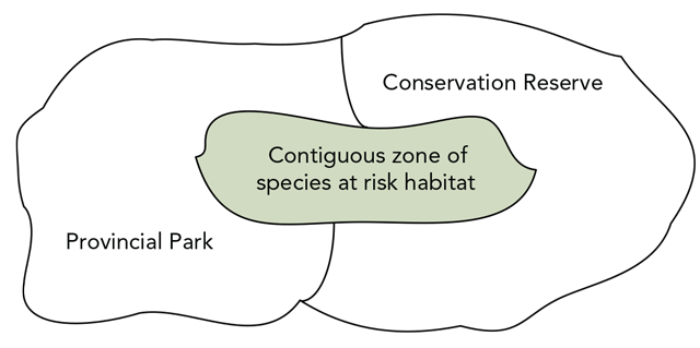
2.7.5 Prepare zone maps
Where defined, zones must be depicted on a map which clearly shows their location within the protected area. When preparing zoning maps, consider the following:
- use the appropriate recommended mapping template.
- scale zoning maps appropriately. It should be evident where the zone is located in relation to surrounding zones and the protected area boundary. The map should be at the appropriate scale that the configuration of small zones is clear.
While clear communication of zoning is important, the identification of sensitive values must be carefully considered when preparing protected area documentation, particularly where they are accessible (e.g. pictograph site on a canoe route). General reference can be made where a feature significantly contributes to the protected area system, but the precise location or extent should not be depicted on a map.
Carry the zoning forward to the preliminary management direction document (stage 4). Zone specific policies will be outlined during stage 4. If zoning options are brought forward to address pressures on values, or to consider different operational management alternatives, present these in the management options document (stage 3).
Process check-in:
At the end of stage 2, the following should have been completed:
- assembled and assessed information sources
- identified values, VCI, and pressures
- conducted a values and pressures analysis to determine priorities
- completed and received approvals for either a background information file or background information document
- provided involvement opportunities, where applicable
- conducted a situational analysis and identified:
- actions to address pressures on values
- other actions
- where enabling language is needed
- monitoring needs
- developed preliminary zoning
Stage 3 – Developing management options
Management options provide an opportunity to further consider and gain input on alternative approaches to managing a protected area. The purpose of this stage is to provide direction on when and how to describe management options and prepare the management options document (options document). An options document is developed when potential options, related to possible actions, result from situational analysis.
Management options are frequently developed to outline different approaches on the following topics:
- management and protection of natural and cultural values
- stewardship activities
- proposed infrastructure development
- sustainable recreation opportunities and land use
Table 17 outlines the steps associated with stage 3 of the management planning process, based on the complexity of the planning project.
| Steps | Management Statement (non-complex) | Management Plan (moderately complex) | Management Plan (very complex) |
|---|---|---|---|
| 3.1 Bring forward options | N/A | required |
Required |
| 3.2 Define management options | N/A | required |
|
| 3.3 Describe context and consider management options | N/A | 3 |
|
| 3.4 Map options | N/A | Discretionary |
|
| 3.5 Prepare and approve the management options document 3.5.1 Determine the format 3.5.2 Determine the content 3.5.3 Finalize and approve |
N/A | required |
3.1 Bring forward options from situational analysis
During stage 2, situational analysis identified actions to address management priorities and other actions related to operations and development. All actions were then evaluated and categorized. During this step, bring forward actions that were categorized as option
as a result of situational analysis. These options will form the basis for the development of comprehensive management options that will be included in the options document. Box 1 below outlines an example of bringing forward results from situational analysis.
Box 1: Results from situational analysis (stage 2):
Planning topic: Backcountry camping
Value: Backcountry campsites, Pressure: Degradation of several sites
Underlying causes: trampling, garbage, human waste
| Action | Category |
|---|---|
| 1. education | implement |
| 2. permanent trail closure | option |
| 3. temporary/seasonal trail closure | option |
| 3. temporary/seasonal trail closure | option |
| 4. reroute portions of trail | option |
| 5. relocate entire trail | option |
| 6. install infrastructure (boardwalk) | defer |
| 7. do nothing | deny |
3.2 Define management options
Defining management options involves combining the discrete actions associated with a particular pressure, issue or proposal to create comprehensive management options to address that pressure, issue or proposal. Box 1 provides an example of bringing forward actions categorized as an option as a result of situational analysis. Looking at this example, actions 2, 3, 4 and 5 could be combined in various ways to develop a number of comprehensive management options (Appendix V). In developing comprehensive management options consider the following:
- how individual options interact and can be combined.
- how to best combine options to achieve overall intent.
- how to create a range of comprehensive management options (less restrictive to more restrictive).
The number of management options developed will depend on the complexity of the issue(s) or proposal(s). For actions that are proposed externally, consider providing an explanation to the proponent, once a decision has been made, on whether or not to bring the proposal forward as a management option.
3.3 Describe the context and consider management options
After defining the comprehensive management options, the context for each of these must be described and considered. Describe the following for each management option:
- planning topic (pressure, issue or proposal)
- value(s), where applicable
- pressure/overarching issue, where applicable (including a description of the underlying causes, where applicable)
- management options (including associated actions) to address the pressure/issue
- consideration of each management option, including:
- anticipated result/impact (value and pressure) ,
- potential implications on resources (financial and human),
- potential implications to protected area users and activity, and
- ability to enforce.
See the example in Appendix V.
3.4 Map management options
Depending on the management options being presented (i.e. if there is a spatial component), maps can help provide visual context. Maps can help portray the management options in relation to specific activities or development in the protected area and overall protected area management.
Consider mapping the protected area to reflect topics, such as:
- access and internal traffic circulation
- proposed zoning
- development patterns, services or facilities
- recreational opportunities
- sites for specialized management
- specialized species needs (e.g. habitats, hibernacula)
If appropriate, consider showing zoning for the entire protected area to provide additional context for the management options. Such a map could be helpful in depicting proposed management options in the context of the entire protected area and in relation to other zones. However, guidance should be provided to focus reviews specifically to the topic of the management option. It should be noted that at this time it is not the intent to provide preferred direction as part of the options document.
3.5 Prepare and approve the management options document
Once management options have been defined, described and considered, they are presented in the options document. There is no template for the options document; however, the following provides advice on formatting and content of the document.
3.5.1 Determine the format
The format of the management options document is flexible. For example, consider developing a management options brochure for a planning project with a limited number of management options. For multiple and complex options, consider developing a full document. Regardless of the format, be sure to include minimum content requirements listed below.
3.5.2 Determine the content
Regardless of format, at a minimum all options documents should have the same general content:
Introduction
Describe of the overall context for managing the protected area, including topics such as:
- the planning area
- the purpose of this stage of planning, and the management planning process
- the scope of the management options
- what you are asking people to comment on and how comments will be considered to help determine preferred direction
- any additional information that assists the reader in understanding the management options in the broader context of the protected area
Management options
Include the information generated from step 3.3. Consider arranging the pressures/issues into categories to help organize the document. This will clarify the context of the variety of pressures, issues or proposals and create a user friendly document. For example, include all recreation related pressures/overarching issues (such as degradation of backcountry campsites) in a recreation uses section of the document; and include all new development related proposals together.
In presenting management options, provide clear direction on what type of information MNR is seeking during involvement. For example, ask respondents to clearly identify a preferred option and provide a rationale or additional comments related to their choice.
Involvement opportunities
Provide a summary of the involvement opportunities to date (e.g. Environmental Registry postings, mailings, meetings) and the overall results. Results could include a description of the input and how the input was addressed, with an emphasis as to how this input has influenced the management options. This section should be consistent with the involvement strategy.
References
Provide any references that were used in the preparation of the options document, including any references to sources that may assist external parties in understanding the options.
At the discretion of the planning team, other headings may be added to adequately describe management options or provide additional context.
3.5.3 Finalize and approve
The finalized management options document will require review and approvals. Contact appropriate staff in PPAPS for up-to-date procedures on approvals. The approved management options document should be stored in PAPIR.
Opportunities for involvement should be provided as outlined in the involvement strategy. MNR will use the input received during involvement to determine preferred or recommended policies or actions as part of Stage 4: Developing Preferred Management Direction.
Process check-in:
At this point, the following should have been completed:
- brought forward options from situational analysis
- created comprehensive management options
- described the context of and considered management options
- mapped management options (discretionary)
- prepared and approved the management options document
- provided involvement opportunities
Stage 4 – Developing preferred management direction
The preliminary management direction document provides an opportunity to present information and gain input on the preferred direction and policies for a planning project. The purpose of this stage is to provide guidance on consolidating the preferred direction to include in the preliminary management direction document. The document should provide enough policy direction to manage the protected area over the next 20 years to help achieve the vision and objectives, while being consistent with the purpose statement and overarching land use intent. At this point, the planning team should familiarize themselves with the Management Direction Template to identify what information will be included in the preliminary management direction document.
Table 18 outlines the steps associated with developing the preliminary management direction document according to planning complexity.
| Steps | Management Statement (non-complex) | Management Plan (moderately complex) | Management Plan (very complex) |
|---|---|---|---|
|
4.1 Develop purpose and vision statements 4.1.1 Purpose statement |
required step | required step | required step |
|
4.2 Develop objectives 4.2.1 Consider objectives in the PPCRA |
required step | required step | required step |
|
4.3 Develop preliminary management policies 4.3.1 Finalize zoning |
required step | required step | required step |
| 4.4 Finalize and approve preliminary management direction document | required step | required step | required step |
4.1 Develop purpose and vision statements
Consider the original components of the purpose and vision statements (stage 1), along with the results of the analysis and involvement thus far in order to develop both statements. These statements will be presented in the preliminary mangement direction document.
4.1.1 Purpose statement
Review the components of the purpose statement to confirm that it reflects the results of analysis completed in stage 2 and input received thus far through involvement.
While it is important to develop a succinct purpose statement, additional information can also be provided by explanatory text (Box 2). In this example the explanatory text may be informed by the list of values and may also assist in the development of the protection objective.
Box 2: Example of a purpose statement and associated explanatory text for Clear Lake Conservation Reserve.
The purpose statement:
Clear Lake Conservation Reserve was established to protect its provincially significant representation of old growth eastern hemlock upland forests and a freshwater complex; as an established long-term ecological research site; and its potential for research of a meromictic lake.
Explanatory text:
Today, it is also recognized for its landscape level function as a core area connecting other protected areas and managed wilderness areas together; its excellent condition as an undisturbed ecosystem and relatively remote character that supports elements of biodiversity including: a representative pocket of sparse coniferous forest on bedrock; old growth red pine, white pine and sugar maple forest components; structural characteristics of mature/old growth stands; potentially suitable habitat for species at risk; preferred habitat for area sensitive wildlife and provincially managed wildlife; and opportunities for ecologically sustainable traditional outdoor heritage activities.
4.1.2 Vision statement
Review the components of the vision statement to confirm it reflects the results of the analysis completed in stage 2 and the input received thus far. The components should be brought together to develop a comprehensive vision statement. The statement should be written with a 20-year perspective in mind and may discuss the future condition and key actions needed to reach this future condition.
A vision statement should be:
- comprehensive and inclusive to reach all audiences, interests and users,
- compelling, inspiring and emotive, and
- provide a long term view that concentrates and guides towards a future state.
Consider engaging someone from outside the team who can bring a different and broader perspective to help develop the vision statement. Explanatory text can be added to support the vision statement (Box 3).
Box 3: Example of a vision statement and associated explanatory text for Kawartha Highlands Signature Site Park.
Our vision for the Kawartha Highlands Signature Site is that of a legacy of protection and stewardship, ensuring that the semi-wilderness characteristics are preserved.
The protection of the ecological integrity of the area is of paramount importance. Long-term protection of both natural and cultural heritage values is required for the preservation of this unique area. Careful management is required to protect the environmentally sensitive aspects of the area, and to maintain it for the benefit of future generations.
Traditional activities including cottaging will continue to be an integral component of the area, and diverse low-density recreational opportunities will continue to be available. Continued public involvement in the planning and management of this area is essential. Management of the area will respect the existing private lands and tenure within the park.
4.2 Develop objectives
Protected area objectives should aim to facilitate and enhance the protected area program and individual protected area objectives. Fulfillment of the objectives would be expected to lead to the achievement of the vision for the protected area.
4.2.1 Consider PPCRA objectives
The PPCRA establishes four objectives for provincial parks and three for conservation reserves. Specific objectives for the protected area should be consistent with and address the overarching PPCRA objectives but should be reflective of a specific protected area(s) and not simply a re-statement of the PPCRA objectives. Not all provincial objectives will necessarily apply to all protected areas; however, at a minimum, a protection objective should be created for all protected areas. For example, a small protected area with no known values would still have a protection objective that works to maintain the integrity of the protected area boundary.
4.2.2 Create protected area objectives
After reviewing the situational analysis and identifying which provincial objectives apply, the specific protected area objectives are now developed. A set of similar or related actions from situational analysis can be rolled up to identify trends and create an objective that is focused on the underlying causes, pressures and associated value(s) (Box 4). These objectives may reflect the VCI, particularly those under pressure, and management actions identified to address these pressures.
Objectives should be SMART (step 2.5.6). Focus objectives at the appropriate level to guide management activities. In focusing objectives, consider the following:
- Protected areas vary in size, shape and landscape context.
- Certain protected areas have very specific and/or few values while others have many.
- Certain protected areas may have limited pressures while others may have many, indicating higher potential risks.
- Grouped planning projects may have a wider scope.
- Planning projects may elect to co-ordinate the preparation of management direction with implementation planning/Class EA evaluations, suggesting greater specificity.
- Certain protected areas have significant capital development and are staffed (e.g. operating parks) while others are managed via alternative administrative approaches (e.g. conservation reserves, non-operating parks).
- If the protected area contributes to larger landscape resource management objectives (e.g. old growth forest, caribou ranges).
Protection objective
Consider that each protected area must have a protection objective that addresses one or more of the following:
- values that represent the reason that the protected area was created and/or its contribution to the protected area system
- species at risk and their habitat (known or potential)
- Aboriginal and cultural heritage values
- other VCI that have been identified
When developing objectives, the maintenance and/ or restoration of ecological integrity should be kept in the forefront. Objectives should aim to maintain, restore or enhance the condition of the values for which the protected area was established and other known values. This may include reducing site pressures, and where possible, their underlying causes.
Recreation objective
Consider that each provincial park may have an ecologically sustainable recreation objective that addresses one or more of the following:
- sustainability of recreation activities (i.e. impacts of recreation activities on values and ecological integrity)
- additional opportunities for ecologically sustainable recreation
- economic benefits associated with recreational activities
This objective may recognize needs for visitor use and facilities (including needs for capital development and maintenance), especially in operating parks that may require visitor management.
Traditional outdoor heritage objective
Consider that each conservation reserve may have a traditional outdoor heritage objective that addresses:
- sustainability of traditional outdoor heritage activities (i.e. impacts of these activities on values and ecological integrity)
- associated economic benefits
Natural and cultural appreciation objective
Consider that each provincial park may have a natural and cultural heritage appreciation objective that addresses:
- how to provide for natural and cultural heritage appreciation opportunities
Scientific research objective
Consider that each protected area should have a scientific research objective that addresses one or more of the following:
- to serve as benchmarks for the larger landscape
- specific information needs associated with the protected area
- facilitation of compatible scientific studies
4.3 Develop preliminary management policies
Once the objectives, purpose and vision statements are drafted, it is time to develop the site specific preferred policies to be included in the preliminary management direction. Information on values and pressures analyzed in stage 2 is essential to identifying actions and policies to include in the preliminary management direction. Developing preliminary management direction includes finalizing the preferred zoning, consolidating actions being carried forward and determining policies.
Box 4: Examples of rolling up actions to create protected area objectives.
Examples of protection objectives
1. Addressing a pressure
Pressure: Invasive species have displaced native species.
Actions:
- undertake mechanical removal for the first four years and monitor impact,
- remove newly established locations immediately thereafter, and
- design a re-introduction program and monitoring to assess effectiveness.
Objective: Eliminate the currently established invasive species within four years, prevent re-establishment of invasive species and re-establish the native species within 10 years.
2. Addressing a pressure and enhancing the condition of a natural value
Pressure: Fires are suppressed and therefore natural processes are not occurring and rare prairie ecosystems are being lost.
Action: Plan and implement prescribed burns on a five-year cycle.
Objective: Re-establish the fire regime to perpetuate natural processes and maintain and restore the rare ecosystems.
3. Establishing a new development
Pressure: Potential pressure of development within snake habitat.
Actions:
- Ensure that the design and construction of any infrastructure considers snake habitat needs (e.g. build in an area not used by snakes and reduce building footprint),
- improve the educational opportunities to enhance appreciation of snakes and their habitat for protected area visitors and staff.
Objective: Maintain snake habitat to help reduce snake mortality within the protected area.
Examples of recreation objectives
1. Maintaining a recreational value
Pressure: Camping at an access point is causing erosion, garbage and sanitation problems.
Actions:
- introduce a site plan and necessary facilities and
- establish a partnership agreement or other mechanism for development and stewardship.
Objective: Within five years, establish services to ensure the ecologically sustainable recreational use of the site in partnership with user groups.
4.3.1 Finalize preferred zoning
Finalize the zoning based on the preliminary zoning developed in stage 2. The final preferred zoning should take into consideration internal discussions, best practices, expert advice and input from previous involvement opportunities (e.g. during stage 3), where applicable. The zoning section of the preliminary management direction includes the name, description and intent of each zone and includes a zoning map.
4.3.2 Consolidate actions being carried forward
Review the results of situational analysis. Ensure actions that were identified as “carry forward” are included in the preliminary management direction document, particularly those actions that were identified as requiring enabling language. Not all actions need to be included in the preliminary management direction document (step 2.5.7). Look at actions in the light of the draft purpose and vision statements as well as the objectives to make sure all actions are supportive.
Identify preferred actions in the appropriate headings of the policy section of the preliminary management direction document. Additionally, summarize and prioritize these actions in the implementation priorities section of the document. The Management Direction Template provides further guidance on prioritizing actions.
Carefully consider the level of detail required to enable actions in the preliminary management direction and guide implementation. The enabling language should be specific enough to allow the type of activity or development, but not so restrictive that it does not allow for flexibility at the time of implementation planning.
For example, in a provincial park it would be sufficient to enable the development of a major new building complex in a specific development zone by describing the general intent of the complex (e.g. visitor centre), without providing the exact locations and dimensions of the building. Those details would later be determined through implementation planning and the Class EA-PPCR. It would be insufficient to enable a major development without identifying the intent of the development and the zone.
In a conservation reserve, it would be sufficient to enable the development of a snowmobile trail without identifying the specific location. The exact location would be determined through implementation planning and the Class EA-PPCR. However, it would be insufficient to enable the development of a trail without identifying the use/intent of the trail; as without knowing the intent of the trail, it cannot be determined whether the action is consistent with the conservation reserve purpose statement, vision and objectives.
4.3.3 Determine protected area policies
The Management Direction Template provides a format for organizing protected area policies, in the preliminary management direction document, by including a policy section where management policies and actions should be placed to reduce repetition of policies in multiple areas of the document. The policy section identifies management themes and topics that may potentially apply. Consider which management themes and topics are applicable to the protected area, and provide clear and concise descriptions of the associated policies, consistent with overarching provincial policy direction and legislation. For provincial parks, general, class and zone specific policies are outlined in the Ontario Provincial Parks: Planning and Management Policies, 1992 Update. For conservation reserves, general policies are outlined in the conservation reserves policy.
Determine which policies are appropriate to meet the protection of the identified values. Where appropriate, propose zone specific direction (step 4.3.4) that should be considered during park management planning to further meet these objectives.
The policy section of the preliminary management direction should be clear on what activities will be permitted, and unless it is absolutely critical (e.g. fire management planning as a secondary plan), should not defer policy to another process.
4.3.4 Determine zone specific policies
It may be appropriate to develop policies that are specific and unique to a particular zone. One example may be resource management activities, such as vegetation management, occurring in one zone only. Wherever possible, zone specific policies should be included in the policy section of the preliminary management direction document. This ensures a consistent location of policy in the document, which allows ease of reference for MNR staff and external audiences. However, in limited circumstances it may be appropriate to include zone specific policies in the zoning section. Policies should not be repeated in multiple places within the document, such as the policy and zoning sections.
If zoning is proposed in a conservation reserve, zone specific policies should be developed based on the need for or intent of the zone (e.g. protection of values, providing for access).
4.4 Finalize and approve the preliminary management direction document
The preliminary management direction document can be in the form of a statement (non-complex planning projects) or a plan (moderately or very complex planning projects) (Table 1). Typically the preliminary management direction document is developed as stage 4 progresses using the Management Direction Template. At this point, ensure the document is complete and finalized.
The finalized preliminary management direction document will require appropriate review and approvals. Contact appropriate staff in PPAPS for up-to-date procedures on approvals. The draft and approved preliminary management direction documents should be stored in PAPIR.
After the preliminary management direction is approved, opportunities for involvement should be provided as outlined in the involvement strategy. The stage in the management planning process at which this opportunity takes place is dependent on the complexity of the planning project (Table 1).
Process check-in:
At this point, the following should have been completed:
- developed the objectives of the protected area(s)
- drafted the purpose and vision statements
- developed the preferred direction (finalized zoning, consolidated actions and determined policies)
- prepared and approved the preliminary management direction document
- provide opportunities for involvement
Stage 5 – Finalizing management direction
The approved management direction document represents the final management direction for a protected area. The purpose of this stage is to finalize and approve the management direction by considering previous input and undertaking appropriate revisions to create the final management direction document for approval.
Table 19 outlines the steps associated with the approved management direction stage, according to planning complexity.
| Steps | Management Statement (non-complex) | Management Plan (moderately complex) | Management Plan (very complex) |
|---|---|---|---|
| 5.1 Finalize management direction | required step | required step | required step |
| 5.2 Approve management direction document | required step | required step | required step |
5.1 Finalize management direction
Consider input received during involvement and determine if additional analysis and/or input is required to make final decisions on any outstanding issues or concerns. Address any issues that arose as a result of involvement on the preliminary management direction document. The Involvement Guideline provides direction on how to address comments as a result of involvement.
In some cases the need to resolve issues or concerns may arise after the opportunity for involvement on the preliminary management direction ends. It may be appropriate to undertake further scoped involvement, at the discretion of the planning team, to enhance input on the preliminary management direction. Alternatively, a process upgrade maybe warranted. Involvement is typically scoped to a particular issue or concern and to those known to have an interest in, or may potentially be affected by, an aspect of the preliminary management document. The responsible manager will make this determination. All input is considered and the planning team incorporates relevant comments into the final management direction, as the responsible manager considers appropriate.
Where revisions are required, make the appropriate changes to the preliminary management direction document.
The content of the approved management direction document is essentially the same as the preliminary management direction document, taking into consideration any revisions made as a result of previous involvement opportunities.
5.2 Approve management direction document
The finalized management direction document will require appropriate review and approvals. Contact appropriate staff in PPAPS for up-to-date procedures on approvals.
The approved management direction document is stored in PAPIR.
Update the appropriate MNR intranet and internet sites to indicate the approval and location of the new management direction. Once approved, the management direction document provides direction on how to effectively manage the protected area with a goal of meeting the objectives and vision statement. The approved management direction document should be used as a tool by protected area managers. See the Planning Manual for further information on implementing the content of the management direction document.
Process check-in:
At this point, the following should have been completed:
- considered previous involvement and revised the preliminary management direction document accordingly
- approved the finalized management direction document to create the approved management direction document
- considered commitments related to secondary plans
References
Fisher, B., Turner R.K., and Morling P. 2009. Defining and classifying ecosystem services for decision making. Ecological Economics. Vol. 68 pp.643-53
[OMNR] Ontario Ministry of Natural Resources. 2005. A Class Environmental Assessment for Provincial Parks and Conservation Reserves. Peterborough: Queens Printer for Ontario.
[OMNR] Ontario Ministry of Natural Resources. 2011. A Practitioner’s Guide to Climate Change Adaptation in Ontario’s Ecosystems. Peterborough: Queens Printer for Ontario.
[OMNR] Ontario Ministry of Natural Resources. 1973. A Topical Organization of Ontario History. Peterborough: Queens Printer for Ontario.
[OMNR] Ontario Ministry of Natural Resources. 1992. Ontario Provincial Parks: Planning and Management Policies (1992 Update).
[OMNR] Ontario Ministry of Natural Resources. 2006. Provincial Parks and Conservation Reserve Act, 2006.
[TNC] The Nature Conservancy. 2007. Conservation action planning handbook: developing strategies, taking action and measuring success at any scale. Arlington, VA: The Nature Conservancy. Available online: www.conserveonline.org.
Thomas, L. and J. Middleton. 2003. Guidelines for management planning of protected areas. IUCN Best Practice Guideline No. 10. Gland: International Union for the Conservation of Nature, World Commission on Protected Areas.
Paleczny, D. 2010. Protected area assessment and reporting: an examination of current approaches and evolving needs with application of an integrated model in Egypt. Greenwich: London, PhD dissertation.
Young, T.F., and S. Sanzone (eds). 2002. A framework for assessing and reporting on ecological condition. Washington, DC, Ecological Reporting Panel Ecological Processes and Effects Committee, Environmental Protection Agency Science Advisory Board.
Appendix I: Description of life and earth science and cultural resource criteria
This appendix provides a description of the life and earth science and cultural resource representation criteria often referred to in protected area system and management planning, and for designing monitoring initiatives.
Life science selection criteria
The first two criteria (representation, condition) are applied at a landscape level. They help identify relatively intact sites that contain features representative of Ontario’s natural diversity. The remaining three criteria (diversity, ecological functions, special features) are assessed at a site level. These criteria help to distinguish the best examples of representative features, and to design functional protected area boundaries that promote the persistence of biodiversity.
Criterion 1 – Representation:
Ecological representation is based on the principle that the full range of Ontario’s natural diversity should be systematically identified and protected. Fundamentally, protected area systems should include representative examples of the known biodiversity within ecologically defined regions. Examples of biodiversity that are not adequately represented within protected areas are identified as gaps in representation.
Criterion 2 – Condition:
An underlying principle of Ontario’s protected area system is to secure the best examples of the full range of the province’s natural heritage. The ecological condition of a site helps to determine its significance within an ecodistrict.
Criterion 3 – Diversity:
Diversity refers to the heterogeneity of landscapes and species within a proposed site. Sites with greater variety of physical habitats tend to support a wider array of species and ecosystems.
Criterion 4 – Ecological functions:
Ecological functions refer to the ecological role of a site within the broader context of the surrounding landscape and watershed. This criterion relates directly to biodiversity persistence. Ecological functions, in part, determine how well biodiversity, physiographic features and natural processes are likely to be maintained within a protected area. Hydrologic processes, and the size, shape and connectivity of protected areas are particularly important within this criterion.
Criterion 5 – Special features:
The special features criterion refers primarily to populations of species and vegetation communities known to be rare in Ontario, as well as localized habitat features important to their persistence. Recognized areas such as Important Bird Areas are also considered under this criterion.
Earth science selection criteria
Criterion 1 – Representation:
The primary criterion for choosing earth science features is representation. A representative feature is one that best displays its components, or make-up, and its environment(s) of formation. A representative feature of the geological record can generally be thought of as one that is typical, or normal, or one that shows “classical” elements of the feature.
Criterion 2 – Special features:
Where two or more sites have similar earth science values, the presence of special features may determine the selection of a preferred site. Special features refer to type sections, reference sections, type localities, morphotypes, and other related features or aspects of a selected site. Type sections provide standard definitions for representative lithostratigraphic (rock types and age) and biostratigraphic (fossil record) rock units. They may also refer to unusual or unique elements of a theme not represented elsewhere, or regionally important sites used for education and/or interpretation. Special features may also constitute less scientific values such as the quality of a feature’s setting or the aesthetic values of a site. The geology of an area may contribute significantly to the character of that area’s landscape.
Criterion 3 – Diversity:
The diversity criterion addresses the variability of form or features within a site. A site that incorporates more than one element or feature of the identified geologic unit (e.g. an outcrop of a bedrock formation) or, an association of features (e.g. a glacial landscape of drumlins, eskers and meltwater channels), usually occurs within a relatively small area as opposed to being dispersed throughout the landscape. Such associations, offering a diversity of features in a single site, are more efficient, have a higher ecological value, and may generally be ranked more favourably than a collection of individual sites in separated areas.
Criterion 4 – Integrity (condition):
Integrity refers to the wholeness, completeness, or condition, of a geological feature, and the lack of significant external impacts or alteration by natural or man-induced activities. This applies particularly to landforms, where morphological completeness is a requirement for their adequate definition.
Criterion 5 – Life science values:
When comparing sites where earth science values are similar, overlapping life science values may be used to prioritize selection. This approach is generally only relevant to landscape sites (landforms, landform associations and/or process features) that are large enough to support significant vegetation stands or communities.
Cultural heritage representation criteria
Cultural heritage representation provides the basis for identifying, evaluating, and protecting the archaeological and cultural features of Ontario. MNR has developed a Historical Systems Plan, which provides an organizational approach to historical resources as they relate to outdoor recreation and land management programs of MNR. Representation of archaeological and historical resources is based on A Topical Organization of Ontario History (OMNR 1973). This theoretical framework organizes history in relation to activities rooted in the landscape and physical environment that are basic to human development, including both Aboriginal and European settlement. This topical organization is based on three conceptual areas: economic and social, military and political.
These conceptual areas are divided into 13 themes, each based upon an important phase of distinct common activity such as mining, logging, fur trading, and agriculture that can be linked back to a certain time and place in Ontario’s history (table below). These themes are further subdivided into 115 theme segments to reflect the involvement of part of the population in a specific region (such as Thunder Bay silver mining) during a specific time in history (in this example, 1866 to 1932). These are found in Ontario Provincial Parks Planning and Management Policies (1992 Update).
| Historical themes | Number of theme segments |
|---|---|
| 1. Early post-glacial immigrants | 2 |
| 2. Environmental frontiersman | 2 |
| 3. Indigenous settlers, traders and potters | 4 |
| 4. Indigenous peoples’ farming societies | 4 |
| 5. Northern hunters and fishers | 4 |
| 6. Post-contact tribes and bands | 6 |
| 7. Fur trade and fur trading communities | 16 |
| 8. Agriculture and agriculture communities | 22 |
| 9. Forest industry and forest industry communities | 16 |
| 10. Mining and mining communities | 17 |
| 11. Transportation and the integration of economies and communities | 12 |
| 12. Military | 5 |
| 13. Political | 5 |
Almost one third of all historical themes and theme segments in the province are currently found within protected areas. These examples provide a valuable link to the cultural past. Although a comprehensive catalogue has not been completed, some of these historical themes are represented to greater degrees than others in protected areas. For example, protected areas contain several good examples of theme seven, fur trade and fur trading communities.
Appendix II: Attributes of ecological integrity
These aspects/attributes of ecological integrity should be considered by planning teams when collecting information on protected area values and pressures and developing indicators. For more information on these aspects, consult Young and Salzone (2002).
Landscape condition
- extent of ecological system/habitat types
- landscape composition
- landscape pattern and structure
Biotic condition
- ecosystems and communities
- species and populations
- organism condition
Chemical and physical characteristics (water, air, soil and sediment)
- nutrient concentrations
- trace organic and inorganic chemicals
- other chemical parameters
- physical parameters
Ecological processes
- energy flow
- material flow
Hydrology and geomorphology
- surface and groundwater flows
- dynamic structural characteristics
- sediment and material transport
Natural disturbance regimes
- frequency
- intensity
- extent
- duration
Appendix III: Values and pressures worksheets
The following worksheets (adapted from Paleczny 2010) may be used to record information on values (worksheets 1-5) and pressures (worksheet 6).
Ideally, worksheets should be completed for all values and pressures. However, this may not be possible due to the large number of values and/or pressures and workloads associated with planning and management of protected areas. Therefore, the worksheets are considered discretionary. The following recommendations should be considered:
- non-complex planning projects – complete values and pressures worksheets for all values and all pressures
- moderately complex planning projects – complete values worksheets for all VCI and all other values taken forward to situational analysis (i.e. all priority values) – complete pressure worksheets for all pressures
- very complex planning projects – complete values worksheets for all values taken forward to situational analysis (i.e. all priority values) – complete pressure worksheets for all pressures
Focus on recording information in worksheets that has not been documented elsewhere (e.g. other reports, check sheets).These worksheets can be adapted to suit local circumstances. Gaps in information should be identified.
All completed worksheets must be stored in PAPIR.
Worksheet #1: Description of life science values
- Name of (ecosystem/species/natural resource) value:
- Short description of value (is this a “value of conservation interest” and if so, why?)
- Size and shape:
- For an ecosystem or a resource, indicate the current size of the area:
- For species found in the protected area, indicate the following, including the information source where applicable:
- current size of the population
- size of the area needed to sustain the population:
- if it is a tracked species (if yes, what is its rank?)
- if it is a species at risk
- Condition (describe):
- Composition: (e.g. presence, absence of native and alien species)
- Structure: (e.g. ground/shrub/canopy vegetation, quality of habitat, age structure)
- Functional/Biotic interactions: (e.g. competition, predation, disease)
- Landscape context (describe):
- Dominant regimes and processes: (e.g. hydrology, water chemistry, geomorphology, climate, fire, other natural disturbances)
- Connectivity: (e.g. species access to habitats needed for their life cycle, fragmentation)
- Does the value specifically support:
- outdoor recreation activities:
- traditional outdoor heritage activities:
If the answer is yes to either question, complete Worksheet #4.
- Sensitivity (high, medium, low) and overall condition of the value (good, fair, poor): (provide rationale)
- Information gaps/needs and suggested actions:
- Identify information gaps (e.g. areas lacking adequate inventories) and potential information needs for planning
- Determine the need for local data layer development (e.g. species range mapping) - provide rationale and supportive interpretations.
- Opportunities for efficiencies through grouping or consolidation of information prior to modelling and scenariodevelopment
Worksheet #2: Description of earth science values
- Name of earth science value:
- Short description of the area (is this a “value of conservation interest” and if so, why?)
- Size:
- Current size of the area:
- Condition (describe):
- quality and condition:
- associated ecological, cultural, ecotourism resources or communities:
- Landscape context (describe):
- dominant regimes and processes associated with or affecting the value: (e.g. wind/water erosion, hydrology, geomorphology, climate, fire, other natural disturbances)
- connectivity: (e.g. linkages to other geological/fossil sites, fragmentation, species access to habitats needed for their life cycle)
- Does the value specifically support:
- outdoor recreation activities
- traditional outdoor heritage activities
If the answer is yes to either question, complete Worksheet #4.
- Sensitivity (high, medium, low) and overall condition of the value (good, fair, poor): (provide rationale)
- Information gaps/needs and suggested actions:
- identify information gaps (e.g. areas lacking adequate inventories) and potential information needs for planning
- determine the need for local data layer development - provide rationale and supportive interpretations.
- opportunities for efficiencies through grouping or consolidation of information prior to modelling and scenario development
Worksheet #3: Description of Aboriginal sites/cultural/historical values
- Name of aboriginal site/cultural/historical value:
- Short description of the area (is this a value of conservation interest and if so, why?)
- Size and age:
- current size of the area:
- age/period/historical theme represented:
- Condition (describe):
- composition/Significance: (e.g. describe the cultural features at the site, their special or unique qualities for the country or region, their popularity among the public/level of use)
- integrity and authenticity: (e.g. quality of original characteristics/state of degradation)
- Landscape context (describe):
- dominant regimes and processes associated with or affecting the value: (e.g. wind/water erosion, hydrology, geomorphology, climate, fire, other natural disturbances)
- connectivity: (e.g. linkages to other cultural/historic sites)
- associated ecological, geological resources, ecotourism resources or communities: (describe)
- Does the value specifically support:
- outdoor recreation activities
- traditional outdoor heritage activities
If the answer is yes to either question, complete Worksheet #4.
- Sensitivity (high, medium, low) and overall condition of the value (good, fair, poor): (provide rationale)
- Information gaps/needs and Suggested Actions:
- identify information gaps (e.g. areas lacking adequate inventories) and potential information needs for planning
- determine the need for local data layer development - provide rationale and supportive interpretations.
- opportunities for efficiencies through grouping or consolidation of information prior to modelling and scenario development
Worksheet #4: Supplementary description of outdoor recreation and/or traditional outdoor heritage activity
- Name outdoor recreational or traditional outdoor heritage activity:
- Short description of outdoor recreational or traditional outdoor heritage activity:
- Size/number:
- current size of the area where activity occurring:
- current number of visitors participating in activity (estimate):
- Condition (describe):
- caturalness: (e.g. has the area retained its natural qualities?)
- clean and safe: (e.g. garbage, pollution, traffic hazards)
- Landscape context (describe):
- impacts on conservation priorities: (e.g. on ecosystems, species)
- impacts on adjacent land uses: (e.g. positive and negative impacts)
- Sensitivity (high, medium, low) and overall condition of the value (good, fair, poor): (provide rationale)
- Information gaps/needs and suggested actions:
- identify information gaps (e.g. areas lacking adequate inventories) and potential information needs for planning
- determine the need for local data layer development - provide rationale and supportive interpretations.
- opportunities for efficiencies through grouping or consolidation of information prior to modelling and scenario development
Worksheet #5: description of local community, social or economic benefits
- Name of community/activity:
- Short description of community/activity:
- Size/number:
- current geographic size of the area (if inside protected area):
- demographic characteristics: (e.g. population, age structure, literacy, income levels, employment profile)
- Condition (describe):
- economic benefits derived from protected area: (e.g. direct employment, indirect tourism)Z
- productive systems: (e.g. fisheries, agriculture, livestock)
- use of natural resources: (inside and outside protected area)
- Management context:
- impacts of community on conservation and ecotourism values:
- impacts of protected area on the community or the value:
- involvement of community in protected area management: (e.g. current involvement, opportunities for participation, co-management)
- Consider, as appropriate, sensitivity (high, medium, low) and overall condition of the value (good, fair, poor): (provide rationale)
- Information gaps/needs and suggested actions:
- identify information gaps (e.g. areas lacking adequate inventories) and potential information needs for planning.
- determine the need for local data layer development - provide rationale and supportive interpretations.
- opportunities for efficiencies through grouping or consolidation of information prior to modelling and scenario development.
Worksheet #6: Description of pressures
- Name of pressure:
- Short description of pressure:
- Size and status of pressure:
- size of areas affected by the pressure:
- indicate if pressure is new, existing or legacy:
- indicate if pressure is increasing, decreasing, remaining stable or status is unknown
- Pressure category:
- indicate the category associated with the pressure:
- alien/invasive species
- climate change
- connectivity
- disturbance regimes
- fragmentation
- hyper-abundant species
- pollution
- visitation
- other
- is the impact of the pressure cumulative with other pressures?
- indicate the category associated with the pressure:
- Source:
- Indicate if the origin of the pressure is internal, external or both:
- Indicate if the pressure is a result of:
- a permitted use
- a non-conforming use
- illegal use
- commercial activity
- industrial activity
- other
- Does the pressure specifically affect:
- life science values, including VCI (if so, complete Worksheet #1)
- earth science values, including VCI (if so, complete Worksheet #2)
- Aboriginal sites/cultural/historical values, including VCI (if so, complete Worksheet #3)
- outdoor recreation activities/opportunities (if so, complete Worksheet #4)
- traditional outdoor heritage activities/opportunities (if so, complete Worksheet #4)
- economic benefits/opportunities (if so, complete Worksheet #5)
- Information gaps/needs and Suggested Actions:
- identify information gaps (e.g. areas lacking adequate inventories) and potential information needs for planning
- determine the need for local data layer development - provide rationale and supportive interpretations.
- opportunities for efficiencies through grouping or consolidation of information prior to modelling and scenario development
Appendix IV: Monitoring
It is through monitoring that we learn and can adapt, thereby improving knowledge and influence decision- making and our ability to manage protected areas. Staff are advised to use tested protocols when available.
There are three types of monitoring associated with the management planning cycle, each addressing a specific question:
- Condition monitoring: Condition or surveillance monitoring is used to establish the baseline condition of a value or the status of a pressure within a protected area and to measure changes in that condition or status over time. This may simply be to keep an eye on things or to learn more about a value or pressure (e.g. research) and may help to determine where actions are needed to address pressures on values. This type of monitoring may have been identified as an action as part of situational analysis.
- Implementation monitoring: Implementation monitoring addresses whether or not actions identified in the management direction were carried out. This has implications for evaluating the effectiveness of management direction and is recorded for purposes of future examinations of the management direction. Implementation monitoring will apply to all actions, whether or not they are intended to mitigate the impacts of pressures on values.
- Effectiveness monitoring: Effectiveness monitoring is used to determine if actions identified to address pressures have been effective in achieving what they were intended to. This usually involves monitoring the condition of a value or the status of a pressure (i.e. condition monitoring) in association with the implementation of an action to determine if activities intended to mitigate undesirable impacts on values have been successful. Effectiveness monitoring is the cornerstone of an adaptive management approach. Together with implementation and condition monitoring it is possible to assess the effectiveness of both individual actions and the overall management direction as a whole. Working with only those actions that have been categorized as carry forward, option or implement the planning team begins by indicating what is required for effectiveness monitoring. Think about what is it that we need to know about the value or the pressure that would indicate that it is changing.
Monitoring can range from very simple recording of information (e.g. a photograph) to very complex programs involving specialized equipment, training and statistical inferences. Monitoring requirements will often need to be tailored to the specific situation (i.e. to a value, the pressures on a value and/or our understanding of both). For more complex monitoring requirements, it is advisable to seek assistance from individuals with experience in experimental design and statistical analysis. Conducting monitoring will be subject to available resources, a necessary consideration in identifying information requirements and indicators.
Data collection to support monitoring
Monitoring involves the collection of data and information in a consistent manner over time to address specific questions related to protected area monitoring. Consistent data collection is important because it allows comparison of results over time and from place to place. It is also necessary to design monitoring to address specific questions. Otherwise, the purpose of the monitoring is unclear, the results have limited use, and human and financial resources are not used to full advantage.
For monitoring, data collection methods can range from very straightforward to very comprehensive, depending on:
- the question being asked
- what is currently known about the value to be monitored
- the pressures on that value
- the type of monitoring that is required
As the intricacy of data collection to support monitoring increases, the cost and need for additional specialized assistance (e.g. for statistical design and analysis) also increases. Regardless of the monitoring methods used, it is important that MNR staff and others collect the data in a systematic manner and report on findings in a manner that is accessible for the planning team.
Indicators
Indicators help to provide guidance during the decision- making process on effectiveness of management actions. The following definition is provided for understanding the concept of an indicator:
An indicator can be simple and straightforward or complex and representative of multiple measures. An example of simple indicator would be the number of visitors to a visitor centre as an indication of the use of that visitor centre. Measurement of blood pressure and body temperature are examples of complex indicators because, beyond simply indicating blood pressure and temperature, they also indicate other aspects of the functioning of the human body. In most instances, the planning team will be looking to develop monitoring programs involving simple indicators. In cases where indicators are complex, it is advisable to seek advice of individuals experience with designing monitoring programs.
To determine the appropriate scale of measurement for an indicator, the temporal and spatial scales at which processes operate and respond must be known or estimated. Regardless of whether they are simple or complex, to the extent possible all indicators should be SMART (step 2.4.6). Choosing indicators that meet these criteria will help to ensure that the information can reasonably be collected and monitoring can be implemented successfully.
In cases where it is determined that removing the pressure is all that is required to elicit the desired response in the value, the emphasis should be on measuring the impact of the action on the pressure (i.e. has the pressure been reduced or removed?). However, it is advisable to monitor the value as well, although perhaps at a lesser intensity, to confirm the desired response of the value to the action. In other cases, such as restoration efforts, it may be necessary to focus on monitoring the response of the value.
Thresholds
In addition to identifying measurable indicators, it is necessary to determine the thresholds. A threshold is the range or limits of change or impact against which success or failure of an action can be assessed and that would be considered acceptable.
In most cases, monitoring will be initiated in response to an action implemented to mitigate the impact of a pressure on a value. Therefore, monitoring will target both the value and the pressure. It is up to the planning team to determine what changes in the value and the pressure constitute movement towards either success or failure. It is important to recognize that it may take some time for a response either way. Every monitoring situation is different and there is no single formula for determining thresholds of success or failure of a management action.
Consider the following questions about thresholds:
- What level of change would be required to determine a significant change in the condition of the value (good or bad) and thereby indicate success or failure of a management action?
- What level of change would be required to determine a significant change in the pressure (good or bad) and thereby indicate success or failure of a management action?
| Action | Associated pressure(s) | Information needs | Indicator(s) |
|---|---|---|---|
| educate users | degradation of trail due to overuse | N/A |
|
| permanent closure of trail | degradation of trail due to overuse |
condition of trail (recovery)
|
|
| temporary/ seasonal closure of trail | degradation of trail due to overuse | same information needs as above | same indicators as above |
| reroute portions of trail | degradation of trail due to overuse | same information needs as above | same indicators as above |
| relocate entire trail | degradation of trail due to overuse | same information needs as above | same indicators as above |
| establish outpost camp | N/A | N/A | N/A |
The only actions to be brought forward to determine monitoring needs are those that have been categorized as carry forward, option or implement during situational analysis.
Appendix V: Example of rolling up discrete actions and description of management options
Protected area: Nadeau River Provincial Park
Planning topic: Hiking
Hiking is an important recreation use in Nadeau River Provincial Park and contributes to the provision of sustainable and compatible outdoor recreation opportunities in the area.
Values: Hiking trail
There is currently a 7 km trail that is used by park visitors at all times of the year for hiking and snowshoeing. The trail is well travelled and part of a larger network of trails in the area that extends onto adjacent Crown land. The trail provides a source of recreational opportunities for people in the area. The trail also intersects with a wetland area where there is a population of species at risk turtles.
Pressures: Degradation of the trail
Portions of the hiking trail are showing signs of significant ecological stress and physical degradation that is affecting the quality of the trail. The underlying causes have been identified as soil compaction, root exposure and erosion from trampling and over use along the trail. Additionally, disturbance to species at risk as a result of human presence near a wetland area is a concern. Not all portions of the trail are experiencing the same impacts; however, significant portions of the trail are currently being impacted.
Therefore, MNR is proposing the following options to address this increasing trend in trail degradation:
Option 1: permanent closure of the trail
Considerations:
- allow degraded trail to naturally recover/rehabilitate over time.
- reduce disturbance and impacts on species at risk.
- will result in fewer in park trail use opportunities; however, there are other trails available for use (outside and inside park).
- resource and operations implications for permanent closure of trail (e.g. gates and signage) and enforcement (unauthorized use).
- reduce human ecological footprint and associated pressures on ecological integrity (potential for invasive species movement, wildlife disturbance, fragmentation of habitat).
Option 2: temporary/seasonal closure of trail
Considerations:
- temporary closure of the trail may allow for limited natural recovery/rehabilitation.
- temporary closure will not eliminate soil compaction and root exposure from continuing to worsen over time.
- potential to reduce impact to species at risk during sensitive times of the year (i.e. breeding).
- will result in fewer in park trail use opportunities during any temporary/seasonal closure; however, other opportunities for recreation will continue to be available.
- resource and operations implications for temporary/ seasonal closure of trail (e.g. gates, signage) and enforcement (unauthorized use). May be difficult to enforce temporary closure.
Option 3: reroute portions of the trail outside of sensitive areas
Considerations:
- allow portions of the degraded trail to naturally recover/rehabilitate over time.
- reduce disturbance and impacts on species at risk in sensitive areas.
- will continue to provide opportunities for trail use within the park.
- resource implications with rerouting trail (cost of creating trail versus cost of recovering species at risk population).
- potential management planning implications with rerouting trail (e.g. finding suitable alternate location, zoning).
Option 4: relocate entire trail
Considerations:
- allow degraded trail to naturally recover/rehabilitate over time.
- reduce disturbance and impacts on species at risk in sensitive areas.
- resource implications with relocating trail (cost of creating trail).
- potential management planning implications with relocating trail (e.g. finding suitable alternate location, zoning).
- potential to relocate trail outside of park, as part of larger network and therefore reduce opportunities for trail use in park.
Footnotes
-
footnote[1]
Back to paragraph
Process upgrades and downgrades are discretionary and involve a change in the level of planning complexity and requirements (e.g. number of involvement opportunities and planning documentation). - footnote[2] Back to paragraph Crown Land Use Policy Atlas (CLUPA)
- footnote[3] Back to paragraph For further information on land use amendments and the boundary regulation process, refer to the Guide for Crown Land Use Planning and contact appropriate staff in the regions or PPAPS.
- footnote[4] Back to paragraph Use of value and pressure worksheets to record information is discretionary.
- footnote[5] Back to paragraph Zoning is required for provincial parks and is optional for conservation reserves. Where conservation reserves are not zoned, a map of the protected area still needs to be produced.
- footnote[6] Back to paragraph Although scientific research is not in itself considered a value category. Those values subject to research would typically be captured under the value categories identified in Table 8.
- footnote[7] Back to paragraph A Practitioner’s Guide to Climate Change Adaptation in Ontario’s Ecosystems provides an approach, tools and techniques to assess climate change vulnerability.
- footnote[8] Back to paragraph Letter and numeric codes (L (low) = 1; M (medium) = 2; H (high) = 3; VH (very high) = 4).
- footnote[9] Back to paragraph Indicates step is required where management options are being presented. Where no management options are presented stage 3 does not apply.