Kawartha Highlands Provincial Park Management Plan
This document provides policy direction for the protection, development and management of Kawartha Highlands Provincial Park and its resources.
Park Management Plan
Ontario Parks is a program of the Ontario Ministry of Natural Resources
Copies of this publication may be downloaded online at:
http://OntarioParks.com/planning [Link no longer active.]
Cette publication hautement specialisée Kawartha Highlands Signature Site Park Management Plan n'est disponible qu'en Anglais en vertu du Règlement 411/97 qui en exempte l'application de la Loi sur les services en français. Pour obtenir de l'aide en français, veuillez communiquer avec Carolyn Bonta au ministère des Richesses naturelles au 613-545-4016.
52185
(500 P.R., 08 10 10)
ISBN 978-1-4249-7567-9 (PDF)
© 2008, Queen’s Printer for Ontario
Printed in Ontario, Canada
Dear Sir or Madam:
I am pleased to approve the Kawartha Highlands Signature Site Park Management Plan as Ontario Parks' policy for the management and development of this park. This plan is consistent with the requirements of the Kawartha Highlands Signature Site Park Act and Provincial Parks and Conservation Reserves Act, and is the culmination of years of hard work, dedication and communication between diverse groups and individuals, all of whom care deeply about this park.
This plan was developed with the assistance of the Kawartha Highlands Signature Site Park Management Advisory Board. The Management Advisory Board will continue to have an active role in future planning and management of the Kawartha Highlands.
This document outlines implementation priorities for the plan’s elements and summarizes the consultation that occurred as part of the planning process.
The management plan will be used to guide park management activities over the next 20 years.
I would like to express my appreciation to all those who participated in the planning process. Your valuable ideas have assisted in the completion of this plan.
Sincerely,
Signed by:
The Honourable Donna Cansfield
Ontario Minister of Natural Resources
Date: September 05, 2008
Vision statement
Our vision for the Kawartha Highlands Signature Site is that of a legacy of protection and stewardship, ensuring that the semi-wilderness characteristics are preserved.
The protection of the ecological integrity of the area is of paramount importance. Long-term protection of both natural and cultural heritage values is required for the preservation of this unique area. Careful management is required to protect the environmentally sensitive aspects of the area, and to maintain it for the benefit of future generations.
Traditional activities, including cottaging, will continue to be integral components of the area, and diverse low-density recreational opportunities will continue to be available.
Continued public involvement in the planning and management of this area is essential. Management of the area will respect the existing private lands and tenure within the park.
1.0 Introduction
Figure: Kawartha Highlands straddles the four geographic townships of Cavendish, Harvey, Burleigh and Anstruther, in the northern half of Peterborough County.
Kawartha Highlands Signature Site Park (herein referred to as "Kawartha Highlands") is the most southerly of the nine Signature Sites identified in the July 1999 Ontario’s Living Legacy Land Use Strategy. On April 21, 2005, the Ontario Government formally placed into regulation Kawartha Highlands Signature Site Park. This provincial park is found within the Ministry of Natural Resources' (MNR) Bancroft District and the Ontario Parks Southeast Zone administrative areas.
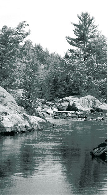
Located 50 kilometres (km) north of Peterborough, the site contains a range of natural and recreational values and is used by a variety of stakeholders and residents. Situated along the southern edge of the Canadian Shield, this relatively undeveloped area encompasses 37,587 hectares (ha) and features a rugged rolling landscape of small lakes, wetlands, forests and rocky barrens.
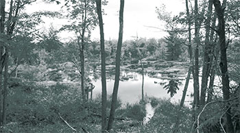
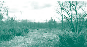
Kawartha Highlands straddles the four geographic townships of Cavendish, Harvey, Burleigh and Anstruther, in the northern half of Peterborough County (Figure 1). The northern portion of Peterborough County has a mixed landscape of forested areas, bedrock hills and lakes. The typical landscape of this area is one of rugged wooded hills and valleys, and many lakes and wetlands. Regional topography varies from slightly broken rolling land to steep cliffs and deep valleys. Soils are generally shallow, with areas of exposed bedrock.
The City of Peterborough is the nearest major regional centre to Kawartha Highlands (50 km) with the Town of Lindsay being the next largest community (53 km). Minden to the northwest, Haliburton to the north, Bancroft to the northeast, Lakefield and Bridgenorth to the south and Bobcaygeon to the southwest are located between 30 and 60 km from the park boundary. Immediately adjacent are the communities and hamlets of Buckhorn, Burleigh Falls, Big Cedar, Woodview, Haultain, Apsley, Gooderham and Catchacoma. The close proximity of this site to the Greater Toronto Area (just over 200 km from downtown Toronto to the centre of Kawartha Highlands on Anstruther Lake Road) makes the area readily accessible to the largest population centre in Canada.
Unique to Kawartha Highlands are two documents that provide specific direction for this park: the Kawartha Highlands Signature Site Charter (the Charter) and the Kawartha Highlands Signature Site Park Act (KHSSP Act). Both of these documents are the result of a previous planning process for Kawartha Highlands.
A Local Stakeholder Committee (LSC) was established in August 2000 to make recommendations to the Minister of Natural Resources on land use in Kawartha Highlands, the appropriate protection designation and possible boundary refinements. Prior to making their recommendations, the LSC offered substantial opportunities for Aboriginal and public involvement and consultation. Further focussed discussions between a range of stakeholder groups (Local Stakeholder Committee, Ontario Federation of Anglers and Hunters, Stakeholder Groups of the Kawartha Highlands, Partnership for Public Lands) and the government resulted in a signed Charter agreement for the protection of the Kawartha Highlands Signature Site. The Charter contained proposed legislative wording for the KHSSP Act, which was based largely on the recommendations of the government-appointed LSC.
The Charter reflected the intent of the MNR to manage this area as an operating natural environment class provincial park and provided interim direction for the management of the park until the park management plan was approved. The KHSSP Act (see Appendix 1) outlines site-specific policy and operational direction for Kawartha Highlands and incorporates the provisions of the Provincial Parksand Conservation Reserves Act (PPCR Act) and its regulations.
The purposes of the KHSSP Act are presented in Section 2 of the Act. The exact wording should be referred to; however, in short, these purposes include:
- protection of the ecological integrity of Kawartha Highlands is the overriding priority;
- policies that govern the park will protect the park’s natural and cultural values, maintain its traditional uses and provide the opportunity for recreational activities that are compatible with the natural heritage values and semi-wilderness character of the park;
- permit continued access to private property and tenured land; and
- decisions with respect to the development of the park management plan and any major revisions are made with prior public consultation.
The KHSSP Act received Royal Assent on June 26, 2003 at which time Section 5 (Management Advisory Board section) came into force.
A Management Advisory Board (MAB) was established in August 2003 with appointments made by the Lieutenant Governor. Appointments generally are for a three year term, and interested persons may apply through the Public Appointments Secretariat website (www.pas.gov.on.ca) at any time. The MAB Highlands. The MAB's mandate is described in the KHSSP Act and includes the following areas of advice:
- the identification of roads or trails that are to be approved as pre-existing roads and trails for the purposes of the KHSSP Act;
- the preparation of the management plan for the park;
- advertising and marketing with respect to the park;
- park fees;
- matters relating to the long-term sustainability of the park; and
- other matters as may be specified by the Minister.
On June 15, 2007, the KHSSP Act was proclaimed by the Lieutenant Governor in Council and the remaining sections of the Act came into force.
The approved park management plan will guide the management, operation and development of Kawartha Highlands over the next 20 years. The park management plan can be reviewed or amended to address changing issues or conditions as necessary. At the ten year interval, this plan will be examined for the need for a review or amendment as described in Section 11.0.
Public and Aboriginal engagement were an essential part of the process for the development of the park management plan (see Appendix 2) and this engagement will continue to be a very important part of future planning and management for Kawartha Highlands. Encouraging a broader stewardship ethic in park users and interested organizations will be critical for assisting in the ongoing management and operations of Kawartha Highlands.
The Kawartha Highlands Signature Site Park Management Plan was guided by the Kawartha Highlands Signature Site Charter (2003), and was developed in accordance with the KHSSP Act (2003), Ontario Provincial Parks: Planning and Management Policies (OMNR 1992), Ontario’s Living Legacy Land Use Strategy (1999) and the Crown Land Use Policy Atlas. In accordance with this plan, the MNR will amend affected area- specific land use policies and mapping found in the Crown Land Use Policy Atlas.
Further details on the past process, background information on the park, as well as electronic versions of the Charter and legislation, can be viewed on-line at the Kawartha Highlands website (www.ontarioparks.com/english/kawa.html)[Link no longer active.].
Figure: Kawartha Highlands protects a highly diverse natural area straddling the boundary of two ecoregions.
2.0 Context
2.1 Statement of Environmental Values and the Environmental Bill of Rights
In 1994, the Ministry of Natural Resources finalized its Statement of Environmental Values (SEV) under the Environmental Bill of Rights (EBR). The SEV is a document that describes how the purposes of the EBR are to be considered whenever decisions are made in the Ministry that might significantly affect the environment. This includes decisions made as a result of the park management planning process.
The primary purpose of the EBR is "to protect, conserve and, where reasonable, restore the integrity of the environment." From the Ministry’s perspective, that broad statement of purpose translates into four objectives in its SEV:
- to ensure the long-term health of ecosystems by protecting and conserving our valuable soil, aquatic resources, forest and wildlife resources as well as their biological foundations;
- to ensure the continuing availability of natural resources for the long-term benefit of the people of Ontario;
- to protect natural heritage and biological features of provincial significance; and
- to protect human life, the resource base and physical property from the threats of forest fires, floods and erosion.
The Ministry’s SEV has been considered throughout the planning process. The management plan for Kawartha Highlands will further the objectives of managing Ontario’s resources on an environmentally sustainable basis.
2.2 Aboriginal peoples
The Kawartha Highlands is within the area covered by the Rice Lake Treaty (Treaty No.20) signed in 1818, and the Williams Treaty signed in 1923. The Mississauga Tribe traditionally used the Kawartha Highlands area to some degree for hunting, fishing, spiritual and/or ceremonial purposes. No long-term Aboriginal occupation of the site is known to have occurred, although the area was used seasonally. The Curve Lake First Nation Reserve is located just south of Buckhorn and the Kawartha Nishnawbe community is generally concentrated in the Burleigh Falls area.
2.3 Planning context
This park management plan has been prepared consistent with direction contained in Our Sustainable Future, Ministryof Natural Resources Strategic Directions (2005). This document has also been prepared consistent with direction contained in Protecting What Sustains Us: Ontario’s Biodiversity Strategy (2005). The Ministry’s vision is "sustainable development" and the Ministry’s mission is "ecological sustainability". The Ontario Parks program contributes mainly to the goal of: "Healthy Natural Environment for Ontarians", but contributes to other strategic elements as well. The mandate of the Ministry for Ontario Parks is to deliver Ontario’s parks and protected areas program, which includes: the protection and management of provincially significant natural, cultural and recreational environments; provincial parks operations; provision of tourism opportunities; natural heritage education; planning and management of parks and protected areas; policy leadership on conservation reserves; and monitoring, auditing and public reporting on Ontario’s parks and protected areas.
3.0 Park values
A brief summary of the park’s natural, cultural and recreational features is presented here. For more detailed information please refer to the Kawartha Highlands Signature Site Management Plan Background Information document (OMNR 2005).
3.1 Life sciences
Kawartha Highlands protects a highly diverse natural area straddling the boundary of two ecoregions (Figure 2). The site lies within ecodistrict 5E-11 and its southern boundary is at the northern limit of ecodistrict 6E-9. 'The Land Between' represents the transition zone between the Canadian Shield to the north and the St. Lawrence Lowlands to the south. It is one of the most important zones of biological diversity in Ontario, and Kawartha Highlands protects part of this ecosystem edge.
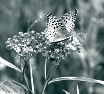
At 37,587 ha, Kawartha Highlands is a large, relatively intact natural area and is part of a forest landscape that joins it to major protected areas to the north (Algonquin Provincial Park and Silent Lake Provincial Park), the east (Petroglyphs Provincial Park, the Peterborough Crown Game Preserve and the Sharpe Bay Fen Conservation Reserve), the west (Queen Elizabeth II Wildlands and Kawartha Barrens Enhanced Management Area) and the south (Wolf Island Provincial Park). Its extensive forests, rock barrens, lakes, rivers and wetlands provide diverse habitat for at least 37 mammal species (or 53% of the provincial total); 176 bird species, of which 146 have shown evidence of breeding within the park area (representing 51% of bird species that breed in Ontario); 13 species of reptiles; 16 species of amphibians; 74 species of dragonflies and damselflies; 65 species of butterflies; and 688 species of vascular plants, of which 628 are native to the region.
Figure: Butterfly – Aphrodite Fritillary
Kawartha Highlands exhibits several significant ecological features including:
- large tracts of relatively undisturbed natural landscape having wilderness qualities and supporting large mammals with extensive home ranges;
- vast rock barrens;
- old forest stands, some with old-growth qualities;
- representation of the northern limit of Palaeozoic bedrock vegetation in this part of Ontario;
- high-quality bog and fen communities;
- disjunct Atlantic Coastal Plain flora; and
- concentrations of species at risk.
Special features of Kawartha Highlands include globally rare and provincially significant alvar and provincially significant species such as bald eagle (Haliaeetus leucocephalus), red-shouldered hawk (Buteo lineatus), cerulean warbler (Dendroica cerulea), Blanding’s turtle (Emydoidea blandingii), five-lined skink (Eumeces fasciatus), eastern hog-nosed snake (Heterodon platirhinos) and 15 provincially rare vascular plant species, including several Atlantic Coastal Plain disjunct species. Thirteen of the site’s Odonata (dragonflies and damselflies) are considered to be provincially rare and another 11 are considered to be provincially rare to uncommon. Forty-two of the site’s plant species and 13 bird species are rare in Peterborough County.
Kawartha Highlands contains two Areas of Natural and Scientific Interest (ANSI), identified for their representation of landform-vegetation patterns within ecodistrict 5E-11. The Bottle Creek ANSI was selected for its provincially significant "aquatic and shoreline features" and the Long Lake Barrens ANSI was selected for its "extensive, undisturbed bedrock barrens".
3.2 Earth sciences
The rocks underlying Kawartha Highlands lie within the Grenville Province, one of the major subdivisions of the Canadian Precambrian Shield. The rocks of this province are highly folded and contorted and are believed to represent the deep-seated roots of mountains built during a collision between two continental masses that happened over 1,100 million years ago.
The Grenville Province is subdivided into several units based on structural style, age and composition. Kawartha Highlands lies within the Central Metasedimentary Belt, an area in which there has been an accumulation of volcanic rocks, metasedimentary rocks and marbles. The belt is subdivided into a number of terranes. Kawartha Highlands lies within the Harvey-Cardiff Arch of the Elzevir Terrane, a unit consisting of deformed metavolcanic rocks, carbonate metasedimentary rocks and a distinctive suite of intermediate intrusive rocks.
The northern portion of Kawartha Highlands is underlain by a dome of gneissic and migmatitic intrusive rocks known as the Anstruther Mantled Basement Gneissic Complex. The southern portion is underlain by another dome of banded migmatite and is known as the Burleigh Gneiss Complex. These domes represent the oldest rocks in the region and form the basement on which subsequent sedimentary and volcanic rocks were placed. These rocks are very strongly folded and form distinctive curving landform patterns on the landscape. These patterns have been enhanced through glacial and melt water erosion, and are highly visible because of their excellent exposure.
The significance of the younger cover rocks in the area is that they host post-tectonic pegmatite and pegmatitic granite dikes and sills, which in turn are host to uranium and other radioactive minerals.
Kawartha Highlands provides an excellent representation of the wide range of rock types and units present in the Harvey-Cardiff Arch Domain, one of the three subdivisions of the Elzevir Terrane. Due to their superb exposure and pristine condition, this representation is considered to be provincially significant.
Limestone and minor shale of the Gull River Formation occur near the extreme southwestern portion of Kawartha Highlands, although bedrock exposure is poor. The limestone is part of a Paleozoic outlier, an erosional remnant of the southern Ontario Paleozoic plain to the south. The north facing edges of the outlier exhibit very strong and distinctive sculpting, the result of erosion by powerful, sediment-laden sheet floods beneath glacial ice that happened near the close of glaciation in the region. Fluting and streamlining of landforms also occurs on the upper surfaces of the outliers, and are the result of the same erosional processes.
Kawartha Highlands is overlain by a mantle of stony sandy till, the composition of which reflects the local Precambrian bedrock. This type of bedrock-drift is common throughout the Shield. In the southern portion of Kawartha Highlands, there is virtually no sediment cover, whereas in the northern portion, sediment cover is more continuous. Besides the stony till on bedrock surfaces, this sediment consists largely of kettled sand and gravel deposits in river valleys and other bedrock lineaments. These valley-fill sediments represent minor deposition of ice-contact outwash at a time when the ice front was in the immediate vicinity of Kawartha Highlands.
Representation of elements of the surficial geology in Kawartha Highlands is locally significant. Bedrock-drift complexes are common to the region and are well represented in other protected areas.
3.3 Cultural resources
Kawartha Highlands protects a landscape that has a rich and varied history that is important within a local and regional context.
Very little archaeological survey work has been done in and around Kawartha Highlands. Only two registered archaeological sites and one unregistered site have been recorded for the park. However, an understanding of pre- and post-contact Aboriginal activities in Southern Ontario and archaeological evidence in the region clearly suggest that this area would have been used by Aboriginal people for hunting, fishing and gathering, perhaps not continuously but repeatedly over a long period of time. Kawartha Highlands has high archaeological potential; there may be several sites that have not yet been identified, as no systematic study has been done.
Figure: Prairie Smoke, an Alvar species;
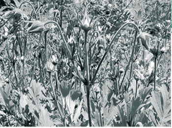
Figure: Typical Alvar Community in Kawartha Highlands
During the post-contact period, lumbering was the most significant activity within the Kawartha Highlands. The area was in the core of Trent Valley square timber and lumber activities. As logs were transported by water whenever possible, many lakes, rivers and creeks had "improvements" made to them to improve water levels and flows. Remnants of old logging dams can still be found within Kawartha Highlands on Rathbun Lake, between Cherry and Stoplog lakes, and along Stoney Creek. Most rapids on the Mississagua River show some evidence of damming, chutes or channelization. A preliminary inventory of built heritage features that exist within the Kawartha Highlands area includes the sites and remnants of former logging camps, depots, stone dams and mills, log flumes and a quarantine camp for loggers afflicted with tuberculosis.
Early settlers used Kawartha Highlands for a variety of reasons. Old beaver meadows were harvested for hay, and trails lead from some of the settled areas to lakes, taking fishing parties into the interior.
During the last couple of decades of the 1800s and into the 1900s tourism became important on the Kawartha Lakes. Resort hotels, private cottages and farm holidays provided accommodation for mostly American tourists. These were primarily fishing vacations, and much of the orientation was towards the larger Kawartha Lakes. However, the interior lakes were also destinations for guided fishing trips, and some of the trails that can still be found in the Kawartha Highlands were cart trails for fishing expeditions to such areas as Turtle (Bellamy, 1984), Elm and McGee lakes in Burleigh Township.
In 1819, a military canal system was proposed that would link the Ottawa River and Rideau Canal through Lake Ontario to Georgian Bay. The canal system never had a navigable water link for recreational boating to the Kawartha Highlands; however, the canal system along the Trent-Severn did have an impact. As a means of providing an adequate water supply, about 70 lakes in the northern part of Peterborough and Haliburton Counties were acquired as reservoirs by the federal Government in 1906 and a system of dams was installed to regulate water flow. Dams at Bottle Lake, Mississagua Lake and Anstruther Lake continue to be operated by the Trent-Severn Waterway to this day.
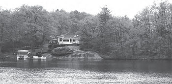
After the Second World War, with the opening up of the "backcountry" lakes for cottage lots, cottaging became important to the area. Large cottage communities developed on lakes accessible from County Road 507 and from Highway 28 near Apsley. Today approximately 2000 cottages are located on lakes that are surrounded by or immediately adjacent to the boundaries of Kawartha Highlands and are visible reminders of the long association cottagers have had and will continue to have with Kawartha Highlands.
3.4 Recreation
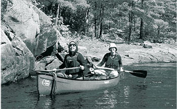
The rugged beauty of Kawartha Highlands, its scenic lakes, mature forests, and rich array of wildlife have contributed to the park becoming a popular destination for backcountry travel and semi-wilderness recreation. Adjacent landowners, cottagers, recreation camp members and visitors to the area pursue numerous activities in the park including, but not limited to, backpacking, camping, nature appreciation, canoeing, fishing, hunting, snowmobiling, snowshoeing and skiing.
Figure: Adjacent landowners, cottagers, recreation camp members and visitors to the area pursue numerous activities in the park.
Cottaging is a significant economic driver of the local economies in the area. It should be noted that the KHSSP Act, the PPCR Act and the park management plan do not alter an individual’s rights to use his or her property. Many activities are associated with "cottage life" including, but not limited to, boating, regattas, fishing and hiking. Cottagers' activities in the park will be guided by the policies outlined in the park management plan. Cottage associations are in place on most of the developed lakes and these associations will continue to play a significant role in future stewardship of the entire area.
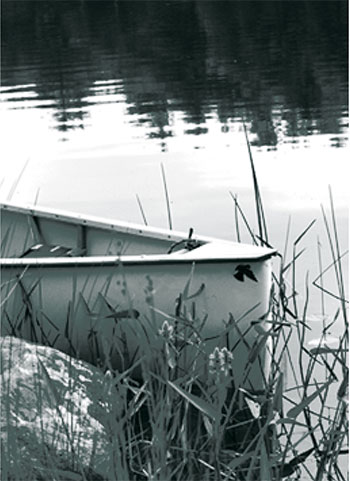
There are several well-used canoe routes and approximately 117 backcountry campsites in Kawartha Highlands, which were developed in the 1960s and have been popularized through various canoe route literature since the 1980s. Numerous lakes can be accessed by portage, which makes Kawartha Highlands a desirable location for those interested in routes offering solitude and adventure.
Both cold and warm water sport fishing opportunities are found throughout Kawartha Highlands. Lake trout, smallmouth bass and largemouth bass are the predominant sport fish found in many lakes in the park. Year round opportunities for angling exist, as many of the lakes are accessible by snowmobile in the winter. Fifty-seven (57) private recreation camps are authorized in the park through Land Use Permits and have been used primarily for hunting purposes since their establishment beginning in the 1940s. Traditional hunting in Kawartha Highlands has been mostly for deer, moose, small game and migratory birds.
Elevation changes dramatically throughout the park, offering a challenge to those seeking a backcountry hiking, snowshoeing or skiing experience. The exposed bedrock, rocky ridges and wetland features provides a feeling similar to more remote locations in Northern Ontario.
4.0 Park classification
Through park classification, Ontario’s provincial parks are organized into broad categories, each of which has particular purposes and characteristics. The Kawartha Highlands is classified as a natural environment park.
Natural environment parks protect outstanding recreational landscapes, representative ecosystems and provincially significant elements of Ontario’s natural and cultural heritage, and provide high quality recreational and educational experiences.
Figure: Natural environment parks protect outstanding recreational landscapes.
5.0 Boundary
Kawartha Highlands was established in 2005 under Ontario Regulation 180/05 and is now designated as a natural environment class park through Ontario Regulation 316/07 under the PPCR Act. The park is 37,587 ha in size. The park boundary is shown in Figure 3.
A portion of the Kawartha Highlands already existed as a provincial park prior to the regulation of the Kawartha Highlands Signature Site Park. This pre-existing park has been incorporated into the new park boundary. The pre-existing Kawartha Highlands Provincial Park was a natural environment class park and was considered "non-operating" as funding was not allocated for active management. This area of 1,861 ha surrounding Bottle and Sucker lakes was put into regulation under the Provincial Parks Act in 1989.
5.1 Cottages and other private landholdings
There are over 500 private properties which are surrounded by Kawartha Highlands. The most significant cottage development occurs on Anstruther, Wolf, Loon Call, Long, Loucks and Rathbun lakes, and along the Mississagua River. None of these properties are regulated as part of the park, and all are governed by municipal by-laws and other applicable legislation and regulations.
The area adjacent to Kawartha Highlands consists of a mix of private as well as Crown land. Immediately adjacent to the west boundary of the park are approximately 1500 lakefront properties (on Pencil, Catchacoma, Mississagua, Beaver and Gold lakes) and in the southeast of the park approximately 160 lake front properties (Big Cedar and Coon lakes). Adjacent to the park, along the Mississagua River, are a number of private properties, as well as several aggregate permit and licence areas.
5.2 Adjacent lands
Ontario Parks is committed to an ecosystem approach to park planning and management. The PPCR Act governs activities within the regulated boundary of the park. An ecosystem approach allows park management to consider the relationship between the park and the surrounding environment and to seek cooperative relationships to promote stewardship.
There is one area, approximately 150 ha in size, near the southwest corner of Kawartha Highlands which has a land use designation of "forest reserve". The forest reserve designation indicates the intention of incorporating this area into the larger protected area if the existing mining leases are retired through normal processes. Until that time, areas with mining tenure do not form part of Kawartha Highlands.
Park managers must consider potential impacts on park values and features from activities occurring on adjacent lands, and potential impacts from park activities on land uses in adjacent areas. Ontario Parks will work with adjacent landowners to protect significant natural and cultural features outside park boundaries.
Park management plan policies apply only to the area within the regulated boundary of the park. Within the park boundary, the protection of park values and features will be achieved through control of land use and activities, shared stewardship, education, and monitoring of ecological impacts.
Ontario Parks will support, in principle, the acquisition of property for the purposes of adding to the park. Land acquisition priorities will be identified by Ontario Parks based on an evaluation of the extent that lands will add value to the park, including: enhancement of ecological integrity or biodiversity, protection of natural or cultural values, resource management and/or park operations. Lands may be obtained through purchase, donation or conservation easement. When lands are considered for purchase they will be subject to funding, fair market value and willingness of owners to sell their property. No private land shall be expropriated under subsection 8 (3) or (4) of the Ministry of Government Services Act for the purpose of increasing the area of the park (KHSSP Act s.4).
Figure: Adjacent lands
6.0 Vision
This Vision Statement was first developed by the Local Stakeholder Committee based on public and stakeholder values identified during the initial consultations. During the Charter negotiations, the Vision statement was further refined. Curve Lake First Nation has indicated their support of the Vision identified below. Management policies presented in this document have been designed to realize the Kawartha Highlands Vision:
Our vision for the Kawartha Highlands Signature Site is that of a legacy of protection and stewardship, ensuring that the semi-wilderness characteristics are preserved.
The protection of the ecological integrity of the area is of paramount importance. Long-term protection of both natural and cultural heritage values is required for the preservation of this unique area. Careful management is required to protect the environmentally sensitive aspects of the area, and to maintain it for the benefit of future generations.
Traditionalactivitiesincludingcottagingwill continue to be an integral component of the area, and diverse low-density recreational opportunities will continue to be available.
Continuedpublicinvolvementin the planning and management of this area is essential. Management of the area will respect the existing private lands and tenure within the park.
7.0 Overview of goals, objectives and desired outcomes
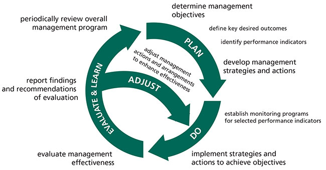
Results-based management is the process of managing for specific and pre-defined objectives and measuring progress towards the desired outcomes. This process is adaptive in nature and involves setting goals, objectives and desired outcomes based on a collective vision, and developing strategies with the intent of achieving the desired outcomes. Results-based management promotes a clear understanding of the purpose of management actions and allows management effectiveness to be measured. Results-based management leads to improvement in management effectiveness, strengthens accountability and increases the defensibility of future management actions (Worboys et al. 2005).
Managing for predefined results involves periodic adjustments to make management actions more effective. Adaptive management involves modification of management strategies in response to monitoring, new information and analysis of the results of past actions and experiences. Figure 4 shows adaptive management as a systematic, practical approach to improving resource management.
Science has provided us with a good understanding of ecosystem structure, composition and function; however, ecosystems are very complex, continually changing and variable in ways that are not yet fully understood by scientists and managers. This is true of the ecology of Kawartha Highlands, where we are continually obtaining new information.
The intent of the park management plan is to provide for the protection or enhancement of ecological integrity, while offering quality recreational opportunities for existing and future generations.
The PPCR Act defines ecological integrity as "a condition in which biotic and abiotic components of ecosystems and the composition and abundance of native species and biological communities are characteristic of their natural regions and rates of changes and ecosystem processes are unimpeded." Ecological integrity can be challenging to measure.
Figure: Kawartha Highlands Signature Site Park
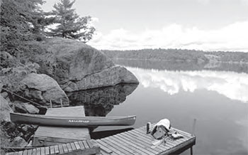
Figure 4: Adaptive Management Cycle
(Jones 2005)
A critical first step in managing for protection and enhancement of ecological integrity is to identify stressors and assess their impacts. Ranking stressors and aiming mitigation and reduction efforts at the most serious stressors is an effective approach to achieving protection objectives.
The following table (Table 1) is provided to assist in understanding how policies in the remaining Sections of this document relate back to the Vision for the area.
Goals have been developed consistent with the Vision Statement. The goals have been grouped within four general headings: Protection, Recreation, Public and Stakeholder Interests, and Aboriginal Engagement. Management objectives and desired outcomes have been provided for each goal statement.
Table 1. Park Goals, Management Objectives and Desired Outcomes
1. Protection:
Ontario Parks' protection objective is to permanently protect representative ecosystems, biodiversity and provincially significant elements of natural and cultural heritage and to manage these areas to ensure that ecological integrity is maintained.
In working towards the Vision for Kawartha Highlands, the ecological integrity of the park will be protected and en- hanced using adaptive management, cooperation with park users and policy enforcement.
| Goals | Management objectives | Desired outcomes |
|---|---|---|
| 1.1 To protect the ecological integ- rity of the park as the first and overriding priority. Explanation of protection of ecological integrity. Protection and enhancement of the natural composition and abundance of native species, biological communities and ecological processes for the benefit of future generations. |
1.1.1 Use an adaptive management approach to maintain biodiversity, ecological rates of change and sup- porting processes so that ecosystems are characteristic for their natural region and likely to persist. 1.1.2 Participate in recovery efforts for spe- cies at risk as identified in recovery strategies or management plans and in partnership with recovery teams. 1.1.3 Protect and enhance the ecologically sensitive values of the park (e.g. ecosystems such as wetlands and alvars). 1.1.4 Reduce the impact of primary stressors on park ecosystem composition, function and structure. 1.1.5 Contribute to the maintenance of water quality in lakes, streams and wetlands. |
|
| 1.2 To preserve semi-wilderness characteristics. | 1.2.1 Maintain or enhance semi-wilderness characteristics. 1.2.2 Reduce noise levels in semi-wilder- ness areas. 1.2.3 Reduce light impacts on dark night skies. |
|
| 1.3 To protect the cultural resources of the park. | 1.3.1 Identify, map, document and foster appreciation for cultural heritage artifacts and remnants. |
|
2. Recreation:
Ontario Parks' recreation objective is to provide opportunities for ecologically sustainable outdoor recreation opportunities and encourage associated economic benefits.
Consistent with the Vision for Kawartha Highlands, this park will strive to achieve a balance between permitting many traditional or new low-intensity recreational activities compatible with the semi-wilderness experience and not compromising the ecological integrity of the park.
| Goals | Management objectives | Desired outcomes |
|---|---|---|
| 2.1 To provide opportunities for diverse, low-intensity recreation which are compatible with the natural heritage values and semi-wilderness experience, while allowing traditional recreational activities to continue. | 2.1.1 Allow authorized traditional recreational activities to continue within the park. 2.1.2 Provide opportunities for semi- wilderness backcountry camping (canoeing and hiking) to the extent that they are compatible with protection goals. 2.1.3 Contribute social and economic benefits to local communities |
|
3. Public and stakeholder interests:
The Kawartha Highlands is part of a greater area: socially, politically, ecologically and historically.
Ontario Parks must consider how management actions in Kawartha Highlands affect the surrounding environment and society.
| Goals | Management objectives | Desired outcomes |
|---|---|---|
| 3.1 To provide appropriate opportunities for public involvement in stewardship, planning and management of the park. 3.2 To allow continued access to and enjoyment of private and tenured land. 3.3 To allow existing commercial activities to continue. 3.4 To provide for a continued advisory role for the Management Advisory Board. |
3.1.1 Provide public involvement in planning, management and stewardship activities through meaningful opportunities. 3.2.1 Both private and tenured landholders surrounded by the park continue to access and enjoy their lands. 3.3.1 Trapping, bait harvesting, bear hunting and tourist operations continue in a manner that maintains the ecological integrity of the park. 3.4.1 Management Advisory Board provides advice on items related to the long- term sustainability of the park. |
|
4. Aboriginal engagement:
Although not specifically identified in the Vision Statement, it has been the clear intent for Kawartha Highlands to engage the Aboriginal communities in the planning and management of the park.
| Goals | Management objectives | Desired outcomes |
|---|---|---|
| 4.1 To engage Aboriginal communities adjacent to the park in appropriate, and mutually beneficial, planning and management activities. | 4.1.1 Aboriginal communities are engaged in park management activities that are consistent with the park Vision and mutually beneficial activities including, but not limited to, cultural heritage research and protection. |
|
8.0 Park policies
The following policies are intended to achieve the goals, management objectives and desired outcomes for Kawartha Highlands as set out in Section 7.0. An adaptive management approach will be applied to management activities within Kawartha Highlands. All resource management, operations and development projects undertaken by Ontario Parks will comply with A Class Environmental Assessment for Provincial Parks and Conservation Reserves (OMNR 2004).
8.1 Industrial use policies
8.1.1 Forestry operations
- Commercial forestry is not permitted (KHSSP Act, s.12).
8.1.2 Mining
- Prospecting, staking of mining claims, developing mineral interests, working mines are not permitted (KHSSP Act, s.12).
8.1.3 Aggregate and peat
- Extraction of sand, gravel, topsoil or peat is not permitted (KHSSP Act, s.12).
8.1.4 Power generation
- Commercial electric power development is not permitted (KHSSP Act, s.12).
8.2 Commercial use policies
8.2.1 Wild rice harvesting
- There is no existing commercial wild rice harvesting operation within the park.
- New operations will not be permitted.
8.2.2 Trapping
- There are portions of 24 registered trapline areas within the park and all are considered "existing".
- Existing commercial fur harvesting may continue under the Fish and Wildlife Conservation Act (KHSSP Act, s.11). Under the Fish and Wildlife Conservation Act, the MNR has the authority to establish licence types and to impose written conditions upon the licence, which may include mandatory reporting. Conditions will take into account conservation principles and public safety.
- Transfer of existing traplines is permitted, subject to the MNR approval and established allocation procedures. Transfer may occur either when a trapper surrenders a registered trapline, or trapper privileges are revoked. In addition, trap cabins are considered to be part of the trapline and will also be considered for transfer with the trapline. Where a current trap cabin location poses a significant impact to natural values, relocation of the cabin may be considered.
- New commercial fur harvesting operations, including new cabins on existing lines, are not permitted in the park. New operations include applications for any area in the park which does not currently have a trapline.
- Under the authority of Ontario Parks, abandoned trap cabins may be removed or considered for alternative uses.
8.2.3 Fishing
- There are no existing commercial fishing licences in the park.
- New operations will not be permitted.
8.2.4 Bait harvesting
- There are portions of 14 bait harvesting areas (BHAs) in the park and all are considered existing.
- Existing commercial bait harvesting may continue subject to conditions attached to the licence. Conditions will take into account conservation principles and public safety.
- No new bait harvesting licences will be permitted; however, active licences may be transferred, subject to review and approval by the MNR and following established allocation procedures.
- As areas become available, every effort will be made to realign the boundaries of these BHAs prior to transfer so that reporting and monitoring will be specific to the park area.
8.2.5 Bear Management Areas
- There are portions of 5 Bear Management Areas (BMAs) in the park and all are considered existing commercial uses.
- Bear hunting in existing BMAs is permitted to continue, subject to licence conditions, except in portions designated as access zones.
- New BMA licences will not be issued. New operations include applications for any area in the park which is not currently a designated BMA.
- An existing authorized BMA licence may be renewed or transferred where the current operator sells a bear hunting business if the BMA transfer is approved by the MNR. If an operator surrenders a BMA, or if the BMA is revoked, reallocation of the BMA may occur, following applicable screening processes. Applications for the renewal or transfer of a BMA will be assessed by the MNR staff, with due consideration to management objectives, conservation principles and public safety.
- As areas become available, every effort will be made to realign the boundaries of these BMAs prior to transfer so that reporting and monitoring will be specific to the park area.
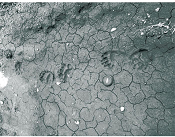
Figure: Black bear tracks
8.2.6 Tourist operations
- There are four commercial outpost camps within Kawartha Highlands located on Fair Lake, Elm Lake, Pilot Lake and Bear Lake. These existing commercial tourism facilities may continue within the park.
- No new commercial outpost camps will be considered.
- Existing Land Use Permits (LUPs) may continue to be renewed for commercial tourism purposes, provided that the terms, conditions and intent of the permit are being met.
- Commercial tourism establishments that have tenure by LUP may be eligible for enhanced tenure, but not sale of the land on which they are situated.
- Transfer of commercial tourism facilities is permitted.
- Commercial outpost camp LUPs that are not renewed will be reviewed by Ontario Parks to determine the appropriate future for the camps.
- As future demand may warrant, proposals for expanded or new tourism opportunities may be considered if the opportunity does not impact the significant features or ecological integrity of the park.
8.3 Resource management policies
Kawartha Highlands will be managed in accordance with the policies set out in Ontario Provincial Parks: Planning and Management Policies (OMNR 1992) for natural environment class parks, and Ontario’s Living Legacy Land Use Strategy (OMNR 1999). The following policies will guide the management of park resources consistent with the KHSSP Act, Endangered Species Act, PPCR Act and with the requirements of the Environmental Assessment Act.
8.3.1 Land management
- The management of Kawartha Highlands will be directed toward maintaining the ecological integrity of the park, and will be supported by inventory, monitoring, assessment and research activities.
- Terrestrial ecosystems and biodiversity of the site will continue to be documented through inventories, assessments and research.
- New energy transmission and communications corridors will be discouraged within the park boundary and alternate locations outside of the park will be sought wherever possible.
- Applications for the installation of power or communication lines across park lands to provide service to patented properties can be authorized by Ontario Parks, subject to ensuring that the lines are constructed with minimal possible impact and in accordance with all required legislation, standards and procedures. Where possible marine cables should be used to minimize impacts.
- Sewage from in-building park washroom facilities that may be constructed at Kawartha Highlands will be disposed of in MOE- approved septic systems. Sewage from vault privies will be removed from the park by licensed sewage haulers and disposed of at MOE-approved sites.
- A conservation philosophy of recycling and 'pack-in, pack-out and take home' will be promoted to all park users to address the issue of garbage accumulation within the interior of Kawartha Highlands.
- Ontario Parks intends to amend existing regulations under the PPCR Act to prohibit interior travellers from possessing non-burnable food or beverage containers other than containers specifically designed and intended for repeated use and for which no deposit is charged. For clarification purposes, nothing in this policy will prohibit property owners and land tenure holders from transporting cans and glass bottles directly to their property, but they would be prohibited from possessing cans and glass bottles in the park beyond their property or tenured holdings.
- Aggregate for park purposes will be acquired from sources outside the park.
- Minor dispositions of land are permitted (e.g. to allow the installation of a new or upgraded septic system), providing they do not affect the values an area is intending to protect.
- Work undertaken in the park may require a work permit under the PPCR Act.
- A number of LUPs and Licences of Occupation currently exist in Kawartha Highlands for facilities such as docks, parking lots and storage buildings. Extended tenure may be granted by Ontario Parks, by increasing the term of the existing tenure from one year up to five years, but the type of tenure will not change.
- Where commercial marinas have a LUP or a Licence of Occupation for facilities in the park such as docks, parking lots or storage buildings and these facilities cease to be operated as commercial ventures, Ontario Parks will cancel these LUPs or Licences of Occupation. If facilities such as docks and parking lots located on these LUPs or Licences of Occupation are required for public access, and if no other alternatives for public access exist, Ontario Parks will work towards ensuring that these facilities will continue to be provided.
- A Lands Management Plan will be developed to provide further direction on, but not limited to, boat caches, LUPs, work permits and fuelwood permits.
8.3.1.1 Private recreation camps
- There are 57 recreation camps (hunt camps) within the park boundaries under the authority of a LUP currently issued on a yearly basis, with conditions applied.
- Existing recreation camp LUPs will be allowed to continue providing permit conditions are met. Permit conditions will be established in the Lands Management Plan.
- No new recreation camps will be considered.
- Extended tenure may be granted by Ontario Parks by increasing the term of the LUP from one year up to five years.
- The decision to renew existing tenure or to grant extended tenure will be the result of a screening process which will be established in the Lands Management Plan and may include:
- an assessment of the effect of the camp on park ecological integrity
- impact on natural heritage values and/or conflict with other users and assessment of public interests; and
- history of compliance with LUP conditions or payment (including municipal taxes).
- Recreation camp LUPs may be transferred within the documented camp membership with appropriate supporting information and approval of Ontario Parks.
- Recreation camp LUPs that are not renewed will be reviewed by Ontario Parks to determine the appropriate future for the camp; the review process will be established in the Lands Management Plan.
- Any addition or improvement to an existing recreation camp will require a work permit issued by Ontario Parks. The process for considering work permit applications for additions or improvements to recreation camps will be established in the Lands Management Plan.
8.3.1.2 Boat caches
- Boat caches are permitted within Kawartha Highlands for any user.
- A permitting system will be implemented. Boats will be cached in specific locations on lakes as authorized by Ontario Parks and will be regulated by permit, which may include time-of-year restrictions:
- Year One (within one year of park management plan release): Owners will be required to display a boat cache decal, as issued by Ontario Parks, on cached boats.
- Year Two (within two years of park management plan release): Any boats found within Kawartha Highlands without an affixed authorized boat cache decal will be removed.
- Ontario Parks will work with stakeholders and the MAB to develop an approach for boat caches (part of the Lands Management Plan), which will include quotas, fees and authorized cache sites. This approach will consider any impacts to park ecological integrity. Boats cached for access to private property or tenured lands will continue and no fee will apply. Boats that are cached and used for recreational purposes will be subject to fees and must be cached at designated locations only.
8.3.2 Water management
- Ontario Parks will continue to work in cooperation with the Ministry of Environment and other partners to establish baseline information for water quality within Kawartha Highlands.
- In high-use areas (e.g. access and backcountry camping locations), water quality may be monitored where feasible, in accordance with provincial standards.
- In 1915, a series of stone dams were installed to aid in regulating water levels in the Otonabee and Trent rivers. These stone dams remain under federal ownership but no longer play a role in regulating water levels. The MNR will work with federal authorities to explore regulating these sites as part of Kawartha Highlands.
- A dam at the outlet of Bottle Creek is maintained by the Ministry of Natural Resources, but managed by agreement for the Trent-Severn Waterway. The Mississagua Lake dam is owned and operated by the Trent-Severn Waterway. Anstruther Lake dam is also used to control water levels in the Trent-Severn and is operated by the Trent-Severn Waterway. Ontario Parks will work cooperatively with the Trent-Severn Waterway to address park concerns arising from water control management and impact to park ecological integrity.
8.3.3 Forest fire management
- The MNR recognizes fire as an essential ecosystem process, fundamental to restoring and maintaining the ecological integrity of protected areas in the Great Lakes – St. Lawrence Forest Region (see Appendix 3 for more detailed description).
- Fire management within Kawartha Highlands will help to restore and maintain ecological integrity while preventing personal injury, value loss and social disruption.
- Fire management will be conducted in accordance with the following management direction.
- Fires that pose a threat to public health and safety, property and infrastructure, or other values will receive a full response and sustained action. Sustained action, if required, will be directed through an approved Fire Assessment Report that has been developed in consultation between Ontario Parks and authorized fire management personnel.
- Opportunities for modified response and monitoring to achieve ecological or hazard reduction objectives may be considered in consultation between Ontario Parks and authorized fire management personnel. Consideration and documentation will be in accordance with the Guidelines for Modified Response and Monitoring during Managed Fire Operations (OMNR 2006).
- During periods of escalated fire activity, availability of suppression resources may be limited. If necessary, fires will be prioritized for initial attack and/or sustained action. Prioritization will involve consultation between senior park and fire managers at the district and regional levels. Approved Fire Assessment Reports will be used to prioritize fires and identify the appropriate response options.
- "Light on the land" fire suppression techniques will be used whenever feasible, so as not to unduly disturb natural or cultural values. Examples may include limiting the use of heavy equipment or the felling of trees during fire response.
- Prescribed fire is any forest fire deliberately utilized in a predetermined area in accordance with a pre-specified and approved burning prescription to achieve preset objectives. Prescribed fire does not include prescribed burning. Because of the limited size of the park and extensive visitor use during the fire season, the use of randomly ignited prescribed fire is not feasible and will not be used.
- Prescribed burning is the deliberate, planned and knowledgeable application of fire by authorized personnel to a specific land area to accomplish pre- determined objectives. Prescribed burning to achieve ecological or hazard reduction objectives may be considered. Plans for any prescribed burning will be developed in accordance with the MNR Prescribed Burn Policy, its associated planning manual, and the Class Environmental Assessment for Provincial Parks and Conservation Reserves, in cooperation with Haliburton Fire Management personnel.
- Response for structural fires and forest fires is guided by a municipal forest fire management agreement between the Ministry of Natural Resources and the Municipality of the Township of North Kawartha and the Municipality of Galway-Cavendish and Harvey. Fire evacuation procedures will be as outlined in the Fire Emergency and Evacuation Plan for Kawartha Highlands
- Partial or total fire bans may need to be put in place and enforced at the discretion of Ontario Parks following consultation with the MNR fire personnel and the local municipal fire departments.
8.3.4 Vegetation management
- Vegetation of the Kawartha Highlands will be managed to preserve, protect and enhance natural composition and abundance of native species, biological communities and ecological processes (i.e. ecological integrity). An approach for the protection and enhancement of communities at risk, such as the globally rare alvar community, will be identified in the Science and Information Management Plan.
- The harvesting of non-timber forest products (birch bark, yew, Christmas trees, etc.) is not permitted.
- The cutting of live vegetation is not permitted unless authorized by Ontario Parks.
- Existing fuelwood permits may be renewed. Water access properties are eligible to apply for new fuelwood permits. Permits will be issued subject to an assessment that will determine the impact of fuelwood harvesting on park ecological integrity and direction for this assessment will be incorporated into the Lands Management Plan. Ontario Parks will identify areas for fuelwood harvesting (e.g. blowdown areas) as available.
- Ontario Parks intends to amend existing regulations under the PPCR Act to prohibit the use of chainsaws in the park except for the following purposes:
- collection of firewood when authorized through a fuelwood permit;
- access road and trail maintenance where authorized by Ontario Parks;
- emergency purposes (e.g. where a tree has blocked a road or trail);
- removal of safety hazards; and
- park management.
For clarity, chainsaws may not be used to collect fuelwood for camping or campfire purposes.
- Where planting or seeding is necessary for rehabilitation purposes (e.g. roads and trails, interior campsites), use will be made of species native to the park from sources in or near the park.
- Herbicide applications for vegetation management are discouraged except to address visitor health and safety, or ecological integrity.
- Brushing along existing approved roads and trails may be permitted, providing that park values are not negatively impacted.
8.3.5 Wildlife management
- Wildlife within Kawartha Highlands will be managed on a sustainable basis, in accordance with current policies and legislation.
- Wildlife management will be directed towards the maintenance and/or enhancement of natural composition and abundance of species and populations.
- Animal populations or individual nuisance animals may be controlled when essential to protect human health and safety or the values for which the park has been established. Where control is necessary, techniques that have minimal effects on park ecological integrity will be used. Appropriate methods of population control may be undertaken directly by Ontario Parks, or through partnerships.
- Direction for wildlife management may be prepared for the park and would be part of the Science and Information Management Plan.
- Wildlife management planning and the design of inventory, monitoring and research projects will be conducted in cooperation with the MNR, Bancroft District.
8.3.6 Fisheries management
- Fisheries management will focus on managing the park’s fisheries to maintain native species diversity and genetic stocks, protect self- sustaining native species fisheries (e.g. lake trout), maintain or enhance high quality fishing opportunities and to keep the harvest of fish within sustainable levels.
- Both the Strategic Plan for Ontario’s Fisheries – SPOF II (OMNR 1992) and the New Ecological Framework for Recreational Fisheries Management in Ontario (OMNR 2005) will provide direction for the management of fisheries that are now contained in the park.
- Fish stocking may occur subject to the MNR's current fish stocking guidelines and principles, and consideration of the intent of Ontario Parks' policies. The purpose of fish stocking within Kawartha Highlands will be to distribute angling pressure on lakes within the park. Stocking of lakes with such species as splake and rainbow trout may only continue where their stocking supports the angling demand for cold water species and where the impact to ecological integrity is within acceptable limits.
- Naturally-reproducing lake trout populations will be managed to control the harvest at sustainable levels through appropriate harvest restriction regulations.
- Fish sanctuaries may be established primarily to protect genetic stocks of fish species (e.g. lake trout).
- Spawn collection by the MNR is permitted with authorization from Ontario Parks to help support the ongoing efforts of the MNR to perpetuate the gene pool of fisheries stocks in other water bodies.
- Monitoring of fish populations by conducting assessments of fish populations using approved MNR protocols is permitted with authorization from Ontario Parks.
- Fisheries habitat rehabilitation is permitted with authorization from Ontario Parks.
- Fisheries management, planning and the design of inventory, monitoring and research projects will be conducted in cooperation with the MNR, Bancroft District. This includes working cooperatively with officials of other agencies to address fisheries concerns (e.g. the Trent-Severn Waterway regarding the timing of water draw-down during the lake trout spawning season).
- To protect the fishery from introductions of invasive and non-native species, Ontario Parks proposes to request an amendment to the Ontario Fishery Regulations under the federal Fisheries Act to institute a ban on the use and possession of live baitfish in park waters. This would include Aboriginal engagement and public consultation.
8.3.7 Species at Risk
- The MNR provides protection to endangered, threatened or special concern species that are listed on the Species at Risk in Ontario (SARO) list. This is carried out through legislation, policies and the development of recovery strategies (endangered and threatened species) and management plans (only for special concern species that will not already receive a recovery strategy or management plan under the federal Species at Risk Act), and through the implementation of published statements of the intended actions of the government of Ontario in response to recovery strategies.
- Species at risk and their habitats will be protected consistent with the Endangered Species Act and its regulations and Ontario Parks' policy. A plan for protecting species at risk in Kawartha Highlands will be part of the Science and Information Management Plan.
- Inventory, monitoring, assessment and research activities will contribute to protection or recovery actions identified by recovery strategies, management plans and government response statements for species at risk in the park.
- Extirpated species may be reintroduced and existing populations of species at risk replenished as long as these actions are consistent with the Endangered Species Act and a published recovery strategy or management plan, and maintain or enhance ecological integrity.
Figure: Blanding’s Turtle – a Species at Risk
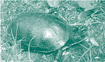
Figure: Five-lined Skink – a Species at Risk
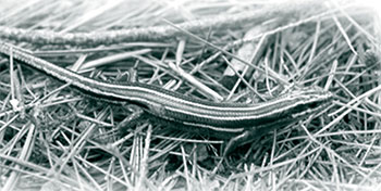
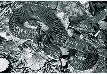
Figure: Eastern Hog-nosed Snake – a Species at Risk
8.3.8 Non-native and invasive species
- Non-native species (species not native to Ontario) and invasive species (species that are likely to spread and negatively affect native ecosystems) will not be deliberately introduced.
- Management actions, including inventory, monitoring and education, may be taken to reduce the threat to ecological integrity posed by non-native or invasive species. Inventory and monitoring activities will incorporate measures designed to detect occurrences of non-native species and invasive species.
8.3.9 Insects and diseases
- Insects and diseases affecting animals and plants will be allowed to progress naturally, except where they impact park ecological integrity, significant aesthetic values in the park or adjacent lands, in which case they may be controlled.
- Where control is undertaken, it will be directed as narrowly as possible to the specific insect or disease so as to have minimal effects on park ecological integrity. Non-chemical and species-specific controls will be used whenever feasible.
8.3.10 Cultural resources management
- The management of cultural heritage resources within Kawartha Highlands will be directed towards protection, heritage appreciation and research opportunities.
- Ontario Parks will continue to work with the Ministry of Culture and with Aboriginal communities to inventory, protect and maintain archaeological and historic sites.
- Periodic inspection of all identified significant cultural sites will be carried out by Ontario Parks staff and controls to protect sites will be established where required.
- The removal of artifacts, or the disturbance or destruction of historical features, is not permitted.
- Protection and management of cultural heritage resources will be undertaken consistent with A Technical Guideline for Cultural Heritage Resources for Projects Planned under the Class Environmental Assessment for the MNR Resource Stewardship and Facility Development Projects and the Class Environmental Assessment for Provincial Parks and Conservation Reserves (OMNR 2006).
- If significant cultural heritage resources are identified, the management plan may be amended through zoning changes and other means, if necessary, in order to provide for their protection.
8.3.11 Scientific collecting
- The scientific collection of fossils, rocks, minerals, archaeological/cultural artifacts, plants, seeds and animals may be permitted by research permit and/or scientific collector permit.
8.3.12 Research
- Scientific research by qualified individuals contributing to the knowledge of natural and cultural history and to adaptive management will be encouraged and must be authorized by Ontario Parks.
- Research partnerships with universities, colleges, industry, government and non- government organizations, First Nations or Aboriginal communities, and other associations will be encouraged.
- A Science and Information Management Plan will be prepared and will provide direction for research activities in the park. This direction will be consistent with current southeast zone and corporate research strategies.
- Priority research projects in Kawartha Highlands include:
- identification of park-specific indicators of ecological integrity; and
- quantification of the impact of recreational activities on indicators of park ecological integrity.
- Temporary facilities in support of approved research and monitoring activities may be considered.
- Removal of natural materials or artifacts is not permitted, unless authorized by Ontario Parks.
- Any First Nation cultural heritage research will include the involvement of local Aboriginal communities.
8.3.13 Inventory and monitoring
- Planning and management decisions will be made with the best available information. Where this information is lacking, Ontario Parks may conduct inventories and monitoring, as necessary, to provide this information. Such efforts will be undertaken based on established methodologies, best practices and subject to available resources.
The complex task of developing a monitoring program requires a front- end investment in planning and design to ensure that the program meets the most critical science needs of the park, makes maximum use of leveraging and partnerships with other agencies and academia, and produces scientifically credible data that is accessible and useful to managers, researchers and educators.
- Inventory and monitoring activities will be designed to assess the effect of management activities on reducing ecological stress and maintaining or enhancing park ecological integrity. Park specific indicators may be identified and monitored over the long term to assess broad scale changes in park ecological integrity. Such monitoring will utilize existing protocols and partnership opportunities with other federal and provincial agencies.
- An approach for monitoring will be prepared as part of an overarching Science and Information Management Plan and will detail park monitoring objectives and information needs.
- The Science and Information Management Plan will detail specific monitoring projects, inventory and research needs, and provide direction for the management and assessment of information. Information reporting structure and direction for the use of science- based information in park management decisions will also be contained in this plan.
- Priority inventory projects include:
- 'Ecological Land Classification' inventories to prepare an ecosite vegetation map;
- key habitat areas for species at risk;
- aquatic species/ecosystem inventory; and
- cultural resources inventories with priority emphasis on pre-contact archaeological inventories.
- Priority monitoring projects include the evaluation and assessment of:
- impacts of stressors on indicators of park ecological integrity;
- effectiveness of management actions for protecting ecological integrity;
- indicators of ecological integrity to determine trends;
- natural and human impacts on cultural sites;
- pack-in/pack-out garbage initiative;
- carrying capacity;
- impact of fuelwood harvesting; and
- impact of motor vehicle use on the road and trail network.
8.4 Recreation management policies
- Kawartha Highlands will be managed to provide for diverse low-density semi-wilderness recreational opportunities that do not significantly compromise the ecological integrity of the park. Traditional activities, including canoeing, hiking, fishing and hunting will continue to be integral components of the park’s recreation program as provided for in the KHSSP Act.
- Consistent with this direction, the carrying capacity for recreation will be evaluated.
- An approach for recreational use will be developed as part of the Park Operations Plan to provide further direction including, but not limited to, new recreational opportunities such as backpacking and hiking, multi-user trails, trail user etiquette, and partnership and stewardship opportunities.
8.4.1 Services for visitors
- Staff from Kawartha Highlands will work cooperatively with local tourism information centres, including local provincial and municipal travel centres, to provide information about the park and its services.
- New facilities and/or services may be considered if they are consistent with the Vision, goals and objectives established for the park or to respond to park user needs. Local business communities will be consulted in order to address concerns.
8.4.2 Permits and fees
- With the exception of exemptions under the KHSSP Act, the Ontario Parks' fee schedule will apply to users of Kawartha Highlands. Whether charges apply or not, all persons using motor vehicles and motorized snow vehicles in Kawartha Highlands must obtain valid permits as required by the KHSSP Act and the PPCR Act. Ontario Parks may also charge other fees from time to time, as required by the PPCR Act or as recommended by the Management Advisory Board.
- Waived fees, as well as conditions, are found in the KHSSP Act, s.13. In general, fees are waived for certain activities for those persons who own property, operate a business or who have tenured land that is surrounded by or abuts park land, and their guests or tenants. These persons may operate a motor vehicle or a motorized snow vehicle without charge (but still require a permit) for the following purposes:
- to access their property or tenured land (if the normal means of gaining access to the property or tenured land was through the park); or
- to access areas for hunting purposes.
- Aircraft landing to access properties or tenured lands is permitted without charge with an aircraft landing permit. A permit is required and a fee may be charged for recreational aircraft landings.
- Ontario Parks may limit the number of vehicle permits to be issued without charge at one time to guests of property owners, tenured land holders or tenants of either.
- Licenced trappers, bait harvesters and Bear Management Area holders may access their licence areas without charge but still require a vehicle permit.
8.4.3 Hunting
- Kawartha Highlands lies within Wildlife Management Unit (WMU) 60. Hunting is permitted (KHSSP Act, s.11), subject to the Fish and Wildlife Conservation Act, sustainable wildlife management prescriptions, and applicable provincial and federal hunting regulations.
- Hunting is not permitted in access zones.
- Hunters may use an All Terrain Vehicle (ATV) on the approved pre-existing road and trail network to access areas for the purpose of hunting (KHSSP Act, s.15(2)1), subject to permit requirements.
- The use of ATVs for the purpose of retrieving game is only permitted on the approved pre-existing road and trail network.
- The use of hunting blinds or stands is permitted, providing that they are of a temporary nature. These must be removed at the end of the hunting season. Permanent hunting blinds or stands will be phased out.
8.4.4 Fishing
- Kawartha Highlands lies within Fisheries Management Zone (FMZ) 15. Recreational fishing is permitted (KHSSP Act, s.11), subject to the provincial (Fish and Wildlife Conservation Act) and federal (Fisheries Act) regulations as set out in the Ontario Recreational Fishing Regulations Summary.
- No person is permitted to use an ATV to access lakes in the park for fishing purposes.
- A person may enter the park and operate a motorized snow vehicle on a body of water in the park that is covered with ice or on the approved pre-existing road and trail network in order to engage in ice fishing (KHSSP Act, s.15(5) & (6)), subject to permit requirements.
- Ontario Parks intends to request an amendment to the Ontario Fishery Regulations under the federal Fisheries Act to institute a ban on the use and possession of live baitfish within Kawartha Highlands. A public education and awareness campaign will support this policy during its implementation.
- The use of a portable ice fishing hut is permitted, providing that it is not left unattended or overnight in the park.
8.4.5 Backcountry camping and travel
- Backcountry camping is permitted on designated campsites only.
- A reservation system may be introduced in the future. Ontario Parks may reduce the maximum length of stay on certain lakes.
- Campsites are limited to a maximum of 9 persons per campsite. Drive-in camping (tent trailers, mobile homes, etc.) is not currently available and will not be permitted in the park.
- A conservation philosophy of recycling, 'pack-in, pack-out and take home' will be promoted to all park users, to reduce garbage accumulation within the park interior.
- Ontario Parks intends to amend existing regulations under the PPCR Act to institute
- Park users will be encouraged to use portable refillable camp stoves in the interior as a means of reducing the need for recreational fires. The use of portable stoves will also reduce site degradation caused by the removal of vegetation for campfires, and decrease the removal of ecologically important woody debris.
- Fires are permitted in designated fire pitsonly.
- Electronically amplified music is only permitted with the use of headsets, in keeping with the semi-wilderness experience desired for Kawartha Highlands.
- Ontario Parks intends to amend existing regulations under the PPCR Act to prohibit the possession of generators at backcountry campsites.
8.4.6 Winter camping
- Winter camping is allowed by permit in Kawartha Highlands but, to minimize impacts, Ontario Parks intends to amend existing regulations under the PPCR Act to allow winter camping no closer than 30 metres from shorelines and portages.
- Winter campers will be required to carry out and take home all garbage.
8.4.7 Mechanized travel
8.4.7.1 Aircraft
- Aircraft may land on lakes (open or frozen) by permit, for recreation and/or access to private properties and tenured land (KHSSP Act, s.13(6)).
- Aircraft may land in the park to carry out park management activities or to provide emergency services (KHSSP Act, s.16(b)).
8.4.7.2 Motorboats
- Ontario Parks intends to amend existing regulations under the PPCR Act to reflect the following direction: Motorboats will be allowed (see Figure 5):
- on Anstruther, Wolf, Loon Call, Rathbun, Long, Loucks and Buzzard lakes for all users;
- on lakes that have, or access, private or tenured land for all users (Ontario Parks will work with the MAB, recreational users, private property owners and tenure holders to monitor current motorboat use, assess impacts and determine appropriate controls. Any restrictions would require an amendment to the plan, including consultation, and a change to regulation.); and
- anywhere in the park for park management or emergency purposes.
- Ontario Parks intends to prepare a regulation under the PPCR Act to prohibit overnight mooring of motorboats.
8.4.7.3 Motorized snow vehicles
- Motorized snow vehicles may only be operated on the approved pre-existing road or trail network (KHSSP Act, s.15(5)).
- For purposes of gaining access to winter fisheries, motorized snow vehicles may travel over frozen bodies of water (KHSSP Act, s.15(6)).
- No person shall operate a motorized snow vehicle in the park unless the person has obtained a vehicle permit issued under the PPCR Act.
- A person who holds a valid trail permit issued under the Motorized Snow Vehicles Act or who is otherwise entitled under the Act to operate a motorized snow vehicle on a trail operated or maintained by the Ontario Federation of Snowmobile Clubs (OFSC) may, without charge for the use of the trail or for entrance to the park on that trail, operate a motorized snow vehicle on any such OFSC trail that is located in the park (KHSSP Act, s.15(7)).
- Persons who hold a licence to trap or harvest bait under the Fish and Wildlife Conservation Act in an area that is situated in the park, or a person authorized by the licence holder, may enter the park and operate a motorized snow vehicle anywhere in the park, but only to the extent that is necessary in order to access their licenced area for the purpose of trapping or bait harvesting (KHSSP Act, s.14(4) & (5)).
- A person may operate a motorized snow vehicle anywhere in the park if the vehicle is operated for one of the following purposes (KHSSP Act, s.15(8)):
- In order to carry out park management activities.
- In order to provide emergency services.
- An ATV modified with a snow track instead of wheels shall be considered a motorized snow vehicle for the purposes of the KHSSP Act (see definition of "motorized snow vehicle" under KHSSP Act, s.1).
8.4.7.4 Motor Vehicles (including ATVs)
- A person may only operate a motor vehicle in the park on an approved pre-existing road or trail for the following purposes (KHSSP Act, s. 13(2) & 15(2)):
- access to private property or tenured land (e.g. recreation camps, BMA holders);
- access to areas for hunting purposes; or
- access to a park facility on the most direct route from park entrance (a park facility is something that may be created in the future for the use of park visitors, such as a visitor center).
- Only ATVs on trail network: A motor vehicle that is not an all-terrain vehicle, shall not be operated on approved pre-existing trails in the park but shall only be operated on approved pre-existing roads (KHSSP Act, s.15 (4)).
- No person shall operate a motor vehicle in the park unless the person has obtained a vehicle permit issued under the PPCR Act.
- Persons who hold a licence to trap or harvest bait under the Fish and Wildlife Conservation Act in the park, or a person authorized by the licence holder, may enter the park and operate an ATV anywhere in the park, but only to the extent that is necessary in order to access their licensed areas for the purpose of trapping or bait harvesting (KHSSP Act, s.14(4) & (5)).
- A person may operate a motor vehicle anywhere in the park if the vehicle is operated for one of the following purposes (KHSSP Act, s.15(8)):
- In order to carry out park management activities.
- In order to provide emergency services.
- Recreational use of motor vehicles, including races and rallies, are not permitted (KHSSP Act, s. 13(2) & 15(2)).
8.4.7.5 Motorcycles, motorized bikes and scooters
- No person shall operate a motorcycle, motorized bike or scooter within Kawartha Highlands except in a designated access zone or on approved pre-existing roads (KHSSP Act, s.15 (4)).
- Recreational use of motorcycles, motorized bikes and scooters, including races and rallies, are not permitted (KHSSP Act, s.13(2) & 15(2)).
8.4.8 Other recreational uses
- Geocaching may be permitted, at the discretion of Ontario Parks. Access to geocache sites will be restricted to park hiking trails only.
- The following activities will be permitted:
- Cross-country skiing
- Snowshoeing
- Bird watching
- Dog sledding (on designated trails only)
- Mountain biking (along approved pre- existing roads and on trails designated for this purpose)
- Horseback riding (on trails designated for this purpose)
- Scuba and skin diving
- Sailing and sailboarding
- The following activities will not be permitted:
- Adventure racing
- Llama trekking
- Rock climbing
- Ice climbing
- War games
- Drive-in camping
- New recreational activities that are consistent with the park Vision, goals and objectives may be considered through an amendment to the park management plan.
8.5 Operations policies
- A Park Operations Plan will be prepared to provide direction required to operate the park.
- The provisions of the plan will be consistent with the approved Ontario Provincial Parks Minimum Operating Standards, and will be reviewed annually and updated as required.
8.5.1 Natural Heritage Education
- The goal of the Natural Heritage Education Program is to develop visitor awareness and appreciation of Ontario Parks' natural and cultural heritage, fostering a commitment to its protection for future generations. Natural heritage education will include: information, park interpretation and outdoor recreation programs. For Kawartha Highlands, natural heritage education will be at the self-use level.
- An approach for natural heritage education will be developed for the park and become part of the Park Operations Plan.
- Natural heritage education will place an emphasis on achieving the following two purposes:
- to develop a spirit of cooperation and stewardship among all users of Kawartha Highlands to address the semi-wilderness characteristics of the park, and allow environmentally sensitive aspects of the area to be maintained for the benefit of future generations; and
- to improve the semi-wilderness experience of backcountry campers by improving awareness of the skills, knowledge, and behaviour necessary for both personal satisfaction and environmental preservation.
- Components of the program are described below .
8.5.1.1 Information
- Emphasis will be on providing the following information:
- Park Concept and Development – An informative description of Kawartha Highlands, its values and features and how all users can work cooperatively towards their protection.
- Interior Travel Routes – Detailed information, suitable for field use, which describes trails, canoe routes and designated campsites.
- Code of Ethics – An environmental code of behaviour governing park users, emphasizing the need to protect park resources and the rights of other users.
- Leave No Trace Camping – Minimal- impact camping including litter control, use of stoves and portable shelter, protection of water supply, and other considerations.
- General Information – Distributed through such means as letters, newsletters, kiosks, website as well as personal contact with park staff, to keep park users and stakeholders current with respect to the management of Kawartha Highlands and aware of stewardship opportunities.
8.5.1.2 Park interpretation
- The protection of the ecological integrity of Kawartha Highlands is of paramount importance to address the long-term protection of both natural and cultural heritage values of this unique area. The interpretive program will create an understanding among all users about the important environmentally sensitive aspects of Kawartha Highlands, and the key stressors affecting park ecological integrity.
- The main themes for Kawartha Highlands interpretation include:
- Protecting the Legacy. This theme will explain how Kawartha Highlands will be managed to protect its ecological integrity and semi-wilderness characteristics. The contribution of monitoring and research for adaptive management of the park will be explained, and opportunities for individuals and groups to assist in these activities will be made available. Planning and management of protected areas, and the implementation of the Kawartha Highlands' park management plan, will form another aspect of this theme.
- Shared Stewardship. This theme will promote an ethic in which people care for the land and are part of the ecosystem. To participate in environmental stewardship is to make a personal commitment to the land and to sustain and enhance it for generations to come.
- The kawartha Highlands Landscape. This theme will explain features for which the park was established, including mature forests, high quality wetlands, rock barrens and habitats for species at risk. It will also recognize that Kawartha Highlands' rich mosaic of diverse habitats and species is the direct result of its unique location between two major ecological regions (The Land Between): the Great Lakes St. Lawrence Lowlands and the Canadian Shield.
- Forest Landscape Connections. This theme will emphasize Kawartha Highlands' connectivity with surrounding protected areas and how this is important in addressing the ecological integrity of the park.
- An Important Headwaters Area. This theme will describe how the park’s watersheds are protected and how this contributes to water quality in the greater Kawartha Lakes area.
8.5.1.3 Outdoor recreation programs
- Outdoor recreational skills training programs (e.g., wilderness tripping, map and compass skills, canoeing) may be offered by Ontario Parks or through partnerships with private contractors, to help visitors develop skills in backcountry travel including "leave no trace" camping, wilderness tripping, map and compass navigation skills, and canoeing.
8.5.2 Partnerships and stewardship
- In the implementation of the park management plan, Ontario Parks will pursue opportunities for partnerships in resource management, operations and education through formal partnership agreements. Partnerships may involve Aboriginal communities, adjacent local communities, municipalities, local and provincial interest stakeholder groups, local cottagers and their associations.
- Successful management of Kawartha Highlands for future generations must include the involvement of an engaged community of stewards. Cultural values and ethics are the essence of land stewardship.
A land ethic, then, reflects the existence of an ecological conscience, and this in turn reflects a conviction of individual responsibility for the health of the land. Health is the capacity of the land for self-renewal. Conservation is our effort to understand and preserve this capacity… (Leopold 1966).
- Stewardship of the Kawartha Highlands will be encouraged through interested stakeholders and local communities that wish to assist with the implementation of the approved park management plan. Ontario Parks will continue to encourage local community participation in programs led by other agencies (e.g. "Dock Talk" led by Federation of Cottage Associations, "Invasive Species Awareness Program" led by Ontario Federation of Anglers and Hunters).
8.7 Development policies
- All development undertaken by Ontario Parks, or by partners on its behalf, will be carried out in accordance with approved site and development plans that meet development standards for provincial parks. The design and construction of park facilities will minimize environmental impacts.
- No facility that is intended for public use shall be erected or constructed by Ontario Parks at a location that is within 100 metres of private property that is surrounded by, or abuts, park lands (KHSSP Act, s.9).
8.6 Marketing and communications policies
8.6.1 Marketing
- The park will not be marketed until such time as funding and infrastructure are in place to meet projected uses and user demand.
- When a decision to market the park is made, an approach for marketing will be prepared that will be consistent with the Ontario Parks Marketing Plan and will be reviewed at three- year intervals or as required.
8.6.2 Communications
- Information regarding Kawartha Highlands will be made available to the public through means such as the Ontario Parks website, at designated kiosks throughout the park and by staff presentations.
8.7.1 Access Roads
- The potential for two new public access roads to Kawartha Highlands was provided for in legislation (KHSSP Act, s.10(2)).
- An Access Roads Environmental Study Report (ESR) that considered possible access route options has been completed. The study aimed to maximize access to the park while minimizing the degree of intrusion and impacts on ecological integrity in the park.
- Ontario Parks supports the following recommendations of the Final ESR:
- no new access roads will be constructed;
- Beaver Lake Road and Anstruther Lake Road will be the two preferred primary access roads into Kawartha Highlands;
- other existing side roads (e.g. Mississagua Dam Road, Long Lake Road) will continue to be used by park users to provide access to canoe routes and campsites that would otherwise be inaccessible; and
- Ontario Parks and the municipalities will work together to identify what mitigation measures may be necessary to address local concerns. Such mitigation measures may include improved signage, parking lot development, road improvements, and may consider the development of municipal road improvement agreements and funding proposals.
8.7.2 Pre-existing roads and trails (motorized use)
- Motorized travel within Kawartha Highlands is limited to approved pre-existing roads and trails only. Exceptions to this are found in Section 8.4.7. Figure 5 shows the pre-existing road and trail network, as approved by the Minister of Natural Resources, and Section 12.0 outlines a two year appeal process designed to resolve any disputed roads or trails.
- No new roads, including roads constructed solely to provide access to private property that is surrounded by or abuts park lands, will be constructed in or through the park (KHSSP Act, s.10(1)).
- No new trails for all-terrain vehicles or motorized snow vehicles shall be constructed in the park (KHSSP Act, s.10(6)).
- The construction of new roads and trails intended solely for park management purposes is permitted (KHSSP Act, s.10(4) & (8)). The reconstruction or maintenance of an existing road may be authorized through a work permit issued by Ontario Parks (KHSSP Act, s.10(5)).
- Ontario Parks may authorize the route followed by a pre-existing road or trail to be altered (KHSSP Act, s.10(7)). Major alterations of roads or trails will be considered through a management plan amendment with consultation, while minor alterations may be approved by Ontario Parks.
- Under provisions of the PPCR Act, Ontario Parks may close roads or trails to motor vehicles. Any permanent closures of roads or trails must be authorized through an amendment to this park management plan. The amendment process will be consistent with the PPCR Act and planning manual.
- Alteration or closure of any road or trail would primarily address situations where continued use would result in significant impact to ecological integrity or public safety.
- Any portion of road or trail that may be abandoned as a result of a route being altered or closed will be left to, or encouraged to, regenerate and vehicular travel will not be permitted.
- Where existing roads that provide access to private properties are regulated as part of the park, maintenance will not normally become the responsibility of the park. These roads will continue to be maintained by the individuals or groups who are currently responsible, unless otherwise agreed.
8.7.3 Parking areas
- As part of the Park Operations Plan, an approach for parking will be prepared to address parking needs at Kawartha Highlands. This approach will be prepared with local input to address the location and size of parking areas. The approach will strive to reduce conflicts between park visitors and private landowners or tenure holders who use public launching and parking facilities to access their properties, and to address health and safety concerns from inappropriate parking along roadways.
- All parking areas will be developed following approved site plans.
8.7.4 Day use areas
- Day use areas currently exist at access zones within the park.
- No new day use areas or beach development
8.7.5 Campgrounds
- No drive-in campgrounds will be developed in the park.
8.7.6 Backcountry campsites
- Kawartha Highlands has approximately 117 backcountry campsites that can be accessed by boat or canoe. Sites will be assessed following specific criteria including site suitability, rehabilitation requirements, impact on park values (e.g., species at risk, Atlantic Coastal Plain flora) and carrying capacity. Some campsites may be closed and/ or rehabilitated.
- Additional campsites may be developed provided that decisions to develop further sites are consistent with the overall Vision for Kawartha Highlands and carrying capacity.
- All backcountry campsites will be developed to minimum backcountry standards (fire rings, privies, signage, etc.).
8.7.7 Roofed accommodation
- Roofed accommodation may be considered, consistent with the overall Vision for Kawartha Highlands and supported by an approved business plan.
8.7.8 Trails (and portages)
- There are currently no designated backpacking trails at Kawartha Highlands. New backcountry camping trails may be developed.
- New hiking trails may be developed, in accordance with the Park Operations Plan.
- Hiking and backpacking trails will be maintained.
- Portages will be maintained as part of the interior canoe route system.
8.7.9 Maintenance and administrative areas
- Any administration and maintenance facilities will be developed at a site to be determined during the implementation phase of this plan.
9.0 Zoning
- Natural environment and access zones have been designated for Kawartha Highlands (Figure 3) based on Ontario Provincial Parks: Planning and Management Policies (OMNR 1992). No development, historical, nature reserve or wilderness zones have been designated.
- Many traditional and recreational uses will continue to occur throughout the Kawartha Highlands based on commitments in the KHSSP Act. Protection of ecological integrity can be achieved without the use of nature reserve zones, under which many of these activities would be considered non- conforming, by taking an active and ongoing role in managing the impact of specific stressors on any given area.
- Using inventory and monitoring data, assessments can be made about whether an activity is likely to cause impact to important park values and whether mitigation actions are required. A computerized geographic information system will be used to identify areas where ecologically stressful activities overlap with areas determined to be ecologically sensitive to the specific disturbance.
- This assessment will allow for accountable, timely and adaptive management of park ecological integrity, and will actively seek to improve results through time. An assessment of progress towards objectives can be made using a well designed monitoring program which will provide information on the impact of a given activity on indicators of ecological integrity or semi-wilderness values.
- Zoning will be examined at the 10 year management plan assessment, or sooner as required.
9.1 Natural environment zones
- Natural environment zones include natural landscapes which permit the minimum level of development required to support low-intensity recreational activities. Development is generally limited to backcountry campsites, portages, necessary signs and minimal interpretive facilities. One natural environment zone, which covers most of the park, has been identified for Kawartha Highlands.
NE-1 – Semi-wilderness area
All policies outlined in Section 8.0 apply to this zone.
9.2 Access zones
- Access zones serve as staging areas, a means of both providing and regulating use in areas of the park geared towards recreation. Generally development will be limited to roads, parking areas, information kiosks, boat launches, and sanitation facilities. Provisions may be made for limited orientation, interpretive or educational facilities, though generally more for self-use rather than through structured personal service. Limited facilities for research and park management may also be present. Seven access zones are identified.
A1 – Long Lake Access
A2 – Loon Call Lake Access
A3 – Wolf Lake Access
A4 – Anstruther Lake Access
A5 – Anstruther Lake Access (adjacent to Marina)
A6 – Bottle Lake Access
A7 – Mississagua River Access
Policies outlined in Section 8.0 apply to these zones with the exception that, for safety reasons, no hunting is allowed within any access zone.
10.0 Implementation priorities
- This Section contains a summary of priorities and policies to be implemented upon the approval of the management plan. Activities will be contingent upon the availability of funding and unforeseeable changes in priorities or policy.
- During the implementation phase, partnerships will be encouraged for projects relating to resource management, operations and development of Kawartha Highlands. Ontario Parks will encourage building partnerships and business agreements for the mutual benefit of all interests. Partnerships may be pursued with local communities, Aboriginal communities, cottage associations, local outdoor recreationists, environmental organizations, government agencies, academic institutions and others. Partnerships that may contribute to local economies will be encouraged.
- Implementation of the management plan and operation of the park will meet the requirements of the KHSSP Act, Environmental Assessment Act, A Class Environmental Assessment for Provincial Parks and Conservation Reserves, Environmental Bill of Rights, PPCR Act, Endangered Species Act, and other pertinent legislation.
- Implementation of the operations and management of Kawartha Highlands will follow the direction contained in the park management plan and will be phased in. A number of implementation priorities will result from ongoing dialogues with key stakeholders such as municipalities, Aboriginal communities, cottage associations, Ontario Provincial Police, etc. The ongoing management of the park will continue to recognize the essential role played by these stakeholders. As shared stewardship opportunities are developed over time, priorities for implementation may change. Resource management approaches may also establish implementation priorities.
- There will be three main plans developed for managing the Kawartha Highlands: a Park Operations Plan, a Lands Management Plan and a Science and Information Management Plan. These plans will be completed in phases over several years and will involve an appropriate level of public and Aboriginal involvement.
- Implementation priorities are outlined in three separate phases:
Phase 1 (Years 1-2):
Administrative:
- Amend regulations (i.e. chainsaws, generators, non-burnable food or beverage containers, motorboats, winter camping and use and possession of live baitfish)
- Amend the Crown Land Use Policy Atlas
Operations and development, resource management:
- Plan Development:
- Prepare Park Operations Plan (e.g. direction for access and permitting, emergencies)
- Initiate preparation of Science and Information Plan (e.g. direction for monitoring, inventory and research activities, information management)
- Initiate preparation of Lands Management Plan (e.g. direction for conditions on Land Use Permits, process for work permit applications and extended tenure, direction for issuing fuelwood permits)
- Implementation:
- Issue permits for boat caches (year 1)
- Remove boats cached without permits (year 2)
- Identify ecological stressors, assess impacts and identify potential mitigation
- Evaluate and quantify recreational carrying capacity
Management advisory board:
- Provide ongoing advice:
- advertising and marketing with respect to the park
- park fees
- matters relating to the long-term sustainability of the park
- such other matters as may be specified by the Minister
- Develop recommendations resulting from appeal process for pre-existing roads and trails (Section 12.0)
Phase 2 (Years 3-5):
Administrative:
- Amend park management plan, if required, as a result of the appeal process for pre-existing roads and trails
Operations and development, resource management:
- Implementation:
- Implement reservation system, boat cache direction and monitoring
- Implement permit issuing and fee collection
- Monitor motorboat use and assess associated ecological and social impacts
- Apply trail network mitigation measures to reduce impacts
- Develop recommendations resulting from appeal process for pre-existing roads and trails (Section 12.0)
Phase 3 (Years 6-10):
Administrative:
- 10 year assessment of park management plan
Operations and development, resource management:
- Collection, assessment and utilization of monitoring information
- Assess impact of fuelwood harvesting
- Implement ecological stress reduction measures
Management advisory board:
- Provide ongoing advice:
- motorboat use and associated ecological and social impacts
- matters relating to the long-term sustainability of the park
- such other matters as may be specified by the Minister
Note that these phases are not mutually exclusive, and projects may not necessarily be implemented in the order shown.
11.0 Plan amendment and review
- The park management plan can be reviewed or amended to address changing issues or conditions as necessary. At the ten year interval, this plan will be examined for the need for a review or amendment.
- A review may involve a reassessment of all or part of the plan, including classification, zoning, goals, objectives and all resource management, operations and development policies.
- An amendment involves proposed changes to the plan’s management or development policies that are consistent with the classification, goals and objectives of the park.
- Amendments will be undertaken consistent with policy and will include opportunities for Aboriginal and public consultation.
12.0 Appeal process – pre-existing roads and trails
The KHSSP Act outlines specific direction regarding the "pre-existing roads and trails" to be authorized for motor vehicle use in Kawartha Highlands. The first criteria was that any road or trail must have been constructed and in use on and before March 29, 1999. The second criteria was that within a year after proclamation of the KHSSP Act, the Minister of Natural Resources must approve the "pre-existing roads and trails" and that the network must be included within the park management plan (KHSSP Act, s.1). The Act also directed that the Management Advisory Board (MAB) provide advice to the Minister with respect to the identification of roads or trails that were to be approved as "pre-existing roads and trails" (KHSSP Act, s.5(3)(a)).
Trail inventory work began in 2001 and continued through 2007. A subcommittee of the MAB worked directly with Ontario Parks to gather information on roads and trails in Kawartha Highlands through public open houses as well as direct mailings to recreation camps and cottage associations.
Of the 880 km of roads and trails inventoried, the MAB recommended for approval, all but 8.2 km of trails. This represents over 99% of the entire road and trail inventory. The MAB's rationale for not recommending the continuation of roads or trails was either because they were:
- not in existence on March 29,1999 (built since, unauthorized), or
- not deemed to have been used for the purposes laid out in the Act.
The Minister has approved the "pre-existing roads and trails" as recommended by the MAB and this network is shown in Figure 6.
As also recommended by the MAB, an appeal process has been established to confirm the accuracy and completeness of the approved pre-existing road and trail network for motor vehicle use. The appeal period will last for 24 months beginning on the day that the approved pre- existing road and trail network is released to the public as part of the park management plan.
Appeals must be based on one of the following categories:
- roads or trails which Ontario Parks staff were unable to find during the trail inventory;
- roads or trails which Ontario Parks staff inventoried but the MAB did not recommend for approval;
- roads or trails included in the approved pre-existing road and trail network which the applicant has reason to believe should not have been approved: or
- roads or trails which the applicant has reason to believe are incorrectly classified (i.e. a trail that should be classified as a road or a road that should be classified as a trail).
To place an appeal, an applicant must:
- submit a written request to the MAB through the park office that the road or trail in question be reviewed;
- provide an explanation of why the road or trail should or should not be included in the approved pre-existing road and trail network, or should be reclassified;
- provide a map of the location of the road or trail in question; and
- accompany park staff to locate and geo- reference the road or trail.
Once an applicant has completed the steps necessary to place an appeal, including the site visit with park staff, the MAB will review each application and determine whether to recommend approving or denying the application.
Based on recommendations from the MAB, the MNR will consider amendments to the Road and Trail Network Map during the 24 month appeal period in accordance with current park management plan amendment procedures.
13.0 Effect of aboriginal and public input
All Aboriginal and public input was taken into consideration during the Kawartha Highlands planning process, and was an important component in the determination of the management direction contained within this plan. There has been a high level of involvement throughout the Kawartha Highlands planning process and this was demonstrated once again with the 769 responses Ontario Parks received on the preliminary park management plan. These responses are extremely important to the MNR, as they have helped to refine the management direction and background contained within this document.
Changes made in this park management plan have been guided by the Vision statement and followed these principles:
- protect ecological integrity – highest priority;
- protect semi-wilderness characteristics;
- allow for diverse, compatible, low-density recreational opportunities;
- respect the existing private lands and tenure within the park; and
- promote partnership and stewardship opportunities.
Comments received from Aboriginal communities and the public were measured by these principles and many changes have been made based on those comments. Not all comments effected change to the document, as a diversity of views were presented on any given topic or policy. However, for those who did provide comments, Ontario Parks anticipates that most respondents will see some change to the document based on their input.
Aboriginal communities have provided comments on the plan and changes have been made to address their input. At the request of Curve Lake First Nation, we have included their support of the Vision for Kawartha Highlands. Wording in the Goals, Objectives and Desired Outcomes (Section 7.0) under Aboriginal Engagement was reviewed and minor changes were made for clarity. Ontario Parks and both Aboriginal communities share a desire to engage in future management and planning, including economic development opportunities.
The following changes have been made based on comments received during the public review of the preliminary park management plan and/or new information.
- Policies presented in this plan, which have their origin in the KHSSP Act (Appendix 1), have now been directly referenced.
- Management direction for both mountain biking and horseback riding has been changed. Upon further examination of the impacts of these activities and how they could be managed, both of these activities are now permitted with controls. These activities would have less impact than motor vehicles on approved roads and trails, and potential conflicts with other trail users could be mitigated by designating specific trails for these uses.
- The management direction for aircraft has been changed; aircraft landing is not restricted to access only. Use of the park lakes for this activity is relatively low and impacts to the park are not expected to increase, and will be monitored and mitigated through a permit system.
- Management direction for motorboat use and boat caches have also been modified based on input received and the acknowledged need to gather further information on the extent and impact of these activities and to determine appropriate controls by working with local residents, property owners, recreational users and other stakeholders.
- An error in management direction for snowmobiles and motor vehicles with respect to the use of the pre-existing roads and trails has been corrected.
- Some comments noted areas where the plan was silent and suggested that direction be provided for these activities. This included winter camping, use of ice fishing huts and hunting blinds/stands. Management direction for these activities has been included.
- The Zoning Section (9.0) has been modified to provide a greater understanding of the Kawartha Highlands approach to protecting significant features and values without the use of more extensive zoning (e.g. nature reserve zones).
- As partnerships and stewardship undertakings were always intended to be essential elements to the successful management of Kawartha Highlands, additions have been made throughout the document to provide more emphasis in these areas.
- The plan also includes new information on the "pre-existing roads and trails". This network was recommended by the Management Advisory Board (MAB) and approved by the Minister of Natural Resources in June 2008. The MAB also recommended a two year appeal process for any disputed roads or trails (those included or not included) and a new Section has been added to describe this process (Section 12.0). A map showing the network has been incorporated into the plan as well (Figure 6).
- The Recreation Section (3.4) has been expanded to incorporate a description of some of the main recreational activities in the park.
- Changes have been made throughout the plan to provide clarity and context, reduce duplication and for language use consistency. Sections of the plan have been reorganized to improve the flow of information for the reader. Additional background on the past planning processes, including the role of the MAB, has been provided in many areas of the document for context. For the most part, duplicate policy descriptions (e.g. same policy mentioned in 2 or more Sections) have been removed and the policy is retained in the most appropriate Section only. Where several different terms have been used to describe ecological integrity, these have been changed to reduce confusion.
The Kawartha Highlands Signature Site Park Management Plan has been made stronger and more relevant by the input received on the preliminary park management plan.
References
Bellamy, K. 1984. A Historical Summary of Turtle Lake. OMNR, Haliburton Hastings Fisheries Assessment Unit, Bancroft. 19pp.
Bellhouse, T. 2005. Identificationof Perceived Stresses at Kawartha Highlands Signature Site. Ontario Parks unpublished report. 6pp.
Brownell, V.R. and J.L. Riley. 2000. The Alvars of Ontario. Federation of Ontario Naturalists, Don Mills. 269pp.
Jones, G, 2005, 'Is the management plan achieving its objectives?' pp 555-557 in Worboys, G, Lockwood, M & DeLacy, T, ProtectedArea Management. Principles and Practice, Second edition, Oxford University Press.
Leopold, A. 1966. A Sand County Almanac: With Essays on Conservation from Round River. New York: Ballantine Books. 295pp.
Ontario Ministry of Natural Resources (OMNR). 1992. Ontario Provincial Parks: Planning and Management Policies (1992 Update). Queen’s Printer for Ontario, Toronto. 90pp.
Ontario Ministry of Natural Resources (OMNR). 1992. Strategic Plan for Ontario Fisheries – SPOF II – An Aquatic Ecosystem Approach to Managing Fisheries. Queen’s Printer for Ontario, Toronto. 22pp.
Ontario Ministry of Natural Resources (OMNR). 1999. Ontario’s Living Legacy – Land Use Strategy. Queen’s Printer for Ontario, Toronto. 136pp.
Ontario Ministry of Natural Resources (OMNR). 2003. Kawartha Highlands Signature Site Charter. Queen’s Printer for Ontario, Toronto. 18pp.
Ontario Ministry of Natural Resources (OMNR). 2004b. Fire Management Policy for Provincial Parks and Conservation Reserves. Queen’s Printer for Ontario, Toronto. 5pp.
Ontario Ministry of Natural Resources (OMNR). 2004. A Class Environmental Assessment for Provincial Parks and Conservation Reserves. Queen’s Printer for Ontario, Toronto. 120pp.
Ontario Ministry of Natural Resources (OMNR). 2005. Protecting what sustains us: Ontario’s Biodiversity Strategy. Queen’s Printer for Ontario, Toronto. 44pp.
Ontario Ministry of Natural Resources (OMNR). 2005. A New Ecological Framework for Recreational Fisheries Management in Ontario. Unpublished. 4pp.
Ontario Ministry of Natural Resources (OMNR). 2005. Kawartha Highlands Signature Site Park: Background Information. Queen’s Printer for Ontario, Toronto. 111pp.
Ontario Ministry of Natural Resources (OMNR). 2006. A Technical Guideline for Cultural Heritage Resources for Projects Planned Under the Class Environmental Assessment for MNR Resource Stewardship and Facility Development Projects and the Class Environmental Assessment for Provincial Parks and Conservation Reserves. Ontario Ministry of Natural Resources. 40p.
Ontario Ministry of Natural Resources (OMNR). 2006. Guidelinesfor Modified Response and Monitoring during Managed Fire Operations. Ontario Ministry of Natural Resources, Queen’s Printer for Ontario, Toronto. 21pp.
Parks Canada Agency. 2000. "Unimpaired for Future Generations": Protecting Ecological Integrity with Canada’s National Parks. Vol. I "A Call to Action." Vol. II "Setting a New Direction for Canada’s National Parks." Report of the Panel on the Ecological Integrity of Canada’s National Parks. Ottawa, ON.
Van Sleeuwen, M. 2006. Natural fire regimes in Ontario. Ontario Ministry of Natural Resources. Queen’s Printer for Ontario, Toronto. 145pp.
Worboys, G.L., M. Lockwood, and T. De Lacy. 2005. Protected Area Management: Principlesand Practice. Oxford University Press.
Appendix 1 – Kawartha Highlands Signature Site Park Act
Please note that from time to time, administrative changes to the wording of legislation are required to conform with other legislative changes (i.e. passage of a new Act may require an amendment to an existing Act). A copy of the KHSSP Act is provided here for ease of reference, but the most current legislative wording should be viewed through the government website www.e-laws.gov.on.ca .
Definitions
- In this Act,
"all-terrain vehicle" means a self-propelled vehicle that is designed to be driven primarily on trails or terrain on which a road has not been constructed; ("véhicule tout terrain")
"management advisory board" means the Kawartha Highlands Signature Site Park Management Advisory Board established under section 5; ("conseil consultatif de gestion")
"management plan" means a plan prepared under subsection 10 (5) of the Provincial Parks and Conservation Reserves Act, 2006; ("plan de gestion")
"Minister" means the Minister of Natural Resources or such other member of the Executive Council to whom the administration of this Act may be assigned under the Executive Council Act; ("ministre")
"Ministry" means the Ministry of Natural Resources or the ministry of the member of the Executive Council to whom the administration of this Act may be assigned under the Executive Council Act; ("ministère")
"motor vehicle" means any vehicle propelled or driven otherwise than by muscular power, including an automobile, bus, all-terrain vehicle, motorcycle or motor assisted bicycle, but does not include a motorized snow vehicle; ("vehicule automobile")
"motorized snow vehicle" means a self-propelled vehicle designed to be driven primarily on snow; ("motoneige")
"Park" means the Kawartha Highlands Signature Site Park referred to in subsection 3 (1); ("parc")
"pre-existing road or trail" means,- during the 12-month period that begins on the day section 13 comes into force, any road or trail that was constructed and in use on and before March 29, 1999, and
- after the end of the 12-month period described in clause (a), a road or trail referred to in clause (a) that has been approved by the Minister as a pre- existing road or trail for the purposes of this Act and is shown as such on a map that,
- is included in the management plan for the Park, or
- is available at the Ministry and is identified as having been prepared with a view to being included in the management plan for the Park; ("route ou piste préexistante")
"road" means a route with a specially prepared surface that is intended to be used by automobiles and other vehicles licensed for use on a highway as defined in the Highway Traffic Act; ("route")
"superintendent" means the superintendent designated by the Minister for the Park under the Provincial Parks and Conservation Reserves Act, 2006. ("directeur") 2003, c. 6, s. 1; 2006, c. 12, s. 62 (1, 2).
Purpose
- The purposes of this Act are to ensure,
- that the protection of the ecological integrity of the Kawartha Highlands Signature Site Park is recognized as the overriding priority in the management and administration of the Park, so as to preserve, protect and enhance the natural composition and abundance of native species, biological communities and ecological processes in the Park;
- that the policies governing the Park, including its management, will protect the Park’s natural and cultural values, maintain its traditional uses and provide the opportunity for recreational activities that are compatible with the natural heritage values and semi-wilderness character of the Park;
- that the Park will be managed so as to permit continued access to and enjoyment of private property and of Crown land that is subject to a land use permit, licence of occupation or lease under the Public Lands Act where that private property or Crown land is surrounded by Park lands or abuts Park lands; and
- that decisions with respect to the development and any major revision of the management plan for the Park are made with prior public consultation. 2003, c. 6, s. 2.
Application to park
- (1) This Act applies to the Kawartha Highlands Signature Site Park established under the Provincial Parks and Conservation Reserves Act, 2006. 2003, c. 6, s. 3 (1); 2006, c. 12, s. 62 (2).
Lands included
(2) The Park shall be comprised of such lands as are set apart under the Provincial Parks and Conservation Reserves Act, 2006 and described in regulations made under that Act. 2003, c. 6, s. 3 (2); 2006, c. 12, s. 62 (2).
Provincial Parks and Conservation Reserves Act, 2006 applies
(3) The Provincial Parks and Conservation Reserves Act, 2006 and any regulation made under that Act applies to the Park. 2003, c. 6, s. 3 (3); 2006, c. 12, s. 62 (2).
Excluded lands
(4) The following types of lands shall not be included in the description of Park lands set out in the regulations made under the Provincial Parks and Conservation Reserves Act, 2006, even though those lands are otherwise surrounded by Park lands:
- Lands that have been patented under or by authority of any statute, including mining patents, unless,
- the lands are owned by the Crown in right of Ontario, or
- the lands are subject to an agreement under which the owner of the lands authorizes the Ministry to include the lands in the description of park lands in the regulations and to treat the lands as park lands for the purposes of the Provincial Parks and Conservation Reserves Act, 2006.
- Roads that, on the day this section comes into force, are under the jurisdiction and control of a municipality, including any right of way adjacent to the roads.
- Any portion of an unopened road allowance that abuts the shoreline of a lake or river on one side of the allowance and, on the other side of the allowance, private property.
- Land owned by the Crown in right of Canada.
- Lands that, on the day this section comes into force, are subject to a lease, or occupied pursuant to a permit, granted under or by authority of any statute, regulation or order in council respecting mines, minerals or mining or aggregate extraction.
- Lands that, on the day this section comes into force, have been staked and recorded in accordance with the Mining Act. 2003, c. 6, s. 3 (4); 2006, c. 12, s. 62 (2).
Expiry of lease, permit
(5) If a lease or permit referred to in paragraph 5 of subsection (4) expires or is revoked, cancelled or otherwise terminated, the lands that were the subject of the lease or permit shall form part of the Park on and after the day of the expiration, revocation, cancellation or termination, whether or not the regulation made under the Provincial Parks and Conservation Reserves Act, 2006 containing the description of Park lands has, as of that day, been amended to include those lands. 2003, c. 6, s. 3 (5); 2006, c. 12, s. 62 (2).
Same
(6) Subsection (5) applies to lands described in paragraph 5 of subsection (4) where,
- the lands are surrounded by Park lands; or
- the lands abut lands that are excluded from the Park under paragraph 1 of subsection (4) and together those lands are surrounded by Park lands. 2003, c. 6, s. 3 (6).
Termination of mining claim
(7) If a mining claim in respect of lands that are excluded from the Park under paragraph 6 of subsection (4) expires or otherwise becomes invalid, the lands shall form part of the Park on and after the day of the expiration or invalidity, whether or not the regulation made under the Provincial Parks and Conservation Reserves Act, 2006 containing the description of Park lands has, as of that day, been amended to include those lands. 2003, c. 6, s. 3 (7); 2006, c. 12, s. 62 (2).
- Lands that have been patented under or by authority of any statute, including mining patents, unless,
No expropriation
- Despite subsection 9 (2) of the Provincial Parks and Conservation Reserves Act, 2006, no land shall be expropriated under subsection 8 (3) or (4) of the Ministry of Government Services Act for the purpose of increasing the area of the Park. 2003, c. 6, s. 4; 2006, c. 12, s. 62 (3).
Management advisory board
- (1) The Kawartha Highlands Signature Site Park Management Advisory Board is hereby established. 2003, c. 6, s. 5 (1).
Members
(2) The management advisory board shall consist of such members as may be appointed by the Lieutenant Governor in Council. 2003, c. 6, s. 5 (2).
Board function
(3) The management advisory board shall provide advice to the Minister with respect to the planning and management of the Park including,
- the identification of roads or trails that are to be approved as pre-existing roads and trails for the purposes of this Act;
- the preparation of the management plan for the Park;
- advertising and marketing with respect to the Park;
- Park fees;
- matters relating to the long-term sustainability of the Park; and
- such other matters as may be specified by the Minister. 2003, c. 6, s. 5 (3).
Park management, zoning
- Any decisions, designations or approvals made or issued by the Minister under section 12 of the Provincial Parks and Conservation Reserves Act, 2006 with respect to the planning and management of the Park, the designation of zones or the construction, acquisition, operation or use of Park facilities, utilities or equipment shall be consistent with the purposes set out in section 2 of this Act. 2003, s. 8; 2007, c. 6, s. 62.
Management plan
- (1) The Minister shall ensure that the preparation of a management plan for the Park is initiated under section 10 (5) of the Provincial Parks and Conservation Reserves Act, 2006 no later than one year after the day this section comes into force. 2003, c. 6, s. 7 (1); 2006, c. 12, s. 62 (5).
Same
(2) The Minister shall ensure that the management plan for the Park is consistent with the purposes set out in section 2. 2003, c. 6, s. 7 (2).
Public consultation
(3) The Minister shall ensure that the management plan for the Park and any major revisions to that plan are prepared with prior public consultation. 2003, c. 6, s. 7 (3).
Management of natural resources
- The Park’s natural resources shall be managed so as to protect the Park’s ecological integrity in accordance with the purposes set out in section 2, the Park’s management plan and with any document approved by the Minister relating to the management of natural resources in the Park, including species listed on the Species at Risk in Ontario List under the Endangered Species Act, 2007. 2003, c. 6,
Restrictions on park development
- No facility that is intended to be used by the public shall be erected or constructed by the Ministry at a location that is within 100 metres of private property that is surrounded by Park lands or abuts Park lands on or after the day this section comes into force. 2003, c. 6, s. 9.
Roads and trails no new roads
- (1) Despite section 28 of the Provincial Parks and Conservation Reserves Act, 2006, no new roads, including roads constructed solely to provide access to private property that is surrounded by Park lands or that abuts Park lands, shall be constructed in or through the Park on or after the day this section comes into force. 2003, c. 6, s. 10 (1); 2006, c. 12, s. 62 (6).
Exception
(2) Despite subsection (1), two new roads may be constructed in the Park, one of which shall provide public access to the Park from the western border of the Park and the other shall provide public access to the Park from the eastern border of the Park, if,
the exact location of the entrances to the Park and of their route through the Park is approved by the Minister; and
the construction begins within 30 months of the day this section comes into force. 2003, c. 6, s. 10 (2).
Considerations for approval
(3) In approving the location of entrances to the Park and of the route of new roads constructed in the Park under clause (2) (a), the Minister shall take into consideration public concerns and shall ensure that the degree of intrusion into the Park and of potential environmental impacts are minimized. 2003, c. 6, s. 10 (3).
Same
(4) Despite subsection (1), a new road may be constructed in the Park if the road is intended to be used solely for park management purposes. 2003, c. 6, s. 10 (4).
Reconstruction
(5) Nothing in subsection (1) shall prevent the reconstruction or maintenance of an existing road in the Park in accordance with section 28 of the Provincial Parks and Conservation Reserves Act, 2006. 2003, c. 6, s. 10 (5); 2006, c. 12, s. 62 (7).
No new trails
(6) No new trails for all-terrain vehicles or motorized snow vehicles shall be constructed in the Park on or after the day this section comes into force. 2003, c. 6, s. 10 (6).
Alteration of existing trails
(7) Despite subsection (6) and subject to the requirements of the Environmental Assessment Act, the superintendent may authorize the route followed by a pre- existing trail to be altered. 2003, c. 6, s. 10 (7).
Exception
(8) Despite subsection (6), a new trail may be constructed in the Park if the trail is intended to be used solely for park management purposes. 2003, c. 6, s. 10 (8).
Hunting, fishing and trapping
Prohibited uses
- For greater certainty and despite subsection 15 (1) of the Provincial Parks and Conservation Reserves Act, 2006, a person may hunt, fish and trap in the Park in accordance with the Fish and Wildlife Conservation Act, 1997 . 2006, c. 12, s. 62 (8).
- The following activities shall not be carried out on lands that are part of the Park:
- Prospecting, staking mining claims, developing mineral interests or working mines.
- Aggregate extraction.
- Peat extraction.
- Commercial forest harvesting.
- Commercial electric power development. 2006, c. 12, s. 62 (9).
Access rights for property owners, etc. Application
Use of vehicles
(2) Subject to subsection (3), a person described in subsection (1) may, without charge, enter the Park and operate a motor vehicle or a motorized snow vehicle in the Park,
Restriction
(3) A person operating a motor vehicle or motorized snow vehicle under subsection (2) shall not operate the vehicle in the Park unless they do so on a pre-existing road or trail or on a road constructed under subsection 10 (2). 2003, c. 6, s. 13 (3).
OFSC trails
(4) Despite subsection (2), a person described in subsection (1) shall not operate a motorized snow vehicle on a pre-existing trail operated or maintained by or on behalf of the Ontario Federation of Snowmobile Clubs unless he or she holds a valid permit for such a trail under the Motorized Snow Vehicles Act or is otherwise entitled to use such a trail under that Act. 2003, c. 6, s. 13 (4).
Ice fishing
(5) A person described in subsection (1) may, without charge, enter the Park and operate a motorized snow vehicle on a body of water in the Park that is covered with ice in order to engage in ice fishing. 2003, c. 6, s. 13 (5).
Aircraft landings
(6) A person described in subsection (1) may land an aircraft in the Park, without charge for the landing or for entrance to the Park, in order to gain access to land or property described in subsection (1) if the superintendent has issued a permit authorizing the person to land an aircraft in an area of the Park set out in the permit. 2003, c. 6, s. 13 (6).
Permit required
(7) Despite subsections (2) and (5), a person described in subsection (1) shall not operate a motor vehicle or a motorized snow vehicle in the Park unless the person has obtained a vehicle permit issued under the Provincial Parks and Conservation Reserves Act, 2006, and no fee shall be charged in respect of the issuance of such a permit. 2003, c. 6, s. 13 (7); 2006, c. 12, s. 62 (10).
Limit on number of guests
(8) The superintendent may limit the number of vehicle permits to be issued without charge at one time to guests of a person described in clause (1) (a) or (b) or of a tenant of a person described in clause (1) (a). 2003, c. 6, s. 13 (8).
- (1) This section applies to,
- an owner of private property that is surrounded by Park lands or that abuts Park lands;
- a person who holds a lease of land, a licence of occupation or a land use permit issued under the Public Lands Act, where the land is surrounded by Park lands or abuts Park lands;
- the guests of an owner or person described in clause (a) or (b);
- a tenant of an owner described in clause (a) or the tenant’s guests; or
- if a business is operated on a property or lands described in clause (a) or (b), the owner of the business and any employee or customer of the business who are not using other Park facilities. 2003, c. 6, s. 13 (1).
- if it is necessary in order to gain access to the land and property described in subsection (1);
- if the normal means of gaining access to the land or property described in subsection (1) was, before the day this section comes into force, through the Park; or
- in order to access areas within the Park for hunting purposes. 2003, c. 6, s. 13 (2).
Other rights of access mining and aggregate extraction
Same, employees
(2) Any person who is employed by, or otherwise authorized by, the person referred to in subsection (1) to carry out mineral exploration or development or aggregate extraction on the lands described in subsection (1) may, without charge, enter the Park and operate a motor vehicle or a motorized snow vehicle anywhere in the Park but only to the extent that it is necessary in order to access lands for the purpose of mineral exploration or development or of aggregate extraction, as the case may be. 2003, c. 6, s. 14 (2).
Limitation
(3) The right to enter the Park and operate a vehicle in the Park without charge under subsection (1) and (2) applies only where the sole means of accessing the land is through the Park. 2003, c. 6, s. 14 (3).
Trapping
(4) A person who holds a licence to trap under the Fish and Wildlife Conservation Act, 1997 in a registered trapline area that is situated in the Park, or a person authorized by the licence holder, may, without charge, enter the Park and operate a motor vehicle or a motorized snow vehicle anywhere in the Park but only to the extent that it is necessary in order to access the registered trapline area for the purpose of trapping. 2003, c. 6, s. 14 (4).
Bait fish harvesting
(5) A person who holds a bait fish licence under the Fish and Wildlife Conservation Act, 1997 with respect to a bait fish licence area situated in the Park, or a person authorized by the licence holder, may, without charge, enter the Park and operate a motor vehicle or a motorized snow vehicle anywhere in the Park but only to the extent that it is necessary in order to access the bait fish licence area for the purpose of harvesting bait fish. 2003, c. 6, s. 14 (5).
- (1) A person who holds a valid mining claim or a mining lease under the Mining Act, or who holds a permit under the Aggregate Resources Act, with respect to lands that are surrounded by Park lands or that abut Park lands may, without charge, enter the Park and operate a motor vehicle or a motorized snow vehicle anywhere in the Park but only to the extent that it is necessary in order to access lands for the purpose of mineral exploration or development or of aggregate extraction, as the case may be. 2003, c. 6, s. 14 (1).
Use of vehicles
Motor vehicles
(2) A person may operate a motor vehicle in the Park if the motor vehicle is operated on a pre-existing road or trail or on a road constructed under subsection 10 (2) for one of the following purposes:
- (1) No person shall operate a motor vehicle or a motorized snow vehicle in the Park unless they do so in accordance with this section or with section 13 or 14. 2003, c. 6, s. 15 (1).
Limitation
(3) Despite paragraph 2 of subsection (2), a person operating a motor vehicle in the Park in order to access a Park facility shall only operate the motor vehicle on the roads or trails that provide the most direct route from the entrance of the Park to the facility. 2003, c. 6, s. 15 (3).
Some vehicles restricted to roads
4) Despite subsection (2), a motor vehicle that is not an all-terrain vehicle, shall not be operated on trails in the Park but shall only be operated on roads referred to in subsection (2). 2003, c. 6, s. 15 (4).
Motorized snow vehicles
(5) A person may operate a motorized snow vehicle in the Park if the motorized snow vehicle is operated on a pre-existing road or trail or on a road constructed under subsection 10 (2). 2003, c. 6, s. 15 (5).
Same, ice fishing
(6) A person may operate a motorized snow vehicle on a body of water in the Park that is covered with ice in order to engage in ice fishing. 2003, c. 6, s. 15 (6).
OFSC member use of snowmobile trails
(7) A person who holds a valid trail permit issued under the Motorized Snow Vehicles Act or who is otherwise entitled under that Act to operate a motorized snow vehicle on a trail operated or maintained by the Ontario Federation of Snowmobile Clubs may, without charge for the use of the trail or for entrance to the Park, operate a motorized snow vehicle on any such trail that is located in the Park. 2003, c. 6, s. 15 (7).
Park management, etc.
(8) A person may operate a motor vehicle or a motorized snow vehicle anywhere in the Park if the vehicle is operated for one of the following purposes:
- In order to access areas within the Park for hunting purposes.
- In order to access a Park facility. 2003, c. 6, s. 15 (2).
- In order to carry out park management activities.
- In order to provide emergency services. 2003, c. 6, s. 15 (8).
Landing of aircraft
- Subject to subsection 13 (7), no person shall land an aircraft in the Park unless,
- (a) he or she pays the fee imposed under the Provincial Parks and Conservation Reserves Act, 2006 and lands the aircraft in an area of the Park operated by the superintendent for that purpose and under the authority of a valid aircraft landing authorization issued under the Provincial Parks and Conservation Reserves Act, 2006; or
- (b) the landing is required for park management activities or for the provision of emergency services. 2003, c. 6, s. 16; 2006, c. 12, s. 62 (10).
Right of access
Change in route of access
(2) Subject to the requirements of the Environmental Assessment Act, the superintendent may authorize a change in the location of a trail or road providing a right of access if the change is required for reasons of public safety or in order to protect the Park’s ecological integrity. 2003, c. 6, s. 17 (2).
- (1) Subject to subsection (2), nothing in this Act shall limit or in any way diminish a right of access to or through land that is part of the Park where that right was granted under the Public Lands Act or other provincial legislation on or before March 29, 1999. 2003, c. 6, s. 17 (1).
Authorized occupation of land
- Nothing in this Act shall affect any right to occupy land that is part of the Park where the right to occupy the land was granted under the Public Lands Act before the day this section comes into force and is exercised in accordance with the terms and conditions contained in the instrument granting the right or in a provision under the Public Lands Act. 2003, c. 6, s. 18.
Offence
- Every person who contravenes this Act is guilty of an offence and on conviction is liable to a fine of not more than $25,000. 2003, c. 6, s. 19.
Conflict
- If there is a conflict between a provision in this Act and a provision in the Provincial Parks and Conservation Reserves Act, 2006 or a regulation made under that Act, the provision in this Act prevails. 2003, c. 6, s. 20; 2006, c. 12, s. 62 (10).
Environmental Assessment Act applies
- The Environmental Assessment Act applies in respect of any undertaking, as defined in that Act, proposed in respect of the Park or carried out in the Park. 2003, c. 6, s. 21.
- Omitted (provides for coming into force of provisions of this Act). 2003, c. 6, s. 22.
- Omitted (enacts short title of this Act). 2003, c. 6, s. 23.
Appendix 2 – Summary of Public & Aboriginal engagement
Public consultation and Aboriginal engagement were essential parts of the planning process for the development of the Kawartha Highlands Signature Site Park Management Plan. This planning process began in early summer 2005, with the release of the Invitation to Participate and the Terms of Reference.
The stages of this park management planning process were as follows:
Stage 1: Invitation to Participate and Terms of Reference (June 2005); and Release of Background Information (November 2005)
Stage 2: Release of Management Options (July 2006)
Stage 3: Release of Preliminary Management Plan (August 2007)
Stage 4: Release of Approved Management Plan (Summer 2008)
Each stage included the following: newspaper advertisements; distribution of notices to stakeholders and the mailing list; posting project proposals on the Environmental Bill of Rights (EBR) Registry; posting of documents on the Ontario Parks website; distribution to the Ontario Parks Southeastern Zone Office in Kingston and the MNR offices in Bancroft and Minden; and to the MNR Information centres in Toronto and Peterborough. Public Information centres were held at open houses during stages 1-3 and information meetings arranged with Aboriginal communities.
Stage 1 (Part 1) – Invitation to participate:
Terms of reference
Released June 17, 2005 for 45 day review.
Open housesheld:
- May 28 – Apsley Community Centre – 114 persons attended
- June 4 – Buckhorn Community Centre – 174 persons attended
Meetings with Aboriginal communities:
- March 9, 2004 – Kawartha Nishnawbe
- April 19, 2004 – Curve Lake First Nation
- May 10, 2005 – Curve Lake First Nation
Written comments received: 4 (2 mail; 2 e-mail)
Overview of comments:
- Concern about the dramatic increase in use of ATVs throughout the area, and motorboats on Copper and Serpentine lakes.
- Any new access roads would have detrimental impact on the area which is not consistent with the agreed-upon Vision. Money spent on new access roads would be better spent on staffing to support the area.
- Support for the Vision statement and the realistic planning schedule in Terms of Reference.
- Most important consideration should be protecting the environment for future generations.
Stage 1 (Part 2) – Background information
Released November 25, 2005 for 45 day review.
Open housesheld:
- November 19 – Apsley Community Centre – 49 persons attended
- November 20 – Cavendish Community Centre – 60 persons attended
Written comments received: 0
Stage 2 – Management options
Released July 10, 2006 for 60 day review.
Open housesheld:
- July 29 – Cavendish Community Centre – 132 persons attended
- July 30 – Wilson Park Community Centre – 103 persons attended
Meetings with Aboriginal communities:
- October 15, 2006 – Kawartha Nishnawbe
- November 1, 2006 – Curve Lake First Nation
Comments received:
367 [296 received during review and 71 late submissions] (316 written [274 + 42], 8 e-mail [7 + 1], 43 fax [15 + 28])
Overview of comments:
- The focus of this review period was to seek Aboriginal and public comment on seven management topics: aircraft landing, motorboat restrictions, ATV use, backcountry camping, recreational activities, fuelwood permits and commercial tourism. A detailed breakdown of the range of comments was presented in the Preliminary Park Management Plan.
Stage 3 – Preliminary park management plan
Released August 23, 2007 for 60 day review.
Open housesheld:
- September 15, 2007 – Wilson Park Community Centre – 161 persons attended
- September 16, 2007 – Cavendish Community Centre – 232 persons attended
Meetings with Aboriginal communities:
- March 12, 2008 – Curve Lake First Nation
Written comments received: 769 responses received
- 19 submissions from stakeholder groups, cottage associations, municipalities and environmental groups;
- 347 submissions received from individuals (a broad spectrum of users);
- 402 electronic form submissions requesting that mountain biking be permitted; and
- 1 petition (134 signatures) for horseback riding to be continued.
Overview of comments:
- While many respondents were supportive of the PPMP recommendations, others felt that the plan was either too restrictive or not restrictive enough.
- Key concerns included park access, traditional uses, the continued use of motor vehicles, the exclusion of mountain biking as a permitted activity, maintaining ecological integrity and the possibility of expanding the scope of hunting within Kawartha Highlands.
- Public comments also identified the need for ongoing assessment and monitoring of human use patterns and associated environmental impacts in making future management decisions. This was especially emphasized with respect to the need for greater monitoring and enforcement of motorized access restrictions.
- Many comments were received stating great concern about the uncertainty of future funding required to support the implementation and operation of this signature site.
Appendix 3 – Forest fire ecology & management
- Fire plays an important but complex role in the Great Lakes-St. Lawrence Forest region (Uhlig et al. 2001). The Kawartha Highlands lies within the broad transition between the Boreal Forest to the north, and the Deciduous Forest to the south. It includes many fire- adapted and fire-tolerant species from each of the adjacent forest regions (Carleton 2003).
- The Great Lakes-St. Lawrence Forest region hosts low intensity surface fires occurring at relatively short intervals, as well as higher intensity, stand-replacing fires occurring at long intervals. This is thought to have played an important role in the establishment and maintenance of pine- and oak-dominated forests (van Sleeuwen 2006). Surface fires do not generate enough heat to consume most large trees and rarely flare up into the canopy. As a result, these fires create small openings in the forest and kill young, shade-tolerant trees and shrubs, and occasionally individual mature trees, thereby altering succession. High-intensity, stand-replacing fires are less common than in the Boreal region, but have been known to affect large areas and appear to be associated with high levels of ground fuels following prolonged drought, wind, ice storm, or repeated insect damage (Kershaw 1993).
- Fire management involves the protection of values and the attainment of resource management objectives through two main areas:
- Fire response: The protection of people, property and natural areas from wildfire; and
- Fire use: The strategy of maintaining fire as an ecological process or meeting resource management objectives through the application or management of prescribed fire.
- The Forest Fire Management Strategy for Ontario (OMNR, 2004) provides strategic direction for the management of wildfire across Ontario. Kawartha Highlands Signature Site Park is in the Great Lakes-St. Lawrence Fire Management Zone according to this provincial strategy.