Lake Superior Provincial Park Management Plan
This document provides policy direction for the protection, development and management of Lake Superior Provincial Park and its resources.
Ontario Ministry of Natural Resources
ISBN 0-7778-0990-7
© 1995, Queen’s Printer for Ontario Printed in Ontario, Canada
For more information or additional copies of this publication contact:
Lake Superior Provincial Park
P.O. Box 267
Wawa, Ontario
P05 1KO
(705) 856-2284
Approval statement
We are pleased to approve the Lake Superior Provincial Park Management Plan, as official policy for the protection, management and development of this park. The plan reflects the Ministry of Natural Resources' intent to protect the natural and cultural features of Lake Superior Provincial Park while maintaining and developing high quality opportunities for outdoor recreation and heritage appreciation for both residents of Ontario and visitors to the province.
Lake Superior Provincial Park was established in 1944 to protect a significant area of Lake Superior’s shoreline between Sault Ste. Marie and Wawa. Encompassing some of the most rugged and spectacular landscape in Ontario, the park includes opportunities for a variety of outdoor recreational activities.
The original Master (Management) Plan for Lake Superior Provincial Park was approved in 1979. A review of the plan was initiated in 1988, during which, proposals for the management and development of the park were presented to the public for comments. We appreciate the input from those individuals and groups who submitted comments. Your feedback was important in developing the final Management Plan for Lake Superior Provincial Park. This document reaffirms some of the policies from the 1979 plan and includes some new policies for how the park will be managed to fulfill its objectives for protection, heritage appreciation, recreation and tourism over the next 10 years.
A. Stewart
Regional Director
Central Region
N R. Richards
Director, Provincial Parks and
Natural Heritage Policy Branch
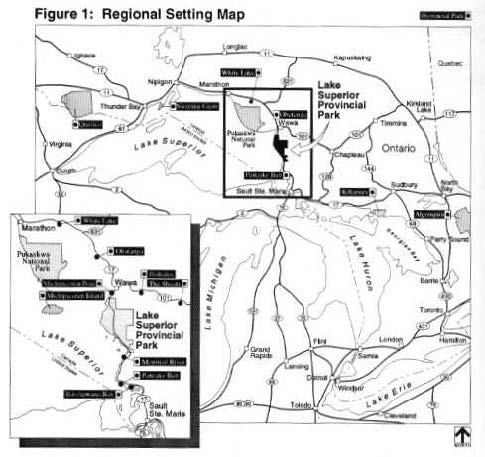
Figure 1 - Regional Setting Map
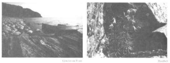
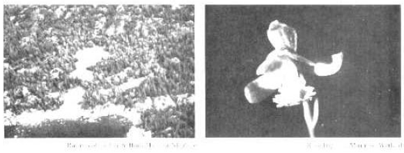
Images of Lake Superior Provincial Park
1.0 Introduction
Lake Superior Provincial Park is a 155,659 hectare Natural Environment Park located along the rugged eastern shore of Lake Superior. The park was established in 1944 by Order-in-Council to protect a significant area of Lake Superior’s coastline between Sault Ste. Marie and Wawa.
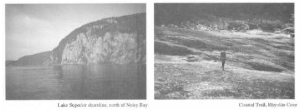
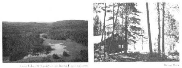
The park includes a varied landscape of rugged shoreline, beaches, rolling hills and inland lakes. Lake Superior Provincial Park’s 2.6 billion year geological history is one of intense volcanic activity, mountain building, faulting, rifting and glaciation. The park is located in a transition zone between the Great Lakes-St. Lawrence and Boreal Forests. The local climate is influenced by Lake Superior. In summer, coastal areas are generally cooler than inland areas and winter temperatures along the coastline are slightly milder than further inland.
The park is located 130 kilometres northwest of Sault Ste. Marie (population 81,000) and 15 kilometres south of Wawa (population 4,600). The majority of the park visitors use the park as a stopover, while travelling across Canada or around Lake Superior on a circle tour. The main recreational activities are hiking, camping, fishing, canoeing and picnicking.
Lake Superior Provincial Park has been readily accessible to the general public since the completion of the Trans-Canada Highway (Highway 17) through the park in 1960. Increased demands on the park to meet a variety of protection, recreation and resource products objectives and increased public concern about how these objectives would be reconciled, necessitated the development of a park Master Plan (now called a Management Plan) in 1979.
On April 1, 1988, a review of the 1979 Master Plat was initiated. Park Management Plan reviews are carried out on a regular basis to reconfirm with the public that the park management and development policies reflect current resource and recreation needs and conditions. Plan reviews also provide an opportunity to report new information regarding park resources and development. Plan reviews are generally undertaken within 10 years of approval but may be initiated as the need arises.
The Lake Superior Provincial Park Plan Review involved four phases: Phase I: Background Information and Issues; Phase II: Issues and Policy Options; Phase III: Preliminary Management Plan; and Phase IV: Approved Management Plan. Phases I through III, included opportunities for public comment. Interested individuals, businesses and organizations were invited to respond. A total of 731 comments were received. Copies of all public input received during the plan review are on file at the Park Office. Refer to section 12.0 Public Consultation.
This document, the Lake Superior Provincial Park Management Plan, 1995 will supersede the Lake Superior Provincial Park Master Plan of 1979. The 1979 version will serve as a background information document along with all other documents and materials collected and or prepared prior to this Management Plan.
Images of Lake Superior Provincial Park
2.0 Summary of significant issues
The major issues raised during the Park Plan Review were: Timber Management, Sand River Road, Commercial Trapping, Commercial Development, Use of Beaver Rock (MacGregor Cove) and Hunting.
Timber management:
During Phase II a review of timber management in Lake Superior Provincial Park was completed. Following this review timber harvesting is discontinued in Lake Superior Provincial Park. This decision considered public input to Phase I and II of the Master Plan Review as well as findings of the report Review of Timber Management in Lake Superior Provincial Park, July 1989. A summary of this report was included in the Phase II tabloid. The Ministry will work with the two companies affected to ensure that the loss of this source of supply will not have any adverse long-term effects.
Sand River Road:
The Sand River Road will continue to be available for use as a forest access road by timber companies with allocations east of the park. Workers, vehicles and equipment may use the Sand River Road year-round. Timber may be hauled through the park only after October 15 and before May 1. Maintenance and rehabilitation of the Sand River Road between the two gates will be the responsibility of the timber companies. It will also be the responsibility of the timber companies to erect and maintain the gates at both ends of the road to prohibit unauthorized access (section 10.3 Roads).
Commercial trapping:
In accordance with Provincial Parks Policies, announced May 1988, commercial trapping will be phased out of all areas within the park by the year 2010, with the exception of status Indians (section 8.3 Wildlife and Fisheries).
Commercial development:
Commercial development in the park, as outlined in the Phase II tabloid, would allow the development of commercial accommodations including fixed-roof and simple interior hut facilities. In response to public input, such developments will not be considered in this plan (section 9.5 Tourism Services).
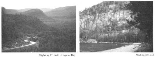
Use of Beaver Rock (MacGregor Cove):
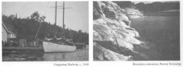
As per the 1979 Master Plan, the Ministry of Natural Resources will extend the park boundary to include the northwest portion of Peever Township, west of Highway 17. When this area is regulated it is recommended for zoning as two natural environment zones (135 ha and 468 ha), one development zone (173 ha) and an extension of the Lake Superior Waters Access Zone (838 ha). These proposed zones are described in section 7.0 Zoning (MacGregor Cove Development Zone, page 7) and are outlined on the Zoning Map.
Lake Superior Provincial Park zoning map
Hunting:
Hunting will continue to be permitted for moose, grouse and varying hare. In keeping with Provincial Parks Policies, hunting is not permitted in nature reserve and wilderness zones. The approved hunting area is approximately 18% of the total park land base (section 9.3 Recreation Management; map on page 24).
Images of Lake Superior Provincial Park
3.0 Classification
Lake Superior Provincial Park is classified as a Natural Environment Park, one of the six classes of Ontario Provincial Parks.
Natural Environment parks are units of land and water of particular recreational, historical and natural interest. They are attractive and diverse landscapes. While these parks may include developed recreational areas, their rich and varied environments are the main reasons for their establishment. Recreation is based on interaction with the natural environment and appreciation of the natural and cultural values. Activities may range from interior travel and camping in the largely natural interior of these parks, to car-camping and day-use activities in more developed areas. Natural Environment parks provide a great many Ontarians with opportunities to experience the grandeur and solitude of undeveloped Ontario.
4.0 Goal
The goal of Lake Superior Provincial Park is:
To provide a variety of outdoor recreation opportunities based on interaction with the natural environment and appreciation of natural and cultural values and to protect provincially significant natural, cultural and recreational environments.
Lake Superior Provincial Park will contribute to the achievement of all four of the objectives of the Provincial Parks System: Protection, Recreation, Heritage Appreciation and Tourism.
5.0 Objectives
5.1 Protection
To protect the provincially significant natural environment of Lake Superior Provincial Park incorporating cultural, natural and recreational features.
The natural environment of Lake Superior Provincial Park has representative landscapes, which incorporate provincially sig nificant earth and life science features, provincially significant pre-historical and historical resources and outstanding opportunities for high quality, low-intensity recreation.
Natural and cultural features are protected in Lake Superior Provincial Park under a system of park zones, which include 21 nature reserve, 2 wilderness, 11 natural environment and 3 historical zones. All of these landscapes and features will be protected. Unique and representative features are described under each zone (7.0 Zoning).
5.2 Recreation
To provide in Lake Superior Provincial Park day-use and facility-based camping opportunities in areas of outstanding recreational potential associated with the natural environment of the park.
Lake Superior Provincial Park will emphasize experiences, which provide individuals, families and groups with a wide variety of recreational opportunities.
To provide in the natural environment of Lake Superior Provincial Park interior travel and camping opportunities.
Images of Lake Superior Provincial Park
The recreational experience will be characterized by solitude, challenge and personal interaction with nature. The dispersed use and relatively undeveloped landscapes of Lake Superior Provincial Park enhance this.
5.3 Heritage appreciation
To provide opportunities for unstructured individual exploration and appreciation of the natural and cultural heritage of the eastern shore area of Lake Superior.
Exploration and appreciation of Lake Superior Provincial Park will be encouraged to the greatest extent compatible with and complementary to protection of natural environments, earth and life science features and historical resources in the park.
To provide opportunities for exploration and appreciation of natural and cultural environments through visitor services programs. Staff-led and self-use programming will interpret the character and significance of Lake Superior Provincial Park as expressed by the theme of the park "Human response to a rugged and wild shoreline and backcountry".
Lake Superior Provincial Park will provide a major level of service for information, interpretation and outdoor recreation programs, which reflect the diversity of features and resources in the park. These are directed to contact the widest possible variety of individuals and groups using the park (refer to 9.1 Visitor Services).
5.4 Tourism
To provide Ontario’s residents and out-of-province visitors with opportunities to discover and experience the cultural and natural environments of the eastern shore of Lake Superior.
The spectacular scenery and varied recreational opportunities in Lake Superior Provincial Park will attract visitors from the local area, as well as from considerable distances.
6.0 Boundary
The park is bounded on the west by Lake Superior and on the east by the Algoma Central Railway, or lands owned by that railway. To the south, the boundary includes the northern portion of Peever Township, east of Highway 17, and to the north it includes the southern portions of Rabazo and Dulhut Townships. The park includes the waters of Lake Superior within 1.6 kilometres from shore and the islands within 6.9 kilometres from shore (Zoning Map, insert). There are a number of patented (private) lands within the park boundaries. The Park Management Plan does not regulate existing or future uses of private holdings within the park. These lands will be acquired as funds permit, and as owners are willing to sell.
The Ministry of Natural Resources will add the northwest portion of Peever Township, west of Highway 17, to the park. This 1,614 hectare Crown land and water area includes significant recreational, earth science and life science features complementary to the park. The area known as Beaver Rock is included in this parcel. Once this area becomes part of the park it is recommended to be zoned as indicated on the Zoning Map (insert).
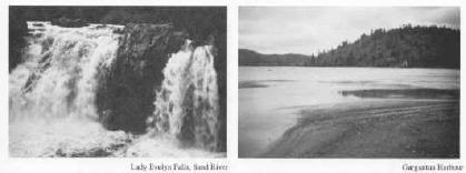
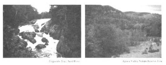
Lady Evelyn Falls and Gargantua Harbour
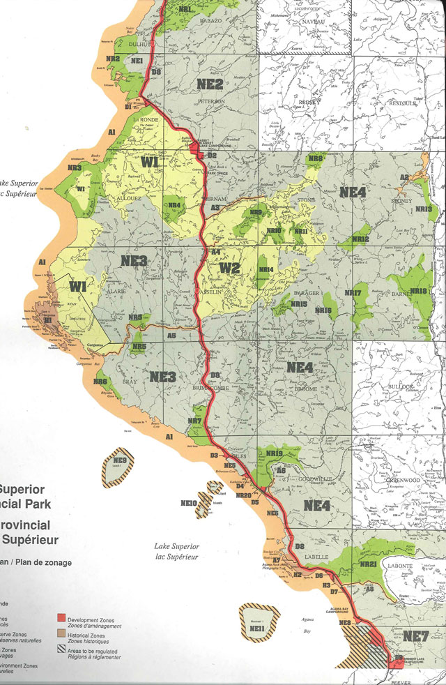
7.0 Zoning
To fulfill the objectives of Lake Superior Provincial Park, lands and waters within the park are zoned on the basis of their significance for protection and their potential for recreation appropriate for a Natural Environment park. Specific policies for each zone are established for resource protection, development and management. Table 1 (page 6) outlines the permitted uses in each zone.
The map provided in the 1979 Plan included zoning for areas proposed for addition to the park. The maps included in this Management Plan have been adjusted to show only those areas currently within the park boundaries. Patent properties in the park have not been shown to be excluded from the zones, due to their small size. As private lands are acquired, they will be zoned as indicated on the Zoning Map (insert). Table 2 (page 8) indicates zone areas.
As a result of the discontinuation of timber harvesting in the park, the former recreation-utilization zones are converted to natural environment zones (refer to 7.5 Natural Environment Zones). Further research is needed in the areas of the former recreation-utilization zones to determine if there are significant natural or cultural features which may warrant different zoning (i.e. nature reserve, wilderness, historical).
Minor boundary adjustments to the original park zoning (1979) reflect new information from the 1988 Life Sciences Survey. Other changes were proposed to more accurately reflect the activities or developments within a particular zone. Changes to zones D2, D7, A5, NR18 and the Highway 17 Corridor (D8) are described below:
Rabbit Blanket Lake Development Zone (D2):
The western portion of D2 has been incorporated into Coastal Wilderness Zone (W1) to protect the wetland at the inlet of Rabbit Blanket Lake. The 1988 Life Science Survey recommended that this area be protected. Although D2 has been reduced, there is still adequate area for future campground development, if required. This adjusted zone more accurately reflects the area of development.
Agawa Bay Development Zone (D7):
The portion of D7 east of Highway 17 and south of the Frater Road was eliminated to more accurately reflect the area of development. This excluded section will become a part of Lost Lake Natural Environment Zone (NE7).
Gargantua Road Access Zone (A5):
Gargantua Road extends from Highway 17 to a parking area near Lake Superior. The area northwest of the parking area, formerly part of A5, has been included in Coastal Wilderness Zone (W 1) to protect significant flora along the shoreline and to protect the remote nature of Gargantua Harbour. The section south of the parking area has been added to Gargantua Natural Environment Zone (NE3). The Gargantua Road Access Zone now more accurately reflects the area of access to Lake Superior and the Coastal Trail. The portions excluded from the former access zone are only accessible by foot.
Sand River Road Access Zone (A6):
The Preliminary Management Plan recommended that this access zone be extended to include the Sand River Forest Access Road through Goodwillie Township. In keeping with the Ontario Provincial Park Planning and Management Policies, the access zone (A6) will only include the first 1.9 kilometres of the road, which is open to the public. The purpose of this zone is to provide access to the take-out point of the Sand River Canoe Route. The portion of the road closed to public access (15.1 kilometres) is included within Natural Environment Zone 4 and will continue to serve as a forest access road (refer to section 10.3 Roads).
Table 1 - Permitted uses in Park Zones
| Uses | Development Zones | Access Zones | Wilderness Zones | Nature Reserve Zones | Natural Environment Zones | Historical Zones |
|---|---|---|---|---|---|---|
| Boating (powered) | may be permitted in these zones | may be permitted in these zones | may be permitted in these zones | |||
| Campgrounds - car | normally permitted in these zones | may be permitted in these zones | ||||
| Campgrounds - boat-in or walk-in | may be permitted in these zones | may be permitted in these zones | may be permitted in these zones | may be permitted in these zones | ||
| Campgrounds - group | may be permitted in these zones | may be permitted in these zones | ||||
| Campgrounds - backcountry | normally permitted in these zones | normally permitted in these zones | ||||
| Canoeing/Kayaking | normally permitted in these zones | normally permitted in these zones | normally permitted in these zones | may be permitted in these zones | normally permitted in these zones | may be permitted in these zones |
| Cycling/Mountain Biking | may be permitted in these zones | may be permitted in these zones | may be permitted in these zones | may be permitted in these zones | may be permitted in these zones | |
| Hiking | normally permitted in these zones | normally permitted in these zones | normally permitted in these zones | may be permitted in these zones | normally permitted in these zones | may be permitted in these zones |
| Horseback Riding Trails | may be permitted in these zones | may be permitted in these zones | may be permitted in these zones | may be permitted in these zones | may be permitted in these zones | |
| Orienteering | normally permitted in these zones | normally permitted in these zones | normally permitted in these zones | may be permitted in these zones | normally permitted in these zones | may be permitted in these zones |
| Outfitting Services | may be permitted in these zones | may be permitted in these zones | ||||
| Picnic Grounds | normally permitted in these zones | normally permitted in these zones | may be permitted in these zones | |||
| Playing Fields/Playgrounds | may be permitted in these zones | |||||
| Recreation Programs (organized) | may be permitted in these zones | may be permitted in these zones | may be permitted in these zones | |||
| Resorts | may be permitted in these zones | may be permitted in these zones | ||||
| Restaurants/Food Services | may be permitted in these zones | may be permitted in these zones | ||||
| Sailing/Sailboarding | normally permitted in these zones | may be permitted in these zones | may be permitted in these zones | may be permitted in these zones | normally permitted in these zones | may be permitted in these zones |
| Scuba and Skin Diving | may be permitted in these zones | may be permitted in these zones | may be permitted in these zones | may be permitted in these zones | may be permitted in these zones | may be permitted in these zones |
| Skiing (cross-country)/Snowshoeing | normally permitted in these zones | normally permitted in these zones | normally permitted in these zones | may be permitted in these zones | normally permitted in these zones | may be permitted in these zones |
| Sport Fishing | normally permitted in these zones | normally permitted in these zones | normally permitted in these zones | normally permitted in these zones | normally permitted in these zones | normally permitted in these zones |
| Sport Hunting (decided during mgmt planning) | may be permitted in these zones | may be permitted in these zones | may be permitted in these zones | |||
| Snowmobiling (designated trails) | may be permitted in these zones | may be permitted in these zones | may be permitted in these zones |
Images of Agawa Bay and MacGregor Cove
O'Connor Nature Reserve Zone (NR18):
The northern boundary of NR18 has been extended to include a peatland, which contains two regionally significant plants.
Highway 17 Corridor Development Zone (D8):
The Highway 17 right-of-way is under the jurisdiction of the Ministry of Transportation Ontario and is not part of the park. The area extending 180 metres beyond the right-of-way is within the park and will be maintained as a development zone. This type of zoning will allow for developments such as powerline upgrading, information kiosks and parking and pull-off areas adjacent to Highway 17.
When the park boundary is extended to include the northwest portion of Peever Township, this area will be zoned as follows:
West Bay Natural Environment Zone (135 ha):
A small portion of West Bay (NE8) is currently within the park. The pine covered rocky shoreline is representative of the south end of the park Vrooman Island, which supports a large gull colony is within the proposed area of West Bay.
Sugarloaf Hill Natural Environment Zone (468 ha):
Along with West Bay Natural Environment Zone, this area is also representative of the southernmost coastal area of the park. This proposed zone features rugged pine covered hills, including one of the highest points in the area, Sugarloaf Hill.
MacGregor Cove Development Zone (173 ha):
This proposed zone includes the area known as Beaver Rock. A tourist lodge operated at Beaver Rock from 1921 until 1972, when the Ministry of Natural Resources purchased the site. The Ministry operated a Junior Ranger camp here from 1977 until 1988. Following the addition of this area into the park there may be opportunities to develop the Beaver Rock site as an environmental learning centre or recreational skills centre. The focus of such a facility would be on those activities, which develop skills appropriate to Lake Superior Provincial Park, such as low impact camping. The Ministry will discuss this potential with local communities. Alternatively this site may be used by the Ministry for an Ontario Ranger camp or lodging for park staff. Existing facilities require upgrading.
Lake Superior Waters Access Zone (Al extension, 1,598 ha):
When West Bay, Sugarloaf Hill and MacGregor Cove become part of the park, Al would extend south to include the waters 1.6 kilometres offshore of these zones. In addition it is proposed that the Lake Superior Waters Access Zone include the waters 200 metres offshore of the islands within 9.6 kilometres of shore. These areas would add 1,598 hectares to the current Al zone.
7.1 Development zones
Development zones provide the main facilities and services for a range of day-use and car camping activities. Development permitted within these zones includes trails, roads, washrooms, visitor and entry control structures and visitor centres. Specific facilities are listed under individual zones.
Table 2 - Summary of Zoning Lake Superior Provincial Park
Development Zones
| Development Zones | Hectares |
|---|---|
| D1 - Old Woman Bay | 34 |
| D2 - Rabbit Blanket Lake | 181 |
| D3 - Coldwater River | 20 |
| D4 - Katherine Cove | 5 |
| D5 - Sand River | 27 |
| D6 - North Agawa Bay | 60 |
| D7 - Agawa Bay | 65 |
| D8 - Highway 17 Corridor | 2,524 |
| D9 - Crescent Lake | 142 |
| Total | 3,058 |
Access Zones
| Access Zones | Hectares |
|---|---|
| A1 - Lake superior Waters | 14,562 |
| A2 - Sand Lake | 321 |
| A3 - Mijinemungshing Road | 22 |
| A4 - Gamitagama Road | 9 |
| A5 - Gargantua Road | 42 |
| A6 - Sand River Road | 8 |
| A7 - Sinclair Cove | 7 |
| A8 - Frater Road | 22 |
| Total | 14,993 |
Wilderness Zones
| Wilderness Zones | Hectares |
|---|---|
| W1 - Coastal | 12,576 |
| W2 - Interior | 11,323 |
| Total | 23,899 |
Nature Reserve Zones
| Nature Reserve Zones | Hectares |
|---|---|
| NR1 - Treeby Lake | 1,571 |
| NR2 - Brulé Harbour | 1,247 |
| NR3 - Cap Chaillon | 1,834 |
| NR4 - Upper Red Rock River | 516 |
| NR5 - Upper Buckshot Creek | 559 |
| NR6 - Rhyolite | 302 |
| NR7 - Orphan Lake | 628 |
| NR8 - Valentine Lake | 273 |
| NR9 - Tiernan | 593 |
| NR10 - Anjigami River | 215 |
| NR11 - Mirimoki Lake | 215 |
| NR12 - Stoney | 417 |
| NR13 - Aspen | 448 |
| NR14 - Baillargeon Lake | 369 |
| NR15 - Black Lake | 226 |
| NR16 - Barager | 288 |
| NR17 - Upper Sand River | 718 |
| NR18 - O'Connor | 1,679 |
| NR19 - Lower Sand River | 1,203 |
| NR20 - Sand Dunes | 21 |
| NR21 - Agawa Valley | 2,538 |
| Total | 15,914 |
Natural Environment Zones
| Natural Environment Zones | Hectares |
|---|---|
| NE1 - Brulé Hill | 1,344 |
| NE2 - Old Woman River | 18,288 |
| NE3 - Gargantua | 19,424 |
| NE4 - Sand River Valley | 51,341 |
| NE5 - Robertson Cove | 148 |
| NE6 - Barrett River | 249 |
| NE7 - Lost Lake | 4,550 |
| NE8 - West Bay | 29 |
| NE9 - Leach Island | 550 |
| NE10 - Lizard Islands | 139 |
| NE11 - Montreal Island | 773 |
| Total | 96,835 |
Historical Zones
| Historical Zones | Hectares |
|---|---|
| H1 - Cape Gargantua | 720 |
| H2 - Agawa | 202 |
| H3 - Agawa Meadows | 38 |
| Total | 960 |
Summary of Zones
| Summary of Zones | Hectares |
|---|---|
| Development Zones | 3,058 |
| Access Zones | 14,993 |
| Wilderness Zones | 23,899 |
| Nature Reserve Zones | 15,914 |
| Natural Environment Zones | 96,835 |
| Historical Zones | 960 |
| Total Park Area | 155,659 |
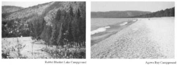
Images of Rabbit Blanket Lake and Agawa Bay
Day-use and camping facilities will be maintained at, and any new facilities will be developed to, provincial parks standards.
Dl: Old Woman Bay (34 ha)
This popular day-use area includes picnic facilities and vault toilets. Old Woman Bay is the departure point for the Nokomis Trail. This zone will also serve as an access point to the Coastal Trail when the trail is completed. Future development may include an information kiosk.
D2: Rabbit Blanket Lake (181 ha)
Rabbit Blanket Lake Campground is located on an inland lake at the northern end of the park. Facilities include a comfort station with showers and laundromat and a small outdoor theatre. This zone also provides access to the Peat Mountain and South Old Woman River Trails. Future developments may include electrical sites and additional campsites if required. A small-scale multi-purpose visitor services facility, suitable for interpretive and recreational programs may be developed as the need arises and as priorities permit.
D3: Coldwater River (20 ha)
Pre-engineering surveys indicate that this zone has potential for a major park visitor centre (refer to section 9.1 Visitor Services). Coldwater River was formerly used as a day-use area (1964 - 1969).
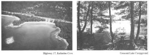
D4: Katherine Cove (5 ha)
The existing day-us area includes a beach, picnic facilities, paved parking area and vault toilets.
Katherine Cove also provides access to the Coastal Trail.
D5: Sand River (27 ha)
The existing day-use area on the north side of the Sand River includes picnic facilities, paved roads, vault toilets and access to the Pinguisibi Trail.
D6: North Agawa Bay (60 ha)
This zone may be developed if required in the future to relieve pressure on the existing facilities within the Agawa Bay Development Zone (D7). The former Agawa Lodge is located in this zone.
D7: Agawa Bay (65 ha)
This zone includes the Agawa Bay Campground, located on Lake Superior. The existing car campground will be retained. The current group camping area will be phased out and moved to Crescent Lake Campground, 10 kilometres south of Agawa Bay. The group camping area at Agawa Bay could then be available for future campsite development. Additional facilities such as comfort stations, electrical hookups, campsites and other visitor facilities may be constructed in response to public needs for additional services.
D8: Highway 17 Corridor (2,524 ha)
The Highway 17 Corridor Development Zone extends 180 metres either side of the right-of-way. Development permitted within this zone may include powerline upgrading, information kiosks and parking and pull-off areas adjacent to Highway 17.
The right-of-way of Highway 17 varies between 46 and 61 metres through the park. The highway right-of-way is under the jurisdiction of the Ministry of Transportation Ontario and is not within the park, however for mapping purposes, it is shown as a part of the development zone (Zoning Map). The Ministry of Natural Resources does not have any jurisdiction over developments within the 46-61 metre right-of-way. Lakes totally or partially within either the highway right-of-way or the Highway 17 Corridor Development Zone (D8) are not part of the deve lopment zone but become part of the adjacent zone.
Images of Katherine Cove and Crescent Lake
Negotiations will continue between the Ministry of Transportation Ontario and the Ministry of Natural Resources to provide a right-of-way aesthetically appropriate to Lake Superior Provincial Park, compatible with highway safety needs. Unofficial pull-offs will either be improved or closed. In addition the Ministry of Natural Resources will work with the Ministry of Transportation Ontario to address highway right-of-way maintenance and design to reduce moose-vehicle collisions (i.e. improved drainage ditches). The two Ministries will also continue to cooperate in the design and location of highway corridor signs in order to provide park information to travelers.
Aggregate (gravel) extraction from within the park for development and maintenance of the Trans-Canada Highway will be permitted (refer to section 8.1 Lands and Waters).
The Agawa Bay Work Centre and Red Rock Lake Park Office are within D8.
Agawa Bay Work Centre:
This seasonal work centre includes quarters for seasonal staff. Maintenance and staffhouse facilities may be upgraded or replaced as required. Residences for permanent staff are not required at this time.
Red Rock Lake Park Office:
This facility includes the Park Office, a work centre and quarters for seasonal staff. Maintenance and staffhouse facilities may be upgraded or replaced as required. The aesthetics of the grounds will continue to be upgraded. Residences for permanent staff are not required at this time.
D9: Crescent Lake (142 ha)
Group campsites will be developed at Crescent Lake. A portion of the campground will be retained for individual sites. Priority for group campsites will be given to youth groups on a reservation system. Appropriate water and toilet facilities will be developed.
This zone also includes the former South Boundary Information Centre. New self-use information facilities will be developed at the south boundary and at the north boundary of the park. These centres will provide orientation and information services for travelers.
Other Development Zones - North Boundary Information Centre:
In conjunction with the construction of a new South Boundary Information Centre, a pull-off and self-use information facility will be developed near the northern boundary of the park, on the west side of Highway 17 at a location not yet identified. If the North Boundary Information Centre is located within the park, a small development zone may be designated from Brulé Hill Natural Environment Zone (NE1) to accommodate this need. This will require a minor amendment to the plan (refer to section 11.3 Plan Amendment).
7.2 Access zones
Access zones serve as staging areas and entry points to the park interior and Lake Superior waters for low intensity recreational and educational experiences. The coastal waters of Lake Superior are recognized as an access zone. Secondary park roads (A3, A4, A5, A6, A7 and A8) and their cleared right-of-ways will normally have a maximum width of 30 metres. This width may be exceeded where required to provide park operational facilities, such as parking areas, visitor registration and information facilities. Specific facilities are listed under individual zones.
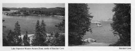
Images of Lake Superior and Sinclair Cove
Al: Lake Superior Waters (14,562 ha)
This zone includes the waters of Lake Superior within 1.6 kilometres of shore. The waters of Lake Superior provide, among other opportunities, water access to the entire coastline. The Lake Superior Waters Access Zone represents approximately 96% of the total area of the access zones. It is recommended that this zone be extended to also include the waters 200 metres offshore of the islands within 9.6 kilometres of shore. This would include the waters surrounding Leach, Montreal and Lizard Islands (refer to Zoning Map, insert). Except as noted specifically in this Management Plan, park waters will be available for the same uses as the rest of the Canadian waters of Lake Superior (i.e. fishing, boating, etc.). Commercial fishing is permitted except within 1000 metres of river mouths.
A2: Sand Lake (321 ha)
Sand Lake provides access from the Algoma Central Railway to the Sand River Canoe Route. The north end of Sand Lake is not within the park.
Motorboats of 7.5 kW (10 horsepower) or less are permitted on Sand Lake.
A3: Mijinemungshing Road (22 ha)
This road extends 7 kilometres from Highway 17, providing access to Mijinemungshing Lake and the central interior lakes of the park. The road will be maintained and the dock will be upgraded. A small self-use centre at Mijinemungshing Lake provides information and registration facilities for interior users.
A4: Gamitagama Road (9 ha)
This zone provides access from Highway 17 to a parking area adjacent to the portage to Gamitagama Lake. This zone also contains micro-wave tower sites. The first kilometre of Gamitagama Road is open to the public. The continuation of the road to the tower sites is closed to public vehicles.
A5: Gargantua Road (42 ha)
Gargantua Road is one of the main access routes for the Coastal Trail. The access zone extends 14 kilometres, from Highway 17 to a parking area at Lake Superior. The Gargantua Road will be maintained for public use.
A6: Sand River Road (8 ha)
The first 1.9 kilometres of this road provides public access from Highway 17 to a parking area at the take out point of the Sand River Canoe Route. The portion of the road beyond the gate (15.1 kilometres) is within the Sand River Valley Natural Environment Zone (NE4). The portion of the road beyond the gate serves as a forest access road and is closed to public access (refer to section 10.3 Roads).
A7: Sinclair Cove (7 ha)
This zone, extending 1.8 kilometres from Highway 17, provides paved access to the Agawa Rock Indian Pictographs parking lot and to Lake Superior waters. Sinclair Cove is currently a small craft harbour under the jurisdiction of the Canada Department of the Environment, Fisheries and Oceans. The Department of the Environment has upgraded this facility by removing the remnants of the old docks and repairing the boat launching ramp. The Ministry of Natural Resources will negotiate with the Federal Government to have this area turned over to the park for maintenance. This zone also provides access to the Coastal Trail.
Images of Lake Superior Provincial Park
A8: Frater Road (22 ha)
This 7.2 kilometre road provides access to the Towab Trail and to Rater Station on the Algoma Central Railway.
7.3 Wilderness zones
Wilderness zones include wilderness landscapes, which protect significant natural and cultural features and are suitable for wilderness experiences. These zones represent both the shoreline and the backcountry landscapes of Lake Superior Provincial Park.
Development will be limited to backcountry campsites, portages, trails and signs for route identification. Campsites will have limited facilities such as a simple fire pit and a primitive privy.
W1: Coastal (12,576 ha)
The park’s largest wilderness zone includes shoreline features of exceptional natural, cultural and scenic interest with excellent hiking potential. This zone includes the Peat Mountain Trail, the Rabbit Blanket Lake Canoe Route and a portion of the Coastal Trail.
W2: Interior (11,323 ha)
This zone is a representative backcountry area with good canoeing and fishing potential. It includes two major headwaters of considerable natural and scenic interest, the Baldhead and Anjigami Rivers. Mijinemungshing Lake provides the principal access into this zone. Portions of the Old Woman Lake and Anjigami River Canoe Routes are located within W2. The Wawa District Fisheries Management Plan recommends special management of the trout fishery in Mijinemungshing and Maquon Lakes (see section 8.3 Wildlife and Fisheries). The Fisheries Management Plan is scheduled for review in 1995.
7.4 Nature Reserve zones
Nature reserve zones include significant earth and life science features of Lake Superior Provincial Park which require management distinct from that in adjacent zones in order to protect those features. These zones are selected to represent distinctive natural habitats and landforms.
Current Provincial Park Planning and Management Policies do not allow for campsite development within nature reserve zones. These policies specify the activities and development, which can occur in each zone. Campsites will be recognized as non-conforming facilities within these zones. Backcountry camping is an existing use in nature reserve zones. Trails and canoe routes are permitted within these zones and thus campsites are required along overnight trails and canoe routes (i.e. sites are needed in NR2, NR3, NR6 and N7R7 along the Coastal Trail). Backcountry campsites will continue to be permitted in nature reserve zones where they will not impair the values for which the zones were established. It is expected that the issue of campsites within nature reserve zones will be reviewed within the life of this park management plan. Portages, trails and signs for route identification will be provided where required. In addition, minimal interpretive facilities and temporary facilities for management or approved research may be permitted where appropriate.
Images of Lake Superior Provincial Park
NR1: Treeby Lake (1,571 ha)
This zone includes several fault systems and good examples of continuous topographic lineations (lakes carved in parallel alignment by glaciers). The area also includes a complex of lake ecosystems and an excellent representative of an upland white birch forest. NR1 includes the Fenton-Treeby Canoe Route.
NR2: Brulé Harbour (1,247 ha)
Numerous raised and contemporary beach features and the best sequence of undisturbed raised cobble beaches in the park occur in this zone. There are excellent representative shoreline and cobble beach vegetative communities and one of the largest gull colonies and heronries in the park. This zone also includes significant prehistoric habitation sites and associated with the cobble beaches, the best collection of Pukaskwa Pits in the park. Pukaskwa Pits are believed to be man- made depressions, which may have been used for vision pits or shelter by native peoples, prior to European contact.
NR3: Cap Chaillon (1,834 ha)
Features in NR3 include numerous raised and contemporary beaches, an outstanding example of a fault and the only mainland outcrop of Cambrian sandstone in the park. There are excellent representative shoreline vegetative communities including the best arctic -alpine community known on the east coast of Lake Superior and the only mature aspen forest in the park.
NR4: Upper Red Rock River (516 ha)
A significant esker occurs in this area.
N7R5: Upper Buckshot Creek (559 ha)
An esker fragment unique to the park in that it is braided around what appear to be a series of kettles, often occupied by lakes is found within this zone. It also includes the best topographical. evidence in the park of glacial ice front locations.
NR6: Rhyolite (302 ha)
This zone includes an outcrop of columnar rhyolite, which may be the only such site in Ontario, and numerous contemporary beach features. This area also includes a portion of the Coastal Trail.
NR7: Orphan Lake (628 ha)
NR7 includes numerous contemporary fluvial features and examples of raised and contemporary beaches. The Orphan Lake Trail and a section of the Coastal Trail traverse this zone.
NR8: Valentine Lake (273 ha) and NR9: Tiernan (593 ha)
These zones include significant esker fragments. The sub-glacial river which formed the eskers in NR8 and NR9 was likely part of one system.
NR1O: Anjigami River (215 ha) and NR11: Mirimoki Lake (259 ha)
Extensive representative wetland communities occur in these zones.
Mirimoki Lake Nature Reserve Zone includes the largest floating bog apron in the park, one of the few bog associations rich in orchids. This zone includes a portion of the Old Woman Lake Canoe Route.
Images of Upper Sand River and Agawa Valley Nature Reserve
NR12: Stoney (417 ha)
This zone includes the best example of an esker in the park.
NR13: Aspen (448 ha)
The best abandoned glacial drainage channel in the park is found in this zone. The channel indicates that Sand Lake once drained into the Agawa River. NR13 also includes numerous other glacial and contemporary fluvial features and the only major concentration of trembling aspen in the park other than in Cap Chaillon Nature Reserve Zone (NR3).
NR14: Baillargeon Lake (369 ha)
Features in this zone include a ridge which is the highest section of the Gamitagama Lake intrusion and an unusual dwarf maple forest. In areas of extreme exposure, trees average only 6 metres in height compared to 15 metres elsewhere in the park.
NR15: Black Lake (226 ha)
This zone includes excellent representation of bog and fen communities.
NR16: Barager (288 ha)
This zone includes an outcrop of the Gamitagama Lake intrusion and the largest area of open grown sugar maple forest in the park.
NR17: Upper Sand River (718 ha) and NR18: O'Connor (1,679 ha)
These zones include the only significant glacial lake location in the park. In addition there are numerous glacial and contemporary fluvial features. The forest cover is unusual, including meadows, clearings and a significant jack pine stand and the largest black spruce bog in the park. Wildlife habitat is diverse.
NR19: Lower Sand River (1,203 ha)
Within this zone are numerous glacial and contemporary fluvial features and the best sequence of bog and fen communities in the park. A large black spruce bog demonstrates several stages of fill- in-lake bog succession. NR19 includes the Pinguisibi Trail and the lower portion of the Sand River Canoe Route.
NR2O: Sand Dunes (31 ha)
This zone includes the most significant and best developed sand dunes in the park, with at least five generations of dunes.
NR21: Agawa Valley (2,538 ha)
Agawa Valley has numerous glacial and contemporary fluvial features and the most complete representation of the Great Lakes-St. Lawrence Forest in the park. The unique character of the forest cover is likely due to protection by the valley and the rich fluvial deposits. Trees represented here which are not common throughout the park include red oak, white elm and black ash. The herb cover is more diverse than similar areas at higher latitudes. Herbaceous plants unique to the Agawa Valley include poison ivy.
A number of high level terraces relate to glacial movements and the use of the valley as a glacial spillway. The Awausee Trail ascends several of these terraces. NR2 1 also includes the Towab Trail, Agawa Falls and part of the Agawa River.
7.5 Natural Environment zones
Natural environment zones include landscapes of high natural quality in which there is a minimum of development required to support low-intensity recreational activities. There are major changes to the natural environment zones. Following the discontinuation of timber harvesting within the park, the former recreation-utilization zones are converted to natural environment zones, as shown on the Zoning Map (insert). Further research is needed in the areas of the former recreation-utilization zones to determine if there are significant natural or cultural features which may warrant different zoning (i.e. nature reserve, wilderness, historical). Any zoning changes will require a minor amendment to the park management plan. The new natural environment zones are described below.
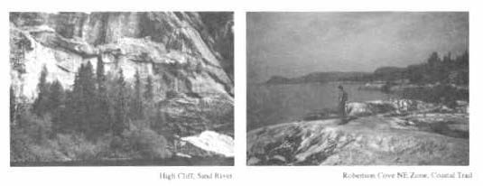
High Cliff and Robertson Cove
With the exception of the Sand River Road, all other existing forest access roads and water crossings within the natural environment zones will be reviewed and a plan will be prepared to identify whether these facilities should be removed, rehabilitated for other uses or allowed to return to a natural state. In the interim, these roads will be monitored and remedial action will be taken to alleviate environmental impacts (e.g. erosion control to maintain fisheries habitat).
Mainland natural environment zones are in general good for hiking and canoeing. Development will be limited to interior campsites, portages, trails, signs for route identification and minimal interpretive facilities where appropriate. Interior campsites will have limited facilities such as a simple fire pit and a primitive privy. The island natural environment zones will remain undeveloped.
Zones NE1 through NE11 include features of considerable natural, cultural and scenic interest. Hiking potential is very good.
NE1: Brulé Hill (1,344 ha)
This zone includes the northernmost portion of the park coastline, which is characterized by boreal and coastal vegetation. Arctic-alpine plants have been identified at Smokey Point. A section of the Coastal Trail passes through NE 1.
NE2: Old Woman River (18,288 ha)
This zone is representative of the northern inland portion of the park. Features include the transition from the Great Lakes-St. Lawrence Forest to the Boreal Forest, the South Old Woman River Valley and the Nokomis Trail. The area also contains several kettles (depressions) and possibly a small area of glacial formed kame (conical hills) and kettle topography. Almonte Lake includes a large fen (wetland) complex and a portion of the Anjigami River Canoe Route.
NE3: Gargantua (19,424 ha)
This zone is representative of the coastal area and rolling hills west of Highway 17 in the middle portion of the park. Significant features include a geological non-conformity, or gap in the geological record, at Beatty Cove. This zone includes the Belanger Lake Canoe Route and a section of the Coastal Trail.
NE4: Sand River Valley (51,341 ha)
This large zone is representative of the interior area of the park, east of Highway 17. The dominant natural and recreational feature in this zone is the Sand River.
NE5: Robertson Cove (148 ha)
This zone is comprised of the coastal area between Coldwater and Katherine Cove. Robertson Cove also includes a section of the Coastal Trail.
NE6: Barrett River (249 ha)
Representative of the southern portion of the park coastline, this zone includes numerous rock outcrops and gravel beaches. This area also includes contemporary coastal features (erosional and depositional) and several small beaches. The presence of these features indicates there is potential for archaeological Sites in this zone. Barrett Island supports a gull colony. NE6 includes a section of the Coastal Trail.
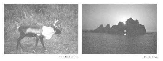
Woodland caribou and Devil’s Chair
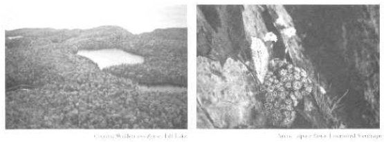
NE7: Lost Lake (4,550 ha)
This zone is representative of the southernmost interior area of the park. Features include good representation of the Great Lakes-St. Lawrence Forest and a dramatic topography of rolling hills and valleys. Hiking potential is good.
NE8: West Bay (29 ha)
This small zone includes the shoreline area between Agawa Bay Development Zone (D7) and the southern boundary of the park, west of Highway 17. This area is representative of the south end of the park.
NE9: Leach Island (550 ha), NE10: Lizard Islands (139 ha) and NE11 Montreal Island (773 ha):
Zones NE9 through NE11 contain the major offshore islands. Composed of low lying sedimentary deposits, these islands are geologically distinct from the mainland. The only mainland outcrop of similar origin is at Grindstone Point. The islands provide a degree of shelter from Lake Superior storms and figure prominently in the coastal history of the park.
In 1984 and 1986, woodland caribou were transferred to the islands from the Slate Islands (225 km northwest of Montreal Island), as part of a program to reintroduce caribou to the park. Further life science surveys are needed on these islands in conjunction with the monitoring of the caribou population. Pending the results of these surveys, the zoning of these islands could change.
The distance of the islands from the mainland is a constraint on development of recreational facilities, such as campsites.
7.6 Historical zones
Historical zones include significant historical resources of Lake Superior Provincial Park.
Development will be limited to trails, signs and where appropriate, interpretation of the historical resource. Where appropriate, facilities for approved research, management, education, interpretation and historical restorations or reconstruction, may also be provided. Interior campsites will be permitted in historical zones where they will not impair the values for which the zones were established.
Hi: Cape Gargantua
This zone includes significant native habitation sites dating back over 600 years. The oldest known artifacts are those of Woodland Indians of the Algonkian culture. There are landforms and features of religious significance to the prehistoric and historic native peoples of the east coast of Lake Superior. This zone also includes numerous raised and contemporary beach features and one of the largest heronries in the park. A priority in this zone will be protection of the cultural and natural features. Gargantua was also the site of an important commercial fishing village from the late 1880's to the late 1950's. This community grew during the depression and was active until the sea lamprey and overfishing depleted the fish stocks in Lake Superior in the 1950's.
Agawa Rock
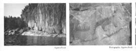
H2: Agawa (202 ha)
This zone consists of two separate areas related to prehistoric and historic activity. Sinclair Cove includes a significant native habitation site. Agawa Point includes landforms and features of religious significance to the native peoples of the east coast of Lake Superior, including Agawa Rock and its pictographs. A short trail to the pictograph site includes displays which convey the significance of theentire area. The priority will be protection.
H3: Agawa Meadows (38 ha)
This zone includes native habitation sites, the site of the Hudson’s Bay Company’s Agawa Post and part of the fishing and tourism settlement of Agawa Bay.
8.0 Resource management policies
In 1992 the Ministry of Natural Resources began preparing a class environmental assessment for provincial park management to comply with the Environmental Assessment Act. When completed, it will describe the way the Ministry will plan and manage activities in provincial parks, to achieve the goal and objectives of provincial parks, while minimizing any adverse effects these activities may have on the environment.
8.1 Lands and waters
Commercial mineral exploration and extraction will not be permitted.
Utility lines may be constructed only within development zones.
Within the park, several old logging dams maintain water levels for recreational use. These structures will be investigated on an individual basis to determine whether they require repair, replacement or removal. No new dams will be built in the park.
Aggregate (gravel) management:
The Ministry of Transportation Ontario will continue aggregate extraction within Lake Superior Provincial Park for development and maintenance of Highway 17 only within the park. This is permitted within the Policy for Aggregate Resource Management in Ontario’s Provincial Parks, based on the fact that a significant portion of the Trans-Canada Highway (83 kin) passes through the park. This direction is similar to that of Parks Canada, in which some National Parks also extract aggregate for road building and maintenance within park boundaries.
An agreement between the deputy ministers of the Ministry of Natural Resources and the Ministry of Transportation Ontario reduces the number of existing pits from 49, identified in the 1979 Master Plan, to now designated for use. All remaining gravel pits will be rehabilitated in accordance with the Aggregate Resources Act (1989). An aggregate resources plan will be developed for the park.
Aggregate will be available to the Ministry of Natural Resources from access and development zones for essential in-park purposes in accordance with the Policy for Aggregate Resource Management in Ontario’s Provincial Parks.
Shoreline management:
Management of the Lake Superior shoreline may be undertaken to protect natural features and park facilities, which are threatened or damaged by human use. This may include walkways to direct pedestrian traffic and stabilization of sand dunes.
Marram Grass and Woodland Caribou transfer
Land disposition:
There are several patented (private) properties within the park boundaries, which do not form part of the park. The majority of these are offshore islands in the Gargantua area. These will be acquired as funds permit, and as owners are willing to sell.
8.2 Vegetation
Vegetation may be removed for development of facilities as approved by the Park Management Plan, in accordance with approved site plans. Where trees are removed for development or management purposes in natural environment, development, historical or access zones, they may be marketed if economic.
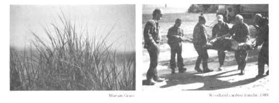
Plants from within the park may be transplanted in other locations in the park for the purposes of rehabilitation or landscaping. For example, marram grass has been replanted at Old Woman Bay to stabilize the beach sands. Plants may be transplanted to any zone where feasible and historically present. Plants may be removed for the purpose of rehabilitation of other park areas only from development, access and natural environment zones.
Non-native plant species will not be introduced, except for historically authentic species in historical zones where these will not have a detrimental impact on native plant communities elsewhere in the park. Where non-native plant species are already established in wilderness, historical or nature reserve zones, a vegetation management plan for their removal may be developed, if they conflict with the value for which those zones have been established. Missing or underrepresented native species may be re-established if biologically feasible and acceptable, usually to rehabilitate areas suffering past or present resource or recreational use impacts.
Native forest insects and diseases in wilderness or nature reserve zones will normally be allowed to develop undisturbed. In other zones, native insects and diseases threatening the values for which these zones have been established will be controlled where feasible. This includes natural and cultural values in nature reserve and historical zones and aesthetic values in development zones. Where insects or diseases occurring within the park threaten areas outside the park, they may also be controlled where feasible. Insects and diseases not native to the Great Lakes - St. Lawrence or Boreal Forest Regions will be controlled where feasible. Where control is desirable, it will be directed as narrowly as possible to the specific insect or disease so as to have minimal effects on the park’s environment. Biological control will be used wherever possible.
8.3 Wildlife and fisheries
Missing native species may be reintroduced and existing populations replenished, if biologically feasible and acceptable.
Wildlife management:
Woodland caribou, present in the park area until the early 1900's, have been reintroduced to selected areas within the park. Between 1984 and 1989 small herds of woodland caribou were moved to Montreal Island, Leach Island and the Gargantua area from the Slate Islands. These animals now represent the southernmost herd of woodland caribou in Ontario. These populations are being monitored. Further assessment of the flora and fauna on the offshore islands is required in conjunction with the monitoring of the woodland caribou population.
Fish stocking and a native encampment
Wildlife populations may be controlled where essential to protect human health and safety or the health of the species in or adjacent to the park. Where control is desirable, techniques used will have minimal effects on other components of the park environment. Any hunting or trapping required for control will be carried out under the supervision of the Ministry of Natural Resources. A Wildlife Management Plan was prepared for the park in 1983. The Wildlife Management Plan will be updated as necessary.
Commercial trapping:
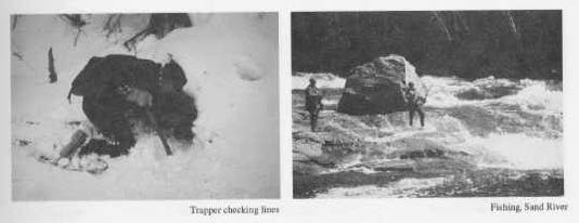
Following 1988 Ministry of Natural Resources policies, commercial trapping will be phased out of all areas within Provincial Parks, except by status Indians. Existing licensed trappers will be phased out by the year 2010, or when the trapper ceases to maintain the line, whichever is sooner. Traplines cannot be transferred except to status Indians. Trapping of individual nuisance animals, such as beaver, will be permitted under the supervision of the Ministry of Natural Resources, if and when required, to protect park facilities (i.e. roads) and Highway 17.
Trapper use of closed access roads:
Trappers with traplines within and east of the park are permitted to use closed access roads, such as the Sand River Road, to service their traplines for the period from two weeks before, until two weeks after the trapping season. This is consistent with Fish and Wildlife procedures for trappers using cabins on Crown land. Trappers are permitted to use motorized vehicles (i.e. snowmobiles and all-terrain vehicles) under permit by the Park Superintendent. Trappers will only be allowed on those roads where the road conditions permit. When traplines within the park are phased out, or when roads are no longer passable, trappers outside of the park will no longer be permitted to use closed access roads.
Fisheries management:
Lake Superior Provincial Park is mainly a brook trout fishery. The exceptions are northern pike in the Noisy River system (Shakwa and Fenton Lakes), lake trout in several lakes (including Mijinemungshing, Gamitagama, Old Woman and Treeby Lakes) and rainbow trout which spawn in rivers flowing into Lake Superior. Chinook, coho and pink salmon also spawn in most rivers in the park.
A District Fisheries Management Plan, which includes some specific recommendations for Lake Superior Provincial Park, was approved in June, 1989. To maintain a high quality fishery in Lake Superior Provincial Park special split-size regulations have been established for Mijinemungshing and Maquon Lakes. In Maquon Lake there will be a catch limit of two brook trout, only one greater than 40 centimetres and only one less than 40 centimetres. In Mijinemungshing Lake the catch limit will be two lake trout, only one greater than 40 centimetres and only one less than 40 centimetres.
Specific concerns for the protection of the park’s fisheries will be addressed in future reviews of the Fisheries Management Plan. When reviewed (scheduled for 1995), there will be opportunities for public input on fisheries management.
Image of a construction worker and Native encampment
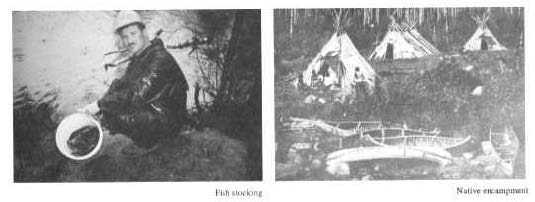
Fish stocking:
To enhance sport-fishing opportunities in the park, fish stocking programs may be undertaken. Wherever possible native brook and lake trout will be stocked. In some lakes, where native species cannot successfully compete with accidentally introduced non-native species such as yellow perch, splake may be stocked. Splake is a hybrid between brook trout and lake trout, which is able to compete with yellow perch better than brook trout. Stocking with splake may continue in lakes that already have splake populations. Rainbow trout will be managed in Lake Superior and its tributaries. Other than splake, no non-native species will be introduced into any inland waters of the park.
Commercial fishing:
Lake Superior waters within the park are available for use by the commercial fishery. Ontario Fishery Regulations prohibit commercial fishing within 1000 metres of river mouths along the Lake Superior shoreline. No commercial fishing or commercial bait fishing is permitted in the inland waters of Lake Superior Provincial Park.
Sport fishing and hunting:
Sport fishing and hunting are addressed in section 9.3 Recreation Management.
8.4 Fire
Natural fire is recognized as a process integral to natural succession in some cases, and to the perpetuation of specific vegetative conditions in others. Therefore, natural fires in wilderness, nature reserve or historical zones will normally be allowed to burn undisturbed unless they threaten human life, structural values, other zones, or lands outside the park. Natural fires threatening the values for which these zones have been established will be suppressed. Prescribed burning may be carried out in wilderness, nature reserve or historical zones to simulate natural fire when desirable. Natural fires in other zones will be suppressed, as will all fires resulting from human causes in all zones, in accordance with the Fire Management Plan for Lake Superior Provincial Park, approved in 1989.
8.5 Cultural resources
The park has a long history of human activity. The earliest known archaeological evidence dates back to 1100 A.D. Several archaeological sites have been studied in the park, including Agawa Bay, Sinclair Cove and Gargantua. An internationally significant pictograph site is located at Agawa Rock.
The recent history of the park area is part of a broader regional history of exploration, fur trade, logging, mining, fishing, trapping, transportation, artistic expression and tourism.
9.0 Operations policies
Activities and the facilities and services that support them vary from park to park. Park managers follow provincial standards to ensure that the level of facilities and services appropriate to each class of park are consistent across the province. For example these standards give direction on maintenance frequency, interpretive programs, etc.
A Park Operating Strategy will be prepared to provide park staff with the necessary information required to operate the park on a day-to-day basis. The provisions of the strategy will be consistent with the approved Ontario Provincial Parks Operating Standards and will be reviewed annually and updated as required.
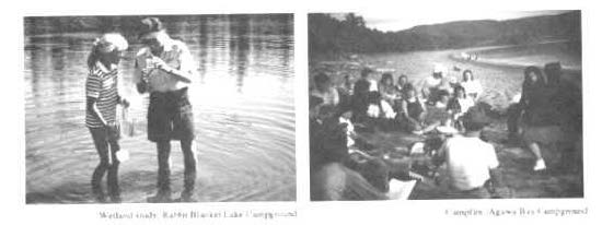
Images people standing in water and a group of people around a campfire
9.1 Visitor services
Visitor services programs will orient park visitors to the natural, cultural and recreational attributes of Lake Superior Provincial Park. There are five levels of visitor services in Provincial Parks. Due to the unique blend of resources and facilities, Lake Superior Provincial Park will operate at the highest level (major activity). The emphasis will be on personal contact and self-use approaches to deliver park information, resource interpretation, recreation skills and park management messages.
The theme of Lake Superior Provincial Park is: "Human response to a rugged and wild shoreline and backcountry". Our relationship to the land on the eastern shore of Lake Superior is that of a participant, not an onlooker. Historically, people canoed, hunted and fished in these forests for survival; today, we hike, observe nature, fish and canoe for our own pleasure, recreation and environmental understanding.
Information:
A high quality communications program is essential for the park. To improve visitor orientation and the identity of the park, new park boundary signs and self -use information facilities will be constructed.
Information will be provided using publications, audio-visual programs, displays, information kiosks, visitor centres, organized programs and personal contacts. Printed and visual material will be developed which will encourage visitors to make the best and fullest use of both highway corridor and backcountry recreational opportunities. Wherever possible, this material will be made available to users before they arrive at the park so that they can plan their visit. Information will also be available to advise visitors of attractions and services in the local area and other provincial parks.
Lake Superior Provincial Park publications, signs and displays are available in French and English. A designated number of staff are bilingual and some visitor services programs may be available in French.
Interpretation:
Interpretive programs and facilities will provide visitors with opportunities to learn about and experience the park’s natural and cultural resources. In this context, a full range of programs will be offered which focus on the natural and cultural features, recreational opportunities and the management of natural resources within the park. Interpretation of the park may be through organized activities or self-use facilities and will be based on natural and cultural landscapes and features throughout the park. At each campground, day-use area and interior entry point, small scale exhibits and displays will be developed. Minimal facilities such as self-guiding trails may be developed wherever appropriate. Programs include recreational and educational activities such as audio visual presentations, conducted walks, recreation skills demonstrations, children’s programs, campfires and special events.
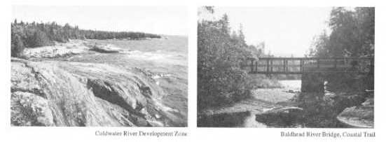
Coldwater River Development Zone and Baldhead River Bridge
Outdoor recreation:
There will be an emphasis on programs, which help visitors develop skills required to travel in the park while minimizing impact on the park’s environments. With improved recreation skills, visitors may make better use of the park and will more fully enjoy themselves. Recreation skills appropriate to Lake Superior Provincial Park include hiking, camping, canoeing, kayaking, fishing, outdoor cooking and backcountry ethics. In response to increasing demand, the park will contact interested school groups to discuss educational programs in the park.
Visitor centre:
Preliminary work has been done to establish a major visitor centre in the park. The purpose of this facility would be to provide a focal point for the park visitor. Information, displays and staff would explain the park theme and stories. Visitors would gain an appreciation for the rugged and fragile nature of the Lake Superior shoreline and backcountry. The recreational opportunities in the park would be promoted with an emphasis on developing recreational skills and the proper use of the park resources. Coldwater River Development Zone (D3) has potential for a visitor centre. Planning for such an important facility will address its operation and function within the park.
9.2 Research
Scientific research by qualified individuals will be encouraged in Lake Superior Provincial Park where appropriate, to contribute to the knowledge of the natural and cultural history and to natural resource management. All research programs will require the approval of the Ministry of Natural Resources and must also meet all requirements under applicable federal and provincial legislation. Faunal and floral specimens, soil and geological samples and archaeological and historical artifacts may be removed for research by approved researchers, or by the Ministry. Research activities and facilities will be subject to Ontario Provincial Parks Planning and Management Policies.
9.3 Recreation management
Day-use and camping activities which are based on interaction with the park’s natural and cultural values will be encouraged in the park. Recreational activities will be of low intensity, except in development zones where they may be of moderate to high intensity.
Hiking:
Eleven trails are currently maintained. These range from short distance interpretive trails (0.4 kilometres), requiring an hour or less, to long distance trails (over 55 kilometres), requiring several days. The longer and more remote the trail, the more primitive and challenging it will be. Additional trails may be developed as demand justifies and priorities permit. Trails may be developed throughout the park and locations will be selected on the basis of landscape capability, resource sensitivity and appeal to the user. Specific trail locations will be identified over time by park staff. Proposed trails will require an inventory of values and assessment of impacts prior to development.
Development of the Coastal Trail began in 1979. The trail will eventually extend the entire length of the park’s coastline (over 115 kilometres). This trail will eventually link with the Voyageur Trail, projected between Sault Ste. Marie and Thunder Bay, part of the proposed trans-Canada National Trail.
Figure 2 - Recreation, Lake Superior Provincial Park
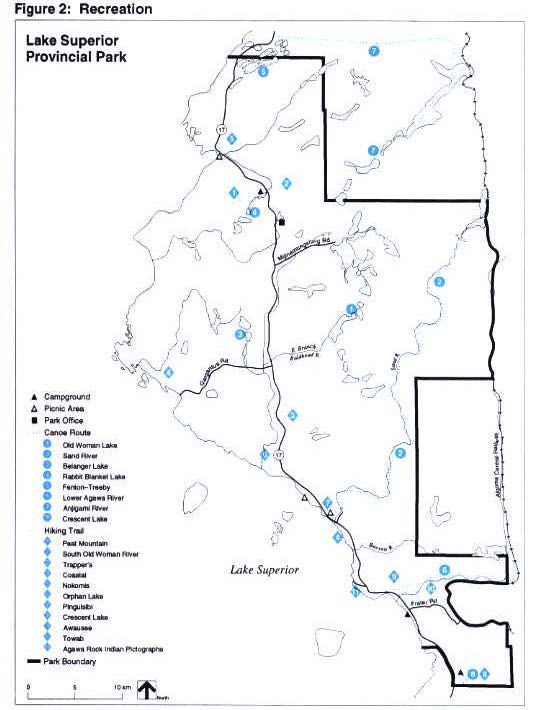
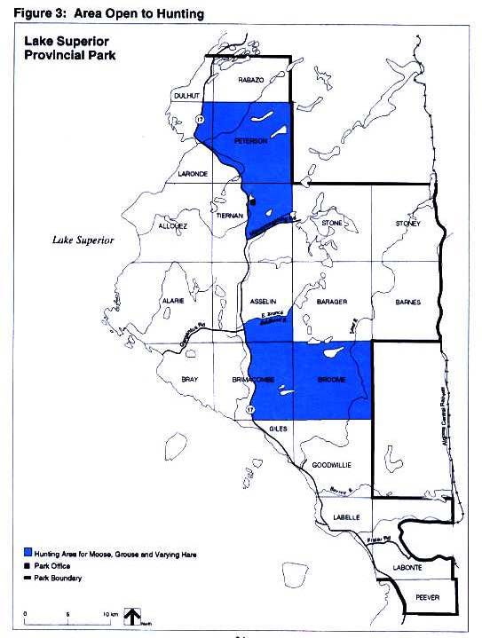
Figure 3 - Area Open to Hunting, Lake Superior Provincial Park
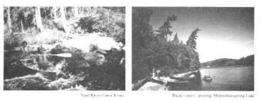
Sand River Canoe Route Backcountry and camping, Mijinemungshing Lake
Canoe routes:
Seven canoe routes are currently maintained within the park boundaries. These range from 3 kilometre day-trips to 56 kilometre routes requiring several days. Although the potential for new canoe routes is minimal, additional routes will be considered based on use and suitability. Proposed routes will require an inventory of values and assessment of impacts prior to development.
Management of Backcountry (interior) camping:
The emphasis on backcountry, or interior recreation in Lake Superior Provincial Park is on low intensity use. Facilities in areas receiving relatively high use, such as Mijinemungshing Lake, Sand River and the Gargantua area, will be upgraded. This may include provision of additional campsites, improved access points and signs and simple interior privies. Sites will be developed and maintained in accordance with Provincial Parks design standards.
Camping is limited to designated campsites within the park. Camping permits are required for all backcountry camping. Users are required to pack out all non-burnable garbage. A can and bottle ban was introduced in 1983. This ban prohibits the use of non-burnable disposable food and beverage containers in the park interior. The number of campers permitted on an interior site is limited to nine. If required in the future, quotas limiting the number of parties, in a particular area may be used at certain times of the year to prevent over-use of specific areas.
Although non-conforming, existing backcountry group campsites will continue to be allowed on Mijinemungshing Lake so that groups (such as Scouts, Guides, etc.) may experience backcountry camping.
Sport fishing:
Sport fishing is one of the favoured activities in the park. Use of live bait fish is not permitted, except in Lake Superior. Certain water bodies may be closed to fishing temporarily or permanently for fisheries research or management purposes. Special daily catch limits, size limits and seasons are discussed in the District Fisheries Management Plan. Fish stocking and special regulations are discussed in section 8.3 Wildlife and Fisheries.
Hunting:
In Lake Superior Provincial Park hunting is permitted for moose, grouse and varying hare, in a designated area of the park east of Highway 17. In keeping with Ontario Provincial Parks Policies, hunting is not permitted in wilderness or nature reserve zones. Wherever possible topographic features are used to delineate the hunting area, where this is not possible, township boundaries are used. The hunting area, as outlined in Figure 3, represents approximately 18% of the total park land base. The reduced area falls within the boundaries of the former hunting area. Certain portions of the hunting area may be closed to hunting temporarily or permanently for wildlife research or management purposes. Current Ministry of Natural Resources hunting regulations will apply.
An average of 20 - 25 moose per year have been harvested from the park over the past decade. These figures reflect the former hunting area. The revised hunting area is approximately 36% of the former hunting area.
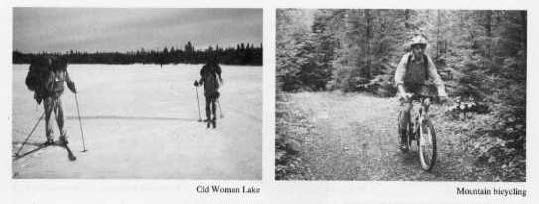
Images of Old Woman Lake and a man on a bike
Off-season use:
The Minimum Operating Dates for Provincial Parks policy specifies the open season for each provincial park. Currently Lake Superior Provincial Park operates from May until October. During the off-season campgrounds are closed and gated. No services are available. The park is open to day-use recreation year-round. Although no backcountry winter camping facilities will be offered, people wishing to camp at this time of year must do so at their own risk. Rules and regulations, such as the can and bottle ban and live bait-fish ban, remain in effect during the off-season.
Cross-country skiing and snowshoeing:
In general, hiking trails will be available for non-mechanized winter use. Past demand for groomed ski trails has not justified the maintenance of such facilities. If and when justified by need, trails may be groomed in development, access and natural environment zones.
A local club has expressed an interest in grooming cross-country ski trails in the park. The Park Superintendent may designate such an area on an existing park road in agreement with the club that they assume public liability, maintenance, signs and all associated costs. The designation of a suitable area would consider the park development guidelines. Trails could be groomed in development, access and natural environment zones. The use of motorized snow vehicles would be permitted for trail grooming only.
Horseback riding:
Horseback riding is not permitted in Lake Superior Provincial Park. The interest in horseback riding has been insufficient to justify development of suitable trails within the park. There are opportunities for this type of recreation on Crown lands in the area.
9.4 Motorized and mechanical transport
To protect the park’s resources and maintain the natural environment, mechanized travel is minimized.
Motor vehicles:
Public use of motor vehicles (as defined in the Highway Traffic Act) will be limited to designated roads within development and access zones. "Vehicle" as defined under the Highway Traffic Act includes motor vehicles and any vehicle drawn, propelled or driven by any kind of power, including muscular power, but does not include a motorized snow vehicle. This does include bicycles.
Mountain bicycles:
Currently bicycling is limited to roads designated for public use of motor vehicles. If the need arises and funds are available, the Park Superintendent may designate and develop existing roads or trails suitable for mountain bicycling. Such a designation would have to consider park zoning and the approved activities in the zones as outlined in the Ontario Provincial Parks Planning and Management Policies (refer to Table 1, page 6). In addition this type of proposal would require an assessment of possible impacts to other values prior to development (i.e. conflicts with other users, impacts on fisheries, etc.)
Wheeled carts:
The use of wheeled carts, such as ricks haws and canoe carts, may be used on trails and roads only where propelled by muscular power. However, other mechanized transport such as bicycles is restricted to designated roads or trails.
Images of people canoeing
Motorized snow vehicles:
Public use of motorized snow vehicles is permitted only on Frater Road to allow access to Frater Station on the Algoma Central Railway. Motorized snow vehicles may travel only along the cleared right-of-way portion of Frater Road and only when the road surface is impassable to motor vehicles (i.e. snow covered and not plowed). Motorized snow vehicles may be permitted for grooming cross-country ski trails if designated by the Park Superintendent.
All-terrain vehicles:
All-terrain vehicles, as defined under the Off-Road Vehicle Act, are not permitted to be operated for public use within the park.
Motorboats:
Motorboats include boats that are propelled by electric and gasoline motors. Public use of motorboats is not permitted within the park, except on Sand Lake where motors will be restricted to 7.5 kW (10 horsepower), or less and on Lake Superior where there are no restrictions.
Private aircraft:
Except under emergency circumstances private aircraft will not be permitted to land in the park.
9.5 Tourism services
In general, commercial services are provided by the private sector, outside of the park boundaries, or in the case of the Agawa Bay Service Centre, on private lands within the park. Wawa and Montreal River Harbour are the main centres for the concentration of these services. Under an agreement with the Ministry, concessionaires may provide services within the park, such as canoe rentals and firewood. Concessions may include minimal support facilities for these services (i.e. canoe racks, storage sheds).
A 1986 Tourism Feasibility Study proposed that commercial accommodations, including fixed-roof and simple interior hut facilities be permitted in the park. Such developments are not being considered for Lake Superior Provincial Park at this time. The Ministry of Natural Resources may continue to review changing visitor needs.
9.6 Marketing
Park information and Highway 17 Park Identification:
Park information services will be upgraded by improving identification of park boundaries and development of self-use information facilities at the north and south park boundaries. In addition, signs identifying park facilities and attractions will continually be reviewed and improved where necessary. Additional publications interpreting park attractions, such as a Coastal Trail guide and mammal checklist may be developed.
9.7 Co-operating association
The Ministry has established a co-operating association to supplement the interpretive and educational programs in the park. Examples include the provision of publications, displays and trail enhancement projects.
Agawa Lodge and comfort station in Agawa Bay Campground
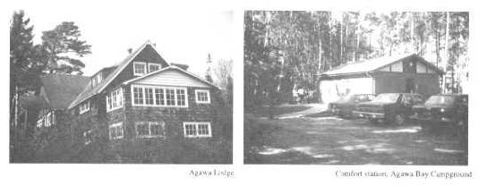
9.8 Existing buildings
There are a number of old buildings in the park which have deteriorated. These include Agawa Lodge, Old Woman Lake Lodge and some small cabins built by trappers, fishermen and a snowshoe club. In consideration of the present condition of these buildings and their location in the park, they are unsuitable for park activities. The Ministry will evaluate the historic significance of the existing buildings in the park to determine if it is feasible to repair them or if they should be removed.
10.0 Development policies
10.1 Campgrounds
Three car camping areas are maintained in the park A portion of Crescent Lake will be converted to a group camping area. Agawa Bay, located in the south end of the park, and Rabbit Blanket Lake, in the north, are regular car campgrounds consisting of pull-through trailer sites and tent sites. Comfort stations, including showers, flush toilets and laundry facilities are available at Agawa Bay and Rabbit Blanket Lake. Electrical sites may be developed at Agawa Bay and Rabbit Blanket Lake Campgrounds if required. Additional water systems and washroom facilities may be developed at all three campgrounds. Visitor services facilities, such as outdoor theatres may be improved or replaced.
If required in the future, additional campsites may be developed, if use justifies and funds permit. No new campgrounds will be developed.
10.2 Barrier-free access
Public buildings within the park have been upgraded to provide visitors with barrier-free access. In addition some facilities, such as picnic sites, hiking trails, viewing areas and fishing platforms may be upgraded to barrier-free access standards.
10.3 Roads
Six access roads are open to public vehicles: Mijinemungshing Road, Gargantua Road, part of Gamitagama Road, the portion of Sand River Road to the canoe route take-out point, Pictographs Road and Frater Road. Public vehicles include motorized vehicles as well as anything driven by muscular power, such as bicycles (refer to section 9.4 Motorized and Mechanical Transport). To protect road conditions these roads may be closed at certain times of the year (i.e. spring break-up).
Frater Road:
As a public road, Frater Road may be used by trappers and timber companies to access areas east of the park boundary. Timber cut outside of the park may be hauled through the park only after October 15 and before May 1. Maintenance and upgrading of the Frater Road to meet standards for hauling timber will be the responsibility of the timber companies. Aggregate required by timber companies to upgrade the road for hauling must be obtained from aggregate sources outside of the park.
Sand River Road:
The Sand River Road will continue to be available for use primarily as a forest access road by timber companies with allocations east of the park. The road was constructed to serve as an internal haul road and to provide access to timber companies with allocations east of the park. Timber companies were provided with alternate sources of supply on public lands outside of the park to compensate for allocations lost within the park as approved in the 1979 Master Plan. Workers, vehicles and equipment may use the Sand River Road year-round. Timber may be hauled on the Sand River Road only after October 1 and before May 1.
Images of Sand River Forest Access Road and Old Woman Bay
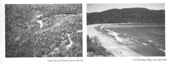
It will be the responsibility of the timber companies to erect and maintain gates at both ends of the road to prohibit unauthorized vehicle access. Maintenance and rehabilitation of the Sand River Road between the gates will also be the responsibility of the timber companies.
The Sand River Road Forest Access Road passes through the Sand River Valley Natural Environment Zone (NM). The road corridor will have a maximum width of 90 metres (measured as 45 metres either side from the centre of the road) to provide aggregate for road maintenance. Road improvements and locations of borrow pits will be subject to approval by the Ministry in accordance with the Aggregate Resources Act and the aggregate resources plan for the park (refer to Aggregate Management, section 8.1 Lands and Waters).
Trappers accessing areas east of the park will also be allowed to use the Sand River Road under permit by the Park Superintendent until such time as trapping within the park is phased out, or when the road is no longer passable (refer to Commercial Trapping, section 8.3 Wildlife and Fisheries).
Additional access via the Sand River Road, beyond the gate, will be permitted as long as the road remains passable, only for emergency situations for train derailments, search and rescue, fires, major power failures on the Great Lakes power line and life threatening situations.
With the exception of the Sand River Road, all other forest access roads and water crossings will be reviewed and a plan will be prepared to identify whether these facilities should be removed, rehabilitated for other uses or allowed to return to a natural state. In the interim, these roads will be monitored and remedial action will be taken to alleviate environmental impacts (e.g. erosion control to maintain fisheries habitat). No additional forest access roads will be built.
The Frater Road and the Sand River Forest Access Road and will be the only roads, besides Highway 17, to cross the park boundary. No additional roads will be built across the park boundary.
As with the rest of this plan, the use of these roads will be reviewed in 10 years.
10.4 Day use areas
There are three day-use areas adjacent to Highway 17, Old Woman Bay, Katherine Cove and Sand River. All have picnic facilities and provide access to water. Old Woman Bay and Katherine Cove provide access to Lake Superior beaches.
Images of Gargantua harbour and Brulé Harbour
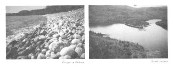
10.5 Small craft access to Lake Superior
Sinclair Cove boat launching facility is currently under the jurisdiction of the Canada Department of the Environment, Fisheries and Oceans. The Department of the Environment has upgraded this facility, including the removal of the old docks and repair of the boat launching ramp. The Ministry of Natural Resources will negotiate with the Federal Government to have this area turned over to the park for maintentance. Sinclair Cove is used by the commercial fishery as a small craft harbour for bringing in and out small boats, and servicing larger boats. No additional support facilities will be developed.
No additional launching facilities will be developed at this time. Such development is limited by the lack of natural, protected harbours within the park. Sinclair Cove, Gargantua Harbour and Brulé Harbour are the only significant protected harbours along the park’s coast. The extensive development required to provide suitable boat launching facilities would have a detrimental impact on the natural features at Brulé Harbour and the historic and recreational values at Gargantua Harbour. Where feasible, small boats may still be carried across beaches from parking areas, such as Old Woman Bay, Gargantua and Coldwater River.
10.6 Scenic lookout
The scenic lookout at Agawa Bay is partially within the highway-right-of-way, under jurisdiction of the Ministry of Transportation Ontario. Information and displays regarding the park may be provided by the Ministry of Natural Resources.
11.0 Implementation and review
11.1 Implementation priorities
The following development and management projects will be priority items during the life of this management plan and will be completed as funds permit.
Resource Protection:
- Extend park boundary to include the northwest portion of Peever Township
- Acquire private holdings within the park on a willing seller basis and as funds are available
- Develop an aggregate resources plan for the park
- Conduct additional research on earth and life science features and cultural values within the former recreation-utilization zones and the off-shore islands
- Develop a plan for former forest access roads and water crossings
Upgraded Facilities:
- Upgrade backcountry facilities
- Upgrade the aesthetics of grounds at Red Rock Lake Park Office and Agawa Bay Work Centre
- Pave internal roads in campgrounds and day-use areas
- Relocate group camping to Crescent Lake Campground
- Upgrade water system and sanitation facilities at Crescent Lake Campground
- Upgrade or replace staffhouse facilities at Agawa Bay Work Centre
- Expand the parking area at the end of Gargantua Road
- Upgrade the dock at Mijinemungshing Lake
- Replace display panels along Agawa Rock Indian Pictographs trail
- Investigate appropriate site improvements at Agawa Rock Indian Pictographs for access, viewing and interpretation
Images of Agawa Rock and a man conducting a life science survey
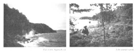
New Facilities:
- Complete the Coastal Trail
- Develop additional hiking trails and canoe routes as required
- Develop small-scale interpretive facilities at campgrounds, day-use areas and interior access points
- Develop a major park visitor centre
- Develop self-use information facilities at the north and south park boundaries
- Investigate feasibility of mountain bicycle trails
- Develop electrical sites, Agawa Bay and Rabbit Blanket Lake Campgrounds
- Provide additional barrier-free access to park buildings and facilities, such as trails and fishing platforms
- As required, develop additional campsites at Agawa Bay Campground and provide water, comfort stations and electrical sites
11.2 Plan review
Upon approval of the Lake Superior Provincial Park Management Plan, other management plans and documents which affect the park will be amended to reflect the policies in the Park Management Plan. Other resource management plans must complement the overall objectives and policies in the Park Management Plan. Where discrepancies occur, the Park Management Plan will take precedence. To ensure that park management plans keep pace with changing needs, plan reviews are undertaken every 10 years, or as the need arises. Additional research may be conducted on natural and cultural resources and park users as funds and priorities permit.
A plan review will result in a re-written management plan where required. All management plan reviews are approved by the Regional Director and the Director of Provincial Parks and Natural Heritage Policy Branch.
11.3 Plan amendment
During the term of any Park Management Plan, circumstances may require the plan to be amended. Amendments to the approved Park Management Plan permit changes, which do not alter the overall intent of the plan. These include changes, which are consistent with the park’s classification, zoning, goal and objectives but differ from the park’s management policy statements, affect specific park targets or are likely to result in significant public reaction.
If the Ministry of Natural Resources staff or the public wishes to seek an amendment to the Park Management Plan, an explanation of the requirements for, and nature of, the proposed amendment must initially be submitted to the Regional Park Operations Manager, who determines whether the proposed amendment should proceed. If the Regional Park Operations Manager’s decision is favourable, the planning, review and approval requirements for the amendment will depend on whether the proposed amendment is considered to be major or minor.
Images of Vrooman Island and Sand River
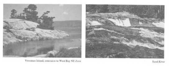
Minor Amendment:
A minor amendment would involve changes to development or management policies that are housekeeping in nature. Examples would include the addition of a new nature reserve zone or historical zone based on new information; a change in emphasis in the visitor services program; changes to development concepts; etc.
Minor amendments do not require public consultation, but must be kept on file in the Park Office as a matter of record. Minor amendments will be brought forward for public information during a future plan review.
Major Amendment:
A major amendment is characterized as a proposed change that would have a potentially significant impact on the environment; involves a contentious issue; affects or conflicts with park users; or, is likely to result in significant public reaction locally, regionally or provincially. Examples would include a major tourist development proposal, changes to the hunting area or alteration of resource management objectives.
A major amendment requires public consultation and will result in an addendum to the original plan consisting of the revised policies.
12.0 Public consultation
This park management plan is a result of a continuing consultation process that has considered the interests and opinions of a variety of individuals and groups. It attempts to achieve balance environmentally, socially and economically in the Ministry of Natural Resources management of Lake Superior Provincial Park. Public involvement in the management plan first began in April 1988, with a news release announcing the review of the 1979 Park Master (Management) Plan and inviting the public to become involved. Approximately 1000 names of interested individuals and groups were included on a mailing list.
The park plan review involved four phases, three of which included opportunities for input:
Phase I: Background Information and Issues;
- 8 page tabloid released in June 1988
- comment deadline October 31, 1988
- 112 comments received
Phase II: Issues and Policy Options;
- 12 page tabloid released in August 1989
- included summary of comments from Phase I
- comment deadline October 31, 1989
- 519 comments received
Phase III: Preliminary Management Plan;
- Preliminary Management Plan released in July 1992
- included summary of comments from Phase II
- public meetings in the fall of 1992; Montreal River Harbour (Sept. 20), Wawa (Sept. 21) and Sault Ste. Marie (Sept. 22); a total of 80 people attended
- comment deadline October 23, 1992
- 100 comments received; including public meeting submissions and written comments
Phase IV: Approved Management Plan
- release of the approved Management Plan (this document) in March 1995
Images of a white water lily and of Lake Superior north of Beatty Cove
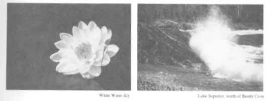
The major issues raised during the Park Plan Review were: Timber Management; Sand River Road; Commercial Trapping; Commercial Development, Use of Beaver Rock (MacGregor Cove) and Hunting. Refer to section 2.0 for a summary of these issues.
While the merit of every comment is considered, public consultation is not always a numerical choice between those favouring or those opposing a particular option. In some cases the Ministry must balance the protection of the park’s natural features with recreational use and resource management. When seeking public input on management plans, the Ministry of Natural Resources considers not just the quantity of comments but also the type of comments and concerns raised by the various park users.
Copies of all comments received during the plan review are on file at the Park Office.
13.0 References
Ontario Ministry of Natural Resources, 1989. Lake Superior Provincial Park Fire Management Plan. MNR, Wawa.
Ontario Ministry of Natural Resources, 1979. Lake Superior Provincial Park Master Plan. MNR, Wawa.
Ontario Ministry of Natural Resources, July 1992. Lake Superior Provincial Park, Preliminary Management Plan / Parc provincial du lac Supérieur, Plan de gestion préliminaire. MNR, Wawa.
Ontario Ministry of Natural Resources, 1983.Lake Superior Provincial Park Wildlife Management Plan. MNR, Wawa.
Ontario Ministry of Natural Resources, 1978. Ontario Provincial Parks Planning and Management Policies. MNR, Toronto.
Ontario Ministry of Natural Resources, June 1988. Phase I: Background Information and Issues; Lake Superior Provincial Park Master Plan Review. MNR, Wawa.
Ontario Ministry of Natural Resources, August 1989. Phase II. Issues and Policy Options; Lake Superior Provincial Park Master Plan Review. MNR, Wawa.
Ontario Ministry of Natural Resources, July 1989. Review of Timber Management in Lake Superior Provincial Park. MNR, Wawa.
Ontario Ministry of Natural Resources, 1989. Wawa District Fisheries Management Plan: 1989 - 2000. MNR, Wawa.
White, D. J., 1988.A Life Science Survey of Lake Superior Provincial Park. MNR, Sudbury.