Strickland River Mixed Forest Wetland Conservation Reserve Management Statement
This document provides policy direction for the protection, development and management of the Strickland River Mixed Forest Wetland Conservation Reserve and its resources.
C1521
Statement of Conservation Interest
Ontario Ministry of Natural Resources Wawa District
November 2004
Prepared by: Tom Kenerknecht, R.P.F.
(Revised October 2004)
Approval statement
I am pleased to approve this Statement of Conservation Interest (SCI) for the Strickland River Mixed Forest Wetland Conservation Reserve (C1518).
Direction for establishing, planning and managing conservation reserves is defined under the Public Lands Act and current policy. "Ontario’s network of natural heritage areas has been established to protect and conserve areas representative of the diversity of the natural regions of the province, including species, habitats, features and ecological systems which comprise that natural diversity." (Policy PL 3.03.05, OMNR 1997).
The public was invited to comment on the proposed boundary of Strickland River Mixed Forest Wetland Conservation Reserve in November 1999. An opportunity was provided for the public to participate in the preparation of this Statement of Conservation Interest (SCI) and notification was posted on the Environmental Bill of Rights Registry. In February of 2001 the public was invited to comment on the draft SCI. Comments and concerns registered are reflected in this Statement of Conservation Interest. A final inspection opportunity will be provided for the public to review the approved SCI document. This document was prepared by an interdisciplinary planning team having expertise in forest ecology, biology, land management, and fire management. A draft was provided to the MNR Regional Planning Unit for review.
This Basic SCI will provide guidance for the management of the conservation reserve and the basis for the ongoing monitoring of activities. More detailed direction at this time is not anticipated. Should significant facility development be considered or complex issues arise requiring additional studies, more defined management direction or special protection measures, a more detailed Resource Management Plan (RMP) will be prepared with full public consultation.
The Strickland River Mixed Forest Wetland Conservation Reserve will be managed under the direction of the District Manager and the Wawa Area Supervisor, Wawa District, Ministry of Natural Resources.
Submitted by:
Tom Kenerknecht, R.P.F.
Plan Author
District Manager Recommendation
Approved by:
original signed by Rob Galloway
Regional Director
Northeast Region
Date: November 24, 2004
1.0 Introduction
The Strickland River Mixed Forest Wetland is a 1638 hectare site that was regulated as a conservation reserve (CR) on December 21, 2000 (Appendix A). The site was recommended for CR status in the Ontario’s Living Legacy Land Use Strategy approved in July 1999, as well as the Crown Land Use Policy Atlas. Extensive public consultation on boundary refinement was conducted in late 1999 prior to regulation.
The site is located on the west side of Highway 631 between the towns of White River and Hornepayne. The CR contains extensive wetlands in its central and western sections, and a varied forest in which mixed wood predominates. The Nameigos River forms the eastern boundary of the conservation reserve.
The purpose of this Statement of Conservation Interest (SCI) is to identify area values and provide clear direction on management activity and appropriate land uses. Mining, hydroelectric power development, and commercial forestry are prohibited by legislation, and many other activities are guided by the approved Ontario’s Living Legacy Land Use Strategy and the Crown Land Use Policy Atlas (see Appendix B and Section 5 for details on permitted land and resource uses). Since the site generated little interest during public consultation on boundary refinement, and since higher level planning documents provide direction on most activities in the CR, a more detailed Resource Management Plan is not required.
The Strickland River Mixed Forest Wetland CR helps contribute to the representation of the province’s ecosystems and natural features. The addition of the protected areas recommended by Ontario’s Living Legacy will complete the Provincial Parks system within the planning area and protect 12% of its land and water base.
2.0 Goals
2.1 Goals of Conservation Reserves
The goal of conservation reserves is to protect natural heritage values on public lands while permitting compatible land use activities.
2.2 Objectives of Statements of Conservation Interest
2.2.1 Short term objectives
- To identify the state of the resource with respect to natural heritage values and current land use activities for the conservation reserve.
- To manage the conservation reserve to protect the integrity of its natural values via specific guidelines, strategies, and prescriptions detailed in this plan
2.2.2 Long term objectives
- To establish representation targets (e.g. future forest conditions) and evaluate the site as a potential scientific benchmark
- To address future new uses and activities
- To identify research and marketing strategies and client services
3.0 Management planning
3.1 Planning context
3.1.1 Planning area
The planning area is defined as the regulated conservation reserve. For purposes of Resource Management Planning for other uses, particularly Forest Management Planning, the boundary of the conservation reserve in itself will not be treated as a 'value'. Management Prescriptions presented in this plan will relate to the activities within the conservation reserve, will identify the location, shape, size, significance and sensitivity of natural heritage values, and will identify additional special features within the boundary of the site. Management actions outside the boundary of the conservation reserve will continue to consider the site’s natural heritage features, recreational values and protection requirements within larger landscape plans such as Forest Management Plans.
3.1.2 Management planning context
The Strickland River Mixed Forest Wetland CR has been withdrawn from the White River Forest Sustainable Forest Licence (SFL), and commercial forestry will no longer occur within its regulated boundaries. Since there has been no recent timber harvesting, post-harvest silvicultural activities will not be required as a non-conforming use.
Fish and wildlife management activities will generally occur in much the same fashion as in surrounding crown lands.
There is currently no land in the CR under land tenure. In the future, land in the CR will not be sold or leased. New uses and potential commercial activities may be acceptable if they do not impact the natural heritage values of the site. Such activities will be considered on a case-by-case basis and reviewed using the Procedural Guideline B – Land Uses – Test of Compatibility PL 3.03.05 (Appendix C). Authorization for potential compatible uses will be in the form of a Land Use Permit or a Licence of Occupation.
Fire management is described in Section 6.2.
3.2 Planning process
The level of management planning required to fulfill the protection targets is determined by the complexity of issues that need to be addressed. Guidelines for the preparation of this document are outlined in Procedural Guideline A for SCI and RMP PL 3.03.05 (OMNR, 1997). This SCI will only address known issues or current proposals with respect to permitted uses or potential economic opportunities brought forward during the planning process. Future proposals for development or land use will be reviewed through a Test of Compatibility (Appendic C).
The planning process for the Strickland River Mixed Forest Wetland CR involves 3 public consultation phases. In January 2001, newspaper notices appeared in the Wawa and Sault Ste. Marie newspapers advising that planning for the CR was being initiated and asking interested people to supply background information and viewpoints. At approximately the same time, there was a direct mail out to people or organizations known to be interested in, or affected by the conservation reserve.
In February of 2001 the public was invited to comment on the draft SCI. Comments and concerns registered are reflected in this Statement of Conservation Interest. The final public consultation phase will be an inspection of the MNR-approved SCI, during which participants in the planning process will be able to request a SCI to see how their comments were addressed. After this plan inspection the SCI will be implemented.
Since this SCI is not considered a policy under the Environmental Bill of Rights (EBR) it is not necessary to place a notice on the EBR Registry. However, to ensure greater public accessibility to information, a notice was posted on the EBR Registry to encourage public comments regarding this CR.
4.0 Background information
4.1 Location and site description
4.1.1 Location
The Strickland River Mixed Forest Wetland is located west of Highway 631 northeast of the town of White River, and southwest of Hornepayne. Access is available only by air, water and foot. Location and administrative information is presented in Table 1.
Table 1: Location and Administrative Details for Strickland River Mixed Forest
| Territorial District | Algoma |
|---|---|
| OMNR Region/District | Northeast/Wawa |
| Township | Strickland |
| Eco Region – Eco District (Hills, 1959; Crins and Uhlig, 2000) |
Eco Region 3E (Lake Abitibi) – Eco District 3E-2 (Hornepayne) |
| Regulation Date | December 21, 2000 |
| Total Area | 1638 ha |
| Ownership | Crown |
| UTM Coordinates (Zone 16) | 5404450 N 653300 E |
| Map Number Nearest Town/Community |
42C/15 (Gourlay Lake) White River |
| OBM Numbers | 166505400 |
| Wildlife Management Unit | 21B |
| Forest Management Unit | White River Forest |
4.1.2 Physical description
The Strickland River Mixed Forest Wetland CR is within the Boreal Forest Region. Forest cover in the conservation reserve ranges from extensive spruce stands in the western section, extensive jack pine in the south central area, to predominantly poplar and birch in the eastern areas.
Past interpretations identified the dominant landform type as strongly broken ground moraine with moderately broken ground moraine (Ritchie, 1998). More recent interpretation indicates the landforms in the conservation reserve are composed of bedrock drift complex, till deposits, ice-contact stratified drift deposits, glaciolacustrine deposits, alluvial deposits, and organic deposits. Upland areas were formed as a result of underlying bedrock, lowlands are comprised of various deposits, and transitional lands between uplands and lowlands are dominated by till deposits (Kristjansson, 2003). If the landform type is actually bedrock drift complex, then landform – vegetation combinations present in the CR are likely provincially significant (Burkhardt, 2002).
The CR and the surrounding areas contain wetlands that are of local significance. The variety of wetland complexes include shore fens, poor fens, treed bogs, meadow marshes, treed and semi-treed bogs, wire sedge and shrub shore fens, and alder swamps. These wetland areas allow for a rich diversity of species within the CR. Lakes in the conservation reserve are classified as warm water lakes.
The Nameigos River forms the eastern boundary of the CR. Downstream, the Nameigos River is designated as a Category "A" canoe route in the Wawa District Land Use Guidelines (DLUG).
4.2 Administrative description
The Ontario Ministry of Natural Resources and the Surveyor General of Ontario certified the legal boundaries of the Strickland River Mixed Forest Wetland and the site was passed into regulation in December of 2000. The Conservation Reserve is within the White River Forest Management Unit, held by Domtar Inc. under a Sustainable Forest Licence. Map 1 shows the location of the Reserve in the Ministry of Natural Resources' Wawa District.
4.3 History of the site
Cutover maps and records since the 1970's indicate the Strickland River Mixed Forest Wetland CR has not been logged recently. There are also no records of aggregate pits in the conservation reserve since the Aggregate Resources Act came into effect (1990).
Use of the site by local First Nations for traditional purposes and the exercise of aboriginal and treaty rights will continue.
4.4 Inventory
Table 2 illustrates the inventories/surveys completed for Strickland River Mixed Forest Wetland CR, as well as any future requirements for earth and life sciences, cultural, recreational or other categories. The detailed Earth (Kristjansson, 2002) and Life Science Checksheets (Burkhardt, 2002), and sections 4.1.2 and section 5.0 describe the key features of the CR.
Table 2: Inventory and Survey Information for Strickland River Mixed Forest Wetland Conservation Reserve
| Survey Level | Earth Science | Life Science | Cultural | Recreational |
|---|---|---|---|---|
| Reconnaissance | Kristjansson, F.J., 2003, Strickland River Mixed- Wood Forest and Wetland Conservation Reserve (C1521) Approved Earth Science Checksheet. | Burkhardt, B., and J.E. Thompson, Strickland River Mixed Forest Wetland Conservation Reserve (C1521) Life Science Checksheet. | Fortin, S. 2002, Strickland River Mixed Forest Wetland Conservation Reserve C-1521 Recreational Inventory Checklist. | |
| Detailed | None | None | None | None |
| Requirement | None | None | None | None |
5.0 State of the resource
The main features represented in the conservation reserve are the wetlands, the mixed forest, and the moraine development.
Except for past forest road construction in the western portion of the CR, industrial activity has had little impact on the moraine.
MNR records, which cover the years since 1921, show that there have been no forest fires in the site since 1921. However, this may be an effect of the suppression of 8 fires in the general area since 1976. It is difficult to assess precisely what impact fire suppression may have had, since it is not certain how many, if any, of these fires would have spread into the conservation reserve.
Fire suppression may have a very significant effect in the future. The boreal forest is a fire dependent ecosystem, and in the absence of fire and other disturbances such as blowdown, the productivity, floral diversity and nutrient cycling of the forest is dramatically affected. The management of fire in the CR is described in section 6.3, but it is important to note that even a "let burn" approach within the CR's boundaries will not replicate nature. The bulk of the area burned in the boreal forest results from a small number of very large fires, and therefore it can be assumed that since glaciation, most of the fires that burned the CR started outside the conservation reserve. The impact of fire suppression on ecosystem representation and management of the CR are further discussed in section 6.2.
5.1 Socio/economic interest in the area
The Hornepayne Highway (Highway 631 between Hornepayne and White River) was completed in 1972. Until that time, this area was remote and its use was limited.
The CR has been and will continue to be open to angling and hunting by native and nonnative users. The extent of this hunting is not known (i.e. the MNR does not have records of where people hunt and fish) but limited access into the site restricts the amount of use. The CR is not a significant tourism attraction but may be of interest to naturalists, bird watchers etc. There is no road access into the CR, although there are trails within the conservation reserve and highway 631 lies just to the east of the boundary.
The lack of industrial disturbance in the conservation reserve and the minimal level of current land use will help to ensure that fragile vegetation communities, significant geological features and waters are protected into the future.
Forest Reserves
This conservation reserve has no mining tenure within it. Mining and surface rights have been withdrawn from staking within the conservation reserve boundaries under the Mining Act (RSO 1990 Chapter M.14).
5.2 Natural heritage stewardship
Generally, the Ontario Living Legacy Land Use Strategy established the intent to add new conservation reserves to the existing network of conservation reserves to complement Provincial Parks in protecting representative natural areas and special landscapes.
There are no existing monitoring programs or research plots in the conservation reserve.
5.3 Fisheries and wildlife
The conservation reserve is located in the White River Forest, and in the Forest Management Planning Process, fish and wildlife values have been identified. None of these values require increased monitoring or special management.
Hunting and Fishing will continue to be permitted on the site, and fish and wildlife management will continue in much the same fashion as before its regulation as a conservation reserve.
Old growth coniferous stand are present around lakes, creeks and wetlands, particularly around the south west shores of the Strickland River Wetland Complex. There is also one old growth trembling aspen stand present in the conservation reserve.
The conservation reserve exhibits high species richness due to the variety of wetland communities and forest units as well as the varied landform coverage. Age distribution of the forest stands also adds to the diversity of the site. Consideration will be given to this feature when reviewing development proposals outside of the reserve boundaries. Approximately 35 forest communities and several wetland communities are bisected as a result of the vectored boundaries of this conservation reserve.
There have been no inventories performed for vulnerable, threatened and endangered species at risk. Additional studies and subsequent development of protection/restoration plans would also be conducted if warranted.
It can be expected that sensitive fish and wildlife values will be protected by the prohibition of industrial activities but restrictions on other uses may be necessary. For example, snowmobile or ATV trails may not be compatible with noise sensitive species and route relocation or timing restrictions may be necessary.
5.4 Cultural heritage stewardship
There are no known archaeological or cultural heritage values in the conservation reserve. Given the lack of evidence of prehistoric use, and the curtailment of industrial activities, an archaeological survey is not necessary at this time.
5.5 Land use and existing development
As described in previous sections, past land use has been low, and there are no known existing developments on site. The conservation reserve rests on Crown Land and is unencumbered by any land use permit, leases or mining claims. No further management actions, such as acquisitions or restrictions on existing use, are required.
The amount of disturbance within the site is ranked as low. There has been no tree harvesting within or next to the site and old access roads on the western section of the CR are no longer visible from the air.
5.6 Commercial use
The area is within a licenced bait fish area (WA-15), two active Bear Management Areas (BMA's) (WA-21B-056, WA-21B-058), and a trapline (WA173). Current use can continue and transfers will be permitted.
Fish and wildlife resources will continue to be managed in accordance with policies and regulations prevailing in the area. Provincial legislation and policies will dictate management and enforcement objectives for this conservation reserve.
There is no commercial wild rice production in the CR, and it is not known if there are any suitable lakes for this purpose within the conservation reserve. Since wild rice production involves considerable alteration to producing lakes, and since opportunities exist outside protected areas, wild rice production will not be permitted in the site.
The collection/removal of vegetation and parts thereof will not be permitted. However, subject to a "Test of Compatibility", Wawa District MNR may authorize the collection of plants and/or parts for the purposes of research or scientific study within the CR if required.
5.7 Tourism and recreation opportunities and use
As described in Section 5.1, the site is not a significant tourism attraction. However, compatible tourism proposals will be assessed on a case-by-case basis and approved if compatible with natural values and other uses that may exist at the time.
Snowmobile trails will generally be permitted but will be subject to a location review to avoid sensitive habitat. Trail development of any type will be discouraged in low-lying areas and/or wetlands. The extensive and undisturbed wetland complexes and shorelines and overall excellent condition of the site and core protected areas will be recognized before trail proposals are considered. Proposals will be subject to a "Test of Compatibility" (Appendix C).
5.8 Client services
No infrastructure or interpretive facilities are proposed for the CR. Informal wildlife viewing and nature appreciation can continue without further development.
6.0 Management guidelines
6.1 Management planning strategies
The land use intent outlined in Ontario’s Living Legacy Land Use Strategy and the Crown Land Use Policy Atlas provides context and direction to land use, resource management, and operational planning activities on Crown Land. Commitments identified in the above strategy and current legislation (PL Procedure 3.03.05) will form the basis for land use within Strickland River Mixed Forest Wetland Conservation Reserve. For up-to-date information on permitted uses refer to the Crown Land Use Policy Atlas at http://crownlanduseatlas.mnr.gov.on.ca/. See Appendix B for a summary of permitted uses in Strickland River Mixed Forest Wetland Conservation Reserve.
Existing permitted uses within the conservation reserve may continue, unless they are shown to have a significant negative impact on the values within the site.
Proposed uses and development within the conservation reserve will be reviewed on a case-by-case basis. A Test of Compatibility (Appendix C) must be passed before they are deemed acceptable. The emphasis will be on ensuring that the natural values of the conservation reserve are not negatively affected by current or future land use activities. Therefore, any application for new specific uses will be carefully studied and reviewed. The Ministry of Natural Resources (MNR), partner organizations and/or proponents may undertake such studies. Applicable environmental assessment requirements will also be met according to A Class Environmental Assessment for MNR Resource Stewardship and Facility Development Projects. Authorization for potential compatible uses will be in the form of a Land Use Permit or a Licence of Occupation.
6.2 State of the resource management strategies
Various activities have been described in previous sections, and the following section briefly summarizes how the site fits into broader perspectives, and strategies to manage specific features are described.
The Strickland River Mixed Forest Wetland contributes to Natural Heritage Stewardship by its contribution to ecosystem representation and Provincial Parks targets. The geological features of the site are not sensitive to non-industrial activities, and will remain essentially unaltered. The wetlands have been protected from industrial activities, and other uses will be informally monitored to ensure that they have no significant negative impacts. Therefore, the wetlands are expected to remain in a condition that will support scientific study of natural wetland ecology. Forest harvesting is planned for the 2003-2023 White River Forest Management Plan up to the boundary of the conservation reserve (Grant, 2002), therefore vector boundaries need to be well defined to prevent any potential encroachment problems.
Under the Ontario Living Legacy Land Use Strategy and the Crown Land Use Policy Atlas, mining and related access will be allowed in a forest reserve. For those activities that could negatively influence the natural heritage values within the conservation reserve, Wawa District MNR will work with the proponent to identify and mitigate potential mining or natural heritage concerns.
Mining will not occur in any portion of the regulated conservation reserve boundary.
The MNR recognizes fire as an essential process fundamental to the ecological integrity of conservation reserves. In accordance with existing Conservation Reserve Policy and the Forest Fire Management Strategy for Ontario, forest fire protection will be carried out as on surrounding lands.
Whenever feasible, the MNR fire program will endeavour to use "light on the land" techniques, which do not unduly disturb the landscape, in this conservation reserve. Examples of light on the land techniques may include limiting the use of heavy equipment or limiting the number of trees felled during fire response efforts.
Opportunities for prescribed burning to achieve ecological or resource management objectives may be considered. These management objectives will be developed with public consultation prior to any prescribed burning, and reflected in the document that provides management direction for this conservation reserve. Plans for any prescribed burning will be developed in accordance with the MNR Prescribed Burn Planning Manual (OMNR, 1997b), and the Environmental Assessment Act (R.S.O. 1990, Chapter E.18).
As upland stands in the CR age, they are likely to become more fire prone as balsam fir and white spruce become more prevalent, especially in the understory. If a fire occurs, the site would be valuable for the study of post-fire ecology.
The other main feature of the site is the wetlands. The site was proposed and regulated as a conservation reserve and not a Nature Reserve Park, and thus some impacts from trapping of beaver are acceptable (an emphasis of Nature Reserve Parks is the maintenance of natural environments and thus human impacts are kept to a minimum. Conservation reserves are managed to be free from industrial activities, and any other activities that have a major impact on the CR's main features, but a wider array of uses are permitted). Two other wetlands in Wawa District have been regulated as Nature Reserve Parks, and traplines in these parks will be phased out by the end of 2009. These Nature Reserve Parks will serve to provide ecological benchmarks and protect natural gene pools.
There are no natural heritage values on the site that are known to require specific protection, management or restoration, but as discussed in section 5.3, future inventories may identify such values and they will be managed according to their specific needs.
Native use of the site for traditional purposes and the exercise of native rights will continue.
The site has been excluded from the White River Forest, but the loss of land base to Domtar Inc. is within the context of Ontario’s Living Legacy, the OLL Forest Accord, and the Living Legacy Trust, all of which support the long term continuity and security of wood supply.
The area may not be heavily used for tourism purposes in the foreseeable future but the Strickland River Mixed Forest Wetlands CR, and the abundance of protected areas in the region will contribute to tourism marketing by local communities.
6.3 Specific features and management strategies
There are no known specific features in the conservation reserve that require special attention or management.
6.4 Promote inventory, assessment, and monitoring and research
Scientific research by qualified individuals, which contributes to the knowledge of natural and cultural history and to environmental and recreational management, will be encouraged. Research related to the study of natural processes will also be encouraged provided it does not harm the values of the conservation reserve. All research programs will require the approval of the Ontario Ministry of Natural Resources and will be subject to ministry policy and other legislation. Those interested in pursuing research within the conservation reserve must apply to the Area Supervisor for approval. Applications to complete the research will follow guidelines established by Ontario Parks for research within provincial parks (Procedural Guidelines C – Research Activities in Conservation Reserves from PL 3.03.05) or equivalent direction formulated by the OMNR, Wawa District. Approvals will meet all terms and conditions established by Wawa District Office.
At this present time, further cultural inventory and assessment is not required.
The ministry may approve on a case by case basis the removal of any natural or cultural specimen by a qualified researcher. All such materials removed remain the property of the Ontario Ministry of Natural Resources.
New research developments will not be considered until a Test of Compatibility is conducted. The Test of Compatibility or environmental screening process could include a review of the demand for structures or may require more detailed life or earth science or cultural information and possibly a more detailed management plan.
6.5 Implementation and plan review strategies
This SCI does not propose any active management of the site. Curtailment of industrial activities will fulfill the goal of protecting natural heritage values and the integrity of the site.
Implementation of the SCI and management of the reserve are the responsibility of the Area Supervisor. This SCI will be reviewed on an ongoing basis, as there is no formal review or expiry date for the document. If changes in management direction are needed at any time, the significance of the changes will be evaluated. Minor changes, which do not alter the overall protection objectives, may be considered and approved by the Area Supervisor without further public consultation and the plan will be amended accordingly. In assessing major changes, the need for a more detailed Resource Management Plan will first be considered. Where a management plan is not considered necessary or feasible, a major amendment may be considered with public consultation. The Regional Director will approve major amendments.
This SCI or future RMP, if required, plus the Crown Land Use Atlas and associated website (http://crownlanduseatlas.mnr.gov.on.ca/) will be amended to reflect any changes in management direction.
6.6 Marketing strategies
There are no plans to actively promote the area for research or commercial purposes such as tourism.
7.0 References
Burkhardt, B. and J.E. Thompson. 2002. Strickland River Mixed Forest Wetland Conservation Reserve (C1521) Life Science Checksheet.
Crins, W., and P. Uhlig. 2000. Ecoregions of Ontario: Modifications to Angus Hills' Site Regions and Districts. Revisions and Rationale. 8pp.
Fortin, S. 2002. Strickland River Mixed Forest Wetland Conservation Reserve C-1521, Recreational Inventory Checklist.
Grant, C. 2002. Forest Management Plan for the White River Forest.
Hills, G.A. 1959. A Ready Reference to the Description of the Land of Ontario and its Productivity. Ontario Ministry of Natural Resources.
Kristjansson, F.J. 2003. Strickland River Mixed-Wood Forest and Wetland Conservation Reserve (C1521)Approved Earth Science Checksheet.
Ontario Ministry of Natural Resources (OMNR). 1997b. MNR Prescribed Burn Planning Manual.
Ontario Ministry of Natural Resources. 1997. Conservation Reserve Policy and Procedure PL 3.03.05. Ontario Ministry of Natural Resources. 30pp.
Ritchie, G. and J.E. Thompson. 1998. Lands for Life Natural Heritage Reference Binder – Boreal East Planning Area.
8.0 Appendices
Appendix A Recreation inventory for Strickland River Mixed Forest Wetland CR
Figure 1 - Recreation Inventory
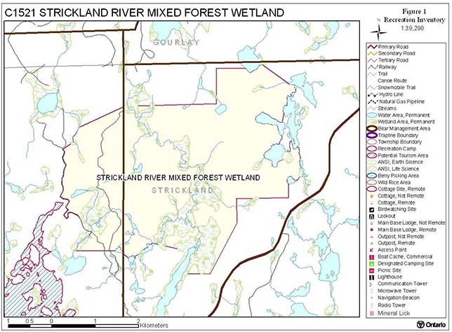
Enlarge Figure 1 - Recreation Inventory map
Appendix B Summary of permitted land and resource uses
| Use | Permitted New | Permitted Existing |
|---|---|---|
| Commercial timber harvest, commercial hydro development | No | No |
| Mineral exploration and mining | No | No |
| Bait fishing, commercial fishing, commercial fur harvesting, wild rice harvesting | Maybe | Yes |
| Sport hunting | Yes | Yes |
| Sport fishing | Yes | Yes |
| Seasonal recreation camps ("hunt camps") | No | Yes |
| Commercial bear hunting | No | Yes |
| Tourism Facilities (for resource based tourism) and recreational trails | Maybe | Yes |
| Land Disposition | No | Yes |
| Roads | No | Yes |
Appendix C Procedural guideline B – land uses – test of compatibility
(PL Procedure 3.03.05)
The Conservation Reserve policy provides broad direction with regard to the permitted uses. The policy provides only an indication of the variety of uses that will be considered acceptable in conservation reserves. The only caution is that "any new uses, and commercial activities associated with them, will be considered on a case by case basis, and, they must pass a test of compatibility to be acceptable." What does a 'test of compatibility' mean? An examination of this must start from the premise of why an area is set aside – specifically, its representative natural heritage values. Criteria are then identified to guide compatibility considerations. These criteria apply to the long-term acceptability of both existing uses and new uses.
- Conformity to SCI/RMP: SCI describe values for which an area has been set aside and the range of appropriate uses that will be permitted in the area. SCI may also speak to the acceptability of other 'new' uses currently not occurring in the area.
The first 'test' is: "do proposed new land uses and/or commercial activities conform to the direction of the SCI/RMP for the conservation reserve? Would the new use(s) depart from the spirit of appropriate indicator land uses in the SCI/RMP?"
- Impact Assessment: If the proposed use(s) pass test 1 it is important to determine their impact on the area before they are approved. This should include the following:
- Impact on natural heritage values: "will the new use(s) impact historical or archaeological values in the area?"
- Impact on research activities: "will the new use(s) affect research activities in the area?"
- Impact on current uses: "will the new use(s) have any negative impact on the array of current uses?"
- Impact on area administration: "will the new use(s) increase administrative costs and/or complexity?" (For example, the cost of area monitoring, security and enforcement.)
- Impact on accommodating the use outside the conservation reserve: "could the use(s) be accommodated as well or better outside the conservation reserve?"
- Impact on socio-economics of the area: "will the new use(s) affect the community(ies) surrounding the area in a positive or negative way?" (For example, will the new use make an area less remote thereby affecting a local tourism industry that is dependent on the area’s remoteness for its appeal?)
- Impact on area accessibility: "does the new use(s) give someone exclusive rights to the area or a portion of the area to the exclusion of other existing uses?"