Land Evaluation and Area Review (LEAR) methodology
Learn about this mapping methodology used to identify and designate prime agricultural areas.
Land Evaluation and Area Review (LEAR) and Agricultural Land Evaluation System (ALES) are two recognized methodologies for informing the designation of prime agricultural areas, if a study is needed. A study using these approaches may be conducted to help identify prime agricultural areas or the agricultural land base more broadly, for designation in official plans. In municipalities where the land outside settlement areas meets the definition of a prime agricultural area, a study may not be required in order to designate the area in an official plan.
This page provides a recommended LEAR approach for identifying and designating prime agricultural areas. LEAR is a commonly used tool in Ontario developed by OMAFRA to quantitatively evaluate the relative importance of lands for agriculture based on the land's inherent characteristics and other factors affecting agricultural potential. LEARs are a starting point to identify prime agricultural areas. LEARs may be supplemented with additional analysis and field verification prior to designating prime agricultural areas.
OMAFRA surveyed LEAR practitioners from across Ontario to learn from their experiences. The Ministry then developed a rigorous LEAR process to use across the Greater Golden Horseshoe (GGH) using consistent factors, datasets, and weightings. This was used to identify areas of agricultural potential using consistent criteria.
The same LEAR methodology has been successfully used outside the GGH, and OMAFRA recommends it be used. Municipalities interested in completing a LEAR should contact the OMAFRA Rural Planner for their area to see what assistance is available.
There are two parts to a LEAR evaluation:
- Land Evaluation (LE), which assesses inherent soil and climatic conditions for agriculture. OMAFRA's CLI mapping is used to identify and compare the agricultural capability for common field crops.
- Area Review (AR), which considers other factors important to agricultural potential such as fragmentation of the land base and how land is used.
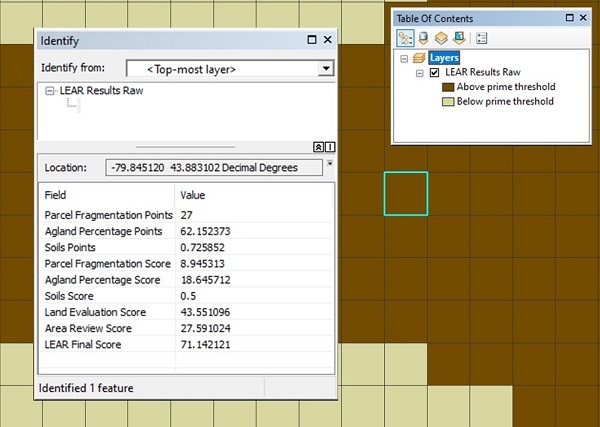
Scores from the LE and AR components are weighted and combined to provide an overall LEAR score for each evaluation unit in the study area. The highest scoring evaluation units represent areas with the greatest agricultural potential. Additional analysis and criteria are involved in delineating prime agricultural areas, including mapping areas with high LEAR scores to identifiable boundaries.
For the Greater Golden Horseshoe LEAR, OMAFRA assigned 60% of the LEAR score to LE factors and 40% to AR factors. Greater weighting was given to the LE score because provincial policy emphasizes the need to recognize the inherent suitability of the land for agriculture. The two AR factors used were: the fragmentation of the land base and the area in agricultural production. Use of these combined factors means that areas may still receive a high LEAR score even if there are a small number of non-agricultural uses and small residential lots because the area as a whole is predominantly in agriculture and the land base is relatively intact.
Once the total LEAR score for each evaluation unit in the study area was calculated, evaluation units with high, medium and low scores were grouped based on specific threshold scores arrived at through sensitivity analysis and consultation.
Principles for LEAR studies:
- Alignment with provincial objectives and policies.
- Use of the most recent and robust data available for the entire study area.
- Factors are mutually exclusive to avoid double counting.
- The number of factors is limited to avoid diffusing the importance of each factor.
- Factors are well-reasoned and understandable to the public, agricultural stakeholders and decision-makers.
- The method addresses differences between municipalities.
- A balanced approach is used where agriculture and natural heritage overlap.
Additional detail is provided in the Agricultural System Mapping Method (OMAFRA, 2018). This document is available on request to OMAFRA's Agricultural Information Contact Centre,