Forest fire activity
Current fire activity
Information about the current forest fire danger, forest fire activity and fire restrictions across the province.
Interactive fire map
View the new and active fire situation and restricted fire zones. Most of the data used in the Interactive Map is available on Ontario GeoHub.
Report a fire

North of the French and Mattawa Rivers, call

South of the French and Mattawa Rivers, call 911.
Public safety
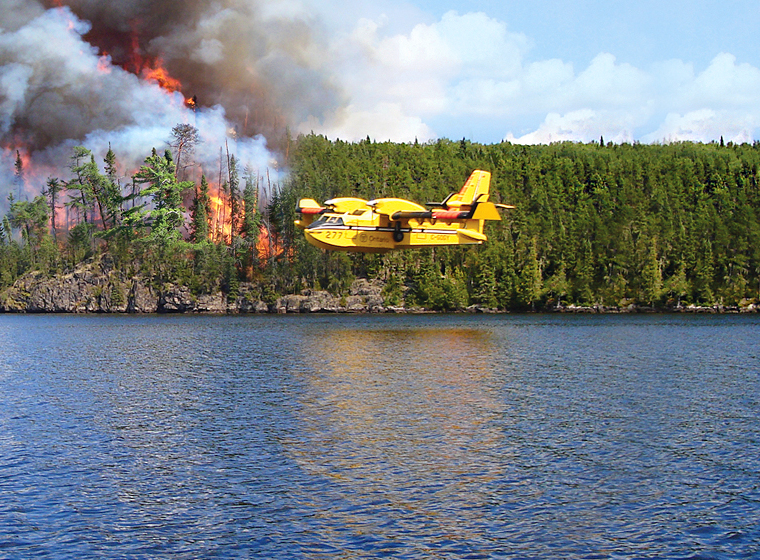
Drones, waterbombers and airspace around forest fires
Learn about the safety rules in the airspace around active forest fires and stay safe on Ontario’s waterways.
Burn grass and woody debris safely
Learn how to burn grass and woody debris safely in Ontario.
Outdoor fire restrictions
Outdoor fire restrictions
Find out about current outdoor fire restrictions and what restricted fire zones mean for you.
Outdoor fire rules and permits
Learn the rules and regulations for outdoor fires in Ontario.
Industrial operators
Learn about the regulations for industrial operations in and near forested areas.
Fire prevention
Prevent forest fires
Learn how to prevent fires while fishing, hunting, camping or hiking outdoors.
FireSmart your property
Tips to keep your home, cottage and property safe from the impacts of forest and wildland fires.
How we manage wildland fires
Fire management
Learn how Ontario manages and responds to forest and wildland fires.
Join our team
How to apply for a job as an Ontario FireRanger or Type 2 wildland firefighter and learn about other seasonal and temporary opportunities.
Wildland fire behaviour
Explore the science behind forest and wildland fires and how fire impacts the ecosystem.
Aviation services
Learn how our aviation services support forest fire suppression and find information for air operators.
Prescribed burns
Find out about upcoming prescribed burns in Ontario.
Emergency preparedness
Learn how to prepare for other emergencies in Ontario, such as a flood.
Contact us
For general information or questions, follow us on: