Forest Resources Inventory
Learn about Ontario’s Forest Resources Inventory (FRI), a large-scale survey of the province’s forests and wetlands.
About
The Forest Resources Inventory (FRI) provides information about tree species, including their:
- composition
- range
- age
- distribution
Ontario’s forest resource inventories allow us to support resource management and land use decisions, and help sustain healthy, natural environments.
Forest resource inventories for each forest management unit are legally required under the Crown Forest Sustainability Act (1994). Every 10 years, the ministry creates a new forest management plan where inventory data is updated and must be compliant with the requirements detailed in the Act.
Ontario’s FRI is also used to meet provincial, federal and international reporting requirements.
Forest Resources Inventory area
An enhanced forest inventory covers about 555,000 square kilometres of forest land and wetlands. This land falls in areas that are:
- designated forest management units
- selected large parks adjacent to those designated forest management units, formerly referred to as the Area of the Undertaking (AOU)
- the southern portion of the Far North
Different inventory techniques are used to capture and map land cover information for both the Far North (Far North Land Cover) and areas in Southern Ontario (Southern Ontario Land Resources Information System).
Map of Forest Management Units
The Forest Resources Inventory area includes:
- lands licensed to the forest industry
- non-licensed areas within:
- designated forest management units
- provincial parks, national parks, and protected areas
- private lands (see Figure 1)
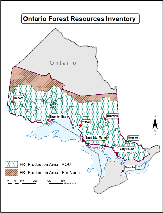
Figure 1. Area surveyed for Ontario’s enhanced Forest Resources Inventory from 2007–2017, included the Area of the Undertaking and southern parts of the Far North. The area captured by the FRI program, with a full set of FRI attributes and delivery schedule, can sometimes change depending on information needs. For example, in 2007–2017, the FRI included the AOU and southern portion of lands designated as Far North, but the inventory areas in 2018–2028 do not include those Far North lands.
Investing in advanced technologies and approaches
Ontario’s forest industry requires accurate forest cover information and detailed inventory information on the location, quantity and quality of forest products within a forest management unit.
Earlier versions of the Forest Resources Inventory were based on digital aerial photo interpretation and field surveys. More recently, the Ontario government invested $84.5 million in modern techniques to collect more accurate information about the wood supply in Ontario. We are now using aerial imagery and remote sensing technologies, including Light Detection and Ranging (LiDAR), to improve forest inventory information to better inform forest management planning and decision-making.
As part of this enhanced approach, up to $19 million will be invested to conduct field surveys to:
- calibrate LiDAR data
- develop forest growth models
- report on the status of forest resources
Benefits of modernization
Reliable and detailed forest inventory information is essential for planning and operational decision-making to manage forest sustainability.
LiDAR is a technology that we can use to measure forest structure and land cover, resulting in a three-dimensional image that provides accurate tree height and ground elevation information. This laser measurement is more accurate and detailed than previous manual interpretation methods of aerial photos. When combined with field-based measurements, we can use LiDAR to generate other estimates, such as wood volume and basal area. Overall, investments in a modernized forest inventory will provide more detailed, accurate and precise information beyond what is available by conventional inventory means.
How the inventory is made
Inventory data sets are updated to reflect all changes that occur within the forest. Changes in forest areas may include the following:
- regeneration of areas previously affected by disturbance and land use change (for example, abandoned agriculture land, road construction, etc.)
- harvested trees to produce forest products
- trees lost or damaged by wildfire, insects, disease or wind
- tree growth and forest succession
Information from forest resource inventories provides the basis for major forest resource planning and ministry policy decisions.
Integrating LiDAR technology into the inventory process, combined with a statistically designed field program, provides for more timely inventory data as some of the processing is now automated – thereby shortening the inventory production period. The current production of FRI inventories involves several steps:
- Acquiring LiDAR and optical data for the inventory area.
- Processing the data to develop terrain and forest canopy model products.
- Assessing the quality of the data and products developed.
- Acquiring field data for modelling and validation.
- Combining LiDAR and field data to generate predictive models and forest attributes.
- Mapping forest attributes and making inventory products available.
- Continuous maintenance of forest inventory.
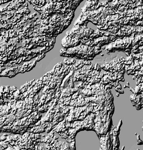
Digital terrain models are generated from LiDAR and optical data, and they provide accurate and detailed views with:
- roads
- lakes
- trees
- urban areas
- residential areas
This digital terrain model product allows us to prepare a three-dimensional model for photo interpretation.
Contact
Email us at info.mnrfscience@ontario.ca for more information.