Minister’s Annual Report on Lake Simcoe, 2015
This Annual Report summarizes implementation actions taken during 2015, as well as advice received from the two Minister’s advisory committees.
Lake Simcoe is the largest inland lake in southern Ontario, and is home to a natural heritage that includes wetlands, woodlands and wildlife and fish habitats, as well as more than 435,000 people. The Lake Simcoe Protection Act (2008) was the first legislation in Canada to focus on a watershed and the Lake Simcoe Protection Plan (the Plan), which was established in 2009, was the first of its kind in Ontario to address identified threats to the Lake Simcoe watershed. Implementing the Plan continues to be a key priority for the province.
Our detailed Lake Simcoe 2014 Monitoring Report, released in March 2015, provided an overview of results from our monitoring and research on the lake up to 2012. The Minister’s Five-Year Report on Lake Simcoe, released in October 2015, described the actions taken in the first five years of Plan implementation. This 2015 Annual Report highlights how our work undertaken since the release of the Five-Year Report has continued to focus on phosphorus loading to the lake, as well as addressing emerging priorities such as chloride levels and climate change adaptation.
The long-term monitoring data up to 2015 indicates that the health of the Lake Simcoe ecosystem has continued to improve. Since the 1980s, springtime phosphorus levels in the lake have decreased significantly, and the end-of-summer deepwater dissolved oxygen has significantly increased to levels that are much more favourable for aquatic life. With these water quality improvements, naturally occurring coldwater fish populations such as Lake Trout, Lake Whitefish and Cisco (also known as Lake Herring) continue to respond positively. Notably, in January 2015, a recreational fishing season for Cisco was re-opened for the first time in 14 years.


The province is continuing to monitor, research and learn about the lake. Working with partners we are using the results to guide our adaptive management decisions and actions to help restore and protect the health of Lake Simcoe.
Our vision for Lake Simcoe includes:
- a healthy environment where communities can enjoy all of the recreational and economic benefits of living within the watershed
- a healthy ecosystem for the many native species of fish, wildlife and plants that make Lake Simcoe a treasured resource
- natural shorelines where development is well-planned and sustainable for future generations
- greater cooperation and leadership among all partners who work to protect the lake
Water Quality
Emerging Concern: Winter Salt
Results from research undertaken by the Lake Simcoe Region Conservation Authority (LSRCA) and other partners have identified a cause for concern when it comes to the use of winter salt in parking lots and roads. In an average winter, an estimated 90,000 tonnes of salt is applied in the Lake Simcoe watershed. Decisions on application rates on parking lots are largely based on concerns about liability rather than industry-led guidance on appropriate standards of care. In a survey conducted by the University of Waterloo, many contractors indicated a lack of certainty about how much they were applying. Follow-up research by the University of Waterloo has found that an application rate of 60 to 75 grams per square metre (g/m2) is sufficient to regain bare pavement within an hour of most winter snow events. Parking lot monitoring in the Lake Simcoe watershed is indicating that seasonal contractors can over-apply salt by more than 20 per cent. In a single application, rates across a commercial lot were seen to vary from 60g/m2 to as high as 4,766g/m2.
High levels of chloride flow into tributaries and eventually into the lake. At times, the chloride levels in some tributaries are high enough to potentially disrupt ecosystem functions.
The Ministry of Environment and Climate Change (MOECC) and the LSRCA are working with partners to reduce chloride by:
- monitoring salt application rates and chloride concentrations in surface and storm water to better understand cumulative effects;
- mapping salt vulnerable areas and promoting methods to reduce chlorides through road salt management with municipal and private stakeholders; and
- continuing to work with the Smart About Salt program to train property owners and contractors on ice/snow control practices.
Sewage Treatment Plants (STPs)
All sewage treatment plants in the watershed are now meeting their reduced phosphorus concentrations and annual loading limits. These reduced limits as set out in the Phosphorus Reduction Strategy have led to improvements in phosphorus removal technology. Even with significant population growth, the STPs in the Lake Simcoe watershed are now some of the most effective at removing phosphorus in Ontario. The total phosphorus reduction from the 1980s to 2015 is approximately 30 tonnes.
Septic systems
Phase 1 of the septic inspection program has now been completed by watershed municipalities. They have completed inspections of all septic systems within 100 metres of Lake Simcoe, and have committed to a five year re-inspection cycle. Municipalities will be continuing with Phase 2 of the program so that septic systems near ponds, permanent rivers or streams will also have been inspected and put on a re-inspection cycle. More than 6,000 copies of a SepticSmart DVD, educational booklets, and checklists have now been produced and distributed across the province by the Ministry of Agriculture, Food and Rural Affairs (OMAFRA) to assist land owners with properly maintaining their septic systems.
Low Impact Development
One of the major sources of pollution to the lake is from urban stormwater. Watershed stakeholders are recognizing the value and opportunity of being trend setters in the use of Low Impact Development (LID) to reduce this type of run-off. LIDs use innovative design techniques that are modelled after nature to infiltrate, filter, store, evaporate and detain rainwater close to its source.
Collaborative work with the LSRCA has included the development of LID and stormwater policies to be incorporated into municipal official plans and the delivery of training on LID opportunities in watershed municipalities. Several LID demonstration sites were completed in 2015, including one in Newmarket on Forest Glen Road that was also supported by the Town of Newmarket and Environment and Climate Change Canada. This project is an excellent example of how LID features can be used instead of traditional curbs and gutters to manage stormwater. This work included the creation of a LID feature, called a bioswale, to help to increase infiltration and groundwater recharge, and reduce erosion and maximize flood control at Western Creek.

LID techniques are also very effective when implemented by individual home owners. The use of residential rain gardens to reduce the impact of stormwater run-off was showcased at the 2015 Canada Blooms Festival. With support from the province, Parklane Nurseries created a 278 square meter interactive garden space with four demonstration rain gardens, permeable paving applications, functional artistic downspouts, water conservation methods, native planting schemes and aesthetic low impact development techniques that home owners could implement to reduce residential stormwater run-off.

Bio-filter Technology
OMAFRA supported research in the Lake Simcoe watershed to assess the effectiveness of woodchip filters to improve water quality. Study sites involved treating run-off water from a greenhouse and a carrot, sod, and cash crop farm. Results showed that woodchip filters can be effective in reducing particulate phosphorus in run-off from farmland. OMAFRA is looking at ways to support farmers in the wider adoption of this practice where applicable.
Phosphorus Offsetting
The Lake Simcoe Region Conservation Authority is piloting a phosphorus offsetting project (LSPOP) to improve and protect water quality. The LSPOP will use tools such as low impact development practices to manage phosphorus discharges from new residential construction and will create opportunities to invest in stormwater retrofits. It will also encourage innovation in the design of new residential development.
Water Quantity
Water Budgets
MOECC have worked with partners to complete Tier 2 Water Budget studies for all the Lake Simcoe subwatersheds, which provides us with a complete groundwater model representation for the entire Lake Simcoe Basin. These groundwater flow models will help us improve our management of our water resources and provides critical information for subwatershed planning.
In-Stream Flows
LSRCA, with support from the province, is continuing to lead research to estimate the flows required to maintain healthy aquatic ecosystems in the watershed. Through our research project we are learning more about how the flow fluctuates during storm events and different seasons. Generally, concern has focused on low flows; however, recent work in the Lover’s Creek Subwatershed has highlighted that high flows are creating a surge-like flow that may result in erosion and reduced stability of the stream banks. The results from flow research provide information to inform actions that can be taken to mitigate issues caused by high flows; for example, mitigation measures like LID can be implemented to reduce the pressure caused by heavy rain events.
Water Smart Farming Project
With support from the province, water use assessments were conducted with farmers to optimize water use in the barn and in fields that they are irrigating. By providing farmers with better information about their water use, they are often able to reduce or optimize their water consumption, cut costs and implement lower cost water treatment systems.
Protecting and Restoring Natural Heritage
The Ministry of Natural Resources and Forestry (MNRF) is continuing to assess and rehabilitate spawning and nursery habitat along Lake Simcoe shorelines, support pilots to demonstrate effective shoreline naturalization, restore priority sites in stressed subwatersheds and support the restoration of priority wetland habitat with partners.
Shoreline Management
The MNRF is leading the development of a Shoreline Management Strategy that will address best management practices for the shoreline including restoration, protection and land use planning. The strategy is being developed with input from stakeholders around the watershed, including municipalities. Upon completion of the Shoreline Management Strategy, municipal official plans shall be amended to ensure they are consistent with the recommendations of the strategy.
ReWilding
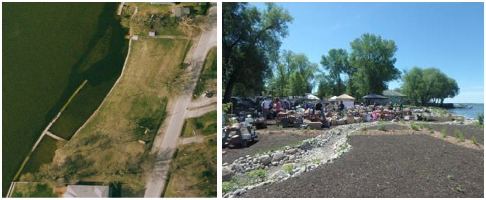
With support from the province, ReWilding Lake Simcoe, an initiative of the Ontario Water Centre, undertook a diverse range of activities to pilot an innovative way of restoring underperforming or ‘forgotten’ public shoreline spaces. Four sites identified as experiencing waterway impacts due to environmental degradation were selected as project sites to rewild. Walkabouts, design labs, idea campaigns, and best life workshops were held to help determine how rewilding the spaces would best meet the needs of both people and nature simultaneously. Construction on the sites was completed in 2015 and showcased stormwater innovation in their final design.
Terrestrial Monitoring
The MNRF is currently partnering with the University of Toronto to continue implementing a terrestrial monitoring protocol throughout the watershed. The protocol gathers local data from four years of field work and is being used to index and document high quality natural cover in the watershed in order to assess progress towards the Plan’s targets. This local data is also being linked to broader landscape data to support development of a terrestrial monitoring strategy. With the terrestrial monitoring strategy, MNRF will be able to determine the proportion of high quality natural vegetative cover, and make forecasts that would allow the implementation of timely watershed management actions.
Other Threats
Invasive Species
In 2015, the province launched a program with Boating Ontario to demonstrate to boaters how to clean their boats and other watercraft to reduce water quality pollution and the spread of invasive species.
MNRF also continues to encourage anglers to properly dispose of bait fish to help minimize invasive species through programming such as Operation Bait Bucket.
The MNRF has delivered a number of invasive species outreach/education initiatives with partners, including:
- Updated the Lake Simcoe Watch List;
- Held Invasive Species workshops for landowners;
- Distributed awareness materials in the watershed;
- Operated mobile boat washing stations; and
- Promoted awareness of the invasive species Early Detection and Distribution Mapping System - EDDMapS Ontario. This work included the installation of trailhead signs for EDDMapS by municipalities, land trust groups, Conservation Authorities, and the Chippewas of Georgina Island First Nations.
To date, EDDMapS has received 2,322 reports of invasive species being observed in the Lake Simcoe watershed.
Invasive Species Rapid Response
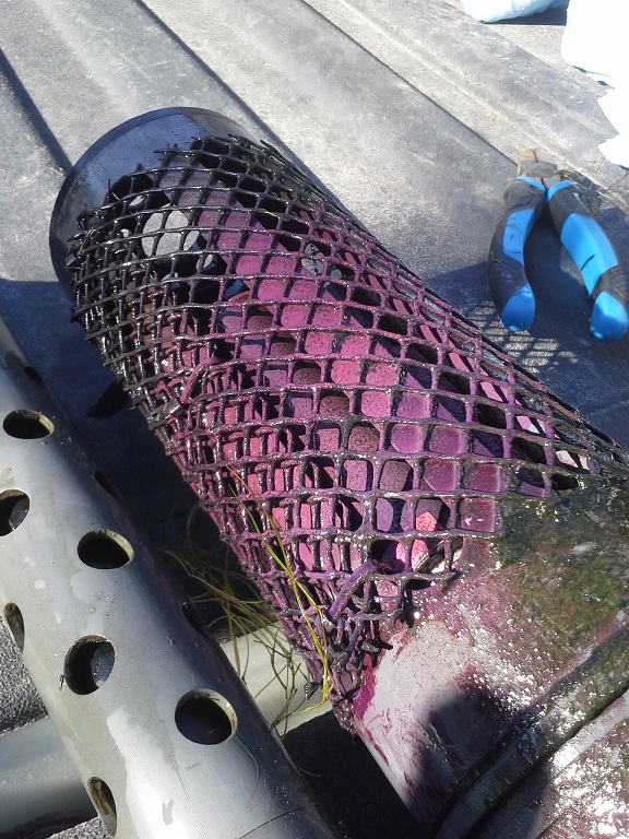
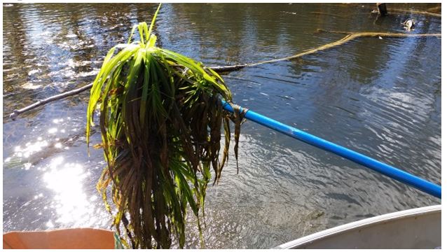
MNRF has developed a system whereby appropriate actions are taken when invasive species are reported. For example, after detecting the presence of Water Soldier—an invasive aquatic plant—in the Black River in the fall of 2015, MNRF took swift and targeted action. They designed and implemented a Response Plan to eradicate the relatively small population (under 1 hectare) before it could take hold. Containment of the plant colonies, manual extraction, and herbicide applications were immediately implemented. Continued rapid response, effectiveness monitoring and reconnaissance for new colonies are taking place.
These efforts have continued in 2016, targeting the minimal regrowth from the 2015 colonies as well as a new colony found upstream. The MNRF have prioritized outreach in the community through the use of awareness signage and by holding an open house in September. This rapid response in the Black River, built on the experience of past work in the Trent River, will provide lessons for other collaborative response efforts to control the introduction of invasive species.
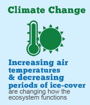
Climate Change
The MOECC is continuing to support work that will help us adapt to climate change, including working closely with the LSRCA to implement LID approaches across the watershed. For example, the LSRCA recently approved revised watershed development policies, LID and Stormwater policies to be incorporated into municipal official plans. In addition, LSRCA has offered and delivered training on LID opportunities to municipalities to help them adapt to impacts associated with climate change.
The MOECC also continues to work with the Chippewas of Georgina Island First Nation (CGIFN) to collect Traditional Ecological Knowledge about changing climate and weather, plants and animals, land and water. This knowledge will be used to develop Climate Change Adaption Strategies for three First Nation communities around the watershed.
Local Priorities
Subwatershed Plans
Subwatershed plans evaluate area-specific hydrologic and hydrogeologic functions and natural heritage resources, and are intended to help guide planning, monitoring, and stewardship decisions.
In 2015, with support from the province and watershed municipalities, the LSRCA completed the Ramara Creeks Subwatershed Plan. The Whites Creek and Upper Talbot subwatershed plans and the Georgina Island First Nation Plan are scheduled for completion in 2016. The completion of these two plans in 2016 means that every major subwatershed flowing into the lake will have a plan.
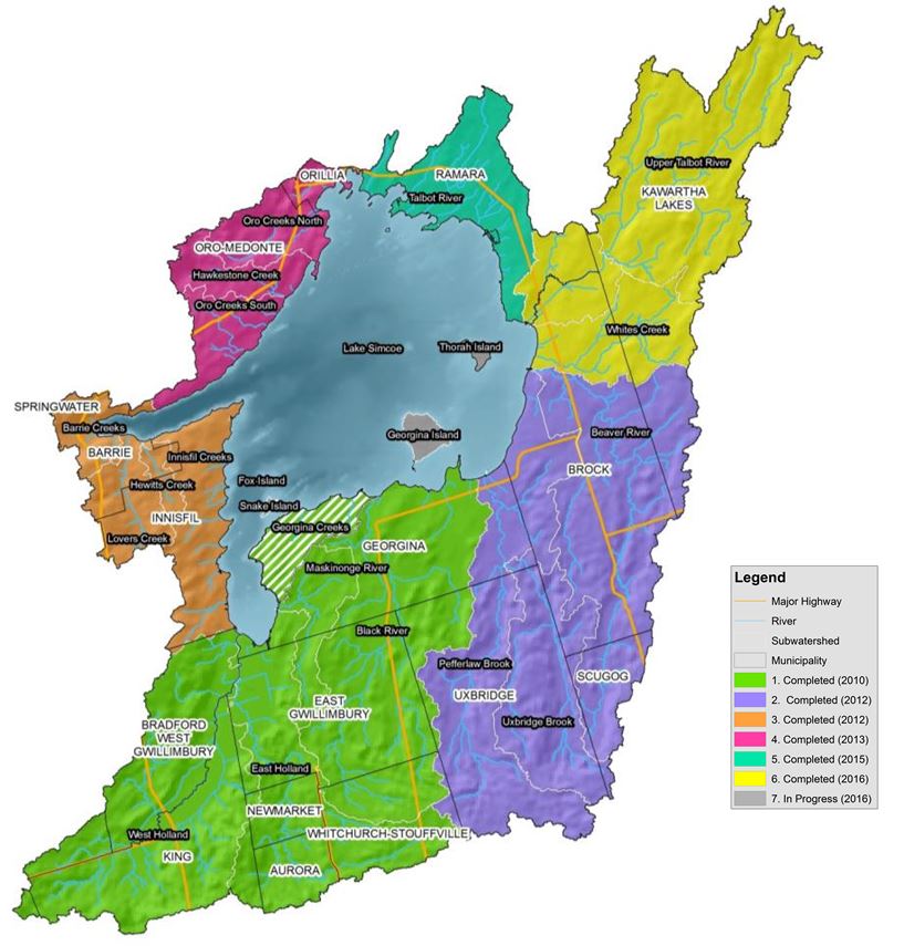
LSRCA in collaboration with partners has been implementing subwatershed plan recommendations since the first plan was completed in 2010. In 2015, 44 of 57 recommendations were completed or on target for completion. The types of projects being undertaken as a result of the subwatershed plan recommendations include improving stormwater management, safe wildlife passage, professional training and winter salt management.
All completed subwatershed and implementation plans can be found on the LSRCA website.
Stewardship
With support from the MOECC, the LSRCA created a Stewardship Priorities and Opportunities Tool (SPOT). The SPOT identifies for interested organizations and partners restoration projects related to improving fish habitat, increasing forest cover or applying LID features to manage stormwater within the Lake Simcoe watershed. This web-based interactive mapping tool uses monitoring data to prioritize locations and projects that would achieve the greatest benefit to watershed health.
The province collaborated to deliver the Lake Simcoe Southeastern Georgian Bay Community Stewardship Program with the Dufferin South Simcoe Stewardship Network. The MNRF supported pilots to demonstrate effective shoreline naturalization and restoration of priority sites in stressed subwatersheds.
The MNRF also continued to work with Ontario Streams and other partners to identify and enhance critical tributary fish spawning and nursery habitat, restore the Lake Simcoe shoreline, remove invasive species, and restore native components of the aquatic community to Lake Simcoe (i.e. wild rice and Muskellunge).
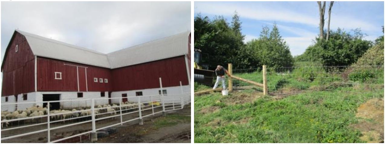
OMAFRA worked with Kawartha Conservation and local farmers to complete several stewardship projects on livestock farms in the Talbot River watershed.
Sharing Knowledge
Sharing the knowledge learned through research and monitoring on Lake Simcoe with our partners is an important priority.
Research
Provincial staff hosted the third biennial Lake Simcoe Science Forum at the Latornell Conference in November 2015 to share how our management actions are helping to protect and restore the lake.
Engagement
The implementation of the Plan at local levels requires leadership and commitment from watershed municipalities. To support this, MOECC held two workshops in March 2015 in Barrie and Sunderland with representatives from watershed municipalities to give them an opportunity to share their experiences and best practices for implementing the Plan. Over forty-five staff from twenty-one municipalities attended.
MOECC worked in partnership with Ryerson University to design and create a guide for festival organizers and tourism organizations that supports their efforts to adopt best management practices for making festivals in the Lake Simcoe watershed more sustainable. The Mariposa Folk Festival implemented recommendations found in the Guide to Green Festivals in their planning. For their efforts, they were awarded the Tourism Industry Association of Ontario (TIAO) Award of Excellence for Sustainable Tourism at the Association’s 11th Annual Ontario Tourism Summit.
The Explore Lake Simcoe Project (ELS) was developed by Tourism Barrie in partnership with the MOECC to assist small-to-medium size businesses, with a focus on tourism operators, to set targets and develop action plans to reduce the environmental impact of business choices. The project was focused on encouraging businesses to incorporate sustainable practices into daily operations and long-term goals. Sector-specific greening toolkits were developed and are being used by business operators to assess current practices and identify green initiatives they wish to adopt. The ELS Project contacted over 300 businesses in a variety of sectors, including marinas, golf courses, outfitters and accommodations, to set up individual meetings. Sixty-five businesses have worked one-on-one with the ELS Project Coordinator and nineteen businesses have committed to working on applying new sustainable business practices to their operations.
MOECC also provided support to the Ontario Water Centre to create an interactive graphic on the Our Lake Simcoe website to help the engage the public on the goals of the Lake Simcoe Protection Plan.
Advice from the Minister’s Advisory Committees
Two publicly appointed Committees were established in 2010 under the Lake Simcoe Protection Act – the Lake Simcoe Coordinating Committee and the Lake Simcoe Science Committee. These committees provide advice to the Minister of the Environment and Climate Change on the implementation of the Lake Simcoe Protection Plan and the ecological health of the Lake Simcoe watershed.
In addition to regular advice provided to provincial staff during committee meetings, the committees submitted three joint priority recommendations in 2015 to the Minister to support Lake Simcoe Protection Plan implementation. Advice provided by the committee informs the adaptive management process and focused on three key themes:
- Continued innovation is required to meet the Lake Simcoe Protection Plan targets. The Lake Simcoe initiative should be a provincial model for both technological and social innovation on a watershed basis;
- The Lake Simcoe Climate Change Strategy should be linked into broader provincial climate change initiatives. All stakeholders associated with the Lake Simcoe Protection Plan can, and should, play a strong role in climate change initiatives which can demonstrate how local actions can assist in addressing the challenges of global change; and
- The Lake Simcoe Protection Act and Lake Simcoe Protection Plan represent an international model for integrated watershed management and coordinating. Further integration of local partners should be addressed in order to improve efficiencies and effectiveness in science, research, stewardship, monitoring and reporting.
Other considerations that the committees asked the Minister to take under advisement included:
- Continued funding for modernizing stormwater management through innovation and resources;
- Improved alignment between the Growth Plan and Lake Simcoe Protection Plan;
- Improvement in shoreline protection;
- Implementation of a Lake Simcoe Phosphorus Offsetting Program;
- Reducing the impact of emerging contaminants, such as pharmaceuticals and personal care products, and especially winter salt; and
- Development of an environmental monitoring program to assess the status and trends of the terrestrial natural heritage systems and features.
The province has continued its commitment to take strong action to protect and restore the ecological health of Lake Simcoe and its watershed and would like to thank all committee members for their commitment to Lake Simcoe and for providing us with their best advice.