Size and location of Urban Growth Centres in the Greater Golden Horseshoe
The following size and location mapping is being released for use in implementing the Growth Plan for the Greater Golden Horseshoe, 2006. The urban growth centre identification does not confer a land use designation. Any development on lands within the urban growth centre boundary is still subject to the applicable provincial plans and relevant provincial and municipal land use planning policies and approval processes.
Note that maps are shown at different scales:
- Urban growth centres that will be planned to achieve 150 residents and jobs per hectare are presented at a scale of 1:25,000.
- Urban growth centres that will be planned to achieve 200 residents and jobs per hectare are presented at a scale of 1:30,000.
- Urban growth centres that will be planned to achieve 400 residents and jobs per hectare are presented at a scale of 1:40,000.
The information displayed in illustrations and base maps in this document has been compiled from various sources, may not accurately reflect approved land-use and planning boundaries, may not be to scale, and may be out of date. The Province of Ontario assumes no responsibility or liability for any consequences of any use made of these illustrations and maps.
First Nations lands are not subject to Ontario's land use planning system and First Nations reserve lands are not in the Growth Plan area.
Downtown Barrie Urban Growth Centre
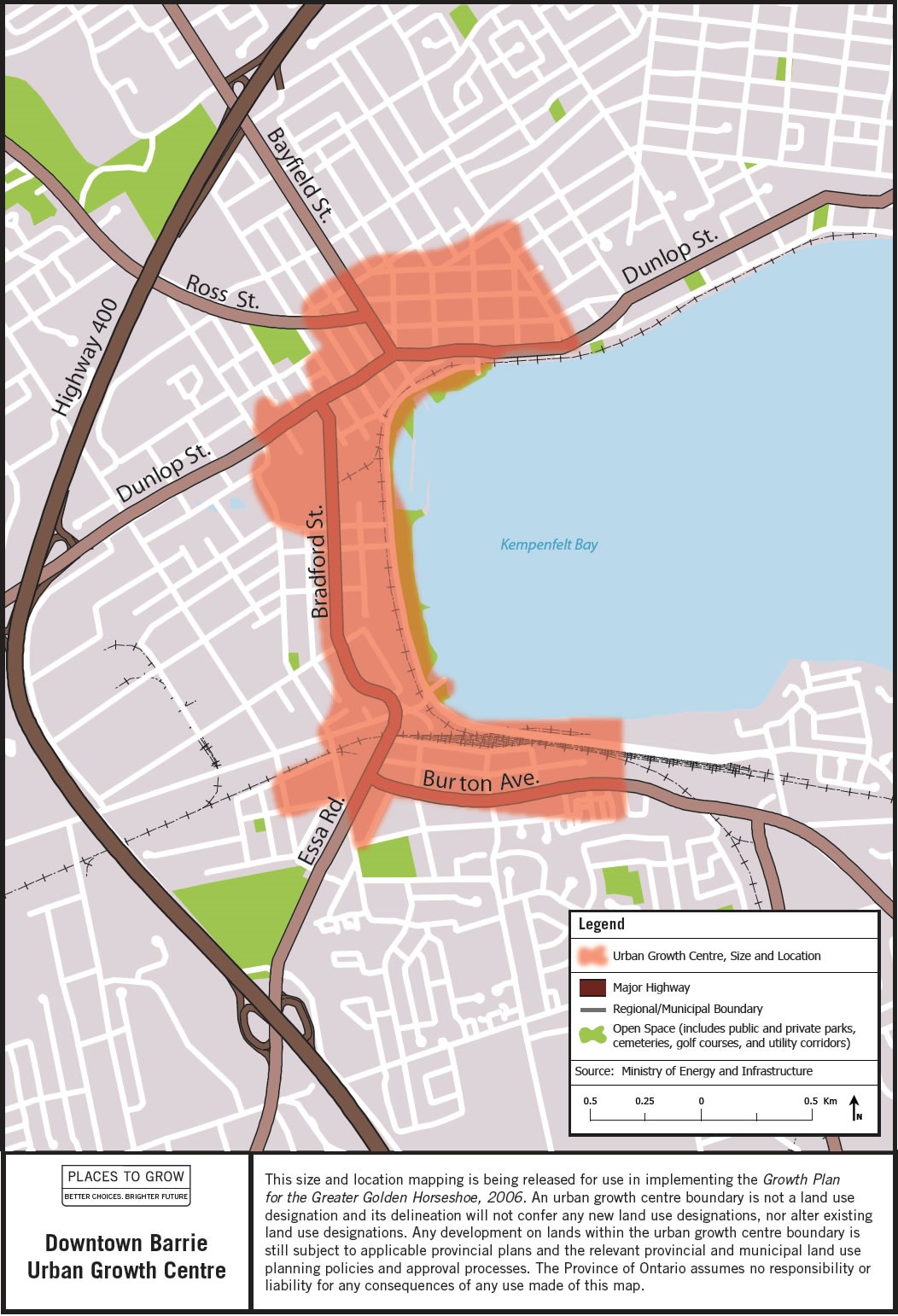
Image description: Map of the approximate size and location of the Downtown Barrie Urban Growth Centre in the vicinity of Bradford Street and Burton Avenue.
Downtown Brampton Urban Growth Centre
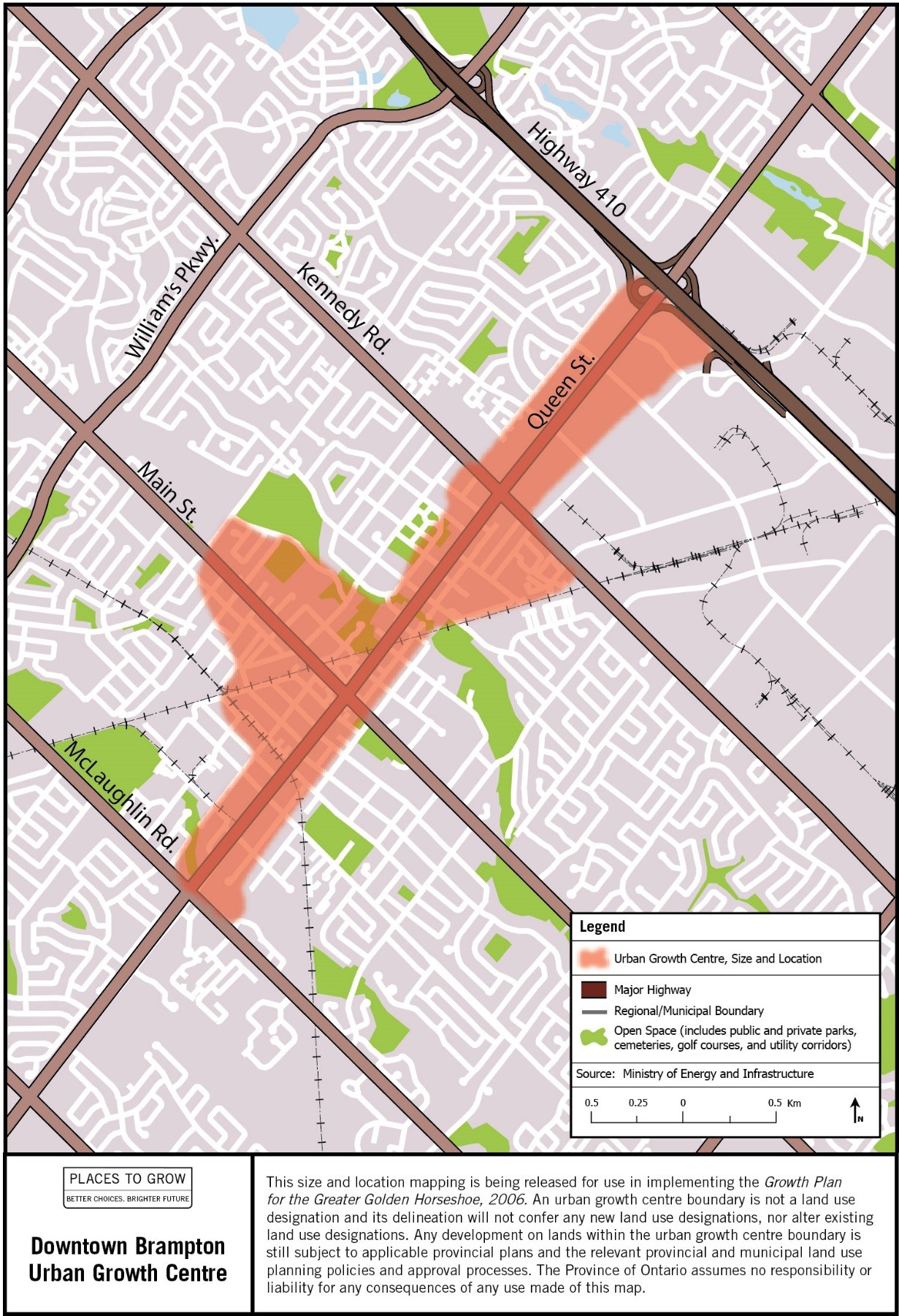
Image description: Map of the approximate size and location of the Downtown Brampton Urban Growth Centre in the vicinity of Queen and Main Streets.
Proposed Downtown Brantford Urban Growth Centre
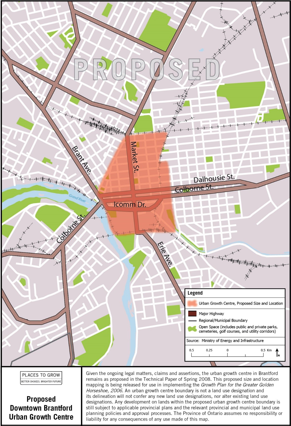
Image description: Map of the approximate size and location of the Proposed Downtown Brantford Urban Growth Centre in the vicinity of Market and Dalhousie Streets.
Downtown Burlington Urban Growth Centre
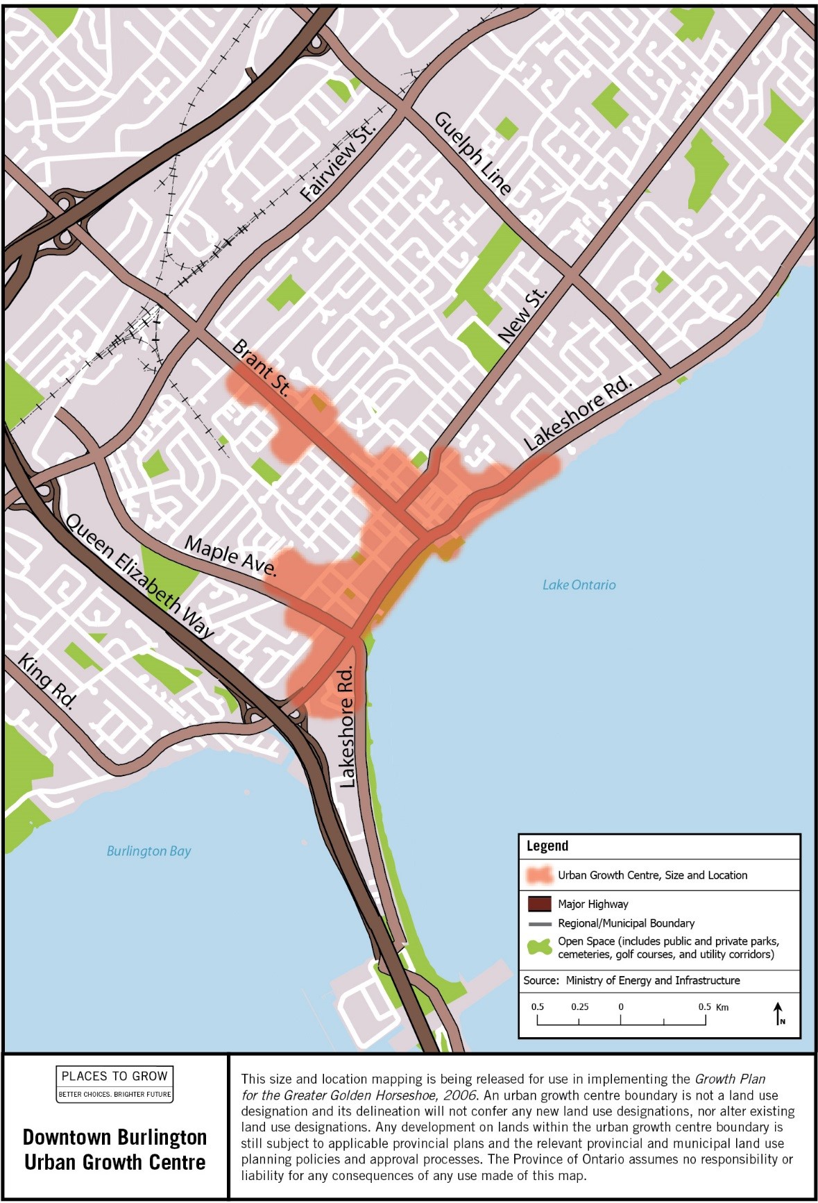
Image description: Map of the approximate size and location of the Downtown Burlington Urban Growth Centre in the vicinity of Brant Street and Lakeshore Road.
Downtown Cambridge Urban Growth Centre
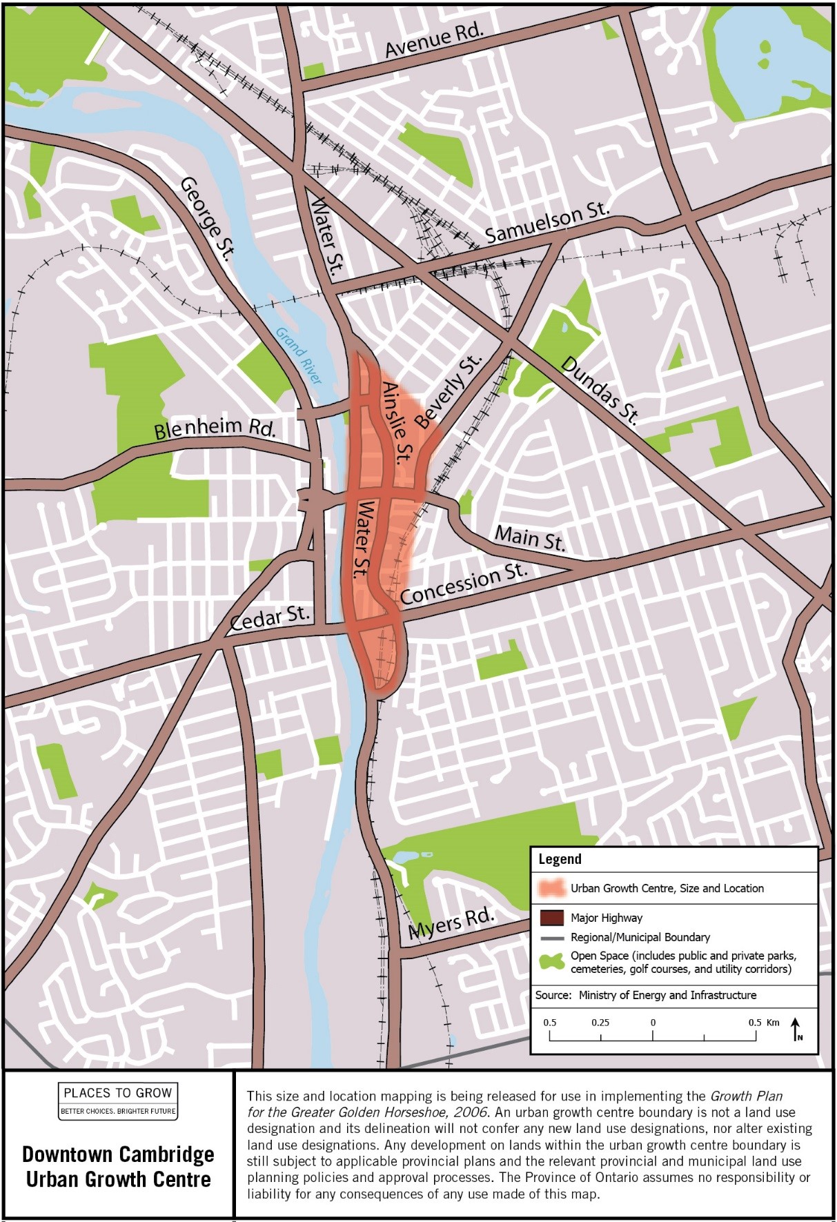
Image description: Map of the approximate size and location of the Downtown Cambridge Urban Growth Centre in the vicinity of Water and Concession Streets.
Downtown Guelph Urban Growth Centre
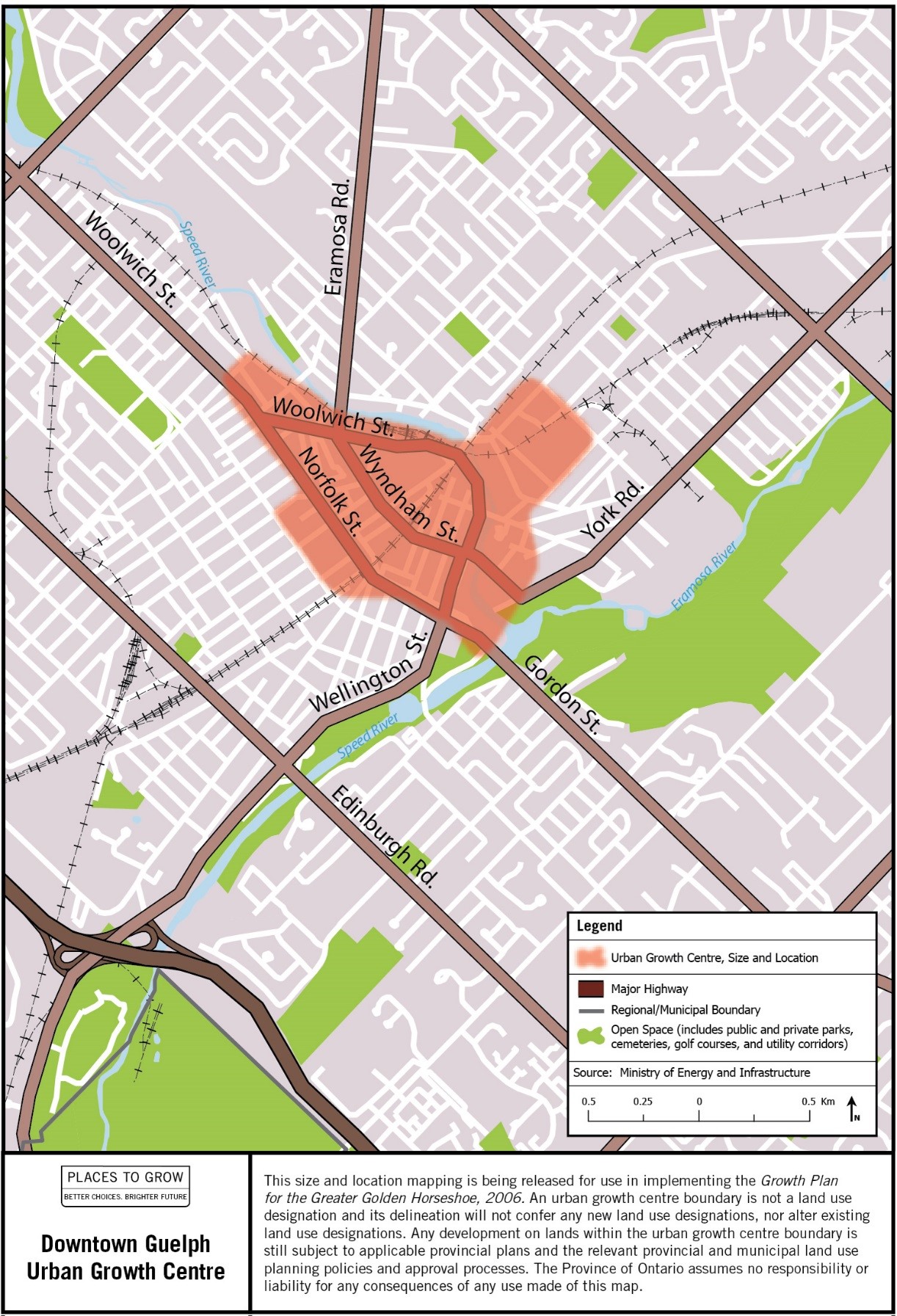
Image description: Map of the approximate size and location of the Downtown Guelph Urban Growth Centre in the vicinity of Wyndham and Woolwich Streets.
Downtown Hamilton Urban Growth Centre
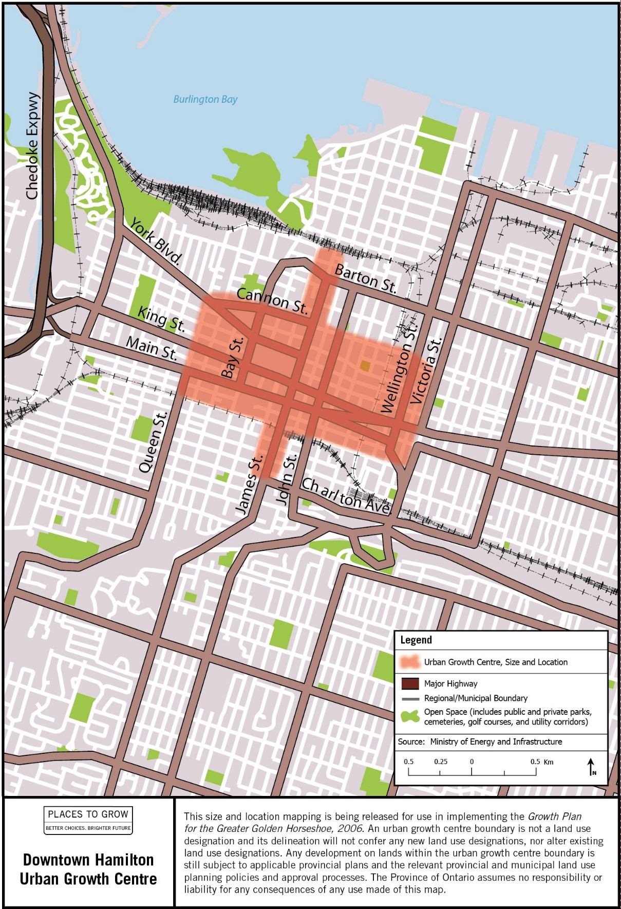
Image description: Map of the approximate size and location of the Downtown Hamilton Urban Growth Centre in the vicinity of James and King Streets.
Downtown Kitchener Urban Growth Centre
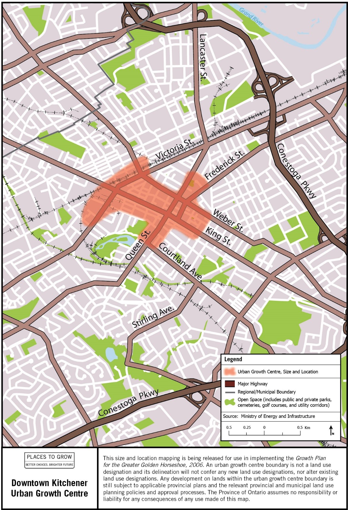
Image description: Map of the approximate size and location of the Downtown Kitchener Urban Growth Centre in the vicinity of King and Queen Streets.
Markham Centre Urban Growth Centre
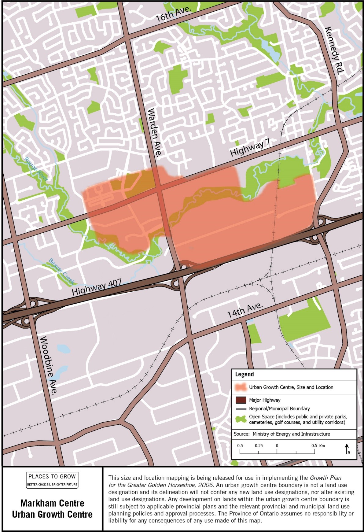
Image description: Map of the approximate size and location of the Markham Centre Urban Growth Centre in the vicinity of Warden Avenue and Highway 7.
Downtown Milton Urban Growth Centre
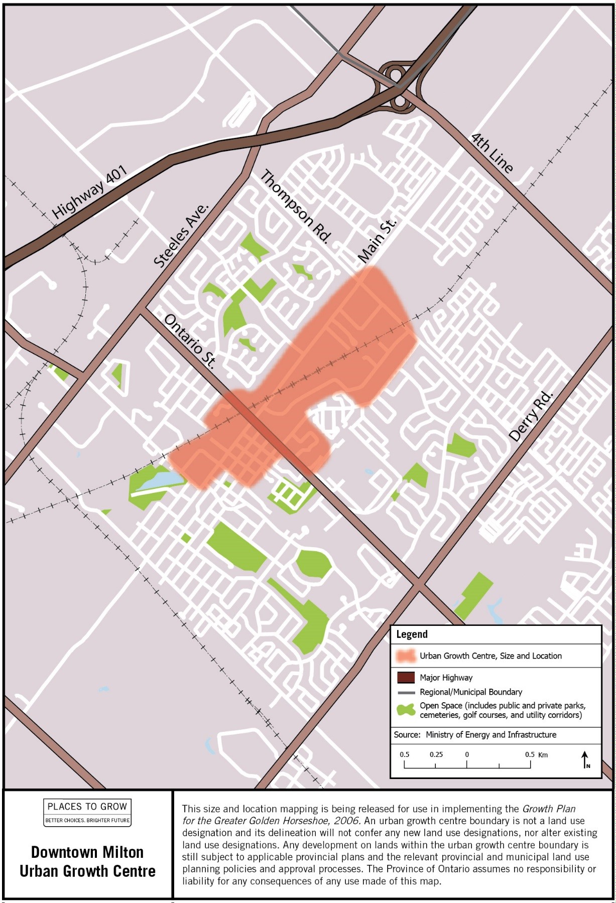
Image description: Map of the approximate size and location of the Downtown Milton Urban Growth Centre in the vicinity of Ontario and Main Streets.
Mississauga City Centre Urban Growth Centre
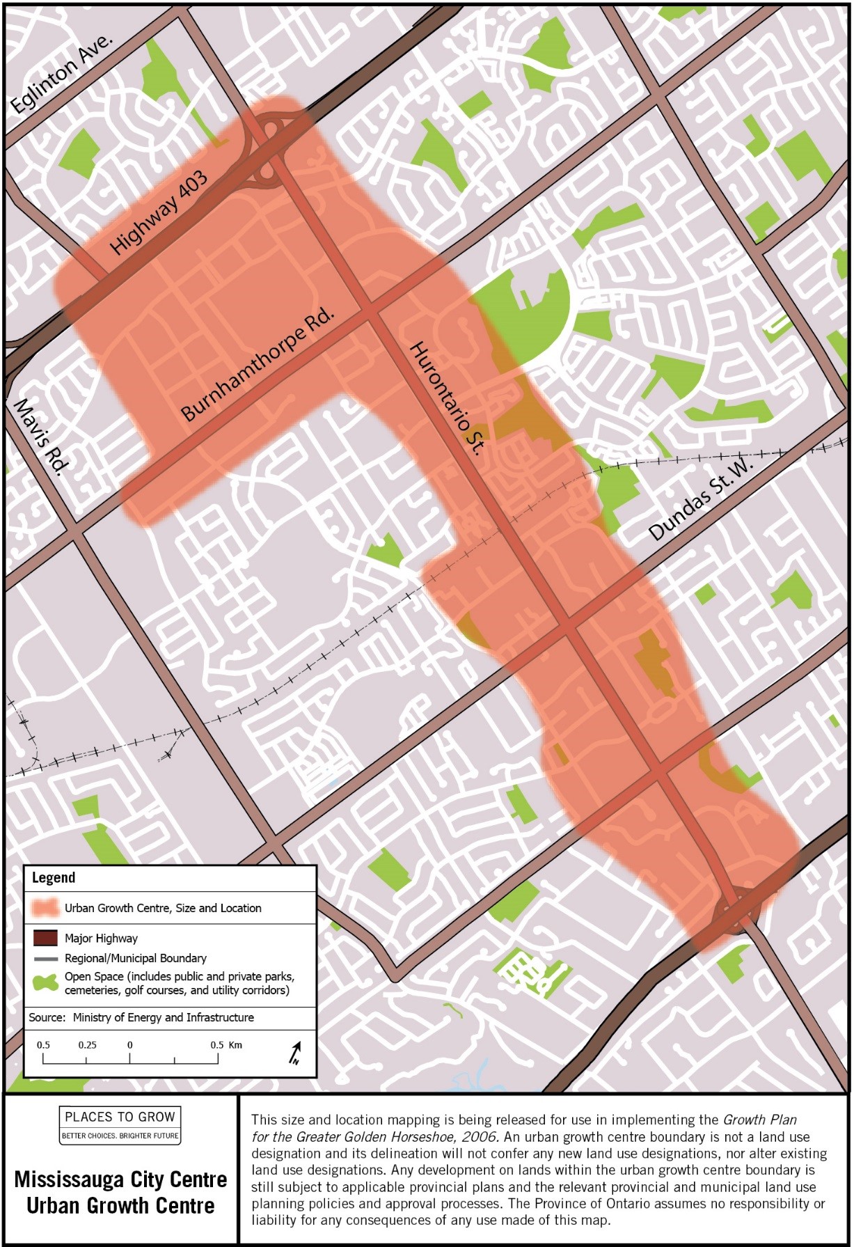
Image description: Map of the approximate size and location of the Mississauga City Centre Urban Growth Centre in the vicinity of Burnhamthorpe Road and Hurontario Street.
Newmarket Centre Urban Growth Centre
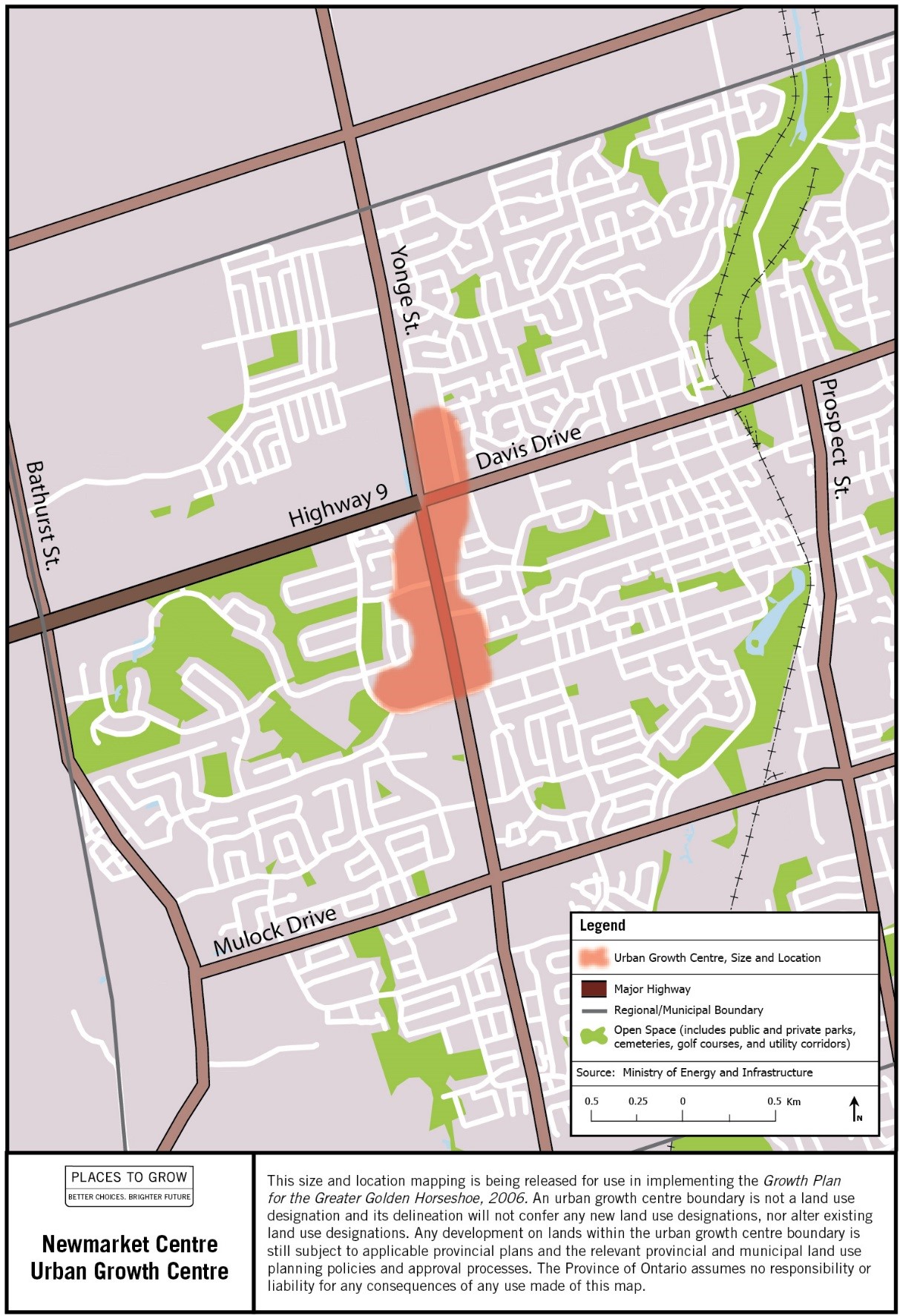
Image description: Map of the approximate size and location of the Newmarket Centre Urban Growth Centre in the vicinity of Davis Drive and Yonge Street.
Midtown Oakville Urban Growth Centre
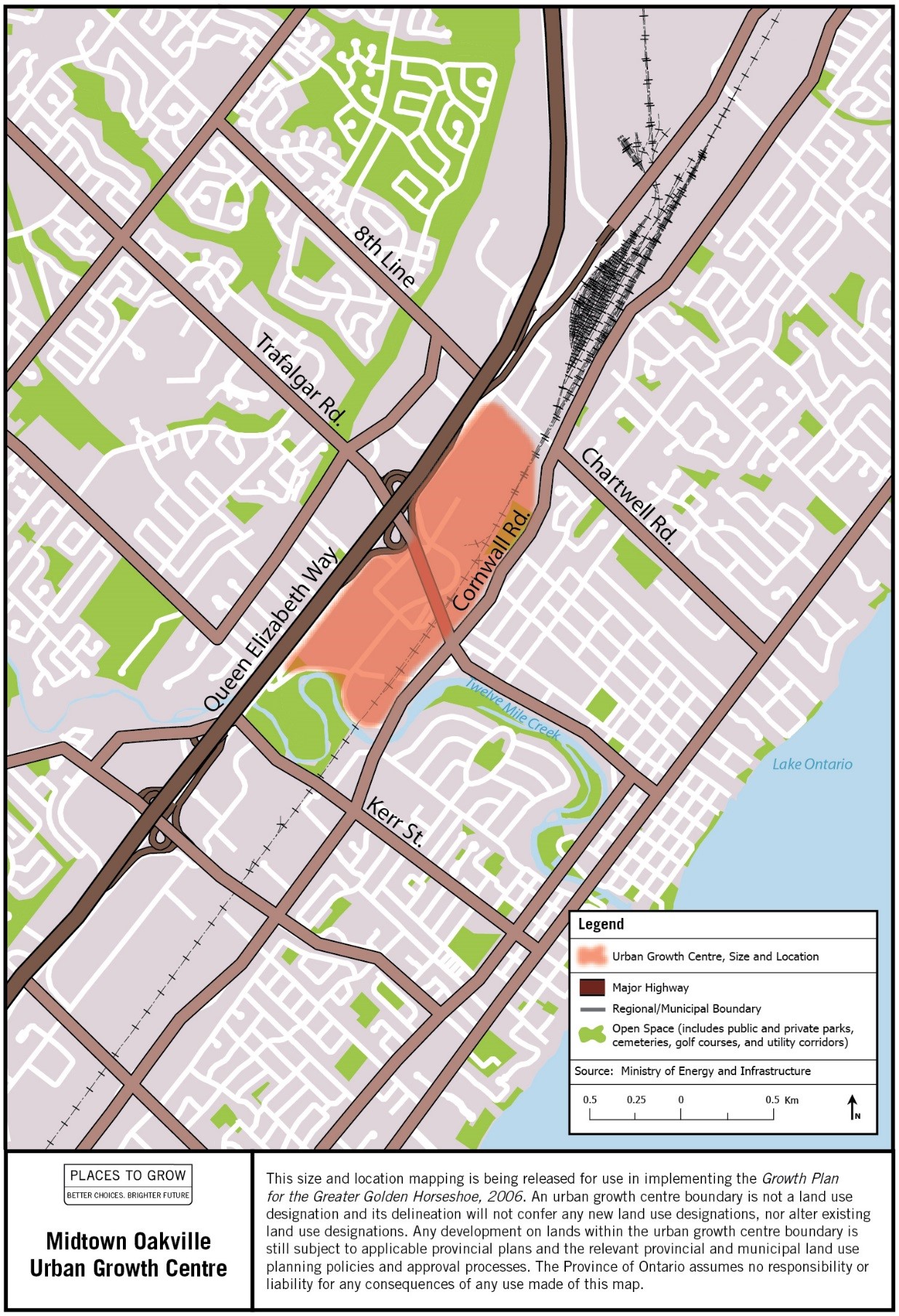
Image description: Map of the approximate size and location of the Midtown Oakville Urban Growth Centre in the vicinity of Cornwall and Trafalgar Roads.
Downtown Oshawa Urban Growth Centre
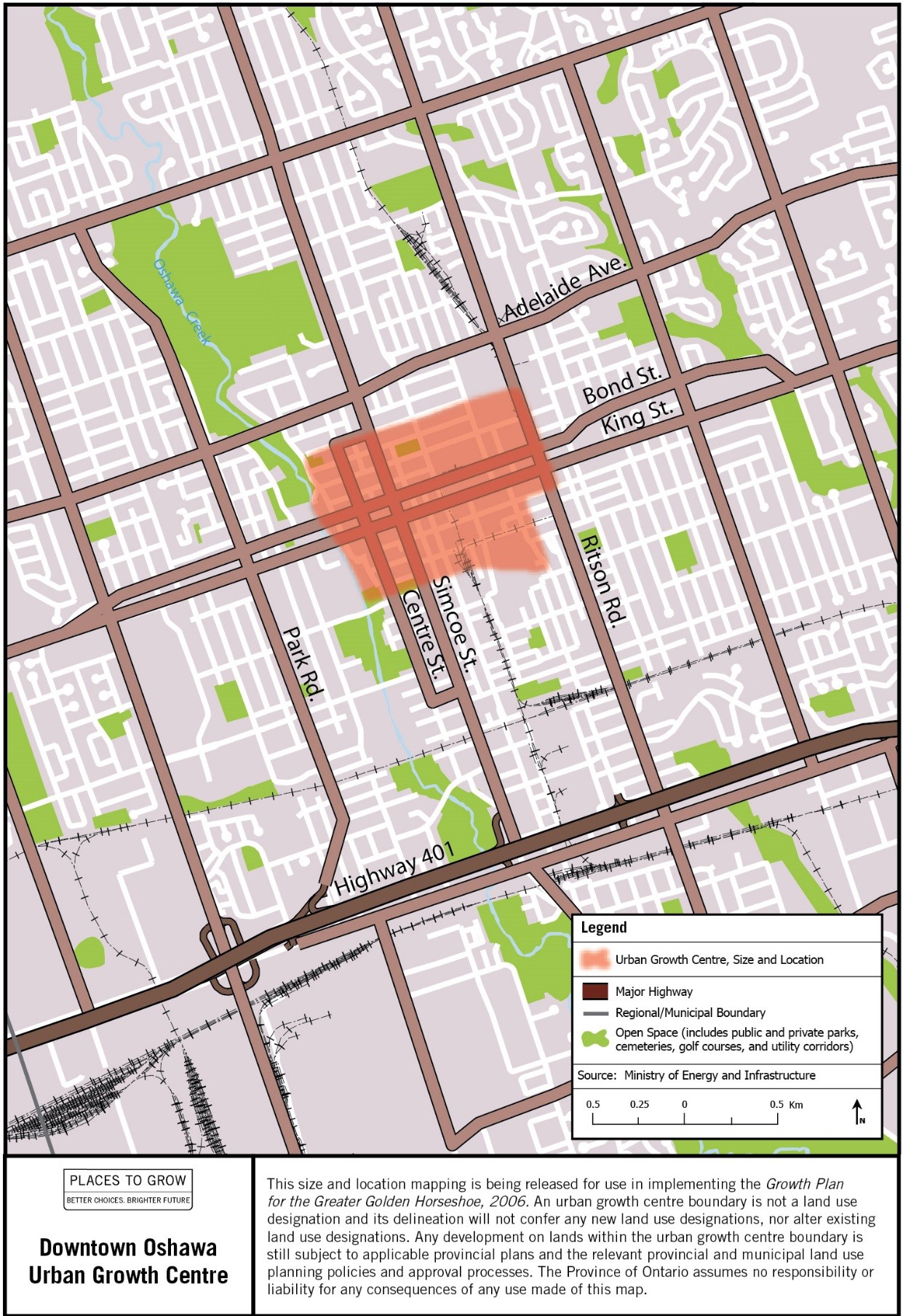
Image description: Map of the approximate size and location of the Downtown Oshawa Urban Growth Centre in the vicinity of Simcoe and Bond Streets.
Downtown Peterborough Urban Growth Centre
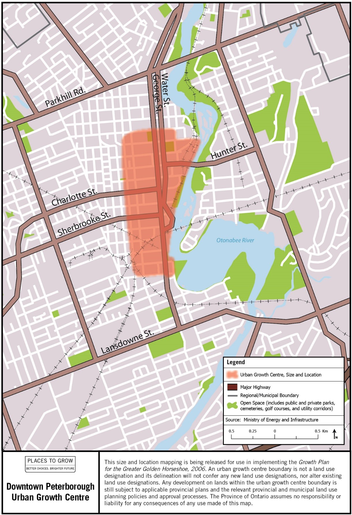
Image description: Map of the approximate size and location of the Downtown Peterborough Urban Growth Centre in the vicinity of George and Charlotte Streets.
Downtown Pickering Urban Growth Centre
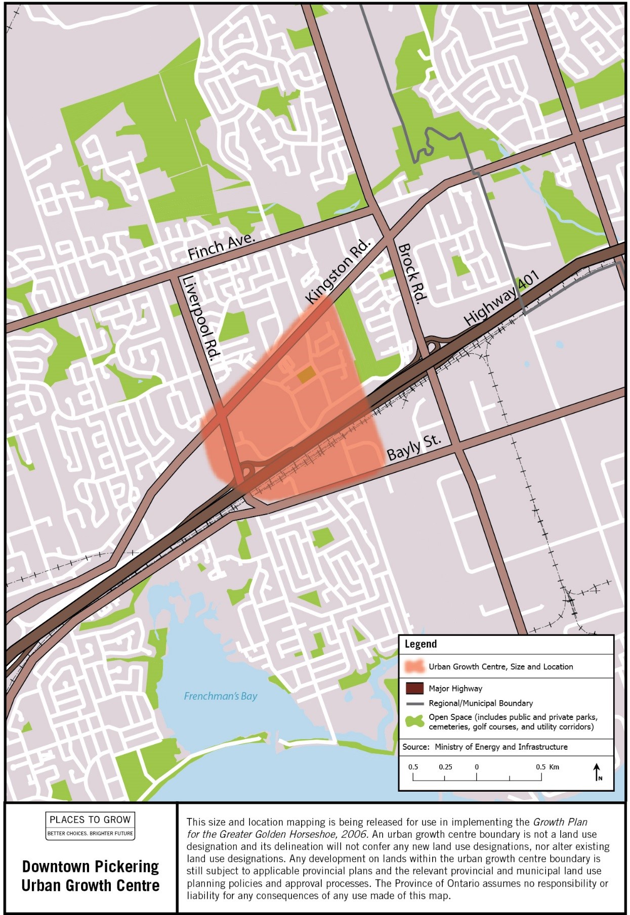
Image description: Map of the approximate size and location of the Downtown Pickering Urban Growth Centre in the vicinity of Highway 401 and Liverpool Road.
Richmond Hill/Langstaff Gateway Urban Growth Centre
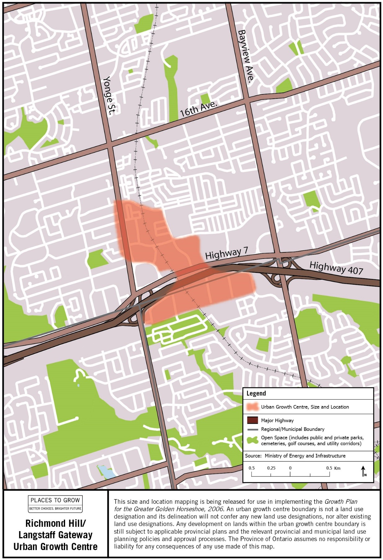
Image description: Map of the approximate size and location of the Richmond Hill/Langstaff Gateway Urban Growth Centre in the vicinity of Highway 7 between Yonge Street and Bayview Avenue.
Downtown St. Catharines Urban Growth Centre
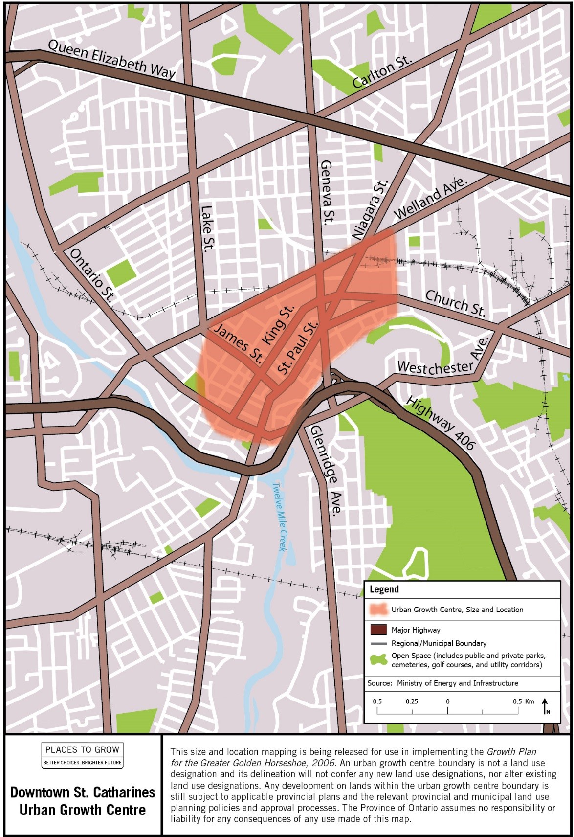
Image description: Map of the approximate size and location of the Downtown St. Catharines Urban Growth Centre in the vicinity of Geneva and King Streets.
Toronto: Downtown Urban Growth Centre
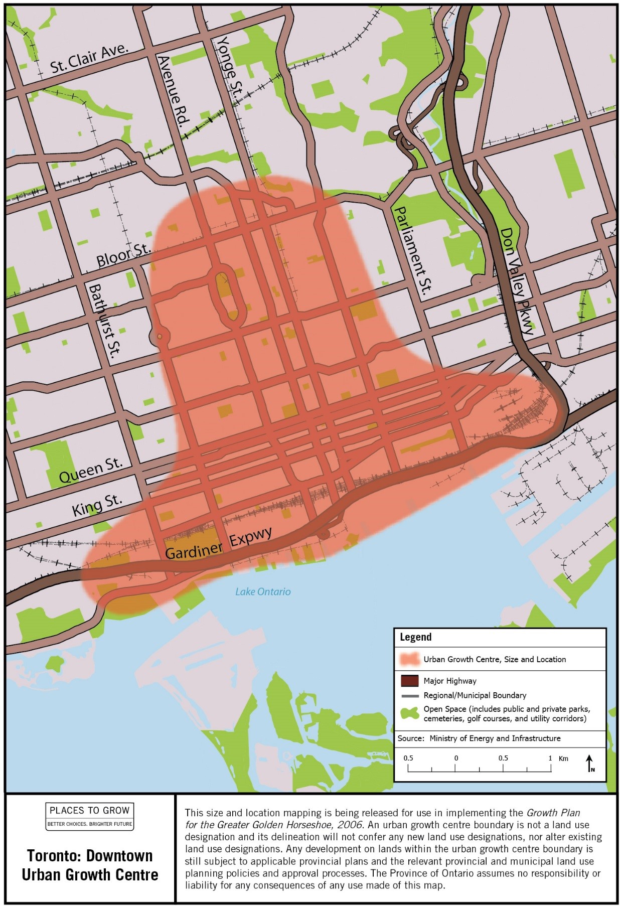
Image description: Map of the approximate size and location of the Toronto: Downtown Urban Growth Centre in the vicinity of Yonge and Queen Streets.
Toronto: Etobicoke City Centre Urban Growth Centre
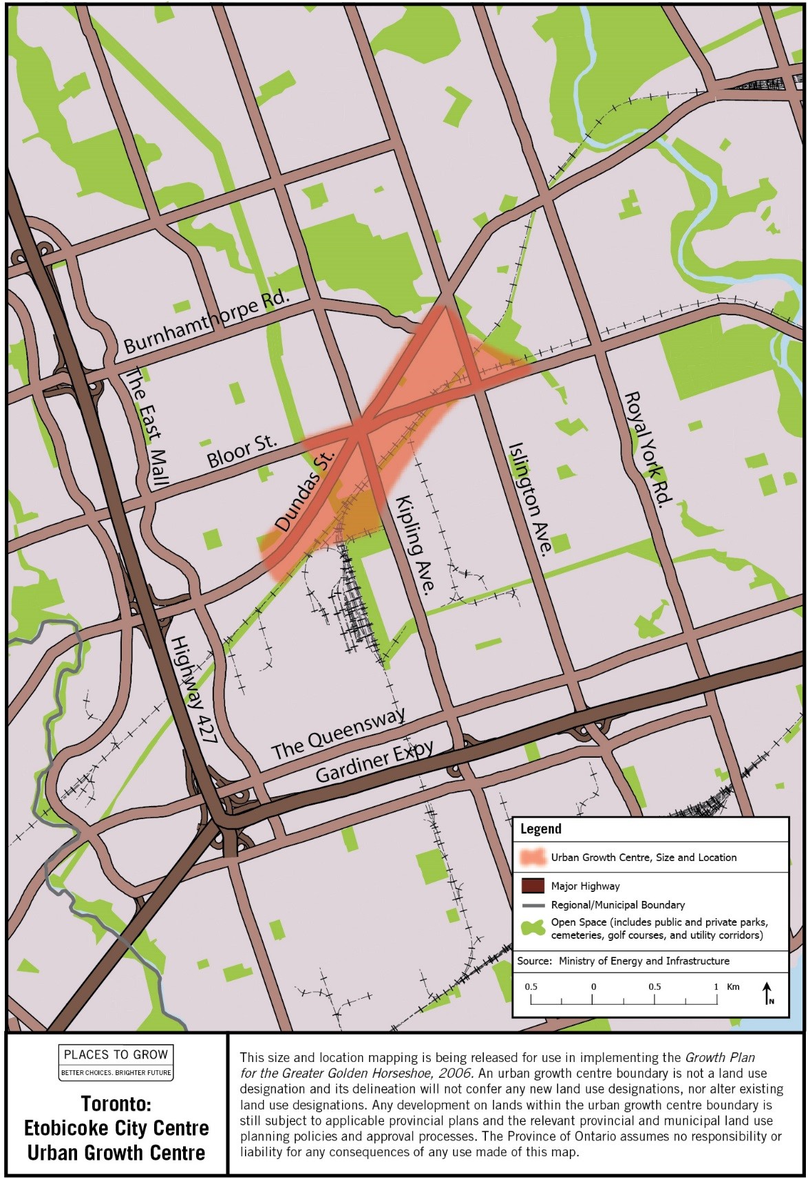
Image description: Map of the approximate size and location of the Toronto: Etobicoke City Centre Urban Growth Centre in the vicinity of Kipling Avenue and Dundas Street West.
Toronto: North York Centre Urban Growth Centre
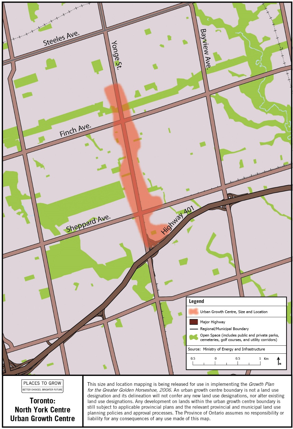
Image description: Map of the approximate size and location of the Toronto: North York Centre Urban Growth Centre in the vicinity of Sheppard Avenue and Yonge Street.
Toronto: Scarborough Centre Urban Growth Centre
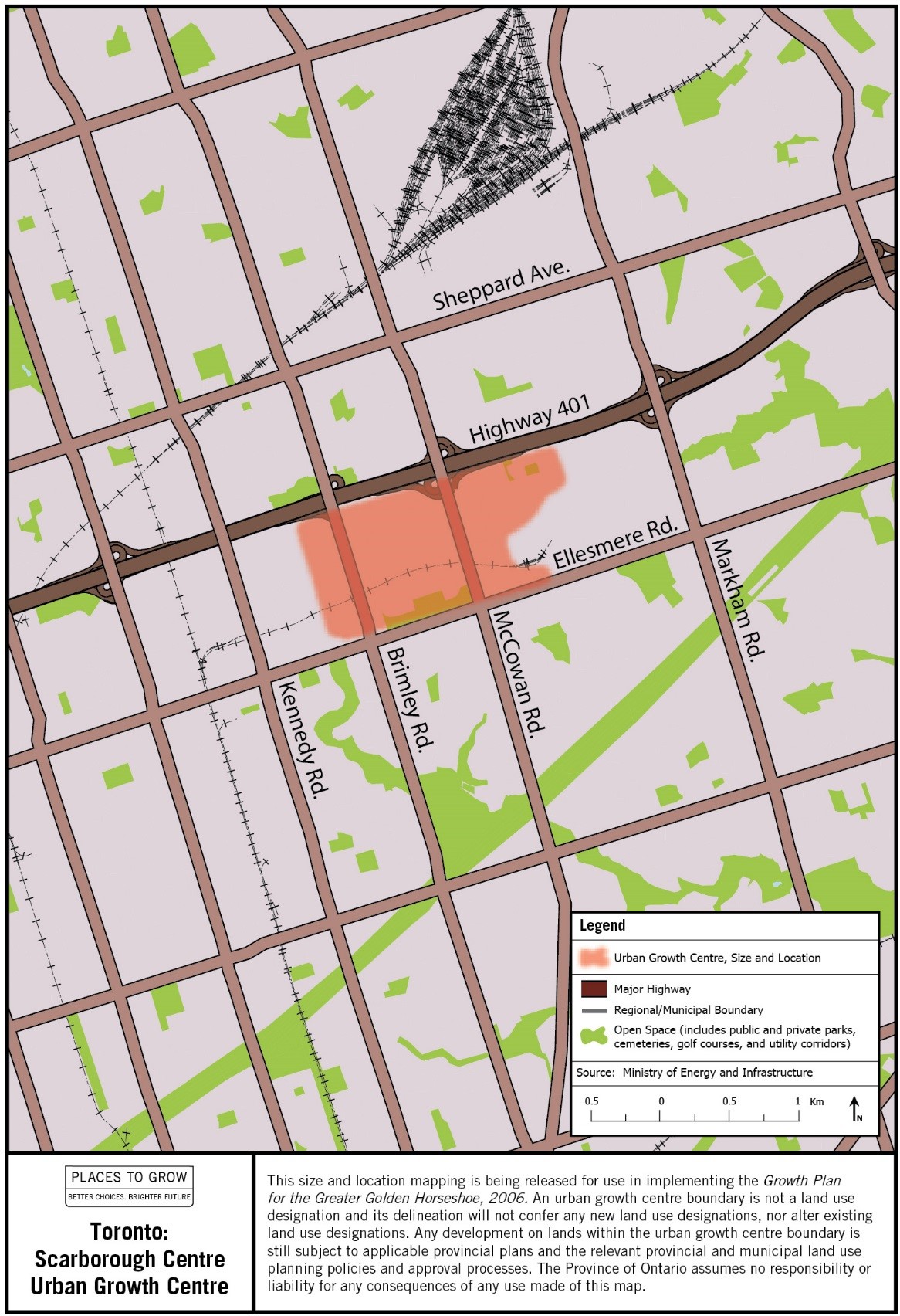
Image description: Map of the approximate size and location of the Toronto: Scarborough Centre Urban Growth Centre in the vicinity of McCowan and Ellesmere Roads.
Toronto: Yonge-Eglinton Centre Urban Growth Centre
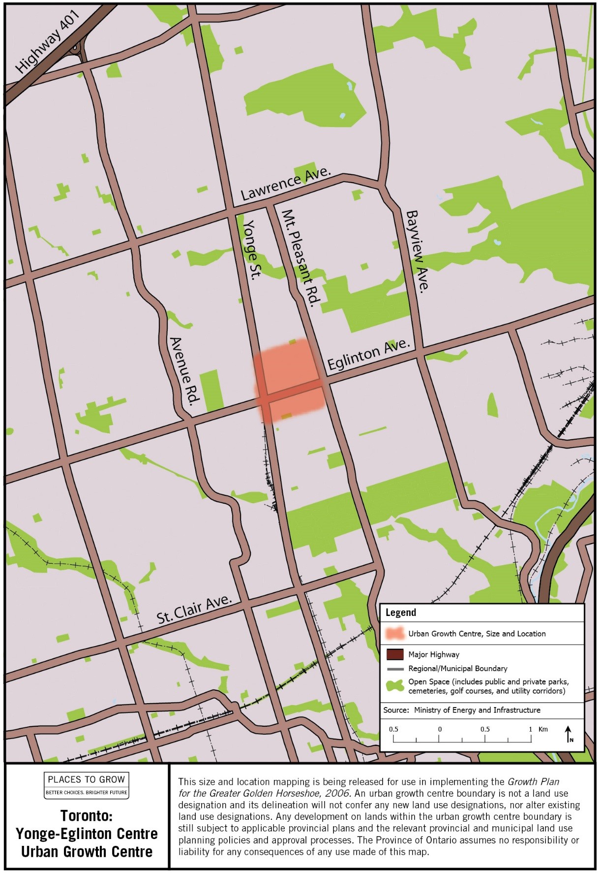
Image description: Map of the approximate size and location of the Toronto: Yonge-Eglinton Centre Urban Growth Centre in the vicinity of Yonge Street and Eglinton Avenue.
Vaughan Corporate Centre Urban Growth Centre
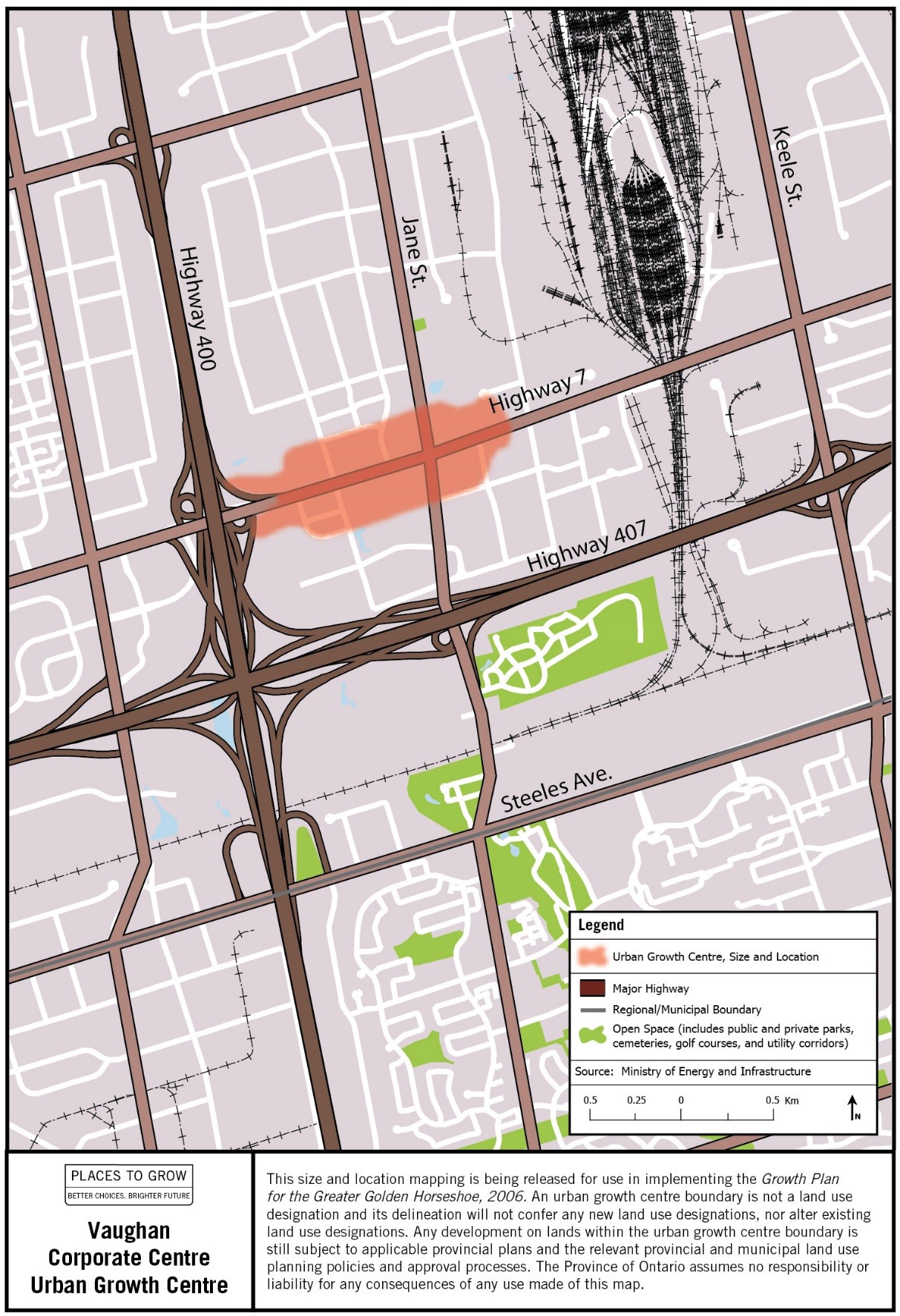
Image description: Map of the approximate size and location of the Vaughan Corporate Centre Urban Growth Centre in the vicinity of Jane Street and Highway 7.
Uptown Waterloo Urban Growth Centre
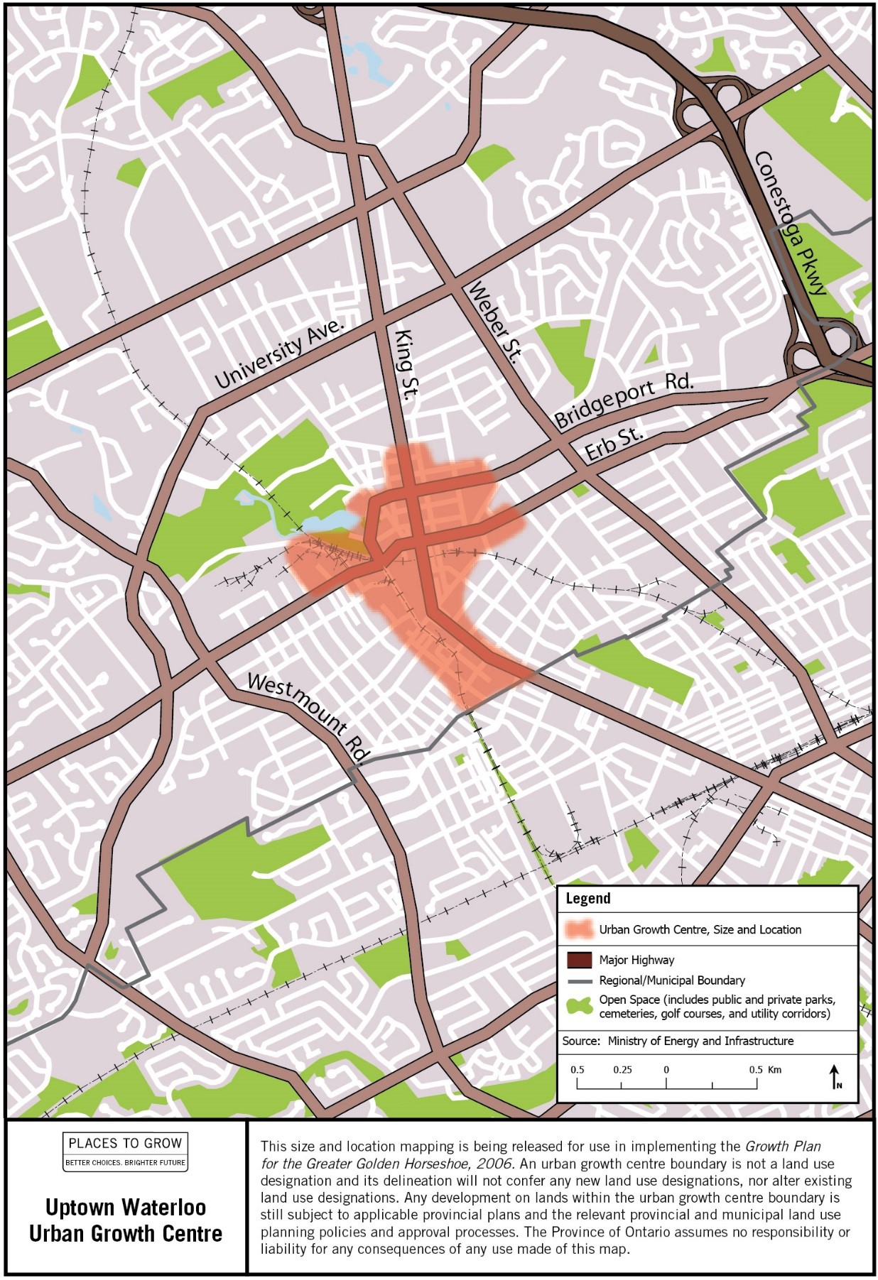
Image description: Map of the approximate size and location of the Uptown Waterloo Urban Growth Centre in the vicinity of King and Erb Streets.