2021 Surveyor General report
Read about the expertise and regulatory support that the Office of the Surveyor General provides to ensure Ontario’s Crown land is effectively managed.
Introduction
Welcome to my first Surveyor General’s report. For those of you who don’t know me, I was appointed the 23rd Surveyor General of Ontario on April 30th, 2021.
I’ve been a member of the Association of Ontario Land Surveyors for 30 years although I spent the last 14 years practicing land surveying in Alberta.
I returned to Ontario for the opportunity to participate in some extraordinary activity within the survey profession and contribute my energies towards moving the Office of the Surveyor General forward as leaders of change. This Office is built on strong foundations that we will rely on to address current and upcoming challenges.
With the legal responsibility to manage all surveys and legal descriptions on Crown land, the Surveyor General also has the duty to maintain original plans, field notes and instructions related to these surveys. As a result, I’m updating my knowledge of Ontario’s legislation, policy and survey practices including the management and patenting of Ontario’s vast Crown lands. I’ve been greatly assisted by the team of dedicated professionals within the Office of the Surveyor General. I am continually impressed by their expertise, experience, and commitment to public service.
My predecessor, Susan MacGregor, is a tough act to follow. She always put the protection of the public’s interests first, conveyed technical information clearly and delivered hard messages to the Association’s membership as required. I will strive to do the same.
2021 was another year of change for our office. We said goodbye to several long-term colleagues who started their retirements and welcomed new land surveyors from outside the ministry and province. This is a significant achievement as it is vitally important that survey professionals remain in the public service to provide direction and guidance to government.
In addition, the Ministry of Natural Resources and Forestry amalgamated with the Ministry of Northern Development and Mines although our priorities and direction continue to be the same. Working remotely presents unique challenges for our teams, particularly onboarding and training new staff although we’ve continued to maintain a high productivity rate. And certainly, the pandemic continues to show the need for us to streamline and modernize our processes to be part of a digital government. We continue to scan our collection of nearly 125,000 historic records and will make them available online.
I invite you to read the report to learn more about our teams and their incredible work.
Sincerely,
W. Bruce Clark
BSc, OLS, OLIP, ALS
Crown Land Surveys Unit
Land surveys and legal descriptions define clear boundaries which protect property rights, avoid landowner disputes and support policy that enables economic investment and preserves Crown Title.
Who we are
- Coordinator, Vacant
- Senior Crown Surveyors, Prakhar Shrivastava
- Crown Surveyor, Roger Grose, Michael Matthews
- Project Manager, Karen Hoover
- Crown Land Technologists, Thomas Guilbeault, Alex Gawlina, Mike Bar, Bruce Johnson and Rachel Dyson
- Survey Records Clerk, Lisa Casselman
- Vacant: one Senior Crown Surveyor, two Crown Surveyor and one Records Clerk position
What we do
- Issue survey instructions to surveyors for Crown location and mining claim plans and review all plans prior to accepting and filing with our office.
- Provide descriptions for parcels shown on Crown location plans.
- Assist our ministry’s Regional Operations Division, other ministries, private sector surveyors, and the public with survey inquiries or requests for information.
- Procure surveys for Crown land for districts or other ministries.
- Provide support for mapping products for Indigenous Affairs Ontario, Ministry of the Environment, Conservation and Parks as well as the Ministry of Municipal Affairs and Housing.
- Provide surveying support to Indigenous Affairs Ontario related to settling claims with First Nations.
- Provide advice on legislation regarding surveys in conjunction with the ministry’s Legal Services Branch.
- Provide advice to District Office regarding Land Titles Absolute applications with respect to Crown interests as adjoining landowner.
In 2021, we
- Processed more than 800 requests for information.
- Supported Indigenous Affairs Ontario on numerous projects including Treaty 3 flooding claims and other land claims.
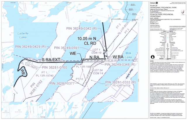
- Issued survey instructions and approved a plan of survey for a 3,300-hectare mining site near the City of Timmins, the largest and most complex mining survey in our history.
- Received 231 new Crown survey submissions and authored 174 legal descriptions.
Parcel Mapping and Georeferencing Unit
Descriptive maps and legal descriptions are critical support for the regulation of Ontario’s Crown land as well as land claim negotiations. Geographic names are an integral part of society and essential for navigation, mapping, emergency response and resource management.
Who we are
- Coordinator, Jennifer McMurray
- Project Manager, Ouvry Roberts
- Cadastral Data Support Officer, Audrey Parr
- Provincial Geodesist and Geographic Names Board Secretary, J. Morgan Goadsby
- Geodetic Control Survey Specialist, Hassan Ibrahim
- Geodetic Control Analyst, Robert Hamer
- Crown Parcel Specialist, Donna Gertridge
- Land and Resource Data Support Officers, Michael Vanderdoelen, Daniel Carbone, Steven Groulx, Nicholas Kaluzny, Drew Gertridge, Élysabeth Théberge
- Provincial Geographic Names Specialist, Yves Blanchard
- Vacant: Geographic Names Records Clerk
What we do
- Manage data and mapping to define property or parcel boundaries, administrative and provincial boundaries, First Nation Reserves, federal lands, and the province’s original township fabric.
- Produce descriptive maps of land parcels that require a legal definition to support regulations such as:
- Provincial Parks and Conservation Reserves
- Wildlife Management Units
- Fire Zones
- Fish Management Zones
- Wild Rice Harvesting Areas
- Local Service Board Area
- Far North boundary
- Greenbelt, Oak Ridges Moraine, Niagara Escarpment and Parkway Belt
- Produce maps to support descriptions for legal agreements and negotiations with Indigenous communities.
- Support the Ontario Geographic Names Board by seeking public input on name applications and maintaining approximately 60,000 official feature names.
In 2021, we
- Supported the Geographic Names Board’s consideration of 38 name proposals resulting in 20 recommendations to the Minister of Northern Development and Mines, Natural Resources and Forestry.
- Maintained current membership of the Ontario Geographic Names Board with the re-appointment of the Board Chair for a three-year term.
- Created mapping products that bridge the gap between thematic maps and survey plans for 14 Indigenous communities.
- Developed 11 regulation plans for the legal descriptions of provincial parks for the Ministry of the Environment, Conservation and Parks and development control boundaries for the Niagara Escarpment Commission.
- Upgraded staff skill sets to include ArcPro as our standard mapping software.
- Continued to improve and modernize data maintenance tools.
Geodetic activities
A geodetic control network contains highly accurate survey points that provide positional reference for surveying and mapping and allow for accurate engineering and infrastructure construction. The Office of the Surveyor General’s geodetic team collaborates with municipal, provincial and federal governments to improve and maintain these control networks.
The COntrol Survey INformation Exchange (COSINE) database is the official source of control survey information for Ontario. In 2021, we improved the usability and reliability of the database as well as our maintenance procedures. COSINE Online provides users with access to geodetic control data. We also improved COSINE quality control and assurance procedures.
The geodetic team continued to work with other agencies to improve our geodetic reference system. The 2021 Canadian Geodetic Reference System (CGRSC) meeting focused on the possible future implementation of new horizontal and vertical reference systems in Canada. These systems are promoted by the United States National Geodetic Survey for North America and include:
- North American Terrestrial Reference Frame 2022 (NATRF2022) horizontal datum
- North American-Pacific Geopotential Datum 2022 (NAPGD2022) vertical datum
We expect the new vertical datum to be equivalent to the Canadian Geodetic Vertical Datum 2013 (CGVD2013) which is used across Canada with over 20,000 benchmarks already available through COSINE.
The implementation of one datum by all geodetic agencies in Canada would lead to the adoption of a specific version and epoch of NAD83-CSRS horizontally and CGVD2013 (with a specific version of the Canadian Gravimetric geoid) vertically. This would position provincial and national agencies to evaluate and potentially adopt the NATRF2022 horizontal and NAPGD2022 vertical datums in the future.
The Ontario Digital Levelling Vertical Control Survey Specifications were updated to include a section on the establishment of precise elevations and/or 3D control points that can be included in the COSINE database. These specifications will be available through Geodesy Ontario in early 2022.
To access COSINE Online, or for more information about geodetic activities, visit Geodesy Ontario or email geodesy@ontario.ca.
Foundation geospatial data
The Office of the Surveyor General is within the ministry’s Mapping and Information Resources Branch. In addition to surveying, the branch provides information management services and acquires, maintains, and makes geomatics data and services available to government, partners, and Ontarians. High-quality, authoritative foundation geospatial data ensures accurate mapping and supports sound decision-making for government, businesses, and the public.
Examples of foundation geospatial data:
- roads
- water
- utilities
- wetlands
- elevation
- imagery
- COSINE (provincial geodetic control)
- geographic names
- township fabric
This foundation data is referenced by the survey community when developing survey plans or planning survey activities and is available from Land Information Ontario.
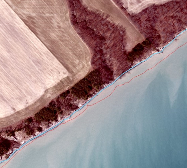
Ontario hydro network
This year we updated water mapping for over 16,000 km2 in southern Ontario including the Lake Erie shoreline. We also collaborated with Natural Resources Canada’s National Hydro Network team to provide input on the design of the new National Hydrographic Network.
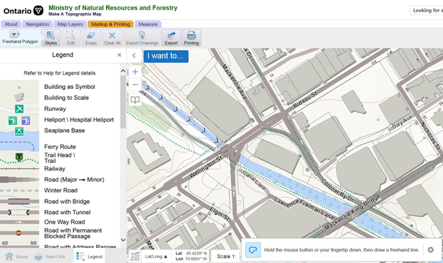
Advancing the topographic map
Users of survey and geomatics software and web mapping applications reference the topographic map cache regularly for authoritative mapping. Vector-based map cache technology allows for faster update times, less storage space, supports better display quality and printing, and allows for dynamic labeling with clearer text. In 2021, cartographers made improvements to the cache including clear labelling of lots, concessions and road features making it easier for users to identify and locate features.
Imagery
Land Information Ontario (LIO) coordinates partnerships to collect imagery across the province. The partnership approach provides cost savings to all parties, allowing access to the imagery at a cost typically in the range of $four–six per square kilometre.
In the spring of 2021, the LIO Imagery Acquisition Program acquired over 49,000 km2 of high-resolution leaf-off imagery in central Ontario, from Parry Sound in the south, west to Thessalon and north to Timmins. Project partners shared in the cost of acquisition and included private sector companies, conservation authorities, municipalities, and the provincial and federal governments. This imagery will be available for purchase in 2022.
LIO coordinates imagery acquisitions across Ontario on a five-year cycle. The imagery is multi-spectral, with a spatial resolution of 16 cm for southern Ontario and 20 cm for north-central Ontario. Ground control is established for each project area, resulting in a horizontal accuracy of 45 cm for southern Ontario and 50 cm for north-central Ontario. Stereo data is also available to partners at no additional cost. Elevation data generated from these projects includes an imagery-derived, unclassified, digital surface elevation model accurate to plus two meters.
Survey firms are invited to participate in future shared-cost imagery acquisitions and gain access to their selected imagery as soon as it is available. Planning is currently underway for the next acquisition of imagery in Northwest Ontario in the spring of 2022. We are also in the planning stages for the third collection program, which proposes to recollect imagery across the province from 2023 to 2027.
Surveyors can purchase imagery products and access elevation products through an open data license. More information is available on GeoHub or by emailing imagery@ontario.ca.

Looking ahead
In closing, I would like to emphasize how proud I am of my team who have continued to provide vital services to Ontarians throughout the pandemic. Our surveying, geodetic and mapping work is not always easy to do remotely and their perseverance and innovation continues to be greatly appreciated. I would also like to acknowledge their willingness to collaborate with colleagues in the Mapping and Information Resources Branch, across the ministry and OPS on projects and initiatives.
Moving forward together, the Office of the Surveyor General will focus on delivering our services and identifying new opportunities to improve our processes while meeting public expectations. We will continue to commit significant time and resources to the digitization of our survey records collection as well as the historical annotated maps, correspondence, and documentation for Ontario’s official geographic names. We will establish a technical working group with our Northern Development and Mines colleagues to streamline the various mining processes including survey instructions, file submission and plan review as identified in our business process mapping exercise. We will also move forward with our colleagues in the Ministry of Government and Consumer Services toward the electronic submission of Crown survey plans. Further ahead, we will undertake preliminary investigations to develop a public-facing web portal for accessing Crown survey records.
It’s going to be an interesting journey but as we go forward, don’t hesitate to reach out to myself or any of the Office Surveyor General team with questions or concerns.