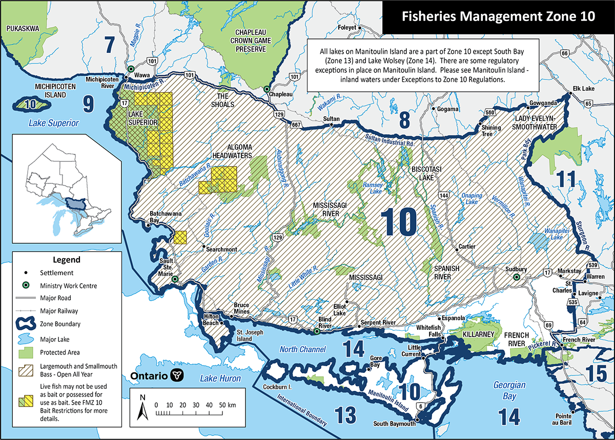
Fisheries Management Zone 10 (FMZ 10)
Information about fishing and how fish resources are managed in Fisheries Management Zone 10 (Northeast Region: Sudbury and Sault Ste. Marie).
News and updates
As of January 2024, the Fisheries Management Zone 10 rules changed for:
- walleye
- northern pike
- smallmouth bass
- muskellunge exception for select rivers
- French River exception
- stocked lakes and sanctuaries
Read the goals and key highlights of the changes for walleye, northern pike and muskellunge. For information on all the changes, refer to the Ontario Fishing Regulations Summary.
Fishing rules
You can:
- find specific rules for fishing in FMZ 10
- use the Fish ON-Line mapping tool
- find a complete set of fishing rules in the Ontario Fishing Regulations Summary
About this zone
FMZ 10 is located in Northeastern Ontario. This zone has:
- the highest road and population density of all the Northeast zones
- more lake trout lakes and brook trout lakes than any other Northeast zone
- many streams flowing into Lakes Superior and Huron
- small, deep, clear inland lakes
FMZ 10 is one of 20 fisheries management zones in the province.
Location
FMZ 10:
- is north of Lake Huron and Georgian Bay
- its eastern border extends northwards from the mouth of the French River to Elk Lake
- its western border follows the east shore of Lake Superior from Sault Ste. Marie, north to Wawa
- cities include Sudbury, Espanola and Blind River
Legal boundary map and detail maps
Legal boundary map for FMZ 10 and detail maps 1 - 31.1 (PDF)
Monitoring reports and management plans
- Status of lake trout populations in Northeastern Ontario: full report
- FMZ 10 lake trout objectives and management strategies
Zone advisory council
The FMZ 10 council provides advice during the development of fisheries objectives and strategies.
Council members represent a broad range of views including:
- angling groups
- scientists and researchers
- conservation groups
- interested community members
The advisory council participates in fisheries management by:
- sharing ideas and expertise with the ministry
- helping to develop and implement management strategies
- communicating with the local and angling community
For more information about the Fisheries Management Zone 10 advisory council, please contact your local work centre.
