Ontario First Nations Maps
How to locate First Nation reserves, Tribal Councils, political organizations and land covered by treaties.
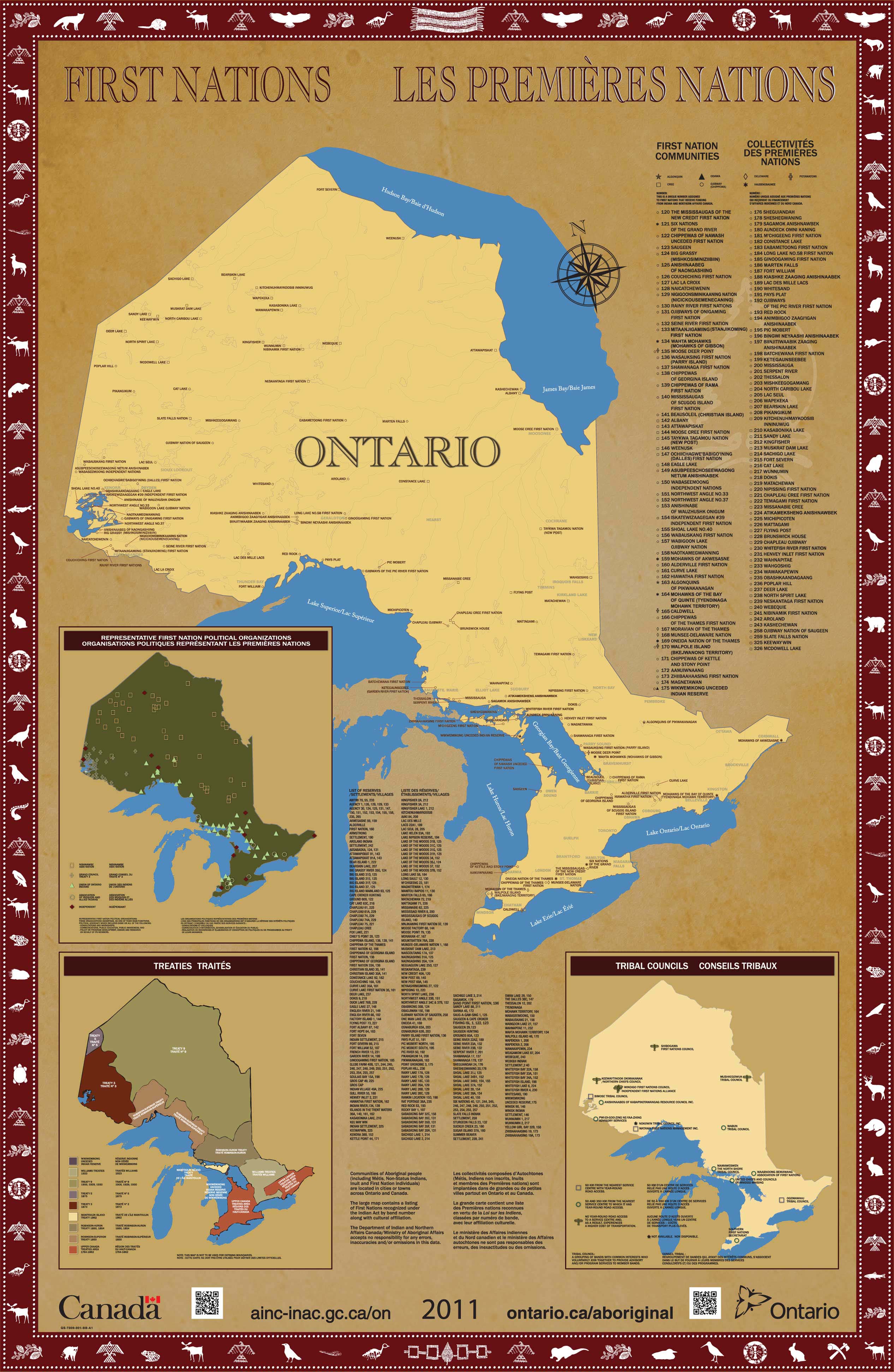
First Nations map
The Ontario First Nations map shows the locations of:
- First Nation communities: listed by band number and cultural affiliation (e.g., Algonquin, Cree, Ojibway)
- Tribal Councils (a grouping of bands with common interests who join together to provide advice and programs to their members)
- reserves (land set aside for bands under the Indian Act and treaty agreements)
- political organizations (e.g., Union of Ontario Indians, Grand Council Treaty 3)
- land covered by specific treaties
The border shows symbols that have special meaning to First Nations in Ontario.
Treaties map
Ontario is covered by 46 treaties which were signed between 1781 and 1930.
This map was published on May 20, 2014. It illustrates the First Nations and treaties in Ontario. The coordinate system is Lambert Conformal Conic.
Legal notice
This map is provided for illustrative purposes only. It is not intended to reflect the position of Ontario nor to constitute any admission or limit Ontario’s rights in any way. The Government of Ontario and its ministers, agents and employees disclaim all responsibility for any errors, omissions and inaccuracies.
Reproducing the maps
First Nations map
The map can be reproduced for non-commercial and commercial purposes.
Commercial reproductions
You need permission from both of these organizations to commercially reproduce the maps:
- Indigenous and Northern Affairs Canada
- Senior Copyright Analyst
ServiceOntario Publications
416-326-5153
copyright@ontario.ca
Non-commercial reproductions
To reproduce the map for non-commercial purposes, please:
- take care to be accurate with the information
- do not represent the map as an official version
- acknowledge the Government of Canada copyright
Source data
First Nations map
Many sources are used to ensure the map’s accuracy, including:
- The Canada Lands – Ontario First Nations Lands and National Parks map (published by Natural Resources Canada)
- First Nation Profiles (published by Indigenous and Northern Affairs Canada)
- Historical Treaties of Canada map (published by Indigenous and Northern Affairs Canada)
Information is also cross-checked against other sources such as:
- interactive First Nations maps
- First Nations political organization websites
- community websites
Treaties map
- Used under license from Geobase, Geogratis, the Ontario Realty Corporation, Indigenous and Northern Affairs Canada, and Members of the Ontario Geospatial Data exchange and data held by the Ministry of Aboriginal Affairs.
- The treaty boundaries illustrated for Treaty 3, 1873, Treaty 5, 1875 and Treaty 94, 1862 are those shown on the Ontario First Nations Map (above).
- The treaty boundaries illustrated for areas outside of Ontario are those shown on the Pre-1975 Treaties of Canada map produced by the Government of Canada.
- The remaining treaty boundaries illustrated are taken from James L. Morris, Indians of Ontario (Toronto: Department of Lands and Forests, 1943). See the Provisional Algonquin Settlement Area for more information.