Map of Ontario treaties and reserves
Learn about the treaties that cover where you live, go to school or work, and find reserves in Ontario.
Instructions
- To find a treaty – search, then click anywhere in a shaded area to see the name and date of the treaty in that location.
- To find a reserve – search, or use the zoom button to find burgundy areas. Click on a burgundy area to learn about a reserve.
Please note that this map has some limitations and is one of many ways to learn about treaties. Indigenous communities may have different understandings of the treaties than is represented here.
Treaties in Ontario
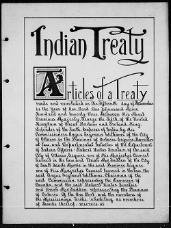
More than 40 treaties and other land agreements cover Ontario. Treaties are legal agreements that set out the rights and responsibilities of First Nations and the provincial and federal governments.
Ajetance Purchase
Treaty 19
Treaty 19, also known as the Ajetance Purchase, was signed on October 28, 1818, by representatives of the Crown and Anishinaabe peoples. The territory described in the written Treaty covers approximately 6,500 km².
The Ajetance Purchase is named for the Chief of the Credit River Mississaugas. Some signatories of this Treaty also signed Treaty 18, such as James Givins, who worked with Reverend Peter Jones at the Credit Mission.
Current communities in the area include Brampton, Georgetown and the Caledon “Badlands.”
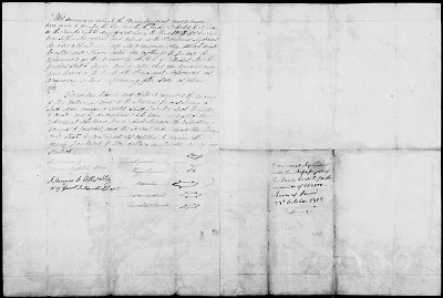
Images of the Ajetance Purchase
Transcript of the Ajetance Purchase
Between the Lakes Purchase
Treaty 3
The Between the Lakes Purchase was signed on December 7, 1792, by representatives of the Crown and certain Mississauga peoples. The territory described in the written treaty covers approximately 3 million acres.
The original Between the Lakes Purchase was signed in 1784. Due to uncertainties with the description of the lands in the original surrender, Treaty 3 was entered into in 1792 to clarify what was ceded. The Between the Lakes Purchase was named as such because it included all the land “lying and being between the Lakes Ontario and Erie.”
Current communities in the area include St. Catharines, Guelph and Simcoe.
Transcript of the Between the Lakes Purchase
Brant Tract
Treaty 3 ¾
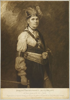
Treaty 3 ¾, also known as the Brant Tract, was signed on October 24, 1795, by representatives of the Crown and the Mississauga peoples. The territory described in the written treaty covers approximately 3,500 acres.
The treaty is known as the Brant Tract because it was purchased by the Crown for the Mohawk Chief Joseph Brant for his military service to the British during the American Revolutionary War.
Current communities in the area include Burlington and Oakville.
Crawford’s Purchases
Crawford’s Purchases were made by Captain William Crawford on behalf of the Crown, and certain Indigenous peoples in October 1783, and involved the land along the north shore of eastern Lake Ontario and the St. Lawrence River.
These purchases were designed to provide land to Loyalists who fought on behalf of the British during the American Revolution, including Indigenous allies and United Empire Loyalists.
Current communities in the area include Kingston and Brockville.
Crown Grant to the Six Nations or the Haldimand Tract
Treaty 4
Treaty 4 is also known as the Simcoe Patent and was issued in 1793.
The British purchased land from the Mississauga peoples and then issued the Haldimand Proclamation later that year. The Proclamation granted a tract of land, often referred to as the Haldimand Tract, to the Six Nations in recognition of their support of the Crown during the American Revolution. The Simcoe Patent, or Treaty 4, was later issued to clarify a number of matters, including the extent of the land grant made to the Six Nations.
Current communities in the area include Brantford, Kitchener, and Caledonia.
Information about Six Nations of the Grand River
Information about the Haldimand Proclamation
Crown Grant to the Mohawks of the Bay of Quinte
The Crown Grant to the Mohawks of the Bay of Quinte was issued in 1784. The land had been acquired in the Crawford Purchase and was then granted to the Mohawks of the Bay of Quinte in recognition of their support of the Crown during the American Revolutionary War.
The Mohawk Chief John Deserontyon led a group of Haudenosaunee people to settle on the Bay of Quinte.
Current communities in the area include Shannonville and Deseronto.
More information about Chief Deserontyon
Head of the Lake Purchase
Treaty 14
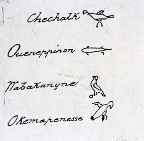
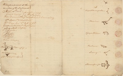
The doodems of four Mississauga chiefs who signed Treaty 14. (Library and Archives Canada)
Treaty 14, or the Head of the Lake Purchase, was signed on September 12, 1806 by representatives of the Crown and certain Mississauga peoples. The treaty indicates that it includes lands along the north shore of Lake Ontario to the southwest of the Toronto Purchase.
The treaty payment was one thousand pounds of provincial currency in goods “at the Montreal price,” made the previous year in the interim agreement of Treaty 13A.
Current communities in the area include the cities of Mississauga and Oakville.
Images of the Head of the Lake Purchase
Transcript of the Head of the Lake Purchase
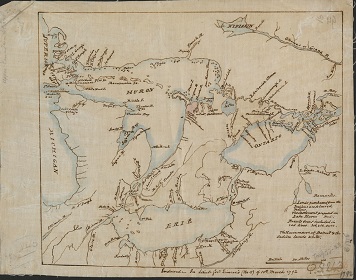
Huron Tract Purchase
Treaty 29
Treaty 29, or the Huron Tract Purchase, was signed on July 10, 1827, by representatives of the Crown and certain Anishinaabe peoples. The territory described in the written treaty covers approximately 2,200,000 acres.
Treaties often reference natural features of the landscape to mark boundaries. This treaty uses the intersection of the St. Clair River and “a hickory tree marked with a broad arrow on two sides” to mark part of its boundary.
Current communities in the area include Sarnia and Stratford.
Images of the Huron Tract Purchase
Transcript of the Huron Tract Purchase
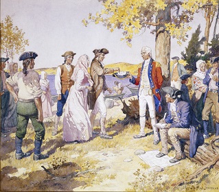
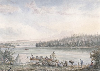
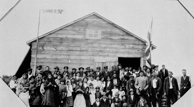
James Bay Treaty
Treaty 9
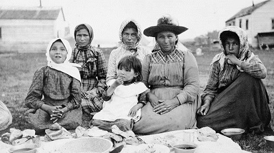
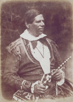
Image description: Women and children at a feast at Fort Metagami during the Treaty 9 payment ceremony in 1905. (Archives of Ontario, I0010709)
Treaty 9 was signed in 1905 and 1906 by representatives of certain Cree (including the Omushkegowuk), Ojibway (Anishinaabe) peoples, and the Crown. It is also known as the James Bay Treaty and is the northernmost treaty in Ontario. In 1929 and 1930, an adhesion was added to this Treaty area that extends from the Albany River to Hudson Bay.
After signing ceremonies at each location, Crown and First Nation representatives participated in a feast and made formal speeches.
Eabametoong First Nation was a signatory to Treaty 9 but their reserve is located north of the Albany River.
Current communities in the area include over 14 First Nations, Hearst and Kapuskasing.
Images of the James Bay Treaty
Transcript of the James Bay Treaty
Archives of Ontario online exhibit about the James Bay Treaty
More information about the James Bay Treaty
John Collins' Purchase
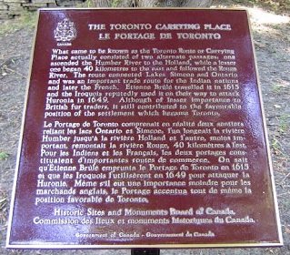
The John Collins’ Purchase was entered into between representatives of the Crown and certain Anishinaabe peoples. It concerned lands extending from the northwestern end of Lake Simcoe to Matchedash Bay.
This early Upper Canada treaty was conducted during an expedition of Captain William Crawford and surveyor John Collins, along the Toronto Carrying Place from the Humber River to Lake Simcoe.
Johnson-Butler Purchase
One of the Johnson-Butler Purchases, sometimes called the "Gunshot Treaty," was entered into in 1788 by representatives of the Crown and certain Anishinaabe peoples. The treaty covers the north shore of Lake Ontario, beginning at the eastern boundary of the Toronto Purchase and continuing east to the Bay of Quinte, where it meets the Crawford Purchase.
This treaty was sometimes referred to as the "Gunshot Treaty" because it covered the land as far back from the lake as a person could hear a gunshot.
These lands were the subject of a confirmatory surrender in the Williams Treaties of 1923.
Current communities in the area include Oshawa and Cobourg.
Lake Simcoe Purchase
Treaty 16
Treaty 16, or the Lake Simcoe Purchase, was signed in 1815 at Kempenfelt Bay by representatives of the Crown and certain Anishinaabe peoples. The territory described in the written Treaty covers approximately 100,000 hectares.
The Penetanguishene Road, which extended from Lake Simcoe to Georgian Bay, is contained in this treaty.
Current communities in the area include Orillia, Midland, and part of Barrie.
Images of the Lake Simcoe Purchase
Transcript of the Lake Simcoe Purchase
London Township Purchase
Treaty 6
Treaty 6, or the London Township Purchase, was signed on September 7, 1796, by representatives of the Crown and certain Anishinaabe peoples. The territory described in the written treaty is approximately 30 km².
Some of the treaty payments included calico and serge cloths, cooking implements, rifles and flint, and vermillion.
Current communities in the area include the city of London.
Images of the London Township Purchase
Transcript of the London Township Purchase
Long Woods Purchase
Treaty 21
Treaty 21, also known as the Long Woods Purchase, was signed on March 9, 1819 by representatives of the Crown and certain Anishinaabe peoples. The territory described in the written treaty covers approximately 220,000 hectares.
The River Thames, which was called Askanessippi in Anishinaabemowin, meaning the “antlered river,” runs through this area.
Current communities in the area include Strathroy and Mt. Brydges.
Images of the Long Woods Purchase
Transcript of the Long Woods Purchase
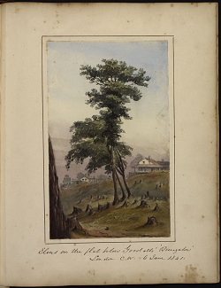
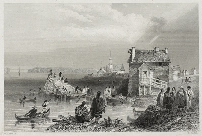
Manitoulin Island Treaty
Treaty 94
View near the foot of South Bay, Manitoulin Island by Robert Bell. (Library and Archives Canada)
Manitoulin Island was subject to Treaties in 1836 and 1862 but the peoples of Wikwemikong did not sign the latter, known as Treaty 94. Treaty 94 was signed on October 6, 1862 by representatives of the Crown and many First Nations residing on Manitoulin Island.
Treaty 94, which revised the previous 1836 Treaty, outlined that Manitoulin Island would be surveyed and divided into acres, with each head of a family on the island receiving 100 acres, and every single person at least 21 years of age receiving 50 acres.
Current communities in the territory described by the written Treaty include Little Current and Manitowaning.
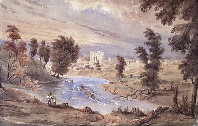
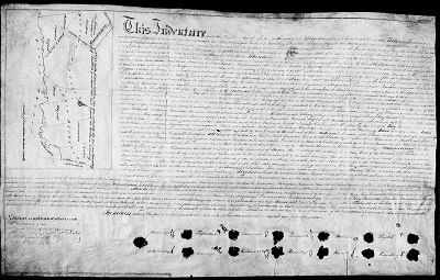
McKee Purchase
Treaty 2
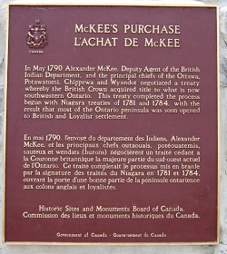
Treaty 2, or the McKee Purchase, was signed on May 19, 1790 by representatives of the Crown and various First Nations. It is the southernmost Upper Canada treaty. The territory described in the written treaty includes Point Pelee – Canada’s southernmost point.
There were over 50 signatories to this Treaty, including settlers and Indigenous leaders. The treaty payments included cloth and linen, tools for hunting and cooking, looking glasses, combs, ribbons and laced hats.
Current communities in the area also include Windsor, Chatam-Kent and part of London.
Transcript of the McKee Purchase
Niagara Purchase
Treaty 381
Treaty 381, better known as the Niagara Purchase, was signed on May 9, 1781 by representatives of the Crown and certain Anishinaabe peoples. The written treaty covers a 4 mile strip on the west side of the Niagara River, which connects Lake Ontario and Lake Erie.
The treaty was signed during the American Revolution and was one of the first land acquisitions in what would become Upper Canada.
Current communities in this area include Niagara Falls, Niagara-on-the-Lake and Fort Erie.
Images of the Niagara Purchase
Transcript of the Niagara Purchase
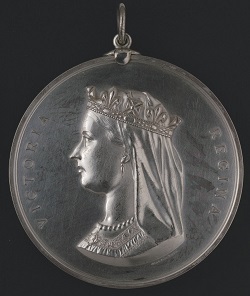
North-West Angle Treaty
Treaty 3
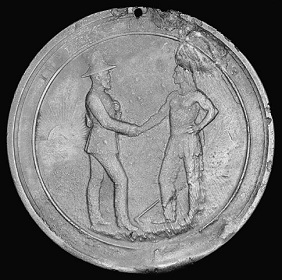
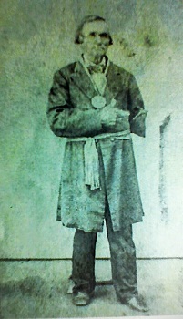
Treaty 3, also known as the North-West Angle Treaty, was signed in 1873 by a number of First Nation Chiefs and representatives of the Crown. Each Chief who signed was given a medal and a flag.
Adhesions to Treaty 3 were signed by other First Nations chiefs later in 1873 and in 1874. In 1875, Nicholas Chatelaine signed an adhesion as a leader of Métis people living in the area.
Current communities in the area include Red Lake, Kenora and Sioux Lookout.
Images of North-West Angle Treaty
Transcript of North-West Angle Treaty
More information about the North-West Angle Treaty
Nottawasaga Purchase
Treaty 18
Treaty 18 was signed on Oct 17, 1818, by representatives of the Crown and certain Anishinaabe peoples. It is also known as the Lake Simcoe-Nottawasaga Treaty and was the first of three treaties signed between October and November of 1818. A fourth, Treaty 27, was signed in the Spring of 1819. The treaty details include a payment of goods at the "Montreal Price," because Montreal was the economic hub of Upper and Lower Canada.
Current communities in the area include Wasaga, Bradford and Collingwood.
Images of the Nottawasaga Purchase
Transcript of the Nottawasaga Purchase
Penetanguishene Purchase
Treaty 5
Treaty 5, or the Penetenguishene Purchase, was signed on May 22, 1798, by representatives of the Crown and certain Anishinaabe peoples.
This treaty was conducted out of a desire of Lieutenant Governor John Simcoe to acquire a harbour for British vessels on Lake Huron.
The current area includes Penetanguishene and Awenda Provincial Park.
Images of the Penetanguishene Purchase
Transcript of the Penetanguishene Purchase
Proposed Algonquins of Ontario Settlement Area
Negotiations are in progress toward Ontario’s first modern-day treaty. If successful, this will resolve a land claim that was formally submitted to Canada in 1983 and Ontario in 1985. Historic records related to the claim include a series of Algonquin petitions to the Crown that date back as far as 1772 and assert Algonquin rights to land and other natural resources.
An Agreement-in-Principle was signed on October 18, 2016 by Ontario, Canada and the Algonquins of Ontario. It identifies the Algonquins of Ontario Settlement Area, which covers 36,000 square kilometres in eastern Ontario.
The Algonquins of Ontario collective includes the following communities: Antoine, Algonquins of Pikwakanagan First Nation, Bonnechere, Greater Golden Lake, Kijicho Manito Madaouskarini (Bancroft), Mattawa/North Bay, Ottawa, Shabot Obaadjiwan (Sharbot Lake), Snimikobi (Ardoch), Whitney and Area.
More information about the Algonquin land claim
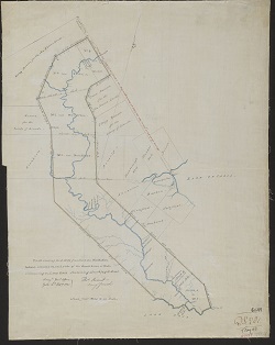
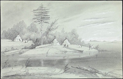
Rice Lake Purchase
Treaty 20
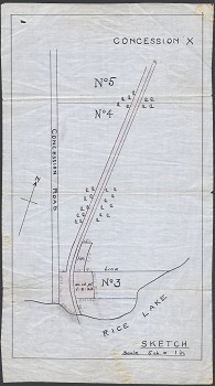
A sketch of part of the Rice Lake Indian Reserve. Today the area is part of Hiawatha First Nation. (Library and Archives Canada)
Treaty 20, also known as the Rice Lake Purchase, was signed on November 5, 1818 by representatives of the Crown and certain Anishinaabe peoples.
This is the last of three Upper Canadian treaties signed with Anishinaabe peoples in what is now central southern Ontario, in October and November of 1818. A fourth, Treaty 27, was signed in the spring of 1819. These treaties enabled the northward expansion of settlement in Upper Canada.
Current communities in the area include Peterborough and Lindsay.
Images of the Rice Lake Purchase
Transcript of the Rice Lake Purchase
Rideau Purchase
Treaty 27 and 27 ¼
Treaty 27 and 27 ¼ , or the Rideau Purchase, was entered into on May 31, 1819, and confirmed in 1822 by representatives of the Crown and certain Anishinaabe peoples.
The Rideau Canal, a vital waterway in Upper Canada, was built through this territory after the Treaty was signed.
Current communities in the area include Marmora and Pembroke.
Transcript of the Rideau Purchase
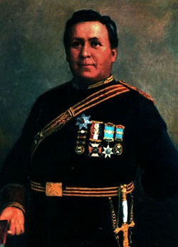
Robinson-Huron Treaty
Treaty 61
The Robinson-Huron Treaty was signed on September 9, 1850 in Sault Ste. Marie. Treaty Commissioner William Robinson signed on behalf of the Crown, and a number of chiefs signed on behalf of several First Nations. The territory described in the written treaty includes the land east of Georgian Bay and the northern shore of Lake Huron.
One of the signatories of the Robinson Huron Treaty was noted Anishnaabeg Chief Shinguakonse (Little Pine) (1773-1854), veteran of the War of 1812 who had helped establish Garden River First Nation.
Current communities in the area include Sault Ste. Marie, Kirkland Lake and North Bay.
Images of the Robinson-Huron Treaty
Transcript of the Robinson-Huron Treaty
Robinson-Superior Treaty
Treaty 60
The Robinson-Superior Treaty was signed on September 7, 1850 in Sault Ste. Marie. Treaty Commissioner William Robinson signed on behalf of the Crown, and a number of chiefs signed on behalf of several First Nations. The territory described in the written treaty includes the north shore of Lake Superior.
The Crown’s motivation for entering into the Robinson Treaties was partly to open up the Treaty territories to mineral resource exploration and potential mining.
Current communities in the area include Thunder Bay, Nipigon and Wawa.
Images of the Robinson-Superior Treaty
Transcript of the Robinson-Superior Treaty
Saugeen Peninsula Treaty
Treaty 72
Treaty 72 was signed on October 13, 1854, by First Nations residing on the “Saugeen Peninsula” and representatives of the Crown. The Treaty area covers most of what is now known as the Bruce Peninsula.
At the time of signing, the peninsula was known as the Saugeen Peninsula. The treaty is sometimes today referred to as the Bruce Peninsula Treaty.
Current communities in the area include Sauble Beach, Tobermory, and Southampton.
Images of the Saugeen Peninsula Treaty
Transcript of the Saugeen Peninsula Treaty
Saugeen Tract Purchase
Treaty 45 ½
Treaty 45 ½, or the Saugeen Tract Purchase, was signed on August 9, 1836 by representatives of the Crown and certain Anishinaabe peoples. The territory described in the written treaty covers approximately 1.5 million acres of land, and was a part of the Bond Head Purchases, along with Treaty 45 for Manitoulin Island.
The treaty was signed in Manitowaning in 1836 when an annual distribution of gifts for Indigenous peoples was taking place on Manitoulin Island.
Current communities in this area include Owen Sound and Hanover.
Images of the Saugeen Tract Purchase
Transcript of the Saugeen Tract Purchase
Sombra Township Purchase
Treaty 7
Treaty 7, also called the Sombra Township Purchase, was signed on September 7, 1796 by representatives of the Crown and certain Anishinaabe peoples. Three Ottawa Chiefs are listed as witnesses to the Treaty. Their names were Shemmeendock, Negug, and Mitchewas.
Some of the treaty payments included kettles of brass, tin, and copper, silk handkerchiefs, 1400 pounds of shot, and combs made of ivory and horn.
Current communities in the area include St. Clair and Sombra.
Images of the Sombra Township Purchase
Transcript of the Sombra Township Purchase
St. Joseph’s Island Purchase
Treaty 11
Treaty 11, or the St. Joseph’s Island Purchase, was signed on June 30, 1798, by representatives of the Crown and certain Anishinaabe peoples. The territory as described in the written treaty covers approximately 360 km², or nearly all of St. Joseph Island on the Canada/US border.
St. Joseph’s Island is known as Payentanassin in Anishinaabemowin.
The written treaty indicates payments of red, green, and blue cloth, vermillion, kettles, and cooking implements.
Images of the St. Joseph’s Island Purchase
Transcript of the St. Joseph’s Island Purchase
St. Regis Purchase
Treaty 57
Treaty 57, or the St. Regis Purchase was signed on June 1, 1847 by representatives of the Crown and certain Mohawk peoples.
The written treaty indicates that it covers a parcel of land that is also known as the “Nutfield Tract,” a corridor of land running north of the St. Lawrence River towards the Ottawa River.
Current communities in the area include the city of Cornwall.
Images of the St. Regis Purchase
Toronto Purchase
Treaty 13
Treaty 13, also known as the Toronto Purchase, was signed on August 1, 1805, by representatives of the Crown and certain Mississauga peoples. The treaty covers approximately 250,800 acres.
The original Toronto Purchase of 1787 was revisited in 1805 with Treaty 13. A land claim regarding the 1805 Treaty was settled with Canada in 2010 for $145 million.
An 1805 map of the Toronto Purchase appears to show that the Toronto Islands were included within the boundaries of the purchase. Although the lands were originally connected to the mainland, they separated during a storm in the mid-19th century.
Current communities include the city of Toronto.
Images of the Toronto Purchase
Transcript of the Toronto Purchase
Treaty 5
Treaty 5, signed in 1875, covers the northwest corner of Ontario and parts of Manitoba and Saskatchewan. This treaty had several later adhesions, which were signed in northern Manitoba between 1876 and 1910. The territory described in the written treaty covers approximately 345,500 km², only a small portion of which lies in Ontario.
Chiefs who signed were presented with the Queen Victoria medal. Many of the written treaty terms resemble the written terms of Treaty 3 and Treaty 9, including individual annuity payments and a formula for determining each First Nation’s reserve lands.
Sandy Lake First Nation entered into Treaty 5 in 1910, but their current reserve is located in the territory covered by the Treaty 9 Adhesion.
More information about Treaty 5
Treaty 9 Adhesion
The adhesion to Treaty 9 was signed in 1929 and 1930 by representatives of certain Cree and Anishinaabe peoples and representatives of the Crown. The adhesion to Treaty 9 extends from the Albany River to Hudson Bay.
After the adhesion, Treaty 9 became the largest treaty area in Ontario.
Current communities in the area include over 20 First Nations and the town of Pickle Lake.
Transcript of Treaty 9 Adhesion
Treaty 35
Treaty 35 was signed on August 13, 1833, by representatives of the Crown and the Huron-Wendat.
In the mid-seventeenth century, the Huron-Wendat were displaced from the territory between Lake Ontario, Lake Simcoe, and Georgian Bay after wars with other Indigenous peoples. Some Huron-Wendat moved to Lorette, near Quebec City. Others moved to the west and the south, including this treaty area.
Current communities in the area include LaSalle and Amherstburg.
More information about the Huron-Wendat
Treaty 82
Treaty 82 was signed on February 9, 1857, by representatives of the Crown and certain Anishinaabe peoples. The territory described in the written Treaty is approximately 4,000 hectares, and covers a strip of land north of the contemporary community of Owen Sound.
The representatives of the Chippewas of Newash signed with their clan or "totem" signature.
Notable signatories to this treaty include R.T. Pennefather, Superintendent General of Indian Affairs, and Rev. Peter Jones, a Mississauga chief, author, and Methodist missionary who translated the Bible into Anishinaabemowin.
Current communities in the area include Kemble.
Treaty of Manitowaning
Treaty 45
Treaty 45, or the Manitoulin Island Treaty, was signed on August 9, 1836, by representatives of Upper Canada and certain Anishinaabe peoples. The territory described in the written Treaty covers most of Manitoulin Island and the islands along the north shore of Lake Huron.
Archaeological records provide evidence that Indigenous people lived on Manitoulin Island from 9,000 B.C.E. In 1836, the island became home to many more Indigenous peoples, some of whom had moved from other places in Upper Canada.
Current communities in the territory described by the written Treaty include Little Current and Manitowaning.
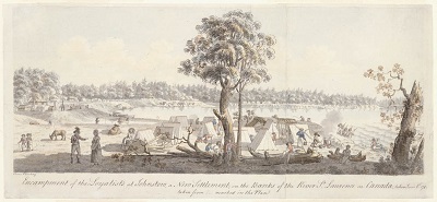
Williams Treaties
The Williams Treaties were signed on October 31 and November 15, 1923, by seven Anishinaabe First Nations and representatives of the Crown. A commission was established by Canada and led by Treaty Commissioner A.S. Williams to address lands that had not been surrendered via treaty.
The territory covered by the Williams Treaties stretched from the northern shore of Lake Ontario to Lake Nipissing, and together cover approximately 52,000 km². The geography of the Treaties overlaps with several previous treaties.
Current communities in the area include Huntsville and Bracebridge.
Images of the October signing of the Williams Treaties
Transcript of the October signing of the Williams Treaties
Images of the November signing of the Williams Treaties
Transcript of the November signing of the Williams Treaties
Reserves in Ontario
A reserve is an area of land set aside by the federal government for the use and benefit of a First Nation. You can find a full list of reserves in Ontario on the federal government website.
Limitations
This interactive map was designed for illustrative purposes for educators, students, researchers and the general public to gain a sense of Ontario’s treaty history. Treaties and the treaty relationship are more than what is recorded in historical maps. This map and all accompanying materials are not intended to be a complete source of treaty history and do not replace engagement with local Indigenous peoples.
This map does not purport to reflect actual treaty boundaries and is provided for illustrative purposes only. It is not intended to reflect the position of Ontario nor to constitute any admission or limit Ontario’s rights in any way, and should not be relied on to assess legal rights.
A map of the Provisional Algonquin Settlement Area is available on the Algonquin Land Claim page.
This map was created with data used under license from Geobase, Geogratis, the Ontario Realty Corporation, Indigenous and Northern Affairs Canada, and Members of the Ontario Geospatial Data exchange and data held by the Ministry of Indigenous Relations and Reconciliation. The treaty boundaries illustrated for Treaty 3, 1873, Treaty 5, 1875 and Treaty 94, 1862 are those shown on the First Nations and Treaties map produced by the Province of Ontario and the Government of Canada. The treaty boundaries illustrated for areas outside of Ontario are those shown on the Pre-1975 Treaties map produced by the Government of Canada. The remaining treaty boundaries illustrated are based on James L. Morris, Indians of Ontario (Toronto: Dept. of Lands and Forests, 1943).
Converting these maps into a digital map may have resulted in unintentional deviations. For example, Google Maps shows more geographic detail than the printed maps. The Government of Ontario and its ministers, agents and employees disclaim all responsibility for any errors, omissions and inaccuracies in any of these maps, accompanying materials or external links.