Ontario’s landbase
All of Ontario – land class and ownership
Ontario is over 107.6 million hectares, of which 66% is forest. To better understand this breakdown, the tables below highlights land classes and ownership groups for the province.
Ontario’s forests - Quick facts:
1.7% of the world’s forests
20.3% of Canada’s forests
70.4 million hectares of forest
56.3 million hectares of productive forest
6.5 billion cubic metres of growing stock
| Land class | Crown | Parks & protected areas | Other | Total |
|---|---|---|---|---|
| Water | 15,830,239 | 2,952,632 | 294,162 | 19,077,033 |
| Wetland | 8,863,646 | 1,227,356 | 367,069 | 10,458,071 |
| Field/agriculture/grass | 24,863 | 11,046 | 5,339,991 | 5,375,900 |
| UCL/other | 375,945 | 33,399 | 1,173,238 | 1,582,582 |
| Rock | 278,390 | 332,296 | 66,987 | 677,673 |
| Treed wetland | 11,755,320 | 1,050,457 | 220,406 | 13,026,183 |
| Brush/hedgerows | 884,931 | 100,531 | 166,578 | 1,152,040 |
| Productive forest | 43,624,760 | 6,052,603 | 6,620,015 | 56,297,378 |
| All forest subtotal | 56,265,011 | 7,203,591 | 7,006,999 | 70,475,601 |
| Grand total | 81,638,094 | 11,760,320 | 14,248,446 | 107,646,859 |
Visual display
Tables and supporting data are available on the Ontario Data Catalogue. To support representation of complex data, a variety of tables, charts and maps are available in a visualization format.
View data visualization - Managed Forest Zone
Managed Forest Zone (MFZ)
The Managed Forest Zone (see previous section on administrative zones) in Ontario covers the middle portion of the province and is 46.4 million hectares in size, of which nearly 80% is productive forest
Quick facts:
46.4 million hectares of land and water
27.8 million hectares of Crown forest
13.0% parks and protected areas
33.3% of Ontario’s managed forests are black spruce
3.0% of Ontario’s managed forests are sugar maple
The following summaries for forests within the Managed Forest Zone include area by land type, forest type, seral stage, age class, tree species and volume of growing stock.
Land class by ownership
| Land class | Crown | Parks & protected areas | Other | Total |
|---|---|---|---|---|
| Water | 4,333,980 | 1,135,199 | 202,872 | 5,672,051 |
| Wetland | 999,754 | 183,329 | 237,434 | 1,420,517 |
| Field/agriculture/grass | 10,942 | 2,239 | 578,957 | 592,138 |
| UCL/other | 183,714 | 15,398 | 448,640 | 647,751 |
| Rock | 63,206 | 51,721 | 48,995 | 163,922 |
| Treed wetland | 498,447 | 113,437 | 55,172 | 667,056 |
| Brush/hedgerows | 347,545 | 49,839 | 106,916 | 504,300 |
| Productive forest | 27,830,594 | 4,473,691 | 4,396,005 | 36,700,290 |
| Grand total | 34,268,181 | 6,024,852 | 6,074,991 | 46,368,025 |
| Land type | Crown | Parks & protected areas | Other | Total |
|---|---|---|---|---|
| Water | 4,250,752 | 840,943 | 112,931 | 5,204,626 |
| Open muskeg | 1,011,780 | 185,815 | 241,490 | 1,439,084 |
| Treed muskeg | 501,450 | 114,973 | 56,160 | 672,583 |
| Brush/Alder | 358,950 | 51,643 | 109,820 | 520,413 |
| Grass | 9,008 | 2,133 | 202,696 | 213,837 |
| Agriculture | 1,604 | 94 | 376,420 | 378,119 |
| Rock | 42,432 | 41,028 | 44,672 | 128,132 |
| Islands | 32,571 | 19,421 | 7,405 | 59,397 |
| Unclassified | 173,742 | 9,343 | 459,568 | 642,653 |
| Productive forest | 27,706,923 | 4,413,998 | 4,479,951 | 36,600,872 |
| Area not inventoried | N/A | N/A | N/A | 507,745 |
| Total | 34,089,211 | 5,679,393 | 6,091,113 | 45,859,717 |
Provincial forest types
The following provincial forest type summaries highlight forests within the Managed Forest Zone, and includes area by forest type, seral stage, age class, tree species and volume of growing stock.
| Forest type | Crown | Parks & protected areas | Other owners | Total |
|---|---|---|---|---|
| Red and white pine | 953,854 | 258,188 | 239,780 | 1,451,822 |
| Jack pine | 2,307,528 | 442,709 | 65,901 | 2,816,138 |
| Conifer upland | 7,855,934 | 1,260,090 | 554,504 | 9,670,528 |
| Conifer lowland | 6,091,857 | 727,881 | 525,899 | 7,345,638 |
| Mixedwood | 6,084,078 | 1,038,240 | 1,139,966 | 8,262,284 |
| Poplar | 1,965,937 | 187,611 | 619,439 | 2,772,987 |
| White birch | 1,232,070 | 204,607 | 279,589 | 1,716,266 |
| Tolerant hardwoods | 1,215,664 | 294,672 | 1,054,873 | 2,565,209 |
| Total | 27,706,923 | 4,413,998 | 4,479,951 | 36,600,872 |
| Forest type | Pre-sapling | Sapling | Immature | Mature | Late-successional |
|---|---|---|---|---|---|
| Red and white pine | 48,942 | 65,072 | 218,474 | 805,411 | 313,923 |
| Jack pine | 178,044 | 801,896 | 971,105 | 680,638 | 184,455 |
| Conifer upland | 632,238 | 1,619,275 | 1,857,322 | 3,872,368 | 1,689,325 |
| Conifer Lowland | 351,952 | 457,838 | 862,725 | 3,806,366 | 1,866,756 |
| Mixedwood | 180,007 | 583,145 | 2,452,969 | 4,187,938 | 858,225 |
| Poplar | 112,407 | 382,244 | 941,230 | 922,596 | 414,510 |
| White birch | 53,301 | 92,445 | 359,629 | 986,073 | 224,817 |
| Tolerant hardwoods | 59,725 | 34,797 | 231,245 | 2,136,067 | 103,374 |
| Total | 1,616,617 | 4,036,712 | 7,894,700 | 17,397,457 | 5,655,386 |
Red and white pine forest type
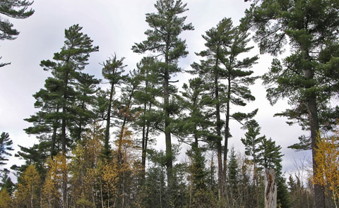
The red and white pine forest type is dominated by pine. It is often a mixedwood with an overstory of white pine and an understory of other tree species including poplar, spruce and hardwoods. This forest type is most commonly found in the Great Lakes-St. Lawrence forest region.
| Metric | Value |
|---|---|
| Total area in MFZ (hectares) | 1,451,822 |
| Crown managed forest area (hectares) | 953,854 |
| Proportion of MFZ forest (%) | 4.0% |
Jack pine forest type
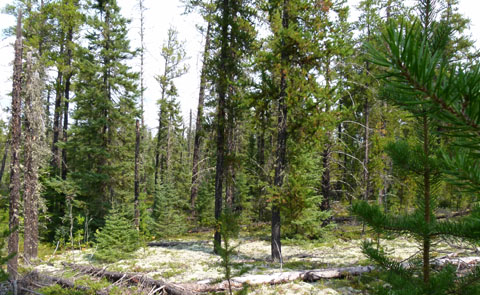
The jack pine forest type is dominated by homogenous, even-aged stands, often on well drained sandy sites. It can be associated with poplar and spruce on some sites but is generally almost pure jack pine. It is most commonly found in the Boreal forest, especially in northwest.
| Metric | Value |
|---|---|
| Total area in MFZ (hectares) | 2,816,138 |
| Crown managed forest area (hectares) | 2,307,528 |
| Proportion of MFZ forest (%) | 7.7% |
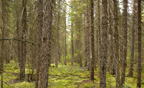
Conifer upland forest type
The conifer upland forest type is dominated by black and white spruce, jack pine and balsam fir, often with a component of poplar and white birch. It occurs on upland or well drained to shallow sites and is most commonly found in the Boreal forest.
| Metric | Value |
|---|---|
| Total area in MFZ (hectares) | 9,670,528 |
| Crown managed forest area (hectares) | 7,855,934 |
| Proportion of MFZ forest (%) | 26.4% |
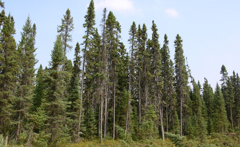
Conifer lowland forest type
The conifer lowland forest type is dominated by black spruce, often associated with cedar and larch. It is commonly found on moist to wet or organic soils on lowland sites. The lowland conifer forest type is found primarily in the Boreal forest, especially in the clay belt area in northeast Ontario.
| Metric | Value |
|---|---|
| Total Area in MFZ | 7,345,638 |
| Crown managed forest area | 6,091,857 |
| Proportion in MFZ Forest (%) | 20.1% |
Mixedwood forest type
The mixedwood forest type is composed of mostly spruce, poplar, jack pine, balsam fir, and white birch. Occurring on a wide variety of sites, mixedwood stands are commonly found throughout the Boreal forest.
| Metric | Value |
|---|---|
| Total area in MFZ (hectares) | 8,262,284 |
| Crown managed forest area (hectares) | 6,084,078 |
| Proportion of MFZ forest (%) | 22.6% |
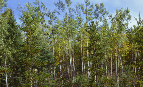
Poplar forest type
The poplar forest type is dominated by trembling aspen (poplar), and is often associated with white birch, spruce, jack pine and balsam fir. It occurs primarily on deep, fresh upland sites in the Boreal forest.
| Metric | Value |
|---|---|
| Total area in MFZ (hectares) | 2,772,987 |
| Crown managed forest area (hectares) | 1,965,937 |
| Proportion of MFZ forest (%) | 7.6% |
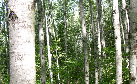
White birch forest type
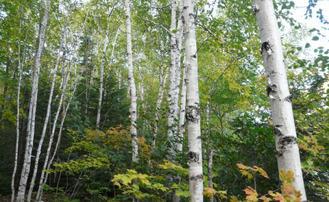
The white birch forest type is dominated by white birch, and is associated with poplar, spruce and fir. It is often found with spruce/fir in the understory. This forest type is typically found on fresh to moist sandy sites in the boreal forest.
| Metric | Value |
|---|---|
| Total area in MFZ (hectares) | 1,716,266 |
| Crown managed forest area (hectares) | 1,232,070 |
| Proportion of MFZ forest (%) | 4.7% |
Hardwood forest type
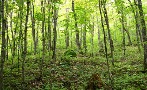
The hardwood forest type consists of a wide range of deciduous species, primarily sugar maple with a lesser component of yellow birch, oak, beech, basswood, ash and white pine. It is the dominant forest type in the Great Lakes-St. Lawrence forest region.
| Metric | Value |
|---|---|
| Total area in MFZ (hectares) | 2,565,209 |
| Crown managed forest area (hectares) | 1,215,664 |
| Proportion of MFZ forest (%) | 7.0% |
Forest area infographic
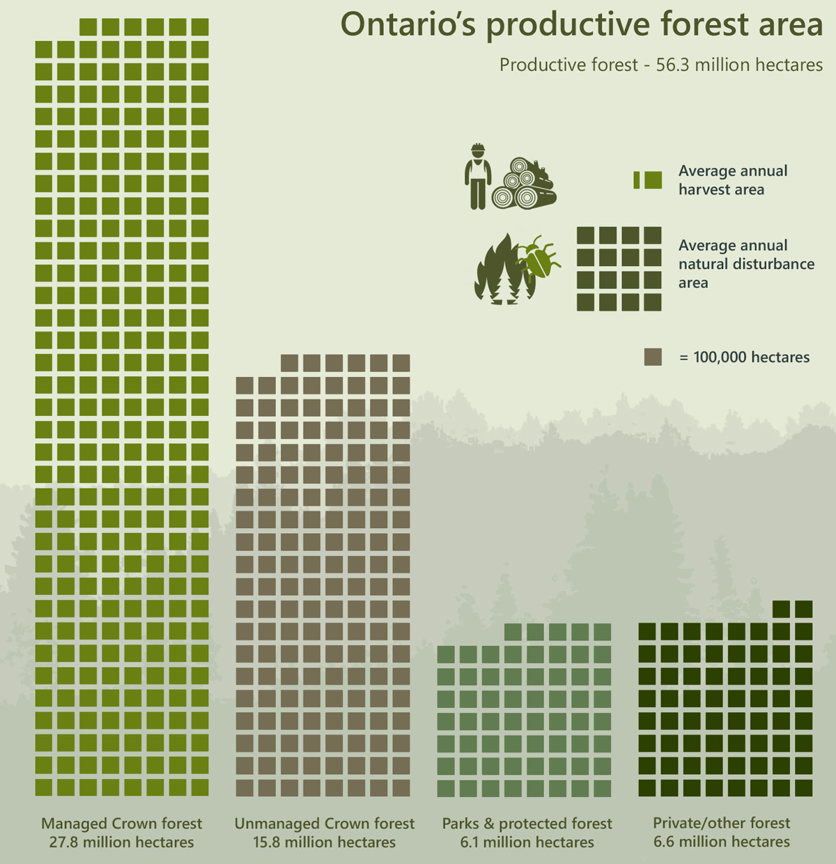
| Category | Area (hectares) |
|---|---|
| Managed Crown forest | 27,830,594.5 |
| Unmanaged Crown forest | 15,794,165.5 |
| Parks & protected forest | 6,052,603.4 |
| Private/other forest | 6,620,014.5 |
| Average harvest | 132,697.0 |
| Average natural disturbance | 1,629,664.8 |