Brown’s Inlet Conservation Reserve Management Statement
This document provides policy direction for the protection, development and management of the Brown’s Inlet Conservation Reserve and its resources.
Statement of Conservation Interest
Ministry of Natural Resources
Rainy Lake Area
Fort Frances District
March, 2002
John Munroe
District Planner
Approval Statement
I am pleased to approve this Statement of Conservation Interest for the Brown’s Inlet Conservation Reserve.
This Statement of Conservation Interest provides guidance for the management of the conservation reserve and the basis for the ongoing monitoring activities. More detailed direction at this time is not anticipated. Should significant facility development be considered or complex issues arise requiring additional studies, more defined management direction, or special protection measures, a more detailed Resource Management Plan will be prepared with full public consultation.
The public was consulted during the original regulation process and further consultation is not required at this time.
The conservation reserve will be managed under the jurisdiction of the Rainy Lake Area Supervisor, Fort Frances District, Ministry of Natural Resources.
Signed by:
C. Lauer
Regional Director
Northwest Region
Date: March 24, 2003
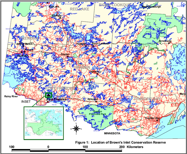
Figure 1: Location of Brown’s Inlet Conservation Reserve
Enlarge Figure 1: Location of Brown’s Inlet Conservation Reserve
1.0 Introduction
On July 16, 1999, the Ontario Government released the Ontario’s Living Legacy Land Use Strategy to guide the planning and management of Crown lands in central and parts of northern Ontario. A major part of the Ontario’s Living Legacy Land Use Strategy was a government intent to establish 378 new protected areas. This commitment marks the biggest expansion of provincial parks and conservation reserves in Ontario’s history.
The Brown’s Inlet Conservation Reserve is part of this significant expansion of Ontario’s protected areas system.
Conservation reserves are areas of Crown land set aside by regulation under the Public Lands Act, complementing provincial parks in protecting representative natural areas and special landscapes. Most recreational (e.g. hiking, skiing, tourism related uses, nature appreciation) and non-industrial (e.g. fur harvesting, commercial fishing and bait harvesting) activities that have traditionally been enjoyed in the area will continue, provided that these uses do not impact on the natural features needing protection. Hunting and fishing is permitted within all new conservation reserves proposed through Ontario’s Living Legacy.
Commercial timber harvesting, mining, aggregate extraction and commercial hydroelectric development are prohibited in conservation reserves.
Brown’s Inlet Conservation Reserve is located in northwestern Ontario in the Fort Frances Administrative District of the Ontario Ministry of Natural Resources, approximately 15 kilometres north of the town of Fort Frances. The site is accessible by road with its southern boundary being made up in part by a portion of the Wasaw/Boffin Road which accesses Rainy Lake Indian Reserve 18C (Stanjikoming) to the south. The Brown’s Inlet site is approximately 3185 hectares in size (OMNR, 2001). The conservation reserve and surrounding area is largely undeveloped Crown land and the dominant land uses are mining, recreation and forestry. A tertiary road bisects the area, running north from the Wasaw/Boffin Road to private property on Brown’s Inlet. The waters of Rainy Lake form the northern and eastern boundaries of the site.
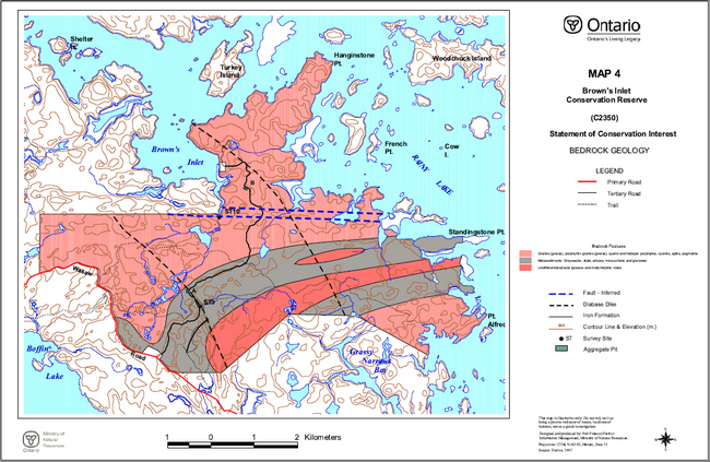
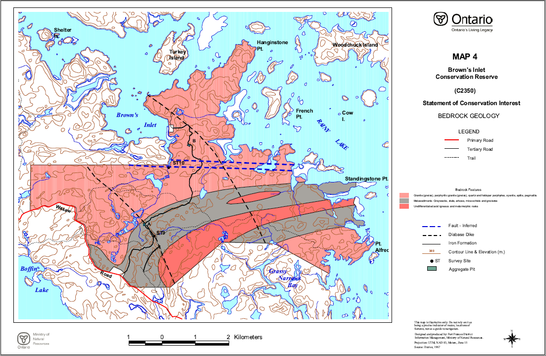
Brown’s Inlet Conservation Reserve is located within Hills' Site Region 5S and Site District 5S-1 (Hills, 1961). The site lies within the Wabigoon subprovince of the Superior geological province. The conservation reserve lies entirely over the Rainy Lake batholithic complex, with felsic igneous rocks intruding parallel belts of clastic metasediments. Complex rocks typify the contact zone between metasedimentary and granitic rocks. Two diabase dikes have been mapped within the conservation reserve and the Quetico Fault runs east-west through the northern portion of the area. Gneissic rocks are found throughout the area, particularly in the vicinity of the Quetico Fault. Relatively little mineral exploration has traditionally occurred within the area owing to the low mineral potential (Springer, 1978) in comparison to surrounding areas.
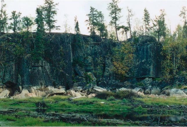
Figure 2: Rock scarp, near north boundary, Brown’s Inlet Conservation Reserve.
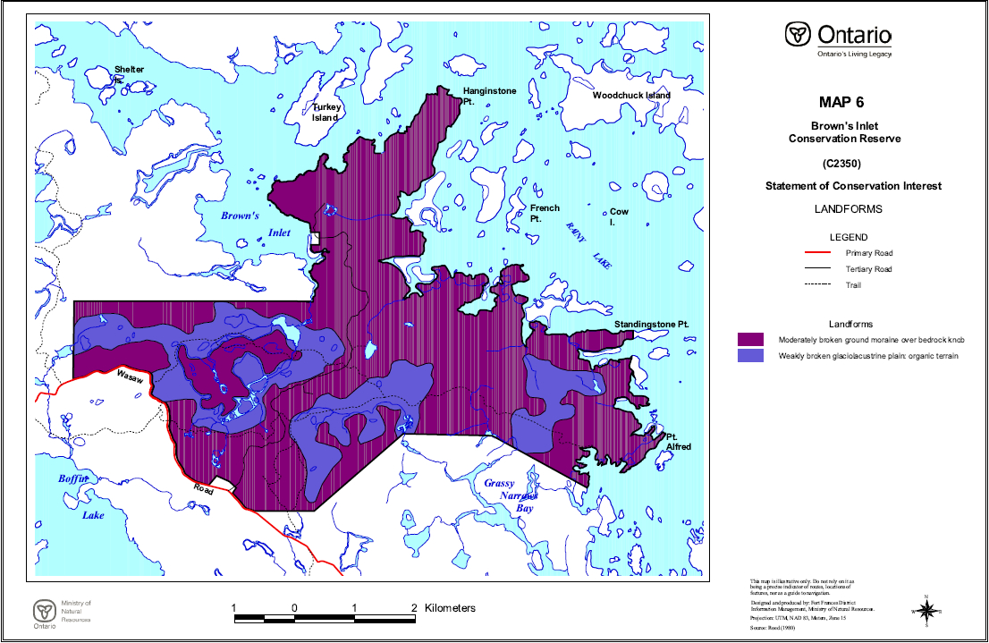
Surficial geological features are dominantly ground moraine, representing shallow tills forming a discontinuous cover over the Precambrian bedrock, which is often exposed on the surface. The low-lying areas contain glaciolacustrine sediments, including sandy, clay and mixed materials that may have been deposited during the Emerson phase high stand of glacial Lake Agassiz. The presence of a subordinate, under-represented glaciolacustrine clay element (Noble, 1997), has been confirmed within the site. The rugged topography varies from a maximum elevation of approximately 380 metres on some of the hilltops and ridges in the south to approximately 340 metres in the peatlands and along the shores of Rainy Lake. Organic deposits of Recent origin occupy the depressions between the surrounding uplands.
The wetlands, which dominate much of the area of the conservation reserve, represent a local headwater area and consist of two primary drainage basins, with several smaller drainages emptying directly into Rainy Lake. The main drainages consist of: a large basin west of the central tertiary road which bisects the site, that flows north into the waters of Brown’s Inlet; and a southeastern drainage that flows south into Grassy Narrows Bay. Beaver dams are frequent throughout the area, creating significant impoundments.
The wetlands captured by the Brown’s Inlet Conservation Reserve include representative areas of black spruce treed bog, black spruce poor swamp, black spruce intermediate swamp, black spruce/tamarack treed fen, open poor fen, open moderately rich fen, thicket swamp, shore fen, sheltered marsh and meadow marsh. Upland ecosites include rock barren; red, white and jack pine on very shallow soil; black spruce and jack pine on very shallow soil; hardwood, fir and spruce mixedwoods on coarse, loamy and sandy soils; and pine/spruce feathermoss sites. Black ash occurs in pockets throughout the area on moist, fine-textured soils and remnant large white pine occur sporadically. Scattered, stunted red oak occurs periodically on the shallow soils of the bedrock uplands. The occurrence of tree species here such as red and white pine and red maple, which are more common further to the south, led to the inclusion of the area as part of the Great Lakes - St. Lawrence Forest Region (Rowe, 1972). Rowe recognizes the Rainy River area as part of a separate section of the forest region that is influenced by the northward movement of the southern forest, the prairie to the west and the northern forest.
The Natural Heritage Information Centre has recorded no rare plant species for the site, however detailed life science surveys would be required to confirm this. Species diversity within this conservation reserve is not expected to be as great as that for areas lying farther to the west in the District. The conifer, hardwood and mixedwood forested lands of the conservation reserve provide a variety of habitat for species such as moose, lynx, red squirrel, grey wolf, black bear, marten, grey jay and great grey owl. Much of the upland forest surrounding the wetlands has been harvested over the past twenty years, which provides a temporal or seral diversity to the forest habitats as well. The wetland portions of the conservation reserve provide nesting and foraging habitat for a variety of waterfowl, while the forested margins provide habitat for upland birds. The presence of dwarf leatherleaf (Chamaedaphne calyculata) that had been suggested as existing within the site and being rare in the site district (Noble, 1997), has been confirmed at two sample locations. Several deer wintering areas have been identified within the conservation reserve, and two osprey nesting sites have also been identified within the area. A walleye spawning site exists along the northern boundary of the conservation reserve, at the head of the estuary at the south end of Brown’s Inlet.
The site has a low to moderate potential for outdoor recreational activities, owing to the dominant wetland features of the site. Direct road access exists from the Wasaw/Boffin Road, which runs along the southern boundary of the site, and the central tertiary road that bisects the site. Numerous old tertiary roads and trails cross the southernmost portions of the area, although not passable in places to vehicular traffic. Access may also be gained by water from access points on Rainy Lake off Highway #11 to the south. Several large beaver ponds exist in the area, but no sport fish are known to exist within the waters. The best recreational opportunities are associated with activities such as nature study, bird and wildlife viewing and photography, and hunting.
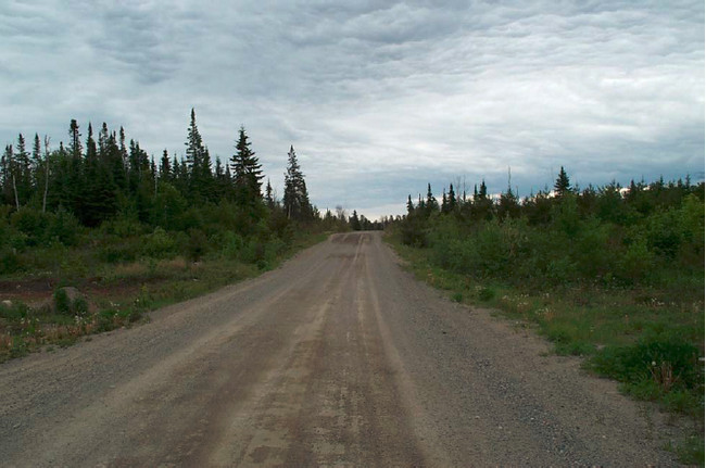
Figure 3: Wasaw/Boffin Road looking west (boundary of Brown’s Inlet Conservation Reserve is at the edge of the right-of-way on the right).
The purpose of this Statement of Conservation Interest is to identify the natural heritage values of the Brown’s Inlet Conservation Reserve, the activities which occur there and, through a set of management guidelines, outline the activities which will and will not be permitted, as well as the management direction for the area (MNR, 1997).
2.0 Background Information
The Brown’s Inlet Conservation Reserve is an area protected as representative of landforms and vegetation types, including a mixture of forest types on weakly broken ground and end moraine, as well as treed and open wetlands (OMNR, 1999). The dominant features of the site are the large peatland basins and the wetland ecosites that occur there. The area is accessible by road and water, although penetrating to the interior requires significant effort. Forestry, mining and trapping are the dominant land uses surrounding the conservation reserve, but comparatively little development has occurred. The Wasaw/Boffin Road, which forms the southwestern boundary of the site, accesses the Stanjikoming I.R. to the south.
Table 1: Background Information
| Name | Brown’s Inlet Conservation Reserve |
|---|---|
| Site Region / Site District | 5S / 5S-1 |
| Ecosite Class | ES 7, 11, 12, 14, 19, 20, 21, 23, 34, 35, 36, 40, 41, 42, 44, 45, 46 and 47 |
| OMNR Administrative Region / District / Area | Northwest / Fort Frances / Rainy Lake Area |
| Total Area (ha) | 3185 |
| Regulation Date | Not yet regulated (anticipated 2003) |
| First Nations with Interest in Area | Treaty Three: Stanjikoming and Couchiching First Nations. Other First Nations may also have an interest |
| OBM | 15U 4700/54030 |
| Lat./Long. | 48° 46' 50"N; 93° 24' 30"W |
| Basemap | 2015 460054000, 470054000 |
| Forest Cover | Forest Cover Upland forest: red, white and jack pine on very shallow soil; black spruce and jack pine on very shallow soil; hardwood, fir and spruce mixedwoods on coarse, loamy and sandy soils; and pine/spruce feathermoss sites. Lowland forest: black spruce treed bog, black spruce poor swamp, black spruce intermediate swamp, and black spruce/tamarack treed fen. . Black ash occurs in pockets throughout the area on moist, fine-textured soils and remnant large white pine occur sporadically. Scattered, stunted red oak occurs periodically on the shallow soils of the bedrock uplands. Approximately 74% of the area supports tree growth, with trembling aspen, white birch, jack pine and black spruce being the dominant species overall. Approximately 22% of the forested area is currently under 30 years of age. (Refer to Appendix D) |
| General Location Description | The Brown’s Inlet Conservation Reserve is situated approximately 15 kilometres north of the town of Fort Frances. The site is accessible by road with its southern boundary being made up in part by a portion of the Wasaw/Boffin Road which accesses Rainy Lake Indian Reserve 18C (Stanjikoming) to the south. The Brown’s Inlet site is approximately 3185 hectares in size (OMNR, 2001). The conservation reserve and surrounding area is largely undeveloped Crown land and the dominant land uses are mining, recreation and forestry. A tertiary road bisects the area, running north from the Wasaw/Boffin Road to private property on Brown’s Inlet. The waters of Rainy Lake form the northern and eastern boundaries of the site. The conservation reserve is comprised entirely of Crown land within unorganized territory (refer to Figure 1.) |
| Access | Access can be gained via Highways #11 and #611, and the Wasaw/Boffin Road. Alternatively, access may be gained by water, from access points on Rainy Lake along Highway #11 east of Fort Frances. Old tertiary logging roads and trails cross the southern portions of the conservation reserve, but are primarily winter roads that are not passable during the frost-free period. A central tertiary road running from the Wasaw/Boffin Road north to private property on Brown’s Inlet bisects the site and is passable year-round, but is unmaintained. Access to the interior is primarily by foot. A short ATV trail runs east off the central tertiary road to access a large beaver pond, and shows signs of regular use |
2.1 Targets
This section provides a summary of the earth and life science system and values, cultural resources represented and recreational opportunities available or possible.
Table 2: Summary of Social, Economic and Environmental Opportunities
| Life Science Representation | The Brown’s Inlet Conservation Reserve contains representative examples of vegetated bedrock, sparse forest, conifer forest, deciduous forest, deciduous and conifer mixed forest and open wetland over both weakly and moderately broken ground moraine. Within the lowland basins of the site are examples of conifer forest, deciduous forest and open wetlands on weakly broken glaciolacustrine plain. These features contribute towards representation targets within Site District 5S-1. The most distinctive life science features of the conservation reserve are the wetland ecosites, and the rock barrens of the bedrock ridgetops, and their associated biotic communities. The inclusion of surrounding upland areas representing young conifer, hardwood and mixedwood forests less than 30 years of age contributes, at least in the short term, to representation. The peatlands of the conservation reserve exhibit little patterning in the vegetation, as observed in other wetlands in the district, due to a more highly developed system of streams throughout the site. Detailed life science surveys have not been conducted on the site. The presence of dwarf leatherleaf (Chamaedaphne calyculata) has been suggested as existing within the site and being rare in the site district (Noble, 1997). No records of rare plant species occurring in the area exist (NHIC, 2001). |
|---|---|
| Earth Science Representation | The dominant landform features within the conservation reserve area) moderately to weakly broken ground moraine over bedrock knob, and b) weakly broken glaciolacustrine plain/organic terrain (Roed, 1980). A thin, discontinuous, sandy glacial till has been deposited over the Archean bedrock, with minor glaciolacustrine silts and clays deposited in the lowland areas (Zoltai, 1961). Physiographic units with clay elements are under-represented in the regional and provincial park systems (Noble, 1997). The conservation reserve lies entirely over the Rainy Lake batholithic complex, with felsic igneous rocks intruding parallel belts of clastic metasediments. Complex rocks typify the contact zone between metasedimentary and granitic rocks. Two diabase dikes have been mapped within the conservation reserve and the Quetico Fault runs east-west through the northern portion of the area. Gneissic rocks are found throughout the area, particularly in the vicinity of the Quetico Fault. |
| Cultural Resource Representation | The site contains no known cultural resource values. A major historical travel route in the area lies off the east shore and through Northwest Bay of Rainy Lake. Settlements and encampments tended to be to the south and west. The wetland nature of much of the site may have limited the use of the Brown’s Inlet area to incidental use. More recent uses have been associated with resource extraction and have not resulted in permanent settlement or development, with the exception of unmaintained tertiary forest roads and trails. |
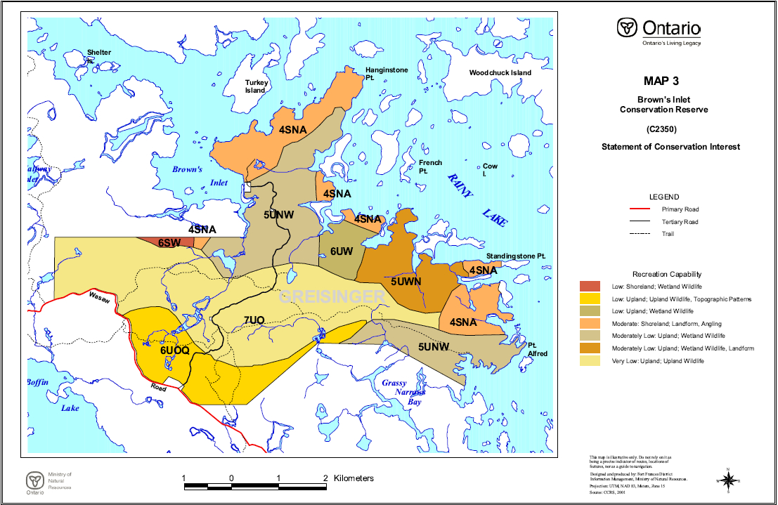
| Recreational Opportunities | The overall recreational potential of the conservation reserve is ranked as moderate. Of the potential recreational activities identified, those which are associated with nature activities such as nature study, bird and wildlife viewing, photography and hunting are considered the most viable, although these are somewhat hampered over much of the area by access limitations and difficulty. The limited easy access to the central wetland features tends to limit use primarily to the upland areas along existing roads and margins of the peatlands. Although there are indications of a relatively high population of large mammals in the area, the advancing regeneration in the area increasingly limits visibility and hunters may favour more recently disturbed areas elsewhere. No navigable waterways or recreational waterbodies exist within the conservation reserve, although the site does include approximately 18 kilometres of shoreline on Rainy Lake, which forms the northern and eastern boundaries of the area. |
2.2 Survey Information
This section provides an overview of the inventories completed, their level of detail and any further inventories required.
Table 3: Level of Survey Performed
| Survey Level | Life Science | Earth Science | Cultural | Recreational |
|---|---|---|---|---|
| Reconnaissance | Yes 1 | Yes 2 | No | Yes 3 |
| Detailed | No | No | No | No |
| Requirement | No | No | No | No |
The reconnaissance surveys which have been completed, in conjunction with other values and earth/life science records for the area (Munroe, 2002) are deemed sufficient in scope and detail to determine management direction for the conservation reserve. More detailed surveys may be undertaken at a later time if circumstances change.
3.0 Values to be Protected
This section provides a description of the key natural heritage values on the site (Appendices) and their condition relative to past resource use and management activities. It also addresses the values' sensitivity to future land use and management activities.
3.1 Values Identified in the Conservation Reserve
Life Science
Identified ecosites classified in accordance with the Northwestern Ontario Forest Ecosystem Classification (Racey et al, 1996) within the conservation reserve include:
- ES7 Rock Barren
- ES11 Red Pine - White Pine - Jack Pine: Very Shallow Soil
- ES12 Black Spruce - Jack Pine: Very Shallow Soil
- ES14 Pine - Spruce Mixedwood: Sandy Soil
- ES19 Hardwood-Fir-Spruce Mixedwood: Fresh, Sandy - Coarse Loamy Soil
- ES20 Spruce-Pine / Feathermoss: Fresh, Sandy- Coarse Loamy Soil
- ES21 Fir - Spruce Mixedwood: Fresh, Coarse Loamy Soil
- ES23 Hardwood-Fir-Spruce Mixedwood: Moist, Sandy - Coarse Loamy Soil
- ES34 Treed Bog: Black Spruce / Sphagnum: Organic Soil
- ES35 Poor Swamp: Black Spruce: Organic Soil
- ES36 Intermediate Swamp: Black Spruce (Tamarack): Organic Soil
- ES40 Treed Fen: Tamarack - Black Spruce/Sphagnum: Organic Soil
- ES41 Open Poor Fen: Ericaceous Shrub - Sedge/Sphagnum: Organic Soil
- ES42 Open Moderately Rich Fen: Ericaceous Shrub/Sedge: Organic Soil
- ES44 Thicket Swamp: Organic-Mineral Soil
- ES45 Shore Fen: Organic Soil
- ES46 Meadow Marsh: Organic-Mineral Soil
- ES47 Sheltered Marsh: Emergent: Sedimentary Peat Substrate
A map displaying the distribution of the represented ecosites is contained in Appendix C.
The wetlands within the site tend to exhibit minerotrophic conditions, with fens predominating over bogs. The presence of dwarf leatherleaf (Chamaedaphne calyculata) low shrub bog has been confirmed within the conservation reserve, as suggested by earlier reconnaissance (Noble, 1997). Treed and open wetlands constitute approximately 34% of the total area of the conservation reserve.
Those parts of the conservation reserve supporting tree growth include areas dominated by jack pine (19%), black spruce (13%), white birch (20%) and aspen (47%). The absence of carbonates in the glacial tills may explain the lack of eastern white cedar on the site, which is commonly associated with other wetlands in the district. Other tree species found on the area include tamarack, black ash, balsam poplar, red oak, white pine, red pine, white spruce, red maple and balsam fir. The age of the forest cover ranges from 5 to 100 years, but the weighted average age is only 46. The lowland black spruce represents the oldest stands. The white and red pine are most commonly found near the shoreline of Rainy Lake on shallow soils over bedrock, and were observed to be neither exceptionally large nor old. Much of the upland forest has been logged over the past 30 years, accounting for the younger age classes represented in the jack pine and poplar types. Appendix C contains a forest cover map and Appendix D contains stand listings for the conservation reserve.
The vegetation of the conservation reserve is typical of the ecosites represented, with no rare plants listed in the Natural Heritage Information Centre database having been documented for this site.
Two osprey nesting sites have been identified within the boundaries of the conservation reserve. A walleye spawning site has been identified at the stream outlet flowing into the south end of Brown’s Inlet, along the northern boundary of the site.
The extensive marsh areas occurring along the shores of Rainy Lake, particularly along the eastern shore and in Brown’s Inlet, provide excellent nesting and feeding habitat for waterfowl. The presence of wild rice stands throughout the area contributes substantially to the habitat value.
Beaver dams occur frequently throughout the site and are responsible for much of the open water and marsh areas occurring there. These dams and impoundments are transient over time and several large dams near the northern boundary south of Brown’s Inlet had recently been breached, resulting in the initiation of ecological succession in the drained basins.
A network of well-used game trails crosses wetland features and connects the treed uplands. Signs of use of the area by bear, deer and moose are frequently observed. Deer wintering areas have been identified over much of the eastern half of the conservation reserve.
A more detailed discussion of the life science features of the conservation reserve may be found in the Life Science Reconnaissance Report for the site (Munroe, 2002a).
Earth Science
Located within the western portion of the Wabigoon subprovince, the Brown’s Inlet Conservation Reserve occupies an area dominated by the felsic igneous rocks of the Rainy Lake batholithic complex, which intrudes curvilinear belts of metasedimentary rocks. Two northwest trending diabase dikes have been identified, cutting through both rock types within the area, which form part of the Kenora-Fort Frances Swarm. The Quetico fault cuts through the northern third of the conservation reserve, running east-west in the vicinity of Brown’s Inlet. The rocks consist of mylonite, granitic gneisses, granodiorite, quartz monzonite and gneissic to schistose greywackes.
The topography is moderately to weakly broken, with bedrock knob terrain predominating, rising from an elevation of approximately 340 metres in the wetlands and along the shores of Rainy Lake to 380 metres on some of the ridges and hilltops. The location of the Quetico fault within the site is indicated by a lineament consisting of a deep, steep-sided valley and a series of wetlands running east-west across the northern third of the area at the southern base of the Hangingstone Peninsula. The area is covered by a thin, discontinuous drift of sandy glacial till, with minor occurrences of fine-textured glaciolacustrine sediments and Recent organic deposits occupying depressions between the bedrock uplands. Deeper surficial deposits are localized and tend to occur on the down-ice side of the ice movement to the southwest, in the lea of bedrock features.
The sandy tills in the area were deposited by a glacial advance from the northeast (Zoltai, 1961) and the glaciolacustrine sediments found in the low-lying basins between the bedrock were deposited during the Emerson phase high stand of glacial Lake Agassiz which occupied the area as the ice sheet retreated (Teller et al, 1983). Varved clays may be observed along the outflow stream flowing into Brown’s Inlet, with alternating layers of red and buff sediments. The red clays are believed to have originated from eastern sources during a glacial period when the outflow to Lake Superior was blocked by ice (Zoltai, 1961). Glacial erratics appear sporadically throughout the site, perched upon exposed bedrock. Many of the bedrock hilltops were washed clean of their morainal deposits by wave action from the lake (Zoltai, 1961). Some remnant deposits of the Rainy Lake - Lake of the Woods moraine are found along the southwestern boundary of the area along the Wasaw Road. These deposits are relatively shallow at several metres and appear discontinuous.
The recent deposits within the conservation reserve are represented primarily by the peat deposits that dominate the bedrock-controlled basins within the site. The depth of the peat was found to be greater than 3 metres where sampled, and consisted of a fibric peatymor or typic fibrisol.
Outflow from the western basin into Brown’s Inlet creates a small cascade within the northern boundary of the conservation reserve.
A more detailed discussion of the life science features of the conservation reserve may be found in the Earth Science Reconnaissance Report for the site (Munroe, 2002b).
Cultural
The area contains no identified cultural heritage values.
Aboriginal
The area contains no identified aboriginal values.
Tourism
Brown’s Inlet Conservation Reserve is located in an area where resource extraction has been the primary land use. Although tourism operations exist to the east and south associated with Rainy Lake and the Highway 11 corridor, tourism use of the site has largely not occurred.
Opportunities exist for hunting based upon large mammals such as black bear, white-tailed deer and moose, and nature study/ecotourism based upon the wildlife and vegetation features of the site.
Recreational Fishing
The conservation reserve contains no significant waterbodies, and no gamefish species have been identified within the waters that do occur there, being a few large beaver ponds. Recreational fishing does occur in the adjacent waters of Rainy Lake, and could be associated with limited camping opportunities on the shoreline. A walleye spawning site exists at the outflow into Brown’s Inlet.
Recreational/ Commercial Hunting
Hunting potential, particularly for moose, white-tailed deer and black bear is considered to be high, with evidence found of the use of the area by all three species. The advanced regeneration of the areas once logged increasingly limits visibility and therefore may make hunting more difficult, although some younger disturbances do still exist towards the north on the Hangingstone peninsula. The access limitations associated with the central wetland features of the site limit hunting to the more accessible upland areas and wetland margins along existing access roads. Hunting for upland gamebirds also present opportunities, although again this would be associated primarily with existing access. Hunting for ducks and geese should be excellent, both in the inland marshes and especially the extensive shore marshes along Rainy Lake. Large rafts containing hundreds of ducks were observed along the eastern shore marshes in the fall. The area contains portions of three Bear Management Areas (BMA): FF 09B-017, FF 09B-018, and FF 09B-019 (Refer to Map 2).
Mining
The area is classified as having low mineral potential (Springer, 1978), and was withdrawn from staking activities in 2000 following its having been proposed as a conservation reserve. Little historical exploration has occurred. The area surrounding the conservation reserve contains no active mining claims, with exploration in the area tending to focus on the areas of higher mineral potential to the east, where active claims do exist.
Aggregate
The area is generally low potential for aggregate extraction, with deposits tending to be shallow tills over bedrock (Roed, 1980). No active aggregate pits exist within the conservation reserve, although old inactive pits occur along the central tertiary road and the Wasaw Road.
Forest Harvest
Portions of the upland forest of the conservation reserve have been logged over the past thirty years, although the areas have been regenerated and consist today principally of young poplar, jack pine and mixedwood forest. Approximately 22% of the forested area is less than 30 years of age (Refer to forest resource inventory information in Appendices C and D). Old tertiary logging trails cross the southern portions of the area, although they are largely impassable, except in winter. Scars across some wetland features left by these roads are readily visible on aerial photographs.
Trapping
The conservation reserve contains portions of two traplines: FF25 and FF26. A cabin associated with trapline FF26 has been identified within the conservation reserve to the east of the central road near the shores of Rainy Lake (Refer to Map 2, Appendix C).
Wild Rice
Commercial wild rice harvesting currently does not occur within this conservation reserve, nor have stands been identified. However, significant wild rice stands do occur in the surrounding waters of Rainy Lake.
Wildlife
Although a detailed life science survey would be required to document and substantiate all of the flora and fauna occurring within the conservation reserve, the variety of upland, wetland and aquatic habitat would suggest that the area supports a wide variety of the commonly-occurring local species, either as resident or nesting populations, or occasional visitors. Wildlife species and signs observed in the area during reconnaissance surveys included moose, white-tailed deer, black bear, beaver, red squirrel, grey wolf, snapping turtle, northern painted turtle, northern leopard frog, sharp- shinned hawk, broad-winged hawk, horned owl, bald eagle, sandhill crane, blue-winged teal, Canada goose, mallard duck, black duck, great blue heron, common raven, ruffed grouse, black capped chickadee and pileated woodpecker. A list of the commonly occurring vertebrate species that may be found in the area is contained in the Life Science Reconnaissance Report for the site (Munroe, 2002a). Two osprey nesting sites have been identified within the conservation reserve, as well as deer wintering areas.
Commercial Fish
No commercial fishing for human consumption exists within the conservation reserve. Commercial baitfshing does occur, with the area forming parts of baitfish blocks FF-56 and FF-57.
3.2 Values Protection
The intent of this Statement of Conservation Interest is to protect the identified values by establishing management guidelines for existing and potential uses in this area, given the level of past disturbance and the nature of the existing features. Uses and activities which are permitted, not permitted or conditionally permitted are governed by the policies applying to conservation reserves as stated in the Land Use Strategy and existing conservation reserve policy. Any new uses, and commercial activities associated with them, will be considered on a case by case basis, and must pass a test of compatibility to be acceptable. Compatibility is normally determined through a planning process. The policies outlined in this Statement of Conservation Interest do not supersede any Aboriginal or treaty rights that may exist, or other legal obligations.
Forest Values
The upland forest types and ecosites identified will continue undergoing natural successional and developmental changes already initiated without the advent of a major disturbance such as fire. The lowland black spruce and tamarack forest ecosites are not expected to change, given the autecology of the primary species under these conditions. The treed and untreed peatland features are also likely to remain unchanged in the absence of natural disturbances such as fire. A significant amount of the upland forest is currently less than 30 years of age and will continue to develop naturally in the absence of fire over the next several decades. The upland forest types are dominated by relatively short-lived species such as trembling aspen, white birch and jack pine. Without significant disturbances, these forest types can be expected to slowly succeed to forests dominated by more shade-tolerant species such as balsam fir and black spruce. Human activities that represent the greatest potential impacts on forest structure, such as logging, mining and hydroelectric development, will not be permitted. However, sustaining these values in the long- term may require development of a vegetation management plan and natural disturbance strategy.
Activities occurring on adjacent lands surrounding the conservation reserve are not expected to have a significant impact on the ecology of the site. The conservation reserve captures a headwater area within its boundaries, and no drainage flows into the site from surrounding lands.
Recreational and Commercial Values
The Brown’s Inlet Conservation Reserve contains features that may hold interest for amateur and professional naturalists. There is the potential for a number of low impact, non-consumptive recreational activities such as wildlife viewing and photography, although access difficulties are expected to continue to limit use within the large wetland portions of the site.
The existing traplines, baitfish harvest areas and bear management areas within the conservation reserve will remain and existing uses associated with them allowed to continue. New operations may be considered, subject to the "test of compatibility". Normal application of controls such as quotas and seasons are designed to ensure that affected wildlife populations remain sustainable.
Use of existing trails will be allowed to continue. Proposals for the development of new trails to permit access for these activities will be considered carefully to ensure that the values of the conservation reserve are protected. New trails within the wetland features will be discouraged. Recreational hunting will be permitted, although it is expected that access limitations and maturing young forest will limit this activity over time and the level of use may decline.
Tourism Values
Limited tourism values are associated with this site. Some potential associated with big game and upland bird and waterfowl hunting exists, and the area is currently part of two Bear Management Areas, which will continue to operate. Access is practically limited to the upland areas and peripheries of the wetland features in proximity to existing access roads. Some waterfowl and other hunting opportunities may be possible by boat from the waters of Rainy Lake. The potential for attracting some visitors to the area for non-consumptive recreational activities such as bird watching and wildlife viewing exists, but must be considered relatively limited in the context of other nearby, competing opportunities.
4.0 Management Guidelines
4.1 Land Tenure
The Brown’s Inlet Conservation Reserve consists entirely of Crown land and no disposition of Crown land by sale is permitted within the conservation reserve. The surrounding and adjacent lands consist of Crown lands, as well, with the exception of a relatively small parcel of private property on Brown’s Inlet. No expropriation or purchasing of private land for inclusion in the conservation reserve is planned. New leases or land use permits may be considered for approved activities, subject to the "test of compatibility", but will generally be discouraged within the conservation reserve.
4.2 Existing and Proposed Development
No mining or mineral exploration exists or will be permitted within the conservation reserve.
No maintained roads currently exist within the area and no new roads will be permitted. Existing roads are revegetating and their continued use as trails will be permitted, but no maintenance or repair will be undertaken. The right-of-way associated with the central tertiary access road, as well as two aggregate pits adjacent to it, have been removed from the area of the conservation reserve prior to regulation, to allow continued access to private property.
No commercial aggregate permits exist for the area of the conservation reserve and no new permits will be issued. Aggregate extraction will not be permitted.
No logging operations or facilities, nor hydro-electric facilities or structures currently exist within the area and no new development will be permitted.
Only one identified cabin associated with commercial bear management, traplines or baitfish harvesting on the site exists, and will be allowed to continue. No new cabins or other facilities associated with such operations will be permitted. Existing trails used in conjunction with these activities may continue to be used, but new trails will only be considered subject to the "test of compatibility". New fur harvesting or commercial baitfishing operations can also be considered, subject to the "test of compatibility".
A few limited trails suitable for recreational purposes, such as hiking, skiing, snowmobiling or horseback riding, exist within the conservation reserve, primarily in the form of unmaintained tertiary forest access roads. Continued use of these roads as trails will be permitted. The development of new trails will be subject to further planning if considered desirable. Under such circumstances planning will favour the upland portions of the site, and avoid the wetland features and other sensitive areas in locating trails.
No private recreational camps currently exist within the conservation reserve and no new camps will be permitted.
4.3 Recreational Activities
Recreational hunting will be allowed to continue within the conservation reserve, subject to applicable regulations. The use of motorized and non-motorized means of transport will be permitted, but ATV's will be limited to existing trails. New trails may be permitted, subject to the "test of compatibility", and will be discouraged within the wetland features and other sensitive areas of the site. Other recreational low impact activities and non-motorized recreational travel such as skiing, canoeing and hiking are permitted.
The use of mechanized means of transport such as snowmachines and all-terrain vehicles off of existing trails will not be permitted, except for direct retrieval of game in accordance with existing conservation reserve policy. No evidence of existing recreational snowmachine use has been identified, but occasional use of old tertiary roads crossing the southern portions of the area may be occurring. The recreational use of old logging roads within the site will be permitted to continue on upland portions of the site, but the unauthorized use of motorized vehicles for recreational purposes on those portions of such roads within the wetland features of the site will not be permitted.
Existing Ministry policies and regulations relating to Crown land camping will apply. Traditional use of motor boats is permitted. Existing boat cache authority (recreation) is permitted to continue, unless there are significant demonstrated conflicts. Private recreation boat caches may be permitted subject to the "test of compatability".
Sport fishing is a permitted use within the conservation reserve, subject to applicable regulations, but no identified sport fishing opportunities within the limited waters of the conservation reserve have been identified.
Low-impact recreational activities such as nature appreciation, photography and wildlife viewing are permitted and will be encouraged.
4.4 Commercial Activities
Activities associated with current traplines and baitfish harvesting areas in the conservation reserve will be permitted to continue in accordance with existing policies and regulations. New operations may be considered, subject to a test of compatibility.
Existing bear management areas will be permitted to continue in accordance with existing policies and regulations. No new operations are permitted.
No commercial tourism facilities, such as outpost cabins, resorts or lodges, exist within the conservation reserve. New commercial tourism facilities within the Brown’s Inlet Conservation Reserve may be considered, unless there are significant demonstrated conflicts, subject to review through the planning process as set out in the Draft Class Environmental Assessment for Ontario’s Provincial Parks and Conservation Reserves. Existing Ministry policies and regulations relating to Crown land camping will apply Existing boat cache authority (commercial tourism, resource user) is permitted to continue, unless there are significant demonstrated conflicts. New resource user and commercial tourism boat cache authority may be considered, subject to a planning process and the "test of compatability".
No commercial food fisheries operations exist within the conservation reserve and no new opportunities are believed to exist. In the unlikely event new operations are proposed, they may be considered subject to the "test of compatibility".
Commercial wild rice harvesting does not occur within the conservation reserve, although significant stands do exist in the adjacent waters of Rainy Lake. No other commercial food harvesting (i.e, blueberries) activities have been identified. Any new activities will require the written authorization of the District Manager, be subject to a test of compatibility and alternative locations will be preferred.
4.5 Aboriginal Interests
The creation of this conservation reserve will not affect any Aboriginal or treaty rights. Consultation with interested First Nations towards identifying cultural and spiritual values within the area will continue.
4.6 Natural Resources Stewardship
4.6.1 Vegetation Management
The Brown’s Inlet Conservation Reserve will be managed to allow natural processes to continue. Suppression of fire will occur in accordance with existing MNR fire suppression strategies, similar to those applied to the surrounding landscape. Suppression techniques employed within the conservation reserve will be modified where possible to minimize the impacts on the features and values of the site. Prescribed burning may be carried out to simulate natural fire, subject to a planning process. The development of a vegetation management plan for the area in the context of regional fire strategies is recommended over time.
Control of insects and diseases within the conservation reserve will be carried out, if required, in accordance with existing Provincial programs and policies. All such proposed activities will be reviewed carefully to ensure that the values of the conservation reserve are protected. Control of non-native species will be considered a priority.
The use of pesticides and other control agents within the conservation reserve, should such measures be considered desirable, will favour biological controls.
4.6.2 Fish and Wildlife Management
Current Acts, Regulations and Policies will apply. The lands and waters of the conservation reserve will be included in scheduled fish and wildlife management programs and activities. The terrestrial and wetland ecosites of the conservation reserve will be considered in other resource management planning as a component of the wildlife habitat in the broader landscape. The introduction of non-native species will not be permitted.
4.6.3 Landforms
Activities that tend to impact landforms, such as aggregate extraction and road construction, will not be permitted.
4.7 Non-Commercial Consumptive Uses
The consumptive uses of fish and wildlife resources within the conservation reserve are discussed under Section 4.3, and commercial consumptive uses under Section 4.4.
Non-commercial food gathering activities such as berry picking for personal use will be permitted to continue. Plant collection except for approved research or inventory purposes will not be permitted.
Non-commercial harvesting of traditional forest products such as fuelwood for personal use may be permitted within the conservation reserve, subject to existing Provincial legislation and policy, only if other viable alternatives do not exist outside the reserve boundaries. The location of any areas where such activities may be permitted will be determined subject to the test of compatibility.
4.8 Cultural Resources Stewardship
The location and specific details regarding cultural heritage resources may be kept confidential in order to ensure protection of such values and sites. No cultural heritage values have been identified within the site to date.
4.9 Client Services
No on-site facilities or services exist within the conservation reserve, nor are any proposed at this time.
The permitted uses and recognized values of this conservation area will be made known to the public through public consultation associated with the Land Use Strategy, the site regulation process, and materials, including this Statement of Conservation Interest, available through Government Information Centres. No significant advertising campaign for the Brown’s Inlet Conservation Reserve is planned at this time.
Future planning for the conservation reserve will be in accordance with the Class Environmental Assessment for Provincial Parks and Conservation Reserves, which may involve formal public consultation.
4.10 Research
Research activities which do not detrimentally affect the values which the conservation reserve is designed to protect will be encouraged, but will require the written authority of the District Manager. Potential research projects may include monitoring of the hydrological and vegetational succession within disturbed portions of the wetland features, such as old winter logging roads. Further, more detailed surveys and documentation of the wetland site types and species would also be desirable.
4.11 Marketing
No marketing associated specifically with this conservation reserve for tourism and recreational purposes is planned at this time.
5.0 Implementation
The Brown’s Inlet site will be regulated as a conservation reserve under the Public Lands Act, in 2002/03, following the process set out in the Ontario’s Living Legacy Protected Areas Regulation Implementation Manual (MNR, 2000).
The Fort Frances District, Rainy Lake Area of the Ministry of Natural Resources will be responsible for implementing the management policies and guidelines for the area. All MNR Resource Management Plans or Land Use Plans have been revised as necessary to exclude timber harvesting and other non-permitted activities from this area. All stakeholders and clients will be informed through mail and other consultation of the changes that will take affect. The Rainy Lake Area will have primary responsibility in administering the policies and guidelines. The primary role is providing public information and monitoring of compliance to the policies and guidelines.
6.0 Review and Revisions
6.1 Review and Revision Process
The Brown’s Inlet Conservation Reserve Statement of Conservation Interest will be reviewed on an ongoing basis and revised as needed.
Revisions to the Brown’s Inlet Statement of Conservation Interest will be subject to the requirements as specified in the Draft Class Environmental Assessment for Provincial Parks and Conservation Reserves. Significant changes as defined under the Class EA will involve a public consultation process and approval from the District Manager and Regional Director of the Ministry of Natural Resources.
6.2 Public Consultation
6.2.1 Past Consultation
The Brown’s Inlet site was part of the consultation process throughout the land use planning exercise. Consultation associated with the land use planning initiative occurred at a number of stages in the process:
- Lands For Life round table consultation June 1997- July 1998
- Ontario Forest Accord 1999
- Ontario’s Living Legacy round table discussions 1999
- Ontario’s Living Legacy Land Use Strategy 1999
- OLL Site Regulation Public Consultation Process 2001
6.2.2 Present and Future Consultation
Summary of the 2001 Site Regulation Process:
- Mailouts were sent to adjacent property owners and other affected and interested parties and agencies by the District Manager, and newspaper adds placed in local and regional media, informing of the regulation process and inviting comments on the proposed boundaries
- The commercial baitfisher (Baitfish Block 56) in the area raised questions about any restrictions on his operation in the new protected area. It was explained that commercial baitfishing was a permitted existing use in conservation reserves and the protected area was designated primarily to protect vegetation and earth science features, with the main restrictions applying to mining and timber extraction. Most other uses would continue to be allowed. It was further explained that existing roads and trails may continue to be used to access the area, although permission would be required prior to creating any new trails. In the latter case the potential impact on the features for which the protected area was created would be the determining factor. The individual further enquired about whether the creation of this conservation reserve would lead to an "upgrading" of its' status to some more restrictive category of protected area in the future. In response, it was explained that conservation reserves are not designed to be an interim protection measure or category. Further, it was explained, such areas, regulated under the Public Lands Act, are designated with the primary objective being to ensure that natural earth and life science features are protected, without placing unnecessary restrictions on uses or activities which do not threaten those values. Finally, it was suggested that the possibility always exists that, at some point in the future, the area could be re-designated as some other type of protected area, but this could be true for any area, whether currently protected or not. The process of changing the designation would be no different than that required to create a new protected area elsewhere
- The property owner the private property on the northwest side of the proposed CR, on Brown’s Inlet was particularly interested in the implications for his access road running through the area, specifically whether he would be allowed to continue to use it and whether he would also be allowed access to aggregates for maintenance purposes. The respondent also indicated that the area was heavily used by hunters in the fall, and that some property owners, notably on Turkey Island north of the site, were using the road to access their cottages. It was explained that the area had been visited and existing borrow pits along the road had been identified and the need for access to maintenance materials was recognized. It was further explained that the road would continue to be available for his use, and provisions for maintenance would need to be incorporated into the planning documents for the area
- Recommendations: Based on the input received, it was recommended that the central tertiary access road and its right-of-way be removed from the site, along with two identified aggregate sources for maintenance purposes, and revisions to the boundaries of the site were deemed necessary
(More detailed Consultation Documentation is available on file at the Fort Frances District offices of the Ministry of Natural Resources)
The policies that form the basis of this Statement of Conservation Interest are specified in the approved Ontario’s Living Legacy Land Use Strategy. A policy statement defining the land use intent and specific policies applicable to this conservation reserve may also be found posted on the internet as part of the Land Use Atlas (under review, expected completion 2003). Should revisions to the policies applying to this conservation reserve be required over time, such revisions will be subject to the provisions of the Land Use Strategy regarding amendments.
7.0 References
Bajc, A. F, White, T.A.. and Gray, P.A. 1987. Quaternary Geology, Northwest Bay Area. Ontario Geological Survey. Preliminary Map P.3138. scale 1:50,000.
CCRS. 1999. Canada Land Inventory Classification for Recreation. The Canadian Centre for Remote Sensing, Natural Resources Canada. Ottawa.
Davies, J. C. and Pryslak, A.P. 1967. Kenora - Fort Frances Sheet. Ontario Department of Mines. Geological Compilation Series, Map 2115. scale 1:253,440.
Hills, G.A. 1961. The Ecological Basis for Land-Use Planning. Ont. Dept. Lands and Forests. Toronto, Ont. Res. Rep. No. 42. 63 pp.
Ministry of Natural Resources (MNR). 1997. Conservation Reserves Policy and Procedure. PL 3.03.05.
Ministry of Natural Resources (MNR). 2000. Protected Areas Regulation Implementation Manual; Internal Document.
Munroe, J. 2002a. Brown’s Inlet Conservation Reserve: Life Science Reconnaissance Inventory Report. Ministry of Natural Resources, Fort Frances District. Unpublished report.
Munroe, J. 2002b. Earth Science Reconnaissance Inventory Report: Brown’s Inlet Conservation Reserve. Ministry of Natural Resources, Fort Frances District. Unpublished report.
Munroe, J. 2002c. Recreation Inventory Report – Brown’s Inlet Conservation Reserve Ministry of Natural Resources, Fort Frances District. Unpublished report.
Noble, T. 1997. Brown’s Inlet Peatland (5S1). Preliminary gap analysis report. Ontario Ministry of Natural Resources, Northwest Region. 3 pp.
NHIC 2002. Natural Heritage Information Centre Database. Ontario Ministry of Natural Resources. Page /page/natural-heritage-information-centreAccessed 2002, Feb. 8.
Ontario Ministry of Natural Resources (OMNR) 1996. Forest Resources Inventory - Fort Frances Forest. Ontario Ministry of Natural Resources Digital G.I.S. database, updated to year 2000.
Ontario Ministry of Natural Resources (OMNR) 1999. Ontario’s Living Legacy - Land Use Strategy. Ontario Ministry of Natural Resources Toronto, Ont. 136 pp.
Ontario Ministry of Natural Resources (OMNR). 2001. Brown’s Inlet Conservation Reserve (C2329) Factsheet. Northwest Region. Thunder Bay. 2p.
Ontario Ministry of Natural Resources (OMNR). 2002. Natural Resources Values Information System (NRVIS). Fort Frances District.
Racey, G.D., Harris, A.G., Jeglum, J.K., Foster, R.F. and Wickware, G.M. 1996. Terrestrial and Wetland Ecosites of Northwestern Ontario. Ont. Min. Natur. Resour., Northwest Sci. & Technol. Field Guide FG-02. 94 pp. + Append.
Roed, M.A. 1980. Rainy Lake Area (NTS 52C/NW), District of Rainy River: Ontario Geological Survey, Northern Ontario Geology Terrain Study 53, 14 p. Accompanied by Map 5069, scale 1:100,000.
Rowe, J.S. 1972. Forest Regions of Canada. Dept. Environ., Can. For. Serv. Ottawa, Ont. Publ. No. 1300 172 pp.
Springer, J. 1978. Ontario Mineral Potential, International Falls-Roseau Sheet, District of Rainy River. Ontario Geological Survey Prelim. Map P.1523, Mineral Deposits Ser., Scale 1:250,000
Teller, J.T., Thorleifson, L.H., Dredge, L.A., Hobbs, H.C. and Schreiner, B. T. 1983. Maximum Extent and Major Features of Lake Agassiz. in Glacial Lake Agassiz. Geological Association of Canada. Special paper 26, p. 43-45. incl. map, 1:3,000,000.
Zoltai, S.C. 1961. Glacial History of Part of Northwestern Ontario. Proceedings of the Geological Association of Canada, v.13, p.61-83.
Appendix A – Permitted Uses List
Land Use Activity for Brown’s Inlet Conservation Reserve
Those uses and management activities not listed in the following table are governed by existing Conservation Reserve policy. Management direction is elaborated in the Statement of Conservation Interest or Resource Management Plan. Any new uses, and commercial activities associated with them, will be considered on a case by case basis, and must pass a test of compatibility to be acceptable. Compatibility is normally determined through a planning process.
Commercial Activities
| Activity | Permitted | Guideline |
|---|---|---|
| Aggregate Extraction | No | |
| Bait Fishing (commercial) Existing: | Yes | Existing use permitted to continue, unless there are significant demonstrated conflicts. |
| Bait Fishing (commercial) New: | Maybe | New operations can be considered, subject to the "test of compatibility". |
| Commercial Fur Harvesting Exisiting: | Yes | Existing use permitted to continue, unless there are significant demonstrated conflicts. Existing trap cabins can continue; new cabins are not permitted. |
| Commercial Fur Harvesting New: | Maybe | New operations can be considered, subject to the "test of compatibility". |
| Commercial Hydro Development | No | |
| Commercial Timber Harvest | No | |
| Commercial Tourism Existing: | Yes | Existing authorized facilities can continue, unless there are significant demonstrated conflicts. |
| Commercial Tourism New: | Maybe | New tourism facilities can be considered during the planning for an individual reserve. |
| Bear Hunting by Non-residents (guided) Existing: | Yes | Existing authorized operations permitted to continue. |
| Bear Hunting by Non-residents (guided) New: | No | New operations not permitted. |
| Outfitting Services Existing: | Yes | Existing authorized operations are permitted to continue. |
| Outfitting Services New: | Maybe | New operations can be considered during the planning for an individual reserve. |
| Outpost Camps Existing: | Yes | Existing authorized operations are permitted to continue. |
| Outpost Camps New: | Maybe | New operations can be considered during the planning for an individual reserve. |
| Resorts/Lodges Existing: | Yes | Existing authorized operations are permitted to continue. |
| Resorts/Lodges New: | Maybe | New operations can be considered during the planning for an individual reserve. |
| Energy Transmission and Communications Corridors Existing: | Yes | |
| Energy Transmission and Communications Corridors New: | No | These facilities should avoid conservation reserve lands wherever possible. |
| Food Harvesting (Commercial) Existing: | Maybe | Written authority required. |
| Food Harvesting (Commercial) New: | Maybe | Written authority required. |
| Mineral Exploration and Development: | No | |
| Peat Extraction: | No | |
| Wildrice Harvesting Existing: | Yes | |
| Wildrice Harvesting New: | Maybe |
Land and Resource Management Activities
| Activity | Permitted | Guideline |
|---|---|---|
| Crown Land Disposition Private Use: | Maybe | Sale of lands is not permitted, except for minor dispositions in support of existing uses (e.g., reconstruction of a septic system). No leases or land use permits currently exist within the conservation reserve. New leases or land use permits permitted for approved activities. |
| Crown Land Disposition Commercial Use: | Maybe | Sale of lands is not permitted, except for minor dispositions in support of existing uses (e.g., reconstruction of a septic system). No leases or land use permits currently exist within the conservation reserve. New leases or land use permits permitted for approved activities. |
| Fire Suppression: | Yes | Fire suppression policies are similar to adjacent Crown lands, unless alternative fire policies have been developed through a planning process. Suppression techniques employed within the conservation reserve will be modified where possible to minimize the impacts on the features and values of the site. |
| Fish Habitat Management: | Maybe | |
| Fish Stocking: | Maybe | Conservation Reserves policy indicates that "featured species management" may be permitted. |
| Insect/Disease Suppression: | Maybe | |
| Inventory/Monitoring: | Yes | |
| Prescribed Burning: | Maybe | May be carried out to simulate natural fire. Subject to a planning process. |
| Roads (resource access) Existing: | Yes | Existing roads can continue to be used. Continued use will include maintenance and may include future upgrading. |
| Roads (resource access) New: | No | New roads for resource extraction will not be permitted. |
| Vegetation Management: | Maybe | Conservation Reserves policy indicates that Featured Species Management and Natural Systems Management may be permitted. Vegetation management can be considered in a planning process. |
Science, Education and Heritage Appreciation
| Activity | Permitted | Guideline |
|---|---|---|
| Collecting: | No | |
| Historical Appreciation: | Yes | |
| Nature Appreciation: | Yes | |
| Photography and Painting: | Yes | |
| Research: | Yes | |
| Wildlife Viewing: | Yes |
Recreation Activities and Facilities
| Activity | Permitted | Guideline |
|---|---|---|
| All-Terrain Vehicle Use On Trails: | Yes | Existing use permitted to continue where it does not adversely affect the values being protected. |
| All-Terrain Vehicle Use On Trails: | No | ATV use off trails not permitted except for direct retrieval of game. |
| Campgrounds: | Maybe | |
| Food Gathering: | Yes | |
| Horseback Riding (trail): | Yes | Existing use on trails permitted. |
| Hunting: | Yes | |
| Mountain Bike Use: | Yes | Existing use on trails permitted. |
| Motor Boat Use Commercial: | Maybe | Traditional use of motor boats is permitted. Existing boat cache authority (commercial tourism, resource user, recreation) is permitted to continue, unless there are significant demonstrated conflicts. New commercial tourism boat cache authority may be considered during the planning for an individual reserve. |
| Motor Boat Use Private: | Maybe | Resource user and private recreation boat caches may be permitted subject to the “test of compatibility”. |
| Non-motorized Recreation Travel: | Yes | |
| Private Recreation Camps (Hunt Camps) Existing: | Yes | Existing camps permitted to continue, and may be eligible for enhanced tenure, but not purchase of land. |
| Private Recreation Camps (Hunt Camps) New: |
No | |
| Rock Climbing: | Maybe | |
| Snowmobiling On Trails: | Yes | Existing use permitted to continue where it does not adversely affect the values being protected. |
| Snowmobiling Off Trails: | Maybe | Off trails not permitted, except that snowmobiles maybe used for direct retrieval of game. |
| Sport Fishing: | Yes | |
| Trail Development | Maybe | Development of new trails for a variety of activities (e.g., hiking, cross-country skiing, cycling, horseback riding, snowmobiling) can be considered as part of planning for an individual reserve. No new trails are proposed for this conservation reserve at this time. |
Note: The policies outlined in this table do not supersede any Aboriginal or treaty rights that may exist, or other legal obligations.
Source: OLL Land Use Strategy, Table 4, and Conservation Reserves Policy.
Management of this conservation reserve is carried out within the context of conservation reserve policy as amended by the policies for new conservation reserves outlined in the OLL Land Use Strategy.
Source of Direction:
LUS (1999)
Fort Frances District Fisheries Management Plan (1987)
Appendix B – Survey Checksheets
Earth Science Inventory Checklist
| Name: | Brown’s Inlet Conservation Reserve (C2350) |
|---|---|
| Map Name | Mainville Lake |
| NTS Number | 52C/14 |
| UTM Reference | 15U 4700/54030 |
| OBM Number | 2015 460054000 & 470054000 |
| Latitude | 48° 46' 50" |
| Longitude | 93° 24' 30" |
| NAD | 83 |
| Minimum Altitude | 370 m |
| Maximum Altitude | 390 m |
| Elevation - Maximum | 380 |
| Elevation - Minimum | 340 |
| County | N/A |
| Township | N/A |
| Lot | N/A |
| Area (ha) | 3185 ha |
| Ownership | Crown |
| MNR Region | Northwest |
| MNR District | Fort Frances |
| Park Zone | Northwest |
| Aerial Photographs Year-Roll-Flight Line-Numbers |
95 - 9 - 4826E - 104 to 110 95 - 44 - 4827 - 240 to 244 95 - 39 - 4828D - 51 & 52 |
| Earth Science Features | Site is located upon the felsic igneous rocks of the Rainy Lake batholithic complex which intrude curvilinear zones of metasedimentary rocks; two examples of diabase dikes cut across all rock types; a portion of the Quetico fault bisects the area at the base of the Hangingstone Peninsula; foliated rocks include gneisses and schists associated with the fault zone and the metasedimentary zones; peat deposits occupy the basins. |
| Significance | Regional significance. Representation of features associated with the Quetico Fault, two examples of diabase dikes of the Kenora-Rainy Lake Swarm, the complex rock types associated with the contact zone between the medisedimentary and granitic rocks and the glacial features formed at the last ice front which stood over the area. The peatlands contrast with those to the southwest in being deeper, possibly older and confined to basins within the bedrock-controlled uplands. Suspected glaciolacustrine deposits under-represented in protected areas. |
| Sensitivity | Earth science features within the site not considered sensitive to uses normally permitted within a conservation reserve. Exception would be peatland features which are sensitive to winter trails. |
| Recommendations | Trails should be confined to upland areas whenever possible. More detailed study of the contact zone between metasedimentary and granitic rocks, the glacial deposits beneath the peatlands and the age of the peat deposits themselves are possible subjects for future surveys if time and other resources allow. |
| Major References | Bajc, A. F. (1991); Barnett, P.J., Henry, A.P. and Babuin, D. (1991); Davies, J. C. (1967); Davies, J.C. (1973); Roed, M.A. (1980); Teller, J. T. and Clayton, L. (1983); Zoltai, S.C. (1961). |
| Date Compiled | March 2002 |
| Compiler | John Munroe, District Planner, Fort Frances District |
Natural Heritage Area – Life Science Checksheet
| Name: | Brown’s Inlet Conservation Reserve (P2350) |
|---|---|
| Map Name | Mainville Lake |
| Map Number | 52C/14 |
| UTM Reference | 15U 4700/ 540305396400 |
| Latitude | 48° 46' 50" |
| Longitude | 93° 24' 30" |
| NAD | 83 |
| Minimum Altitude | 340 |
| Maximum Altitude | 380 |
| County | Unorganized Area |
| Locality | Unorganized Area, N. of Fort Frances |
| Township | Greisinger |
| Area | 3185 ha |
| Ownership | Crown Land |
| MNR Region | Northwest |
| Ecoregion and Ecodistrict | 5S, 5S1 |
| Landform Unit(s) | Moderately broken ground moraine/ bedrock knob: organic terrain: weakly broken glaciolacustrine plain |
| MNR District | Fort Frances |
| Aerial Photographs Year-Roll-Flight Line-Numbers |
95 - 9 - 4826E - 104 to 110 95 - 44 - 4827 - 240 to 244 95 - 39 - 4828D - 51 & 52 |
Physical and Biological Features
| Representation | Broadly, the conservation reserve encompasses conifer forest, deciduous forest, deciduous mixed forest, conifer mixed forest, sparse forest and vegetated bedrock on moderately broken ground moraine; and conifer forest, conifer mixed forest, deciduous forest and open wetland on weakly broken glaciolacustrine plain, with a subordinate clay element. The site consists of bedrock knob topography, with three main lowland basins between the surrounding bedrock uplands. Wetland ecosites, which occupy the basins overlying lakebed sediments of glacial Lake Agassiz, include black spruce treed bog, black spruce poor swamp, black spruce intermediate swamp, black spruce/tamarack treed fen, open poor fen, open moderately rich fen, thicket swamp, shore fen, sheltered marsh and meadow marsh. Upland ecosites include rock barren; red, white and jack pine on very shallow soil; black spruce and jack pine on very shallow soil; hardwood, fir and spruce mixedwoods on coarse, loamy and sandy soils; and pine/spruce feathermoss sites. The drainage is to the north and southeast, with frequent beaver dams creating significant impoundments. Black ash occurs in pockets throughout the area on moist, fine-textured soils and remnant large white pine occur sporadically. Scattered, stunted red oak occurs periodically on the shallow soils of the bedrock uplands. |
|---|---|
| Condition | Much of the upland portions of the site have been logged over the past twenty years, although the area has regenerated to jack pine, poplar and mixedwoods, and also includes areas of young red pine plantation. The oldest, undisturbed areas are dominantly black spruce lowlands, and are scattered throughout the site. Some residual areas of undisturbed, mature aspen also occur throughout. Some scarring of the wetland features has occurred from winter roads in the central portions of the area. Old tertiary logging roads traverse the area from east to west in the south, although most are deteriorating and growing in. Numerous beaver dams and ponds are located throughout the area, that create transient areas of open water and marsh. These areas are subject to rapid ecological change, both from flooding when dams are originally constructed and from draining when old dams are breached and not repaired. Evidence of this is noticeable in the area immediately south of Brown’s Inlet where several large, old dams have been breached, exposing large, previously flooded areas. These exposed areas are rapidly succeeding to meadow marsh and as-yet-undetermined upland ecosites. |
| Diversity | The area encompassed by the conservation reserve represents a diverse complex of wetland and upland ecosites. Representation includes 18 ecosites described in the Terrestrial and Wetland Ecosites of Northwestern Ontario, with 8 upland types and 10 lowland or wetland types. Fen conditions tend to predominate over bogs. Along the eastern Rainy Lake shoreline of the site, extensive areas of sheltered marshes and shore fen are common. Some ecosites are not mapable at the scale chosen and therefore are not included in the listings, such as rich, black ash swamp. The presence of dwarf leatherleaf (Chamaedaphne calyculata) that had been suggested as existing within the site and being rare in the site district (Noble, 1997), was confirmed at two sample locations. The presence of a subordinate, under-represented glaciolacustrine clay element, also suggested by Noble, was also confirmed. Evidence of mammals using the area was found, indicating the significant presence of moose, white-tailed deer, wolf and black bear. Several deer wintering areas have been identified within the conservation reserve. Two osprey nesting sites have been identified within the area. Extensive beaver activity was noted throughout. A walleye spawning site exists along the northern boundary of the conservation reserve, at the head of the estuary at the south end of Brown’s Inlet. No rare species have been recorded for the site by the Natural Heritage Information Centre. |
| Ecological Considerations | The conservation reserve contains a wetland complex consisting of three main basins that drain the surrounding uplands. Each basin forms a headwater area flowing into Rainy Lake; the northwestern basin empties into Brown’s Inlet, while the two easternmost basins flow into Grassy Narrows Bay to the south. Several smaller wetlands drain directly into Rainy Lake throughout the site. Old winter trails in the southern portions of the area illustrate the long-term alteration of the ecology that can occur in such wetlands through the use of mechanized vehicles. The use of vehicles such as snowmachines and all terrain vehicles should be confined to existing trails to avoid such damage to the wetland features, and any new trails, if considered, should be confined to upland areas of the site. All mechanized travel within the wetlands should be discouraged. The central tertiary road running through the site, and which accesses private property on Brown’s Inlet, has been removed from the area of the conservation reserve as well as two associated aggregate pits. A large aggregate pit near on the Wasaw Road has also been removed to eliminate these nonconforming uses. |
| Special Features | The primary feature of the conservation reserve is the wetland complex. A small series of waterfalls exist along the small stream at the outlet to Brown’s Inlet. Significant areas of rock barren exist throughout the site, between the wetland features. A large valley between rock ridges traverses the site from east to west in the vicinity of the Quetico fault. The transition from barren, dry, bedrock uplands to low wetland features, representing a series of topographic, soil and vegetation types, is often dramatic across relatively short distances. Significant occurrences of red and white pine occur primarily along the shoreline of Rainy Lake. The sheltered marshes along the Rainy Lake shoreline, in conjunction with a multitude of smaller marshes associated with beaver activity throughout the interior of the site, provide excellent waterfowl breeding and foraging habitat. |
| Major Information Sources | Field surveys (June & Oct., 2001); local sources; Fort Frances Forest F.R.I. (2000); Noble (1997); NRVIS (2001); Racey et al (1996); Brown’s Inlet C.R. Draft Earth Science Report, 2001. |
| Significance Level (Provincial/Regional/Local) and Brief Summary of Major Representative Values | Locally/regionally significant wetlands. |
| Date Compiled | December 2001 |
| Compiler | John Munroe, District Planner Fort Frances District |
Recreation Inventory Checklist
| Name: | Brown’s Inlet Conservation Reserve (C2350) |
|---|---|
| Map Name | Mainville Lake |
| NTS Number | 52C/14 |
| UTM Reference | UTM 4700,54020 |
| OBM Number | 2015 460054000 & 470054000 |
| Latitude | 48° 46' 30" |
| Longitude | 93° 24' 20" |
| Area (ha) | 3,185.00 |
| Ownership | Crown |
| MNR Region | Northeast |
| MNR District | Fort Frances |
| Park Zone | Northeast |
| Count | N/A |
| Township | Greisinger |
| Recreation | 1. W03 Land Mammals - Large 2. E08 Wetland Vegetation 3. M05 Lake, Very Large 4. A03 Aquatic Birds 5. W01 Upland Birds 6. Q07 Hummocky, Rolling, Undulating landform 7. J05 Organic Surface Material - Bog, Fen, Marsh 8. T00 Trails or Routes - General |
| Recreation | 1. H01 Hunting - Game, Large Mammal 2. n05 Nature Study 3. H05 Hunting - Waterfowl 4. n03 Identifying Wildlife 5. F00 Fishing, General 6. k05 Summer Camping Activities 7. t08 Hiking 8. d01 Crosscountry Skiing |
| Recreation | Features | Rating Very High | Rating High | Rating Moderate | Rating Low | Rating N/A |
|---|---|---|---|---|---|---|
| Most Scarce Feature: | 2 | |||||
| Feature Scarcity: | Moderate | |||||
| Most Unique Feature: | 2 | |||||
| Activity Attraction Capability: | Low | |||||
| Scenic Attractiveness: | Moderate | |||||
| Geographic Significance: | Moderate | |||||
| Feature Significance: | Moderate | |||||
| Most Sensitive Feature To Resource | 7 | |||||
| Feature Sensitivity To Recreation Use: | High | |||||
| Most Sensitive Feature To Resource | 7 | |||||
| Feature Sensitivity To Resource Development: | Very High | |||||
| Cultural/Historic and Archaeological Features: | N/A |
| Comments | Hunting, especially for big game (deer, moose & bear), represents the greatest immediate recreational potential, as well as current use. Fishing is available in the adjacent waters of Rainy Lake, although not in the interior. The wetland features of the site, both interior and adjacent to the waters of Rainy Lake, provide opportunities for viewing associated wildlife and vegetation. Old logging roads and trails afford some opportunities for trail-related activities. Overall, the dominant wetlandsand access difficulties limit most traditional recreational uses. |
|---|---|
| Date Compiled | January 10, 2002 |
| Compiler | John Munron |
| Source | Recreation Resource Inventory Standards and Procedures Draft Report, Gov. of British Columbia, Ministry of Forests Range, Recreation and Forests Practices Branch, March 1995. Ontario Ministry of Natural Resources, Ontario Parks 300 Water Street, Peterborough, Ontario K9J 8N1 |
Appendix C – Maps
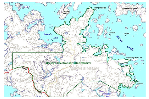
Map 1: Brown’s Inlet Conservation Reserve
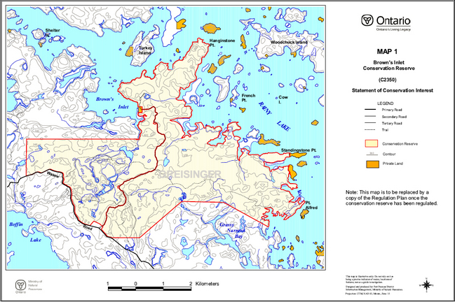
Enlarge Map 1: Brown’s Inlet Conservation Reserve
Map 2: Brown’s Inlet Conservation Reserve
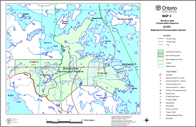
Enlarge Map 2: Brown’s Inlet Conservation Reserve
Map 3: Brown’s Inlet Conservation Reserve
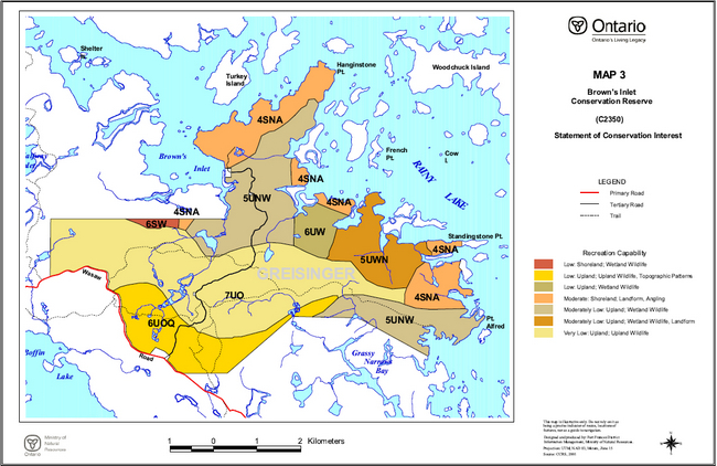
Enlarge Map 3: Brown’s Inlet Conservation Reserve
Map 4: Brown’s Inlet Conservation Reserve – Bedrock Geology
Enlarge Map 4: Brown’s Inlet Conservation Reserve – Bedrock Geology
Map 5: Brown’s Inlet Conservation Reserve – Surficial Geology

Enlarge Map 5: Brown’s Inlet Conservation Reserve – Surficial Geology
Map 6: Brown’s Inlet Conservation Reserve – Landforms
Enlarge Map 6: Brown’s Inlet Conservation Reserve – Landforms
Map 7: Brown’s Inlet Conservation Reserve – Ecosites
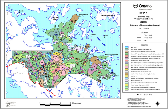
Enlarge Map 7: Brown’s Inlet Conservation Reserve – Ecosites
Map 8: Brown’s Inlet Conservation Reserve – Forest Cover

Enlarge Map 8: Brown’s Inlet Conservation Reserve – Forest Cover
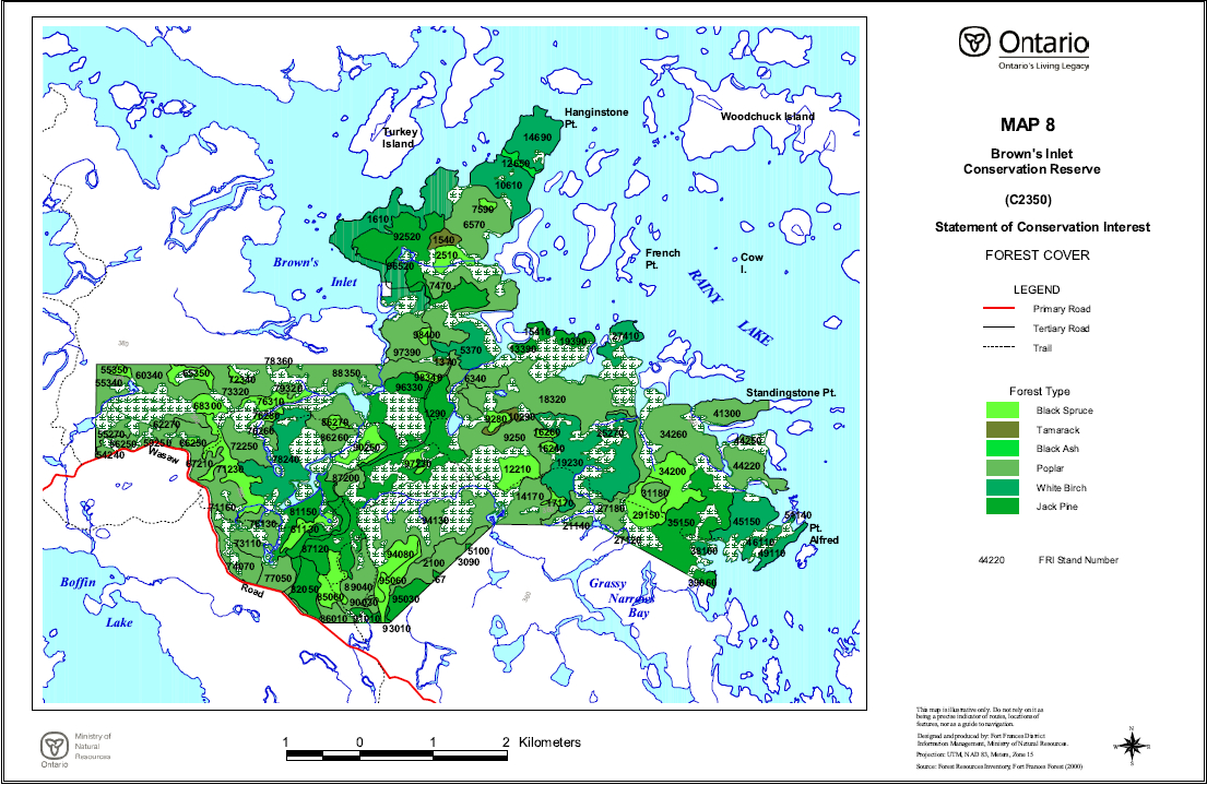
Appendix D – Forest Stand Listings
Brown’s Inlet Conservation Reserve
Forest Stand Listing
Source: Forest Resource Inventory, Fort Frances Forest (2000)
| Stand Number | Area | Perimeter | Age | Working Group | Year Updated | Height | Stkg | Site | Species Composition | Ecosite |
|---|---|---|---|---|---|---|---|---|---|---|
| 14690 | 40.9 | 3706 | 55 | 36 | 2000 | 14 | 0.7 | 3 | BW 5PO 3PR 1SW 1 | 16 |
| 69380 | 0 | 21 | 0 | 0 | 2000 | 0 | 0 | 0 | ||
| 55350 | 3.7 | 879 | 90 | 11 | 2000 | 11 | 0.5 | 3 | SB 0 | 35 |
| 60340 | 30.5 | 3611 | 50 | 33 | 2000 | 17 | 0.7 | 3 | PO 6BW 2PJ 2 | 19 |
| 65350 | 10.2 | 2538 | 90 | 11 | 2000 | 11 | 0.9 | 3 | SB 9L 1 | 36 |
| 72340 | 3 | 848 | 90 | 11 | 2000 | 10 | 0.8 | 3 | SB 0 | 35 |
| 64340 | 3.3 | 981 | 0 | 0 | 2000 | 0 | 0 | 0 | ||
| 90340 | 1.6 | 950 | 0 | 0 | 2000 | 0 | 0 | 0 | ||
| 58330 | 2.6 | 1324 | 0 | 0 | 2000 | 0 | 0 | 0 | ||
| 57330 | 1 | 506 | 0 | 0 | 2000 | 0 | 0 | 0 | ||
| 79320 | 4.5 | 950 | 50 | 33 | 2000 | 17 | 0.7 | 3 | PO 6BW 2PJ 2 | 19 |
| 63300 | 31.8 | 5812 | 0 | 0 | 2000 | 0 | 0 | 0 | ||
| 89310 | 9.9 | 1827 | 0 | 0 | 2000 | 0 | 0 | 0 | ||
| 55330 | 1.8 | 631 | 0 | 0 | 2000 | 0 | 0 | 0 | ||
| 76310 | 12.4 | 2766 | 90 | 11 | 2000 | 9 | 0.8 | 3 | SB 6L 4 | 36 |
| 69280 | 7.5 | 1864 | 0 | 0 | 2000 | 0 | 0 | 0 | ||
| 77300 | 19.7 | 3725 | 0 | 0 | 2000 | 0 | 0 | 0 | ||
| 68300 | 10.5 | 1494 | 100 | 11 | 2000 | 12 | 0.3 | 3 | SB 0 | 35 |
| 86260 | 33.2 | 3981 | 20 | 33 | 2000 | 10 | 0.6 | 2 | PO 5BW 2PJ 2B 1 | 16 |
| 82300 | 4.7 | 1622 | 0 | 0 | 2000 | 0 | 0 | 0 | ||
| 58300 | 12.4 | 1768 | 0 | 0 | 2000 | 0 | 0 | 0 | ||
| 76280 | 4 | 1414 | 0 | 11 | 2000 | 0 | 0 | 3 | SB 0 | 35 |
| 78240 | 55.5 | 7315 | 25 | 36 | 2000 | 7 | 0.6 | 2 | BW 5PJ 3PO 2 | 19 |
| 62270 | 17.9 | 3657 | 40 | 33 | 2000 | 14 | 0.6 | 3 | PO 7PJ 2BW 1 | 16 |
| 71230 | 34.6 | 6524 | 90 | 11 | 2000 | 11 | 0.6 | 3 | SB 8L 2 | 36 |
| 86270 | 4.5 | 1081 | 100 | 11 | 2000 | 9 | 0.4 | 4 | SB 0 | 35 |
| 79280 | 1.9 | 731 | 0 | 0 | 2000 | 0 | 0 | 0 | ||
| 72250 | 24.5 | 2582 | 55 | 33 | 2000 | 20 | 0.5 | 2 | PO 8BW 1PJ 1 | 19 |
| 67210 | 51 | 8551 | 25 | 33 | 2000 | 12 | 0.6 | 2 | PO 5BW 3PJ 2 | 16 |
| 51270 | 0 | 70 | 0 | 0 | 2000 | 0 | 0 | 0 | ||
| 76250 | 8.2 | 2515 | 0 | 0 | 2000 | 0 | 0 | 0 | ||
| 76260 | 5.2 | 1171 | 55 | 33 | 2000 | 20 | 0.5 | 2 | PO 8BW 1PJ 1 | 19 |
| 56250 | 7.8 | 2010 | 25 | 33 | 2000 | 12 | 0.8 | 2 | PO 9PJ 1 | 19 |
| 59260 | 3.7 | 1530 | 0 | 0 | 2000 | 0 | 0 | 0 | ||
| 82240 | 19.2 | 2069 | 0 | 0 | 2000 | 0 | 0 | 0 | ||
| 64260 | 3.1 | 1709 | 0 | 0 | 2000 | 0 | 0 | 0 | ||
| 59250 | 2.1 | 864 | 25 | 33 | 2000 | 12 | 0.8 | 2 | PO 9PJ 1 | 19 |
| 66250 | 1.5 | 488 | 90 | 11 | 2000 | 10 | 1 | 3 | SB 0 | 35 |
| 54250 | 2.6 | 751 | 0 | 0 | 2000 | 0 | 0 | 0 | ||
| 76240 | 0.1 | 193 | 0 | 0 | 2000 | 0 | 0 | 0 | ||
| 85230 | 0.2 | 210 | 0 | 0 | 2000 | 0 | 0 | 0 | ||
| 83200 | 9.9 | 5317 | 0 | 0 | 2000 | 0 | 0 | 0 | ||
| 84220 | 3.7 | 798 | 0 | 0 | 2000 | 0 | 0 | 0 | ||
| 85220 | 0.5 | 384 | 0 | 0 | 2000 | 0 | 0 | 0 | ||
| 87200 | 15 | 2145 | 35 | 33 | 2000 | 15 | 0.8 | 2 | PO 8BW 1PJ 1 | 19 |
| 77220 | 1 | 724 | 0 | 0 | 2000 | 0 | 0 | 0 | ||
| 78210 | 0.5 | 261 | 0 | 0 | 2000 | 0 | 0 | 0 | ||
| 81200 | 0.8 | 943 | 0 | 0 | 2000 | 0 | 0 | 0 | ||
| 83190 | 0.5 | 264 | 0 | 0 | 2000 | 0 | 0 | 0 | ||
| 82180 | 4 | 806 | 0 | 0 | 2000 | 0 | 0 | 0 | ||
| 79150 | 8.3 | 3010 | 0 | 0 | 2000 | 0 | 0 | 0 | ||
| 71160 | 2.6 | 1082 | 0 | 0 | 2000 | 0 | 0 | 0 | ||
| 84170 | 2.1 | 869 | 0 | 0 | 2000 | 0 | 0 | 0 | ||
| 79170 | 0.5 | 261 | 0 | 0 | 2000 | 0 | 0 | 0 | ||
| 76130 | 16.2 | 2846 | 45 | 33 | 2000 | 16 | 0.7 | 3 | PO 7PJ 2BW 1 | 19 |
| 86130 | 2.6 | 1241 | 0 | 0 | 2000 | 0 | 0 | 0 | ||
| 81130 | 12.2 | 2523 | 90 | 11 | 2000 | 14 | 0.9 | 2 | SB 0 | 35 |
| 85140 | 0.2 | 143 | 0 | 0 | 2000 | 0 | 0 | 0 | ||
| 75140 | 0.3 | 222 | 0 | 0 | 2000 | 0 | 0 | 0 | ||
| 71130 | 0.5 | 627 | 0 | 0 | 2000 | 0 | 0 | 0 | ||
| 72130 | 0.1 | 124 | 0 | 0 | 2000 | 0 | 0 | 0 | ||
| 88100 | 1.3 | 815 | 0 | 0 | 2000 | 0 | 0 | 0 | ||
| 89110 | 0.6 | 312 | 0 | 0 | 2000 | 0 | 0 | 0 | ||
| 86110 | 0.8 | 400 | 0 | 0 | 2000 | 0 | 0 | 0 | ||
| 77100 | 0.3 | 263 | 0 | 0 | 2000 | 0 | 0 | 0 | ||
| 76239 | 0.8 | 729 | 0 | 0 | 2000 | 0 | 0 | 0 | ||
| 76232 | 0.2 | 162 | 0 | 0 | 2000 | 0 | 0 | 0 | ||
| 78168 | 0.3 | 451 | 0 | 0 | 2000 | 0 | 0 | 0 | ||
| 78162 | 0.2 | 154 | 0 | 0 | 2000 | 0 | 0 | 0 | ||
| 11630 | 0.4 | 260 | 0 | 0 | 2000 | 0 | 0 | 0 | ||
| 17410 | 0 | 5 | 0 | 0 | 2000 | 0 | 0 | 0 | ||
| 15350 | 8.3 | 1446 | 0 | 0 | 2000 | 0 | 0 | 0 | ||
| 11330 | 2 | 663 | 0 | 0 | 2000 | 0 | 0 | 0 | ||
| 26320 | 4.5 | 839 | 0 | 0 | 2000 | 0 | 0 | 0 | ||
| 12290 | 3.1 | 755 | 0 | 0 | 2000 | 0 | 0 | 0 | ||
| 27180 | 35.3 | 8180 | 45 | 33 | 2000 | 18 | 0.7 | 2 | PO 5B 2PJ 2BW 1 | 19 |
| 19230 | 97.2 | 13752 | 20 | 36 | 2000 | 6 | 0.6 | 2 | BW 4PO 3PJ 2B 1 | 19 |
| 16280 | 3.9 | 1551 | 0 | 0 | 2000 | 0 | 0 | 0 | ||
| 26280 | 0.4 | 266 | 0 | 0 | 2000 | 0 | 0 | 0 | ||
| 25250 | 11 | 2939 | 0 | 0 | 2000 | 0 | 0 | 0 | ||
| 25270 | 2.3 | 729 | 20 | 36 | 2000 | 6 | 0.6 | 2 | BW 4PO 3PJ 2B 1 | 19 |
| 16260 | 3.1 | 822 | 90 | 11 | 2000 | 12 | 1 | 2 | SB 0 | 20 |
| 20260 | 2.6 | 925 | 0 | 0 | 2000 | 0 | 0 | 0 | ||
| 44240 | 0 | 2 | 0 | 0 | 2000 | 0 | 0 | 0 | ||
| 16240 | 2.7 | 693 | 90 | 11 | 2000 | 12 | 1 | 2 | SB 0 | 20 |
| 17230 | 1.8 | 1075 | 0 | 0 | 2000 | 0 | 0 | 0 | ||
| 22230 | 3.2 | 943 | 0 | 0 | 2000 | 0 | 0 | 0 | ||
| 24230 | 3.5 | 872 | 0 | 0 | 2000 | 0 | 0 | 0 | ||
| 34200 | 33 | 3513 | 90 | 11 | 2000 | 10 | 0.6 | 3 | SB 9L 1 | 36 |
| 40200 | 13.4 | 2749 | 0 | 0 | 2000 | 0 | 0 | 0 | ||
| 41210 | 1.6 | 637 | 0 | 0 | 2000 | 0 | 0 | 0 | ||
| 22210 | 5 | 1127 | 0 | 0 | 2000 | 0 | 0 | 0 | ||
| 42210 | 0.2 | 356 | 0 | 0 | 2000 | 0 | 0 | 0 | ||
| 24210 | 1 | 428 | 0 | 0 | 2000 | 0 | 0 | 0 | ||
| 21180 | 6 | 1369 | 0 | 0 | 2000 | 0 | 0 | 0 | ||
| 41200 | 0 | 6 | 0 | 0 | 2000 | 0 | 0 | 0 | ||
| 29150 | 23.7 | 2891 | 90 | 11 | 2000 | 11 | 0.7 | 3 | SB 8L 2 | 36 |
| 35190 | 1 | 487 | 0 | 0 | 2000 | 0 | 0 | 0 | ||
| 31180 | 8.2 | 1080 | 50 | 33 | 2000 | 18 | 0.6 | 2 | PO 6BW 2PJ 2 | 16 |
| 17170 | 3.3 | 1142 | 90 | 11 | 2000 | 12 | 0.4 | 2 | SB 0 | 35 |
| 29120 | 16.9 | 3300 | 0 | 0 | 2000 | 0 | 0 | 0 | ||
| 22150 | 10.3 | 2417 | 0 | 0 | 2000 | 0 | 0 | 0 | ||
| 38150 | 5.3 | 1391 | 0 | 0 | 2000 | 0 | 0 | 0 | ||
| 14150 | 1.5 | 673 | 0 | 0 | 2000 | 0 | 0 | 0 | ||
| 21140 | 4 | 896 | 45 | 33 | 2000 | 18 | 0.7 | 2 | PO 5B 2PJ 2BW 1 | 19 |
| 23130 | 1.1 | 559 | 0 | 0 | 2000 | 0 | 0 | 0 | ||
| 24130 | 0 | 47 | 0 | 0 | 2000 | 0 | 0 | 0 | ||
| 36120 | 2.1 | 836 | 0 | 0 | 2000 | 0 | 0 | 0 | ||
| 24110 | 0 | 21 | 0 | 0 | 2000 | 0 | 0 | 0 | ||
| 24110 | 0 | 24 | 0 | 0 | 2000 | 0 | 0 | 0 | ||
| 24110 | 0 | 418 | 0 | 0 | 2000 | 0 | 0 | 0 | ||
| 27120 | 1.3 | 491 | 45 | 33 | 2000 | 18 | 0.7 | 2 | PO 5B 2PJ 2BW 1 | 19 |
| 38100 | 3 | 775 | 45 | 36 | 2000 | 15 | 0.7 | 2 | BW 4PO 3B 2PJ 1 | 19 |
| 630 | 0 | 51 | 0 | 0 | 2000 | 0 | 0 | 0 | ||
| 9620 | 0.7 | 387 | 0 | 0 | 2000 | 0 | 0 | 0 | ||
| 6570 | 56.6 | 4269 | 60 | 33 | 2000 | 20 | 0.7 | 3 | PO 4BW 3PJ 2B 1 | 19 |
| 10590 | 1.6 | 640 | 0 | 0 | 2000 | 0 | 0 | 0 | ||
| 7590 | 2.5 | 687 | 100 | 11 | 2000 | 10 | 1 | 3 | SB 0 | 35 |
| 2510 | 12.5 | 1818 | 90 | 11 | 2000 | 9 | 0.5 | 3 | SB 0 | 35 |
| 97510 | 1.4 | 1350 | 0 | 0 | 2000 | 0 | 0 | 0 | ||
| 96520 | 1.6 | 1192 | 0 | 0 | 2000 | 0 | 0 | 0 | ||
| 96510 | 1.2 | 448 | 0 | 0 | 2000 | 0 | 0 | 0 | ||
| 9460 | 1.9 | 647 | 0 | 0 | 2000 | 0 | 0 | 0 | ||
| 93480 | 0 | 15 | 50 | 36 | 2000 | 14 | 0.8 | 3 | BW 3PO 3B 1PJ 1PR 1PW 1 | 18 |
| 98400 | 3.5 | 763 | 90 | 11 | 2000 | 12 | 1 | 2 | SB 0 | 35 |
| 6340 | 30.8 | 4885 | 40 | 33 | 2000 | 16 | 0.8 | 2 | PO 5BW 2AB 1B 1PJ 1 | 19 |
| 93376 | 0 | 20 | 0 | 0 | 2000 | 0 | 0 | 0 | ||
| 1370 | 1.8 | 658 | 90 | 18 | 2000 | 11 | 0.8 | 3 | L 0 | 36 |
| 96330 | 16.7 | 1829 | 46 | 7 | 2000 | 12 | 0.7 | 3 | PJ 5B 3BW 1PO 1 | 14 |
| 3290 | 16.6 | 5715 | 0 | 0 | 2000 | 0 | 0 | 0 | ||
| 95290 | 38.4 | 7357 | 0 | 0 | 2000 | 0 | 0 | 0 | ||
| 92320 | 1.1 | 625 | 0 | 0 | 2000 | 0 | 0 | 0 | ||
| 9320 | 0.7 | 427 | 0 | 0 | 2000 | 0 | 0 | 0 | ||
| 10290 | 5.1 | 2014 | 0 | 18 | 2000 | 0 | 0 | 2 | L 0 | 36 |
| 9280 | 6.5 | 1181 | 90 | 11 | 2000 | 13 | 1 | 2 | SB 0 | 35 |
| 3280 | 4 | 856 | 0 | 0 | 2000 | 0 | 0 | 0 | ||
| 9250 | 47 | 5280 | 60 | 33 | 2000 | 18 | 0.5 | 3 | PO 4BW 2PJ 2B 1SB 1 | 19 |
| 90250 | 13.8 | 3484 | 90 | 11 | 2000 | 10 | 0.8 | 3 | SB 8L 2 | 36 |
| 87240 | 13.9 | 3413 | 0 | 0 | 2000 | 0 | 0 | 0 | ||
| 44150 | 0 | 10 | 0 | 0 | 2000 | 0 | 0 | 0 | ||
| 44150 | 0 | 18 | 0 | 0 | 2000 | 0 | 0 | 0 | ||
| 44150 | 0 | 19 | 0 | 0 | 2000 | 0 | 0 | 0 | ||
| 44150 | 0 | 19 | 0 | 0 | 2000 | 0 | 0 | 0 | ||
| 44150 | 0 | 19 | 0 | 0 | 2000 | 0 | 0 | 0 | ||
| 44150 | 0 | 5 | 0 | 0 | 2000 | 0 | 0 | 0 | ||
| 44150 | 0 | 8 | 0 | 0 | 2000 | 0 | 0 | 0 | ||
| 44150 | 0 | 25 | 0 | 0 | 2000 | 0 | 0 | 0 | ||
| 44150 | 0 | 9 | 0 | 0 | 2000 | 0 | 0 | 0 | ||
| 44150 | 0 | 36 | 0 | 0 | 2000 | 0 | 0 | 0 | ||
| 44150 | 0 | 2 | 0 | 0 | 2000 | 0 | 0 | 0 | ||
| 44150 | 0 | 68 | 0 | 0 | 2000 | 0 | 0 | 0 | ||
| 44150 | 0 | 74 | 0 | 0 | 2000 | 0 | 0 | 0 | ||
| 44150 | 0 | 60 | 0 | 0 | 2000 | 0 | 0 | 0 | ||
| 44150 | 0 | 33 | 0 | 0 | 2000 | 0 | 0 | 0 | ||
| 44150 | 0 | 63 | 0 | 0 | 2000 | 0 | 0 | 0 | ||
| 44150 | 0 | 16 | 0 | 0 | 2000 | 0 | 0 | 0 | ||
| 44150 | 0 | 77 | 0 | 0 | 2000 | 0 | 0 | 0 | ||
| 44150 | 0 | 66 | 0 | 0 | 2000 | 0 | 0 | 0 | ||
| 44150 | 0 | 110 | 0 | 0 | 2000 | 0 | 0 | 0 | ||
| 44150 | 0 | 10 | 0 | 0 | 2000 | 0 | 0 | 0 | ||
| 44150 | 0 | 18 | 0 | 0 | 2000 | 0 | 0 | 0 | ||
| 44150 | 0 | 35 | 0 | 0 | 2000 | 0 | 0 | 0 | ||
| 44150 | 0 | 34 | 0 | 0 | 2000 | 0 | 0 | 0 | ||
| 44150 | 0 | 65 | 0 | 0 | 2000 | 0 | 0 | 0 | ||
| 44150 | 0 | 65 | 0 | 0 | 2000 | 0 | 0 | 0 | ||
| 44150 | 0 | 69 | 0 | 0 | 2000 | 0 | 0 | 0 | ||
| 44150 | 0 | 68 | 0 | 0 | 2000 | 0 | 0 | 0 | ||
| 44150 | 0 | 19 | 0 | 0 | 2000 | 0 | 0 | 0 | ||
| 44150 | 0 | 35 | 0 | 0 | 2000 | 0 | 0 | 0 | ||
| 44150 | 0 | 13 | 0 | 0 | 2000 | 0 | 0 | 0 | ||
| 44150 | 0 | 184 | 0 | 0 | 2000 | 0 | 0 | 0 | ||
| 44150 | 0 | 19 | 0 | 0 | 2000 | 0 | 0 | 0 | ||
| 44150 | 0 | 7 | 0 | 0 | 2000 | 0 | 0 | 0 | ||
| 7220 | 22.9 | 2847 | 0 | 0 | 2000 | 0 | 0 | 0 | ||
| 97230 | 4.5 | 1034 | 80 | 11 | 2000 | 7 | 0.7 | 4 | SB 0 | 35 |
| 12210 | 22 | 2133 | 90 | 11 | 2000 | 13 | 0.9 | 2 | SB 0 | 35 |
| 2180 | 0.2 | 332 | 0 | 0 | 2000 | 0 | 0 | 0 | ||
| 98210 | 1.5 | 581 | 90 | 11 | 2000 | 10 | 1 | 3 | SB 0 | 35 |
| 35150 | 73.7 | 7995 | 50 | 7 | 2000 | 16 | 0.7 | 2 | PJ 4BW 3PO 2B 1 | 21 |
| 81150 | 32.7 | 7044 | 30 | 7 | 2000 | 11 | 0.7 | 2 | PJ 6BW 2PO 1SB 1 | 21 |
| 14170 | 33.2 | 3830 | 20 | 33 | 2000 | 9 | 1 | 2 | PO 4PJ 3BW 1SB 1SW 1 | 21 |
| 90140 | 26.1 | 4676 | 0 | 0 | 2000 | 0 | 0 | 0 | ||
| 87120 | 51.9 | 6885 | 30 | 7 | 2000 | 11 | 0.7 | 2 | PJ 5PO 3BW 1SB 1 | 14 |
| 9157 | 3 | 2461 | 0 | 0 | 2000 | 0 | 0 | 0 | ||
| 9160 | 0 | 23 | 0 | 0 | 2000 | 0 | 0 | 0 | ||
| 97130 | 9.1 | 1646 | 0 | 0 | 2000 | 0 | 0 | 0 | ||
| 9158 | 0.4 | 374 | 0 | 0 | 2000 | 0 | 0 | 0 | ||
| 75120 | 13 | 5107 | 0 | 0 | 2000 | 0 | 0 | 0 | ||
| 9155 | 0.3 | 270 | 0 | 0 | 2000 | 0 | 0 | 0 | ||
| 9151 | 0.1 | 130 | 0 | 0 | 2000 | 0 | 0 | 0 | ||
| 8147 | 0.2 | 263 | 0 | 0 | 2000 | 0 | 0 | 0 | ||
| 8149 | 0 | 17 | 0 | 0 | 2000 | 0 | 0 | 0 | ||
| 17100 | 0 | 288 | 45 | 33 | 2000 | 18 | 0.7 | 2 | PO 5B 2PJ 2BW 1 | 19 |
| 74070 | 19.1 | 3617 | 30 | 33 | 2000 | 12 | 1 | 2 | PO 5BW 2SB 2PJ 1 | 19 |
| 73110 | 12.4 | 1635 | 45 | 33 | 2000 | 16 | 0.7 | 3 | PO 7PJ 2BW 1 | 19 |
| 94080 | 19.8 | 2962 | 90 | 11 | 2000 | 8 | 0.7 | 4 | SB 9L 1 | 36 |
| 89040 | 32.1 | 4769 | 25 | 33 | 2000 | 10 | 0.8 | 3 | PO 6BW 3PJ 1 | 19 |
| 95060 | 14.6 | 3330 | 90 | 11 | 2000 | 13 | 0.8 | 2 | SB 9L 1 | 36 |
| 22090 | 0 | 416 | 0 | 0 | 2000 | 0 | 0 | 0 | ||
| 5100 | 0.5 | 331 | 30 | 7 | 2000 | 10 | 0.7 | 2 | PJ 4PO 4B 1BW 1 | 14 |
| 32070 | 0 | 1087 | 50 | 7 | 2000 | 16 | 0.7 | 2 | PJ 4BW 3PO 2B 1 | 21 |
| 72080 | 3.3 | 1013 | 0 | 0 | 2000 | 0 | 0 | 0 | ||
| 76088 | 1.4 | 986 | 0 | 0 | 2000 | 0 | 0 | 0 | ||
| 85060 | 20.9 | 2524 | 82 | 11 | 2000 | 9 | 1.3 | 3 | SB 9PJ 1 | 35 |
| 89080 | 1.3 | 714 | 0 | 0 | 2000 | 0 | 0 | 0 | ||
| 76090 | 0.3 | 214 | 0 | 0 | 2000 | 0 | 0 | 0 | ||
| 3090 | 0.1 | 203 | 30 | 7 | 2000 | 10 | 0.7 | 2 | PJ 4PO 4B 1BW 1 | 14 |
| 77050 | 20.4 | 2796 | 0 | 33 | 2000 | 0 | 0 | 2 | PO 0 | 19 |
| 76082 | 1.1 | 804 | 0 | 0 | 2000 | 0 | 0 | 0 | ||
| 82050 | 25.4 | 2436 | 25 | 7 | 2000 | 8 | 0.8 | 2 | PJ 6PO 3SB 1 | 21 |
| 67 | 0 | 88 | 30 | 7 | 2000 | 10 | 0.7 | 2 | PJ 4PO 4B 1BW 1 | 14 |
| 67 | 0.9 | 505 | 30 | 7 | 2000 | 10 | 0.7 | 2 | PJ 4PO 4B 1BW 1 | 14 |
| 37060 | 0.2 | 233 | 0 | 0 | 2000 | 0 | 0 | 0 | ||
| 95030 | 15.9 | 1946 | 25 | 7 | 2000 | 8 | 0.6 | 2 | PJ 5PO 2B 1BW 1SW 1 | 21 |
| 73050 | 0.1 | 122 | 0 | 33 | 2000 | 0 | 0 | 2 | PO 0 | 19 |
| 90030 | 1.4 | 601 | 0 | 33 | 2000 | 0 | 0 | 2 | PO 0 | 19 |
| 86010 | 10 | 1899 | 50 | 33 | 2000 | 16 | 0.7 | 3 | PO 5SB 2B 1BW 1PJ 1 | 16 |
| 93010 | 1 | 627 | 40 | 7 | 2000 | 11 | 0.7 | 3 | PJ 3BW 2PO 2B 1MS 1SB 1 | 12 |
| 91010 | 4.4 | 1294 | 40 | 7 | 2000 | 11 | 0.7 | 3 | PJ 3BW 2PO 2B 1MS 1SB 1 | 12 |
| 89000 | 3.2 | 1021 | 0 | 0 | 2000 | 0 | 0 | 0 | ||
| 55340 | 17.8 | 2937 | 50 | 33 | 2000 | 15 | 0.6 | 3 | PO 4PJ 3BW 2B 1 | 16 |
| 54280 | 6.6 | 1332 | 0 | 0 | 2000 | 0 | 0 | 0 | ||
| 55270 | 8.6 | 2424 | 35 | 33 | 2000 | 15 | 0.7 | 2 | PO 0 | 16 |
| 54240 | 3.3 | 903 | 25 | 33 | 2000 | 12 | 0.8 | 2 | PO 9PJ 1 | 19 |
| 39060 | 5.1 | 1127 | 65 | 7 | 2000 | 16 | 0.6 | 3 | PJ 4PW 2SB 2BW 1PO 1 | 15 |
| 37080 | 4.8 | 2080 | 0 | 0 | 2000 | 0 | 0 | 0 | ||
| 42100 | 1.8 | 1086 | 0 | 0 | 2000 | 0 | 0 | 0 | ||
| 0 | 1 | 0 | 2000 | 0 | ||||||
| 49110 | 11.5 | 2329 | 45 | 36 | 2000 | 15 | 0.7 | 2 | BW 4PO 3B 2PJ 1 | 19 |
| 51140 | 0.5 | 315 | 45 | 36 | 2000 | 15 | 0.7 | 2 | BW 4PO 3B 2PJ 1 | 19 |
| 48110 | 6.8 | 2236 | 0 | 0 | 2000 | 0 | 0 | 0 | ||
| 0 | 1 | 0 | 2000 | 0 | ||||||
| 46110 | 9.3 | 1809 | 45 | 36 | 2000 | 15 | 0.7 | 2 | BW 4PO 3B 2PJ 1 | 19 |
| 42100 | 10.5 | 3048 | 0 | 0 | 2000 | 0 | 0 | 0 | ||
| 45150 | 34.4 | 3514 | 45 | 36 | 2000 | 15 | 0.7 | 2 | BW 4PO 3B 2PJ 1 | 19 |
| 40200 | 2.1 | 615 | 0 | 0 | 2000 | 0 | 0 | 0 | ||
| 40201 | 1.1 | 849 | 0 | 0 | 2000 | 0 | 0 | 0 | ||
| 44220 | 29.9 | 3330 | 50 | 33 | 2000 | 17 | 0.8 | 3 | PO 4BW 3PJ 2B 1 | 19 |
| 44250 | 1.6 | 533 | 50 | 33 | 2000 | 17 | 0.8 | 3 | PO 4BW 3PJ 2B 1 | 19 |
| 44240 | 10.2 | 2650 | 0 | 0 | 2000 | 0 | 0 | 0 | ||
| 41300 | 27 | 2697 | 50 | 33 | 2000 | 17 | 0.8 | 3 | PO 4BW 3B 2PW 1 | 19 |
| 37280 | 6 | 1911 | 0 | 0 | 2000 | 0 | 0 | 0 | ||
| 34260 | 57.9 | 4444 | 50 | 33 | 2000 | 16 | 0.6 | 3 | PO 4BW 3B 1PJ 1SB 1 | 16 |
| 30250 | 17.2 | 3317 | 0 | 0 | 2000 | 0 | 0 | 0 | ||
| 26400 | 2.3 | 832 | 0 | 0 | 2000 | 0 | 0 | 0 | ||
| 0 | 0 | 0 | 2000 | 0 | ||||||
| 27410 | 15.1 | 3004 | 30 | 36 | 2000 | 8 | 1 | 3 | BW 6PO 2PR 1SW 1 | 16 |
| 18320 | 103.9 | 9810 | 50 | 33 | 2000 | 18 | 0.7 | 2 | PO 6BW 2B 1PJ 1 | 19 |
| 26350 | 21.8 | 4881 | 0 | 0 | 2000 | 0 | 0 | 0 | ||
| 16390 | 1.5 | 1128 | 0 | 0 | 2000 | 0 | 0 | 0 | ||
| 19390 | 9 | 1619 | 65 | 7 | 2000 | 16 | 1 | 3 | PJ 9BW 1 | 20 |
| 15410 | 4.2 | 1039 | 65 | 7 | 2000 | 16 | 1 | 3 | PJ 9BW 1 | 20 |
| 13390 | 4.6 | 1002 | 65 | 7 | 2000 | 16 | 1 | 3 | PJ 9BW 1 | 20 |
| 16390 | 44.6 | 7976 | 0 | 0 | 2000 | 0 | 0 | 0 | ||
| 9480 | 0.5 | 428 | 0 | 0 | 2000 | 0 | 0 | 0 | ||
| 9500 | 1.6 | 828 | 0 | 0 | 2000 | 0 | 0 | 0 | ||
| 7550 | 1.4 | 808 | 0 | 0 | 2000 | 0 | 0 | 0 | ||
| 15650 | 2 | 802 | 0 | 0 | 2000 | 0 | 0 | 0 | ||
| 12650 | 5.6 | 1739 | 65 | 20 | 2000 | 13 | 0.9 | 3 | AB 8PO 2 | 23 |
| 10610 | 42.1 | 4098 | 50 | 36 | 2000 | 14 | 0.7 | 3 | BW 6B 1PJ 1PO 1PR 1 | 19 |
| 3600 | 4.2 | 1056 | 0 | 0 | 2000 | 0 | 0 | 0 | ||
| 1540 | 8.3 | 1325 | 80 | 18 | 2000 | 17 | 0.4 | 1 | L 8SB 2 | 36 |
| 7490 | 18.6 | 4489 | 0 | 0 | 2000 | 0 | 0 | 0 | ||
| 7470 | 37.6 | 5929 | 65 | 33 | 2000 | 22 | 0.8 | 2 | PO 4BW 3AB 1B 1PJ 1 | 19 |
| 92520 | 86.2 | 9199 | 0 | 7 | 2000 | 0 | 0 | 2 | PJ 0 | 13 |
| 2420 | 6.6 | 2059 | 0 | 0 | 2000 | 0 | 0 | 0 | ||
| 5370 | 29 | 3609 | 40 | 36 | 2000 | 15 | 0.8 | 1 | BW 4PJ 3PO 2B 1 | 19 |
| 1375 | 1.8 | 1223 | 0 | 0 | 2000 | 0 | 0 | 0 | ||
| 98340 | 3.3 | 838 | 90 | 11 | 2000 | 9 | 0.9 | 3 | SB 0 | 35 |
| 94220 | 16.7 | 5074 | 0 | 0 | 2000 | 0 | 0 | 0 | ||
| 1290 | 91.5 | 13055 | 30 | 7 | 2000 | 10 | 1 | 2 | PJ 5PO 3BW 2 | 21 |
| 95160 | 90.5 | 9612 | 0 | 0 | 2000 | 0 | 0 | 0 | ||
| 94130 | 56.8 | 9411 | 30 | 33 | 2000 | 13 | 0.8 | 2 | PO 3BW 2PJ 2SW 2B 1 | 21 |
| 2100 | 31.1 | 4280 | 60 | 33 | 2000 | 19 | 1 | 3 | PO 4B 2BW 2PJ 2 | 19 |
| 97390 | 52.8 | 4854 | 45 | 33 | 2000 | 17 | 0.8 | 2 | PO 6PJ 2B 1BW 1 | 19 |
| 93371 | 0.4 | 262 | 0 | 0 | 2000 | 0 | 0 | 0 | ||
| 92360 | 0.3 | 260 | 0 | 0 | 2000 | 0 | 0 | 0 | ||
| 96450 | 7.4 | 2101 | 0 | 0 | 2000 | 0 | 0 | 0 | ||
| 1610 | 90.4 | 11773 | 50 | 36 | 2000 | 14 | 0.8 | 3 | BW 3PO 3B 1PJ 1PR 1PW 1 | 18 |
| 81360 | 0.4 | 280 | 0 | 0 | 2000 | 0 | 0 | 0 | ||
| 88350 | 54.5 | 7186 | 50 | 33 | 2000 | 18 | 0.7 | 2 | PO 6BW 2B 1PJ 1 | 16 |
| 78360 | 1.8 | 691 | 50 | 33 | 2000 | 17 | 0.7 | 3 | PO 6BW 2PJ 2 | 19 |
| 79340 | 14.9 | 4594 | 0 | 0 | 2000 | 0 | 0 | 0 | ||
| 73350 | 3.9 | 1078 | 0 | 0 | 2000 | 0 | 0 | 0 | ||
| 73320 | 33.6 | 4885 | 50 | 33 | 2000 | 17 | 0.7 | 3 | PO 6BW 2PJ 2 | 19 |
Appendix E – Brown’s Inlet Conservation Reserve Factsheet
Brown’s Inlet Conservation Reserve C2350 Fact Sheet
June, 2001
Background
On July 16, 1999, the Ontario Government released the Ontario’s Living Legacy Land Use Strategy to guide the planning and management of Crown lands in central and parts of northern Ontario. A major part of the Ontario’s Living Legacy Land Use Strategy was a government intent to establish 378 new protected areas. This commitment marks the biggest expansion of provincial parks and conservation reserves in Ontario’s history.
The proposed Brown’s Inlet Conservation Reserve is part of this significant expansion of Ontario’s protected areas system.
Size and Location
The Brown’s Inlet site is located in the Fort Frances District, approximately 15 kilometres north of the town of Fort Frances. The site is accessible by road with its southern boundary being the Wasaw/ Boffin road that runs off of Highway 611. The area surrounding this conservation reserve is predominately Crown land. The Brown’s Inlet site is approximately 2,949 hectares in size.
Area Highlights
The Brown’s Inlet site is a unique area that contains a rock ridge peatland with clay as a subordinate element. Claylands are underrepresented in the Ontario system of parks and protected areas. The site also contains a rare form of dwarf leather leaf shrub. Included is approximately 18 kilometres of shoreline on Rainy Lake, which forms the northern and eastern boundaries of the area. It also supports many forms of wildlife including moose, deer, bear, and other smaller mammals, upland birds and waterfowl. The site is easily accessed by land via the Wasaw / Boffon road, or by water via Rainy Lake.
Land Use Intent
Conservation reserves are areas of Crown land set aside by regulation under the Public Lands Act. Conservation reserves complement provincial parks in protecting representative natural areas and special landscapes. Most recreational activities (e.g. hiking, skiing, tourism related uses, nature appreciation) that have traditionally been enjoyed in the area will continue, provided that these uses do not impact on the natural features needing protection. Hunting and fishing is permitted within most new conservation reserves proposed through Ontario’s Living Legacy.
Commercial timber harvesting, mining, aggregate extraction and commercial hydroelectric development are prohibited in conservation reserves. New private access roads and new resource access roads are not permitted in conservation reserves unless a prior commitment has been made, with the exception of necessary access for mineral exploration and development. Careful mineral exploration may occur in specific new conservation reserves proposed through Ontario’s Living Legacy, in areas that have provincially significant mineral potential. If a portion of a new conservation reserve is to be developed for a mine, it would be removed from the reserve, and appropriate replacement lands would be placed in regulation.
Where there are existing Aboriginal and treaty rights, the establishment of this conservation reserve does not extinguish these rights.
Next Steps
The Land Use Strategy established the Ministry’s intent to add these Crown land areas to Ontario’s protected areas system following the extensive public consultation associated with the Ontario’s Living Legacy and Lands for Life land use planning initiatives between 1997 and 1999. Prior to the finalization of the boundary of this Conservation Reserve proposed for regulation under the Public Lands Act, the Ministry is inviting public comment from June 15 - July 15, 2001 on the proposed boundary from all potentially affected stakeholders. The Ministry is committed to ongoing consultation with First Nations who are potentially affected by OLL decisions.
In the interim, the area has been withdrawn and protected from resource extraction activities such as timber harvesting, hydroelectric development, aggregate extraction and new mineral exploration.
In the future and subject to the intended regulation of the area as a conservation reserve, the Ministry of Natural Resources will provide long term management direction for this area. Depending upon the complexity of issues within this conservation reserve, management direction may take the form of a simple Statement of Conservation Interest or a more detailed Resource Management Plan. The public will be invited to participate in the preparation of management plans. Please let us know if you would like to be notified directly of this opportunity. Planning, management and the uses permitted within this conservation reserve will be consistent with the commitments of the Ontario’s Living Legacy Land Use Strategy and Conservation Reserves Policy and Procedure (1997).
For More Information
For further information on the Brown’s Inlet Conservation Reserve, please contact John Munroe Ministry of Natural Resources 108 Saturn Ave. Atikokan, Ontario, P0T 1C0, phone 807-597-6971, extension 241 , Fax: 807-597-6185. You may also visit the Ministry’s Internet web site at www.ontarioslivinglegacy.com (link no longer active) for information on Ontario’s Living Legacy.
Appendix F – Photographs
Figure 4: Aerial view of central portion of Brown’s Inlet Conservation Reserve, showing Wasaw road to the southwest, central tertiary road, and main interior wetland features.
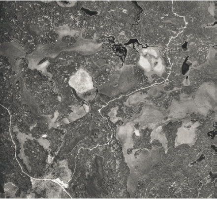
Figure 5: Central tertiary road, Brown’s Inlet Conservation Reserve
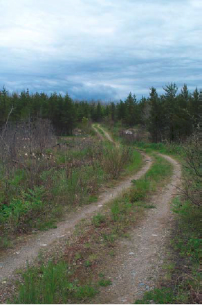
Figure 6: ATV trail off central tertiary road, Brown’s Inlet Conservation Reserve
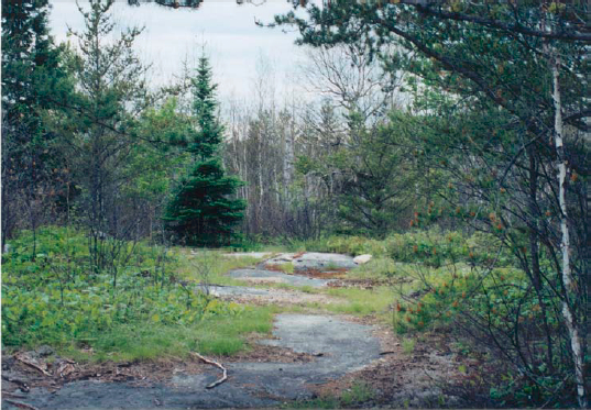
Figure 7: Shoreline of Rainy Lake, Hangingstone Point, Brown’s Inlet Conservation Reserve
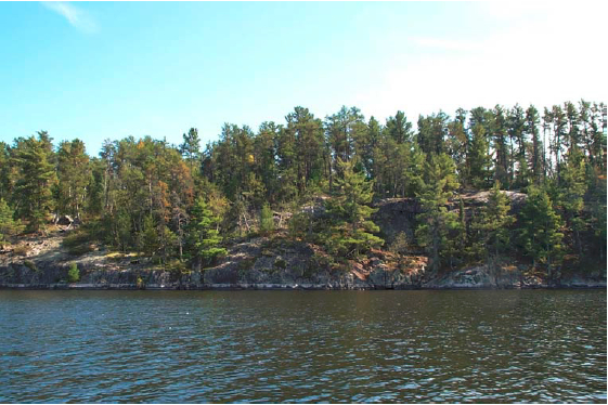
Figure 8: Northern edge of the Quetico fault, looking west, Brown’s Inlet Conservation Reserve
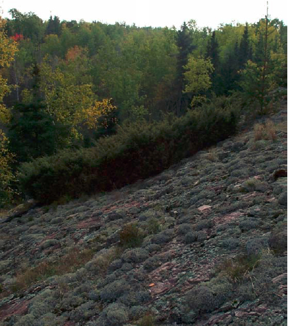
Figure 9: Wave-washed bedrock uplands (ES7/12), Brown’s Inlet Conservation Reserve
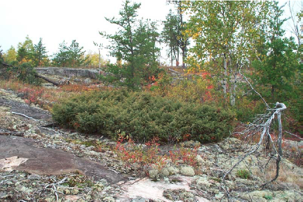
Figure 10: Fen (ES41), west of central tertiary road, looking northwest, Brown’s Inlet Conservation Reserve
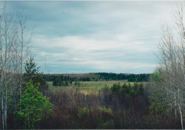
Figure 11: Marsh and fen complex (ES46/41), Brown’s Inlet Conservation Reserve
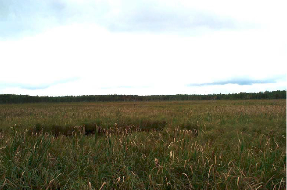
Figure 12: Shore fen (ES45), NE Brown’s Inlet Conservation Reserve
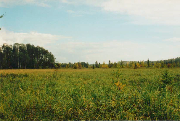
Figure 13: Treed bog (ES34), Brown’s Inlet Conservation Reserve
Figure 14: Beaver dam on bedrock knob, near northern boundary, Brown’s Inlet Conservation Reserve
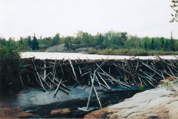
1 Munroe, 2002a
2 Munroe, 2002b
3 Munroe, 2002c