Campfire River Conservation Reserve Management Statement
This document provides policy direction for the protection, development and management of the Campfire River Conservation Reserve and its resources.
Statement of Conservation Reserve (C2368)
OMNR, Kenora District
July, 2001
Updated April 7, 2011
Next Examination Due December 31, 2020
Examination and adjustment history of management direction
Table of adjustment history of management direction
| Approval date | Examination or type of adjustment | Examination outcome | List of supporting documents |
|---|---|---|---|
| May 24, 2011 | Examination | Administrative Update |
|
Approval statement
We are pleased to approve this Statement of Conservation Interest for Campfire River Conservation Reserve.
This Statement of Conservation lnterest provides guidance for the management of the conservation reserve and the basis for the ongoing monitoring activities. More detailed direction at this time is not anticipated. Should significant facility development be considered or complex issues arise requiring additional studies, more defined management direction, or special protection measures, a more detailed Conservation Reserve Management Plan will be prepared with full public consultation.
The public was widely consulted during the original regulation process and further public consultation is not required at this time.
The conservation reserve will be managed under the jurisdiction of the Kenora East Area Supervisor, Kenora District, Ministry of Natural Resources.
Signed by:
Fred S. Hall
District manager
Kenora District
Date: September 6, 2001
Signed by:
Charlie Lauer
Regional Director
Northwest Region
Date: September 30, 2001
1.0 Background Information
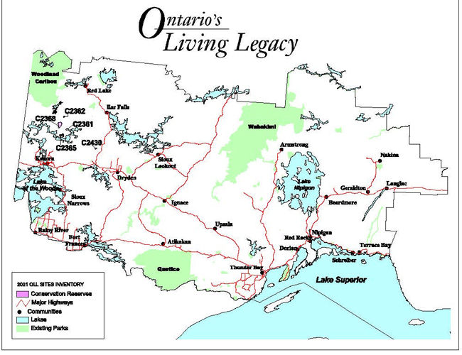
During the Lands for Life process, areas representative of Ontario’s diverse ecosystems and biological/geological features were identified and recommended for regulation as parks and protected areas under the Provincial Parks Act and the Public Lands Act (OMNR, 1999). The goal is to expand the percentage of Ontario’s protected areas to encompass twelve percent of the province’s land and water base. Campfire River Conservation Reserve is one of the representative areas selected for protection in site region/districts 4S-1 and 4S-2 and was regulated on May 21, 2003. The area was selected as a candidate under Ontario’s Living Legacy due to the repesentative landform and vegetation types (including blow downs, open wetlands and mixed conifer forests on weakly broken ground moraine and lacustrine deposits) existing within the area.
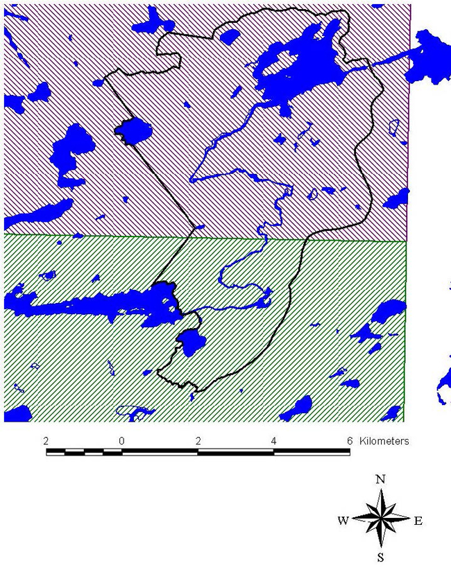
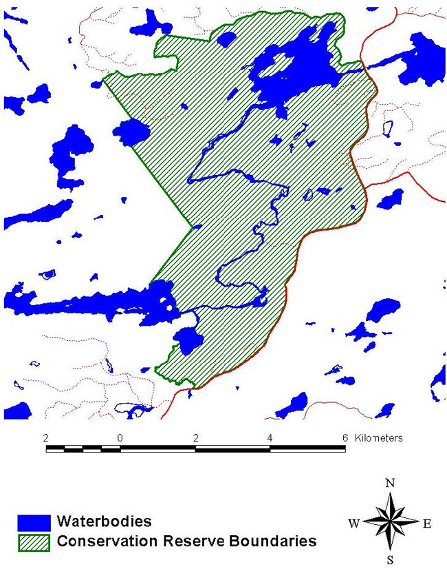
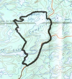
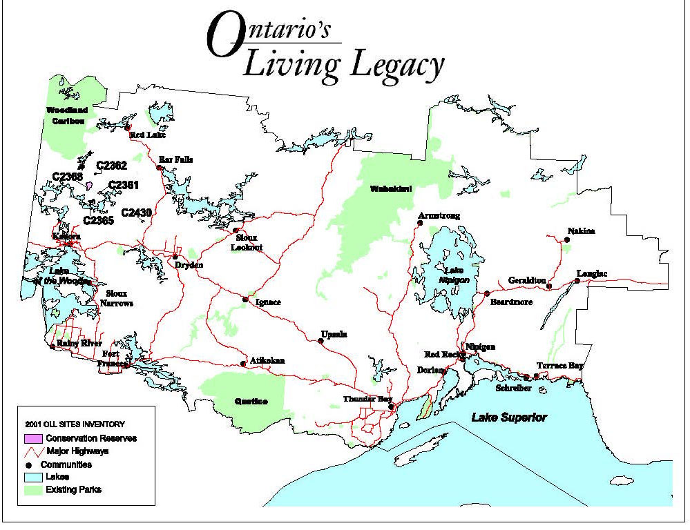
Campfire River Conservation Reserve is located approximately 73 kilometers north of the City of Kenora (Appendix A). The reserve encompasses Paintpot Lake, the portion of Campfire River adjoining Paintpot and Salvesen Lakes, as well as the surrounding terrain (OMNR, 2000). (Refer to Appendix B). The total area to be regulated is approximately 4, 221 hectares. Aboriginal interests in the area are primarily those of Grassy Narrows and Wabaseemoong Independent First Nations.
The intent of this Statement of Conservation Interest is to identify the natural heritage values of Campfire River Conservation Reserve, the activities occurring within the area and (through a set of management guidelines) outline the activities which will be permitted and prohibited.
For further information regarding the basis of this Statement, please refer to the "Conservation Reserve Policy and Procedure PL3.03.05", specifically, pages 2-6 and 14-22 of the procedure (OMNR, 1997a).
| Name | Campfire River Conservation Reserve |
|---|---|
| Site region/Site district | 4S-1/4S-2 |
| OMNR administration region/District/Area | Northwest/Kenora/Kenora East |
| Total area (ha) | 4,221 ha |
| Regulation date | 2001 - 2002 |
| First Nations Interest in Area | Wabaseemoong and Grassy Narrows First Nation (Treaty #3) |
| OBM | 201540000558 |
| Latitude/Longitude | 50 24'/94 18' |
| Basemap | 502942 |
| FRI Stand Numbers (Partially or Wholly Represented within the Reserve) | 116, 139, 144, 149, 151, 152, 348, 3549, 3746, 3951, 4042, 4329, 4396, 4439, 4449, 4538, 4598, 4626, 4722, 4723, 4745, 4899, 5025, 5130, 5137, 5222, 5250, 5255, 5276, 5329, 5336, 5374, 5393, 5402, 5413, 5420, 5434, 5605, 5648, 5694, 5770, 5772, 5726, 5734, 5742, 5800, 5824, 5852, 5880, 5884, 5898, 5908, 5916, 5939, 6094, 6126, 6128, 6133, 6248, 6351, 6387, 6409, 6533, 6542, 6565, 6574, 6579, 6593, 6604, 6608, 6632, 6758, 6767, 6782, 6786, 6823, 6836, 6847, 6877, 6924, 6939, 7002, 7030, 7049, 7101, 7113, 7116, 7134, 7168, 7198, 7199, 7228, 7229, 7238, 7245, 7337, 7386, 7401, 7420, 7423, 7425, 7599, 7600, 7621, 7637, 7754, 7768, 7786, 7796, 7905, 7927, 7995, 8029, 8037, 8039, 8102, 8212, 8219, 8308, 8317, 8338, 8435, 8443, 8445, 8523, 8534, 8535, 8541, 8728, 8748, 8863, 8937, 9044, 9048, 9112, 9136, 9220, 9227, 9237, 9443, 9444, 9523, 9615, 9626, 9637, 9641, 9657, 9663, 9718, 9747, 9750, 9752, 9914, 9923, 9943 |
| General location description | Located approximately 73 kilometers north of the City of Kenora, immediately west of South Pakwash Road (Appendix A). |
| Access | The conservation reserve can be accessed by road along the east border of the reserve via the South Pakwash Road, and by boat along the southwest portion of the reserve that borders the east shore of Salvesen Lake. Access by canoe is limited due to extensive rapids and waterfalls occurring along Campfire River. |
1.1 Representation targets
This section provides a summary of the earth/life science values, cultural resources represented, and recreational opportunities available or possible within the Campfire River Conservation Reserve.
| Life science representation |
Four critical landform-vegetation types are represented within Campfire River Conservation Reserve. |
|---|---|
| Earth science representation | Campfire River Conservation Reserve lies at the southern boundary of the English River Geological Subprovince of the Superior Province (North-South Environmental, 2000b). The reserve is primarily represented by weakly broken bedrock plain with significant deposits of deep, basinal, silty clay from Glacial Lake Agassiz. (Refer to section 2.1.2 and Appendix D.) |
| Cultural resource representation | Unidentified at this time. |
| Recreational opportunities | Fishing (for Northern Pike, Walleye, and Yellow Perch in Paintpot Lake), hunting (for Black Bear, Moose, and waterfowl), and trapping opportunities exist within the reserve. The traditional harvesting of wild rice is practiced in Paintpot Lake. Winter activities include ice fishing and snowmobiling. |
1.2 Survey information
This section provides an overview of the inventories completed, their level of detail and any further inventories that are necessary.
| Survey level | Reconnaissance | Detailed |
|---|---|---|
| Life Science | Checklist and summary report, 2000. Survey conducted by helicopter and | Not required. |
| Earth Science | Checklist and summary report, 2000. Survey conducted by helicopter and boat. | Not required. |
| Cultural | Suggested. | Not required. |
| Recreational | Inventory and summary report, 2000. Survey conducted via helicopter. | Not required. |
| Other | Not required. | Not required. |
2.0. Values to be protected
This section provides a description of the key natural heritage values on the site, their condition relative to past resource use and management activities, as well as their sensitivity to future land use and management activities.
2.1 Values identified on the site
2.1.1 Life sciences
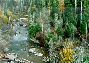
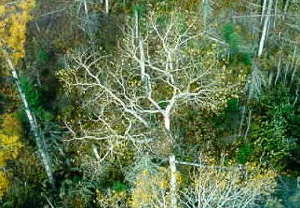
Campfire River Conservation Reserve was selected as a candidate for protection under Ontario’s Living Legacy partially due to its representation of mixed conifer forests (OMNR, 1999). Life science inventories conducted in the area have confirmed the existence of mixed stands of Spruce, Fir, Birch and Aspen (North-South Environmental Inc., 2000c). (Refer to Figure 1 and Appendix C.) In addition, deciduous stands (including open to closed-canopied Aspen/shrub rich and Aspen/Birch stands) and coniferous stands (of lowland Black Spruce/Labrador tea/Sphagnum-Feathermoss swamps and upland Jack Pine and Jack Pine/Black Spruce stands) have been identified.
Figure 1. Campfire River Conservation Reserve provides representation of mixed forest stands of Spruce, Fir, Birch and Aspen
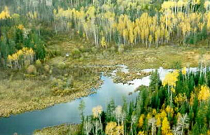
Campfire River Conservation Reserve was also chosen due to the representation of open wetlands (OMNR, 1999). A diverse representation of lacustrine, palustrine (i.e. wetlands with little or no inflow and either permanent or intermittent outflow), and riverine wetland ecosystems occurs within the reserve (Figure 2). Wetland communities include: deep and shallow marshes with submerged aquatics, floating plants and emergents; graminoid marshes and wet meadows characterized by Marsh Reed Grass (Calamagrostis canadensis) and Beaked Sedge (Carex rostrata); low shrub fens of Leatherleaf (Chamaedaphne calyculata); and thicket swamps represented by River Alder (Alnus rugosa) and Willows (Salix spp.).
Figure 2. A diverse representation of lacustrine, palustrine, and riverine (as shown in photograph) wetlands exists within the reserve
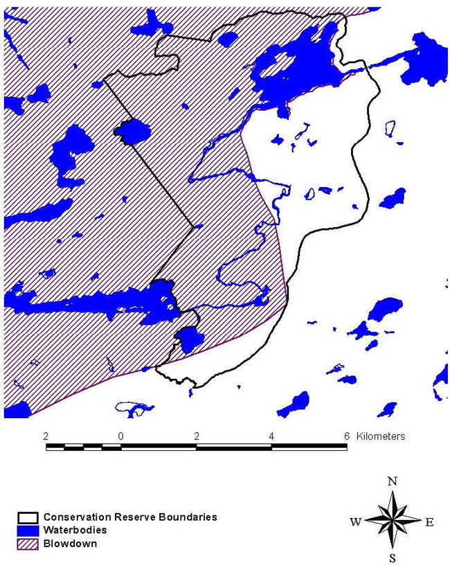
A significant portion of the forest within Campfire River Conservation Reserve was subject to blow down in 1991 (Appendix E). Some of the blow down area along the northwestern portion of the reserve has since been harvested. These harvested areas will likely promote regeneration more quickly than non-harvested blow down areas due to artificial regeneration of the site (Anderson, 2001).
The Prairie Onion (S4) was observed in the conservation reserve during a site visit in 2010.
2.1.2 Earth sciences
The Campfire River Conservation Reserve lies within the English River Geological Subprovince of the Superior Province (North-South Environmental Inc., 2000a; b). The dominant rock types are mostly massive igneous granodiorite and granite. The few areas of exposed bedrock (aged between approximately 2.5 and 3.4 billion years) are generally confined to the high ground surrounding Paintpot Lake and the southwestern portion of the reserve. The surficial geology of this reserve is primarily represented by weakly broken bedrock plain with a significant cover of deep, basinal, silty clay deposits from Glacial Lake Agassiz.
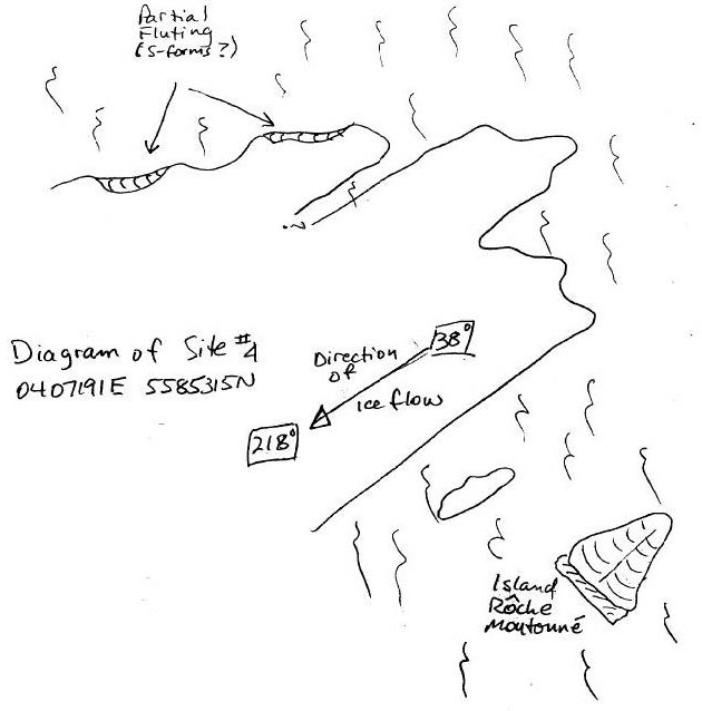
The south shore of Paintpot Lake and nearby small bedrock islands illustrate excellent examples of glacial moulding or polishing (North-South Environmental, 2000b). The rock outcrop located at 407191E and 5585315N exhibits a high degree of glacial moulding, as well as partial fluting along the west side which is typically indicative of "S-forms" (resulting from carving of subglacial meltwater flowing under the ice sheet). This outcrop and nearby small islands also provide representation of rôches moutonnés (which point in the direction opposite of that of glacial movement). Characteristically, these glacial features display a gentle stoss (faces the direction opposite the motion of an overriding glacier) slope with an irregular, "plucked" lee slope.
2.1.3 Cultural/Historical significance
An archeologically significant site has been identified along Salvesen Lake’s east shore immediately adjacent to the reserve boundaries, likely dating back to the pre-contact period (Lockhart, 2001). Salvesen Lake holds additional archeological values, including a pictograph site along its north shore. However, no values of cultural/historical significance within the Campfire River Conservation Reserve itself have been identified, as yet.
2.1.4 Aboriginal values
Any specific aboriginal values or interest within the conservation reserve remain unidentified at this time.
2.1.5 Tourism
There are no tourist lodges/outposts located within or adjacent to Campfire River Conservation Reserve. However, guests residing at Ashambie Outpost Limited (on Salvesen Lake) and Fletcher Lake Lodge (on Fletcher Lake) may access the reserve by waterway since the reserve borders Salvesen Lake’s east shoreline. In addition, two commercial boat caches on Paintpot Lake are licensed to Halley’s Camp and Hideaway Camp, indicating the potential importance of the area to the tourist industry for hunting and fishing activities.
2.1.6 Recreational fishing
Fishing opportunities for Northern Pike, Walleye and Yellow Perch exist within the Campfire River Conservation Reserve. Paintpot Lake (in particular) is easily accessed via the South Pakwash Road, making it a popular fishing and ice fishing area. So as to ensure the sustainability of the area’s fishery, an important walleye spawning bed in Paintpot Lake was enhanced during the fall of 1999 by Abitibi Consolidated Incorporated in Kenora in partnership with the Ontario Ministry of Natural Resources.
2.1.7 Recreational hunting
Campfire River Conservation Reserve forms parts of three Bear Management Areas licensed to Ashambie Outpost Limited, Redden’s Camp and Walsten’s Outpost Cabins, indicating the potential for hunting of Black Bear in the area (Appendix F). In addition, the potential for hunting other animal species (especially Moose and waterfowl) exists in accessible areas of the reserve, particularly along the South Pakwash Road and the east shoreline of Salvesen Lake.
2.1.8 Mining
Careful mineral exploration may occur in specific new conservation reserves proposed through Ontario’s Living Legacy-Land Use Strategy, in areas that have provincially significant mineral potential. If a portion of the new conservation reserve is to be developed for a mine, it would be removed from the reserve, and appropriate replacement lands would be placed in regulation.
2.1.9 Aggregate
None developed on site.
2.1.10 Forest harvest
Timber of commercial value, easy access, and considerable volume exists within Campfire River Conservation Reserve (Anderson, 2001). Four harvest blocks (99.681, 99.682, 99.684 and 99.685) represented within the reserve boundaries were approved in the 1999-2004 term of the Whiskey Jack Forest Management Plan. MNR has begun an amendment process to remove the blocks within the reserve boundaries from the FMP. The area is currently under interim protection, ensuring that no approvals will be granted for harvest in these blocks.
2.1.11 Trapping
Campfire River Conservation Reserve forms part of one registered trapline licensed to a Wabaseemoong Independent First Nation trapper.
2.1.12 Wildlife
The abundance of aquatic vegetation within Campfire River Conservation Reserve supports inhabitance of the area by Moose, as observed during a helicopter flight on October 4, 2000. (Refer to Figure 3 and Appendix G.) Also noted during the fall flight, were several species of migratory birds including Mallards, Canada Geese and Snow Geese, attracted by the extensive wetlands represented within the reserve. In addition, the area appears to sustain a high population of Beaver, as evidenced by the numerous active beaver lodges and dams along Campfire River. Furthermore, one Bald Eagle stick nest is located within the reserve (along Campfire River), two others are located on nearby Salvesen Lake, and one Great Grey Owl nesting site is located immediately southwest of the reserve (Figure 4). The Canada Warbler (Special Concern) was observed in the conservation reserve during a site visit in 2010.
Figure 3. The abundance of aquatic vegetation existing within the reserve provides ample forage for Moose
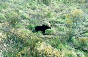
Figure 4. Campfire River Conservation Reserve provides ideal habitat for Bald Eagles, as evidenced by this stick nest located alongside Campfire River
2.1.13 Commercial fish
Campfire River Conservation Reserve represents portions of two commercial baitfishing blocks (Appendix H).
2.2 Values to be protected
The intent of this Statement is to protect identified values by establishing management guidelines for existing and potential uses in this area given the level of past disturbance, as well as the nature of the existing features.
2.2.1 Forest values
The forest stands within the reserve boundaries are to be protected from any alteration resulting from forest management activities (OMNR, 1999; 1997a). Successional changes associated with each forest type occurring in the area (depending on each stand’s stage of maturity, specific vegetation species composition, and soil type) are anticipated to take place as outlined in the following statements. (Please note that for the purpose of this document, the successional time frame is depicted as 100 years.):
- The conifer-dominated mixedwoods on very shallow, dry to moderately fresh, sandy soils within the reserve range from 65 to 100 years in age. In the absence of large-scale natural disturbance, succession of these stands will likely result in stands with declined canopy tree cover, dominated by Black Spruce with remnant Jack Pine and (potentially) White Birch and Balsam Fir (Anderson, 2001; Dawe, 2001; OMNR, 1997b).
- The Black Spruce and Jack Pine-dominated mixedwoods on moist, silty to clayey soils within the reserve are 105 years of age. Dominance of the stand by Black Spruce will likely increase until the canopy closes, at which point Black spruce recruitment will cease (OMNR, 1997b). Over time, Balsam Fir, Trembling Aspen, and White Birch may ingress into the stand, increasing tree diversity. The stand’s maintained canopy closure will likely result in the decline of tall/low shrub and herb cover, with moss species dominating the forest floor.
- The hardwood-dominated mixedwoods on dry to fairly moist, coarse to fine sandy soils within the reserve range from 20 to 100 years in age. Over time and in the absence of natural disturbance, pathological problems will likely kill off the hardwood component of these stands allowing coniferous species (particularly Spruce and Balsam Fir) to regenerate the sub-canopy and seedling layers (Anderson, 2001; Dawe, 2001; OMNR, 1997b). The result is anticipated to be a mixed species stand at various stages of maturity and a more open canopy.
- The Black Spruce-dominated wetlands (ranging in age from 115 to 155 years) on organic soils will likely maintain themselves over the next 100 years due to the nature of the Sphagnum Moss bed and high water table resulting in slow growth of these stands (Anderson, 2001).
- A significant portion of the forest stands within Campfire River Conservation Reserve was subject to blow down in 1991 (Appendix D). This has resulted in large amounts of fallen trees and debris littering the forest floor, creating a dense cover. Consequently, new growth is inhibited, making natural regeneration of these sites difficult. Salvage harvesting of some of the blow down areas took place in 1994 and 1995, therefore removing the blown down timber (Anderson, 2001). Areas were artificially regenerated through planting or seeding after the salvage harvest. This will enable these areas to develop into typical forest stands for the area.
2.2.2 Recreational values
Hunting and trapping opportunities exist within Campfire River Conservation Reserve. Hunting likely occurs along the east boundary of the reserve where access is permitted along the South Pakwash Road. The southwest portion of the reserve may also be hunted through access gained along Salvesen Lake’s east shoreline.
Campfire River Conservation Reserve is commonly fished for Northern Pike, Walleye and Yellow Perch. Paintpot Lake is a popular area for fishing during both the summer and winter due to its easy accessibility via the South Pakwash Road.
Campfire River Conservation Reserve is a traditional wild rice harvesting area for First Nations. Wild rice harvesting has been facilitated through improved accessibility of the area resulting from the reconstruction of the walleye spawning bed in Paintpot Lake.
2.2.3 Tourism values
No tourist lodges or outposts have been established within the Campfire River Conservation Reserve boundaries. However, guests residing at nearby lodges/outposts may access the reserve by water or roadway, therefore, utilizing the area for hunting, fishing, camping and shorelunch activities. (Refer to sections 2.1.5, 2.1.6 and 2.1.7.)
3.0 Management guidelines
The following topics briefly indicate the existing situation followed by the management guidelines to be implemented or continued.
3.1 Land tenure
Campfire River Conservation Reserve consists entirely of Crown land. No disposition by sale, Crown Lease or Land Use Permit will be permitted within the reserve (OMNR, 1997a).
3.2 Existing and proposed development
Other than enhancement of the Walleye spawning bed on Paintpot Lake, no development has taken place within Campfire River conservation Reserve. No future development (such as newly established campsites and trails) will be permitted within the reserve that would result in disturbance of the forest including its understory.
3.3 Recreational activities
Most recreational activities that have been practiced within Campfire River Conservation Reserve thus far may continue provided that they pose little threat on the natural ecosystems and features identified/protected within the reserve (OMNR, 1997a). Permissible activities include boating, fishing, hiking, hunting, scenic/wildlife viewing, snowmobiling, and resident Crown land camping. Campfire River Conservation Reserve falls within a Green Zone, therefore, non-resident Crown land camping is prohibited within the reserve. The construction of new trails will not be permitted.
3.4 Commercial activities
Trapping will continue as a permitted activity, as the area forms part of a trapline licensed to a Wabaseemoong Independent First Nation trapper. No trapper’s cabins have been developed within the conservation reserve. The area is presently part of two commercial baitfishing blocks and three Bear Management Areas; no changes of these areas are required at this time provided that they do not impact the reserve’s identified and protected natural heritage values. No further commercial activities will be permitted in the area, including road construction, removal of aggregates, and development of utility corridors (OMNR, 1999; 1997a).
The conservation reserve has been permanently removed from the operable Whiskey Jack Forest Land Base and withdrawn from all mining exploration and extraction activities by the Ministry of Northern Development, Mines and Forestry (MNDMF) at MNR’s request.
3.5 Aboriginal interests
Campfire River Conservation Reserve is likely of primary interest to both Grassy Narrows and Wabaseemoong Independent First Nations, as they hold trapping and wild rice harvesting interests in the area. Any additional specific aboriginal values associated with the conservation reserve are unknown at this time, although they may be identified during First Nation consultation. Nothing in this Statement of Conservation Interest will affect existing or future aboriginal or treaty rights.
3.6 Natural resources stewardship
3.6.1 Vegetation management
The Forest Fire Management Strategy for Ontario (OMNR 2004) places Campfire River Conservation Reserve in the boreal zone providing the same level of protection from fire as the surrounding forest. Should natural large-scale disturbance (forest fires, further blow downs) not take place, the area will mature through successional processes as outlined in section 2.2.1.
Fuelwood permits will not be issued within the area encompassed by Campfire River Conservation Reserve. However, usage of the areas wood resource for shorelunch and campfires will be permitted provided that there will be no resulting damage or alteration of the forest and its understory.
3.6.2 Fisheries and wildlife management
No management action is required other than the implementation of existing Wildlife Management Unit and sport fishing regulations and management activities. Fishing opportunities are limited due to site inaccessibility associated with low water levels.
3.6.3 Landforms
The landforms represented within Campfire River Conservation Reserve will not be altered through any landform modification activities, including filling and extracting of aggregates, peat, soils, and similar materials (OMNR, 1997a).
3.7 Cultural resources stewardship
No archeological sites or artifacts have been identified or recovered within Campfire River Conservation Reserve. However, nearby identified archeological sites on Salvesen Lake may indicate the potential for archeological significance within the reserve. Further research may be beneficial in uncovering any cultural/historical significance within the reserve boundaries and ensuring their protection, provided that the research does not alter the reserve’s currently identified values.
3.8 Client services
Information regarding this conservation reserve will be made available so as to ensure that all resource users (particularly forestry and mining companies) are aware of its location, recognized values, and permitted uses. Potential users include tourists, local fishermen/hunters/trappers, recreationalists (ex. hikers, snowmobilers), and the general public, all of who may utilize the areas wood resource for camping, shorelunches, firewood, and personal use.
3.9 Research
Non-destructive research relating to cultural and historical values within the reserve would be beneficial to add further potential values to the reserve, as well as to ensure their protection.
3.10 Marketing
There are no marketing requirements at this time.
4.0 Implementation
These management guidelines will be implemented immediately by Kenora District. Any MNR Resource Management Plans or Land Use Plans which include this area will be amended accordingly. Any affected clients will be immediately informed of amendments to this management direction. Administrative responsibility for the conservation reserve rests with the Planning and Information Management Supervisor. Implementation will primarily involve monitoring activities to ensure adherence to the management guidelines.
5.0 Review and revisions
5.1 Review and revisions
Methods of reviewing management direction will be consistent with the Protected Areas Planning Manual (OMNR 2009) and its associated guidelines. In accordance with the Provincial Parks and Conservation Reserves Act, 2006, MNR will annually examine management direction documents that have been in place for ten years or more. The next scheduled examination for Campfire River Conservation Reserve will be in 2020.
5.2. Public consultation
5.2.1 Results of past consultation
Contact regarding the regulation of Campfire River Conservation Reserve was made with timber companies, local communities, and the general public in August, 2000. Consultation efforts involved the direct mailing of a District information package to local interest groups ( such as the Local Citizens Committee), as well as to all those with patent land, boat caches, bear management areas, trapline areas, baitfishing areas, and Sustainable Forest Licences within and/or adjacent to the reserve’s proposed boundaries. In addition, an interview was held on CJRL radio (Kenora) and newspaper advertisements were issued in the Kenora Enterprise and the Kenora Daily Miner in mid-August, 2000.
First Nation consultation associated with Campfire River Conservation Reserve occurred. The Grand Council Treaty #3 office has hired an individual to assist both MNR and the area First Nations to complete these consultations. First Nation consultation will be completed for this conservation reserve.
5.2.2 Present and future consultation
Other than the completion of First Nations consultation, more widespread consultation is not deemed necessary at this time due to the extensive consultation which took place in August, 2000 (refer to section 5.2.1).
5.2.3 Author
This Statement of Conservation Interest was prepared by Sheila Thomson (OLL Coordinator) and Amanda Watson (OLL Intern), Kenora District.
6.0 References
Anderson, Dave. 2001. Area Forester. Personal Correspondence. OMNR, Kenora District.
Dawe, Mike. 2001. Senior Forest Specialist. Personal Correspondence. OMNR, Kenora District.
Lockhart, Scott. 2001. Resource Liaison Specialist. Personal Correspondence. OMNR, Kenora District.
North-South Environmental Inc. 2000a. Earth and Life Science Reconnaissance Survey. 14 Provincial Parks and Conservation Reserves in the Western Part of Northwestern Ontario: Summary Report to the Earth and Life Science Checksheets.
North-South Environmental Inc. 2000b. Earth Science Inventory Checklist: Campfire River Conservation Reserve.
North-South Environmental Inc. 2000c. Natural Heritage Area - Life Science Checksheet: Campfire River Conservation Reserve.
Ontario Ministry of Natural Resources. 1997a. Conservation Reserves Policy and Procedure. PL 3.03.05.
Ontario Ministry of Natural Resources. 1997b. Silvicultural Guide to Managing for Black Spruce, Jack Pine and Aspen on Boreal Forest Ecosites in Ontario. Book II: Ecological and Management Interpretations for Northwest Ecosites. Version 1.1 September, 1997.
Ontario Ministry of Natural Resources. 1999. Ontario’s Living Legacy – Land Use Strategy. OMNR.
Ontario Ministry of Natural Resources. 2000. Campfire River Conservation Reserve (C2368) Fact Sheet. OMNR, Kenora District.
Ontario Ministry of Natural Resources. 2004. Forest Fire Management Strategy for Ontario. Queen’s Printer for Ontario, Toronto. 64 pp.
Ontario Ministry of Natural Resources. 2009. Ontario Protected Areas Planning Manual. Peterborough. Queen’s Printer for Ontario. 50 pp.
Provincial Parks and Conservation Reserves Act. 2006. Toronto. 44 pp. [online]
Appendix A
Regional setting of Campfire River Conservation Reserve (C2368).
Enlarge Regional setting of Campfire River Conservation Reserve (C2368).
Appendix B
Campfire River Conservation Reserve boundaries.
Appendix C
The Campfire River Conservation Reserve Life Science Checksheet (North-South Environmental Inc., 2000c).
Natural Heritage Area - Life Science Checksheet
| Name | Campfire River Conservation Reserve C2368 |
|---|---|
| Map name | Lennan Lake |
| Map Number | 52 L/08 |
| UTM ref. | 407500 5583250 |
| County | Unorganized Area |
| Latitude | 50 24' |
| Longitude | 94 18' |
| NAD | 83 |
| Minimum altitude | 360 |
| Maximum altitude | 380 |
| Locality | Unorganized Area |
| Township | Unorganized Area |
| Area | 4221 ha |
| Ownership | Crown Land |
| MNR region | Northwest |
| Ecoregion and ecodistrict | 4S1 |
| Landform unit(s) | See attached table |
| MNR Distrit | Kenora |
| Aerial Photographs Year-Roll-Flight Line-Numbers |
Physical and biological features
| Representation | The forest types represented in this reserve include: (1) deciduous types, such as open- to close-canopied trembling aspen/shrub rich and aspen-birch stands; (2) mixed types, with aspen, birch, fir and spruce stands; and (3) coniferous types – mostly lowland black spruce/Labrador tea/Sphagnum-feathermoss swamps and upland Jack pine and Jack pine-black spruce stands. Wetlands are present throughout the reserve and are extensive in many areas, providing excellent moose feeding habitat. They range from palustrine, to riverine and lacustrine types, with the majority concentrated along Campfire River and around Paintpot Lake. Represented types are the deep and shallow marshes (with submerged aquatics, floating plants and emergents), graminoid marshes and wet meadows (Carex utriculata, Calamagrostis canadensis), low shrub fens (Chamaedaphne calyculata), and thicket swamps (Salix spp., Alnus rugosa). The reserve is a traditional native wild rice harvesting area (MNR Fact Sheet). |
|---|---|
| Condition | The vegetation of the reserve is in natural condition, mostly unaffected by man’s activities. Some impact may be expected from the use of Paintpot Lake for fishing and native wild rice harvesting. The road along the eastern boundary greatly facilitates human penetration into the area, particularly via a channel connecting Paintpot Lake and a lake directly to the east. Also, there appear to exist a few access trails from the road to the river which may eventually cause degradation of natural habitats. Logging operations occur right to the edge of the reserve. |
| Diversity | The reserve is quite diverse in terms of vegetation cover types present (see description of "Representation" above). Interesting zonation within wetlands and from wetlands to upland types can be observed in many areas. Also, around Paintpot Lake are examples of sharp contrast between lichen-covered rock faces and adjacent deep marshes. |
| Ecological considerations | Within the reserve, the Campfire River system functions as an ecological corridor between Campfire-Paintpot Lakes and Salvesen Lake. It protects a broad floodplain and associated wetlands along this corridor. The reserve also provides extensive wildlife habitats, including moose aquatic areas. Diverse upland and wetland habitats contain a variety of plant and animal species. |
| Special features | The reserve does not contain unusual habitats and no rare species were recorded. Still, well developed wetland zonation provides opportunities for scientific research and interpretation. |
| Major information sources | Field work (September 2000) |
| Significance level (Provincial/Regional/Local) and brief summary of major representative values | Local significance owing to the abundance, degree of development and diversity of wetland areas. |
| Date compiled | November 2000 |
| Compiler | Christopher Zoladeski, North-South Environmental Inc. |
Life Science Checksheet Map
Illustrated image of Campfire River Conservation Reserve
Campfire River Conservation Reserve
Plot sampling methods follow those outlined in:
North-South Environmental Inc. 2000. Earth and Life Science Reconnaissance Survey. 14 Provincial Parks and Conservation Reserves in the Western Part of Northwestern Ontario: Summary Report to the Earth and Life Science Checksheets. 20pp.
Plot 1:
407152E 5578506N
Description:
Open upland aspen stand, canopy discontinuous, 25-30 m, with a discontinuous secondary canopy of fir and spruce. Heavy shrub layer, rich herb layer.
Composition:
T1:
- Populus tremuloides 3
- Picea glauca 1
T2:
- Abies balsamea 1
- Picea mariana 1
TS:
- Corylus cornuta 3
- Abies balsamea +
- Picea glauca +
LS:
- Corylus cornuta 3
- Diervilla lonicera 2
- Abies balsamea 1
- Viburnum rafinesquianum 1
- Rubus pubescens 1
- Amelanchier sp. +
- Rosa acicularis +
- Symphoricarpos albus +
- Cornus stolonifera +
- Viburnum edule +
H:
- Cornus canadensis 1
- Linnaea borealis 1
- Aralia nudicaulis 1
- Oryzopsis asperifolia +
- Clintonia borealis +
- Petasites palmatus +
- Hepatica americana +
- Maianthemum canadense +
- Streptopus roseus +
- Lathyrus ochroleucus +
M-L:
- Brachythecium spp. 1
Other notes:
Moose feces in cutover just S of plot, three white-tailed deer in the cutover.
Plot 2:
406909E 5578307N
Description:
Lowland, open-canopied black spruce stand.
Composition:
T:
- Picea mariana 3
- Abies balsamea 1
TS:
- Picea mariana 2
LS:
- Ledum groenlandicum 4
- Picea mariana 2
- Abies balsamea 1
- Rubus pubescens 1
- Amelanchier sp. +
H:
- Calamagrostis canadensis 2
- Cornus canadensis 1
- Pyrola secunda 1
- Smilacina trifolia 1
- Gaultheria hispidula +
- Linnaea borealis +
- Vaccinium Oxycoccos +
- Anemone quinquefolia +
- Petasites palmatus +
- Epilobium angustifolium +
M-L:
- Sphagnum spp. 4
- Sphagnum magellanicum 2
- Dicranum spp. 2
- Pleurozium schreberi 2
Plot 3:
50°21.565'N 94°18.062'W
Description:
Leatherleaf fen. Humocky, spongy ground, water very close to surface. Very representative of wetlands in this area.
Composition:
LS:
- Chamaedaphne calyculata 5
- Salix pedicellaris +
- Alnus rugosa +
- Spiraea alba +
H:
- Carex cf. utriculata 1
- Potentilla palustris +
- Equisetum arvense +
Other vegetation communities:
There is also a wetter version of this community, with a higher representation of Spiraea.
Other notes:
Bald eagle seen.
Plot 4:
407470E 5579380N
Description:
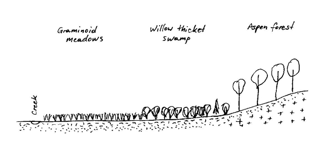
Willow thicket with dense leatherleaf that forms a continuous low shrub layer. Hummocky ground. Very common in wetlands of the area.
Composition:
TS:
- Salix planifolia 4
- Spiraea alba 1
- Alnus rugosa 1
LS:
- Chamaedaphne calyculata 4
- Salix pedicellaris +
- Spiraea alba +
- Potentilla palustris +
H:
- Carex cf. utriculata 1
M-L:
- Brown mosses 2
- Brachythecium spp. +
Other vegetation communities:
On still drier land willows become taller and attain higher cover.
Other notes:
Occurs behind shrub fens, on wetland periphery, on somewhat less wet ground. A bald eagle observed.
Plot 5:
407191E 5585325N
Description:
In lake’s shoreline water, 30-40 cm deep.
Composition:
H:
- Myriophyllum sibiricum 4
- Potamogeton sp. 1
Other notes:
Abundant otter scats at lake shoreline.
Plot 6:
407150E 5585345N
Description:
Sedge shoreline meadow-marsh, with cattail overtopping the sedge layer. Very wet, spongy ground, pools of open water.
Composition:
LS:
- Potentilla palustris +
H:
- Carex cf. utriculata 5
- Typha latifolia 2
- Calamagr. canadensis 1
- Scirpus cyperinus +
- Lycopus uniflorus +
- Epilobium sp. +
- Lemna minor +
Other vegetation communities:
Grades into tall willow thicket swamp, away from lake shore (which is similar to plot 4). Scirpus validus (or S. acutus) also observed in vicinity.
Other notes:
Garter snake seen.
Plot 7:
407009E 5585097N
Description:
Young aspen stand, canopy continuous, 15-18 m tall. Heavy tall shrub layer of Corylus and Acer. Several logs on the ground, well decomposed now.
Composition:
T:
- Populus tremuloides 4
- Picea glauca 1
TS:
- Corylus cornuta 3
- Acer spicatum 3
- Viburnum rafinesq. +
LS:
- Diervilla lonicera 1
- Rubus pubescens 1
- Rosa acicularis +
- Ribes triste +
H:
- Cornus canadensis 1
- Clintonia borealis +
- Oryzopsis asperifolia +
- Aster ciliolatus +
- Actaea rubra +
- Aster macrophyllus +
M-L:
- Brachythecium spp. 1
Plot 8:
405028E 5578038N
SW section of the reserve
Description:
Sedge marsh, with some characteristics of a graminoid meadow. Herb layer 7-80 cm tall. Water close to surface.
Composition:
LS:
- Potentilla palustris +
- Spiraea alba +
H:
- Carex cf. utriculata 4
- Calamagrostis canadensis 2
Plot 9:
404994E 5578093N
Description:
Wet grass meadow. Calamagrostis canadensis forms big tussocks (1.2 m). Ground somewhat springy, but firming up.
Composition:
H:
- Calamagrostis canadensis 4
- Carex cf. utriculata +
Other vegetation communities:
This and Carex utriculata meadows are very extensive along the creek, with Calamagrostis being the dominant type. Tall willow thicket swamps are intermixed, especially closer to forest edge.
Species observed during 2010 site visit
Trees:
- Balsam Fir (Abies balsamifera)
- Black Spruce (Picea mariana)
- Trembling Aspen (Populus tremuloides)
- White Spruce (Picea glauca)
- White Birch (Betula papirifera)
Shrubs:
- Beaked Hazel (Corylus cornuta)
- Blueberry sp. (Vaccinium sp.)
- Common Juniper (Juniperus communis)
- Dwarf Raspberry (Rubus pubenscens)
- Labrador Tea (Ledum groenlandicum)
- Prickly Wild Rose (Rosa acicularis)
- Red Osier Dogwood (Cornus stolonifera)
- Red Raspberry (Rubus idaeus)
- Saskatoon (Amelanchier Alnifolia)
- Speckled Alder (Alnus incana)
- Willow sp. (Salix sp.)
Herbs & grasses:
- Blue-beaded Lily (Clintonia borealis)
- Blue-joint Grass (Calamagrostis canadensis)
- Bishop’s Cap (Mitella diphylla)
- Bracken Fern (Pteridium aquilinum)
- Bunchberry (Cornus canadensis)
- Bush Honeysuckle (Diervilla lonicera)
- Canada Mayflower (Maianthemum canadense)
- Canada Thistle (Cirsium arvense)
- Common Plantain (Plantago major)
- Creamy Pea-vine (Lathyrus ocholeucus)
- Downy Arrow-wood (Viburnum rafinesqueanum)
- Fireweed (Epilobium angustifolium)
- Foxtail Barley (Hordeum jubatum)
- Horsetail sp. (Equisetum sp.)
- Northern Bedstraw (Galium boreale)
- Palmate-leaved Coltsfoot (Petasites frigidus var palmatus)
- Prairie Onion (Allium stellatum)
- Rose-twisted Stalk (Streptopus lanceolatus)
- Snowberry (Symphoricarpos albus)
- Snakeroot (Ageratina sp.)
- Spreading Dogbane (Apocynum androsaemifolium)
- Strawberry sp. (Frageria sp.)
- Sweet Flag (Acorus calamus)
- Twinflower (Linnaea borealis)
- White Sweet Clover (Melilotus albus)
- Wild Ginger (Asarum canadense)
- Wild Sarsaparilla (Aralia nudicaulis)
- Yellow Sweet Clover (Melilotus officinalis)
Birds:
- American Kestrel (Falco sparverius)
- Black and White Warbler (Mniotilta varia)
- Black-capped Chickadee (Poecile atricapillus)
- Blue Jay (Cyanocitta cristata)
- Canada Warbler (Cardellina canadensis)
- Cedar Waxwing (Bombycilla cedrorum)
- Common Grackle (Quiscalus quiscula)
- Common Raven (Corvus corax)
- Common Tern (Sterna hirundo)
- Common Yellowthroat (Geothlypis trichas)
- Eastern Wood Pewee (Contopus virens)
- Northern Flicker (Colaptes auratus)
- Red-eyed Vireo (Vireo olivaceus)
- Red-winged Blackbird (Agelaius phoeniceus)
- Ruffed Grouse (1 adult, 4 young) (Bonasa umbellus)
- Spotted Sandpiper (Actitis macularius)
- Swainson’s Thrush (Catharus ustulatus)
- Turkey Vulture (Cathartes aura)
- White-throated Sparrow (Zonotrichia albicollis)
- Winter Wren (Troglodytes hiemalis)
Appendix D
The Campfire River Conservation Reserve Earth Science Checksheet
Detail (North-South Environmental Inc., 2000b).
Campfire River Conservation Reserve
Field Work Completed: September 28, 2000
Protection history:
This reserve was identified under the provincial Lands for Life – Ontario’s Living Legacy Program. It was principally identified for its life science representation with no previous earth science significance assigned.
Setting:
Campfire River Conservation Reserve lies approximately 35 km southeast of Woodland Caribou Provincial Park immediately east of Umfreville Lake. It encompasses a short section of the Campfire River incorporating all of Paintpot Lake and lowlands along the river from Paintpot Lake to the river’s outlet on Salvesen Lake. The elevation of the reserve ranges between 360 and 380 m. asl.
Although the forests within the reserve have not been harvested, a logging road forms the east and southeast boundaries of the reserve and forest harvesting has recently been undertaken adjacent to the reserve in this area. There are no significant impacts or cultural features within the reserve.
Earth science features:
The summary report prepared in conjunction with this checklist provides an overview of the bedrock geology and surficial geology history and representation of this reserve and should be consulted for more information (North-South Environmental Inc. 2000). Detailed site information collected during the reconnaissance field surveys is provided on the attached table and in the accompanying site photographs. A map of the surficial geology also accompanies this checklist (prepared from Northern Ontario Engineering Geology Terrain Study Map 5106).
Bedrock geology:
Campfire River CR lies within the English River Geological Subprovince of the Superior Province. The dominant rock types are massive igneous granodiorite and granite. Bedrock exposures are few, generally confined to the highland around Paintpot Lake and the extreme southwest. The bedrock provides additional representation of the Archean Era of the Precambrian (Neo to Mesoarchean, 2.5 to 3.4 billion years old).
Surficial geology:
The surficial geology of this reserve consists principally of a weakly broken bedrock plain with a significant cover of Glacial Lake Agassiz silty clay deep basinal deposits. No evidence of the presence of till (ground moraine) was observed during the field studies. The lowest portions of the clay plain, particularly in the area along the river, are undergoing paludification by organic terrain (refer to life science checksheet).
The south shore of Paintpot Lake (UTM 407191E, 5585315N, Site #4 in attached table) and nearby small bedrock islands in the lake display excellent examples of glacial moulding. The association of forms is illustrated in the attached photographs of this site and surrounding area. Of particular interest are the small rôches moutonnés islands which display the characteristics of a gentle stoss slope and an irregular, "plucked" lee slope (see accompanying photos). Unlike drumlins, the tapered point of these features point in the direction the ice sheet came from. In addition, the rock outcrop on the shore of the lake illustrates a high degree of glacial polishing or moulding. This outcrop is itself a large rôche moutonné feature but the west side displays partial fluting features (see accompanying photos) which are more characteristic of "S-forms" carved by subglacial meltwater flowing under the ice sheet (Kor et al. 1991). These are only tentatively defined as such as the presence of bedrock S-forms has not been previously described in northwestern Ontario. The representation of these features is likely late Wisconsinan, possibly during the Algonquin Stadial.
Diagram of site #4 0407191E 5585315N
Sensitivity:
In general the earth science features within this reserve are not considered sensitive to natural or cultural impacts. Changes in the level of Paintpot Lake (damming, draining or climate change impacts), although not directly impacting the features, would alter their potential interpretative or educational values.
Significance:
The bedrock outcrops within this reserve are considered of low overall significance for earth science representation within the park’s system. Similar rock types representing the same geological time frame are already represented elsewhere. Also, this type of lithology is generally not of value with respect to mining interests.
The outcrop and small bedrock islands at the south end of Paintpot Lake are tentatively designated as locally significant on the basis of the high quality of their form, particularly in combination with the water plane which accents their form and character. They would provide excellent examples of landforms for interpretive and educational uses.
If the presence of S-forms is substantiated, consideration should be given to raise the level of significance to at least regional.
Recommendations:
It is recommended to undertake further examination of the outcrop at Site #4 to determine whether or not the partial fluting forms may be classed as S-forms. The area surrounding this site and the large island to the north in Paintpot Lake should also be examined for similar landforms. The need for this field work is not considered a high priority at this time but should be considered in light of recommendations for additional field studies at other nearby reserves (such as Scotty Lake).
Earth and life science reconnaissance surveys
Northwestern Ontario Region
Conservation Reserve or Park Area: Campfire River - C2368
Field Data Collection Date: 28-Sep-00
| Location 1 | Easting | Northing | Elevation (m)2 | Vegetation type | Landform type |
|---|---|---|---|---|---|
| Plot 1 Site 1 |
407152 | 5578506 | 346 | Open aspen/shrub-herb rich V6 | Weakly broken silty clay glaciolacustrine plain |
| Plot 2 Site 2 |
406909 | 5578307 | 343 | Lowland black spruce/Labrador tea/Aphagnum-feathermoss V34 | Deep organic over flat glaciolacustrine plain |
| Plot 3 | 407458 | 5579403 | Low shrub fen (Chamaedaphne) | Deep organic over flat glaciolacustrine plain | |
| Site 3 | 407333 | 5578251 | 350 | Weakly broken bedrock–glaciolacustrine complex | |
| Plot 4 | 407470 | 5579380 | Thicket swamp (Salix planifolia/chamaedaphne) | ||
| Site 4 | 407191 | 5585315 | 343 | Roches moutonnees and fluting landform features | |
| Plot 5 | 407191 | 5585325 | Submerged aquatics (Myriophyllum) | ||
| Plot 6 | 407150 | 5585345 | Graminoid marsh (Carex cf. utriculata) | ||
| Plot 7 Site 5 |
407009 | 5585097 | 335 | Aspen/shrub-rich V5 | Weakly broken silty clay glaciolacustrine plain |
| Plot 8 | 405028 | 5578038 | Graminoid marsh-meadow (Carex utriculata, Calamagrostis) | ||
| Plot 9 | 404994 | 5578093 | Graminoid meadow (Calamagrostis canadensis) |
Appendix E
Areas within Campfire River Conservation Reserve subject to the 1991 blow down.
Appendix F
The boundaries of the Bear Management Areas represented within Campfire River Conservation Reserve.
Appendix G
Areas of wildlife significance within Campfire River Conservation Reserve.
Appendix H
The boundaries of the two baitfishing blocks represented within Campfire River Conservation Reserve.