Farrington Township Conservation Reserve Management Statement
This document provides policy direction for the protection, development and management of the Farrington Township Conservation Reserve and its resources.
Statement of Conservation Interest
Ministry of Natural Resources
Rainy Lake Area
Fort Frances District
March, 2003
John Munroe
District Planner
Approval statement
I am pleased to approve this Statement of Conservation Interest for the Farrington Township Conservation Reserve.
This Statement of Conservation Interest provides guidance for the management of the conservation reserve and the basis for the ongoing monitoring activities. More detailed direction at this time is not anticipated. Should significant facility development be considered or complex issues arise requiring additional studies, more defined management direction, or special protection measures, a more detailed Resource Management Plan will be prepared with full public consultation.
The public was consulted during the original regulation process and further consultation is not required at this time.
The conservation reserve will be managed under the jurisdiction of the Rainy Lake Area Supervisor, Fort Frances District, Ministry of Natural Resources.
C. Lauer
Regional Director
Northwest Region
Date: April 28, 2003
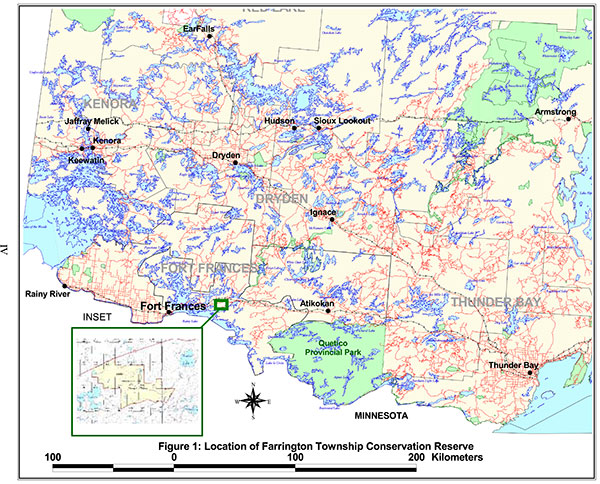
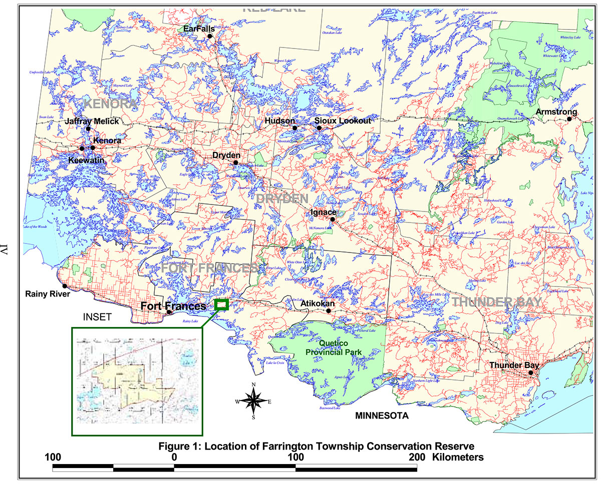
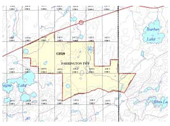
Figure 1: Location of Farrington Township Conservation Reserve
1.0 Introduction
On July 16, 1999, the Ontario Government released the Ontario’s Living Legacy Land Use Strategy to guide the planning and management of Crown lands in central and parts of northern Ontario. A major part of the Ontario’s Living Legacy Land Use Strategy was a government intent to establish 378 new protected areas. This commitment marks the biggest expansion of provincial parks and conservation reserves in Ontario’s history.
The Farrington Township Conservation Reserve is part of this significant expansion of Ontario’s protected areas system.
Conservation reserves are areas of Crown land set aside by regulation under the Public Lands Act, complementing provincial parks in protecting representative natural areas and special landscapes. Most recreational (e.g. hiking, skiing, tourism related uses, nature appreciation) and non-industrial (e.g. fur harvesting, commercial fishing and bait harvesting) activities that have traditionally been enjoyed in the area will continue, provided that these uses do not impact on the natural features needing protection. Hunting and fishing is permitted within all new conservation reserves proposed through Ontario’s Living Legacy.
Commercial timber harvesting, mining, aggregate extraction and commercial hydroelectric development are prohibited in conservation reserves.
Farrington Township Conservation Reserve is located in northwestern Ontario in the Fort Frances Administrative District of the Ontario Ministry of Natural Resources, approximately 48 kilometres east of the town of Fort Frances. The site is accessible by road with its northern boundary being made up of a portion of Highway 11 just to the east of Rainy Lake Indian Reserve 26A (Nicickousemenecaning). The Farrington Township site is approximately 948 hectares in size (OMNR, 2001). The conservation reserve and surrounding area is largely undeveloped Crown land and the dominant land uses are mining, recreation and forestry. Forest access roads surround the Reserve on the east, south and west sides, and Highway #11 forms the northern boundary. Access may be gained from a number of points along the forest access roads or from the highway.
Farrington Township Conservation Reserve is located within Hills' Site Region 4S and Site District 4S-5 (Hills, 1961). The site lies within the Wabigoon subprovince of the Superior geological province. The area occupies a sinuous basin between bedrock-controlled uplands of moderately to steeply rolling and broken bedrock terrain situated on the felsic to intermediate intrusive rocks of the Ottertail Lake Stock, with the southernmost portions overlapping a portion of the felsic to intermediate metavolcanics and metamorphosed mafic and ultramafic intrusive rocks of the Fort Frances - Mine Centre greenstone belt. Mineral potential is rated as low (least), with the exception of the southernmost portions of the conservation reserve, which border an area considered to be of high mineral potential (Springer, 1978). Historically the area surrounding the conservation reserve has been the subject of mining and exploration activity since the late 1800's. Surficial geological features are dominantly ground moraine, representing shallow tills forming a discontinuous cover over the Precambrian bedrock. The low-lying areas contain sandy fine sediments that may have been deposited during the Emerson phase high stand of glacial Lake Agassiz. The rugged topography varies from a maximum elevation of approximately 400 metres on some of the hilltops and ridges in the south to approximately 370 metres in the peatlands. Evidence of carbonate content in the soil is manifested in the common occurrence of eastern white cedar throughout the area. Organic deposits of Recent origin occupy the depressions between the surrounding uplands.
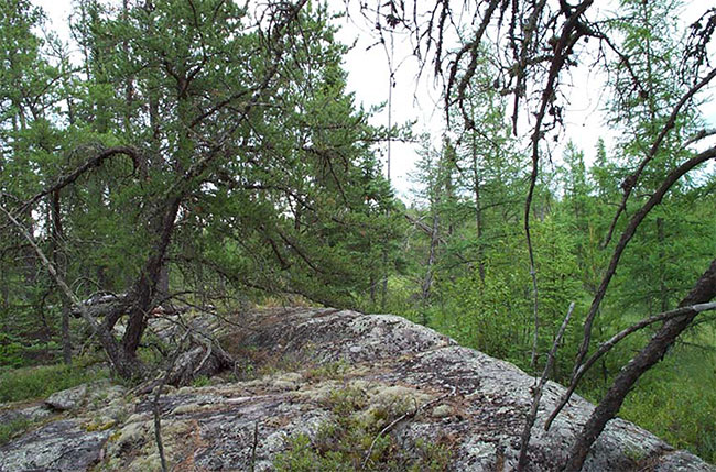
Figure 2: Rock cleft and falls at the outlet to the southern basin, Farrington Township Conservation Reserve.
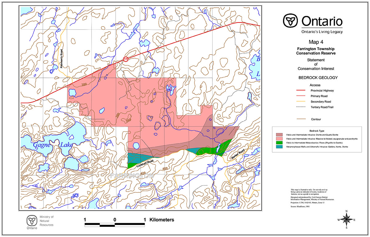
The wetlands which dominate much of the area of the conservation reserve represent a headwater area and consist of two distinct basins, with the northernmost draining to the northeast, and the larger, southern basin draining to the southeast.
The upland forests and wetlands captured by the Farrington Township Conservation Reserve include representative areas of black spruce and jack pine on very shallow soil, hardwood, fir and spruce mixedwoods, and pine/spruce feathermoss, black spruce treed bog, black spruce poor swamp, black spruce intermediate swamp, black spruce/tamarack treed fen, open bog, open moderately rich fen, thicket swamp, shore fen and meadow marsh. The occurrence of tree species here such as red and white pine and red maple, which are more common further to the south, led to the inclusion of the area as part of the Great Lakes - St. Lawrence Forest Region (Rowe, 1972). Rowe recognizes the Rainy River area as part of a separate section of the forest region that is influenced by the northward movement of the southern forest, the prairie to the west and the northern forest.
The conservation reserve does not contain any known rare species, however detailed life science surveys would be required to confirm this. Species diversity within this conservation reserve is not expected to be as great as that for areas lying farther to the west in the District. The conifer, hardwood and mixedwood forested lands of the conservation reserve provide a variety of habitat for species such as moose, lynx, red squirrel, grey wolf, black bear, marten, grey jay and great grey owl. Much of the upland forest surrounding the wetlands has been harvested over the past twenty years, which provides a temporal or seral diversity to the forest habitats as well. The wetland portions of the conservation reserve provide nesting and foraging habitat for a variety of waterfowl, while the forested margins provide habitat for upland birds.
The site has a low to moderate potential for outdoor recreational activities, owing to the dominant wetland features of the site. Direct road access exists from Highway #11 which runs along the northern boundary of the site, and the Barber and Lockhart Roads along the southern boundary. Numerous old tertiary roads and trails enter the site from the north, east and south, although not passable in places to vehicular traffic. Each of the two basins has one dystrophic lake, and several large beaver ponds exist in the area, but no sport fish are known to exist within the waters. the best recreational opportunities are associated with nature activities and viewing, and hunting.
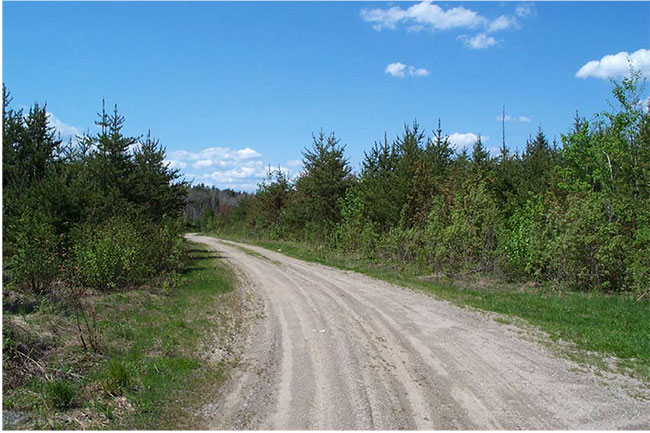
Figure 3: Lockhart Road looking west (boundary of Farrington Township Conservation Reserve is at the edge of the right-of-way on the right).
The purpose of this Statement of Conservation Interest is to identify the natural heritage values of the Farrington Township Conservation Reserve, the activities which occur there and, through a set of management guidelines, outline the activities which will and will not be permitted, as well as the management direction for the area (MNR, 1997).
2.0 Background information
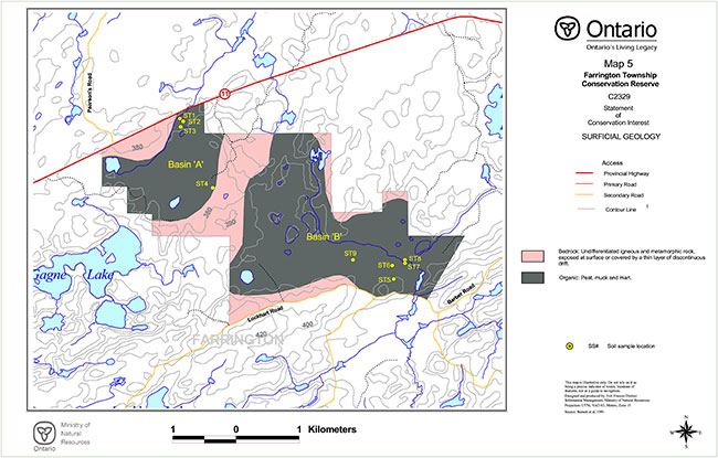
The Farrington Township Conservation Reserve is an area protected as representative of wetlands and mixed forest types on weakly broken ground moraine (OMNR, 1999). The dominant features of the site are the two peatland basins and the wetland ecosites that occur there. The margins of the area are accessible by road, although penetrating to the interior requires significant effort. Forestry, mining and trapping are the dominant land uses surrounding the conservation reserve, but comparatively little development has occurred.
Table 1. Background Information
| Name: | Farrington Township Conservation Reserve |
|---|---|
| Site Region / Site District: | 4S/4S-5 |
| Ecosite Class: | ES 12, 19, 20, 21, 22, 23, 25, 28, 29, 34, 35, 36, 39, 40, 42, 44, 45 and 46. |
| OMNR Administrative Region / District / Area: | Northwest / Fort Frances / Rainy Lake Area |
| Total Area (ha): | 948 |
| Regulation Date: | Regulation expected in 2003. |
| First Nations with Interest in Area: | Treaty Three: Nicickousemenecaning (Red Gut Bay) and Seine River First Nations. Other First Nations may also have an interest. |
| OBM: | 15U 5119/ 53964 |
| Latitude/Longitude: | 48° 43' 30"N; 92° 50' 45"W |
| Basemap: | 2015 500053900, 510053900 |
| Forest Cover: | Upland forest: black spruce and jack pine on very shallow soil, hardwood, fir and spruce mixedwoods, and pine/spruce feathermoss. Lowland forest: black spruce treed bog, black spruce poor swamp, black spruce intermediate swamp, black spruce/tamarack treed fen. Jack pine, black spruce and trembling aspen are dominant. Nearly 70% of the forested area is currently under 20 years of age. (Refer to Appendix D) |
| General Location Description: | The Farrington Township Conservation Reserve is situated approximately 48 kilometres east of the Town of Fort Frances. The village of Mine Centre lies approximately 15 kilometres to the east along Highway #11. Rainy Lake Indian Reserve 26A lies approximately 2 kilometres to the west. The conservation reserve is comprised entirely of Crown land within unorganized territory (refer to Figure 1.). |
| Access: | Access can be gained via Highway #11 to the north or off the Barber and Lockhart forest access roads to the south. Several entrances currently exist off the highway, but these are scheduled to be removed. Old tertiary logging roads enter the site from the north, east and south, but are rapidly growing in and subject to flooding in locations. Access to the interior is primarily by foot. |
2.1 Targets
This section provides a summary of the earth and life science system and values, cultural resources represented and recreational opportunities available or possible.
Table 2. Summary of Social, Economic and Environmental Opportunities
| Life Science Representation: | The Farrington Township Conservation Reserve contains representative examples of deciduous forest, deciduous mixed forest and open wetland over both weakly and moderately broken ground moraine; plus conifer forest, conifer mixed forest, sparse forest and vegetated bedrock over weakly broken ground moraine within Site District 4S-5. The most distinctive life science features of the conservation reserve are the wetland ecosites of the two lowland basins dominating the site. The inclusion of surrounding upland areas representing young conifer, hardwood and mixedwood forests less than 20 years of age contributes, at least in the short term, to representation. The peatlands of the conservation reserve exhibit some signs of patterning in the vegetation, as observed on aerial photographs, due to water movement through the area and collection into defined water tracks. Although not as highly developed or dramatic as those of the peatlands in site district 5S-2, the patterning is significant for this site district. A well-developed system of strings and flarks does exist in the southernmost part of the south basin. The abundance of small (0.3 - 6.3 ha.) treed bedrock islands within the peatland features, coupled with an abundance of tracks and trails leading to and from and connecting these islands, would raise the possibility of use by moose as calving areas. Although not the preferred location for calving sites, there is documented evidence of such use elsewhere (Jackson et al, 1981). This possibility is worthy of further investigation. Detailed life science surveys have not been conducted on the site. No records of rare species occurring in the area exist (NHIC, 2001). |
|---|---|
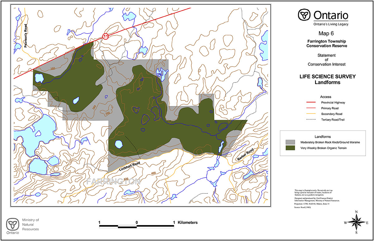
| Earth Science Representation: | The dominant landform features within the conservation reserve are: a) moderately broken bedrock knob with subordinate ground moraine consisting of a sandy till, and b) weakly broken peaty organic terrain (Roed, 1980). A thin, discontinuous, sandy glacial till has been deposited over the Archean bedrock, with minor glaciolacustrine silts and clays deposited in the lowland areas (Zoltai, 1961). A portion of the Ottertail Lake stock underlies much of the conservation reserve. This posttectonic stock represents felsic to intermediate intrusive rocks which differ in age, structure and composition from the rocks of the larger batholitic plutons occurring more internally within the Wabigoon subprovince (Blackburn et al, 1991). To the south of this stock within the southern boundary of the site is a portion of a diverse volcanic sequence of metavolcanic and metaorphosed intrusive rocks of the Fort Frances - Mine Centre greenstone belt. |
| Cultural Resource Representation: | The site contains no known cultural resource values. The major historical travel route in the area lies along the Seine River and through Seine Bay of Rainy Lake and settlements and encampments tended to be associated with the large waterbodies nearby. The wetland nature of much of the site may have limited the use of the Farrington Township area to incidental use. More recent uses have been associated with resource extraction and have not resulted in permanent settlement or development. |
| Recreational Opportunities: | The overall recreational potential of the conservation reserve is ranked as moderate. Of the potential recreational activities identified, those which are associated with nature activities and hunting are considered the most viable, although these are somewhat hampered over much of the area by access limitations and difficulty. Such activities could include nature study, bird and wildlife viewing and photography. The limited easy access to the central wetland features tends to limit use primarily to the uplands and margins of the peatlands. Although there are indications of a relatively high population of large mammals in the area, the advancing regeneration in the area increasingly limits visibility and hunters may favour more recently disturbed areas elsewhere. No navigable waterways or recreational waterbodies exist within the conservation reserve. |
2.2 Survey information
This section provides an overview of the inventories completed, their level of detail and any further inventories required.
Table 3. Level of survey performed
| Survey Level | Life Science | Earth Science | Cultural | Recreational |
|---|---|---|---|---|
| Reconnaissance | Yes1 | Yes2 | No | Yes3 |
| Detailed | No | No | No | No |
| Requirement | No | No | No | No |
1 Munroe, 2002a
2 Munroe, 2002b
3 Munroe, 2002c
The reconnaissance surveys which have been completed, in conjunction with other values and earth/life science records for the area (OMNR, 2002) are deemed sufficient in scope and detail to determine management direction for the conservation reserve. More detailed surveys may be undertaken at a later time if circumstances change.
3.0 Values to be protected
This section provides a description of the key natural heritage values on the site (Appendices) and their condition relative to past resource use and management activities. It also addresses the values' sensitivity to future land use and management activities.
3.1 Values identified in the conservation reserve
Table 4. Values identified in the conservation reserve
| Life Science: | Identified ecosites classified in accordance with the Northwestern Ontario Forest Ecosystem Classification (Racey et al, 1996) within the conservation reserve include:
Although not as well defined as those of larger peatlands to the west of Fort Frances, the wetlands do exhibit some patterning in the vegetation as a consequence of water movement through the peat. This is primarily observed from the air or on aerial photographs (Figure 4). An old winter road scar crosses the wetland features in the southwest corner of basin 'B' (Figure 5). Those parts of the conservation reserve supporting tree growth include areas dominated by jack pine (29%), black spruce (17%) and aspen (54%). The presence of carbonates in the glacial tills may explain the occurrence of cedar throughout the site, in small pockets and as a component species. Other tree species found on the area include tamarack, black ash, white birch, balsam poplar, white pine, red pine, white spruce, red maple and balsam fir. The age of the forest cover ranges from 5 to 115 years, but the weighted average age is only 32. The lowland black spruce represents the oldest stands. Two large residual white pine were located in the southern end of the area which were estimated to be between 120 and 150 years of age. Much of the upland forest has been logged over the past 20 years, accounting for the younger age classes represented in the jack pine and poplar types. Appendix C contains a forest cover map and Appendix D contains stand listings for the conservation reserve. The vegetation of the conservation reserve is typical of the ecosites represented, with no rare plants having been documented for this site. Although a detailed survey of plant species has not been undertaken, a list of the plant species common to the area is contained in Appendix B. A large beaver dam controls the outlet to the southern basin (B) near the southeastern boundary of the conservation reserve (Figure 6),and other, smaller dams were noted in peripheral lagg areas. A complex network of well-used game trails connects the numerous treed bedrock islands in the peatlands, with signs of use by bear and moose (Figure 7). Moose may use these islands for calving purposes, although this is unconfirmed (Jackson et al, 1991). Deer sign were abundant on old logging roads surrounding the wetlands. |
|---|---|
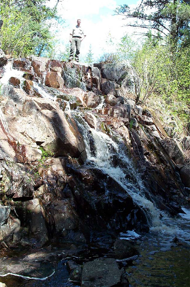
| Earth Science: | The bedrock geology of the area between Mine Centre and Fort Frances has been the subject of a variety of geological studies and investigations since gold was first discovered in the area in the late 1800's (Poulsen, 1984). As a consequence the geological setting of the Farrington Township Conservation Reserve is relatively well understood. The specific geology of the site is only understood in this larger context and a more detailed survey would be required to document the geology of the site more specifically. Located within the western portion of the Wabigoon subprovince, the Farrington Township Conservation Reserve lies largely atop the felsic to intermediate igneous intrusive rocks of the Archean age Ottertail Lake stock. This stock is a zoned late tectonic stock with a core of granodiorite to granite, and a rim of monzodiorite to diorite (Blackburn et al, 1991). The southernmost portions of the conservation reserve lie atop felsic to intermediate metavolcanic rocks and metamorphosed mafic to ultramafic intrusive rocks of the Fort Frances-Mine Centre greenstone belt. The rocks consist of rhyolitic to dacitic tuffs, agglomerates and flows and gabbro, norite and diorite, respectively (Davies and Pryslak, 1967). The entire area lies within a wedge-shaped dextral wrench zone between the Quetico fault to the north and the Seine River-Rainy Lake fault to the south (Poulsen, 1984). The topography is moderately broken, with bedrock knob terrain predominating, rising from an elevation of approximately 370 metres in the wetlands to 400 metres on some of the ridges and hilltops. The topography is more steeply rolling in the south than in the north. The area is covered by a thin, discontinuous drift of sandy glacial till, with minor occurrences of fine-textured glaciolacustrine sediments and Recent organic deposits occupying depressions between the bedrock knolls (Barnett et al, 1991). Deeper surficial deposits are localized and tend to occur on the down-ice side of the ice movement to the southwest, in the lea of bedrock features. The sandy tills in the area were deposited by a glacial advance from the northeast (Zoltai, 1961) and the glaciolacustrine sediments found in the low-lying basins between the bedrock were deposited during the Emerson phase high stand of glacial Lake Agassiz which occupied the area as the ice sheet retreated (Teller et al, 1983). Glacial erratics appear sporadically throughout the site, perched upon exposed bedrock. Many of the bedrock knobs were washed clean of their morainal deposits by wave action from the lake (Zoltai,1961). Outflow from the southern basin is partially controlled by a rock ridge trending to the northeast, creating a small cascade near the southeast boundary of the conservation reserve. A deep, steep sided cleft in the rock of uncertain origin occurs here (Figure 8). Recent deposits within the conservation reserve are confined to accumulations of peat in the low lying depressions between the bedrock, and were found to vary between 2 and greater than 4 metres in depth, with the deeper deposits found in the southernmost portions of basin 'B'. The peat was found to be predominantly a fibric peatymor with occasional occurrences of mesic peatymors. Numerous small bedrock islands occur throughout both lowland basins within the site. The abundance of eastern white cedar, that cedar tends to favour more alkaline soils, would seem to indicate the presence of carbonate material within the glacial tills and sediments. |
| Culthral: | The area contains no identified cultural heritage values. |
| Aboriginal: | The area contains no identified aboriginal values. |
| Tourism: | Farrington Township Conservation Reserve is located in an area where resource extraction has been the primary land use. Although tourism operations exist to the east and west associated with the larger lakes and the Highway 11 corridor, tourism use of the site has largely not occurred. Opportunities exist for hunting based upon large mammals such as black bear, white-tailed deer and moose, and nature study/ecotourism based upon the wildlife and vegetation features of the site. |
| Recreational Fishing: | The conservation reserve contains no significant waterbodies, and no gamefish species have been identified within the waters that do occur there, being three small dystrophic lakes and a few large beaver ponds. |
| Recreational/ Commercial Hunting: | Hunting potential, particularly for moose, white-tailed deer and black bear is considered to be high, with evidence found of the use of the area by all three species. The advanced regeneration of the areas once logged increasingly limits visibility and therefore may make hunting more difficult. The access limitations associated with the central wetland features of the site limit hunting to the more accessible upland areas and wetland margins. Hunting for upland gamebirds and waterfowl also present opportunities, although in the latter case the area is off major flyways and may be limited primarily to early-season hunting of locally nesting birds. The area contains a portion of a Bear Management Area (BMA), FF 09B-026. (Refer to Map 2) |
| Mining: | The conservation reserve is situated in an area that has been the focus of active mineral exploration and mining since the late nineteenth century. An abandoned mineshaft exists to the west of the site, but no workings are known to exist within the conservation reserve itself. Activity has tended to focus on the greenstone belts, only a small portion of which is captured within the site on the southern end. The site contains no active mining claims, although active claims do exist to the southeast and southwest. The area is ranked as low (least) in terms of mineral potential, with the exception of the portions of the greenstone belt included in the extreme south of the site, which are ranked as high potential (Springer, 1978). |
| Aggregate: | The area is generally low potential for aggregate extraction, with deposits tending to be shallow tills over bedrock (Roed, 1980). One active aggregate pit currently exists to the east of the conservation reserve along the Barber Road. |
| Forest Harvest: | Much of the upland forest of the conservation reserve has been logged over the past twenty years, although the area has been regenerated and consists today principally of young poplar, jack pine and mixedwood forest. Approximately 67% of the forested area is less than 20 years of age, with 37% requiring inventory surveys to document the regeneration, 9% being 5 to 10 years of age and 20% being 11 to 20 years of age. (Refer to forest resource inventory information in Appendices C and D) |
| Trapping: | The conservation reserve contains a portion of trapline FF38. No cabins associated with this trapline are located within the conservation reserve. Evidence of active trapping was found in the form of a marten box and trap near the southeast corner of the site. |
| Wild Rice: | Commercial wild rice harvesting currently does not occur within this conservation reserve, nor have stands been identified. |
| Wildlife: | Although a detailed life science survey would be required to document and substantiate all of the flora and fauna occurring within the conservation reserve, the variety of upland, wetland and aquatic habitat would suggest that the area supports a wide variety of the commonly-occurring local species, either as resident or nesting populations, or occasional visitors. Wildlife species and signs observed in the area during reconnaissance surveys included moose, white-tailed deer, black bear, beaver, red squirrel, varying hare, grey wolf, red fox, redbacked vole, garter snake, red-tailed hawk, broad- winged hawk, grey jay, common crow, common raven, turkey vulture, hairy woodpecker, black capped chickadee and pileated woodpecker. A list of the commonly occurring vertebrate species that may be found in the area is contained in Appendix B. |
| Commercial Fish: | No commercial fishing for human consumption exists within the conservation reserve. Commercial baitfshing does occur, with the area forming parts of baitfish blocks FF-78 and FF-79. |
3.2 Values protection
The intent of this Statement of Conservation Interest is to protect the identified values by establishing management guidelines for existing and potential uses in this area, given the level of past disturbance and the nature of the existing features. Uses and activities which are permitted, not permitted or conditionally permitted are governed by the policies applying to conservation reserves as stated in the Land Use Strategy and existing conservation reserve policy. Any new uses, and commercial activities associated with them, will be considered on a case by case basis, and must pass a test of compatibility to be acceptable. Compatibility is normally determined through a planning process. The policies outlined in this Statement of Conservation Interest do not supersede any Aboriginal or treaty rights that may exist, or other legal obligations.
Forest Values
The upland forest types and ecosites identified will continue undergoing natural successional and developmental changes already initiated without the advent of a major disturbance such as fire. The lowland black spruce and tamarack forest ecosites are not expected to change, given the autecology of the primary species under these conditions. The treed and untreed peatland features are also likely to remain unchanged in the absence of natural disturbances such as fire. Most of the upland forest is currently less than 20 years of age and will continue to develop naturally in the absence of fire over the next several decades. Human activities that represent the greatest potential impacts on forest structure, such as logging, mining and hydroelectric development, will not be permitted. Sustaining these values in the long-term may require development of a vegetation management plan and natural disturbance strategy.
Activities occurring on adjacent lands surrounding the conservation reserve are not expected to have a significant impact on the ecology of the site, with the adjacent forested lands being largely younger forest resulting from recent logging activities.
Recreational and commercial values
The Farrington Township Conservation Reserve contains features that may hold interest for amateur and professional naturalists. There is the potential for a number of low impact, non- consumptive recreational activities such as wildlife viewing and photography, although access difficulties are expected to continue to limit use within the large wetland portions of the site.
The existing trapline, baitfish harvest areas and bear management area within the conservation reserve will remain and existing uses associated with them allowed to continue. New operations may be considered, subject to the "test of compatibility". Normal application of controls such as quotas and seasons are designed to ensure that affected wildlife populations remain sustainable. Use of existing trails will be allowed to continue. Proposals for the development of new trails to permit access for these activities will be considered carefully to ensure that the values of the conservation reserve are protected. New trails within the wetland features will be discouraged. Recreational hunting will be permitted, although it is expected that access limitations and maturing young forest will limit this activity over time and the level of use may decline.
Tourism values
Limited tourism values are associated with this site. Some potential associated with big game and upland bird hunting exists, and the area is currently part of a Bear Management Area, which will continue to operate. Access is practically limited to the upland peripheries of conservation reserve and old forest access roads are unmaintained, growing in and flooded in locations. The potential for attracting some visitors to the area for non-consumptive recreational activities such as bird watching and wildlife viewing exists, but must be considered relatively limited in the context of other nearby, competing opportunities.
4.0 Management guidelines
4.1 Land tenure
The Farrington Township Conservation Reserve consists entirely of Crown land and no disposition of Crown land by sale is permitted within the conservation reserve. The surrounding and adjacent lands consist of Crown lands, as well. No expropriation or purchasing of private land for inclusion in the conservation reserve is planned. New leases or land use permits may be considered for approved activities, subject to the "test of compatibility", but will generally be discouraged within the conservation reserve.
4.2 Existing and proposed development
No mineral exploration or mining development will be permitted in the conservation reserve.
No maintained roads currently exist within the area and no new roads will be permitted. Existing roads are revegetating and their continued use as trails will be permitted, but no maintenance or repair will be undertaken. Entrances on Highway #11 are slated for removal as part of ongoing highway planning.
No commercial aggregate permits exist for the area of the conservation reserve and no new permits will be issued. Aggregate extraction will not be permitted.
No logging operations or facilities, nor hydro- electric facilities or structures exist within the area and no new development will be permitted.
No cabins or other facilities associated with commercial bear management, traplines or baitfish harvesting on the site exist, and no new facilities will be permitted. Existing trails used in conjunction with these activities may continue to be used, but new trails will only be considered subject to the "test of compatibility". New fur harvesting or commercial baitfishing operations can also be considered, subject to the "test of compatibility".
Trails suitable for recreational purposes, such as hiking, skiing, snowmobiling or horseback riding, exist within the upland areas of the conservation reserve, in the form of unmaintained tertiary forest access roads. Continued use of these roads as trails will be permitted. The development of new trails will be subject to further planning if considered desirable. Under such circumstances planning will favour the upland portions of the site, and avoid the wetland features and other sensitive areas in locating trails.
No private recreational camps currently exist within the conservation reserve and no new camps will be permitted.
4.3 Recreational activities
Recreational hunting will be allowed to continue within the conservation reserve, subject to applicable regulations. The use of motorized and non-motorized means of transport will be permitted, but ATV's will be limited to existing trails. New trails may be permitted, subject to the "test of compatibility", and will be discouraged within the wetland features and other sensitive areas of the site. Other recreational low impact activities and non-motorized recreational travel such as skiing, canoeing and hiking are permitted.
The use of mechanized means of transport such as snowmachines and all-terrain vehicles off of existing trails will not be permitted, except for direct retrieval of game in accordance with existing conservation reserve policy. No evidence of existing recreational snowmachine use has been identified.
Existing Ministry policies and regulations relating to Crown land camping will apply. Existing policies relative to boat and equipment caches will also apply.
Sport fishing is a permitted use within the conservation reserve, subject to applicable regulations, but no identified sport fishing opportunities within the limited waters of the conservation reserve exist.
Low-impact recreational activities such as nature appreciation, photography and wildlife viewing are permitted and will be encouraged.
4.4 Commercial activities
Activities associated with current traplines and baitfish harvesting areas in the conservation reserve will be permitted to continue in accordance with existing policies and regulations. New operations may be considered, subject to a test of compatibility.
Existing bear management areas will be permitted to continue in accordance with existing policies and regulations. No new operations are permitted.
No commercial tourism facilities, such as outpost cabins, resorts or lodges, exist within the conservation reserve. New commercial tourism facilities within the Farrington Township Conservation Reserve may be considered, unless there are significant demonstrated conflicts, subject to review through the planning process as set out in the proposed Class Environmental Assessment for Ontario’s Provincial Parks and Conservation Reserves. Existing Ministry policies and regulations relating to Crown land camping will apply. Existing policies relative to boat and equipment caches will apply.
No commercial food fisheries operations exist within the conservation reserve and no new opportunities are believed to exist. In the unlikely event new operations are proposed, they may be considered subject to the "test of compatibility".
Commercial wild rice harvesting does not occur within the conservation reserve, nor have any significant occurrences of wild rice been identified. No other commercial food harvesting (i.e, blueberries) activities have been identified. Any new activities will require the written authorization of the District Manager, be subject to a test of compatibility and alternative locations will be preferred.
4.5 Aboriginal interests
The creation of this conservation reserve will not affect any Aboriginal or treaty rights. Consultation with interested First Nations towards identifying cultural and spiritual values within the area will continue.
4.6 Natural resources stewardship
4.6.1 Vegetation management
The Farrington Township Conservation Reserve will be managed to allow natural processes to continue. Suppression of fire will occur in accordance with existing MNR fire suppression strategies, similar to those applied to the surrounding landscape. Suppression techniques employed within the conservation reserve will be modified where possible to minimize the impacts on the features and values of the site. Prescribed burning may be carried out to simulate natural fire, subject to a planning process. The development of a vegetation management plan for the area in the context of regional fire strategies is recommended over time.
Control of insects and diseases within the conservation reserve will be carried out, if required, in accordance with existing Provincial programs and policies. All such proposed activities will be reviewed carefully to ensure that the values of the conservation reserve are protected. Control of non-native species will be considered a priority.
The use of pesticides and other control agents within the conservation reserve, should such measures be considered desirable, will favour biological controls.
4.6.2 Fish and wildlife management
Current Acts, Regulations and Policies will apply. The lands and waters of the conservation reserve will be included in scheduled fish and wildlife management programs and activities. The terrestrial and wetland ecosites of the conservation reserve will be considered in other resource management planning as a component of the wildlife habitat in the broader landscape. The introduction of non-native species will not be permitted.
4.6.3 Landforms
Activities that tend to impact landforms, such as aggregate extraction and road construction, will not be permitted.
4.7 Non-commercial consumptive uses
The consumptive uses of fish and wildlife resources within the conservation reserve are discussed under Section 4.3, and commercial consumptive uses under Section 4.4.
Non-commercial food gathering activities such as berry picking for personal use will be permitted to continue. Plant collection except for approved research or inventory purposes will not be permitted.
Non-commercial harvesting of traditional forest products such as fuelwood for personal will not be permitted within the conservation reserve. Viable alternatives exist outside the Reserve boundaries.
4.8 Cultural resources stewardship
The location and specific details regarding cultural heritage resources may be kept confidential in order to ensure protection of such values and sites. No cultural heritage values have been identified within the site to date.
4.9 Client services
No on-site facilities or services exist within the conservation reserve, nor are any proposed at this time.
The permitted uses and recognized values of this conservation area will be made known to the public through public consultation associated with the Land Use Strategy, the site regulation process, and materials, including this Statement of Conservation Interest, available through Government Information Centres. No significant advertising campaigns for the Farrington Township Conservation Reserve are planned at this time.
Future planning for the conservation reserve will be in accordance with the proposed Class Environmental Assessment for Provincial Parks and Conservation Reserves, which may involve formal public consultation.
4.10 Research
Research activities which do not detrimentally affect the values which the conservation reserve is designed to protect will be encouraged, but will require the written authority of the District Manager. Potential research projects may include monitoring of the hydrological and vegetational succession within disturbed portions of the wetland features, such as old winter logging roads. Further, more detailed surveys and documentation of the wetland site types and species would also be desireable.
4.11 Marketing
No marketing associated specifically with this conservation reserve for tourism and recreational purposes is planned at this time.
5.0 Implementation
The Farrington Township site will be regulated as a conservation reserve under the Public Lands Act, in 2002, following the process set out in the Ontario’s Living Legacy Protected Areas Regulation Implementation Manual (MNR, 2000).
The Fort Frances District, Rainy Lake Area of the Ministry of Natural Resources will be responsible for implementing the management policies and guidelines for the area. All MNR Resource Management Plans or Land Use Plans have been revised as necessary to exclude timber harvesting and other non-permitted activities from this area. All stakeholders and clients will be informed through mail and other consultation of the changes that will take affect. The Rainy Lake Area will have primary responsibility in administering the policies and guidelines. The primary role is providing public information and monitoring of compliance to the policies and guidelines.
6.0 Review and revisions
6.1 Review and revision process
The Farrington Township Conservation Reserve Statement of Conservation Interest will be reviewed on an ongoing basis and revised as needed.
Revisions to the Farrington Township Statement of Conservation Interest will be subject to the requirements as specified in the proposed Class Environmental Assessment for Provincial Parks and Conservation Reserves, and harmonized with the procedures for amendments to land use direction as needed. Significant changes as defined under the Class EA and the procedures for amendments to land use direction will involve a public consultation process.
6.2 Public consultation
6.2.1 Past consultation
The Farrington Township site was part of the consultation process throughout the land use planning exercise. Consultation associated with the land use planning initiative occurred at a number of stages in the process:
- Lands For Life round table consultation (June 1997- July 1998)
- Ontario’s Living Legacy consultations (Fall 1998 and Spring 1999)
- Ontario’s Living Legacy Land Use Strategy (1999)
- OLL Site Regulation Public Consultation Process (2001).
6.2.2 Present and future consultation
Summary of the 2001 Site Regulation Process:
- Mailouts were sent to adjacent property owners and other affected and interested parties and agencies by the District Manager, and newspaper adds placed in local and regional media, informing of the regulation process and inviting comments on the proposed boundaries.
- The trapper (FF38) in the area raised questions about any restrictions on trapping in the new protected area. It was explained that trapping was a permitted existing use in conservation reserves and the protected area was designated primarily to protect vegetation and earth science features, with the main restrictions applying to mining and timber extraction. Most other uses would continue to be allowed. It was further explained that the use of old roads and existing trails could continue, but that any new trails would require permission and be designed to avoid negative impacts on the values for which the CR was proposed.
- Recommendations: Based on the input received, no revisions to the boundaries of the site were deemed necessary.
(More detailed Consultation Documentation is available on file at the Fort Frances District offices of the Ministry of Natural Resources)
The policies that form the basis of this Statement of Conservation Interest are specified in the approved Ontario’s Living Legacy Land Use Strategy and the Conservation Reserves Policy . A policy statement defining the land use intent and specific policies applicable to this conservation reserve may also be found posted on the internet as part of the Land Use Atlas (under preparation, expected completion 2003). Should revisions to the policies applying to this conservation reserve be required over time, such revisions will be subject to the provisions of the Land Use Strategy regarding amendments.
7.0 References
Barnett, P.J., Henry, A.P. and Babuin, D. (1991): Quaternary geology of Ontario, west central sheet. Ontario Geological Survey.Map 2554. scale 1:1,000,000.
Blackburn, C. E. 1981. Kenora-Fort Frances sheet. Ontario Geological Survey. Geological compilation series. Map 2443. scale 1:253,440.
Blackburn, C.R., Johns, G. W., Ayer, J. and Davies, D. W. 1991. Wabigoon Subprovince. in Geology of Ontario. Ontario Geological Survey. Special volume 4, part 1, p. 303-381.
Davies, J. C. and Pryslak, A.P. 1967. Kenora - Fort Frances Sheet. Ontario Department of Mines. Geological Compilation Series, Map 2115. scale 1:253,440.
Hills, G.A. 1961. The Ecological Basis for Land-Use Planning. Ont. Dept. Lands and Forests. Toronto, Ont. Res. Rep. No. 42. 63 pp.
Jackson, G.L., Racey, G.D., McNicol, J.G. and Godwin, L.A. 1991. Moose Habitat Interpretation in Ontario. Ont. Min. Nat. Resour., NWOFTDU Tech. Rep. 52, 74 pp.
Ministry of Natural Resources (MNR). 1997. Conservation Reserves Policy and Procedure. PL 3.03.05.
Ministry of Natural Resources (MNR). 2000. Protected Areas Regulation Implementation Manual; Internal Document.
Munroe, J. 2002a. Farrington Township Conservation Reserve: Life Science Reconnaissance Inventory Report. Ministry of Natural Resources, Fort Frances District. Unpublished report.
Munroe, J. 2002b. Earth Science Reconnaissance Inventory Report: Farrington Township Conservation Reserve. Ministry of Natural Resources, Fort Frances District. Unpublished report.
Munroe, J. 2002c. Recreation Inventory Report – Farrington Township Conservation Reserve
Ministry of Natural Resources, Fort Frances District. Unpublished report.
NHIC 2001. Natural Heritage Information Centre Database. Ontario Ministry of Natural Resources. Page /page/natural-heritage-information-centre Accessed 2001, Aug. 23.
Ontario Ministry of Natural Resources (OMNR) 1996. Forest Resources Inventory - Fort Frances Forest. Ontario Ministry of Natural Resources Digital G.I.S. database, updated to year 2000.
Ontario Ministry of Natural Resources (OMNR) 1999. Ontario’s Living Legacy - Land Use Strategy. Ontario Ministry of Natural Resources Toronto, Ont. 136 pp.
Ontario Ministry of Natural Resources (OMNR). 2001. Farrington Township Conservation Reserve (C2329) Factsheet. Northwest Region. Thunder Bay. 2p.
Ontario Ministry of Natural Resources (OMNR). 2002. Natural Resources Values Information System (NRVIS). Fort Frances District.
Poulsen, K.H. 1984. The Geological Setting of Mineralization in the Mine Centre-Fort Frances Area, District of Rainy River. Ontario Geological Survey Open File Report 5512. 126 p. + map.
Racey, G.D., Harris, A.G., Jeglum, J.K., Foster, R.F. and Wickware, G.M. 1996. Terrestrial and Wetland Ecosites of Northwestern Ontario. Ont. Min. Natur. Resour., Northwest Sci. & Technol. Field Guide FG-02. 94 pp. + Append.
Roed, M.A. 1980. Seine RiverArea (NTS 52C/NE). District of Rainy River, Ontario. Geological Survey, Northern Ontario Engineering Geology Terrain Study 54. 15 p. Accompanied by Map 5070, scale 1:100,000.
Rowe, J.S. 1972. Forest Regions of Canada. Dept. Environ., Can. For. Serv. Ottawa, Ont. Publ. No. 1300 172 pp.
Springer, J. 1978. Ontario Mineral Potential, Dryden Sheet, Districts of Kenora and Rainy River. Ontario Geological Survey Prelim. Map P.1530, Mineral Deposits Ser., Scale 1:250,000
Teller, J.T., Thorleifson, L.H., Dredge, L.A., Hobbs, H.C. and Schreiner, B. T. (1983): Maximum Extent and Major Features of Lake Agassiz. in Glacial Lake Agassiz. Geological Association of Canada. Special paper 26, p. 43-45. incl. map, 1:3,000,000.
Zoltai, S.C. 1961. Glacial History of Part of Northwestern Ontario. Proceedings of the Geological Association of Canada, v.13, p.61-83.
Appendix A permitted uses list
Land use activity for Farrington Township Conservation Reserve
Those uses and management activities not listed in the following table are governed by existing conservation reserve policy and the Farrington Township Conservation Reserve Statement of Conservation Interest (March, 2003). Any new uses, and commercial activities associated with them, will be considered on a case by case basis, and must pass a test of compatibility to be acceptable. Compatibility is normally determined through a planning process.
Commercial activities
M
| Activity | Permitted | Guidelines |
|---|---|---|
| Aggregate Extraction: | No | |
| Bait Fishing (Commercial) Existing: | Yes | Existing use permitted to continue, unless there are significant demonstrated conflicts. |
| Bait Fishing (Commercial) New: | Maybe | New operations can be considered, subject to the "test of compatibility" |
| Commercial Fishing Existing: | No | No capability within the site. |
| Commercial Fishing New: | No | |
| Commercial Fur Harvesting Existing: |
Yes | Existing use permitted to continue, unless there are significant demonstrated conflicts. Existing trap cabins can continue; new cabins are not permitted. |
| Commercial Fur Harvesting New: |
Maybe | New operations can be considered, subject to the "test of compatibility". |
| Commercial Hydro Development: | No | |
| Commercial Timber Harvest: | No | |
| Commercial Tourism Existing: | No | No tourism facilities exist within the site. |
| Commercial Tourism New: | Maybe | New tourism facilities can be considered during the planning for an individual reserve. |
| Bear Hunting by Non residents (guided) Existing: | Yes | Existing authorized operations permitted to continue. |
| Bear Hunting by Non residents (guided) New: | No | New operations not permitted. |
| Outfitting Services Existing: | No | No outfitting services exist within the site. |
| Outfitting Services New: | Maybe | New operations can be considered during the planning for an individual reserve. |
| Outpost Camps Existing: | No | No outpost camps exist within the site. |
| Outpost Camps New: | Maybe | New operations can be considered during the planning for an individual reserve. |
| Resorts/lodges Existing: | No | No resorts or lodges exist within the site. |
| Resorts/lodges New: | Maybe | New facilities can be considered during the planning for an individual reserve. |
| Energy Transmission and Communication Corridors Existing: | No | None within the site These facilities should avoid conservation reserve lands wherever possible. |
| Energy Transmission and Communication Corridors New: | No | |
| Food Harvesting (Commercial) Existing: | Maybe | Written authority required. |
| Food Harvesting (Commercial) New: | Maybe | |
| Mineral Exploration and Development: | No | |
| Peat Extraction: | No | |
| Wild Rice Harvesting Existing: | Yes | No known capability within the site |
| Wild Rice Harvesting New: | Maybe |
Land and resource management activities
| Activity | Permitted | Guidelines |
|---|---|---|
| Crown Land Disposition Private Use: | Maybe | Sale of lands is not permitted. |
| Crown Land Disposition Commercial Use: | Maybe | New leases or land use permits permitted for approved activities. |
| Fire Suppression: | Yes | Forest fire protection will be carried out as on the surrounding public lands, unless alternative direction is provided through a Statement of Conservation Interest or a Resource Management Plan. Whenever feasible "light on the land" techniques, which do not unduly disturb the landscape, will be employed. |
| Fish Habitat Management: | Maybe | |
| Fish Stocking: | Maybe | Conservation Reserved policy indicates that "featured species management" may be permitted. |
| Fish Stocking: | No | |
| Insect/disease Supperssion: | Maybe | |
| Inventory/Monitoring: | Yes | |
| Prescribed Burning: | Maybe | Subject to the development of a more detailed resource management plan. |
| Roads (Resource Access) Existing: | Yes | Existing roads can continue to be used. Existing roads are unmaintained tertiary roads and continued use will not include maintenance nor upgrading. |
| Roads (Resource Access) New: | No | New roads for resource extraction will not be permitted. |
| Vegetation Management: | Maybe | Conservation Reserves policy indicates that Featured Species Management and Natural Systems Management may be permitted. Vegetation management can be considered in a planning process. |
| Wildlife Population Management: | Maybe |
Science, Education and Heritage Appreciation
| Activity | Permitted | Guidelines |
|---|---|---|
| Collecting: | No | |
| Historical Appreciation: | Yes | |
| Nature Appreciation: | Yes | |
| Photography and Painting: | Yes | |
| Research: | Yes | |
| Wildlife Viewing: | Yes |
Recreation Activities and Facilities
| Activity | Permitted | Guidelines |
|---|---|---|
| All Terrain Vehicle Use On Trails: | Yes | Existing use permitted to continue where it does not adversely affect the values being protected. |
| All Terrain Vehicle Use Off Trails: | No | ATV use off trails is not permitted except for direct retrieval of game. |
| Campgrounds: | Maybe | |
| Food Gathering: | Yes | |
| Horseback Riding(trail): | Yes | Existing use on trails permitted. |
| Hunting: | Yes | |
| Mountain Bike Use: | Yes | Existing use on trails permitted. |
| Motor Boat Use Commercial: | Maybe | Traditional use of motor boats is permitted. Existing boat cache authority (commercial tourism, resource user, recreation) is permitted to continue, unless there are significant demonstrated conflicts. |
| Motor Boat Use Private: | Maybe | New commercial tourism boat cache authority may be considered during the planning for an individual reserve. Resource user and private recreation boat caches may be permitted subject to the "test of compatability". |
| Non-motorized Recreation Travel: | Yes | |
| Private Recreation Camps (Hunt Camps) Existing: | No | No private recreation camps currently exist in the area; no No future development will be permitted. |
| Private Recreation Camps (Hunt Camps) New: | No | |
| Rock Climbing: | Maybe | No known capability within this site |
| Snowmobiling On Trails: | Yes | Existing use permitted to continue where it does not adversely affect the values being protected. |
| Snowmobiling Off Trails: | Maybe | Off trails not permitted, except that snowmobiles maybe used for direct retrieval of game. |
| Sport Fishing: | Yes | |
| Trail Development: | Maybe | Development of trails for a variety of activities (e.g., hiking, cross-country skiing, cycling, horseback riding, snowmobiling) can be considered as part of planning for an individual reserve. No new trails are proposed for this conservation reserve at this time. |
Note: The policies outlined in this table do not supersede any Aboriginal or treaty rights that may exist, or other legal obligations.
Source: OLL Land Use Strategy, Table 4, and Conservation Reserves Policy.
Management of this conservation reserve is carried out within the context of conservation reserve policy as amended by the policies for new conservation reserves outlined in the OLL Land Use Strategy.
Source of Direction:
Ontario’s Living Legacy Land Use Strategy (1999)
Conservation Reserves Policy (1997)
Farrington Township Statement of Conservation Interest (2003)
Fort Frances District Fisheries Management Plan (1987)
Appendix B Survey Checksheets
Recreation Inventory Checklist
| Name: | Farrington township conservation reserve |
|---|---|
| Map Name: | Seine Bay |
| NTS Number: | 52 C/10 |
| UTM Reference: | 15U 5119/ 53964 |
| OBM Number: | 2015510053900 |
| Lattitude: | 48°43' 30" |
| Longitude: | 92°50' 45" |
| Area (ha): | 961.00 |
| Ownership: | Crown |
| MNR Region: | Northwest |
| MNR District: | Fort frances |
| Park Zone: | Northwest |
| Count: | N/A |
| Township: | Farrington |
| Recreation Features: |
|
| Recreation Activities: |
|
| Recreation | Features | Rating: Very High, High, Moderate, Low, |
|---|---|---|
| Most Scarce Feature: | 3 | |
| Feature Scarcity: | Moderate | |
| Most Unique Feature: | 6 | |
| Activity Attraction Capability: | Moderate | |
| Scenic Attractiveness: | Moderate | |
| Geographic Significance: | High | |
| Feature Significance: | Moderate | |
| Most Sensitive Feature To Recreation: | 3 | |
| Feature Sensitivity To Recreation Use: | High | |
| Most Sensitive Feature To Resource: | 3 | |
| Development: | ||
| Feature Sensitivity To Resource Development: | High | |
| Cultural/Historic and Archaelogical Features: |
Comments: Access to the site is relatively good, from surrounding forest access roads or Highway #11. Old logging roads are suitable for hiking. Access within the wetlands is difficult due to their inherent nature. Overall the recreational potential is low, apart from seasonal hunting opportunities.
Date compiled:
December 01, 2001
Compiler:
John Munroe
Source: Recreation Resource Inventory Stadndards and Proceedures draft report, Gov. of British Columbia, Ministry of Forests Range, Recreation and Forests Practices Branch, March 1995.
Ontario Ministry of Natural Resources, Ontario Parks
300 Water Street, Peterborough, Ontario K9J 8N1
Natural Heritage Area – Life Science Checksheet
| Name: | Farrington Township Conservation Reserve (P2329) |
|---|---|
| Map Name: | Seine Bay |
| NTS Number: | 52 C/10 |
| UTM Ref.: | 15U 511900/5396400 |
| County: | Unorganized Area |
| Lattitude: | 48° 43' 30'' |
| Longitude: | 92° 50' 45'' |
| NAD: | 83 |
| Elevation – maximum: | 400 |
| Elevation – minimum: | 370 |
| Localty: | Unorganized Area, W. of Mine Centre |
| Township: | Farrington (part) |
| Area: | 961 ha |
| Ownership: | Crown Land |
| MNR Region: | Northwest |
| Ecoregion and Ecodistrict: | 4S, 4S-5 |
| Landform Unit(s): | Weakly to moderately broken ground moraine, organic terrain. |
| MNR District: | Fort Frances |
| Aerial Photographs Year – Roll – Flight Line – Numbers: | 95 - 14 - 4824 - 92, 93, 94, 95 95 - 16 - 4825 - 40, 41, 42 |
| Physical and Biological Features: | Representation: On a broad scale, the park encompasses deciduous forest, deciduous mixed forest and open wetland on both weakly and moderately broken ground moraine; and conifer forest, conifer mixed forest, sparse forest and vegetated bedrock on weakly broken ground moraine. The site consists of bedrock knob topography, with two distinct lowland basins between the surrounding bedrock uplands. Wetland ecosites, which occupy the basins overlying lakebed sediments of glacial Lake Agassiz, include black spruce treed bog, black spruce poor swamp, black spruce intermediate swamp, black spruce/tamarack treed fen, open bog, open moderately rich fen, thicket swamp, shore fen and meadow marsh. Upland ecosites include black spruce and jack pine on very shallow soil, hardwood, fir and spruce mixedwoods, and pine/spruce feathermoss. The two basins drain to the northeast and southeast, respectively, with some patterning of the wetland features evident in the vegetation patterns due to water movement through the peatlands. Eastern white cedar is common throughout the area and remnant large white pine occur sporadically. Treed bedrock islands occur frequently throughout the wetland features of both basins. Scattered, stunted red oak occurs periodically on the shallow soils of the bedrock uplands. Condition: Most of the upland portions of the site have been logged over the past twenty years, although the area has regenerated to jack pine, poplar and mixedwoods. The oldest, undisturbed areas are concentrated in the southeast and are dominantly black spruce lowlands. Some scarring of the wetland features has occurred from winter roads in the southwestern corner of the area. Old tertiary logging roads enter the area from the north, northwest, east and south, although most are deteriorating and growing in. |
| Diversity: | The area encompassed by the conservation reserve represents a diverse wetland complex in a relatively small area. Representation includes most of the wetland ecosites described in the Terrestrial and Wetland Ecosites of Northwestern Ontario, with the exception of exposed, sheltered and open water marshes normally associated with larger waterbodies. Some of the ecosites are not mapable at the scale chosen and therefore are not included in the listings. Evidence of mammals using the area includes trails throughout the wetland features exhibiting use by moose, white-tailed deer, wolf and black bear. Beaver activity was noted throughout the area, and a large dam at the outlet to the southern basin controls the outflow there. A martin box was noted in one location near the southern end of the site. No rare species have been recorded for the site by the Natural Heritage Information Centre. |
| Ecological Considerations: | The conservation reserve contains a wetland complex consisting of two basins that drains the surrounding uplands. Each basin forms a headwater area eventually flowing into Rainy Lake; the northern basin empties to the northeast into the Ottertail River and eventually Redgut Bay to the west, while the southern basin flows to Seine Bay to the south. An old winter trail in the southwestern corner of the area illustrates the long-term alteration of the ecology which can occur in such wetlands through the use of mechanized vehicles. The use of vehicles such as snowmachines and all terrain vehicles should be confined to existing trails to avoid such damage to the wetland features, and any new trails, if considered, should be confined to upland areas of the site. All mechanized travel within the wetlands should be discouraged. |
| Special Features: | The primary feature of the conservation reserve is the wetland complex. A small waterfall exists at the outlet to the southern basin near the southeastern corner of the site. A small area of string and flark patterned fen exists within the south central portion of the southern basin. Each basin contains a single, small, dystrophic lake. Two large, old remnant white pines were observed on the edge of the wetlands within the southern potion of the site. Numerous small, treed bedrock islands exist throughout the wetland features, ranging from less than a hectare to over 6 hectares in size. |
| Major Information Sources: | Field surveys (Aug. & Oct., 2001); local sources; Fort Frances Forest F.R.I. (2000); Life Science Checksheet (1995); NRVIS, 2001; Racey et al, 1996; Farrington Twp. C.R. Draft Life Science Report, 2001. |
| Significance Level (Provincial/Regional/Local) and Brief Summary of Major Representative Values: | Locally/regionally significant wetlands. |
Date Compiled:
December 2001
Compiler:
John Munroe, District Planner
Fort Frances District.
Earth Science Inventory Checklist
| Name: | Farrington Township Conservation Reserve (C2329) | |
|---|---|---|
| Map Name: | Seine Bay | |
| NTS Number: | 52 C/10 | |
| UTM Ref.: |
15U 5119/53964 |
|
| OBM Number: | 2015510053900 | |
| Lattitude: | 48° 43' 30" | |
| Longitude: | 92° 50' 45'' | |
| Elevation – maximum: | 400 | |
| Elevation – minimum: | 370 | |
| County: | N/A | |
| Township: | Farrington | |
| Lot: | 1, 2, 3, 4; 1, 2, 3, 4, 5, 6; 5, 6. | |
| Concession: | III ; IV; V | |
| Area (ha): | 961 ha | |
| Ownership: | Crown | |
| Aerial Photographs Year – Roll – Flight Line – Numbers: |
95 - 14 - 4824 - 92, 93, 94, 95 95 - 16 - 4825 - 40, 41, 42 |
|
| MNR Region: | Northwest | |
| MNR District: | Fort Frances | |
| Park zone: | Northwest | |
| Earth science features: | Rugged, bedrock dominated upland, with two lowland peatland basins. Occupies a portion of a dextral wrench zone between the Quetico Fault to the north and the Seine River - Rainy Lake Fault to the south. Includes felsic to intermediate intrusive rocks of the Ottertail Lake Stock and felsic to intermediate metavolcanics and metamorphosed mafic and ultramafic intrusive rocks of the Fort Frances - Mine Centre Greenstone Belt in the extreme south.Thin, discontinuous mantle of sandy till over bedrock, with frequent rock outcrops and glacial erratics; basins contain fine - textured glaciolacustrine deposits. Recent deposts confined to basins which contain peat. | |
| Significance: | The location of the site within the dextral wrench zone between the Quetico and Seine River - Rainy Lake faults, coupled with a portion of mafic to ultramafic metamorphosed rocks and felsic to intermediate metavolcanics associated with the greenstone belt captured within the southern end of the site, may contribute towards a local significance. Overall the site is considered of Regional significance, although it is not the geological features directly which lead to this conclusion. | |
| Sensitivity: | None of the geological features of the site are considered sensitive to uses and activities associated with its status as a Conservation Reserve. Mining or aggregate extraction could impact the features, but current interest lies primarily to the south and west. Peatlands are sensitive to vehicular traffic. | |
| Recommendations: | A more detailed survey of the geology of the site may be desireable given time and resources, although this may not be critical to management. | |
| Major references: | Barnett et al, 1991; bidwell, 1990; blackburn et al, 1991; harris, 1969: harris, 1974; poulsen, 1984; zoltai, s.c., 1961. | |
Date compiled:
December 2001
Compiler:
John Munroe, District Planner,
Fort Frances District.
Appendix C maps
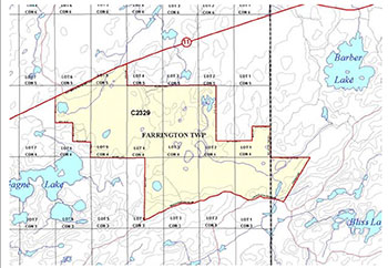
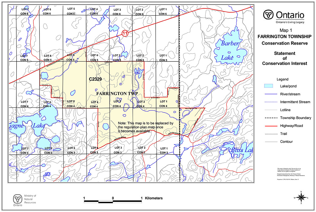
Map 1: Farrington Township Conservation Reserve: Boundaries
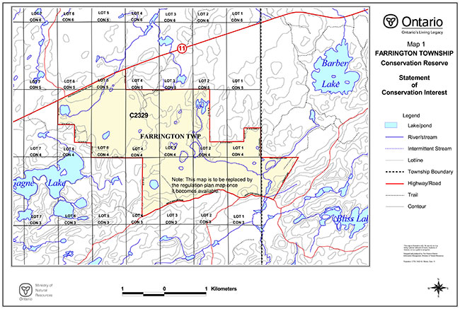
Enlarge Map 1: Farrington Township Conservation Reserve: Boundaries
Map 2: Farrington Township Conservation Reserve: Base Features
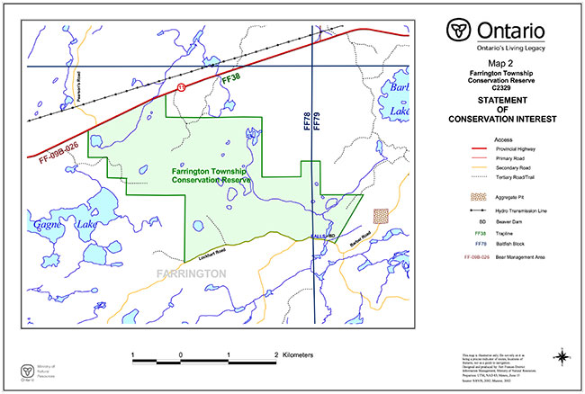
Enlarge Map 2: Farrington Township Conservation Reserve: Base Features
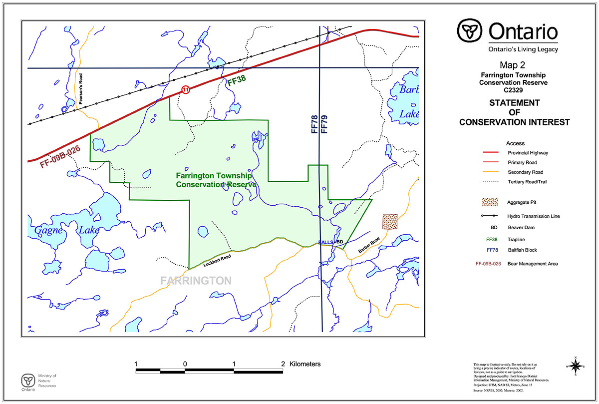
Map3: Farrington Township Conservation Reserve: Recreational Capability

Enlarge Map3: Farrington Township Conservation Reserve: Recreational Capability
Map 4: Farrington Township Conservation Reserve: Bedrock Geology
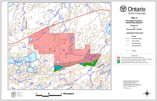
Enlarge Map 4: Farrington Township Conservation Reserve: Bedrock Geology
Map 5: Farrington Township Conservation Reserve: Surficial Geology
Enlarge Map 5: Farrington Township Conservation Reserve: Surficial Geology
Map 6: Farrington Township Conservation Reserve: Landforms
Enlarge Map 6: Farrington Township Conservation Reserve: Landforms
Map 7: Farrington Township Conservation Reserve: Ecosites
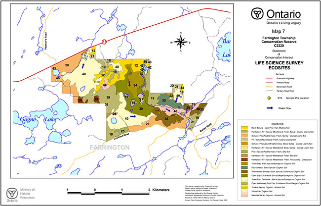
Enlarge Map 7: Farrington Township Conservation Reserve: Ecosites
Map 8: Farrington Township Conservation Reserve: Forest Cover
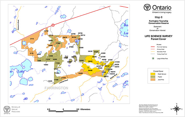
Enlarge Map 8: Farrington Township Conservation Reserve: Forest Cover
Appendix D forest stand listings
Farrington Township Conservation Reserve
Forest Stand Descriptions
(Source: Fort Frances Forest Forest Resources Inventory, 1996)
| Stand | Age | Working group | Area | Updated | Height | Stocking | Site | Species composition |
|---|---|---|---|---|---|---|---|---|
| 10750 | 5 | 7 | 4 | 2000 | 2 | 0.6 | 2 | PJ 3PO 3B 2BW 1MS 1 |
| 15710 | 15 | 7 | 10 | 2000 | 5 | 0.7 | 2 | PJ 5BW 2PO 2B 1 |
| 26700 | 15 | 7 | 10 | 2000 | 3 | 0.6 | 3 | PJ 6PO 2B 1SB 1 |
| 25700 | 15 | 7 | 5 | 2000 | 5 | 0.8 | 2 | PJ 4PO 2SB 2B 1BW 1 |
| 29720 | 15 | 7 | 0 | 2000 | 5 | 0.8 | 2 | PJ 4PO 2SB 2B 1BW 1 |
| 29710 | 70 | 33 | 2 | 2000 | 22 | 0.7 | 2 | PO 5B 2SB 2BW 1 |
| 24710 | 0 | 0 | 0 | 2000 | 0 | 0 | ||
| 20670 | 15 | 7 | 31 | 2000 | 5 | 0.6 | 2 | PJ 5BW 2PO 2B 1 |
| 29700 | 15 | 7 | 7 | 2000 | 5 | 0.8 | 2 | PJ 4PO 2SB 2B 1BW 1 |
| 16710 | 70 | 33 | 1 | 2000 | 22 | 0.6 | 2 | PO 4BW 2PJ 2B 1SB 1 |
| 31710 | 0 | 0 | 0 | 2000 | 0 | 0 | ||
| 18690 | 0 | 0 | 10 | 2000 | 0 | 0 | ||
| 14690 | 70 | 33 | 8 | 2000 | 22 | 0.6 | 2 | PO 4BW 2PJ 2B 1SB 1 |
| 25640 | 0 | 0 | 44 | 2000 | 0 | 0 | ||
| 14650 | 15 | 7 | 23 | 2000 | 5 | 0.6 | 2 | PJ 5BW 2PO 2B 1 |
| 28690 | 0 | 0 | 0 | 2000 | 0 | 0 | ||
| 29690 | 0 | 0 | 0 | 2000 | 0 | 0 | ||
| 30680 | 0 | 0 | 4 | 2000 | 0 | 0 | ||
| 31690 | 0 | 0 | 0 | 2000 | 0 | 0 | ||
| 31690 | 0 | 0 | 0 | 2000 | 0 | 0 | ||
| 27560 | 0 | 0 | 90 | 2000 | 0 | 0 | ||
| 29680 | 0 | 0 | 1 | 2000 | 0 | 0 | ||
| 32590 | 70 | 33 | 37 | 2000 | 22 | 0.7 | 2 | PO 5B 2SB 2BW 1 |
| 17660 | 70 | 33 | 10 | 2000 | 22 | 0.6 | 2 | PO 4BW 2PJ 2B 1SB 1 |
| 28680 | 0 | 0 | 0 | 2000 | 0 | 0 | ||
| 27660 | 15 | 7 | 0 | 2000 | 5 | 0.8 | 2 | PJ 4PO 2SB 2B 1BW 1 |
| 15620 | 0 | 0 | 8 | 2000 | 0 | 0 | ||
| 38630 | 80 | 11 | 7 | 2000 | 14 | 0.8 | 1 | SB 6PJ 2B 1PO 1 |
| 41620 | 65 | 33 | 11 | 2000 | 21 | 0.6 | 2 | PO 5PJ 2SW 2SB 1 |
| 43610 | 0 | 0 | 2 | 2000 | 0 | 0 | ||
| 16580 | 15 | 33 | 27 | 2000 | 7 | 0.8 | 2 | PO 5B 3PJ 1SB 1 |
| 41580 | 0 | 0 | 15 | 2000 | 0 | 0 | ||
| 43600 | 85 | 33 | 1 | 2000 | 24 | 0.5 | 2 | PO 6B 1BW 1PJ 1SB 1 |
| 55570 | 0 | 11 | 10 | 2000 | 0 | 0 | 2 | SB 0 |
| 23500 | 0 | 0 | 86 | 2000 | 0 | 0 | ||
| 38590 | 80 | 11 | 5 | 2000 | 14 | 0.8 | 1 | SB 6PJ 2B 1PO 1 |
| 28570 | 15 | 33 | 6 | 2000 | 7 | 0.9 | 2 | PO 5B 3PJ 2 |
| 38550 | 110 | 11 | 28 | 2000 | 10 | 0.5 | 3 | SB 0 |
| 22580 | 15 | 33 | 2 | 2000 | 7 | 0.8 | 2 | PO 5B 3PJ 1SB 1 |
| 11570 | 85 | 33 | 5 | 2000 | 21 | 0.5 | 3 | PO 4BW 2CE 2B 1SB 1 |
| 48570 | 0 | 33 | 6 | 2000 | 0 | 0 | 2 | PO 0 |
| 17550 | 0 | 33 | 16 | 2000 | 0 | 0 | 2 | PO 0 |
| 25560 | 15 | 33 | 4 | 2000 | 7 | 0.9 | 2 | PO 7B 3 |
| 54510 | 0 | 33 | 66 | 2000 | 0 | 0 | 2 | PO 0 |
| 54510 | 0 | 33 | 66 | 2000 | 0 | 0 | 2 | PO 0 |
| 10560 | 15 | 33 | 2 | 2000 | 7 | 0.8 | 2 | PO 5B 3PJ 1SB 1 |
| 15560 | 0 | 0 | 0 | 2000 | 0 | 0 | ||
| 48540 | 115 | 11 | 9 | 2000 | 14 | 0.7 | 2 | SB 8L 2 |
| 43520 | 0 | 0 | 38 | 2000 | 0 | 0 | ||
| 44530 | 115 | 11 | 3 | 2000 | 14 | 0.7 | 2 | SB 8L 2 |
| 47550 | 0 | 33 | 0 | 2000 | 0 | 0 | 2 | PO 0 |
| 45550 | 0 | 0 | 0 | 2000 | 0 | 0 | ||
| 45540 | 115 | 11 | 3 | 2000 | 0 | 0 | 2 | SB 8L 2 |
| 51550 | 0 | 11 | 0 | 2000 | 0 | 0 | 2 | SB 0 |
| 51530 | 60 | 33 | 16 | 2000 | 19 | 0.9 | 3 | PO 6B 1BW 1PJ 1SB 1 |
| 39490 | 110 | 11 | 38 | 2000 | 13 | 0.6 | 2 | SB 8CE 1L 1 |
| 49530 | 115 | 11 | 2 | 2000 | 14 | 0.7 | 2 | SB 8L 2 |
| 17520 | 15 | 33 | 3 | 2000 | 7 | 0.9 | 2 | PO 5B 3PJ 2 |
| 46510 | 60 | 33 | 2 | 2000 | 19 | 0.9 | 3 | PO 6B 1BW 1PJ 1SB 1 |
| 32490 | 5 | 7 | 47 | 2000 | 2 | 0.8 | 2 | PJ 7MS 1B 1BW 1 |
| 47490 | 75 | 11 | 7 | 2000 | 13 | 0.6 | 1 | SB 3PJ 2PO 2B 1BW 1PW 1 |
| 48500 | 75 | 11 | 0 | 2000 | 13 | 0.6 | 1 | SB 3PJ 2PO 2B 1BW 1PW 1 |
| 17490 | 0 | 0 | 3 | 2000 | 0 | 0 | ||
| 45490 | 0 | 0 | 2 | 2000 | 0 | 0 | ||
| 48490 | 75 | 11 | 0 | 2000 | 13 | 0.6 | 1 | SB 3PJ 2PO 2B 1BW 1PW 1 |
| 17440 | 0 | 33 | 15 | 2000 | 0 | 0 | 2 | PO 0 |
| 46470 | 0 | 33 | 4 | 2000 | 0 | 0 | 2 | PO 0 |
| 17480 | 0 | 0 | 0 | 2000 | 0 | 0 | ||
| 38450 | 5 | 7 | 9 | 2000 | 0 | 0 | 2 | PJ 7MS 1B 1BW 1 |
| 21450 | 75 | 7 | 9 | 2000 | 16 | 0.8 | 3 | PJ 5PO 4SB 1 |
| 15420 | 85 | 33 | 0 | 2000 | 23 | 0.8 | 3 | PO 4B 2BW 2SB 2 |
| 31700 | 0 | 0 | 0 | 2000 | 0 | 0 | ||
| 28671 | 0 | 0 | 1 | 2000 | 0 | 0 | ||
| 43588 | 85 | 33 | 1 | 2000 | 0 | 0 | 2 | PO 6B 1BW 1PJ 1SB 1 |
| 43588 | 85 | 33 | 1 | 2000 | 0 | 0 | 2 | PO 6B 1BW 1PJ 1SB 1 |
| 43584 | 0 | 0 | 1 | 2000 | 0 | 0 | ||
| 43572 | 85 | 33 | 0 | 2000 | 24 | 0.5 | 2 | PO 6B 1BW 1PJ 1SB 1 |
| 46558 | 0 | 33 | 1 | 2000 | 0 | 0 | 2 | PO 0 |
| 46551 | 0 | 0 | 1 | 2000 | 0 | 0 | ||
| 17436 | 0 | 33 | 0 | 2000 | 0 | 0 | 2 | PO 0 |
| 28687 | 0 | 0 | 0 | 2000 | 0 | 0 | ||
| 28685 | 0 | 0 | 0 | 2000 | 0 | 0 | ||
| 96680 | 0 | 0 | 1 | 2000 | 0 | 0 | ||
| 96670 | 0 | 0 | 5 | 2000 | 0 | 0 | ||
| 95680 | 0 | 0 | 0 | 2000 | 0 | 0 | ||
| 98650 | 0 | 0 | 2 | 2000 | 0 | 0 | ||
| 13590 | 0 | 33 | 28 | 2000 | 0 | 0 | 2 | PO 0 |
| 6610 | 0 | 0 | 2 | 2000 | 0 | 0 | ||
| 5560 | 85 | 33 | 6 | 2000 | 21 | 0.5 | 3 | PO 4BW 2CE 2B 1SB 1 |
| 8680 | 0 | 0 | 124 | 2000 | 0 | 0 | ||
| 3710 | 0 | 7 | 29 | 2000 | 0 | 0 | 2 | PJ 0 |
Appendix E Farrington Township Conservation Reserve C2329 Factsheet
Revised April, 2003
Background
On July 16, 1999, the Ontario Government released the Ontario’s Living Legacy Land Use Strategy to guide the planning and management of Crown lands in central and parts of northern Ontario. A major part of the Ontario’s Living Legacy Land Use Strategy was a government intent to establish 378 new protected areas. This commitment marks the biggest expansion of provincial parks and conservation reserves in Ontario’s history.
The proposed Farrington Township Conservation Reserve is part of this significant expansion of Ontario’s protected areas system.
Size and location
The Farrington Township site is located in the Fort Frances District, approximately 48 kilometres east of the town of Fort Frances. The site is accessible by road with its northern boundary being made up of a portion of Highway 11 just to the east of Rainy Lake Indian Reserve 26A (Nicickousemenecaning). The area surrounding this site is predominately Crown land. The Farrington Township site is approximately 948 hectares in size.
Area highlights
The Farrington Township site contains an extensive area of bog, fen and marsh representing a distinctive peatland complex. Sixteen discrete wetland communities have been identified containing populations of flora and fauna that thrive under these conditions. Visitors may observe birds of prey, songbirds, deer, moose, bear, and other smaller mammals associated with the upland and lowland features represented. Due to the wet nature of this area access within the site is limited and difficult.
Land use intent
Conservation reserves are areas of Crown land set aside by regulation under the Public Lands Act. Conservation reserves complement provincial parks in protecting representative natural areas and special landscapes. Most recreational activities (e.g. hiking, skiing, tourism related uses, nature appreciation) that have traditionally been enjoyed in the area will continue, provided that these uses do not impact on the natural features needing protection. Hunting and fishing is permitted within most new conservation reserves proposed through Ontario’s Living Legacy.
Commercial timber harvesting, mining, aggregate extraction and commercial hydroelectric development are prohibited in conservation reserves. New private access roads and new resource access roads are not permitted in conservation reserves unless a prior commitment has been made, with the exception of necessary access for mineral exploration and development.
Where there are existing Aboriginal and treaty rights, the establishment of this conservation reserve does not extinguish these rights.
Next steps
The Land Use Strategy established the Ministry’s intent to add these Crown land areas to Ontario’s protected areas system following the extensive public consultation associated with the Ontario’s Living Legacy and Lands for Life land use planning initiatives between 1997 and 1999. Prior to the finalization of the boundary of this Conservation Reserve proposed for regulation under the Public Lands Act, the Ministry is inviting public comment from June 15 - July 15, 2001 on the proposed boundary from all potentially affected stakeholders. The Ministry is committed to ongoing consultation with First Nations potentially affected by OLL decisions.
In the interim, the area has been withdrawn and protected from resource extraction activities such as timber harvesting, hydroelectric development, aggregate extraction and new mineral exploration.
In the future and subject to the intended regulation of the area as a conservation reserve, the Ministry of Natural Resources will provide long term management direction for this area. Depending upon the complexity of issues within this conservation reserve, management direction may take the form of a simple Statement of Conservation Interest or a more detailed Resource Management Plan. The public will be invited to participate in the preparation of management plans. Please let us know if you would like to be notified directly of this opportunity. Planning, management and the uses permitted within this conservation reserve will be consistent with the commitments of the Ontario’s Living Legacy Land Use Strategy and Conservation Reserves Policy and Procedure (1997).
For more information
For further information on the Farrington Conservation Reserve, please contact John Munroe, Ministry of Natural Resources, 108 Saturn Ave., Atikokan, Ontario, P0T 1C0, phone 807-597-6971 , extension 241, Fax: 807-597-6185 . You may also visit the Ministry’s Internet web site at www.ontarioslivinglegacy.com (link no longer active) for information on Ontario’s Living Legacy.
Appendix F photographs
Figure 4: Aerial photograph of patterned fen (flarks and strings), Farrington Township Conservation Reserve
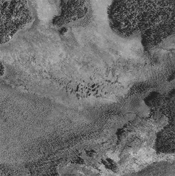
Figure 5: Winter road scar, Farrington Township Conservation Reserve
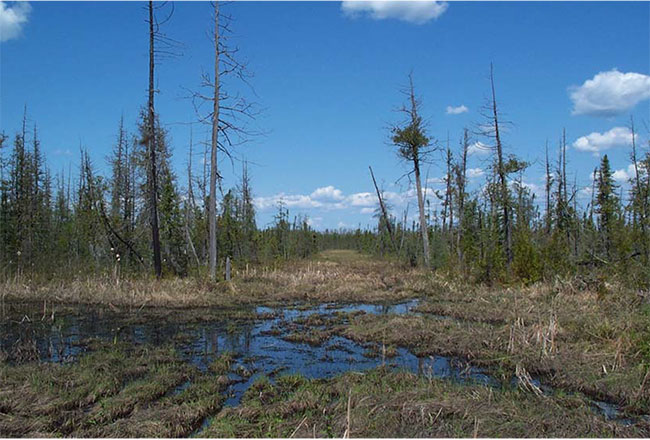
Figure 6: Beaver dam controlling the outflow from basin 'B', Farrington TownshipConservation Reserve
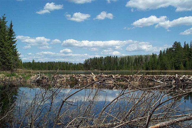
Figure 7: Treed bedrock islands in wetland, Farrington Township Conservation Reserve
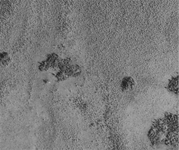
Figure 8: Rock cleft near southeast boundary, Farrington Township Conservation Reserve (scarp on the right is approx. 7 metres in height)
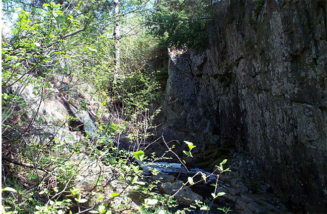
Figure 9: Small marsh seen from Highway #11 looking south, Farrington Township Conservation Reserve
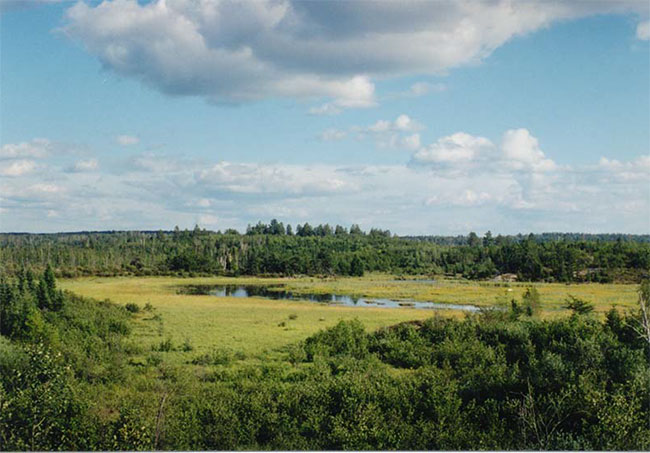
Figure 10: Basin 'B' looking northeast, Farrington Township Conservation Reserve
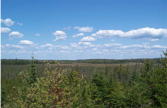
Figure 11: Meadow marsh (ES46), Basin 'B', Farrington Township Conservation Reserve
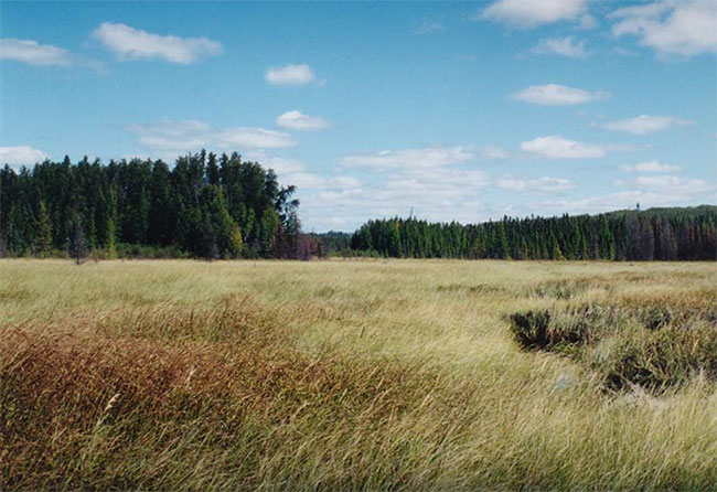
Figure 12: Open poor fen (ES41), Basin 'B', Farrington Township Conservation Reserve
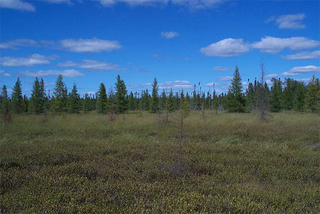
Figure 13: Treed fen (ES40), Basin 'A', Farrington Township Conservation Reserve
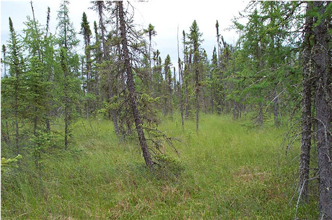
Figure 14: Bedrock knob island in treed fen, Basin 'A', Farrington Township Conservation Reserve