God’s Lake Old Growth White Pine Forest, Spring/Cut Lake Esker & Blue Lake End Moraine Conservation Reserves Management Statement
This document provides policy direction for the protection, development and management of God’s Lake Old Growth White Pine Forest, Spring/Cut Lake Esker and Blue Lake End Moraine Conservation Reserves and their resources.
(C134, C136, C138)
Statement of Conservation Interest
Ontario Ministry of Natural Resources
North Bay District
Approval statement
We are pleased to approve this Statement of Conservation Interest for God’s Lake Old Growth White Pine Forest Conservation Reserve (C134), Spring/Cut Lake Esker Conservation Reserve (C136) and Blue Lake End Moraine Conservation Reserve (C138).
These conservation reserves are part of the 378 new protected areas approved through Ontario’s Living Legacy, a land use strategy aimed, in part, at completing Ontario’s system of parks and protected areas.
These conservation reserves are all found within the McConnell Lakes Recreation Area. This is a high-use recreation area approximately 75 kilometers northeast of the city of North Bay. The areas are part of the McConnell Lakes End Moraine Complex. Due to their proximity and common issues, they have been planned together in one Statement of Conservation Interest.
During the Lands for Life planning process the public was widely consulted and provided valuable input into what became Ontario’s Living Legacy. Comments received during that time, and during consultation related to the formal Public Lands Act regulation of the boundaries of these conservation reserves were generally supportive of the protection of these areas.
Stakeholders who expressed an interest in the planning of these sites were notified regarding the draft SCI and given a one-month review period. Any comments, including input from previous consultation, were considered in the finalization of this document. There was limited interest expressed by the public during the review of the draft SCI. No new issues have been identified. This SCI was also reviewed by MNR staff.
This SCI provides guidance for the management of the conservation reserves and the basis of the ongoing monitoring of activities. More detailed direction is not anticipated at this time. Should significant facility development be considered or complex issues arise requiring additional studies, more defined management direction or special protection measures, a more detailed Resource Management Plan will be prepared with full public consultation.
God’s Lake Old Growth White Pine Forest Conservation Reserve (C134), Spring/Cut Lake Esker Conservation Reserve (C136) and Blue Lake End Moraine Conservation Reserve (C138) are managed under the direction of the District Manager and the Tomiko Area Supervisor, North Bay District, Ministry of Natural Resources.
Prepared by:
Cora A. Sheppard,
OLL Planning Intern
Date: December 02, 2003
Original signed by:
Dave Payne
District Manager
North Bay District
Date: December 17, 2003
Rob Galloway
Regional Director
Northeast Region
Date: January 9, 2004
1.0 Introduction
The purpose of this Statement of Conservation Interest (SCI) is to identify and describe the values of God’s Lake Old Growth White Pine Forest, Spring/Cut Lake Esker and Blue Lake End Moraine Conservation Reserves. The SCI also outlines the activities that occur within the conservation reserves and provides guidelines for the management of current and future activities in the context of protecting the natural, social and cultural values of the conservation reserves. A SCI is prepared under the authority of Procedural Guideline A – Resource Management Planning (PL. Procedure 3.03.05).
The focus of the McConnell Lakes Planning Area is a complex of approximately 35 lakes and their immediate surroundings including the three conservation reserves. The area is located approximately 75 kilometers northeast of the city of North Bay. This area is an important earth science feature as it is composed of glacial deposits and outwash in a moraine complex.
God’s Lake Old Growth White Pine Forest Conservation Reserve (354 hectares) is the most northerly of the conservation reserves. It is located approximately 75 km northeast of the city of North Bay. It is part of one of the most popular outdoor recreation areas in the North Bay district (McConnell Lakes Area). It encompasses God’s and Emerald Lakes lying adjacent to the west of McLarens Bay Road. It is recognized as a significant Life Science Area.
Spring/Cut Lake Esker Conservation Reserve (691 hectares) is a popular outdoor destination. The southeast portion of the conservation reserve is bordered by McConnell Lakes Road. The conservation reserve encompasses Spring and Cut lakes with a long esker ridge of 60-70 year old white birch forest.
Blue Lake End Moraine Conservation Reserve (1,408 hectares) is located in the northern core of the McConnell Interlobate Moraine (see Appendix 3), which is considered a provincially significant Life Science Area. The conservation reserve encompasses Biber, Blue, Halfmoon and Dymond lakes as part of a patterned ice-contact end moraine (see Appendix 3). There is an organized campground in northwest portion of the site operated under the Interim Land Use Plan for the McConnell Lakes Area.
Conservation reserves are established by regulation under the Public Lands Act. God’s Lake Old Growth White Pine Forest, Spring/Cut Lake Esker and Blue Lake End Moraine Conservation Reserves were established by Ontario Regulation 313/02, under authority of the Public Lands Act (O. Reg. 805/94) on December 7, 2002. The planning area for this SCI is the regulated boundary of the conservation reserves. There are also two forest reserves associated with these conservation reserves that will be guided by this SCI (see Section 2.5).
1.1 Planning context
Ontario’s Living Legacy Land Use Strategy was approved in 1999. The objectives of the Land Use Strategy are to complete Ontario’s system of protected areas; recognize the land use needs of resource-based tourism industry; provide forestry, mining and resource industries with greater certainty around land and resource use; and enhance hunting, angling and other Crown land recreational opportunities. God’s Lake Old Growth White Pine Forest, Spring/Cut Lake Esker and Blue Lake End Moraine Conservation Reserves were created as part of the expansion of protected areas.
Conservation reserves protect natural heritage values on public lands, while permitting compatible land use activities. By allocating these lands to the parks and protected areas system through regulation, the province has ensured a certain level of permanence by distinguishing the conservation reserves and their values from the larger general use or more extensively managed landscape. In addition, the conservation reserves' natural features are, and will be available for present and future generations to enjoy and explore.
Ontario’s Living Legacy Land Use Strategy (1999) outlines the general land use policy and management direction for new conservation reserves. Each new conservation reserve will have a planning document, either a SCI or, in more complex situations, a Resource Management Plan, that details site-specific management direction. An Interim Land Use Plan for the McConnell Lakes Area (1980) also provides direction for this area and was considered in the preparation of this SCI.
Comments received during the Lands for Life process, and during consultation related to the formal regulation of the boundaries of these sites were generally supportive of the establishment of these areas as conservation reserves. Stakeholders who expressed an interest in the planning were notified regarding the draft SCI and given a one-month review period where the draft was made available. Any comments, including input from previous consultation, were considered in the finalization of this document. There was limited interest expressed by the public during the review of the draft SCI. This SCI was also reviewed by MNR staff.
Although more detailed direction is not anticipated at this time, should significant facility development be considered or complex issues arise requiring additional studies, more defined management direction or special protection measures, a more detailed Resource Management Plan will be prepared with full public consultation.
1.2 Background information
The following charts summarize administrative information for God’s Lake Old Growth White Pine Forest, Spring/Cut Lake Esker and Blue Lake End Moraine Conservation Reserves:
| Name and OLL ID Number | God’s Lake Old Growth White Pine Conservation Reserves (C134) |
|---|---|
| Ecoregion/Ecodistrict (Hills, 1959; Crins, 2000) | 5E Georgian Bay 5E-6 Tomiko |
| OMNR Administrative Region/District/Area | Northeast Region/North Bay District/ Tomiko Area |
| Total Area (ha.) | 354 |
| Regulation Date | December 07, 2002 (O. Reg. 805/94) |
| Township(s) | McAuslan, Parkman |
| First Nations | Robinson-Huron Treaty |
| OBM map sheets | 2017 6200 51800, 2017 6300 51800 |
| Topographic Map Name/Number | 31 L/14 Ottertail Creek |
| UTM coordinates | 629,100 m E 5,184,100 m N |
| General Location, Description, Access | About 75 km northeast of the City of North Bay and 40 km east of the town of Marten River. Encompasses Emerald and God’s lakes. Adjacent to the west side of McLaren Bay Road. |
| Name and OLL ID Number | Spring/Cut Lake Esker Conservation Reserve (C136) |
|---|---|
| Ecoregion/Ecodistrict (Hills, 1959; Crins, 2000) | 5E Georgian Bay, 5E-6 Tomiko |
| OMNR Administrative Region/District/Area | Northeast Region/North Bay District/ Tomiko Area |
| Total Area (ha.) | 691 |
| Regulation Date | December 07, 2002 (O. Reg. 805/94) |
| Township(s) | McAuslan |
| First Nations | Robinson-Huron Treaty |
| OBM map sheets | 2017 6300 51700, 2017 6300 51800 |
| Topographic Map Name/Number | 31 L/14 Ottertail Creek, 31 L/11 Temiscaming |
| UTM coordinates | 632,000 m E 5,180,700 m N |
| General Location, Description, Access | Nestled between McConnell Lakes Road and Cut Lake Branch Road. Bordered to the east by the McAuslan-Wyse Township line. Approximately 75 km northeast of the City of North Bay. Encompasses Spring and Cut lakes. |
| Name and OLL ID Number | Blue Lake End Moraine Conservation Reserve (C138) |
|---|---|
| Ecoregion/Ecodistrict (Hills, 1959; Crins, 2000) | 5E Georgian Bay, 5E-6 Tomiko |
| OMNR Administrative Region/District/Area | Northeast Region/North Bay District/ Tomiko Area |
| Total Area (ha.) | 1,408 |
| Regulation Date | December 07, 2002 (O. Reg. 805/94) |
| Township(s) | McAuslan |
| First Nations | Robinson-Huron Treaty |
| OBM map sheets | 2017 6200 51700, 2017 6300 51700 |
| Topographic Map Name/Number | 31 L/11, Temiscaming |
| UTM coordinates | 630,300 m E 5,176,700 m N |
| General Location, Description, Access | Located in the southeast quadrant of McAuslan Township, east of McConnell Lake. Bordered to the north and east by McConnell Lakes Road. Approximately 75 km northeast of the City of North Bay. Encompasses Blue, Dymond, Biber and Halfmoon lakes. |
1.3 Goals
The goals of this SCI are:
- To provide background information.
- To identify and describe the values of the conservation reserves.
- To provide guidelines for the management of current and future activities while protecting natural, social and cultural heritage values.
1.4 Objectives
The following objectives are identified as a means to achieve the above-stated goals.
- To describe the state of the resource with respect to natural heritage values and current land use activities.
- To manage the conservation reserves to protect the integrity of their natural values via specific guidelines, strategies and prescriptions.
- To meet planning requirements by addressing the management intent of the conservation reserves and addressing planning and management needs.
- To create a public awareness of the values within the conservation reserves and promote responsible stewardship of the protected area through partnerships with local stakeholders.
- To determine long-term management goals of the conservation reserves by identifying research, client services and marketing strategies.
- To identify scientific values on the sites in relation to provincial benchmarks and identify the necessary monitoring and/or research to maintain the integrity of those values.
- To provide direction to evaluate new uses or economic ventures through the application of Test of Compatibility ((Procedural Guideline B) - Land Uses - PL. 3.03.05) (Appendix 1).
1.5 Representation
The following section provides a summary of the life science, earth science and cultural heritage values, as well as recreational opportunities.
Representation information for all three conservation reserves:
Life science representation:
- Contains rare and uncommon species and communities
- High diversity of plant species
- Significant wildlife habitat
- Coldwater fish habitat
- Several plant species identified as either regionally rare or uncommon in the ecodistrict, most associated with moist to wet sandy shorelines of kettle depressions and lakes (see Appendix 3)
- The lakes are generally oligotrophic (see Appendix 3)
- Lies within the Temiskaming climatic region
- One of the highest populations of woodcock in the North Bay District, with the District having the largest woodcock population in the province
- In the northern limits of the Great Lakes - St. Lawrence Forest Region References: Merchant et al, 2003; Nicholson et al, 2003; King et al, 2003.
Earth science representation:
- Ice marginal deposits associated with a major recessional moraine of provincial significance
- Moderately broken end moraine
- Esker complex and a weakly broken kettled outwash plain (see Appendix 3)
- Most extensive glacialfluvial complex in eastern Canada (see Appendix 3)
- Represents the southern terminus of the Harricana Moraine-Lake McConnell Moraine, one of the longest bodies of interlobate glaciofluvial deposits in eastern Canada
- Soils consist of coarse sand and gravel deposits with some boulder till
- Area lies entirely within the Grenville Structural Province of the Canadian Shield, largely underlain with large gneissic sediments with intrusions of a few small gabbroic dikes (see Appendix 3)
References: Kristjansson, 2003a; Kristjansson, 2003b.
Cultural heritage values:
No cultural heritage resources have been identified (see Appendix 3)
Recreational opportunities:
- Established campground at Blue Lake
- Area used for hunting, angling, swimming, camping, canoeing, wildlife viewing, boating and hiking
- One of the most popular recreational areas in the North Bay District
- Many lakes within the McConnell Lakes area, some supporting cold water fisheries
- Heavily used area in the district by local and non-local hunters
- Two tourist establishments utilize the area, primarily for hunting, angling and snowmobiling
References: Sheppard, 2003a; Sheppard 2003b; Tremblay, 2003.
1.6 Survey work
The following tables provide an overview of inventories completed for each of the three conservation reserves, their level of detail, and any further inventories that are required.
God’s Lake Old Growth White Pine Forest Conservation Reserve (C134)
| Survey Level | Life Science | Earth Science | Cultural | Recreational |
|---|---|---|---|---|
| Reconnaissance | Merchant, B. et al, 2003, Life Science Checksheet Aerial Survey (in progress) | Kristjansson, F.J., 2003, Earth Science Checksheet, Aerial Survey (in progress) | No values identified | Tremblay, D., 2002, Recreational Inventory Checklist, Aerial and Ground Survey |
| Detailed | Bergsma, 1995 – Compiled from both field survey notes and aerial reconnaissance | None | None | None |
| Requirement | None | None | None | Monitor on on-going basis |
Spring/Cut Lake Esker Conservation Reserve (C136)
| Survey Level | Life Science | Earth Science | Cultural | Recreational |
|---|---|---|---|---|
| Reconnaissance | Nicholson, J. et al, 2003, Life Science Checksheet Aerial Survey (in progress) | Kristjansson, F.J., 2003, Earth Science Checksheet, Aerial Survey (in progress) | No values identified | Sheppard, C., 2002, Recreational Inventory Checklist, Aerial and Ground Survey |
| Detailed | Bergsma, 1995 – Compiled from both field survey notes and aerial reconnaissance | None | None | None |
| Requirement | None | None | None | Monitor on on-going basis |
Blue Lake End Moraine Conservation Reserve (C138)
| Survey Level | Life Science | Earth Science | Cultural | Recreational |
|---|---|---|---|---|
| Reconnaissance | King, L. et al, 2003, Life Science Checksheet Aerial Survey (in progress) | Kristjansson, F.J., 2003, Earth Science Checksheet, Aerial Survey (in progress) | No values identified | Sheppard, C., 2002, Recreational Inventory Checklist, Aerial and Ground Survey |
| Detailed | Bergsma, 1995 – Compiled from both field survey notes and aerial reconnaissance | Kor, P., 1995 McConnell Interlobate Moraine: preliminary evaluation of earth science values, airphoto review Noble, T.W., 1998, McConnell Interlobate Moraine: Earth Science Checksheet | None | None |
| Requirement | None | None | None | Monitor on on-going basis |
2.0 State of the resource
These conservation reserves are located entirely within Crins (2000) Ecodistrict 5E-6. Values include life science, earth science, cultural and recreational/aesthetic with an emphasis on the earth and life sciences.
Significance is determined on the basis of the following criteria: representation, diversity, condition, ecological considerations and special features (Crins and Kor 1998). The following describes the significance for the three conservation reserves.
Representation:
The McConnell Lake Moraine is highly representative of the extensive ice marginal deposits associated with the recessional moraine (see Appendix 3). There are no other sites in Hills' (1959) site district 5E-6 that share the same representational values. The Spring Lake Esker is the most rugged and largest of the moraine formations, supporting very different vegetation. The sand lake shorelines are distinctive in the area, and the waters of Emerald Lake are unique in this site district. East-west oriented ridges in the Blue Lake area are perpendicular to the curvilinear trend of other ridges in the area (Bergsma, 1995).
Diversity:
Diversity is a measure of the conservation reserve’s earth and life science variety. The evaluation is based on the number and range (assortment) of landscape features and landforms for earth science values and the relative richness and evenness of the site’s life science components.
There is limited vegetation community diversity associated with this complex terrain unit. This is due, in part, to limiting conditions of the dry terrain that supports only specific vegetation forms. The lake shorelines and bays provide habitat for some wetland vegetation that increases the diversity somewhat. However, there is a good diversity of landform types in this area (C134 – 17 forest communities, C136 – 22 landform/vegetation combinations, C138 – 18 habitat units). The total vascular plant species diversity was 121 species, which is good considering the low diversity of vegetation associations (Bergsma, 1995).
Condition:
The area has been disturbed by cutting and fires. The forests outside the boundary in the northern half of the area have been extensively cut-over. Some localized disturbances are associated with boat launching areas for fishing and other recreational activities such as camping and day use. The lakes and shorelines are relatively undeveloped and pristine. The campground at Blue Lake has disturbed the surrounding forest due to historical cutting for new campsites and facility development (Bergsma, 1995).
Ecological considerations:
The boundaries of the three conservation reserves were drawn to encompass the significant features represented. God’s Lake Old Growth White Pine Forest Conservation Reserve includes Emerald Lake, the shoreline and pine dominated forests and kettled terrain on the western and northern end of the lake. Spring/Cut Lake Esker Conservation Reserve’s boundaries follow the topography of the major esker ridge and morainal deposits surrounding Spring and Cut Lakes. The kettled esker north of these lakes was also included in the boundary. Blue Lake End Moraine Conservation Reserve includes, Biber, Blue, Halfmoon and Dymond Lakes and the surrounding uplands that form a pattern of ice-contact end moraine deposits.
Special Features:
There are several identified plant species that are either regionally rare or uncommon for Hill’s Site District 5E-6. Most of the uncommon or rare plants were associated with moist to wet sandy shorelines of kettle depressions and lakes. In God’s Lake Old Growth White Pine Forest Conservation Reserve the presence of leatherwood (Dirca palustris) is significant as this is the species' northern limit. This conservation reserve also contains white pine forest up to 140 years old.
This area provides opportunities for fishing, wildlife viewing, hunting, camping and general day-use activities. There are designated camping and boat launches in the McConnell Lakes area. The fish and wildlife resources of the area are important to the integrity of the site in terms of ecological function and social value. There are some restrictions on fishing and the use of live bait to protect coldwater fisheries. The lakes in the area are also known for special scenic and aesthetic qualities that are associated with the white sandy beaches, pine forests and clear blue waters.
These three conservation reserves are recognized for significant earth science features. In particular, the Spring/ Cut Lake Esker Conservation Reserve falls within the boundary of a larger core area of a spectacular complex of perched deltas, pitted outwash eskers and intervening longitudinal kettle depressions, kames and crevasse fillings (Kor, 1995).
Also, the Nipissing Game Preserve is located to the west of the McConnell Lakes area.
2.1 Life science
Gap analysis is a method of identifying gaps in representation of all landform/vegetation features within Ecodistricts, and to identify potential sites that best fill those gaps. The objective of gap analysis is to complete representation of all vegetation community and landform types within protected areas (Bergsma, 1995). This conservation reserve was identified using gap analysis for life science representation in Hill’s Site District 5E-6 within North Bay District.
God’s Lake Old Growth White Pine Forest Conservation Reserve (C134)
This area is named for the stand of old growth white pine found near God’s Lake in the west of the conservation reserve. The white pine in these stands are not large, and are often mistaken for mature pine, but old growth does not necessarily mean large trees. There are six different landform vegetation communities in the conservation reserve with several regionally rare or uncommon plants. The dominant vegetation type in this site is mature white pine and red pine coniferous forests that mantle the upper slopes and ridge tops of the glacial deposit features. Deciduous and mixed stands dominated by white birch, trembling aspen and some balsam fir, sugar maple and jack pine are associated with the dominant white pine stands. A distinctive community of grasses and sedges, bulrushes, rushes and low shrub and herbaceous wetland species are found along the shoreline of Emerald Lake. The smaller kettle depressions represent non-forested communities supporting species such as water horehound, wild mint, horsetail, fragrant bedstraw and buttercup.
Spring/Cut Lake Esker Conservation Reserve (C136)
Spring/Cut Lake Esker Conservation Reserve supports five different landform vegetation communities. The dominant vegetation community is 60-70 year old fire generated white birch deciduous forest. A mixed association of white birch, trembling aspen, red maple and white and red pine stands are found on the esker slopes and in the northern part of the site. There is one kettle depression that supports a low shrub open meadow with choke cherry, hepatica and carex. Two rock ridges support an open forest of mature white and red pine with scattered white birch and balsam fir.
Blue Lake End Moraine Conservation Reserve (C138)
Blue Lake End Moraine Conservation Reserve supports 12 different vegetation communities. The dominant vegetation feature in this conservation reserve is an assemblage of intolerant deciduous species, particularly white birch and trembling aspen. These deciduous stands are regenerated from past cutting and repeated fires. Dry, coarse sand and gravel supports white birch, poplar and pockets of pine and balsam fir. The canopy is semi-open with a dense shrubby understorey. The shorelines around the lakes are dominated by narrow bands of low shrubs on shallow organic soils over sand. Open areas of sandy to marly soils support herbaceous and graminoid vegetation. There are also a number of small poor fen areas with black spruce, tamarack, ericaceous shrubs and cotton grass on sphagnum moss in low-lying pockets adjacent to the lakes. Submerged aquatic communities are found sparsely within this conservation reserve.
2.2 Earth science
The landscape of this area is underlain by a variety of glacial landforms. This area is only part of a much larger glaciofluvial interlobate system that separated two ice lobes of ice in a recessional glacier. The McConnell Interlobate Moraine is part of a major re-entrant "V" that can be distinguished from the Lake Simcoe area to the Harricana Lake in northwestern Quebec. The area consists of an array of esker ridges, kames, kettle holes and troughs. This area is important for the study of glacial landforms.
God’s Lake Old Growth White Pine Forest Conservation Reserve (C134)
Emerald Lake is at the northern end of a hummocky esker-kame complex (see Appendix 3) that extends along the western boundary of the planning area. A lobe of outwash breaks this complex plain immediately below Emerald Lake. The ice contact deposits here are less pronounced than those found in Spring/Cut Lake Esker Conservation Reserve and consist of kame hills and small esker ridges with numerous troughs and kettle holes. Emerald Lake itself is a large kettle lake depression with white sandy beaches. Numerous small kettle depressions are present west of the lake, including God’s Lake. At the north end of the conservation reserve there are a few east- west trending ridges that may be part of a minor recessional moraine.
Spring/Cut Lake Esker Conservation Reserve (C136)
Almost all of this conservation reserve is within the northern core area of the geological feature McConnell Interlobate Moraine. This site represents hummocky end moraines and esker ridges with moderately broken ice contact deposits. Spring and Cut lakes are two long, deep, curvilinear lakes occupying kettle troughs and separated by an esker ridge. The soils are coarse, sand and gravel deposits with some bouldery till. These materials allow water to infiltrate the ground quickly resulting in dry soils. In the north end of the site, the esker ridge is pitted with numerous small dry to wet kettle holes. In the south, the esker ridge deteriorates and two rock knob ridges interrupt hummocky end moraines. The shorelines of the lake consist of coarse pebbly materials.
Blue Lake End Moraine Conservation Reserve (C138)
This conservation reserve consists of a moderately broken end moraine with several large shallow lakes and several kettle depressions. The conservation reserve is on the edge of the extensive outwash plain that extends from McConnell Lake west to the Osborne Patterned Peatland. This peatland is located in Jocko Rivers Provincial Park.
2.3 Cultural values
There are no archeological sites identified within these conservation reserves. There are some identified high potential heritage areas in Spring/Cut Lake Esker Conservation Reserve and Blue Lake End Moraine Conservation Reserve. High potential cultural heritage areas are identified using a computer based predictive modeling program. Based on a series of pre-defined parameters, the program identifies candidate areas, which are most likely to be culturally significant.
2.4 Recreational/aesthetic values
The main access corridor to the McConnell Lakes is from McConnell Lakes Road off of Highway 63. This road began as a Forest Access Road to connect McLarens Bay to Highway 63, but the Ministry of Natural Resources is no longer responsible for maintaining this road. McConnell Lakes Road ends at a T-intersection where McLarens Bay Road goes to McLarens Bay. The other road is Diver Camp Road, which travels southwest to Diver Camp on Boland Lake and to the abandoned airfield. Most lakes in the area are adequate for landing float-equipped aircraft.
There are many recreational uses of the area including swimming, hiking, hunting, angling, canoeing, boating and wildlife viewing and camping. The area is attractive to recreationists as it supports the most significant and extensive brook trout fishery in the North Bay District. There are also the added attractions of lake trout, rainbow trout and some warm water fish species. The area is popular for moose, black bear and upland game hunting. Most hunting is from the existing road network. There are three officially designated camping areas in the McConnell Lakes Area – Little McDougal, Blue Lake and Boland Lake Campgrounds. Blue Lake Campground is the only campground located in a conservation reserve. No overnight camping is permitted in all three conservation reserves except:
- At Blue Lake Campground,
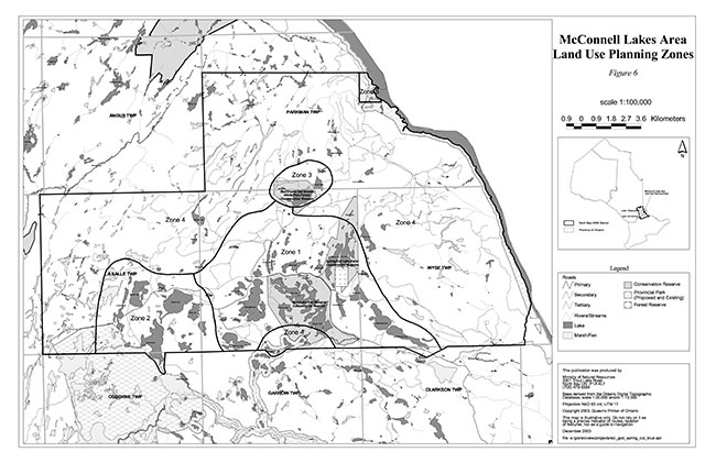
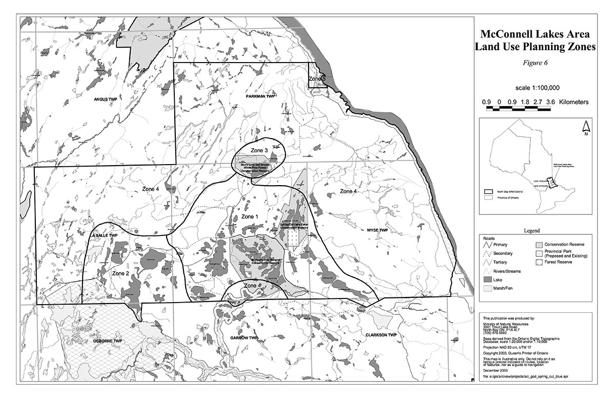
- Wilderness camping in Zone 4 of the McConnell Lakes Plan (see Figure 6) and if 0.8 kilometers or more away from designated roads (OMNR, 1980).
God’s Lake Old Growth White Pine Forest conservation Reserve (C134)
This conservation reserve is known for beautiful white sandy beaches and pine forests. Emerald Lake is a clear, aqua-blue lake enjoyed by users for picnicking, swimming, canoeing and beach activities. There is one day-use area on the beach of Emerald Lake. Brook trout fishing, or the use of live bait for angling is not permitted on Emerald Lake to preserve the sensitive fisheries (OMNR, 2003a). Loons are found in relatively large numbers on Emerald Lake making it a good destination for wildlife viewing. Camping is not permitted in this conservation reserve, and the access to this area is not maintained. Emerald Lake Branch Road leads from McLaren Bay Road to the southeastern shore of Emerald Lake, and is in poor condition.
Although dispersed and difficult to access, the old growth white and red pine stands provide a good opportunity for big tree observation. There are some old logging trails that lead to the northwest edge of the conservation reserve where the old growth stands are found (see Figure 3).
A commercial tourist operator has a main base on Troutbait Lake in the McConnell Lakes Recreation Area EMA (E122r) and an outpost camp on Emerald Lake. There is a trapper’s cabin located near the western boundary inside the conservation reserve.
Spring/cut lake esker conservation reserve (C136)
Spring and Cut Lakes are both beautiful clear lakes with lake trout. There is one designated access point at the end of Spring Lake Branch Road at the south end of Spring Lake. Spring Lake Branch Roads connects McConnell Lakes Road to Spring Lake and is in fair condition. There is a road connecting McConnell Lakes Road to Cut Lake, but it is in poor condition, especially during periods of heavy precipitation. There is a small canoe launch area at both Spring and Cut Lakes.
The lake areas are good for swimming, fishing and canoeing. Cut Lake has a high capability to produce lake trout. There is little beach area, but there are day-use areas on both Spring and Cut Lakes near the access points. The day-use areas on Spring Lake are not available during periods of spring run-off or melt due to flooding (see Figure 4).
There is a portage connecting the two lakes at a low point in the esker ridge (see Appendix 3). The lakes are very clear and appear to be blue, making this a very aesthetic area for canoeing or kayaking.
Blue lake end moraine conservation reserve (C138)
Blue Lake End Moraine Conservation Reserve encompasses Blue, Halfmoon, Dymond and Biber Lakes. This is a high use area for fishing, boating, camping, hunting and wildlife viewing. Blue Lake has good angling opportunities for lake trout, speckled trout and splake. Dymond Lake is a warm water lake, containing walleye, pike and smallmouth bass. Halfmoon Lake is a cold water lake with low recreational use due to the difficulty in accessing it.
The area is used for its natural beauty and tranquility as well as angling and hunting. There is a portage connecting the two lakes at a low in the point terrain. There is a boat launch at the northwestern end of Blue Lake beside the campground. Blue Lake and the surrounding shorelines are good areas for wildlife viewing, especially for loons. There are two day-use sites on Blue Lake, one near Blue Lake Campgrounds and one on an island in the eastern portion of the lake. There is also a boat launch in the southeastern end of Dymond Lake. There is a day- use site at the boat launch area. There are white pine stands that are over 90 years old, approaching 30 m in height on the western shore of Dymond Lake that are a good location for nature study. The trail accessing Halfmoon Lake is suitable for ATV's or for hiking. There are two day-use sites on the northern shore of Halfmoon Lake (see Figure 5).
Three campgrounds were established by the MNR in the early '80s. One of these, Blue Lake Campground, is within a conservation reserve. Regular maintenance is no longer provided by the MNR, except for periodic upkeep. As a result, the campsites have degraded, and garbage has accumulated. In 2002, MNR North Bay District put out a Request for Proposals to invite applicants interested in assuming the operation and maintenance of the three campgrounds. The request for proposal was awarded and the campgrounds are now maintained by a private individual, with a main cabin in the Blue Lake Campgrounds. The Blue Lake Campground is a 7.3-hectare campground supporting 90 individual campsites. The individual campsites are equipped with their own fire pit and there are outdoor washroom facilities for the campground area.
2.5 Forest reserves
Spring/Cut Lake Esker Conservation Reserved contained one mining claim at the time of regulation, which has been designated as forest reserve. This forest reserve is approximately 90 hectares.
Blue Lake End Moraine Conservation Reserve contained one mining claim at the time of regulation, which has been designated as forest reserve. This forest reserve is approximately 19 hectares.
A forest reserve is a land use designation applied to areas that were initially identified for inclusion in the conservation reserve but where subsequent detailed examination determined that there were existing mining claims or leases.
Mining and surface rights have been withdrawn from staking within the conservation reserve boundaries under the Mining Act (RSO 1990 Chapter M.14). Therefore, no new claims can be staked within the conservation reserve boundary. The intent is that forest reserve areas will be added to the conservation reserve if a claim or lease is retired through normal process.
Policies for forest reserves are similar to the policies for new conservation reserves, except that mining and related access will be allowed in a forest reserve. Management of these two forest reserves will be guided by this SCI.
2.6 Enhanced management areas
In addition to the three conservation reserve, there are three Enhanced Management Areas (EMAs) in the McConnell Lakes Area. Enhanced Management Areas are a new land use category created in the Ontario’s Living Legacy Land Use Strategy. The EMA designation was established in order to provide more detailed land use direction in areas of special features or values. This SCI applies to the regulated boundaries of the three conservation reserves in the McConnell Lakes Area, but it is important to note the presence and importance of these EMAs on the surrounding landscape. The EMAs provide linkage to the conservation reserves as part of the larger landform-vegetation complex. Linking the three core areas creates a larger natural heritage area with a better shape for buffering and maintenance of the integrity of the core areas and the overall land form pattern and process of the area.
There are two types of EMAs present in the area. McConnell Interlobate Moraine (E133n) and McConnell Lakes Intervening Area (E135n) are both natural heritage category EMAs. Natural heritage EMAs are intended to protect areas with significant natural values, while allowing a range of resource activities. McConnell Lakes Recreation Area (E122r) is a recreation category EMA. Recreation EMAs are intended to protect areas with high recreational use or significant recreation values for activities such as angling, hunting, motorized and pedestrian trail use and canoeing.
McConnell Interlobate Moraine (806 hectares) is a natural heritage category enhanced management area, which incorporates a spectacular collection of glacial features. These glacial deposits are part of the most extensive landscape of its kind in eastern Canada. The northern section is located south of Green Lake and abuts the northeast border of Spring/Cut Lake Esker Conservation Reserve. The southern section consists of the area between Threetrails, Wyse and Little McDougal Lakes.
McConnell Lakes Intervening Area (2,271 hectares) is a natural heritage category enhanced management area, which provides a linkage between the three conservation reserves. It also contains a unique sandy outwash plain.
McConnell Lakes Recreation Area (7,008 hectares) is a recreation category enhanced management area, which incorporates the core recreation and tourism zones in the McConnell Lakes area. A commercial main base camp is located on Troutbait Lake near God’s Lake Old Growth White Pine Forest Conservation Reserve. The EMA includes, Pole, Mug, Wyse, Big McDougal, Quarry, Little McDougal lakes and the Boland Lake and Little McDougal Lake campgrounds. The area supports high quality recreation use, surrounds core natural heritage areas and contains high quality forest resources.
2.7 Heritage estate contributions
God’s Lake Old Growth White Pine Forest Conservation Reserve includes old growth areas of white and red pine. Although difficult to access these areas are beautiful and majestic. Emerald Lake is a clear lake with a green colouring and white sandy beaches. This area is ideal for day trips, picnicking and swimming.
Spring and Cut Lakes are two deep, clear lakes with a blue colouring. These lakes are good for canoeists who would like a tranquil setting surrounded by birch trees. There are several areas on both lakes for day-use picnicking and swimming.
Blue Lake End Moraine Conservation Reserve is a high use recreational area. There is a beautiful campground located on Blue Lake that has been used extensively by recreationists. This conservation reserve boasts beautiful lakes and different fisheries for anglers. There are boat launch facilities on Blue and Dymond Lakes for access of motorized boats. The area is also good for wildlife viewing, day use and canoeing.
The life science and earth science values of this area make an aesthetically pleasing area full of recreation opportunities. Together these three conservation reserves are part of one of the most popular outdoor recreation areas in the North Bay District. People are attracted by the beaches and forests, but also by the coldwater fishery that has been acknowledge as one of the best in Ontario. There are also many hunting opportunities in the area. The area is full of activity year round.
3.0 Management guidelines
3.1 Management planning strategies
The land use intent outlined in Ontario’s Living Legacy Land Use Strategy provides context and direction to land use, resource management, and operational planning activities on Crown land. Commitments identified in the above strategy and current legislation (PL Procedure 3.03.05) will form the basis for land use within God’s Lake Old Growth White Pine Forest, Spring/Cut Lake Esker and Blue Lake End Moraine Conservation Reserves. For up-to-date information on permitted uses refer to the Crown Land Use Atlas at http://crownlanduseatlas.mnr.gov.on.ca/.
Existing permitted uses within the conservation reserves may continue, unless they are shown to have a significant negative impact on the values within the site.
Proposed uses and development within the conservation reserves will be reviewed on a case-by- case basis. A Test of Compatibility (Appendix 1) must be passed before they are deemed acceptable. The emphasis will be on ensuring that the natural values of the conservation reserves are not negatively affected by current or future land use activities. Therefore, any application for new specific uses will be carefully studied and reviewed. The Ministry, partner organizations and/or proponents may undertake such studies. Applicable environmental assessment requirements will also be met.
3.2 Land tenure
Background:
God’s Lake Old Growth White Pine Forest, Spring/Cut Lake Esker and Blue Lake End Moraine Conservation Reserves consist entirely of Crown lands (Figures 1 and 2).
There are no Ontario Federation of Snowmobile Club trails in these conservation reserves.
There is one tourism outpost camp, authorized by land use permit, located on Emerald Lake in God’s Lake Old Growth White Pine Forest Conservation Reserve. This outpost camp is associated with a commercial tourism establishment on Troutbait Lake.
Guideline:
The sale of Crown lands within the conservation reserves is not permitted.
Existing land use permits are permitted to continue. They may be eligible for "enhanced" tenure, but are not eligible for purchase of land. There are two forms of enhanced tenure that may be considered:
- An upgrade in the nature or type of tenure (e.g. from Land Use Permit to a lease); and/or
- An extension in the term of the tenure (e.g. from 1 year to 10 years).
Applications for enhanced tenure will be approved if determined acceptable using a screening criteria. A change in tenure does not convey a commitment to provide for, or agree to, a change in the type or the standard of existing access to the outpost camp.
New recreation camps are not permitted.
Unauthorized occupations of lands within the conservation reserves will be handled in accordance with approved policy, and any required structural removal will be at the owner’s expense.
3.3 Development and access
Background:
In God’s Lake Old Growth White Pine Forest Conservation Reserve, current development includes a road leading into the day-use area at Emerald Lake and roads leading into the old growth area in the northwestern portion of the conservation reserve. These roads are in poor condition and are not maintained.
In Spring/Cut Lake Esker Conservation Reserve current development includes roads leading into the Spring Lake day-use area and into the Cut Lake day-use area. These roads are in poor condition and are not maintained.
In Blue Lake End Moraine Conservation Reserve current development includes a boat launch at both Blue Lake and Dymond Lake. There is a road from McConnell Lakes Road that leads to the southern shore of Dymond Lake at the boat launch. There is also a trail leading from the boat launch on Blue Lake to the northern shore of Halfmoon Lake. The main campground in the McConnell Lakes recreation area is at Blue Lake. This is an established campground with washroom facilities and fire pits for each individual campsite. There is also a portable cabin located on-site that is used by the operator for the three campgrounds in the area. Operation and maintenance of Blue Lake Campground is authorized by a legal agreement with the MNR. The agreement was awarded to the campgrounds operator for a period of two years in March 2003. The agreement will be reviewed after the two year period. There is a fee to camp within the campground.
It is possible to access these conservation reserves via McConnell Lakes Road off of Highway 63. God’s Lake Old Growth White Pine Forest Conservation Reserve is located along McLaren Bay Road.
Guideline:
New roads for resource extraction and/or private use will not be permitted, nor will additions to existing roads or upgrading of existing private roads be permitted.
New trails are not encouraged, however they may be considered when compatible with other recreational uses and the maintenance of environmental integrity. Any new trail development must go through a Test of Compatibility to ensure the quality of the life and earth science representation and any additional values (e.g. aesthetics, landscape views, sensitive areas) are maintained.
Existing authorized snowmobile trails may be permitted in conservation reserves as long as they do not impair the natural features and values for which the area is identified and as long as there are no significant environmental impacts. Consideration for new snowmobile trails will occur on a case-by-case basis. Public consultation will be an important part of the process.
In the case of ATV's, the demand, as well as the environmental impact of this activity, will be determined before specific trails are designated or constructed. In general, ATV trails will be discouraged.
The use of existing unauthorized trails will be monitored to ensure that conservation reserve values are not being adversely impacted. Depending on the results of the monitoring, some of the unauthorized trails may need to be redirected from sensitive areas or eliminated completely.
The district may sometime in the future consider developing a trails strategy to ensure the values within the conservation reserves are fully protected while maintaining current permitted uses to occur. Access to resources will include both direct access (e.g. current roads or trails) and/or more remote access (e.g. waterways) opportunities. Such planning could include public consultation.
Facility infrastructure and development for recreation may be considered in future if there is a demonstrated need for such facilities. A more detailed management plan would be required prior to construction.
3.4 Recreational activities
Background:
Existing recreational uses include fishing, hunting, canoe-tripping, camping, snowmobiling, all-terrain vehicle use and general nature activities.
Guideline:
Most recreational activities that have traditionally been enjoyed in this area can continue provided they pose no threat to the natural ecosystems and features protected by the conservation reserves.
Mechanized travel is permitted only on existing trails. Off-trail mechanized travel is permitted for retrieval of game only.
New recreational activities will be considered on a case-by-case basis. Emphasis will be placed on activities that have a low impact on the environment of the conservation reserves.
No overnight camping is permitted in all three conservation reserves except:
- At Blue Lake Campground,
- Wilderness camping in Zone 4 of the McConnell Lakes Plan (see Figure 6) and if 0.8 kilometers or more away from designated roads (OMNR, 1980).
Other areas and access points are for day use only.
3.5 Industrial activities
Background:
God’s Lake Old Growth White Pine Forest, Spring/Cut Lake Esker and Blue Lake End Moraine Conservation Reserves are located within the Nipissing Forest but have been removed from the licensed area. An examination of the possible impact of activities on adjacent lands should be evaluated in the Forest Management Plan.
There are no existing mining, timber harvesting, aggregate extraction or utility activities within the conservation reserves.
Mining and surface rights have been withdrawn from staking within the conservation reserves under the Mining Act (RSO Chapter M.14).
Guidelines:
Conservation reserve regulations do not permit mining, commercial forest harvesting, hydroelectric power development, the extraction of aggregate and peat or other industrial uses (Public Lands Act, Ontario Regulation 805/94).
Under the OLL LUS, mining and related access will be allowed in a forest reserve. For those activities that could negatively influence the natural heritage values within the FR and/or the CR, the district will work with the proponent to identify and mitigate potential mining or natural heritage concerns.
Mining will not occur in any portion of the regulated conservation reserve boundary.
3.6 Commercial activities
Background:
The conservation reserves include registered traplines, baitfish licence areas and Bear Management Areas (BMAs). The Ministry of Natural Resources authorizes these activities.
There is one trap cabin located near the western boundary within God’s Lake Old Growth White Pine Forest Conservation Reserve.
Guideline:
Existing non-industrial commercial uses such as trapping and baitfish harvesting will be permitted to continue. These activities will continue to be monitored in order to ensure they do not deplete natural resources and that they impose a minimal impact on the features identified for protection.
New non-industrial commercial activities (i.e. traplines) which overlap with the conservation reserves may be considered subject to a Test of Compatibility (Appendix 1), consistent with provincial direction. Any new trails associated with the new non-industrial commercial activities must also be considered subject to a Test of Compatibility.
Existing commercial bear hunting operations are permitted to continue but the introduction of new operations will not be allowed.
The issuance of Licences to Provide Bear Hunting Services will be allowed where areas have been licensed or authorized under agreement for the activity since January 1, 1992 (there must be documentation in Ministry files that commercial bear hunting has been licensed during the period January 1, 1992 to present) unless:
- The Government has taken action to discontinue the activity; or
- Proceeding would create/aggravate resource sustainability issues (e.g., wildlife management reasons, imparts on values); or
- Licensing or permitting should be deferred due to Aboriginal issues.
Licences to Provide Bear Hunting Services will not be issued in areas where issuance has not occurred since January 1, 1992.
New commercial tourism developments will not be permitted.
New trap cabins in the conservation reserves will not be permitted.
3.7 Aboriginal interests
Background:
This site is located within the Robinson – Huron Treaty Area of 1850, and as such the general area of these conservation reserves is known to be of interest to various First Nations.
Guideline:
All aboriginal and treaty rights will continue to be respected and are not affected by the establishment of these conservation reserves.
Any future proposals or decisions that have potential impact(s) on the individual or aboriginal or community values will involve additional consultation with the affected aboriginal groups.
3.8 Natural resource stewardship
The McConnell Lakes Area contains important life science values. There are rare and uncommon species within the conservation reserves. Several of the plant species were identified as being either regional rare or uncommon in the ecodistrict. Most of these uncommon plants are associated with moist to wet sandy shorelines of kettle depressions and lakes. The area also contains significant wildlife habitat and coldwater fish habitat. The area has one of the highest populations of woodcock in the District.
The area has been disturbed by cutting and fires. Other disturbances in the conservation reserves are associated with recreation use such as boat launching and camping.
Guideline-vegetation:
The conservation reserves will be managed by allowing natural ecosystems and processes to function as they would with minimal human interference.
The MNR recognizes fire as an essential process fundamental to the ecological integrity of conservation reserves. In accordance with existing Conservation Reserve Policy and the Forest Fire Management Strategy for Ontario, forest fire protection will be carried out as on surrounding lands.
Whenever feasible, the MNR fire program will endeavour to use "light on the land" techniques, which do not unduly disturb the landscape, in these conservation reserves. Examples of light on the land techniques may include limiting the use of heavy equipment or limiting the number of trees felled during fire response efforts.
Opportunities for prescribed burning to achieve ecological or resource management objectives may be considered. These management objectives will be developed with public consultation prior to any prescribed burning, and reflected in the document that provides management direction for these conservation reserves. Plans for any prescribed burning will be developed in accordance with the MNR Prescribed Burn Planning Manual, and the Class Environmental Assessment for Provincial Parks and Conservation Reserves (approval pending).
Personal use permits for wood harvesting are not permitted.
Programs may be developed to control forest insects and diseases in the conservation reserves where these threaten significant values in or adjacent to the site. Where insects or disease threaten significant values, in or adjacent to the site, control will be directed as narrowly as possible to the specific insect or disease. Biological control will be used whenever possible. Regard shall be had for the Test of Compatablity.
Guideline-fish and wildlife:
Fish and wildlife resources will continue to be managed in accordance with policies and regulations prevailing in the area and under the direction of the Tomiko Area Supervisor. Provincial legislation and policy will dictate management and enforcement objectives for this area.
Some lakes do not permit the use of live bait, or restrict fishing by sanctuary.
3.9 Cultural resource stewardship
Background:
No specific studies or inventories have been undertaken within the conservation reserves, and no specific significant cultural resource values have been evaluated or identified to date.
Guideline:
Should the MNR consider new structural development, significant clearing of vegetation or altering of land within these conservation reserves, the MNR will adhere to the cultural heritage resource screening process as is identified in its Memorandum of Understanding (MOU) with the Ministry of Culture (MCL). While the purpose of this MOU is to provide a process to identify and protect cultural heritage resources when the MNR is reviewing work permits of disposing of Crown rights under the authority of the Public Lands Act, the considerations and criteria would also enable the MNR to identify high potential cultural heritage areas for other purposes within conservation reserves. If the screening process indicates that the site of a proposed activity is within an area of high cultural heritage potential, the MNR will consult with the MCL to determine the appropriate cultural heritage assessment requirements and will undertake a preliminary archaeological assessment if appropriate.
3.10 Client services
Background:
There are currently no MNR operated client services for these conservation reserves. Some client services may be available from the campgrounds operator at Blue Lake Campground, such as recreation interpretation.
Guideline:
The focus will remain on low key information and self-interpretation of conservation reserve features. Messages should focus on the area’s natural heritage features, recreation opportunities, nature appreciation and education.
Information regarding the God’s Lake Old Growth White Pine Forest, Spring/Cut Lake Esker and Blue Lake End Moraine Conservation Reserves may be delivered from different sources, however, MNR will be the lead agency for responding to inquiries. A management agreement may be pursued with an appropriate partner to share responsibilities for information services and the delivery of other aspects of this SCI.
Consideration will be given to the strategic location of signs where roads or trails cross the conservation reserves' boundary. There are no other plans for structural development within these conservation reserves.
3.11 Monitoring, assessment and research
Background:
Research and assessment to date has included an earth science, life science and recreation checksheet for each conservation reserve.
Guideline:
Consideration will be given to inventory and documentation of natural and cultural values, and the assessment of use/activity impacts. All research will be carried out in a non-destructive manner. Research proposals must follow Procedural Guideline C – Research Activities in Conservation Reserves (PL 3.03.05).
The collection/removal of vegetation and parts thereof will not be permitted; however, subject to a Test of Compatibility (Appendix 1), the Area Supervisor may authorize the collection of plants and/or parts for purposes of rehabilitating degraded sites within the conservation reserves and collecting seeds for maintaining genetic stock or research.
Research, education and interpretation will be encouraged to provide a better understanding of the management and protection of the natural heritage values and will be fostered through local and regional natural heritage programs, initiatives and partnerships.
3.12 Marketing
Background:
There has been no marketing of these conservation reserves to date. Promotion and information about this site has been primarily through the Ontario’s Living Legacy planning process and public consultation regarding the boundaries of this site. The campgrounds operator at the Blue Lake Campground market the campgrounds and the McConnell Lakes Area through brochures.
Guideline:
Marketing activities of these conservation reserves will be kept to a minimum.
4.0 Implementation
Implementation of the SCI and management of the conservation reserves are the responsibility of the Tomiko Area Supervisor, North Bay District of the Ministry of Natural Resources.
Emphasis will be placed on awareness information highlighting conservation reserve values and appropriate uses.
Long term management will consider balancing between maintaining the quality of representation and needs of recreation and other users
5.0 Review and revision of the statement of conservation interest
God’s Lake Old Growth White Pine Forest, Spring/Cut Lake Esker and Blue Lake End Moraine Conservation Reserves' SCI will be reviewed on an ongoing basis and will include the monitoring of activities to ensure adherence to management guidelines. Partnerships may be pursued to address management needs.
This SCI will be amended through a standard process of minor and major amendments. Minor amendments will be processed in a relatively informal manner and will require the approval of the Tomiko Area Supervisor. These amendments will deal with uses and activities that do not affect any of the policies in this SCI (e.g. new uses and/or activities that are consistent with existing permitted uses).
Uses and/or activities that were not anticipated in the approved SCI and which may have an impact on the values of the conservation reserves will require a major amendment. This will include an opportunity for public comment and input and will require the approval of the North Bay District Manager and Regional Director .
6.0 References
Bergsma, B.M. and Pollard, A. 1995. Life Science Inventory Checklist Site District 5E-6, McConnell Lake Moraine.
Chambers, B.A., Naylor, B.J., Merchant, B. and Uhlig, P. 1997. Field Guide to Forest Ecosystems of Central Ontario.
Crins, W. J. and Kor, P. S. G. 1998. Natural Heritage Gap Analysis Methodologies Used by the Ontario Ministry of Natural Resources. Peterborough: OMNR.
Crins, W.J. and Uhlig, P.W.C. 2000. Ecoregions of Ontario: Modifications to Angus Hills' Site Regions and Districts. Peterborough: OMNR.
EMR Canada. 1995. Topographic Map 1:50,000. Temiscaming. Sheet 31 L/11
EMR Canada. 1995. Topographic Map 1:50,000. Ottertail Creek. Sheet 31 L/14.
Hills, G.A. 1959. A ready reference to the description of the land of Ontario and its productivity. Ont. Dept. of Lands and Forests, Division of Research, Maple, Ontario.
King, L., B. Burkhardt and S. Longyear. 2003. Blue Lake End Moraine Conservation Reserve (C138) Life Science Checksheet – Step 2.
Kor, P. 1995. McConnell Interlobate Moraine: preliminary evaluation of earth science values.
Kristjansson, F.J. 2003a. Draft Earth Science Inventory Checklist: God’s Lake Old Growth White Pine Forest (C134).
Kristjansson, F.J. 2003b. Draft Earth Science Inventory Checklist: Spring/Cut Lake Esker (C136).
Merchant, B., B. Burkhardt, L. King, and S. Longyear. 2003. God’s Lake Old Growth White Pine Forest Conservation Reserve (C134) Life Science Checksheet – Step 2.
Nicholson, J., B. Burkhardt, L. King and S. Longyear. 2003. Spring/Cut Lake Esker Conservation Reserve (C136) Life Science Checksheet – Step 1.
Noble, T.W. 1991. Assessment of Natural Areas and Features for the Northern Portion of the Southern Boreal Forest Region Site Region 5E.
Noble, T.W. 1998. Earth Science Checksheet: McConnell Interlobate Moraine.
Ontario Ministry of Natural Resources. 1980. An Interim Land Use Plan for the McConnell Lakes Area Land Use Planning Programme.
Ontario Ministry of Natural Resources. 1989. Aerial Photos.
Ontario Ministry of Natural Resources. 1997. Public Lands Directive Manual: Natural Heritage- PL 3.03.05.
Ontario Ministry of Natural Resources. 1999. Ontario’s Living Legacy: Land Use Strategy. Peterborough: Queen’s Printer for Ontario.
Ontario Ministry of Natural Resources. 2003a. 2003 Recreational Fishing Regulations Summary.
Ontario Ministry of Natural Resources. North Bay District. 2003b. C134 God’s Lake Old Growth White Pine Forest Conservation Reserve File.
Ontario Ministry of Natural Resources. North Bay District. 2003c. C136 Spring/Cut Lake Esker Conservation Reserve File.
Ontario Ministry of Natural Resources. North Bay District. 2003d. C138 Blue Lake End Moraine Conservation Reserve File.
Sheppard, C. 2002a. Blue Lake End Moraine Conservation Reserve Recreational Inventory Checklist
Sheppard, C. 2002b. Spring/Cut Lake Esker Conservation Reserve Recreational Inventory Checklist
Tremblay, D. 2002. God’s Lake Old Growth White Pine Forest Conservation Reserve Recreational Inventory Checklist.
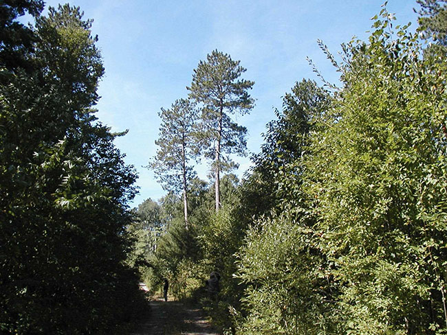
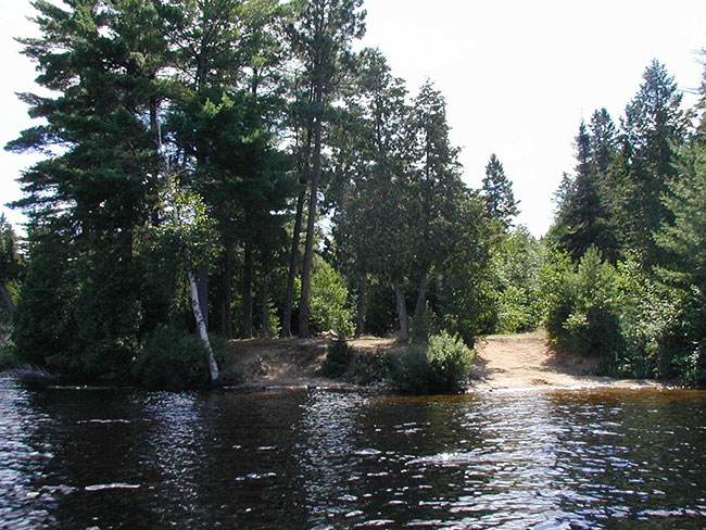
Photos of god’s lake old growth white pine forest conservation reserve (C134)
Photo 1: Northeastern shore of Emerald Lake
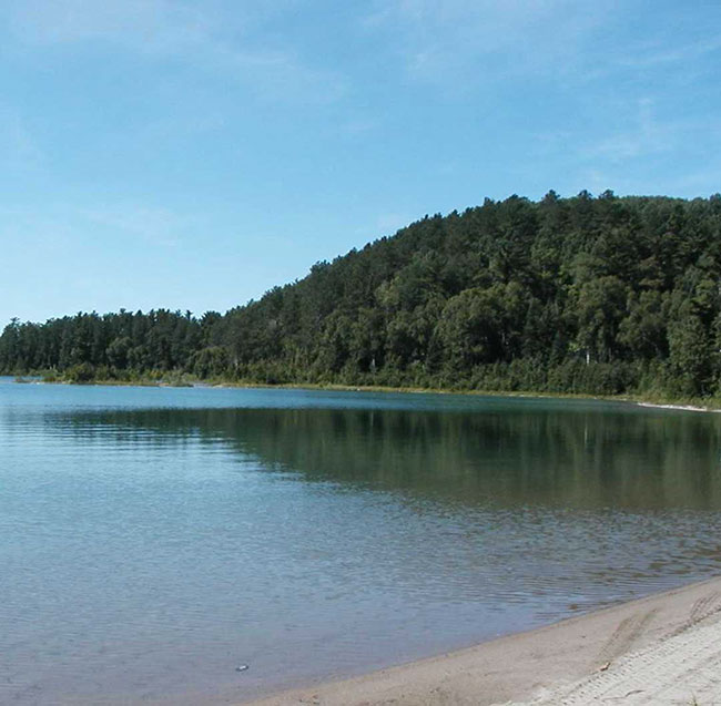
Photo 2: Red pine in northwestern section of conservation reserve
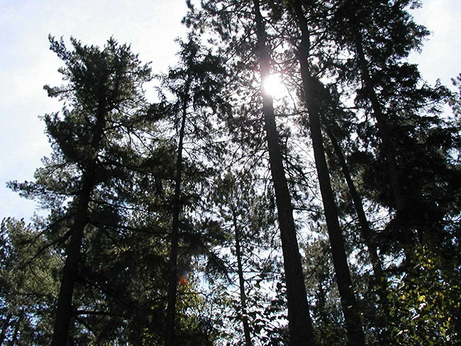
Photo 3: Forested trail in the north of the conservation reserve
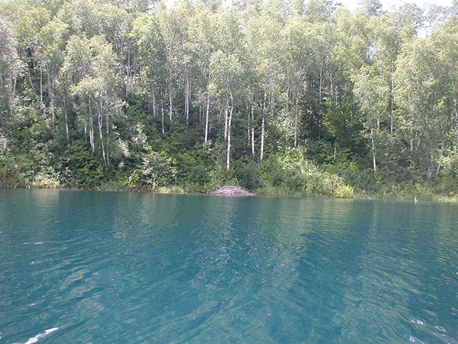
Photos of spring/cut lake esker conservation reserve (C136)
Photo 1: Entrance to portage between Spring and Cut Lakes
Photo 2: Eastern shore from the day- use site on Spring Lake
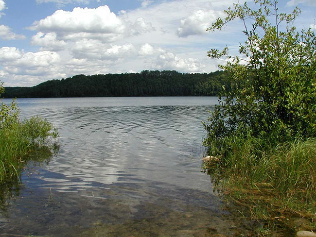
Photo 3: Forested shore and waters of Spring Lake
Photos of blue lake end moraine conservation reserve (C138)
Photo 1: Blue Lake from day-use site on northern shore
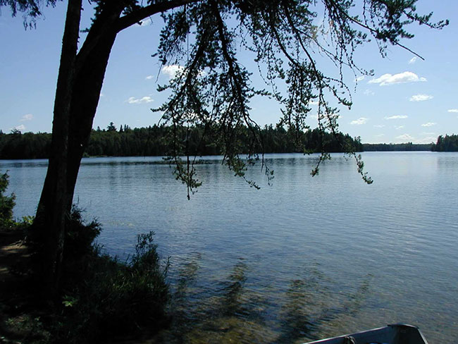
Photo 2: Northern shore of Halfmoon Lake
Photo 3: Boat launch on Dymond Lake
Appendix 1 procedural guideline B – land uses – test of compatibility (PL procedure 3.03.05)
The Conservation Reserve policy provides broad direction with regard to the permitted uses. The policy provides only an indication of the variety of uses that will be considered acceptable in conservation reserves. The only caution is that "any new uses, and commercial activities associated with them, will be considered on a case by case basis, and, they must pass a test of compatibility to be acceptable." What does a 'test of compatibility' mean?
An examination of this must start from the premise of why an area is set aside – specifically, its representative natural heritage values. Criteria are then identified to guide compatibility considerations. These criteria apply to the long-term acceptability of both existing uses and new uses.
- Conformity to SCI/RMP: SCI describe values for which an area has been set aside and the range of appropriate uses that will be permitted in the area. SCI may also speak to the acceptability of other 'new' uses currently not occurring in the area.
The first 'test' is: "do proposed new land uses and/or commercial activities conform to the direction of the SCI/RMP for the conservation reserve? Would the new use(s) depart from the spirit of appropriate indicator land uses in the SCI/RMP?"
- Impact Assessment: If the proposed use(s) pass test 1 it is important to determine their impact on the area before they are approved. This should include the following:
- Impact on natural heritage values: "will the new use(s) impact any natural values in the area? If so how and to what degree? Is it tolerable?"
- Impact on cultural values: "will the new use(s) impact an historical or archaeological values in the area?"
- Impact on research activities: "will the new use(s) affect research activities in the area?"
- Impact on current uses: "will the new use(s) have any negative impact on the array of current uses?"
- Impact on area administration: "will the new use(s) increase administrative costs and/or complexity?" (For example, the cost of area monitoring, security and enforcement).
- Impact on accommodating the use outside the conservation reserve: "Could the use(s) be accommodated as well or better outside the conservation reserve?"
- Impact on socio-economics of the area: "will the new use(s) affect the community(ies) surrounding the area in a positive or negative way?" (For example, will the new use make an area less remote thereby affecting a local tourism industry that is dependent on the area’s remoteness for its appeal?"
- Impact on area accessibility: "does the new use(s) give someone exclusive rights to the area or a portion of the area to the exclusion of other existing uses?"
The following table provides a guide of indicator uses for the consideration of uses that may be permitted within conservation reserves. For any specific conservation reserve that test of compatibility should be applied to determine which specific uses are acceptable.
Appendix 2 - public lands act policy (3.03.05) conservation reserve permitted use table
Indicator uses for conservation reserves
Recreation
| Permitted Activities | Generic Existing | Generic New | (C134, C136 & C138) Specific |
|---|---|---|---|
| Sport fishing | Yes | Yes | Yes |
| Sport hunting | Yes | Yes | Yes |
| Food gathering | Yes | Yes | Yes |
| Facility infrastructure | Maybe | Maybe | Maybe1 |
| Non-trail snowmobiling | Maybe1 | Maybe1 | Maybe2 |
| Non-trail ATV use | Maybe1 | Maybe1 | Maybe2 |
| Rock climbing/caving | Maybe | Maybe | N/A |
| Canoeing/kayaking | Yes | Yes | Yes |
| Motorized boating | Yes | Yes | Yes |
| Picnicking | Yes | Yes | Yes |
| Camping | Maybe3 | Maybe | Maybe |
| Trails | Yes | Maybe | Maybe1 |
| Hiking | Yes | Maybe | Maybe1 |
| X county skiing | Yes | Maybe | Maybe1 |
| Cycling | Yes | Maybe | Maybe1 |
| Horse riding | Yes | Maybe | Maybe1 |
| Snowmobiling | Yes | Maybe | Maybe1 |
M1= New uses will be considered on a case by case basis provided they do not impact the natural heritage values for which the area was established, and must pass a 'test of compatibility' to be acceptable.
M2= For retrieval of game only
M3= Camping only permitted at designated sites
Science, education & heritage appreciation
| Permitted Activities | Generic Existing | Generic New | (C134, C136 & C138) Specific |
|---|---|---|---|
| Research | Yes | Yes | Yes |
| General walking | Yes | Yes | Yes |
| Photography and painting | Yes | Yes | Yes |
| Wildlife viewing | Yes | Yes | Yes |
| Outdoor education/interpretation | Yes | Yes | Yes |
| Collecting | No | No | No |
Commercial Activities
| Permitted Activities | Generic Existing | Generic New | (C134, C136 & C138) Specific |
|---|---|---|---|
| Food harvesting | Maybe | Maybe | No |
| Fishing | Maybe | Maybe | No |
| Baitfish harvesting | Yes1 | Maybe | Yes |
| Trapping | Yes1 | Maybe | Yes |
| Trap cabins | Yes | No | No |
| Resort-outpost camp | Yes1 | No | No |
| Outfitting-bear management | Yes1 | No | Yes |
| Wild rice harvesting | Yes | Maybe | N/A |
Y1= Transfer requests will be considered in the context of a Statement of Conservation Interest (SCI) or Resource Management Plan (RMP) for each conservation reserve.
Resource management
| Permitted Activities | Generic Existing | Generic New | (C134, C136 & C138) Specific |
|---|---|---|---|
| Inventory monitoring | Yes | Yes | Yes |
| Featured species management | Maybe | Maybe | Maybe |
| Natural systems management | Maybe | Maybe | Maybe |
Industrial activities
| Permitted Activities | Generic Existing | Generic New | (C134, C136 & C138) Specific |
|---|---|---|---|
| Timber harvesting | No | No | No |
| Prospecting | No | No | No |
| Mining | No | No | No |
| Hydro generation | No | No | No |
| Energy transmission corridors | Yes | No | No |
| Communications corridors | Yes | No | No |
| Transport corridors | Yes | No | No |
| Resource roads (MNR) | Yes | No | No |
| Land disposition | * | No | No |
| Hunt camps | Yes1 | No | No |
*=Existing dispositions will continue, however, as opportunities arise the Ministry will acquire and/or remove them outside of the conservation reserve.
Y1= Transfer requests will be considered in the context of a Statement of Conservation Interest (SCI) or Resource Management Plan (RMP) for each conservation reserve.
Appendix 3 - glossary of terms
Biotite: a generally black or dark green form of mica that is from crystalline rocks and consists of a silicate of iron, magnesium, potassium, and aluminum1
Canadian Shield: one of the world’s largest stable, low relief areas in the Earth’s crust that are composed of Precambrian crystalline rock, centered on Hudson’s Bay and extending for 8,000,000 square km3
Cultural Resources: sites, features or artifacts related to the Province’s archaeology, anthropology or history, preserved in a natural setting2
Cultural Heritage: collective term describing examples of a society’s evolution (e.g. history, anthropology and archaeology) worthy of study and preservation2
Dike: a tabular body of igneous rock that has been injected while molten into a fissure1
End Moraine: a ridge-like accumulation of glacial drift built along the margin of a glacier4
Esker: a long, narrow, winding ridge composed of stratified sand and gravel deposited by a stream in the glacier, or a stream underneath the glacier1
Gabbro: any of several medium- or coarse-grained rocks that consist primarily of plagioclase feldspar and pyroxene3
Glaciers: a large body of ice moving slowly down a slope or valley or spreading outward on a land surface1
Glacialfluvial: relating to the movement of water in a glacier1
Gneissic Rock: metamorphic rock that has a distinct banding, which is apparent in hand specimen or on a microscopic scale3
Hummocky: comprised of rounded knolls or small hills1
Igneous Rock: any of various crystalline or glassy rocks formed by the cooling and solidification of molten earth material3
Interlobate Moraine: the general landforms deposited between two adjacent ice lobes as the ice melted5
Kame Hills: moundlike hill of poorly sorted drift, mostly sand and gravel, deposited at or near the terminus of a glacier3
Kettle Lakes: depression in a glacial outwash drift made by the melting of a detached mass of glacial ice that became wholly or partly buried3
Metamorphic Rock: any of a class of rocks that result from the alteration of preexisting rocks in response to changing environmental conditions, such as variations in temperature, pressure and mechanical stress3
Moraine: an accumulation of earth and stones carried and finally deposited by a glacier1
Oligotrophic: in a state of low biological activity with low nutrient concentrations
Outwash: deposit of sand and gravel carried by running water from the melting ice of a glacier and laid down in stratified deposits3
Quartz: a mineral consisting of silicon dioxide occurring in colorless and transparent or colored hexagonal crystals or in crystalline masses1
Recessional Moraine: end moraine formed by a still stand of ice during recession of a glacier 4
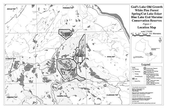
Figure 1: God’s Lke Old Growth White PineForest, Spring/Cut lake Esker, Blue end Moraine Conservation Reserves location map
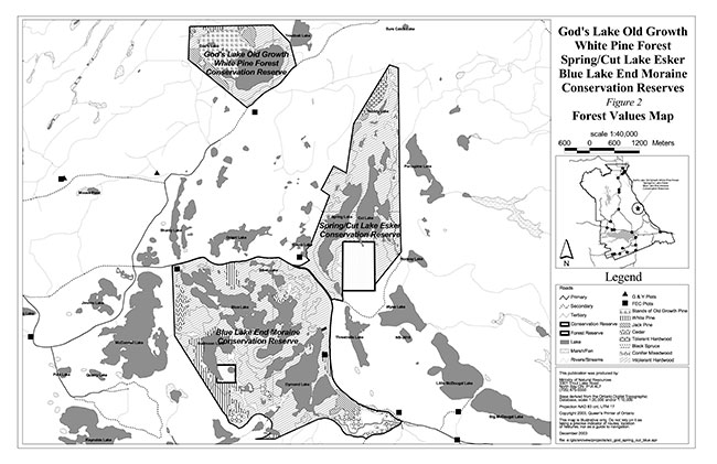
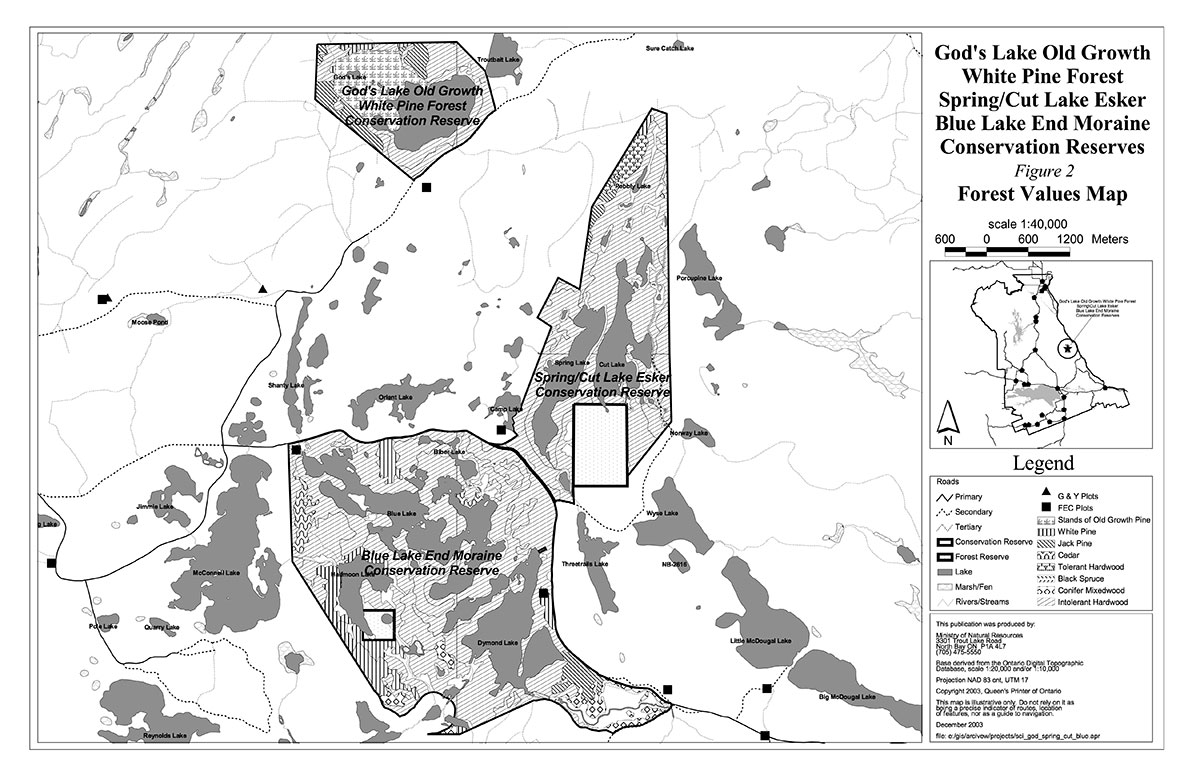
Figure 2: God’s Lke Old Growth White PineForest, Spring/Cut lake Esker, Blue end Moraine Conservation Reserves forest values map
Figure 3: God’s Lke Old Growth White PineForest Conservation Reserves tenure and recreation values map
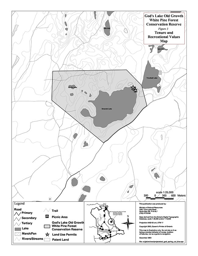
Enlarge God’s Lke Old Growth White PineForest Conservation Reserves tenure and recreation values map
Figure 4: Spring/Cut lake Esker Conservation Reserves tenure and recreation values map
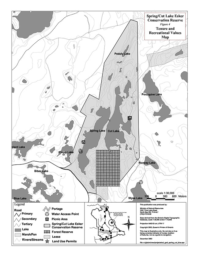
Enlarge Spring/Cut lake Esker Conservation Reserves tenure and recreation values map
Figure 5: Blue end Moraine Conservation Reserves tenure and recreation values map
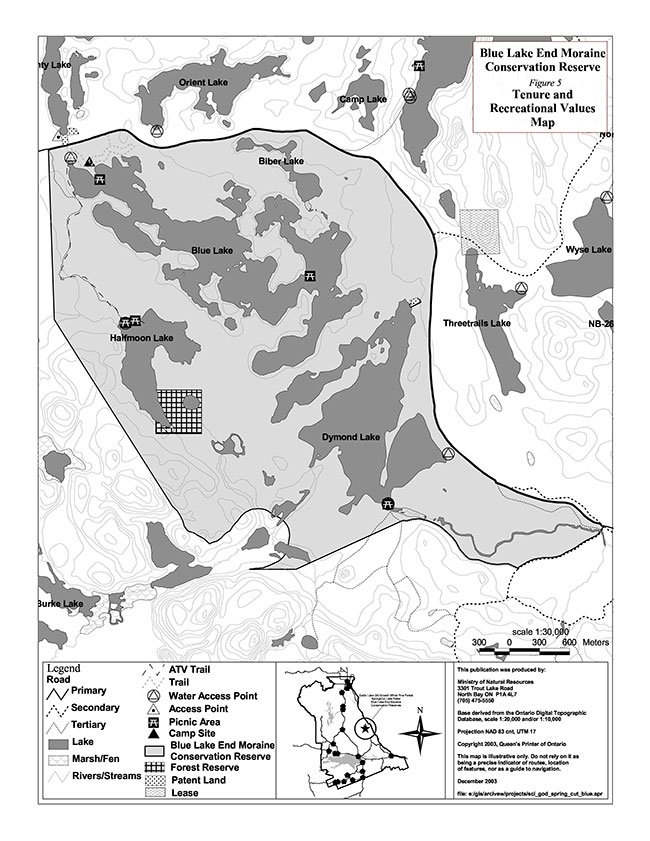
Enlarge Blue end Moraine Conservation Reserves tenure and recreation values map
Figure 6: Mcconnell Lakes area land use planning zones
Enlarge Mcconnell Lakes area land use planning zones
1 Merriam-Webster. 2002. Merriam-Webster Online. www.m-w.com.
2 OMNR. 1992. Ontario Provincial Parks: Planning and Management Policies: 1992 Update. OMNR.
3 Encyclopædia Britannica, Inc. 2002. Encyclopaedia Britannica Online. www.britannica.com.
4 Easterbrook, D.J., 1999. Surface Processes and Landforms: Second Edition. Simon and Schuster/A Viacom Company, New Jersey.
5 Bergsma, B.M. and Pollard, A. 1995. Life Science Inventory Checklist Site District 5E- 6, McConnell Lake Moraine.