Prairie River Mouth Provincial Park Management Statement
This document provides policy direction for the protection, development and management of Prairie River Mouth Provincial Park and its resources.
Interim Management Statement
Ministry of Natural Resources
March, 1985
Regional Director’s approval statement
This Interim Management Statement will provide interim direction for the management of Prairie River Mouth Provincial Park until a comprehensive Park Management Plan is prepared.
This statement will provide the basis for the subsequent preparation of the Park Management Plan.
I am pleased to approve this Interim Management Statement for Prairie
River Mouth Provincial Park
Signed by:
Mr. G.P. Elliott
Regional Director
North Central Region
Background information
| Name: | Prairie River Mouth |
| Proposed class: | Nature Reserve |
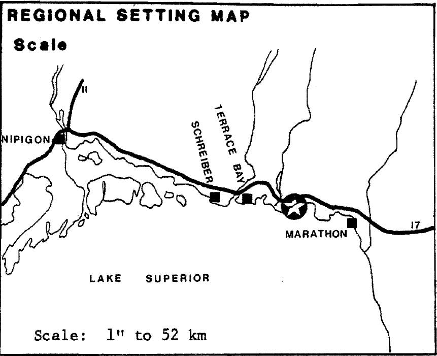
| M.N.R. district: | Terrace Bay |
| M.N.R. region: | North Central Region |
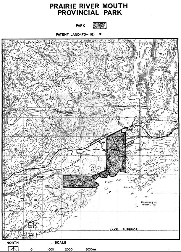
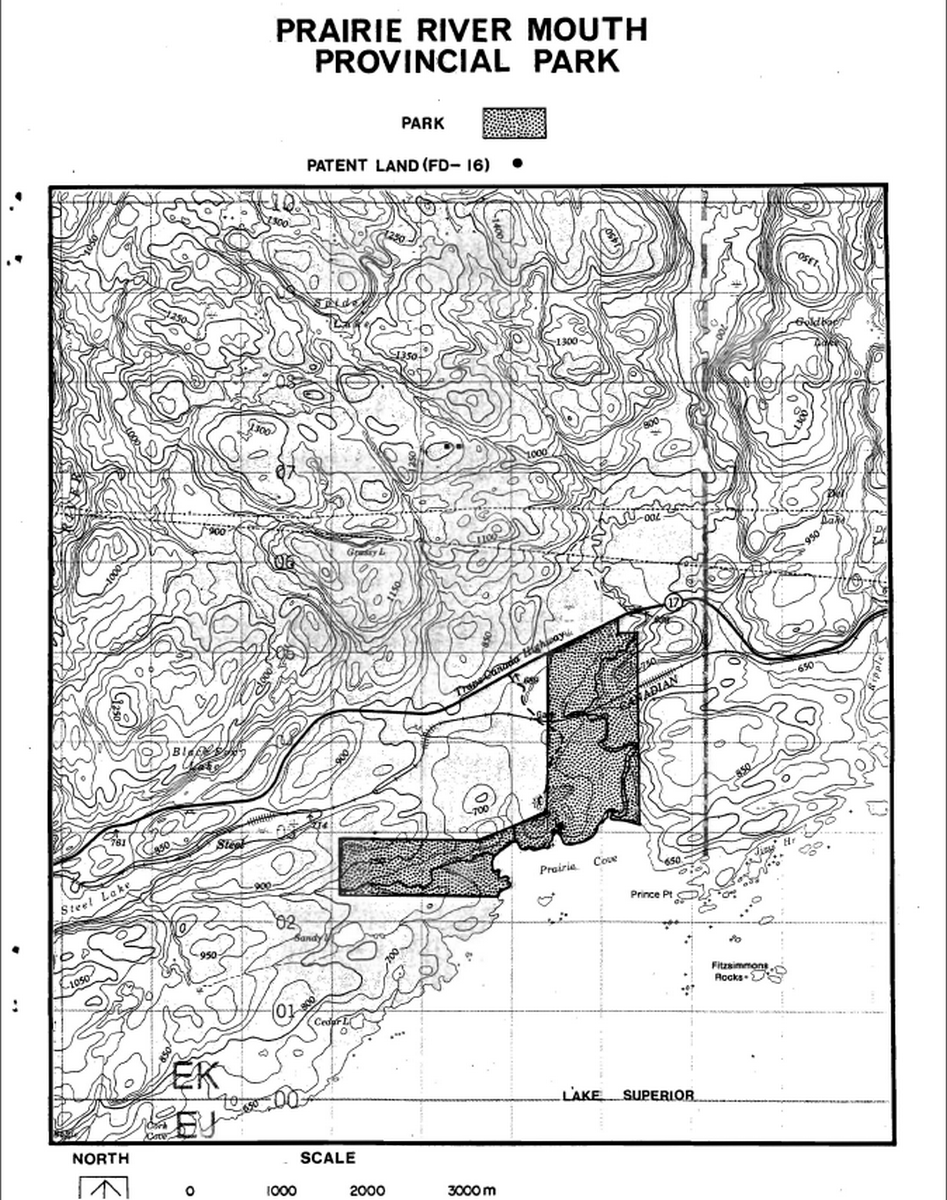
| Total area (ha): | 380 |
| Site region: | 3W |
| Site district: | 5 |
| Date in regulation: | October 19, 1985 |
1. Life science representation
| site type/landscape unit | species/communities |
|---|---|
| Weakly broken lacustrine sand plain with sandy till | Spruce-lichen woodland (Reindeer lichen ground cover) |
2. Earth science representation
| geological theme | feature |
|---|---|
| Timiskaming Interstadial (fluvial, Aeolian landform/process themes) | Fine sand deposit; raised beach deposits; dune complex |
3. Cultural resource representation
| theme | theme segment |
|---|---|
| Unknown (high potential for sites) · |
4. Recreation opportunities
| day use | car camping | wilderness/back country |
|---|---|---|
| N/A | N/A | N/A |
Inventories
| level\type | earth science | life science | cultural | recreational | other |
|---|---|---|---|---|---|
| reconnaissance completion date | checksheet | checksheet | |||
| Detailed completion date | |||||
| required? | detailed inventory | detailed inventory | detailed inventory |
Management guidelines
I. Resource management
The Prairie River Mouth Park is presently recognized as having significant value to both earth and life science programs. Two earth science landform/process themes consisting of a lacustrine/aeoline extensive beach ridge/dune complex (Timiskaming/Interstadial) are found within the park. In terms of life science significance, the park provides suitable habitat for an occurrence of spruce/lichen woodland south of its normal range.
Mineral resources have not been documented.
One archaeological site has been identified within the park.
Mineral resource management:
Guideline:
Mineral exploration will be permitted through an Exploratory Licence of Occupation under Section 190, R.S.O. of The Mining Act.
Mineral extraction may be permitted, providing that the mineral potential of the park is adequately demonstrated to the Minister of Natural Resources, and subject to the approval of the Lieutenant Governor in Council. Mineral extraction activities should not significantly conflict with future management options for the park or the protection of park resources.
Aggregate management:
A large pile of aggregate screenings presently exists in a former gravel pit site.
Guideline:
Aggregate extraction will not be permitted within the park. The pile of screenings will be levelled by the M.N.R. and left to rehabilitate naturally.
Vegetation management:
Guideline:
Commercial logging will not be permitted within the park.
Wildfires and insects/disease will be controlled, as required.
Fisheries and wildlife management:
Guideline:
Hunting, sport fishing, commercial fur trapping and commercial bait fishing will be permitted. The Game and Fish Act and Regulations will be amended as required to permit these activities.
All known archaeological sites will be protected from disturbance.
Cultural resource management:
Guideline:
II. Research
Guideline:
Additional research inventories (earth/life science, cultural, mineral)will be encouraged to further document park values, and may be carried out by M.N.R. or by outside interests.•
Should inventories identify significant features, interim resource management plans will be prepared.
III. Land acquisition/disposal
One patented parcel, summer resort location FD-16 (0.2·hectares in size) on Prairie Cove, is surrounded by the park. As well, the main line of the Canadian Pacific Railway bisects the northeastern arm of the park.
Guideline:
The summer resort location FD-16 shall be put on a list for future acquisition.
The park boundaries will be surveyed and marked out.
IV. Existing/proposed development
Present development includes approximately 1.2 km of road, and two former gravel pit sites, approximately 2.5 ha and 5.5 ha respectively.
Guideline:
The existing access road west of the park is adequate and will receive minimal maintenance by the M.N.R.to allow access to a modest parking area north of the C.P. railway tracks. No further road development will be permitted within the park area.
The two gravel pit sites will be left to natural rehabilitation.
V. Client services
Interpretation:
Guideline:
Interpretation will be conducted as minor, occasional theme of the Neys Provincial Park visitor services program.
A basic information leaflet will be produced providing information on access, significant resources, references, etc.
The park area will be designated on provincially produced maps to clearly delineate boundaries.
Sources/reference
O.M.N.R., 1983. Terrace Bay District Land Use Guidelines
O.M.N.R., 1979. Earth and Life Science Features Inventory - Terrace Bay District
Prairie River Mouth Provincial Park