Quackenbush Provincial Park Management Plan (updated 2019)
This document provides policy direction for the protection, development and management of Quackenbush Provincial Park and its resources.
Examination and adjustment history
| Approval date | Examination or type of adjustment | Examination outcome (where applicable) | List of supporting documents |
|---|---|---|---|
| March 30, 2012 | Examination | Administrative update | Quackenbush Provincial Park Examination Confirmation Statement |
| December 05, 2019 | Administrative update | n/a | Administrative Update Form |
Approval statements
Quackenbush Provincial Park Management Plan administrative update
December 05, 2019
Ontario Parks has updated the Quackenbush Park Management Plan (1986) to:
- address dated formatting, terminology, maps, statistics and targets
- add or update standard direction from provincial policy and legislation that has been revised or repealed since 1986
The need for the administrative update was the outcome of an examination approved March 30, 2012. Information from the examination has been incorporated into the management direction. No new site-specific policy changes have been made as this update is administrative in nature.
Greg Walsh
Manager, Southeast Zone
May, 1986
This Interim Management Statement will provide interim direction for the management of Quackenbush Provincial Park until a comprehensive Park Management Plan is prepared.
This statement will provide the basis for the subsequent preparation of the Park Management Plan.
I am pleased to approve this Interim Management Statement for Quackenbush Provincial Park.
M. Fordyce
Regional Director
Central Region
1.0 Introduction
Quackenbush Provincial Park is a 40-hectare cultural heritage class park in the Township of Douro-Dummer.
Quackenbush Provincial Park lies within the boundary of the Ministry of Northern Development, Mines, Natural Resources and Forestry (MNDMNRF) Peterborough District and is managed by the park superintendent, reporting to the zone manager at the Ontario Parks Southeast Zone office.
This management plan provides the long-term direction for managing Quackenbush Provincial Park.
2.0 Planning context
In 2007, the Provincial Parks and Conservation Reserves Act, 2006 (PPCRA) came into effect replacing the Provincial Parks Act.
The PPCRA established two principles that guide all aspects of planning and management of Ontario’s system of provincial parks and conservation reserves:
- maintenance of ecological integrity shall be the first priority and the restoration of ecological integrity shall be considered
- opportunities for consultation shall be provided
Other legislation (e.g. Endangered Species Act, 2007 (ESA), Ontario Heritage Act, 1990), policies, initiatives (e.g. climate change, invasive species) and best practices (e.g. adaptive management, landscape level planning) also provide additional direction for protecting Ontario’s biodiversity and contribute to guiding protected area planning and management.
All projects undertaken in Quackenbush Provincial Park must comply with Environmental Assessment Act requirements where applicable.
2.1 Ecological integrity
Ecological integrity is a concept that addresses three ecosystem attributes – composition, structure, and function. This concept is based on the idea that the composition and structure of the protected area should be characteristic for the natural region and that ecosystem functions should proceed normally. Simply stated, ecosystems have integrity when their lands, waters, native species and natural processes are intact.
All planning and management activities for Quackenbush Provincial Park will consider ecological integrity first and foremost in their implementation.
3.0 Indigenous communities
Quackenbush Provincial Park is located within the traditional territories of the Anishinaabe Peoples in Treaty 20, 1818. We recognize and respect the long history of First Nations and Métis Peoples in the province.
4.0 Location and boundary
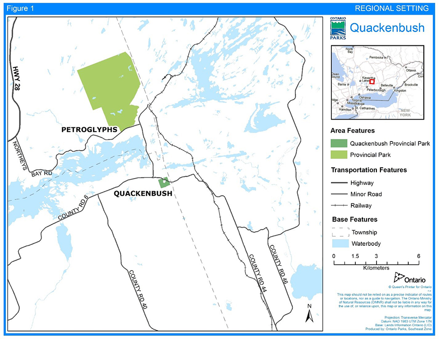
The park is located 40 kilometers (km) northeast of Peterborough in Lot 29, Concession 12, in the Township of Douro-Dummer, County of Peterborough. The site is divided diagonally, into two parts, by the road allowance of Peterborough County Road 44. The part south of County Road 44 (see Figure 1) consists of approximately 33 ha while the part north of County Road 44 is approximately 7 ha.
The park falls just within the Madoc Ecodistrict (6E-9), the northern edge of the Mixedwood Plains.
5.0 Provincial park classification
Through park classification, Ontario's provincial parks are organized into broad categories, each of which has particular purposes and characteristics. Quackenbush Provincial Park is classified as a cultural heritage park.
The objective of cultural heritage class parks is to protect elements of Ontario’s distinctive cultural heritage in open space settings for their intrinsic value and to support interpretation, education, and research.
6.0 Provincial park values
Reconnaissance earth science (OMNR, 1983a), life science (Mackwood, 1972; Mayer et al, 1986), and cultural (OMNR, 1983b) inventories were completed for the park.
6.1 Natural heritage
The park is in the Great Lake-St. Lawrence Forest Region, on the border of the Huron-Ontario and Georgian Bay section. There are various vegetation communities in the park that represent stages of succession including old fields, pasture, and woods. (Mackwood, 1972)
Geological themes in Quackenbush Provincial Park include Precambrian bedrock (plutonic quartz monzonite) and, Paleozoic bedrock (limestone) making contact, and pre-contact. Features of this earth science representation include the two bedrock units that form a low northeastward facing escarpment (Black River Escarpment), a Dummer Moraine which forms part of the southern edge, and the thin overburden which consists of stony, calcareous till, spillway sands and some pockets of clay. (OMNR, 1983a)
The overburden till is shallow, less than three metres over the limestone bedrock. Drainage is predominantly good over the entire site. (OMNR, 1983a)
Approximately 6.5 ha of the park is forested land while 33.5 ha is an early successional field, most of which had been under cultivation in the past.
6.2 Cultural heritage
Cultural resources representation in the park includes Indigenous people as a theme, and Climax Farmers as a theme segment (OMNR, 1973). An additional cultural heritage assessment (e.g. stage 1 archaeological assessment) is necessary if more information is needed on the site’s cultural heritage value.
6.3 Outdoor recreation values
The park has opportunities for day-use, but no car-camping or wilderness/backcountry recreational opportunities (OMNR, 1983b).
7.0 Policies
7.1 Industrial
The following industrial and commercial uses are not permitted:
- commercial timber harvest
- generation of electricity
- prospecting, staking mining claims, developing mineral interests or working mines
- extracting aggregate, topsoil or peat
- other industrial uses
7.2 Wildlife
Trapping is not permitted.
7.3 Vegetation
The overburden till is shallow, less than 3m over the limestone bedrock. Drainage is predominantly good over the entire site.
Specimen trees (native species only) can be planted although planting should occur only in areas which are known to have no archaeological potential.
Any large scale planting will not be carried out until a detailed archaeological inventory is completed.
7.4 Forest fire management
Ontario Parks recognizes fire as an essential ecosystem process, fundamental to restoring and maintaining the ecological integrity of protected areas. MNDMNRF is responsible for responding to forest fires at Quackenbush Provincial Park because it is located inside the Northeast Fire Region (OMNRF, 2014).
Fire management within Quackenbush Provincial Park will help to restore and maintain ecological integrity while preventing personal injury, value loss or social disruption.
7.5 Cultural heritage
The most noteworthy features of this park are its cultural resources. In fact, the archaeological features here are believed to be provincially significant. These features represent the closest known Iroquoian Village (agricultural based) to the Canadian Shield and the Algonquins of Ontario Settlement Area.
This site is an example of the ecological adaptation of the Iroquoian agricultural economy on the border of the Canadian Shield.
Five periods of excavation occurred in 1954, 1955, 1967, 1969/72 and 1973. The digs were conducted by such groups as the Royal Ontario Museum, Trent University and a local high school.
In order to protect the archaeological sites in the interim the following steps should be taken:
- public access to the site is to be discouraged
- excavated areas should be back-filled in consultation with an archaeologist
- the site should be monitored for unauthorized archaeological
7.6 Land
A 20 m wide Ontario Hydro easement parallels the county road, cutting across the northeast corner of the park. Present access to the park is provided by an informa1 agreement, over private property abutting the park. The last year a Land Use Permit had been issued on park land for agricultural purposes, was in 1980.
The park’s 40 ha, acquired in 1973, surround two severed parcels that are located on either side of County Road #44. The larger severed parcel to the south of the county road is approximately 4 ha; the parcel to the north of the road is approximately .5 ha.
Additions to the park boundary will be considered if property is needed to provide park access or enhance the values of the park. Acquisition or securement will be subject to available resources and the willingness of the owners to sell or lease their properties or enter into a conservation easement.
7.7 Science, education and heritage appreciation
An archaeological report done by Mayer, Pihl, Poulton and Associates (1986) recommends a thorough analysis be conducted of available archaeological artifacts and records. The recommendation is also made to carry on a full-scale investigation of the site by a professional archaeological team.
A reconnaissance life science inventory should be conducted.
Research activities require authorization issued under the PPCRA, consistent with relevant policies. Research must meet all requirements under applicable provincial and federal legislation, and may require additional permits or approval (e.g. MNDMNRF Wildlife Scientific Collector authorization or ESA permits).
Even though Quackenbush was regulated as a provincial park in 1986, there are no plans in the near future to promote its use apart from general information provided to the public regarding public landholdings.
7.8 Recreation
The site has limited recreation potential because of its classification, size, and values.
Hunting is not permitted.
7.9 Infrastructure and operations
No development exists within the park boundary. Adjacent land contains several buildings and sheds.
Little or no development is proposed for the park. Development that may be proposed in the future by a park management plan amendment if required, will probably be limited to facilities to aid in the interpretation of the park’s cultural heritage resources.
Future development will also be concerned with the provision of a permanent access road into the park. The ideal situation would be to secure access over the adjacent private property since the topography in the area would make any other route extremely difficult and expensive.
8.0 Implementation
Park and resource management will be contingent upon the availability of funding and resources and unforeseeable changes in priorities or policy and will be undertaken in accordance with the requirements of the Class EA-PPCR and the PPCRA and all other pertinent legislation and policies.
9.0 Examination and adjustment of management direction
This management plan will be examined in accordance with the provisions of the PPCRA to determine whether the management direction is still relevant, effective and current, or if an adjustment is required. In circumstances where this plan is not providing sufficient direction, it can be examined prior to the next scheduled examination.
10.0 References
File: General File 6609-05-36 (Central Region)
Mackwood, D., 1972. An evaluation of the Quackenbush site.
Mayer, Pihl, Poulton and Associates Incorporated, 1986. An Archaeological Overview of the Quackenbush Provincial Park, Dummer Township, Peterborough County, Ontario.
Ontario Ministry of Natural Resources. 1973. A Topical Organization of Ontario History.
Ontario Ministry of Natural Resources. 1983a. A Summary Report of the Earth Science Areas of Natural and Scientific Interest in Lindsay District.
Ontario Ministry of Natural Resources. 1983b. Lindsay District Land Use Guidelines.
Ontario Ministry of Natural Resources. 1983c. Backgrounder - Land Use Guidelines.
Ontario Ministry of Natural Resources. 1992 update. Ontario Provincial Parks: Planning and Management Policies. Ontario Parks. 90 pp. + appendices.
Ontario Ministry of Natural Resources. 2005. A Class Environmental Assessment for Provincial Parks and Conservation Reserves. 47 pp. + appendices.
Ontario Ministry of Natural Resources and Forestry. 2014. Wildland Fire Management Strategy. Toronto.
Provincial Park and Conservation Reserves Act, 2006.
978-1-4868-3309-2 (HTML)