Nakina Northeast Waterway Conservation Reserve Management Statement
This document provides policy direction for the protection, development and management of the Nakina Northeast Waterway Conservation Reserve and its resources.
Statement of Conservation Interest
November 2001
Prepared for the Ontario Ministry of Natural Resources
Nipigon District
By Rebecca Zeran
OLL Resource Manager
Updated April 2012
Next examination due 2022
Approval page
Statement of Conservation Interest for Nakina Northeast Waterway Conservation Reserve C2204
Nipigon District
Northwest Region
The purpose of this Statement of Conservation Interest is to identify the natural heritage values of the Conservation Reserve and to identify the activities which occur at this location. This Statement outlines the activities which will be permitted and those which will be prohibited. From this outline, the management direction for the site can be determined.
Signed and Approved by:
Ian Hagman, District Manager, Nipigon District
Date: February 12, 2002
Signed and Approved by:
Ralph Wheeler, Acting Regional Director, Northwest Region
Date: May 17, 2002
1. Introduction
On July 16, 1999, the Ontario Government released Ontario’s Living Legacy (OLL) Land Use Strategy (LUS) to guide the planning and management of Crown Lands within a large part of northern and central Ontario. A major component of this Land Use Strategy was the establishment of 378 new protected areas in this part of Ontario. This commitment will be the largest expansion of Provincial Parks and other protected areas in the history of Ontario.
The Nakina Northeast Waterway Conservation Reserve (C2204) is one site within this expansion of Ontario’s protected areas.
Conservation Reserves are areas of Crown land set aside by regulation under the Public Lands Act to complement provincial parks in protecting representative natural areas and specific landscape features. Most recreational activities (e.g. hiking, skiing, tourism related uses, nature appreciation) and non-industrial commercial activities (e.g. fur harvesting, bait fishing and commercial fishing) that have traditionally been enjoyed in the area will continue – provided that these uses do not impact upon the natural features requiring protection. Recreational hunting and fishing are permitted uses within all new conservation reserves identified through the OLL Land Use Strategy. Commercial timber harvesting, mining, aggregate extraction and hydroelectric development are prohibited in conservation reserves.
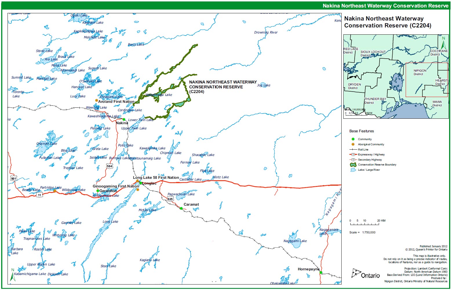
The Nakina Northeast Waterway Conservation Reserve is located in a narrow band running along Cammack Lake, John Bill Lake, Squaw Lake, the Squaw River, Wababimiga Lake, the Wababimiga River, the Drowning River, Relief Lake, Tooth Lake, and Wiggle Lake. It begins approximately 12 km outside of Nakina (beginning at the junction of the Squaw River and Cordingley Lake) and stretches , in a winding pattern, to approximately 80 km northeast of Nakina. The conservation reserve then winds along the Drowning River, ending at the junction of the Drowning River and Lower Twin Lake (OLL Factsheet, 2001).
The Nakina Northeast Waterway is part of a recognized canoe route: the 'Wababimiga- Drowning River Canoe Route'. The canoe route is partially remote, however, access can be gained to various areas along the waterway by means of forest access roads (some access restrictions apply to certain roads – e.g. Poverty Road and Relief Road). The site is also a popular angling area and contains representative landscape and vegetation features. More detail on the natural values of the site can be found in the attached Earth Science Report and Life Science Report as well as an in-depth Life Science Inventory conducted in 2005 by Northern Bioscience and an in-depth earth science inventory conducted in 2004 by North-South Environmental Inc.
The purpose of this Statement of Conservation Interest is to identify the natural heritage values of the Nakina Northeast Waterway Conservation Reserve; this Statement also intends to identify the activities occurring within the reserve. Through a set of management guidelines, this statement will outline the activities which will be permitted and those which will be prohibited. From this outline, the management direction for the area can be determined.
2. Background information
| Name | Nakina Northeast Waterway Conservation Reserve |
|---|---|
| Ecoregion/Ecodistrict | 3W-1, 3W-4, 2W-2, and 2W-3 |
| OMNR Administrative Region / District / Area |
Northwest/Nipigon/ Geraldton Area |
| Total Area (ha) | 12,121 ha |
| Regulation Date | 12 February 2002 |
| Interested First Nations | Aroland, Ginoogaming, Long Lake #58, and Constance Lake First Nations |
| Latitude / Longitude | Wababimiga Lake – latitude: 50°20', longitude: 86°23 Squaw Lake – latitude: 50°25', longitude: 86°24' Relief Lake – latitude: 50°15', longitude: 86°16' Cammack Lake – latitude: 50°19', longitude: 86°34' |
| Basemap | 505861, 504861, 504862, 503861, 503862, 502862, 503863, 502861, 502863 |
| FRI Stands | Specific numbers for the FRI stands occurring within the conservation reserve can be obtained by contacting the Information Management Team in Nipigon or in Geraldton |
| General Location | Begins approx. 12 km outside of Nakina and stretches along the Squaw, Drowning and Wababimiga Rivers. The site includes Cammack Lake, John Bill Lake, Squaw Lake, Wababimiga Lake, Tooth Lake, Relief Lake, and Wiggle Lake. |
| Access | Travel north on Hwy 11 to Geraldton; then north on Hwy 584 to Nakina. Direct access to the site is via an extensive network of logging roads, especially throughout the southern portions of the conservation reserve. Be aware, however, that access restrictions exist on Poverty Road and Relief Road. |
3. Representation targets
This section provides a summary of the earth science, life science and cultural resource values represented in the site. It also outlines existing and potential recreational opportunities available.
| Life Science Representation | Stands of trembling aspen and jack pine on eskers and black spruce on low ground moraine. Significant numbers of shore fens and other riparian environments exist. Unusual marl deposits in Medugama Bay create an environment for calciphytic plants. |
|---|---|
| Earth Science Representation | Landscape surrounding the waterway is classic shield country of low, rolling, densely forested hills and common wetland areas. Several areas of prominent esker ridges and flat glacio-lacustrine plains. Regionally significant active marl deposition in Medugama Bay, Cammack Lake. |
| Cultural Resource Representation | A book, published in 1923 ('Trap-lines North' by Stephen W. Meader), describes the adventures of a local man and his family while they trapped and canoed along the Squaw River. Some interest has been shown by the Nakina Heritage Corporation to re-establish historical sites identified in this book for heritage and tourism purposes. |
| Recreational Opportunities | Opportunities exist for hunting, fishing, canoeing, boating, camping, picnicking, snow-shoeing and a variety of other nature oriented activities. A well recognized canoe route follows the DrowningWababimiga waterway system. Another canoe route follows the Squaw River. A number of tourist outfitters also operate along the rivers and lakes of the reserve. Local adventure tour guides give guided canoe/kayak treks along the Drowning, Wababimiga and Squaw Rivers. |
4. Survey information
This section provides an overview of the inventories completed, their level of detail and any further inventory work required.
| Survey Level | Life Science | Earth Science | Cultural | Recreational |
|---|---|---|---|---|
| Reconnaissance | Yes, Nov. 2001 |
Yes, Nov. 2001 |
No | Yes, Nov. 2001 |
| Detailed | April 2005 | November 2004 | No | No |
| Requirement | No further requirement | No further requirement | No further requirement | No further requirement |
5. Natural & cultural heritage values
This section provides a description of the key natural and cultural heritage values of the site and their condition relative to past and present resource use and management activities. It also addresses the sensitivity of these values to future land use and management activities.
The intent of this Statement is to protect those values identified in the site, by establishing guidelines for existing and potential uses of the area, given the level of past disturbances and the nature of existing features.
Forest values
The entire forest area is to be protected from human disturbance. The forest cover on this site is representative of the surrounding area and is predominately fire origin mature stands.
Vegetation values
The site contains 'representative landscape and vegetation features' (OLL Factsheet, 2001). During field visits, numerous species were encountered including: Large Round-leaved Orchid, Indian Pipe, Dwarf Rattlesnake Plantain, Labrador Tea, Water Horsetail, Marsh Harebell, Carex diandra, Marsh Cinquefoil, Blue-flag Iris, Bog Rosemary, Honeysuckle, Artic Raspberry, Marsh Skullcap. The marl accumulation on the bottom of Medugama Bay creates an environment for calciphytic plants, including a regionally rare plant species (Harris & Foster, 2001).
Geologic values
The marl deposition, found in Medugama Bay, is an example of active shallow water calcium carbonate deposition. The marl accumulation of several metres on the bottom of the bay creates an environment for calciphytic plants, including a regionally rare plant species (Harris & Foster, 2001). The marl deposits could be greatly affected by extensive development. Groundwater flow is essential to maintain the marl forming process and any disruption of the hydrology could change the formation process (Harris & Foster, 2001). Boaters should be discouraged from using this area. Canoeists should also be cautioned not to disturb the sediment of Medugama Bay in an effort to conserve the marl and any significant plant species dependent on the marl (calcium carbonate) to survive. Also, the esker ridges present between Cammack Lake and Wababimiga Lake are "regionally exceptional examples of the size, shape and form of esker ridges expected in this part of the province" (Gauthier, 2001).
Fish & wildlife values
Habitat conditions exist for beaver, mink, marten, otter, muskrat, weasel, moose, bear, wolf, fox, hare, squirrel and upland birds. Records also indicate that osprey, great blue herons, bald eagles, and caribou also utilize the area for one reason or another. Some of these species are provincially rare and should be afforded adequate protection. A diverse array of sport fish is also present in the lakes and rivers of the conservation reserve. Some of these species include: lake whitefish, brook trout, yellow perch, northern pike, and walleye. At present, fish populations seem to be sustainable and can withstand the current levels (and probably a slightly increased level) of fishing pressure. However, in the event that the site becomes 'over-run' with angling enthusiasts, the fishery might be impacted – if recreational angling does increase to substantially high levels, fish population monitoring will need to be carried out regularly.
Riverine values
The conservation reserve is home to seven medium sizes lakes, three important rivers and numerous falls and rapids. Ontario Power Generation (OPG) has indicated that the reserve might include potential waterpower development sites, for example, at Joyce Falls. Hydro development (at sites such as Joyce Falls) could affect water flow and water levels throughout the waterway. Such development has the potential to affect the canoe route, the fishery (spawning areas), wildlife and tourism opportunities along the waterway. Under current policy governing conservation reserves, development of new hydropower generation facilities is not permitted. If any future issue arises concerning waterpower operations and this site, the matter will be dealt with through the development of a Water Management Plan.
Recreation & tourism values
Recreational activities within the reserve include: canoeing, kayaking, fishing, hunting, boating, camping and nature interpretation, to name a few. The area already has high tourism potential for angling, hunting and canoeing. Tourist outfitters exist on site and much of the waterway forms a major recognized canoe route. There has already been interest shown by the local community in developing wilderness tours and in re-building local heritage sites throughout the waterway area.
Cultural values
A book, published in 1923 ('Trap-lines North' by Stephen W. Meader), describes the adventures of a local man and his family while they trapped and canoed along the Squaw River. Some interest has been shown by the Nakina Heritage Corporation to re-establish historical sites identified in this book for heritage and tourism purposes. Heritage appreciation will be encouraged, however, depending on the complexity of the development proposals, a Resource Management Plan may be required for this conservation reserve.
Aboriginal values
The site has probably been used historically by First Nation peoples for traditional hunting, gathering and cultural activities. The MNR has no record that would indicate the levels of historical use for these activities, however, should any be discovered, they will be given appropriate priority and protection. First Nation people also currently utilize the site for hunting, trapping, fishing and recreation. Nothing in this Statement of Conservation Interest in any way affects existing or future aboriginal or treaty rights.
6. Management guidelines
The following topics briefly indicate the existing situation on Nakina Northeast Waterway Conservation Reserve and the management guidelines to be implemented or continued.
6.1 Land tenure
Nakina Northeast Waterway Conservation Reserve consists entirely of Crown land. Existing private land use permits (e.g. recreation camps) may be renewed; no future private land disposition or development will be permitted. Existing commercial development within the site (e.g. outpost camps, outfitters and trapping cabins) may be maintained; no future disposition or development will be permitted. Tourism facilities, however, may apply to upgrade tenure from LUP to lease.
6.2 Existing and proposed development
- A road crosses through the conservation reserve just west of Wababimiga Lake. This road is currently used by the SFL holder to access harvest blocks. The road is graveled and well maintained by the forest company in the summer
- Over 20 established portage trails exist along the waterway. An inventory of existing portages and their condition is recommended. GPS coordinates should be recorded for each portage location
- Four recreation camps exist on Wababimiga Lake
- One tourist outpost camp is located on Relief Lake
- One trapping cabin is located on Relief Lake
- One trapping cabin is located on Tooth Lake
- Eleven boat caches exist within the conservation reserve
- There are six crossings through the CR: one just west of Wabibimiga Lake, a second one crosses an unnamed creek northeast of Medugama Bay, Cammack Lake, and a third cross the Squaw River northeast of John Bill Lake. A fourth is located at the mouth of the Drowning River on Lower Twin Lake. Two other retired crossings exist between Cordingley Lake and Cammack Lake.
Maintenance to existing trails, roads, cabins and cottages will be permitted, however, no new development that would disturb the forest or the forest understory vegetation will be permitted. The area will be managed primarily for low-impact recreation, canoeing, hunting, fishing, public nature appreciation, educational experiences and scientific study. Major tourism facilities and development will not be promoted for the area due to the potential for site degradation. The Land Use Intent for the site indicates that road crossings for forestry purposes are permitted, but should be minimized (LUS, 1999).
The Nakina Heritage Corporation and the Greenstone/Nakina Economic Development Corporation are currently considering a proposal put forward by 'Into the Wild River Adventures' to develop wilderness tours along the waterway in the interest of recreation and tourism. Meetings have been scheduled with these organizations to discuss future plans and management options for the Nakina Northeast Waterway Conservation Reserve. While the maintenance of existing trails is permitted, any new trail development proposal would be closely examined by the Ministry and would be subject to the requirements of the Environmental Assessment Act including the need for public consultation as determined by the District Manager. Depending upon the complexity of the development proposals (e.g. building new cabins), a Resource Management Plan for the site may also be required.
Road crossings for forestry purposes are permitted, but should be minimized.
6.3 Recreational activities
6.3.1 Summary
| Tourism | The majority of the conservation reserve forms a well-known canoe route: the "Wababimiga-Drowning River Canoe Route", stretching for a total distance of approximately 140 km. A canoe route also follows the Squaw River – a book published in 1923 weaves a story around adventures on the Squaw River. Two tourist outfitters also operate in the vicinity of the reserve. A number of tourist outpost camps are also located within or in close proximity to the reserve. A few of the lakes in the reserve see moderate to heavy fishing pressures from anglers and tourists. |
|---|---|
| Recreational Fishing | The lakes and rivers of the Nakina NE Waterway Conservation Reserve already see recreational fishing activity. Brook trout are present in the rivers, while northern pike, yellow perch, lake whitefish and, in some cases, walleye inhabit many of the lakes. Small-mouth bass are also present in the Cammack-Squaw lake chain. In 1989, the MNR and the Nakina Fish & Game Club transferred walleye from a nearby lake into Wababimiga Lake to increase recreational fishing opportunities. |
| Recreational Hunting | Recreational hunting opportunities exist. Two tourist outfitters operate throughout the conservation reserve. A number of tourist outpost camps are located within or in close proximity to the reserve. Five active Bear Management Areas overlap portions of the reserve. Access to various portions of the site is fairly extensive. |
6.3.2 Guidelines
Low-intensity, non-structural activities that do not impact the health of the forest ecosystem (e.g. viewing, canoeing, hunting, fishing, etc.) are permitted. ATV access and snowmobile usage will be closely monitored for possible damage to the trees, hydrology, and to the site’s ability to regenerate. If site degradation occurs, these activities may be excluded from the area. Access to the site by non-mechanized means is the preferred method.
An established canoe route, the 'Wababimiga-Drowning River Canoe Route', follows a large portion of the Nakina Northeast Waterway Conservation Reserve. Beginning and ending at the south-western ends of Cordingley and Lower Twin Lakes, the canoe route stretches approximately 140 km along the Wababimiga and Drowning Rivers. Numerous portages and access points exist along the route. Maintenance and continued use of these trails will be permitted. The development of the Nakina Northeast Waterway for tourism purposes is currently being considered by the Township of Nakina.
Angling is already a significant activity in the lakes and rivers of the Nakina Northeast Waterway. Wababimiga Lake contains populations of northern pike, lake whitefish, lake herring, white sucker and yellow perch. In 1989, the MNR and the Nakina Fish & Game Club stocked Wababimiga Lake with walleye. Squaw Lake is documented as containing northern pike, lake whitefish, yellow perch and white sucker. Relief Lake catch records indicate the presence of walleye, lake whitefish and northern pike. Cammack Lake contains populations of lake whitefish, northern pike and white sucker. And the Drowning River is frequently fished for Brook Trout. Small-mouth bass are also present in the Cammack to Squaw lake chain.
Due to the active marl deposition in Medugama Bay, boaters will be discouraged from using this area. Canoeists should also be cautioned not to disturb the sediment of Medugama Bay in an effort to conserve the marl and any significant plant species dependent on the marl (calcium carbonate) to survive.
More information on the current use and recreational potential of this Conservation Reserve can be found in the Recreation Resource Assessment Report for the Nakina Northeast Waterway Conservation Reserve.
6.4 Commercial activities
6.4.1 Summary
| Mining | The lands of the CR have been permanently withdrawn from staking. |
|---|---|
| Aggregate | None known to exist on site |
| Forest Harvest | Mature forest cover on the site is commercially merchantable. |
| Wild Rice | None observed on site. |
| Trapping | Traplines GE140, GE143, GE144, GE165, GE149, GE141 and GE136 all overlap potions of the conservation reserve. |
| Bear Management Areas | Five BMAs overlap the reserve: GE-18A-017, GE-18A-015, GE-18A-019, GE-18A-20, GE-19-019 |
| Outpost Camps/Outfitters | One tourist outpost camp is located on Relief Lake. |
| Commercial Fisheries | No commercial fishing operations are present within the site. Two baitfish blocks overlap the reserve. |
6.4.2 Guidelines
The site forms part of seven active traplines. Five Bear Management Areas are currently active within the reserve. Two Baitfish Harvest Areas overlap the Conservation Reserve. One 'main' tourist outpost camp, owned by a local tourist outfitter, is located on Wababimiga River. One tourist outpost camp is located on Relief Lake. These activities will be permitted to continue. No new trails, cabins or other development are permitted without specific authorization from the Ministry. However, the maintenance and repair of existing trails and cabins is permitted, as long as the scale and function of the trail or cabin is not significantly altered.
No other commercial activities are known to exist within the Conservation Reserve boundaries and no new commercial activities will be permitted (i.e., mining, hydroelectric development, logging, aggregate extraction, road development, utility corridors, peat development and topsoil removal).
The area of the Nakina Northeast Waterway Conservation Reserve has been permanently removed from the operable area of the Kenogami Forest Sustainable Forest License. The area has also been officially withdrawn from staking by means of a withdrawal order.
Any commercial activities occurring outside the reserve, but nearby to the Medugama Bay area may be assessed to determine any detrimental impact to the hydrology of the Bay and to the marl deposition process. The marl deposits could be greatly affected by extensive development. Groundwater flow is essential to maintain the marl forming process and any disruption of the hydrology could change the formation process (Harris & Foster, 2001). Future development around Medugama Bay should be discouraged.
No harvesting or removal of the marl within Medugama Bay will be permitted.
6.5 Aboriginal interests
Local First Nation communities were asked to provide input into the regulation of the Nakina Northeast Waterway Conservation Reserve. Meetings were held with Pays Plat First Nation to discuss the regulation of the Nakina Northeast Waterway Conservation Reserve (along with 5 other OLL sites). Pays Plat expressed no concern over the regulation of the Nakina Northeast Waterway Conservation Reserve.
Letters were sent to four 'affected' First Nations within the Nishnawbe-Aski Nation (NAN), informing them of the regulation process and inviting them to comment and consult on the boundaries (this included Aroland, Ginoogaming, Long Lake #58, and Constance Lake First Nations). Similar letters were also sent to seven other NAN First Nations: Eabametoong, Kasabonika, Neskantaga, Marten Falls, Nibinamik, Webequie and Wunnumin.
Meetings will not be held with NAN-member First Nations at this time. Consultation is currently underway between NAN and the Ministry of Natural Resources.
Regional and District offices received a letter from the Ontario Metis Aboriginal Association (OMAA) indicating a wish to participate in any management planning regarding OLL sites and also expressing the need to protect aboriginal rights such as hunting, fishing, trapping, and gathering. Consultation with OMAA is being coordinated at a corporate level.
Nothing in this Statement of Conservation Interest in any way affects existing or future aboriginal or treaty rights.
6.6 Natural Resources Stewardship
6.6.1 Vegetation management and fire management
MNR recognizes fire as an essential ecosystem process, fundamental to restoring and maintaining the ecological integrity of protected areas in the Boreal Forest Region. Fire management involves the protection of values and the attainment of resource management objectives through fire response and fire use. The Forest Fire Management Strategy for Ontario (OMNR 2004) provides strategic direction for the management of wildfire across Ontario. The Nakina Northeast Waterway Conservation Reserve is in the Boreal Fire Management Zone according to this provincial strategy. Fire management objectives within the CR will focus on preventing personal injury, value loss and social disruption, as well as using fire management techniques to perpetuate naturally occurring vegetation communities and help to restore and maintain ecological integrity. Fires that pose a threat to public health and safety, property and infrastructure, or other values will receive a full response and sustained action. “Light on the land” fire suppression techniques will be used whenever feasible. These minimal impact suppression techniques do not unduly disturb natural or cultural values. Examples may include limiting the use of heavy equipment or the felling of trees during fire response.
6.6.2 Fish and wildlife management
Fisheries and wildlife will be managed in accordance with existing policies. Opportunities for wildlife viewing will be encouraged.
6.6.3 Landforms
No management requirements exist for this category, except that significant and unique landforms should be afforded continued protection as a natural resource.
The esker ridges present between Cammack Lake and Wababimiga Lake are "regionally exceptional examples of the size, shape and form of esker ridges expected in this part of the province" (Gauthier, 2001). Please see both the reconnaissance level and more in-depth earth and life science surveys for further analysis of the significance of the earth and life science features of the Nakina Northeast Waterway Conservation Reserve.
6.7 Cultural Resource Stewardship
There are no requirements at this time based on existing information. The Ministry of Natural Resources will continue to work with the Ministry of Tourism, Culture and Recreation’s regional chief archaeologist to identify archaeological sites requiring further protection. To date there has been no field survey to assess cultural resources in the Nakina Northeast Waterway Conservation Reserve and the potential for archaeological finds is unknown.
6.8 Client services
Nipigon District and the Information Management Team staff will be the primary contact for responding to inquiries about the basic level of information such as access, nature appreciation, scientific study requests, wildlife viewing opportunities, hunting, permitted uses and boundaries.
6.9 Research
Non-destructive scientific research by qualified/recognized Canadian institutions or organizations that will contribute to the Ministry of Natural Resources natural heritage information base will be encouraged. All research programs will require the approval of the Ministry of Natural Resources and will be subject to ministry policy and other relevant legislation.
6.10 Marketing
Activities will include producing a fact sheet highlighting the importance of the reserve and responding to inquiries about the site. There are no other requirements at this time. A brochure describing the 'Wababimiga-Drowning River Canoe Route' has been produced by the Geraldton Area office and is available for distribution to the public. A copy of this brochure can be found in Appendix D of the Recreation Resource Assessment Report for the Nakina Northeast Waterway Conservation Reserve.
7. Implementation
Implementation of this Statement of Conservation Interest will primarily involve monitoring activities to ensure adherence to management guidelines. The conservation reserve will be managed under the supervision of the Information Management Team supervisor (Nipigon District) and the Geraldton Area supervisor. Any affected clients will be notified of any amendments to this Statement of Conservation Interest.
The Nakina Northeast Waterway Conservation Reserve is slated for regulation in 2002 (by Ontario Regulation 86/01) under the Public Lands Act, following the process set out in the Ontario’s Living Legacy Protected Areas Regulation Implementation Manual (MNR, 2000) and is now governed by the Provincial Parks and Conservation Reserves Act, 2006.
8. Review and revisions
Any changes that may occur to the management direction outlined in this Statement of Conservation Interest for the Nakina Northeast Waterway Conservation Reserve will be evaluated for their significance. Minor changes, which do not alter the overall protection objectives, may be considered and approved by the Area Supervisor. Local consultation may also be required, as determined by the Area Supervisor. The need for a more comprehensive planning process will be considered in the case of major changes. Any major amendments to this document will require public consultation and the approval of the District Manager and Regional Director.
In accordance with the Provincial Parks and Conservation Reserves Act, 2006, MNR will examine management direction documents that have been in place for 10 years or more. The next scheduled examination for the Nakina Northeast Waterway Conservation Reserve will be in 2022.
9. Public consultation
9.1 Results of past consultation
Nakina Northeast Waterway Conservation Reserve has been a part of the land use planning and consultation process:
- Lands for Life round table consultation (June 1997 to July 1998)
- Ontario Forest Accord (1999)
- Ontario’s Living Legacy round table discussions (1999)
- OLL Site Regulation and Public Consultation Process (June 2001)
During the Ontario’s Living Legacy Land Use Strategy site regulation and public consultation process for the Nakina Northeast Waterway Conservation Reserve, contact was made with local stakeholders. In June of 2001, letters from the District Manager were sent to First Nations, representatives from the forestry industry, trappers, municipalities, landowners, prospectors, fish and game clubs, trail and recreational clubs, and tourist operators/outfitters. Newspaper advertisements were also released at this time.
Two written comments and three verbal comments were received regarding the Nakina Northeast Waterway Conservation Reserve (see Appendix 8 for a copy of the OLL Public and Aboriginal Consultation Documentation Form for Nakina Northeast Waterway Conservation Reserve). Meetings were held with the Pays Plat First Nation to discuss the regulation of the Nakina Northeast Waterway Conservation Reserve (along with 5 other OLL sites). Please see section 6.5 for an account of the comments put forward by First Nations. Concerns that arose with respect to the establishment of the conservation reserve were addressed accordingly.
9.2 Present and future consultation
Meetings with the Nakina Heritage Corporation, the Nakina Economic Development Corporation, the Greenstone Economic Development Corporation and Into the Wild River Adventures are currently being planned by MNR staff to discuss tourism development and future management options for the site.
Further widespread consultation is not deemed necessary at this time because of the extensive consultation that has already occurred to date.
Once the Nakina Northeast Waterway Conservation Reserve has been formally regulated under the Public Lands Act, Decision Notices will be sent to all members of the public who expressed interest in the site. Notices will also be sent to all First Nations, industry and municipal organizations potentially affected by the regulation of this site.
10. References
Gauthier, Dave. (2001). Earth Science Inventory Checksheet and Report for the Nakina Northeast Waterway Conservation Reserve (C2204).
Harris, Allan and Rob Foster. (2001). Life Science Inventory Checksheet and Report for the Nakina Northeast Waterway Conservation Reserve (C2204).
Ministry of Natural Resources. (1999). Ontario’s Living Legacy Land Use Strategy, Queen’s Printer for Ontario, Ontario Canada.
Ministry of Natural Resources. (2000). Protected Areas Regulation Implementation Manual, Internal Document.
Ontario Ministry of Natural Resources. (2001). Nakina Northeast Waterway Conservation Reserve (C2204) Fact Sheet, June 2001, Public Document.
Ontario Ministry of Natural Resources. 2011. Ontario Protected Areas Planning Manual. Peterborough. Queen’s Printer for Ontario. 50 pp
Wababimiga-Drowning Route No. 1. (2001). www.canadiancanoeroutes.com (link no longer active)
Appendix 1: Site location reference map

Enlarge Site location reference map
Appendix 2: Site and values map of the Nakina Northeast Conservation Reserve
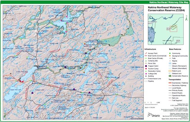
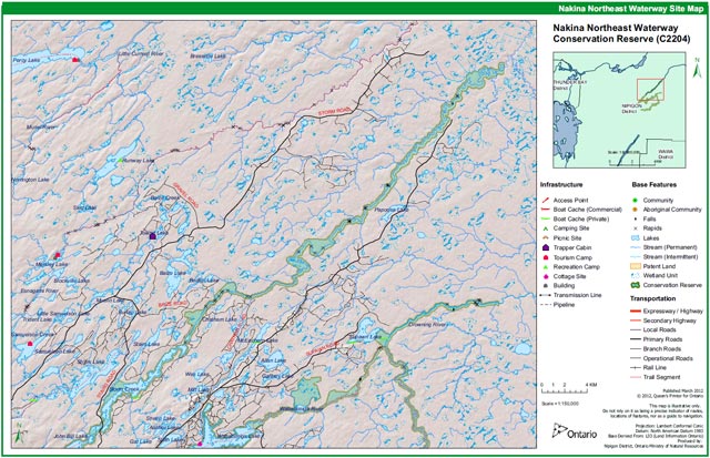
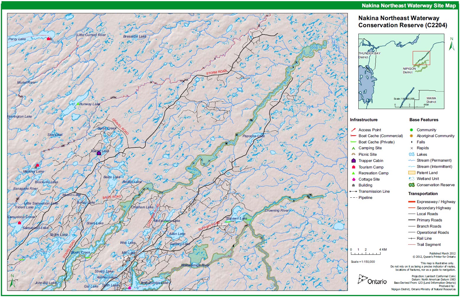
Appendix 3: Permitted uses table:
| Activity/Value | Permitted | Modified | District Manager Approval |
|---|---|---|---|
| Sport Hunting | Yes | ||
| Commercial Trapping | Yes | ||
| Boating / Canoeing / Kayaking | Yes | ||
| Baitfishing | Yes | ||
| Commercial Wild Rice Harvest | N/A | ||
| Mineral Exploration & Extraction | Yes | ||
| Land Disposition for Private Purposes | No | ||
| All Terrain Vehicle | Yes | ||
| Snowmobile | Yes | ||
| Land Claims | Yes | ||
| Traditional Use | Yes | ||
| Native Hunt Camps | Yes | ||
| Commercial Tourism Based Hunting | Yes | ||
| Native Hunting | Yes | ||
| Commercial Native Trapping | Yes | ||
| Wildlife Management | Yes | ||
| Commercial Forest Operations | No | ||
| Vegetation Management (i.e. herbicides) | No | ||
| Timber Harvest for Personal Use | No | ||
| Fuelwood Harvest | No | ||
| Insect & Disease Suppression | Yes | ||
| Sport Fishing | Yes | ||
| Commercial Fishing | No | ||
| Native Fishing | Yes | ||
| Water Control Structures | No | ||
| Aggregate Extraction | No | ||
| Bear Management Areas | Yes | ||
| Trapline Cabins | Yes | ||
| Wild Rice Harvest | N/A | ||
| Boat Caches | Yes | ||
| Fire Management | Yes | ||
| Archeological Study | Yes | ||
| Backcountry Travel | Yes | ||
| Wildlife / Vegetation Viewing | Yes | ||
| Photography | Yes | ||
| Hiking | Yes | ||
| Rock Climbing | N/A | ||
| Mountain Biking | Yes | ||
| Nordic Skiing | Yes | ||
| Snowshoeing | Yes | ||
| Aircraft | Yes | ||
| Roads / Bridges / Culverts | Yes | ||
| Ongoing Research | Yes | ||
| New Research | Yes |
"Modified" – refers to a use which may be permitted under certain circumstances where the use would not impact the values for which the Conservation Reserve was created to protect (e.g. new trails, clearings/docks for aircraft access, etc.)
Figure 1: A wetland at the outlet of the Wababimiga River. Photograph by Allan Harris.
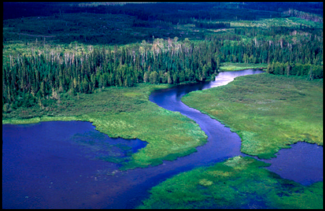
Figure 2: Another wetland, this time along the Drowning River. Photograph by Allan Harris.
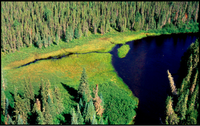
Figure 3: An esker on Cammack Lake. Eskers are long narrow ridges or mounds of sand, gravel, and boulders deposited by a stream flowing on, within, or beneath a stagnant glacier. Photograph by Allan Harris.
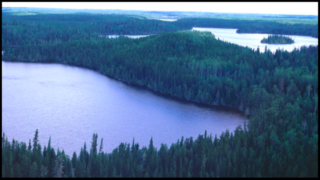
Figure 4: A tombolo on Relief Lake. Tombolos are sand or gravel bars connecting an island with the mainland or with another island. Photograph by Allan Harris.
Figure 5: This photo was taken along the south shore of Medugama Bay, on Cammack Lake. This location was on the side of an esker. The forest cover was a mix of jack pine, black spruce and white spruce with minor components of balsam fir,white birch and poplar. Ground cover was predominately feather moss. Photograph by Dave Barker.
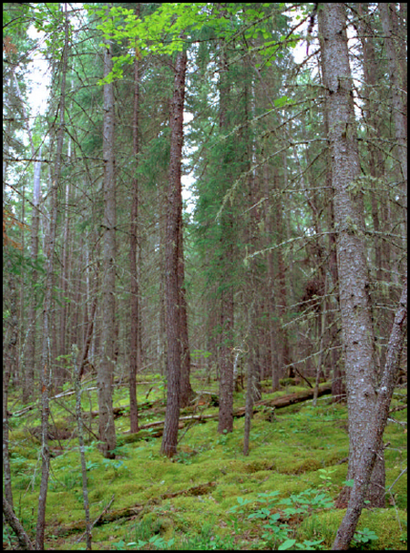
Figure 6: Medugama Bay / Cammack Lake. Photograph by Allan Harris.
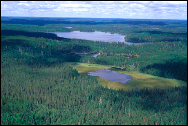
Figure 7: Wetland at the junction of Poverty Creek and the Drowning River. Photograph by Allan Harris.
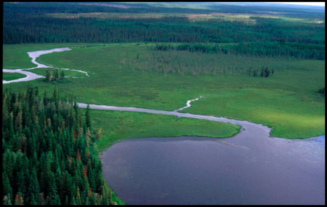
Figure 8: A forest access road. An extensive network of harvest roads provide access to many sections of the conservation reserve. Photograph by Rebecca Zeran.
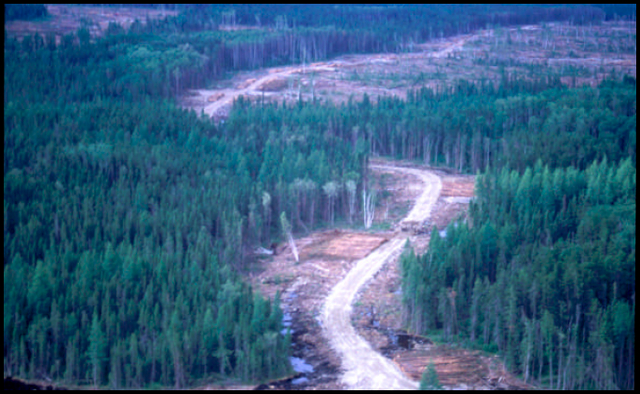
Figure 9: Evidence of a recent cut-over and burn. This is a relatively common sight throughout much of the area surrounding the waterway. Photograph by Allan Harris.
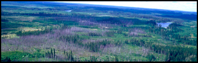
Figure 10: The Jackpine Rapids on the Drowning River. There is a 485 m portage around these rapids. Photograph by Allan Harris.
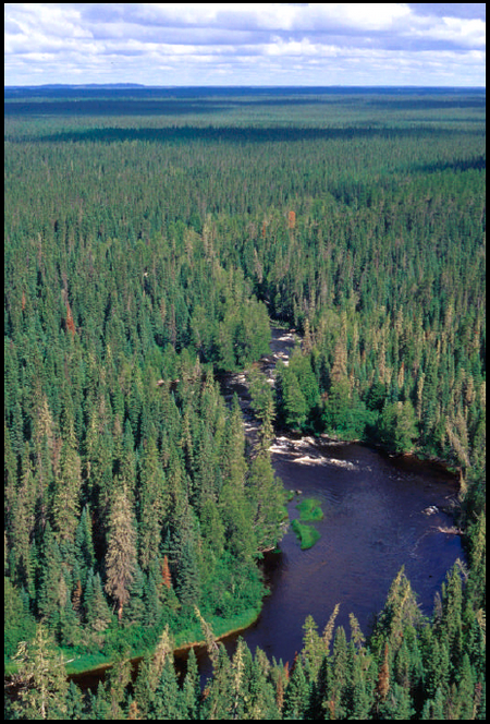
Figure 11: This picture was taken from the shore of the Squaw River, approximately 200 metres upstream from Cammack Lake. Shrub cover and white cedar are apparent along the shore, while black spruce can be seen a few metres back from the water. Photograph by Dave Barker.
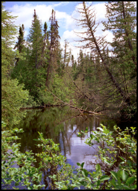
Figure 12: Remains of a campfire on a rock outcrop at the north-end of Medugama Bay (Cammack Lake). Photograph by Rebecca Zeran.
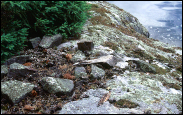
Figure 13: Indian Pipe (Monotropa uniflora). The roots of Indian Pipe are connected by fungi to the roots of nearby trees. In this way, Indian Pipe, which lacks chlorophyll and cannot produce its own food, obtains nutrition from the efforts of another plant (Johnson et al., 1995). Photograph by Rebecca Zeran.
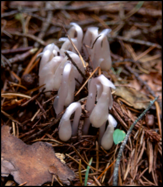
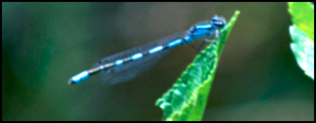
Figure 14: A common damselfly (Argia spp.) resting on an alder-leaved buckthorn plant. This picture was taken on a shore fen at the entrance to Alph Creek on Cammack Lake. Photograph by Rebecca Zeran.