Our Colleagues Conservation Reserve Management Statement
This document provides policy direction for the protection, development and management of the Our Colleagues Conservation Reserve and its resources.
Statement of Conservation Interest
Ministry of Natural Resources
Sault Ste. Marie District
Northshore Area
Ministry of Natural Resources
February, 2005
Ce document est seulement disponible en anglais.
Approval statement
I am pleased to approve this Statement of Conservation Interest (SCI) for Our Colleagues Conservation Reserve (C371).
Our Colleagues Conservation Reserve was established to protect provincially significant representations of jasper conglomerates of the Lorrain Formation, with outcrops featured in two sets of waterfalls. White pine, red pine, balsam fir, white birch and eastern white cedar dominate forest communities in this 92 hectare conservation reserve. This site also serves as a memorial to the four friends and colleagues of the Ministry of Natural Resources who tragically lost their lives on January 21, 2003, while conducting an aerial moose survey. Situated approximately 35 kilometres northeast of the City of Elliot lake in Hughson Township, this conservation reserve was regulated on February 27, 2004.
Direction for establishing, planning and managing conservation reserves is defined under the Public Lands Act, the Ontario’s Living Legacy Land Use Strategy, and other applicable policies. The specific direction for managing this conservation reserve is in the form of a basic SCI, which defines the area to which the plan applies, provides the purpose for which the conservation reserve has been proposed, and outlines the Ministry of Natural Resources' management intent for the protected area. This SCI has been created with input from program specialists within Sault Ste. Marie District. It will provide both the foundation for continued monitoring of activities and guidance for managing the conservation reserve. More detailed direction at this time is not anticipated. However, should significant facility development be considered or complex issues arise requiring additional studies, more detailed management direction in the form of special protection measures or a detailed Resource Management Plan will be prepared with full public consultation.
Public and Aboriginal were solicited prior to the regulation of this conservation reserve. An additional 15-day review period took place in December, 2004 that provided stakeholders with an opportunity to comment on the draft SCI. Some Aboriginal communities chose not to participate in either of these comment periods. Comments from the review period have been considered in the finalization of this document.
The management guidelines outlined in this SCI will be implemented by the Northshore Area Supervisor, and will be reviewed every five years and amended as required by the District Planner, Sault Ste. Marie District, Ministry of Natural Resources.
Written by:
Jennifer Cywink
Protected Areas Planning Intern
Date: February 22, 2005
Submitted by:
Erin Nixon
District Planner
Date: February 23, 2005
Recommended for Approval by:
Dick Hagman
Northshore Area Supervisor
Date: March 2, 2005
Recommended for Approval by:
Trevor Woods
District Manager, Sault Ste. Marie
Date: March 21, 2005
Approved by:
Rob Galloway
Regional Director, Northeast Region
Date: April 5, 2005
1.0 Introduction
The following document is a Statement of Conservation Interest (SCI) for Our Colleagues Conservation Reserve (C371). The purpose of this SCI is to identify and describe the natural, recreational, and cultural values of Our Colleagues Conservation Reserve and to outline the Ministry of Natural Resources' management intent for this area. Sections 1 through 3 of this document highlight the provincial context in which it was produced, state its goal and objectives, and summarize the planning process for conservation reserves. Sections 4 through 7 are specific to Our Colleagues Conservation Reserve and provide background information and management direction for the site. Section 8 outlines the requirements for continued implementation and review of this document.
Management direction specified in this SCI will serve to protect the conservation reserve for the benefit of all Ontario residents. This direction will comply with conservation reserve management as represented in the Ontario’s Living Legacy Land Use Strategy (LUS) (OMNR 1999) and associated policy clarification statements. Additionally, this conservation reserve will be managed under the Public Lands Act (OMNR 1997a), and will comply with all legal requirements as specified under the Environmental Assessment Act (R.S.O. 1990, Chapter E.18).
1.1 Provincial context
Ontario’s network of natural heritage areas has been established to protect and conserve areas representative of the diversity of the natural regions of the province, including the species, habitats, features, and ecological systems which comprise that natural diversity. Protected natural heritage areas are a key component in the sustainable management of natural resources. They ensure that representative sites within the larger managed landscape are retained in as natural a state as possible.
Our Colleagues Conservation Reserve now forms part of Ontario’s network of natural heritage areas and protects provincially significant bedrock outcroppings of jasper conglomerates known as puddingstone, which are members of the Lorrain Formation of the Canadian Precambrian Shield. Best representations of the puddingstone occur within the site at two sets of waterfalls: Ceolin Falls and the upper falls. This conservation reserve is located in the Boland River Valley and includes a 2-km section of the Boland River which provides important habitat for brook trout (Salvelinus fontinalis). On-site forest communities are dominated by white pine (Pinus strobus), balsam fir (Abies balsamea) and white birch (Betula papyrifera) on sandy glacial till. Eastern white cedar (Thuja occidentalis) populates shore fen communities lining the river.
The Ministry of Natural Resources has established conservation reserves as a tool to protect natural heritage areas on public lands, while permitting most traditional public land uses to continue. These uses include recreational activities, such as hunting and fishing, and the traditional activities of Aboriginal communities, as defined under applicable Aboriginal treaties. Lands designated as conservation reserves are removed from the Sustainable Forest License area, and mining and surface rights are withdrawn from staking under the Mining Act (RSO 1990 Chapter M.14).
The LUS (OMNR 1999) and subsequent policy clarification statements (OMNR 2000) outline the general land use policy and management direction for new conservation reserves. Each new conservation reserve will have a planning document, either a SCI or, in more complex situations, a Resource Management Plan, that details site-specific management direction.
2.0 Goal and objectives of the SCI
2.1 Goal
The goal of this SCI is to provide the framework and the direction to guide management decisions affecting Our Colleagues Conservation Reserve.
2.2 Objectives
The following objectives are identified as the means to achieve the above stated goal:
- To describe the site’s current state of the resource in terms of its values and existing uses and activities.
- To outline the Ministry of Natural Resources' management intent for the protected area.
- To determine the land use compatibility of current land uses, and to develop specific guidelines and prescriptions to manage these uses.
- To create public awareness of the values within this conservation reserve by providing information on the resources it contains and protects, and to support responsible stewardship through partnerships with local stakeholders.
- To Identify research, client services, and/or marketing strategies that may contribute to sound long-term management of the conservation reserve.
- To identify the monitoring and/or research necessary to maintain the integrity of protected values.
- To provide direction for the evaluation of proposed new uses or economic ventures through the application of the Test of Compatibility (see Appendix C) and applicable Environmental Assessment Act This test will evaluate the impact of suggested use(s), either positive or negative, on the protected values of the conservation reserve.
3.0 Management planning
3.1 Planning for a conservation reserve
The planning process for a conservation reserve consists of regulating the site and preparing a site specific management plan. Consultation with the public, Aboriginal communities and industry occur during site identification, boundary finalization, and management planning; however, it is noted that some Aboriginal communities do not wish to participate in these consultation efforts. Regulation of a conservation reserve involves preparing a legal description of site boundaries, removing the site from the Sustainable Forest License area, and withdrawing the site from staking under the Mining Act (RSO 1990 Chapter M.14). Once a conservation reserve is regulated, the level of management planning required to fulfill the protection targets is determined, and either a basic or enhanced SCI or a Resource Management Plan is prepared.
A basic SCI is prepared when there is no deviation from the land use direction provided in the LUS (OMNR 1999) and there are few to no issues that require resolution. An enhanced SCI is an intermediary document which is used when a site requires more detailed management direction than would be provided by a basic SCI, but does not have issues significant enough to warrant the preparation of a Resource Management Plan (RMP). A RMP is prepared in situations where one or more complex issues have to be addressed, or where there is widespread public interest in a site. Whichever the determination, the plan must be completed within three years of the conservation reserve’s regulation date. The guidelines for the preparation of these documents are provided in Procedural Guidelines A - Resource Management Planning (Conservation Reserves Procedure PL3.03.05, Public Lands Act, OMNR 1997a) and the Northeastern Region Guidelines on the Planning Process for Conservation Reserves: Statement of Conservation Interest and Resource Management Plan (Thompson 2001).
A SCI is essentially a management plan which receives its direction from the LUS (OMNR 1999). The purpose of a SCI is to identify the state of the resource in terms of the site’s values and Its current land use activities, and to outline the Ministry of Natural Resources' management intent for the conservation reserve. Basic SCIs typically have a 15-day public consultation period, whereas enhanced SCI is and RMPs have a longer consultation period. Upon completion of this public review, the SCI, or RMP, is revised as necessary and approved by the appropriate Regional Director.
Existing permitted uses within conservation reserves may continue, unless they are shown to have a significant negative impact on the values protected by the site. A review/evaluation mechanism is in place to address proposed new permitted uses or land use proposals. The Test of Compatibility (see Appendix C) as outlined in the Public Lands Act Policy PL 3.03.05 (OMNR 1997a), and/or other standard Ministry of Natural Resources' environmental screening processes, are used to screen future proposals. Where cultural resources may be Impacted, proposals may be screened through Conserving a Future for our Past: Archaeology, Land Use Planning & Development in Ontario, Section 3 (Ministry of Culture 1998).
Public comment may be solicited during a review of any future land use proposals that require new decisions to be made. Appropriate Environmental Assessment Act (R.S.O. 1990, Chapter E.18) requirements and amendment processes will apply to any future proposal and/or any significant change in management direction being considered for a site.
3.2 Planning process for our colleagues conservation reserve
Our Colleagues Conservation Reserve was proposed as a conservation reserve in January, 2003. Consultation has occurred with the public, Aboriginal communities, and industry, although some Aboriginal communities did not wish to participate in the consultation efforts. The boundary of the site has been regulated through an amendment to Ontario Regulation 805/94 of the Public Lands Act on February 27, 2004, by Ontario Regulation 34/04. A copy of the public consultation materials from the boundary regulation phase can be found in Appendix E.
To date, no significant issues related to land use in this conservation reserve have been identified. For this reason, it was determined that a basic SCI will adequately identify the site’s significant features and serve as the appropriate format for delivering the management guidelines. It should be noted that this document addresses only those issues or land use proposals currently known to the District Manager. The direction provided by this SCI, and future management decisions, will work to resolve any potential land use conflicts and to ensure that identified values continue to be adequately protected.
3.2.1 Planning area
The planning area for this SCI consists solely of the regulated boundary for Our Colleagues Conservation Reserve (see Figure 2). However, to fully protect values within the conservation reserve, the area beyond the regulated boundary may require additional consideration when larger land use planning initiatives pose potential negative impacts on the conservation reserve. The forest management planning process is an example of when adjacent land management activities may consider sensitive features within the conservation reserve boundary.
4.0 Background information
4.1 Location and site description
Our Colleagues Conservation Reserve is located approximately 35 km northeast of the City of Elliot Lake in Hughson Township. The site was regulated on February 27, 2004, and encompasses 92 ha, including a 2-km section of the Boland River, two sets of waterfalls and provincially significant outcrops of jasper conglomerates (known commonly as puddingstone). It is less than 5 km east of Rawhide Lake Conservation Reserve and Mississagi Provincial Park.
Whenever possible, recognizable natural and cultural features, such as creeks, shorelines or old roads, have been used to delineate conservation reserve boundaries to facilitate on the-ground identification. The northwestern boundary of the conservation reserve is primarily defined by the Boland River Road which roughly parallels the Boland River. The most northerly boundary is defined by a vector from the Boland Road to the Boland River. The eastern boundary follows the river and then merges with the western shoreline of Hughson Township Lake No. 1 (see Figure 1). The southern boundary is defined by vectors that correspond with harvest block boundaries, and the western boundary follows an old road previously cut to facilitate the crossing of the Boland River, later abandoned for a more suitable site downstream.
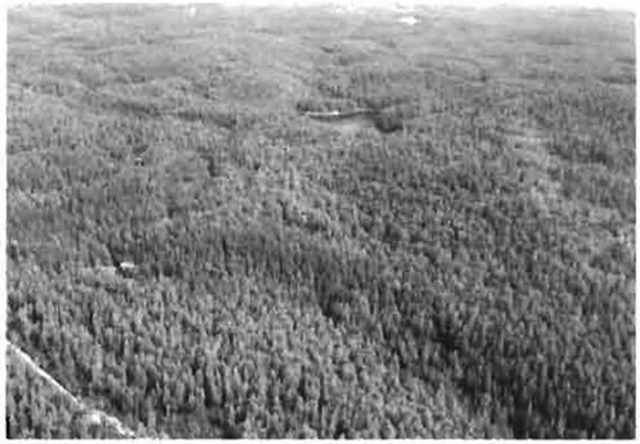
Figure 1: Aerial view of entire conservation reserve looking east. Hughson Township Lake No.1 (shown) defines a portion of the eastern boundary.
The conservation reserve is easily accessed via the Boland River Road north of the City of Elliot Lake. Measured from the intersection with Highway 639, small footpath trails from the Boland River Road provide access into each waterfall location on the river between the 26th and 27th km markers. The cutline forming the western boundary provides access to the western interior of the site from the Boland River Road. The southern portion of the conservation reserve is not easily accessible due to the absence of trails and roads.
Figure 2: Site Location for Our Colleagues Conservation Reserve (C371)
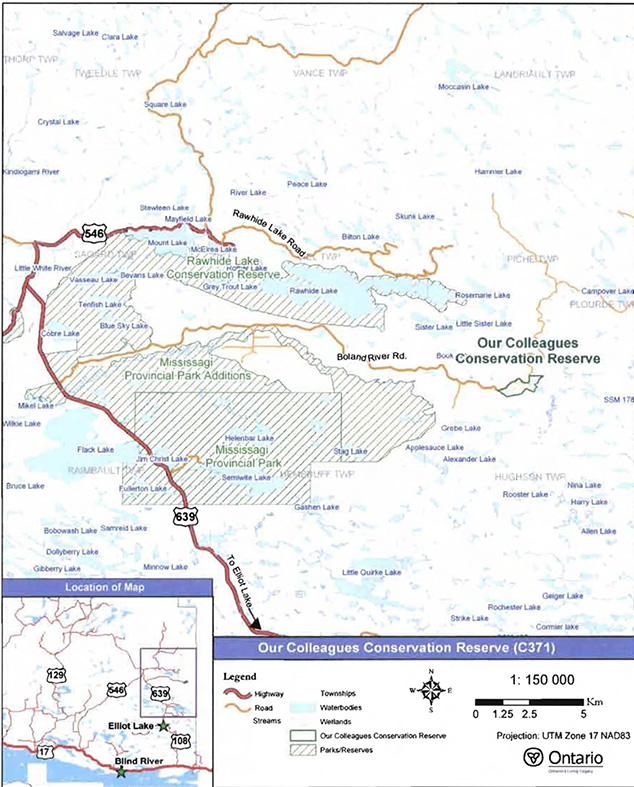
Enlarge figure 2 site location for Our Colleagues Conservation Reserve (C371)
Table 1. Location and administrative details for Our Colleagues Conservation Reserve.
| Name | Our Colleagues Conservation Reserve (C371) |
|---|---|
| Site region - site district (Hills 1959) | 4E-3 |
| Eco region - eco district (Crins and Uhlig 2000) | 4E-3 Mississagi |
| OMNR administrative region/district/ area | Northeast Region/Sault Ste. Marie District/Northshore Area |
| UTM co-ordinates | Easting 383869, Northing 5163699 |
| Area | 92 hectares |
| Nearest city/town | Approximately 35 km northeast of the City of Elliot Lake |
| Township(s) | Hughson |
| OBM numbers | 2017380051600 |
| Topographical map number/name | 41-J 9 Madawanson Lake 41J 10 Rawhide Lake |
| Wildlife management unit | 38 |
| Forest management unit | Northshore Forest |
| Regulated | February 27 2004 |
| SCI completed | February, 2005 |
Our Colleagues Conservation Reserve is located within Site District 4E-3
The diversity for Our Colleagues Conservation Reserve is considered to be low. Based on recent Ontario Parks analysis (2003), there are only three landform: vegetation combinations; including dense coniferous forest, mixed coniferous forest and recent growth on bedrock. Coniferous communities include white pine, white spruce (Picea glauca), jack pine (Pinus banksiana), red pine (Pinus resinosa) and cedar. A super-canopy white pine stand located west of Hughson Township Lake No. 1, forming part of the southeast boundary, adds to the diversity of the conservation reserve. Wetlands in the conservation reserve are limited to a shore fen west of the unnamed lake, and rich conifer swamp (Cudmore et al. 2004) lining the 2-km section of the Boland River. Photos of the conservation reserve can be found in Appendix B.
4.2 History of the site
Our Colleagues Conservation Reserve has been regulated as a tribute to four Ministry of Natural Resources' employees who tragically lost their lives in January, 2003, when their helicopter went down while conducting an aerial moose survey north of Sault Ste. Marie. Protection of this site’s unique waterfalls and puddingstone outcroppings was an important goal of Conservation Officer Walter Ceolin. This goal has been achieved, as the two sets of waterfalls have been included in this conservation reserve. As well, in recognizing Walter’s personal attachment to the site, the larger falls were officially named Ceolin Falls in July, 2003.
Fish, fur, lumber and minerals attracted the first people to this area. Native peoples inhabited the area now located within the Mississagi Provincial Park, less than 5 km from Our Colleagues, for several centuries, leaving behind remnants of old hunting and fishing settlements, and travel routes in the form of portages (OMNR 1996). A portion of the Boland River has been identified as part of a historic canoe route which includes a series of portages beginning at Mount Lake, which forms part of the Rawhide Lake Conservation Reserve boundary, and leads to the Boland River via Rosemarie Creek, just west of Our Colleagues Conservation Reserve. Prior to the construction of the Boland Road in the 1970s, people traveled by canoe in the spring, during high water levers, via Campover Lake, approximately 8 km east of the site, to the Boland River. Present day trails along the Boland River would have evolved from early portage trails, created so that fur traders, fishermen and hunters could navigate around the waterfalls (Millroy pers.comm.).
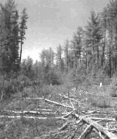
Figure 3: Boland River Road, utilized by logging companies since its construction in the 1970's.
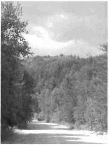
The logging industry has played a major role in the area surrounding this conservation reserve for the past century. Remnants of old logging camps, corduroy roads, dams and chutes can be found in the nearby Raimbault and Hembruff townships, west of the site. Logging within the immediately vicinity of Our Colleagues Conservation Reserve began between 1908 and 1912, south and east of Hughson Township Lake No.1, which in present day, forms part of the eastern boundary of the conservation reserve. In the absence of large lakes, the Boland River was utilized by loggers who hauled lumber along small roadways to the river (southwest of the site) via horse pulls during winter months. Upon spring arrival, white and red pine timber would be sent downstream in the higher water levels (Penikett pers.comm.).
A log boom beginning in the 1950s resulted in harvesting operations north and west of the conservation reserve, and drove the construction of the Boland River Road in the 1970s (Penikett pers.comm.; see Figure 3). Harvesting north, south and west of the site took place as recently as the 1990s. These harvest blocks form the conservation reserve’s south and west boundaries. Forestry operations continue in areas immediately surrounding the conservation reserve.
According to Ministry of Natural Resources' data, the area encompassed within Our Colleagues Conserve Reserve has never been impacted by fire. However, within a 5-km radius of this conservation reserve, several smaller fires occurred due to lightning in 1976 and 1977. More historically, Rawhide Lake Conservation Reserve was subject to several large wildfires in the first half of the 20th century. Generally, extensive operations were undertaken in subsequent years in an attempt to salvage as much timber as possible, affected by forest fires (OMNR 1996).
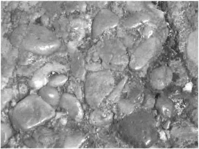
The conservation reserve’s puddingstone formations illustrate the results of geological history (see Figure 4). They have also inspired human interest in the area, as people sought to collect pieces of the unique stone for personal and commercial purposes. Hobbyists and collectors particularly appreciate the stone for its brilliant colours, composition, and for its ability to be cut and polished. A permit was issued in the 1990s, by the Ministry of Natural Resources, for the removal of puddingstone boulders along the Boland River Road. Original intentions were to create a commercial venture for countertops and flooring. Tourism in the Bruce Mines locality is largely based on puddingstone, and similar to the amethyst of Thunder Bay, individuals have expressed interest in having the stone publicized in brochures. In 1984, a local individual submitted a funding proposal to develop a jasper puddingstone brochure, but was unsuccessful in securing funding.
Figure 4: Close up view of puddingstone at the upper falls.
The earliest references of puddingstone date back to the 1800s. English settlers along the North Shore compared the appearance of the conglomerate stone to traditional suet pudding; a rich dessert boiled or steamed with cherries, currants, raisin and nuts. English geologist and physician John Jeremiah Bigsby was the first known individual to document puddingstone outcrops in this area, during his participation in geological surveys of the northwest portion of Lake Huron in 1820. Conglomerate formations are found elsewhere around the world including England, West Africa, Mexico, New Mexico, Philippines, South Dakota, Utah, Missouri and Massachusetts, and have largely become favoured ornamental stones since the mid-1800s (Esch 2004). A cornerstone monument made of nearby local Bruce Mines puddingstone is situated at the Geological Survey Building in Ottawa, as a memorial to Sir William Logan who served as the First Director of Geological Surveys in Canada, and who formalized the naming of Precambrian Jasper Conglomerates (Sabina 2003).
4.3 Inventories
Table 2 (on the following page) indicates the current status of natural heritage inventories that have occurred in Our Colleagues Conservation Reserve. Recommendations for future Inventory needs are located in Table 3, Section 7.2.
Table 2. Existing inventory and survey information for Our Colleagues Conservation Reserve.
| Type of inventory | Inventory method | Date(s) of inventory | Report |
|---|---|---|---|
| Life science | Ground and aerial reconnaissance | Ground: June 29, 2004 Aerial: Sept. 9, 2003 |
Cudmore, W., L. King, and S. Longyear, 2004. Our Colleagues Conservation Reserve (C371), Life Science Checksheet-Step 4. Unpublished Information. Ontario Ministry of Natural Resources. (Draft) |
| Earth science | Aerial reconnaissance | Sept. 9, 2003 | Kor, P., 2004. Earth Science Inventory Checklist for Our Colleagues Conservation Reserve. Unpublished Information. Ontario Ministry of Natural Resources . |
| Recreation | Ground and aerial reconnaissance | Ground: May 1 & 22, June 11, July7 & 25 (2003), June 29 & July 26 , August (2004) Aerial: Sept. 9 2004 |
Hall, M., 2004. Recreation Inventory Report - Our Colleagues Conservation Reserve (C371), Version 1. Unpublished Information. Ontario Ministry of Natural Resources. |
5.0 State of the resource
5.1 Key values
Key values are those values that make this site unique and have led to its designation as a conservation reserve. Their protection is paramount. The key values found within Our Colleagues Conservation Reserve include the following:
- Provincially significant outcrops of jasper conglomerate members of the Lorrain Formation, known as puddingstone
- Waterfalls: upper Boland falls and Ceolin Falls
- Glacial deposited boulder lags lining the Boland River
- White pine, balsam fir and white birch dominated forest communities
- Super-canopy white pine along the site’s southeastern boundary
Additional values as listed in Section 5.2 through Section 5.6 are also important. Descriptions in this section are not necessarily complete. If new values, key or otherwise, are identified, they will be added to this section. f any new value is considered significant, management guidelines may be modified, if required, to ensure its protection.
5.2 Earth sciences values
Our Colleagues Conservation Reserve encompasses a bedrock-dominated terrain along a portion of the Boland River assigned to the Lorrain Formation, a unit of the Huronian Supergroup in the Southern Structural Province of the Canadian Precambrian Shield (Kor 2004). The Lorrain Formation encompasses areas within the Cobalt Embayment including Sault Ste. Marie, Sudbury, and Timmins. The bedrock of the conservation reserve is classified as the Lower Lorrain Formation, and is laden with thin sand and gravel layers of glacial origin. Bedrock outcroppings occur throughout the site in the form of jasper conglomerates known commonly as puddingstone (see Figure 4). Provincially significant representations are exemplified at both Ceolin Falls, and the falls immediately to the east of Ceolin Falls, referred to in this SCI as the upper falls, as well as in other outcrops and boulder deposits throughout the site (Kor 2004). Puddingstone outcrops in the conservation reserve consist primarily of white quartz with a smaller component of red to violet jasper, black chert, magnetite, hematitie, chlorite, epidote and zircon, set in a matrix of white to grey quartzite (Wood 1975).
Figure 5: Boulder deposits featuring layers of puddingstone, next to the upper falls.
(Photo by J. Cywink; June, 2004)
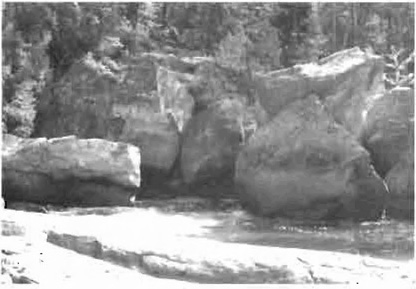
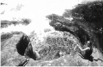
Figure 6: Large glacial pothole formation in the bedrock at the upper falls.
(Photo by MNR; July, 2003)
The conglomerate outcrops began to form some 2.2 to 2.4 billion years ago (Kor 2004) when glacial bodies carried sediments for large distances, eventually depositing them into marine and riverine environments. Over time the deposits became encased within a tough quartzite matrix forming the conglomerate member. Unique formations are found within this conservation reserve and are characteristically called puddingstone. The name derives from a tale of English Settlers comparing the appearance of the rock to boiled suet pudding with cherries, currants and nuts. The only documented exposures of puddingstone in Ontario occur in the area from Sault Ste. Marie to Elliot Lake (Frarey 1977). Formations within the conservation reserve feature brilliant red jasper deposits; therefore, they are suitably termed jasper conglomerates.
Puddingstone found within this site is generally composed of pebble to cobble sized materials, which are well-rounded with smooth surfaces as a result of glacial and postglacial weathering and erosion. The best exposures within this conservation reserve occur as bare bedrock outcrops at Ceolin Falls and the upper falls. Puddingstone boulders are also exposed at several locations along trails within this site. Recent site visits have revealed that puddingstone also exists in the Rawhide Lake Conservation Reserve, approximately 10 km from this site; however, exposures within Our Colleagues Conservation Reserve are considered to be provincially significant (Kor 2004).
According to Kor (2004), the Boland River is located in a valley which was formed as a result of a much greater flowing river, during postglacial times. A sand and gravel matrix of glacial outwash and till makes up most of the valley, with boulder lag deposits lining the shore of the present day river (see Figure 5). Additionally, sculpted bedrock outcrops in both waterfall locations occur as sichelwanne and muschelbrugge formations, also known as p- or s-forms. It is interpreted that these are streamline forms which become sculpted on the surface of bedrock by the catastrophic release of glacial meltwaters beneath collapsing glacial ice. The meltwaters, laden with debris (sand, gravel and boulders), act similar to sandpaper; where under great pressure, speed, and conditions of turbulent flow, caused the erosion visible today on the rock surfaces (Kor pers.comm.) . A large pothole formation near the base of the upper falls, nearly 2 m in diameter, is another resultant feature of glacial meltwaters and vast erosion (see Figure 6).
5.3 Life sciences values
More than 75 percent of Our Colleagues Conservation Reserve consists of stands dominated by white pine, including white pine uniform shelterwood
Figure 7: Forest community at the upper falls, dominated by white pine, balsam fir, with eastern white cedar lining the Boland River.
(Photo by J. Cywink; August, 2004)
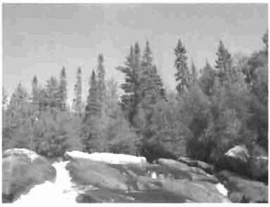
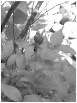
Figure 8: Narrow leaved gentian (Gentiana linearis) amongst shoreline vegetation between Ceolin and upper falls.
(Photo by J. Cywink; August, 2004)
Stocking
Most of the forest stands In the conservation reserve are aged in the range of 60 to 89 years. Typically these stands are predominately white pine. White birch dominated stands, located in the northeast portion and along the site’s western boundary, range between 30 and 59 years. Age distribution for the northwestern to central areas, affected by past harvesting, is between 0 and 29 years. There were no stands identified as old-growth candidates within the conservation reserve (Cudmore et al. 2004).
The southeastern boundary of this site borders the shoreline of Hughson Township Lake No. 1. Wetland communities within the conservation reserve are limited to a small shore fen adjacent to the lake, and rich conifer swamp dominated by white cedar lining the Boland River (Cudmore et al. 2004). Recent ground surveys indicate that some of the common vegetation within the conservation reserve includes bunchberry (Comus canadensis), low sweet blueberry (Vaccinium angustifolium), wild lily-of-the-valley (Maianthemum canadense), blue bead lily (Ciintonia borealis), running clubmoss (Lycopodium clavatum), shining clubmoss (Lycopodium lucidulum), ground pine (Lycopodium obscurum), sweet fern (Comptonia peregrine), sensitive fern (Onoclea sensibilis) and occasional species such as serviceberry (Amelanchier sp.), wild sasparilla (Auralia nudicaulis), pink lady’s slipper (Cypripedium acaule), and narrow leaved gentian (Gentiana linearis; see Figure 8).
A Ministry of Natural Resources' aerial survey from 1979 identified the presence of a beaver (Castor canadensis dam adjacent to the unnamed lake. The presence of a shore fen located in this portion suggests that flooding, resulting from beaver activity, may have contributed to the formation of this wetland. A beaver population existing within this conservation reserve is supported by Ministry of Natural Resources' trapping data from the last five years. As well, canoeists on the Boland River have observed beaver along the route.
Two registered traplines encompass the conservation reserve, and records confirm the presence of mink (Mustela vison), marten (Martes americana), otter (Lontra canadensis), fisher (Martes pennanti), raccoon (Procyon lotor), weasel (Martes sp.), muskrat (Ondatra zibethicus), lynx (Lynx lynx), red squirrel (Tamiasciurus hudsonicus) and red fox (Vulpes vulpes). Recent site visits have confirmed the presence of black bear (Ursus americanus), striped skunk (Mephitis mephitis), eastern chipmunk (Tamias striatus) and ruffed grouse (Bonasa umbellus) within the conservation reserve. Moose (Alces alces) sightings have been documented by canoeists and hikers along the Boland River, which also provides important habitat for brook trout. Additionally, this site is encompassed by a bear management area.
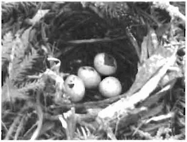
Figure 9: Ovenbird (Seiurus aurocapillus) ground nest with four hatched eggs.
(Photo by J. Cywink; September, 2004)
Please refer to sections 6.3.3 Commercial Fur Trapping and 6.3.4 Bear Management Areas for more details.
According to the Ontario Breeding Bird Atlas (OBBA; www.birdsontario.org), this site falls within survey square number 17LM86, where 33 breeding bird species have been identified based on 3.33 hours of effort in 2003 and 2004. These recordings include the belted kingfisher (Megaceryle alcyon), blue jay (Cyanocitta cristata), winter wren (Troglodytes troglodytes), American goldfinch (Carduelis tristis) and evening grosbeak (Hesperiphona vespertina). Additionally, the ground nest and hatched eggs of an ovenbird (Seiurus aurocapillus) were identified during a recent site visit (see Figure 9). More detailed analysis of life science values is available in the Life Science Inventory Report for Our Colleagues Conservation Reserve (Cudmore et al. 2004).
5.4 Recreational values
The features of this conservation reserve provide numerous recreational opportunities. Access to the site is relatively easy via road travel or waterway. Two footpath trails lead south of the Boland River Road, providing access and short hiking opportunities to both the upper falls and Ceolin Falls. Additionally, the two waterfalls are joined by a trail (0.5 km) which follows the Boland River (see figure 8). Although there are no maintained campsites or campgrounds within this conservation reserve, suitable camping areas have been identified along the Boland River, immediately below both sets of waterfalls.
The 2-km section of the Boland River within this site hosts provincially significant puddingstone outcrops, sculpted bedrock formations, and unique boulder lag deposits lining the river’s shore. Both the upper falls and Ceolin Falls provide excellent exposures of these unique bedrock formations. The two waterfalls also provide prime opportunities for viewing, photography, painting and picnicking for those interested in onshore pleasures. According to Ministry of Natural Resources' staff, local school groups and hiking clubs frequent this site.
Figure 8: Trail along the Boland River joining two waterfall locations.
(Photo by J. Cywink; August, 2004)
The river provides opportunities for swimming and bathing. The two waterfall locations provide easily accessible bathing areas at small sandy beach areas. Sculpted bedrock formations of puddingstone, including a pothole 2 m in diameter, create additional recreational features for water activities (see Figure 6). Diving and jumping at Ceolin Falls is not recommended due to the presence of submergent rocks. Canoeing and kayaking activities could be enjoyed by outdoor enthusiasts. While rapids and waterfalls contribute aesthetically to the waterway, they can be circumvented via informal portage trails.
The Boland River is known to provide angling opportunities primarily for brook trout. Hunting opportunities within this area include big game such as moose and bear, and small game including ruffed grouse. The degree of fishing and hunting within the conservation reserve is currently unknown.
5.5 Cultural values
This site falls within the Robinson-Huron Treaty area. To date, no First Nation community has identified any specific Aboriginal values within this conservation reserve.
5.6 Research values
This site falls within Region 34, survey square number 17LM86 of the Ontario Breeding Bird Atlas (OBBA; www.birdsontario.org). The atlas is a repository of survey data for breeding birds across the province. Volunteers survey 10 km2 areas to assess bird species and breeding populations. To date, 33 breeding bird species have been identified within the block which encompasses Our Colleagues Conservation Reserve. Surveying for the OBBA will be completed in 2005.
Figure 9: Eroded puddingstone bedrock formations at the upper falls.
(Photo by J. Cywink; August, 2004)
5.7 Site condition
The area surrounding Our Colleagues Conservation Reserve has been subjected to a significant amount of disturbance in the form of tree harvesting since the early 1900s, and road construction dating back to the 1970s. Recent harvesting operations have occurred along the northwestern and southern boundaries of the site.
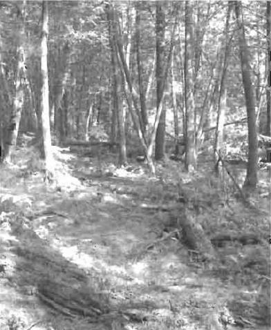
According to Hall (2004), portions of a pine shelterwood harvest, in 1991, were focused north of the Boland River Road, just outside of the conservation reserve. Harvesting expanded south of the road, into what is now the northwest corner of the conservation reserve. In the same year, a line was cleared between the road and the Boland River for planned bridge construction over the river. The bridge project was abandoned shortly thereafter due to the extensive slope of the river bank. The cut line now forms the western boundary of the conservation reserve (see Figure 10).
Figure 10: Cut line forming the western boundary of the conservation reserve.
(Photo by M. Hall; May, 2003)
Approximately 100 m east of the cut line, an abandoned landing area is situated, which logging companies have utilized to load logging trucks. A gravel pit located just north of the Boland River Road, near the Ceolin Falls trail, outside of the conservation reserve, was once used for the storage of gravel for road construction in the area. This abandoned pit provides a parking area for people venturing to the conservation reserve and surrounding area.
Roadside vegetation and trees immediately adjacent to the conservation reserve have sustained some damage, due to logging and grading of the Boland River Road. Trees lining the northern boundary of the site have been knocked over in areas, and gravel has accumulated along the roadside, affecting shrub and herb species. Within the conservation reserve, garbage is limited to the immediate area alongside the road, generally consisting of food and beverage packaging, cardboard, and plastic.
Human disturbance is present in the form of small footpath traits between the upper falls and Ceolin Falls, and trails from the waterfalls to the Boland River Road. The condition of the trails suggests that they were not created recently, but over a period of time, and may have been utilized as portages (prior to road construction in the 1970s) and to gain access to the Boland River Road (post road construction). The footpaths were lightly groomed by the Ministry of Natural Resources in 2004.
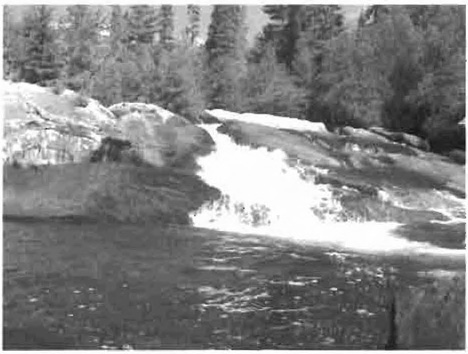
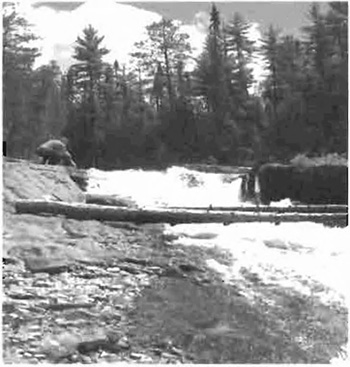
Site visits reveal that trees have recently been cut at the Ceotin Falls location, with the logs placed across the falls, creating a bridge to a bedrock outcrop (see Figure 11). Branches from the tree cuttings were piled near a small fire pit. Additionally, a white spruce has been cut along one trail, apparently to eliminate it as a trail obstruction.
Figure 11: White pine trees cut to form a bridge straddling Ceolin Falls.
(Photo by J. Cywink; June, 2004)
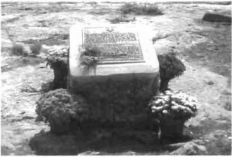
A memorial sign and plaque have been erected in the vicinity of the Ceolin Falls location by the Ministry of Natural Resources, as a tribute to the four colleagues who lost their lives in 2003.
6.0 Management guidelines
All management guidelines in this SCI are based on direction contained in the LUS (OMNR 1999) and associated policy clarification statements (OMNR 2000). The management guidelines outlined in this section are specific to Our Colleagues Conservation Reserve and are intended to protect the site’s unique values. The guidelines in this document may be subject to change and may be amended as necessary. If a conflict between management guidelines exists, the conservation reserve will be managed to protect the integrity of its natural values, while permitting compatible land use activities (OMNR 1997a).
Proposed new uses and/or development, as well as research and education activities, will be reviewed on a case-by-case basis. Before new proposals can be permitted, the Test of Compatibility (see Appendix C) must be passed as well as consideration of cultural values according to Conserving a Future for our Past: Archaeology, Land Use Planning & Development in Ontario, Section 3 (Ministry of Culture 1998). In addition, all new proposals are subject to applicable Environmental Assessment Act (R.S.O. 1990, Chapter E.18) requirements.
The following management strategies have been devised to achieve the goal and objectives of the SCI for Our Colleagues Conservation Reserve. A summary table of the management guidelines for this site can be found in Appendix D. For the most up-to-date version of this summary table, please refer to the Crown Land Use Policy Atlas, located on the Internet at /page/crown-land-use-policy-atlas or contact your local Ministry of Natural Resources office. The Crown Land Use Policy Atlas is a consolidation of existing local land use policies for Crown lands within the OLL planning area, an area that covers 45% of the province, extending from Lake Simcoe in the south to the Albany River in the north.
6.1 Industrial activities
6.1.1 Commercial timber harvest
The area contained within this conservation reserve (92 ha) has been withdrawn from the Northshore Sustainable Forest License area and no commercial timber harvesting will be permitted. Please refer to Section 6.4.3 for information regarding non-commercial wood harvesting.
6.1.2 Mining and exploration
There are no existing mining claims or leases within this conservation reserve. Mining and surface rights have been withdrawn from staking under the Mining Act (RSO 1990 Chapter M.14). Mineral exploration is not permitted.
6.1.3 Extraction of peat, soil, aggregate and other material
Extraction of peat, soil, aggregate and other material is not permitted.
6.1.4 Energy generation
New hydropower developments are not permitted within Our Colleagues Conservation Reserve. Wind power developments are prohibited under the Public Lands Act, Procedure PL 4.10.04 "Wind Power Development on Crown Land" (OMNR 2004c).
6.2 Existing and proposed development
6.2.1 Transportation corridors
6.2.1.1 Roads
According to the LUS (OMNR 1999), new roads for resource extraction will not be permitted except for those identified in Forest Management Plans prior to March 31, 1999. The Boland River forest access road parallels the Boland River, and defines the northern boundary of this site. This road is not located within the conservation reserve and can continue to be used for forest access. No other roads for resource extraction were identified.
6.2.1.2 Trails
Several walking trails have been identified within the conservation reserve. Two trails, each approximately 50 m in length, lead from the Boland River Road to the Upper Boland Falls and Ceolin Falls. The waterfall locations are then joined by an additional footpath which parallels the river. Recreational use of existing trails can continue, though the impact of such use will be monitored. Should negative impacts be identified, an alternate management direction for this site may be developed.
Any proposed new trails will be subject to the Test of Compatibility (see Appendix C) and applicable Ministry of Natural Resources' policies and procedures. Trail development in low lying areas and wetlands will be discouraged, as will trail development over shallow soils on rock outcrops. All new and existing trail heads and trail routes must be recorded using new technologies (le. global positioning systems) to ensure an accurate record of the location of the feature. This location information must be provided to the Sault Ste. Marie District, Ministry of Natural Resources.
6.2.2 Other corridor development/maintenance
No communication, energy transmission, or other non-road corridors are located within this conservation reserve. New corridor developments will be actively discouraged. Proposals for new corridors will be subject to the Test of Compatibility (see Appendix C) and applicable Ministry of Natural Resources' policies and procedures.
6.2.3 Natural heritage appreciation facilities/recreational structures
Memorial signs erected near the Ceolin Falls location provide descriptions of the conservation reserve’s puddingstone outcrops and waterfalls. The Ministry also plans to install two additional signs. One to emphasize the danger of jumping and diving at Ceolin Falls due to underwater hazards (i.e. submerged rocks, fast moving waters), and disturbance of the site, including the removal of rock from within the conservation reserve is prohibited. Currently, there are no other existing authorized natural heritage appreciation facilities or recreational structures (i.e. boardwalks, bird viewing platforms, kiosks, ski shelters). New natural heritage appreciation facilities and recreation structures are permitted, subject to the Test of Compatibility (see Appendix C) and applicable Ministry of Natural Resources' policies and procedures.
6.2.4 Land disposition
Sale of Crown land within the conservation reserve is not permitted.
Presently, no land use permits (LUPs) have been issued within this conservation reserve for private or commercial recreational facilities. New leases or LUPs may be issued for approved public uses (i.e. not for private recreation camps), subject to the Test of Compatibility (see Appendix C) and applicable Ministry of Natural Resources' policies and procedures. These leases/permits will not be sold but may be eligible for enhanced tenure or transfer.
Enhanced tenure is defined as anything beyond the term and form of current tenure. All requests for transfer or enhanced tenure will be subject to the following screening criteria:
- Is the transfer or enhanced tenure consistent with the conservation reserve’s land use intent, which is the protection and enhancement of the site’s natural, recreational and cultural values?
- Is it consistent with the land disposition policies outlined in the District Land Use Guidelines, the Crown Land Use Policy Atlas, this SCI and any other applicable document?
- Does it adversely affect the values as identified in Section 0, and/or conflict with other uses?
- Is land needed by the Crown to protect significant natural or recreational values outlined in this SCI?
- Does the transfer or enhanced tenure clash with traditional Aboriginal uses, land claims or agreements?
- Are all rents, taxes, fees, rates or charges paid up for the existing LUP or lease?
6.3 Commercial activities
6.3.1 Commercial bait harvesting
Hughson Township is allocated to commercial bait harvesting operations. New operations can be considered subject to the Test of Compatibility (see Appendix C) and applicable Ministry of Natural Resources' policies and procedures.
Under Public Lands Act PL 3.03.08 "Buildings for Bait Harvesting Management" (OMNR 2002), cabins for the purposes of bait harvesting may be constructed on Crown land.
However, such buildings should be avoided within this conservation reserve wherever possible and be established, instead, on Crown land outside of the protected area.
6.3.2 Commercial fishing
There are currently no commercial fisheries. New operations may be considered subject to the Test of Compatibility (see Appendix C) and applicable Ministry of Natural Resources' policies and procedures.
6.3.3 Commercial fur trapping
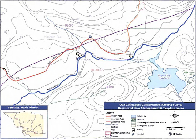
A portion of Registered Trapline Area BL 076 occurs within the northwest portion of this conservation reserve. The remainder of the site is covered entirely by Registered Trapline Area BL 080 (see Appendix A, Map 2). Both areas are currently allocated to head trappers. If a head trapper surrenders a registered trapline, or the head trapper’s privileges are revoked, the registered trapline may be transferred to another trapper following established allocation procedures. If the registered trapline is not transferred in due course, or remains unallocated for a significant period of time, reallocation of the trapline may occur following applicable district screening processes.
The establishment of new trapline trails will be considered following the procedure and criteria for new trails as outlined in Section 6.2.1.2. No trap cabins currently exist within Our Colleagues Conservation Reserve. A completed Test of Compatibility illustrates that the size of this conservation reserve and the values being protected within the site (i.e. puddingstone outcrops, wetlands, shallow soil areas, forest communities, etc.) may be jeopardized by the construction of any establishment, therefore the establishment of new trap cabins will not be permitted.
6.3.4 Bear Management Areas
The conservation reserve is situated within Bear Management Area (BMA) BL-38-072 (see Appendix A, Map 2). Guided hunting activities associated with a BMA may continue. Transfers of BMAs may be permitted in cases where the current operator sells their bear hunting business to another operator and the BMA transfer is approved. If an operator surrenders the BMA or the BMA is revoked, reallocation of the BMA may occur following applicable district screening processes.
6.3.5 Commercial food collection
There are currently no commercial food harvesting ventures. Any new ventures requiring permits from the Ministry of Natural Resources will be subject to the Test of Compatibility (see Appendix C) and applicable Ministry of Natural Resources' policies and procedures.
6.3.6 Commercial non-timber forest products
Commercial harvesting of non-timber forest products is not consistent with the intent of the conservation reserve and will not be approved.
6.3.7 Outpost camps/main base lodges
There are currently no authorized outpost camps or main base lodges in the conservation reserve. A completed Test of Compatibility illustrates that the size of this conservation reserve and the values being protected within the site (i.e. puddingstone outcrops, wetlands, shallow soil areas, forest communities, etc.) may be jeopardized by the construction of any establishment, therefore new outpost camps and main base will not be permitted.
6.4 Non-commercial activities
6.4.1 Nature appreciation/recreation activities
Off-trail hiking, cross-country skiing, snowshoeing, and other non-motorized activities will be permitted within this conservation reserve. However, should the impact of these activities degrade the landscape, the Ministry of Natural Resources will re-evaluate these permitted uses and decide upon a new strategy for this site. New trails to support these activities may be considered. Please refer to Section 6.2.1.2 for more details related to trail development.
6.4.2 Camping
There are no maintained campsites or campgrounds within this conservation reserve. Although access may be difficult, natural tenting areas occur along the south side of the Boland River, below both the upper falls and Ceolin Falls. Crown land camping policies apply, unless significant adverse effects on protected values necessitate further planning and management for this activity. Existing campsites should be used whenever possible and campers should avoid sensitive areas.
6.4.3 Non-commercial consumptive resource use
Cutting of trees for non-commercial purposes may be authorized via a permit issued by the local Ministry of Natural Resources' office, subject to review and determination of the impact that such cutting would have on the values identified in Section 5.0. Such permits are intended only for leaseholders, land use permit (LUP) holders, cottagers and other property owners within the conservation reserve who do not have road access to their property and have no alternate wood source outside of the conservation reserve. This permit is intended to cover fuel wood, dock stringers, and other occasional small scale uses.
However, there are no lease or LUP holders, cottagers or other property owners within this conservation reserve, and permits will not be issued. Additionally, due to the sensitivity of the site’s key values (i.e. puddingstone, wetlands, etc.), cutting of trees is discouraged, and individuals will be encouraged to transport their own and/or gather and utilize existing fallen trees.
Non-commercial harvesting of non-timber forest products such as berries and mushrooms can occur provided the values of the site, identified in Section 5.0, are not jeopardized.
6.4.4 Hunting and fishing
Hunting and fishing are traditional activities occurring within the conservation reserve and are permitted to continue in compliance with current hunting and fishing regulations.
6.4.5ATV and snowmobile use
No authorized snowmobile trails have been identified. Please refer to Section 6.2.1.2 for more information on trails. In general, off-trail use of ATVs and snowmobiles is not permitted. However, off-trail use is permitted for licensed trappers to access their traplines and for licensed bait harvest operators to conduct bait harvest operations. Off-trail ATV and snowmobile use are also permitted for the direct retrieval of big game by hunters. In all these cases, off-trail use is only permitted provided the protection of the site’s values is not compromised. Should the impact of off-trail ATV and snowmobile use degrade the landscape, the Ministry of Natural Resources will re-evaluate these permitted uses and determine a new strategy.
6.5 Resource management activities
Resource management activities refer to those tools used to protect and enhance the values of this conservation reserve. Some management activities may require the use of intrusive techniques. Under normal circumstances, some of these techniques would not be permitted to occur in the conservation reserve; however, if they are found to be necessary, they may be applied under controlled conditions, to achieve a desired result. Infrastructure such as roads, trails and buildings may need to be constructed to support activities such as prescribed burns, forest regeneration, wildfire control, and insect and disease control. Activities described in this section will be deemed acceptable if the ultimate outcome is in compliance with the management intent for this conservation reserve.
6.5.1 Insect and disease control
This conservation reserve will be maintained in as natural a state as possible. Insect and disease control measures should only be considered if the identified values are significantly threatened.
6.5.2 Fire management
The Ministry of Natural Resources recognizes fire as an essential process fundamental to the ecological integrity of conservation reserves. In accordance with existing conservation reserve policy and the Forest Fire Management Strategy for Ontario (OMNR 2004b), forest fire protection will be carried out as on surrounding lands.
Whenever feasible, the Ministry of Natural Resources' fire program will endeavor to use "light on the land" techniques, which do not unduly disturb the landscape, in this conservation reserve. Examples of light on the land techniques may include limiting the use of heavy equipment or limiting the number of trees felled during the fire response efforts.
Opportunities for prescribed burning to achieve ecological or resource management objectives may be considered. These management objectives will be developed with public consultation prior to any prescribed burning, and will be reflected in the document that provides fire management direction for this conservation reserve. Plans for any prescribed burning will be developed in accordance with the Ministry of Natural Resources' Prescribed Burn Planning Manual (OMNR 1997b) and the Environmental Assessment Act (R.S.O. 1990, Chapter E.18).
6.5.3 Fish and wildlife management
New fish and wildlife management activities may be considered but will require the approval of a separate fish/wildlife management plan, which must be referenced in this SCI and/or an amendment to this SCI to include specific management prescriptions. New fish and wildlife management activities are also subject to the Test of Compatibility (see Appendix C) and applicable Ministry of Natural Resources' policies and procedures.
6.5.4 Vegetation management
New vegetation management activities may be considered but will require the approval of a separate vegetation management plan, which must be referenced in this SCI and/or an amendment to this SCI to include specific management prescriptions. New vegetation management activities are also subject to the Test of Compatibility (see Appendix C) and applicable Ministry of Natural Resources' policies and procedures.
6.5.5 Forest renewal
Preference will be given to natural regeneration following any disturbance in the conservation reserve. In some cases, regeneration may be artificially assisted when It is deemed appropriate to mitigate against human disturbances (i.e. illegal occupation and trespass).
6.6 Research
Scientific research is encouraged, by qualified individuals or institutions, that contributes to a better understanding of the natural and cultural values protected by this conservation reserve, or that advances the protection, planning and management of these values. The Sault Ste. Marie District Planner should be contacted for information on research and/or monitoring opportunities within this conservation reserve. Proposals to conduct research should be directed to the Northshore Area Supervisor, Ministry of Natural Resources, Sault Ste. Marie District Office, and will be subject to the Test of Compatibility (see Appendix C) and applicable Ministry of Natural Resources' policies and procedures. Any site that is disturbed during research activities is to be rehabilitated as closely as possible to its original condition. Collecting may only be permitted as part of an authorized research project and may be subject to appropriate permits and conditions.
Existing Forest Resource Inventory surveys and approved resource monitoring activities are permitted to continue.
6.7 Marketing
No active marketing of this conservation reserve by Sault Ste. Marie, Ministry of Natural Resources is anticipated.
6.8 First nations
Traditional activities and Aboriginal rights, as defined in the Robinson-Huron Treaty and other applicable legislation, will not be affected within or by the boundaries of this conservation reserve.
Any First Nation land claims within this area will be addressed according to appropriate Ministry of Natural Resources' procedures. When possible, the Ministry of Natural Resources will work with any First Nation community within the Robinson-Huron Treaty area and/or the Ontario Ministry of Culture to identify archaeological sites to be protected.
7.0 Recommendations
7.1 Additions to the reserve
Our Colleagues Conservation Reserve protects a puddingstone jasper pebble conglomerate of the Lorrain Formation, along with forest communities dominated by white pine, balsam fir and white birch. Additional outcrops of puddingstone have been identified both west and east along the river, but are not included in this site. To fully capture and protect the features of this area, consideration should be given to extending the west and eastern boundaries of the site to include more of the Boland River which has remained undeveloped and unharvested. Additionally, Hughson Township Lake No. 1 and the shore fen, that now form part of the southeastern boundary, should be added to the reserve to increase the diversity of the site.
7.2 Future needs and considerations
The values protected by Our Colleagues Conservation Reserve should be considered in land use management activities on adjacent properties to ensure sufficient protection of the site’s core values.
Table 3 highlights future needs and considerations for Our Colleagues Conservation Reserve.
| Future Needs/Considerations | Details |
|---|---|
| Detailed life science inventory | The Northeast Region should complete the final stage of the life science inventory including an assessment of the site’s significance and its contribution to the parks and protected areas program. |
| Signage | Installation of signs should emphasize that site removal of rock is prohibited. Additionally, submergent rocks and fast moving water at Ceolin Falls are hazards. |
| Boundary marking | Vectored boundaries should be clearly marked for long term recognition, so that the site’s values are protected from surrounding land use activities. |
| Partnership development | Efforts should be made to work with partners (such as First Nations communities, the Ontario Forest Research Institute (OFRI), Sault College of Applied Arts and Technology) to gather baseline data on this site to assist with future monitoring and inspection activities. |
| Winter recreation assessment | Efforts should be made during winter months to further assess recreational activities occurring within the conservation reserve. |
| Education | Educate public who use Crown land features in/around this conservation reserve about the site’s natural heritage; protection intent of the CR; permitted uses; etc. |
| Funding | Efforts should be made to obtain funding to support the above listed items, including monitoring, assessment, and inspection requirements for this site. |
7.3 Monitoring
Periodic monitoring of human activities and/or their impacts within this conservation reserve will be conducted. A schedule for cursory field monitoring will be identified within the District’s annual compliance plan and an IFM (Integrated Field Monitoring) inspection report will be filed at the Sault Ste. Marie District Office. The Northshore Area Supervisor will oversee these activities. In addition, Conservation Officers will complete periodic compliance monitoring to ensure the protection mandate is maintained. If at any time human activities are deemed to be negatively impacting the protected features, the activities will be reviewed and measures taken to mitigate any disturbance.
Approved inventory, monitoring, assessment, or research activities that are compatible with protection objectives are encouraged. Any area that is disturbed during research activities is to be rehabilitated as closely as possible to its original condition. The Northshore Area Supervisor may apply additional conditions.
8.0 Implementation, review and revisions
8.1 Responsibility
The Sault Ste. Marie District will be responsible for implementing the management policies and guidelines for Our Colleagues Conservation Reserve. The primary role will be to provide public information and compliance monitoring to ensure adherence to current policies and guidelines.
8.2 Review and revisions
The SCI for Our Colleagues Conservation Reserve will be reviewed every five years by the District Planner to confirm and update the information in this document. Revisions to this document will be subject to requirements as specified in the Environmental Assessment Act (R.S.O. 1990, Chapter E.18). If changes in management direction are needed at any time, the significance of the changes will be evaluated. Minor amendments to the plan that do not alter the overall protection objectives may be considered and approved by the Area Supervisor without further public consultation. All minor amendments to the SCI will be documented in Appendix F. In assessing major amendments, the need for a more detailed Resource Management Plan (RMP) will first be considered. Where a RMP is not considered necessary or feasible, a major amendment to management direction may be considered with public consultation. Major amendments will be recommended by the District Manager and approved by the Regional Director, and will follow the appropriate guidelines (OMNR 2001b).
Literature cited
Burkhardt, B. 2003. C371 Field notes, in prep. Unpublished information. Ontario Ministry of Natural Resources.
Burkhardt, B., King, L. and Longyear, S. 2004. Wagong Lake Forest Conservation Reserve (C243), Life Science Checksheet-Step 2. Unpublished information. Ontario Ministry of Natural Resources.
Crins, W.J. 1996. Life Science Gap Analysis for Site District 4E-3. Unpublished information. Ontario Ministry of Natural Resources.
Crins, W.J. and Uhlig, P.W.C. 2000. Ecoregions of Ontario: Modification to Angus Hills' Site Regions and Site Districts - Revisions and Rationale.
Cudmore. W., King, L. and Longyear, S. 2004. Our Colleagues Conservation Reserve (C371), Life Science Checksheet-Step 4. Unpublished information. Ontario Ministry of Natural Resources.
Esch, D. 2004. More About Puddingstone [Accessed: August 26, 2004] http://toadisland.tripod.com/drummond/pudmore.html. (link no longer active)
Frarey, M.J. 1977. Geological Survey of Canada Memoir 383. Geology of the Huronian Belt Between Sault Ste. Marie and Blind River, Ontario.
Hall, M. 2004. Recreation Inventory Report - Our Colleagues Conservation Reserve (C371), Version 1. Unpublished information. Ontario Ministry of Natural Resources.
Hills, G.A. 1959. A Ready Reference for the Description of the Land of Ontario and its Productivity. Preliminary Report. Ontario Department of Lands and Forests. Maple. Ontario.
Kor, P. 2004. Earth Science Inventory Checklist for Our Colleagues Conservation Reserve (C371). Unpublished information. Ontario Ministry of Natural Resources.
Kor, P. Senior Conservation Geologist, Ministry of Natural Resources. Personal Communication. August, 2004.
Millroy, S. Area Technician, Ministry of Natural Resources. Personal Communication. August, 2004.
Ministry of Culture. 1998. Conserving a Future for Our Past: Archeology Land Use Planning and Development in Ontario. Ministry of Culture, Heritage and Libraries Branch - Heritage Operations Unit.
Nicholson, J., Burkhardt, B., King, L. and Longyear, S. 2003. Basswood Lake Conservation Reserve Life Science Checksheet-Step 2. Unpublished Information. Ontario Ministry of Natural Resources.
Ontario Breeding Bird Atlas-Bird Studies Canada. [Accessed: October 7, 2004] www.birdsontario.org. Copyright by Bird Studies Canada and bsc-eoc.org.
Ontario Ministry of Natural Resources. July, 1996. Mississagi Provincial Park-Background Information. Unpublished information.
Ontario Ministry of Natural Resources. 1997a. Conservation Reserves. Lands and Waters Branch Policy. Public Lands Act, PL 3.03.05. Date Issued: February 11, 1997.
Ontario Ministry of Natural Resources. 1997b. Prescribed Burn Planning Manual. AFFMB Publication No. 313. Ontario Ministry of Natural Resources.
Ontario Ministry of Natural Resources. 1999. Ontario’s Living Legacy Land Use Strategy. Queen’s Printer for Ontario: Ontario, Canada.
Ontario Ministry of Natural Resources. 2000. Policy Clarification for Conservation Reserves. Unpublished document. September 2000.
Ontario Ministry of Natural Resources. 2001a. Forest Information Manual. Queen’s Printer for Ontario: Toronto, Ontario.
Ontario Ministry of Natural Resources. 2001b. Procedures for the Amendment of Ministry of Natural Resources Land Use Direction. Ontario Ministry of Natural Resources.
Ontario Ministry of Natural Resources. 2002. Buildings for Bait Harvesting Management. Public Lands Act, PL 3.03.08.
Ontario Ministry of Natural Resources. June, 2004a. Forest Management Planning Manual for Ontario’s Crown Forests. Toronto: Queen’s Printer for Ontario.
Ontario Ministry of Natural Resources. 2004b. Forest Fire Management Strategy for Ontario. Ontario Ministry of Natural Resources. Toronto: Queen’s Printer for Ontario.
Ontario Ministry of Natural Resources. 2004c. Wind Power Development on Crown Land. Lands and Waters Policy Branch. Public Lands Act, PL 4.10.04. Date Issued: January 27, 2004.
Penikett, A. Retiree, Ontario Parks. Personal Communication. September, 2004. R.S.O. 1990, Chapter E.18. Environmental Assessment Act. [Accessed: September 15, 2003] http://www .e-laws.gov.on.ca/DBLaws/Statutes/English/90e18_e.htm. (link no longer active)
R.S.O. 1990, Chapter M.14. Mining Act. [Accessed: September 15, 2003] http://www.e-laws.gov.on.ca/DBLaws/Statutes/English/90m14_e.htm (link no longer active).
Sabina, A.P. 1991. Geological Survey of Canada - Miscellaneous Report 49, Rocks and Minerals for the Collector, Sudbury to Winnipeg. Department of Energy, Mines and Resources.
Thompson, J. 2001. Northeast Region Guidelines on the Planning Process for Conservation Reserves: Statements of Conservation Interest and Resource Management Plan. Unpublished information. Ontario Ministry of Natural Resources.
Wood, J. 1975. Geology of the Rawhide Lake Area, District of Algoma-Geoscience Report 129. Unpublished Information. Ontario Ministry of Natural Resources.
Appendix A: Our Colleagues Conservation Reserve Maps
Map 1: Recreational and other values in Our Colleagues Conservation Reserve.
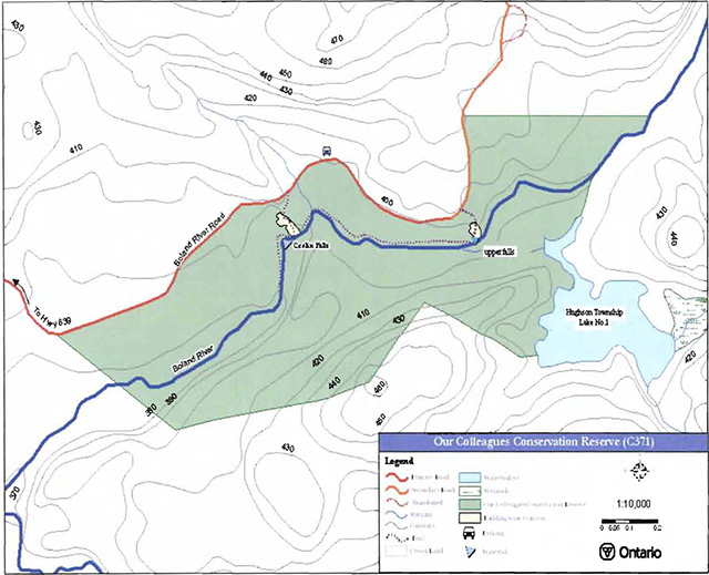
Enlarge map 1: Recreational and other values in Our Colleagues Conservation Reserve.
Map 2: Registered Bear Management and Trapline Areas Encompassing Our Colleagues Conservation Reserve
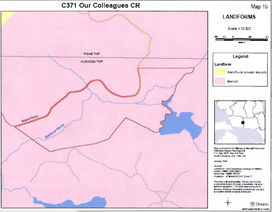
Map 3: Landforms in Our Colleagues Conservation Reserve, according to provincial landform coverage.
(Source: Life Science Checksheet-Step 4 (Cudmore et al. 2004)

Map 4: Forest Communities in Our Colleagues Conservation Reserve.
(Source: Life Science Checksheet-Step 4 (Cudmore et al. 2004))
Appendix B: Our Colleagues Conservation Reserve Photos
Photo 1: Close up of jasper pebble in puddingstone at Ceolin Falls.
(Photo by J. Cywink; June, 2004)
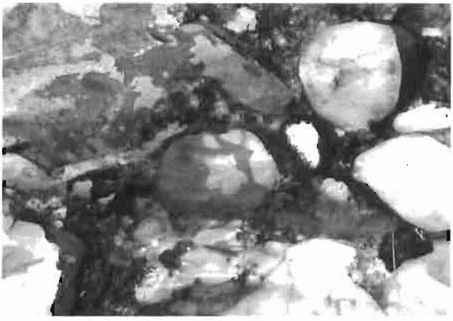
Photo 2: Red belted polypore (Fomitopsis pinicola)
(Photo by J. Cywink; September, 2004)
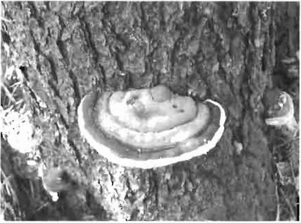
Photo 3: White pines cut down at Ceolin Falls location to form bridge.
(Photo by S. Walsh; June, 2004)
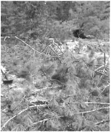
Photo 4: Puddingstone boulder on trail between the upper Boland falls and Ceolin Falls.
(Photo by MNR; July, 2003)
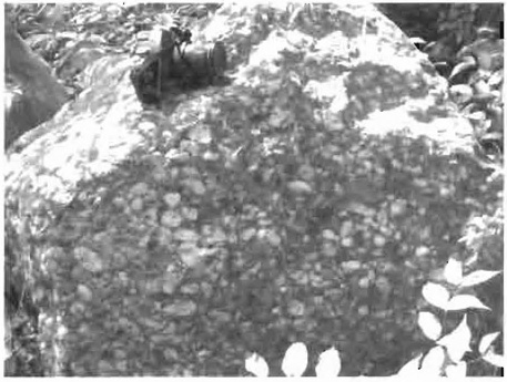
Photo 5: Small sand beach next to the upper falls.
(Photo by J. Cywink; September, 2004)
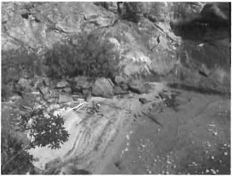
Photo 6: Mushrooms found in clusters on the Boland River Road.
(Photo by J. Cywink; September, 2004)
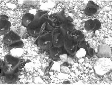
Photo 7: Our Colleagues Conservation Reserve memorial sign, unveiled in September, 2004.
(Photo by MNR; September, 2004)
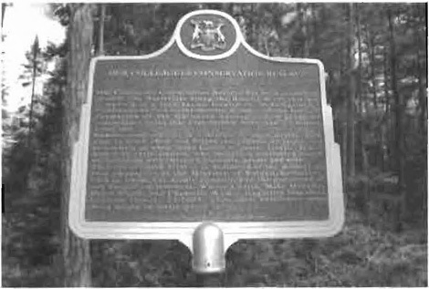
Photo 8: Ceolin Falls memorial plaque
(Photo by MNR; September, 2004)
Appendix C: Test of Compatibility
Test of Compatibility
The Conservation Reserve policy provides broad direction with regard to the permitted uses. The policy provides only an indication of the variety of uses that will be considered acceptable in conservation reserves. Any new uses, and commercial activities associated with them, will be considered on a case by case basis, and, subject to the following test of compatibility. To ensure a standard screening process is followed, reviews of all current and new activities will be subject to the screening criteria as specified by the Environmental Assessment Act (R.S.O. 1900, Chapter E.18).
The following outlines the two steps involved in performing a Test of Compatibility. An assessment of current activities would only follow step two, which focuses on the impacts. An assessment of any new activity would consider the impact of the activity and its conformity to the SCI/RMP.
-
Conformity to SCI/RMP: SCI describe values for which an area has been set aside and the range of appropriate uses that will be permitted in the area. SCI may also speak to the acceptability of other 'new' uses currently not occurring in the area.
The first 'test' is: "do proposed new land uses and/or commercial activities conform to the direction of the SCI/RMP for the conservation reserve? Would the new use(s) depart from the spirit of appropriate indicator land uses in the SCI/RMP?"
- Impact Assessment: If the proposed use(s) pass test 1 it is important to determine their impact on the area before they are approved. This should include the following:
- Impact on natural heritage values: "will the new use(s) impact any natural values in the area? If so how and to what degree? Is it tolerable?"
- Impact on cultural values: "will the new use(s) impact an historical or archaeological values in the area?"
- Impact on research activities: "will the new use(s) affect research activities in the area?"
- Impact on current uses: "will the new use(s) have any negative impact on the array of current uses?"
- Impact on area administration: "will the new use(s) increase administrative costs and/or complexity?" (For example, the cost of area monitoring, security and enforcement).
- Impact on accommodating the use outside the conservation reserve: "Could the use(s) be accommodated as well or better outside the conservation reserve?"
- Impact on socio-economics of the area: "will the new use(s) affect the community(ies) surrounding the area in a positive or negative way?" (For example, will the new use make an area less remote thereby affecting a local tourism industry that is dependent on the area’s remoteness for its appeal?"
- Impact on area accessibility: "does the new use(s) give someone exclusive rights to the area or a portion of the area to the exclusion of other existing uses?"
Appendix D: Summary of Permitted Uses
The following Policy Report was obtained from the Crown Land Use Policy Atlas website during completion of this SCI (February, 2005). Changes may have been made to this policy report since that time. For the most recent version of this policy report, please refer to the Crown Land Use Policy Atlas on the Internet at http://crownlanduseatlas.mnr.gov.on.ca or contact your local Ministry of Natural Resources office.
Ministry of Natural Resources
Crown Land Use Atlas - Policy Report
Identification:
ID: C371
Area Name: Our Colleagues Conservation Reserve
Area (ha): 92
Designation: Conservation Reserve -
District(s): Sault Ste. Marie
Description:
This approximately 92-ha conservation reserve, located along the Boland R1ver in Hughson Township in Site District 4E-3, is of earth science Interest due to the presence of puddingstone conglomerate exposed through the act1ons of the largest waterfall on the Boland River system and a smaller fall upstream. A vegetation community consisting of a jack pine, white pine and red pine mixture covers the site. Since soils are relatively shallow throughout the site, conglomerate surfaces are readily available for viewing where complete lack of vegetation exists.
This area is located upstream from the Mississagi Park Addition (P191) and lies partially within the Whiskey–Quirke Lakes Enhanced Management Area (E232a). The northern boundary parallels the Boland River Forest Access Road and the southern boundary is vectored to correspond with the treed edge of a cutover harvested in 1995. The Boland River bisects the site. There is potential for First Nations' cultural values in the area due to the portages around the falls and potential camping sites at the base of the lower falls.
Land use intent:
Our Colleagues conservation Reserve was regulated on February 27, 2004 by amendment 34/04 to O. Reg. 805/94.
A detailed life and earth science inventory has been prepared for the area. Special protection measures will be considered to prevent the removal of puddingstone conglomerate from this site. These measures will be addressed further In a Statement of Conservation Interest or Resource Management Plan.
Management direction:
Those uses and management activities not 1listed in the following table are governed by existing conservation reserve policy. Over time, the management direction will be elaborated in a Statement of Conservation Interest or Resource Management Plan. Any new uses and/or commercial activities associated with conservation reserves will be considered on a case-by-case basis, and will be required to pass a test of compatibility (Public Lands Act. PL 3.03.05).
Commercial activities
| Activity | Permitted | Guidelines |
|---|---|---|
| Aggregate extraction | No | Special protection measures for the puddingstone conglomerate to be further addressed in the management document for this site. |
| Bait fishing – Existing | Yes | Existing use permitted to continue, unless there are significant demonstrated conflicts. |
| Bait fishing – New | Maybe | New operations can be considered, subject to the "test of compatibility” |
| Commercial fishing – Existing | Yes | Existing use permitted to continue, unless there are significant demonstrated conflicts. |
| Commercial fishing – New | Maybe | New operations can be considered, subject to the "test of compatibility". |
| Commercial fur harvesting – Existing | Yes | Existing use permitted to continue, unless there are significant demonstrated conflicts. |
| Commercial fur harvesting – New | Maybe | New operations can be considered, subject to the "test of compatibility". |
| Commercial Hydro Development | No | |
| Commercial Timber Harvest | No | |
| Commercial Tourism - Existing | Yes | Existing authorized facilities continue, unless there are significant demonstrated conflicts. |
| Commercial Tourism - New | Maybe | New tourism facilities can be considered, subject to the "test of compatibility". |
| Bear Hunting by Non-residents (guided) - Existing: | Yes | Existing authorized operations permitted to continue. |
| Bear Hunting by Non-residents (guided) -New | No | New operations are not permitted. |
| Outfitting Services - Existing: | Yes | Existing authorized operations permitted to continue. |
| Outfitting Services - New: | Maybe | New operations can be considered during the planning for an individual reserve. |
| Outpost Camps - Existing: | Yes | Existing authorized facilities permitted to continue. |
| Outpost Camps – New: | Maybe | New facilities can be considered during the planning for an individual reserve. |
| Resorts lodges - Existing: | Yes | Existing authorized operations permitted to continue. |
| Resorts lodges - New | Maybe | New facilities can be considered during the planning for an individual reserve. New facilities will avoid conservation reserve lands wherever possible. |
| Energy Transmission and Communications - Corridors - Existing: | Yes | |
| Energy Transmission and Communications - Corridors - New | No | |
| Food Harvesting (Commercial) - Existing: | Maybe | |
| Food Harvesting (Commercial) - New | Maybe | |
| Mineral Exploration and Development | No | |
| Peat Extraction | No | |
| Wild Rice Harvesting - Existing: | Yes | |
| Wild Rice Harvesting - New | Maybe |
Land and Resource Management Activities
| Activity | Permitted | Guidelines |
|---|---|---|
| Crown Land Disposition - Private Use: | Maybe | Sale of lands is not permitted, except for minor dispositions in support of existing uses (e.g. reconstruction of a septic system). Renewals of existing leases and land use permits can be permitted. Requests for transfer of tenure can be considered in the context of the Statement of Conservation Interest or Resource Management Plan New leases or land use permits can be permitted for approved activities. Tourism facilities can apply to upgrade tenure from LUP to lease. |
| Crown Land Disposition - Commercial Use: | Maybe | Sale of lands is not permitted, except for minor dispositions in support of existing uses (e.g. reconstruction of a septic system). Renewals of existing leases and land use permits can be permitted. Requests for transfer of tenure can be considered in the context of the Statement of Conservation Interest or Resource Management Plan New leases or land use permits can be permitted for approved activities. Tourism facilities can apply to upgrade tenure from LUP to lease. |
| Fire Suppression | Yes | Fire suppression policies will be similar to adjacent Crown lands, unless alternative fire policies have been developed through a planning process. |
| Fish Habitat Management | Maybe | |
| Fish Stocking | Maybe | Featured species management maybe permitted. |
| Insect/disease Suppression | Maybe | |
| Inventory/Monitoring | Yes | |
| Prescribed Burning | Maybe | |
| Roads (Resource Access) - Existing | Existing roads can continue to be used. Continued use includes maintenance and may include future upgrading. | |
| Roads (Resource Access) - New | New roads for resource extraction are not permitted, with the exception of necessary access to existing forest reserves for mineral exploration and development. | |
| Vegetation Management | Maybe | Featured species management and natural systems management may be permitted. Vegetation management can be considered in a planning process. |
| Wildlife Population Management | Maybe |
Science, Education and Heritage Appreciation
| Activity | Permitted | Guidelines |
|---|---|---|
| Collecting | No | |
| Historical Appreciation | Yes | |
| Nature Appreciation | Yes | |
| Photography and Painting | Yes | |
| Research | Yes | |
| Wildlife Viewing | Yes |
Recreation Activities and Facilities
| Activity | Permitted | Guidelines |
|---|---|---|
| All-terrain vehicle use - on trails: | Yes | Existing use permitted to continue where it does not adversely affect the values being protected. |
| All-terrain vehicle use - off trails: | No | ATV use off trails is not permitted except for direct retrieval of game. |
| Campgrounds | Maybe | |
| Food Gathering | Yes | |
| Horseback Riding (trail) | Yes | Existing use on trails permitted. |
| Hunting | Yes | |
| Mountain Bike Use | Yes | Existing use on trails permitted. |
| Motor boat use - commercial: | Yes | |
| Motor boat use - private: | Yes | |
| Non-motorized recreation travel | Yes | |
| Private recreation camps (hunt camps) - existing | Yes | Existing camps permitted to continue, and may be eligible for enhanced tenure, but not purchase of land. |
| Private recreation camps (hunt camps) – new | No | |
| Rock Climbing | Maybe | |
| Snowmobiling - on trails: existing | Yes | Existing use permitted to continue where it does not adversely affect the values being protected. |
| Snowmobiling - off trails: | Maybe | Snowmobiling off trails is not permitted, except that snowmobiles may be used for direct retrieval of game. |
| Sport Fishing | Yes | |
| Trail Development | Maybe | Development of trails for a variety of activities (e.g. hiking, cross-country skiing. cycling, horseback riding, snowmobiling) can be considered as part of planning for an individual reserve. |
Note: The policies outlined in this table do not supersede any Aboriginal or treaty rights that may exist, or other legal obligations.
/page/crown-land-use-policy-atlas
Management of this conservation reserve will be carried out under the Public Lands Act (1997)
Source of direction:
2003-11: Establishment of Our Colleagues Conservation Reserve
Blind River District Land Use Guidelines (1983)
Appendix E: Regulation Public Consultation Materials
Note that some information in these materials is no longer current - the documents are provided here as a matter of historical record.
64 Church Street
Sault Ste. Marie, ON
P6A 3H3
Telephone: (705) 949-1231
Facsimile: (705) 949-6450
E-mail: serge.teneglia@mnr.gov.on.ca
March 3, 2003
To: Ontario’s Living Legacy Stakeholders
Dear Sir/Madam:
The Ministry of Natural Resources (MNR) is proposing to create a new conservation reserve as a tribute to four MNR employees who lost their jobs while in the line of duty. On January 21, 2003, a helicopter went down while conducting an aerial moose survey north of Sault Ste. Marie. Aboard the aircraft were Chief Helicopter Pilot Mike Maguire, Conservation Officer Walter Ceolin and Resource Technicians Bruce Stubbs and Chantelle Walkey. There were no survivors. The MNR is proposing to create and regulate a new conservation reserve as a permanent memorial to our friends and colleagues who lost their lives while protecting our natural resources.
The proposed conservation reserve has been created to protect a waterfall along the Boland River that is composed of a conglomerate rock known locally as "puddingstone". Protection of the site was a goal for Conservation Officer Walter Ceolin, who believed that the unique earth science value of the "puddingstone fall" was deserving of protection.
Our Colleagues Conservation Reserve would be located approximately 25 kilometers northeast of Elliot Lake in Hughson Township, just east of Mississagi Provincial Park and Addition and the Rawhide Lake Conservation Reserve. The 94-ha site would encompass a section of the Boland River and adjacent shorelands both north and south of the river.
Ultimately, the MNR is intending to propose this site for regulation under the Public Lands Act and as a component of Ontario’s Living Legacy, a broad land use plan which includes a government commitment to the biggest expansion of provincial parks and conservation reserves in Ontario’s history.
Prior to this, however, the MNR is inviting comment on the proposed boundary of the conservation reserve as well as an amendment to the Crown Land Use Atlas from all known potentially affected stakeholders and First Nations from March 3 to April 2, 2003.
Included within this package, you will find a copy of the draft amendment, the proposed policy report, a map of the proposed boundaries of the site and a fact sheet providing background information on the site. The amendment proposal can also be accessed electronically on the Crown Land Use Atlas website at: www.ontario.ca/page/crown-land-use-policy-atlas
In the future and subject to future boundary consultations and the intended regulation of this area as a conservation reserve, the Ministry of Natural Resources will undertake a management planning process to determine the long-term management of this protected area. Depending upon the complexity of issues related to the conservation reserve, management planning may take the form of a simple Statement of Conservation Interest or a more detailed Resource Management Plan. Please let us know if you would like to be notified when planning begins.
Planning, management and permitted uses within this conservation reserve would be consistent with the commitments of the Ontario’s Living Legacy Land Use Strategy.
The Ministry of Natural Resources is collecting comments and information regarding the Crown Land Use Atlas Amendment and draft boundary of the site under the authority of the Environmental Assessment Act to assist in making decisions and determining future public consultation needs. Comments and opinions will be kept on file and may be included in study documentation, which is made available for public review.
Under the Freedom of Information and Protection of Privacy Act (1987), personal information will remain confidential unless prior consent is obtained. However, this information may be used by the Ministry of Natural Resources to seek public input on other resource management surveys and projects. For further information regarding this Act, please contact Tom Mispel-Beyer, Information Management Supervisor, Ministry of Natural Resources, Sault Ste. Marie District (705-949-1231 ext. 288).
If you would like to discuss the amendment and the proposed boundaries for Our Colleagues Conservation Reserve, please contact Sarah Stortz, Ontario’s Living Legacy Resource Technician, Ministry of Natural Resources, 64 Church Street, Sault Ste. Marie, Ontario, P6A 3H3; telephone (705) 949-1231ext. 218, fax (705) 949-6450 , by April 2, 2003. Further information on Ontario’s Living Legacy is available at our office or by visiting the Ministry’s internet website at /page/ministry-natural-resources-and-forestry.
Thank you for your interest.
Yours sincerely,
Serge Tenaglia, RPF
District Manager
Sault Ste. Marie District
ST/ss
Attachments - Fact Sheet, Site Map, Proposed Crown Land Use Atlas Policy Report, Draft Amendment
On peut obtenir Ia version française de Ia présente lettre en s'adressant au bureau du MRN le plus proche, à l'adresse ou au numéro de téléphone ci-dessous.
Our colleagues conservation reserve proposal fact sheet
March, 2003
Background
On January 21, 2003, a helicopter went down while conducting aerial moose surveys north of Sault Ste. Marie. Aboard were Chief Helicopter Pilot Mike Maguire, Conservation Officer Walter Ceolin, and Resource Technicians Bruce Stubbs and Chantelle Walkey. All lives were lost. The Ministry of Natural Resources is proposing to create a new conservation reserve as a tribute to our friends and colleagues who lost their lives while protecting our natural resources.
The proposed conservation reserve would protect a waterfall along the Boland River that is composed of a conglomerate rock known locally as "puddingstone". This waterfall was originally part of a larger, unsuccessful proposal made to the Lands for Life Great Lakes/St. Lawrence Round Table in 1997, that would have created a waterway park on the Boland River. Protection of the site was also a goal of Conservation Officer Walter Ceolin, who believed that the unique earth science value of the "puddingstone fall" was deserving of protection.
Size and location
Our Colleagues Conservation Reserve would be located approximately 25 km northeast of Elliot Lake in Hughson Township, just east of the Mississagi Provincial Park and Addition and the Rawhide Lake Conservation Reserve. The 94-ha site would encompass a section of the Boland River and adjacent shorelands both north and south of the river.
Area highlights
Our Colleagues Conservation Reserve would be located within site district 4E-3, an ecological unit extending roughly from Gogama and Chapleau in the north to Sudbury and Elliot Lake in the south. Located on the Canadian Shield, site district 4E-3 is characterized by a rocky landscape dissected by numerous folds and faults.
This proposed conservation reserve site is of earth science interest due to the presence of bedrock outcrops of puddingstone exposed through the actions of two waterfalls on the Boland River system. Puddingstone is a conglomerate member of the Lorrain Formation of the Huronian Supergroup, which is a Precambrian sedimentary unit consisting mainly of arkose and quartz arenite. The lower unit of this formation, puddingstone consists of a conglomerate of white quartz, black chert and bright red jasper pebbles set in a white matrix of quartz arenite (also known as quartzite). It is this variety of colour that gives the rock its name, as it reminded the early settlers along the north shore of a boiled suet pudding cooked with cherries, currants, plums and nuts. The first written record of the stone came from a party of surveyors in 1820.
There are presently no known outcrops of puddingstone in existing Provincial Parks or Conservation reserves. Our Colleagues Conservation Reserve therefore would provide regionally significant, and possibly provincially significant, representation of this unit.
A vegetation community of mixed jack pine, white pine and red pine covers the site. The Boland River bisects the conservation reserve and is a designated canoe route. There is potential for First Nations cultural values in the area due to the portages around the falls, the potential camping sites, and the site’s proximity to Thunder Mountain, a First Nations' spiritual site to the northwest of the falls.
Land use intent
Conservation reserves are areas of Crown land set aside by regulation made by the Lieutenant Governor in Council under the Public Lands Act.
Conservation reserves complement provincial parks in protecting representative natural areas and special landscapes. Most recreational (e.g. hiking, skiing, tourism related uses, nature appreciation) and nonindustrial (e.g. fur harvesting, commercial fishing and bait harvesting) activities that have traditionally been enjoyed in the area will continue, provided that these uses do not impact on the natural features needing protection. Hunting and fishing are also permitted within all new conservation reserves.
Commercial timber harvesting, mining and mineral exploration, aggregate extraction and commercial energy development are prohibited in conservation reserves. Please refer to Table 4 from the Land Use Strategy for a detailed summary of permitted uses in conservation reserves.
Next steps
Prior to decision-making on the finalization of the boundary of this proposed conservation reserve that will be proposed for regulation under the Public Lands Act and prior to the proposed amendment to the Crown Land Use Atlas, the Ministry is inviting public comment on the proposed boundary as well as an amendment to the Crown Land Use Atlas from all known potentially affected stakeholders and First Nations from March 3 to April 2, 2003.
In the interim, the area has been withdrawn and protected from resource extraction activities such as timber harvesting, hydroelectric development, aggregate extraction and mineral exploration.
In the future and subject to the intended regulation of the area as a conservation reserve, the Ministry of Natural Resources will prepare a long term management plan for this area. Depending upon the complexity of issues within this conservation reserve, management planning may take the form of a simple Statement of Conservation Interest or a more detailed Resource Management Plan. Please let us know if you would like to be notified when planning begins.
Planning, management and policy within this conservation reserve will be consistent with Ontario’s Living Legacy Land Use Strategy.
For more information
For further information on the proposed Our Colleagues Conservation Reserve, please contact Sarah Stortz, Ontario’s Living Legacy Resource Technician, Ministry of Natural Resources, Sault Ste. Marie District (705-949-1231 ext. 218). You may also visit the Ministry’s Internet website at www.ontario.ca/page/ministry-natural-resources-and-forestry for information about Ontario’s Living Legacy. For further information on the Crown Land Use Atlas and amendments, visit the website at: www.ontario.ca/page/crown-land-use-policy-atlas
Appendix F: Amendments to the SCI
Footnotes
- footnote[1] Back to paragraph Ecological site districts are areas characterized by physiographic similarities, and by the successional trends exhibited by the predominant vegetation types on those physiographic features (Hills 1959). See Section 5.0 for more details.
- footnote[2] Back to paragraph Uniform shelterwood stands are defined as follows: A shelterwood system in which the canopy is opened fairly evenly throughout the regeneration area; regeneration is mainly natural, though it may be supplemented artificially; regeneration interval fairly short and resultant crop more or less even-aged and regular (OMNR 2004a).
- footnote[3] Back to paragraph Hardwood stands are defined as follows: pure hardwood stands contain 100% hardwood trees in the canopy; dominant hardwood stands contain less than 10% cover of conifers in the canopy; and predominant hardwood stands contain Less than 20% cover of conifers in the main canopy (Nicholson et al. 2003).
- footnote[4] Back to paragraph Mixedwoods are defined as follows: hardwood mixedwoods are stands dominated by hardwoods with less that 30% cover of conifer in the main canopy; similarly conifer mixedwoods contain less than 30% hardwoods in the canopy. Mixedwoods contain approximately equal percentages of conifer and hardwood trees and true mixedwoods contain a 50:50 split between conifers and hardwoods (Burkhardt et al. 2004).
- footnote[5] Back to paragraph Stocking is a qualitative measure of the density of tree cover in a forest stand. Stocking represents the density of forest stems based on average age, height, canopy closure, and species composition in a forest stand, and is expressed as a percentage (OMNR 2001a).