Crown Land Use Policy Atlas
How to view Crown land use area boundaries, make a map and search for an area-specific land use policy or amendment online.
Overview
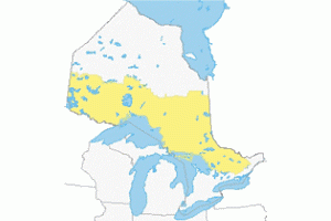
This tool contains area-specific land use policy for Crown lands in Southern, Central and Northern Ontario. This area represents more than 39 million hectares of land and water.
View boundaries, make a map
The Atlas allows users to view Crown land use area boundaries and create maps for a variety of purposes, including recreational.
Read terms of use before using the Atlas
Find a policy report or land use amendment
Use the Atlas to retrieve information on area-specific land use policies or land use amendments.
To find land use policies and land use amendments, click on:
- the Find Information tab at the top of the Atlas
- Policy Reports or Amendment Information to access the respective search tool
Refer to these documents to support your search:
Terms of Use
Acceptance
This website was created by the ministry. Use of this site and any of the data, text, maps and other information on the site (collectively "content") is governed by the terms and conditions set out below ("Terms of Use"). Use of the site implies acceptance of these terms.
Notification
Some of the information in this website may not be compatible with assistive technologies because it is considered unconvertible or has not yet been made accessible. If you need any of the information in an alternate format, please contact the Natural Resource Information and Support Centre.
Disclaimers
The site and its content are made available by the ministry as a public service without warranties of any kind, express or implied. Use of this site and any of its content is at the user’s sole risk. In no event shall the ministry be liable to users or others in any way for any loss, damage or injury, regardless of cause, arising from access to, use of or reliance on this site or any of the content.
Maps in the Atlas are produced with information stored in Ontario’s Land Information Warehouse. Mapped locations for regulated areas, such as Provincial Parks, Conservation Reserves and Crown Game Preserves, are the ministry’s best geographical representation of these areas. Other land use area boundaries, such as general use areas, are based on the best interpretation of the intended boundary.
The Atlas also shows lands not subject to provincial policy, such as national parks, First Nations reserves and private land. Information used for federal lands originates from federal government data. The mapping of private land is not based on detailed survey information and is intended to give only an impression of the general distribution of privately owned land.
The ministry makes no representation or warranty of any kind regarding the site or the content, express or implied, including but not limited to any representation or warranty that: (i) the content is current, accurate, complete, suitable for a particular purpose or reliable; (ii) the site or the content will be secure or available without interruption, error or omission; (iii) errors or omissions on the site or in any of the content will be corrected; (iv) any of the content will be transmitted to users; or (v) the site, related servers or the content are free of viruses or other harmful elements. The content is subject to change without notice.
Users should not rely on any of the content in any instance as authoritative or as an accurate or precise indicator of privately-owned land, a travel route or location of features, or as a guide for navigation. The maps included in the content are illustrative only.
