South Greenhill Lake Sand Delta Conservation Reserve Management Statement
This document provides policy direction for the protection, development and management of the South Greenhill Lake Sand Delta Conservation Reserve and its resources.
February 2005
Prepared by: Angela Anderson
Approval statement
We are pleased to approve this Statement of Conservation Interest (SCI) for the South Greenhill Lake Sand Delta Conservation Reserve (C1533). Direction for the establishment, planning and management of conservation reserves is defined under the Public Lands Act and the Crown Land Use Policy Atlas.
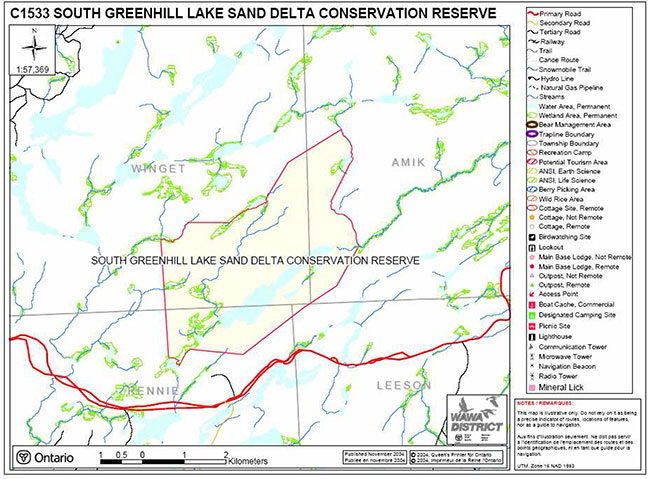
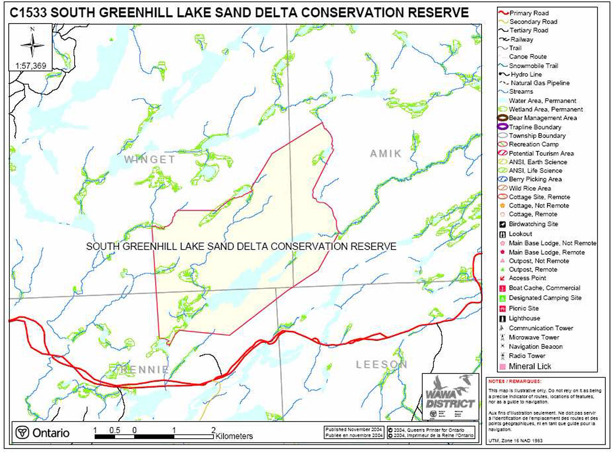
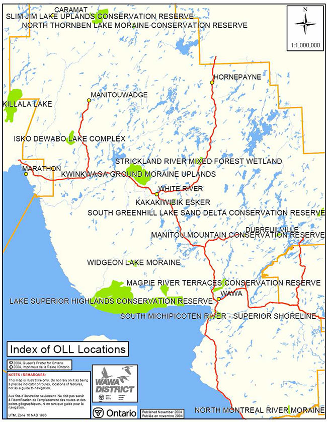
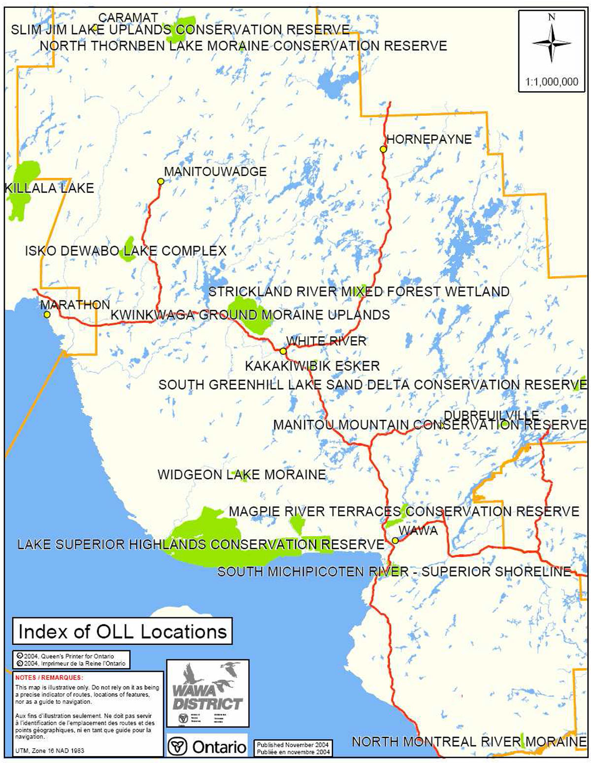
South Greenhill Lake Sand Delta Conservation Reserve is located approximately 45 km northeast of the town of Dubreuilville. The conservation reserve (CR) has an area of 1,463 hectares and is situated in the Chapleau Crown Game Preserve. The CR is within the Magpie Forest Management Unit in the Wawa District.
The public was invited to comment on the proposed boundary of South Greenhill Lake Sand Delta CR in September 2000. The public will be invited to comment on this draft SCI in early 2005. Comments and concerns registered will be reflected in the final Statement of Conservation Interest. A final inspection opportunity will be provided for the public to review the approved SCI document. This document was prepared by an interdisciplinary planning team having expertise in forest ecology, biology, land management, and fire management. A draft was provided to the MNR Regional Planning Unit for review.
This Basic SCI provides guidance for the management of the South Greenhill Lake Sand Delta Conservation Reserve and provides the basis for the ongoing monitoring of activities. More detailed direction is not anticipated at this time. Should significant facility development be considered or complex issues arise requiring additional studies, more defined management direction, or special protection measures, a more detailed Resource Management Plan will be prepared with full public consultation.
The South Greenhill Lake Sand Delta Conservation Reserve is managed under the jurisdiction of the District Manager and the Magpie/Nagagami Area Supervisor, Wawa District, Ministry of Natural Resources.
Submitted by:
original signed by
Angela Anderson
Plan Author
Date: February 24, 2005
original signed by
Terry Taylor
District Manager Recommendation for Approval
Date: February 25, 2005
Approved by:
original signed by
Rob Galloway
Regional Director/Northeast Region
Date: April 10, 2005
1.0 Introduction
The purpose of this Statement of Conservation Interest (SCI) is to identify and describe the values of the South Greenhill Lake Sand Delta Conservation Reserve. The SCI also outlines the activities that occur within the conservation reserve (CR) and provides guidelines for the management of current and future activities in the context of protecting the natural, social and cultural values of the conservation reserve. A SCI is prepared under the authority of Procedural Guideline A – Resource Management Planning (PL Procedure 3.03.05) of the Public Lands Act.
Ontario’s Living Legacy Land Use Strategy (1999) and the Crown Land Use Policy Atlas (updated 2004) outline the general land use policy and management direction for new conservation reserves. Each new conservation reserve will have a planning document, either a SCI or, in more complex situations a Resource Management Plan, that details site-specific management direction.
This Basic SCI provides guidance for the management of the South Greenhill Lake Sand Delta Conservation Reserve and provides the basis for ongoing monitoring of activities. Although more detailed direction is not anticipated at this time, should significant facility development be considered or complex issues arise requiring additional studies, more defined management direction, or special protection measures, a more detailed Resource Management Plan will be prepared with full public consultation.
Conservation reserves protect natural heritage values on public lands while permitting compatible land use activities. By allocating these lands to the parks and protected areas system through regulation, the province has ensured a certain level of permanence by distinguishing the conservation reserve and its values from the larger general use or more extensively managed landscape. In addition, the conservation reserve’s natural features are, and will be available for present and future generations to enjoy and explore.
Ontario’s Living Legacy Land Use Strategy was approved in 1999. The objectives of the Land Use Strategy are to complete Ontario’s system of protected areas; recognize the land use needs of resource-based tourism industry; provide forestry, mining and resource industries with greater certainty around land and resource use; and enhance hunting, angling and other Crown Land recreational opportunities. South Greenhill Lake Sand Delta Conservation Reserve was created as part of the expansion of protected areas.
South Greenhill Lake Sand Delta is a 1,463 hectare conservation reserve located 45 kilometers northeast of the town of Dubreuilville. The boundary falls within the Magpie Forest Management Unit, Wawa District in the townships of Winget, Amik, Rennie, and Leeson (Appendix 8.1). The site provides an interesting landscape of wetlands, rivers, lakes and changing topography.
2.0 Goals and objectives
2.1 Goals of Statements of Conservation Interest
The goals of this SCI are:
- To provide background information
- To identify and describe the values of the conservation reserve
- To provide guidelines for the management of current and future activities while protecting natural, social and cultural heritage values
2.2 Objectives of Statements of Conservation Interest
The following objectives are identified as a means to achieve the above goals.
- To describe the state of the resource with respect to natural heritage values and current land use activities
- To manage the conservation reserve to protect the integrity of its natural values via specific guidelines, strategies and prescriptions
- To meet planning requirements by addressing the management intent of the conservation reserve and addressing planning and management needs
- To create a public awareness of the values within the conservation reserve and promote responsible stewardship of the protected area through partnerships with local stakeholders
- To determine long-term management goals of the conservation reserve by identifying research, client services and marketing strategies
- To identify scientific values on the site in relation to provincial benchmarks and identify the necessary monitoring and/or research to maintain the integrity of those values
- To provide direction to evaluate new uses or economic ventures through the application of a Test of Compatibility (Procedural Guideline B – Land Uses PL 3.03.05 (Appendix 8.2)
3.0 Management planning
3.1 Planning area
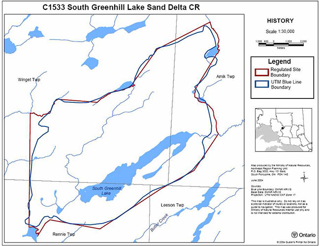
Conservation reserves are established by regulation under the Public lands Act. South Greenhill Lake Sand Delta Conservation Reserve is scheduled to be regulated as a conservation reserve under authority of the Public Lands Act (O. Reg. 805/94). The planning area for this SCI is the regulated boundary of the conservation reserve (there are no Forest Reserves associated with this CR) (Appendix 8.1).
For purposes of Resource Management Planning for other land uses, particularly for Forest Management Planning, the boundary of the conservation reserve in itself will not be treated as a 'value'. Management Prescriptions presented in this plan will relate to the activities within the conservation reserve, will identify the location, shape, size, significance and sensitivity of natural heritage values, and will identify additional special features within the boundary of the site. Management actions outside the boundary of the conservation reserve will continue to consider the site’s natural heritage features, recreational values and protection requirements within larger landscape plans such as management plans.
3.2 Management planning context
The land use intent outlined in Ontario’s Living Legacy Land Use Strategy provides context and direction to land use, resource management, and operational planning activities on Crown Land. Commitments identified in the above strategy and current legislation (PL Procedure 3.03.05) will form the basis for land use within South Greenhill Lake Sand Delta Conservation Reserve. This conservation reserve is also overlain by the Chapleau Crown Game Preserve (CGP2) regulated under the Fish and Wildlife Conservation Act in 1997. Further management direction for this conservation reserve is provided in the Policy Report for the Chapleau Crown Game Preserve. For up-to-date information on permitted uses, refer to the Crown Land Use Atlas at /page/crown-land-use-policy-atlas.
Existing permitted uses within the conservation reserve may continue, unless they are shown to have a significant negative impact on the values within the site. By regulation, this reserve cannot be used for mining, commercial forest harvest, hydroelectric power development, peat/aggregate extraction or any other industrial use. The conservation reserve has been withdrawn from the Magpie Forest Sustainable Forestry Licence (SFL) and commercial forestry will no longer occur within its regulated boundaries. Fish and wildlife management activities will generally occur in a manner similar to surrounding crown lands under the guidance of the Chapleau Crown Game Preserve Management Plan.
Proposed uses and development within the conservation reserve will be reviewed on a case-by-case basis. See section 6.0 and Appendix 8.3 for more details.
3.3 Planning process
The level of management planning required to fulfill protection targets is determined by the complexity of issues that need to be addressed. This SCI will only address known issues or current proposals with respect to permitted uses or potential economic opportunities brought forward during the planning process. Future proposals for development or land use will be reviewed through a Test of Compatibility.
The planning process for the South Greenhill Lake Sand Delta Conservation Reserve involves three public consultation phases. In September 2000, notices appeared in the newspapers for the public review of the boundaries of new protected areas.
Notices will invite anyone interested to request a copy of the draft Statement of Conservation Interest during a one month review period early in 2005. Any comments, including input from previous consultation, will be considered in the finalization of this document. The SCI will also be reviewed by Ministry of Natural Resources (MNR) district and regional staff.
The final public consultation phase will be an inspection of the MNR-approved Statement of Conservation Interest. All participants in the planning process will be notified of plan approval and can request copies of the plan to see how their comments were addressed. Following this consultation, the plan will be implemented.
Notices will not be placed on the Environmental Registry because this SCI is not considered a policy under the Environmental Bill of Rights.
4.0 Background information
4.1 Location and site description
The South Greenhill Lake Sand Delta Conservation Reserve is situated approximately 45 km northeast of the town of Dubreuilville. The boundary is marked by features such as rivers, small lakes and wetlands as well as vectored boundaries (Appendix 8.1). Access to the CR is available only by aircraft. Location and administrative information is presented in Table 1.
Table 1: Location and Administrative Details for South Greenhill Lake Sand Delta Conservation Reserve
| Territorial District | Algoma |
|---|---|
| OMNR Region/District | Northeast/Wawa |
| Townships | Winget, Amik, Rennie, Leeson |
| Ecoregion/Ecodistrict (Hills, 1959; Crins, 2000) | 3E (Lake Abitibi)/3E-5 (Wawa) |
| Regulation Date | Scheduled for 2005 |
| Total Area | 1,463 hectares |
| Ownership | Crown |
| UTM Coordinates | 5372000N 729000E |
| Map Number(s) | 42B/05 (Missinaibi Lake) |
| Nearest Town/Community | Dubreuilville |
| OBM Numbers | 2017280053600 - 2017280053700 |
| Wildlife Management Unit | 32 |
| Forest Management Unit | Magpie Forest |
The South Greenhill Lake Sand Delta Conservation Reserve contains a variety of interesting landform features including wetlands, rivers, lakes, and glacial deposits. The conservation reserve has medium diversity and it is in excellent condition due to its remote location. The changing topography of upland and lowland areas provide an interesting landscape for recreational opportunities and a suitable habitat for a variety of flora and fauna.
The conservation reserve is located in Ecodistrict 3E-5 which is characterized by gently rolling plains of thinly covered rock knobs, sandy outwash and silty depressions (Hills, 1959; Crins, 2000). Material is generally acidic (granitic), locally overlain by low-base and low lime material. The surficial geology is characterized by Bedrock-Drift Complex where the drift is till deposit (Unit 2a), predominant till deposits with bedrock showing through (Unit 3, 2a), and Organic Deposits (Unit 9) (Kristjansson, 2004).
The ecoregion climate type is moderate microthermal, moist humid, southern boreal with the area generally receiving more than 900 mm of precipitation annually. The forest of this ecoregion (3E) is typically boreal including trembling aspen, white birch, and balsam poplar in the early successional stages and black spruce, white spruce and balsam fir in the late successional stages (Hills, 1959).
The conservation reserve is located in the tertiary watershed 4LH of the Moose River Basin (OMNR, 2002).
The conservation reserve is located in the Missinaibi-Cabonga section of the Boreal Forest Region (Rowe, 1972). The Forest Resource Inventory (FRI) data for this site primarily shows white birch mixedwood, black spruce predominant conifer, and black spruce dominant conifer. Other forest communities present include jack pine dominant, trembling aspen dominant and white spruce mixedwood (Cudmore, 2004). Other species occurring on the site in low numbers are maples and supercanopy white pine (Burkhardt, 2003). Fire disturbance has created a fairly even aged distribution. There are three age groups in the site; two dominant age classes are 60-89 and 90-119. The third age class represented is 120-149 years (Cudmore, 2004).
4.2 History of the site
South Greenhill Lake Sand Delta CR was identified for its life science values (landform vegetation combinations) through the Ontario’s Living Legacy (OLL) Land Use Strategy (1999).
The conservation reserve is within the area used by the Missinabie Cree First Nation. The site is in the area covered by the Nishnwabe Aski Nation (NAN) territory and Treaty #9 area.
Disturbance in the South Greenhill Lake Sand Delta Conservation Reserve is pristine (area less than 1% of the CR is disturbed); there has been no road development, harvesting, aggregate or mineral extraction. There is an outpost camp on the southwest tip of South Greenhill Lake that is leased by Hawk Air for remote tourism (Cudmore, 2004). A forest fire burned all but the northern most parts in 1923 (Cudmore, 2004).
4.3 Inventories
Table 2 illustrates the inventories/surveys completed for South Greenhill Lake Sand Delta CR, as well as any future requirements for earth and life sciences, cultural, recreational or other categories. The detailed Life (Cudmore, 2004), and Draft Earth Science Inventory Checklist (Kristjansson, 2004) and sections 4.1 and section 5.0 describe the key features of the CR.
Table 2: Inventory and Survey Information for South Greenhill Lake Sand Delta Conservation Reserve
| Survey Level | Earth Science | Life Science | Cultural | Recreational |
|---|---|---|---|---|
| Reconnaissance | Kristjansson, F.J. 2004. Draft Earth Science Inventory Cheeklist. | Cudmore, W. and S. Longyear. 2004. South Greenhill Lake Sand Delta Conservation Reserve (C1533) Life Science Checksheet – Step 2. | None | East, S., 2004, South Greenhill Lake Sand Delta Conservation Reserve (C1533) Recreation Resource Inventory Report. |
| Detailed | None | None | None | None |
| Requirement | None | Comparison with current provincial landform layers to determine site significance. | None | Recommend monitoring |
5.0 State of the resource
This section will identify the state of the resource within, bordering or crossing the boundary of the site. The state of the resource will include the natural heritage values present within the site and those values that are adjacent to but within the CR boundary or that may cross the conservation reserve’s boundary within the general use area where an artificial vectored boundary exists. Current land use activities including tenure and past and current development within the planning area will also be discussed.
5.0.1 Features Represented in this Conservation Reserve
South Greenhill Lake Sand Delta Conservation Reserve is comprised of forest lands, lake and creek systems, and wetland complexes. This site was originally identified for its life science values, specifically landform/vegetation combinations, through the OLL Land Use Strategy. The FRI data shows that white birch mixedwood, black spruce predominant conifer, and black spruce dominant conifer comprise a large portion of the forest communities in conservation reserve (Cudmore, 2004). There are also some instances of Great Lakes Saint Lawrence forest species such as maple and supercanopy white pine within the conservation reserve (Cudmore, 2004). Stands that remained after the 1923 fire are in a state of decline (Cudmore, 2004).
The quaternary geology of Ontario coverage suggests that the CR is dominated by glaciofluvial ice-contact deposits specifically weakly broken deep lacustrine deltaic sand plain. However, according to Rik Kristjansson, OLL Geologist (2004) there are no instances of sand delta within the conservation reserve. The area is underlain by metavolcanic rock at the north and east boundaries and the rest of the site is underlain by granitic rock. The surficial geology consists of bedrock terrain of till deposit, till deposit with bedrock outcroppings, and organic deposits (Kristjansson, 2004).
Wetlands in this conservation reserve include a mixture of open water marsh, meadow marsh, poor fen, semi-treed bog, graminoid shore fen, tall shrub shore fen, and conifer swamp (Cudmore, 2004). Open water marsh with spikerush and bulrush was found on the north corner of South Greenhill Lake (Cudmore, 2004). South Greenhill Lake contains cold water species and the water colour is brown and clear.
5.0.2 Quality of features represented
The quality of the representation and the current characteristics of the natural features found within the conservation reserve are as important as the overall representative features that are being protected. A number of factors are considered in the evaluation of the site, including; diversity, ecological factors, condition, special features and current land use activities.
Diversity
Diversity is a measure of the site’s life and earth science variability. It is based on the number and variety of natural landscape features and earth science values. Based on the size of the site, the number of forest units and land form features, the diversity of South Greenhill Lake Sand Delta CR is considered to be low (Cudmore, 2004). Ontario Parks analysis identifies 16 landform:vegetation combinations when considering the forest communities wetlands and some aggregate resources (Cudmore, 2004). Values such as South Greenhill Lake, wetlands associated with lakes and creeks, microhabitats, and natural succession pathways will also contribute to the diversity of the site. The true diversity will be determined once earth science data has been confirmed.
Evenness is the number of communities that control the vegetative nature of the site. The South Greenhill Lake Sand Delta Conservation Reserve is moderately skewed (30- 59%) towards pure white birch or white birch dominated hardwood mix (BW1), black spruce pure upland (may contain jack pine) (SP1), and lowland pure black spruce, or black spruce dominated conifer lowland (SB1) forest communities (Cudmore, 2004)
Ecological factors
Ecological factors are significant to the quality of representation within the reserve and include size, shape, sensitivity to potential disturbances, and current linkages to the larger landscape.
The current boundary of the conservation reserve captures many of the landform and vegetation communities within the site. While some of the conservation reserve boundary follows natural features a large portion of the boundary is vectored. Vectored boundaries can weaken the site’s ability to protect against adjacent land uses such as harvesting. Consideration should be given to the inclusion of a section north of the current site boundary (Cudmore, 2004). An addition such as this would allow the boundary to follow a creek system and two lake shorelines to add a sufficient addition and more biological boundaries. The addition would also protect pure white birch/white birch dominated hardwood mix (BW1), pure jack pine (PJ1), SB1, and SP1 forest communities (Cudmore, 2004). Future activities around the conservation reserve should be monitored carefully through sustainable management planning such as the Magpie Forest Management Plan.
Condition
Disturbance within the South Greenhill Lake Sand Delta Conservation Reserve is ranked as pristine. There are no roads, or harvests on the site. The only human disturbance is a fly-in outpost camp on South Greenhill Lake which only supports a couple of people at one time. Natural disturbance includes damage from a spruce budworm infestation, forest tent caterpillar, windthrow and fire in 1923 (Cudmore, 2004).
Special features
There are no known significant wildlife features or habitat for vulnerable, threatened, or endangered (VTE) species in the conservation reserve. The site is in excellent shape due to its remote location and poor accessibility. The changing topography with a mix of upland and lowland areas in the south and along the east side of the river provides an interesting landscape. Lowland areas consist of black spruce and the wetlands and uplands consist of white birch (Cudmore, 2004). During aerial reconnaissance Burkhardt (2003) observed a red tailed hawk in the conservation reserve.
Current land use activities
Current land use activities are limited to fishing, wildlife viewing and boating. There is an outpost camp on the south end of South Greenhill Lake that is leased by Hawk Air and operated as a remote tourism location.
5.1 Social/economic interest in the area
Linkage to local communities
This conservation reserve contributes to the local communities by providing a pristine wilderness environment within a game preserve. This location provides a remote tourism opportunity for a Wawa based business (Hawk Air) which indirectly benefits the local economy.
Heritage estate contributions
South Greenhill Lake Sand Delta CR contributes to the province’s parks and protected areas by preserving a number of natural heritage values mentioned in the previous section (5.0). The lack of industrial disturbance and current land use in the CR will help to ensure that fragile vegetation communities, significant geological features and waters are protected into the future.
Aboriginal groups
The conservation reserve is within the area traditionally used by the Missinabie Cree First Nation. There are no known values located within the conservation reserve boundaries.
Mining industry and Ministry of Northern Development and Mines
This conservation reserve has no mining tenure within it. According to the 1998 MNR Protected Areas Summary Report (E74), mineral resource assessment in 34% of the site was low/moderate and 66% was moderate.
5.2 Natural Heritage Stewardship (vegetative/plant community management and earth science value protection)
The life science targets achieved by the creation of this site are currently unknown and need to be revisited in order to incorporate new landform interpretations. The earth science features found in the CR are considered locally significant (Kristjansson, 2004). The geological features described for this CR are commonly encountered within the surrounding region (Kristjansson, 2004). The sand delta plains are not present in the CR and the site is dominated by bedrock-drift complex with till in lower elevations.
There is no present monitoring or research program being conducted in conjunction with this conservation reserve.
Current fire management is concurrent with that practiced on adjacent crown land. Management strategies are described in section 6.2 State of the Resource Management Strategies. Insect damage to deciduous trees by the forest tent caterpillar and to balsam fir trees by the spruce budworm has been recognized in the conservation reserve (Cudmore, 2003). No management plan has currently been initiated to control damage caused by these pests.
Continued monitoring or further studies on lakes or rivers in the conservation reserve have not been identified.
5.3 Fisheries and wildlife
The Chapleau Crown Game Preserve is home to 119 species of birds including bald eagle, osprey, great blue heron, and common loon. A red tailed hawk was identified over the conservation reserve during aerial reconnaissance (Burkhardt, 2003). There are 49 species of mammals in the preserve including black bear, timber wolf, mink, pine marten, lynx, snowshoe hare, otter, beaver, and moose. Beaver activity was noted on South Greenhill Lake in the 1980 lake survey file and also on the South Greenhill River during aerial reconnaissance in 2003. The current Magpie Forest Management Plan (2004) has designated an area including and surrounding the conservation reserve (5022.3 ha) as a marten core area for the next three 20 year terms.
A lake survey was conducted on South Green Hill Lake in 1980. Aquatic fauna captured in the lake include: lake herring, white sucker, brook trout, lake chub, common shiner, pearl dace, fathead minnow, and crayfish. During aerial reconnaissance in 2003 a boat was seen stashed at the small lake immediately upstream of South Greenhill Lake with a portage trail between the outpost cabin and the small lake. This suggests that there are fishing opportunities at this location as well.
There have been no recent inventories performed for vulnerable, threatened and endangered (VTE) species at risk. There are no known VTE species or habitats within the conservation reserve. Additional studies and subsequent development of protection/restoration plans would be conducted if warranted.
5.4 Cultural Heritage Stewardship
There are no known values located within the boundaries of the conservation reserve at this time.
5.5 Land use/current or past development
As described in previous sections, past land use has been low. There is one small cabin in the CR that is leased by Hawk Air through a land use permit. The conservation reserve rests on Crown Land and is unencumbered by any mining claims. No further management actions, such as acquisitions or restrictions on existing use, are required.
5.6 Commercial use
South Greenhill Lake Sand Delta CR is not part of any traplines or bear management areas. Three baitfish areas also come within the boundaries of the conservation reserve (WA-51, WA-52 and WA-55) however they are inactive. The previous client (2003) for WA-51 alleges that baitfish are not present in large enough supply in this area.
There is no other known commercial use associated with this area.
5.7 Tourism/recreation use/opportunities
Tourism and/or recreational opportunities in this conservation reserve are currently very low due to its inaccessibility. Fishing and remote tourism currently exist within the conservation reserve based out of the outpost camp on the south end of South Greenhill Lake. There is potential for tourism/recreation use to develop in the future. Hiking trails could potentially be developed in the future and camp sites could be cleared to allow for back country camping experiences. These activities would have to be proven not to decrease the value of the remote tourism opportunities currently existing and they would have to pass a Test of Compatibility.
There are no current proposals submitted for recreational development.
5.8 Client services
No infrastructure or interpretive facilities are proposed for the site. Informal wildlife viewing and nature appreciation can continue without further development.
6.0 Management guidelines
6.1 Management planning strategies
The land use intent outlined in Ontario’s Living Legacy Land Use Strategy and the Crown Land Use Policy Atlas provides context and direction to land use, resource management, and operational planning activities on Crown Land. Commitments identified in the above strategy and current legislation (PL Procedure 3.03.05) will form the basis for land use within South Greenhill Lake Sand Delta Conservation Reserve. For up-to-date information on permitted uses refer to the Crown Land Use Policy Atlas at /page/crown-land-use-policy-atlas. See Appendix 8.3 for a summary of permitted uses in South Greenhill Lake Sand Delta Conservation Reserve.
Existing permitted uses within the conservation reserve may continue, unless they are shown to have a significant negative impact on the values within the site.
Proposed uses and development within the conservation reserve will be reviewed on a case-by-case basis. A Test of Compatibility (Appendix 8.2) must be passed before they are deemed acceptable. The emphasis will be on ensuring that the natural values of the conservation reserve are not negatively affected by current or future land use activities. Therefore, any application for new specific uses will be carefully studied and reviewed. The Ministry of Natural Resources, partner organizations and/or proponents may undertake such studies. Applicable environmental assessment requirements will also be met according to A Class Environmental Assessment for MNR Resource Stewardship and Facility Development Projects (upon its approval, A Class Environmental Assessment for Provincial Parks and Conservation Reserves will apply). Authorization for potential compatible uses will be in the form of a Land Use Permit or a Licence of Occupation.
6.2 State of the resource management strategies
Natural Heritage Stewardship – Vegetative/plant community management and earth science value protection
This conservation reserve will be managed by allowing vegetative communities to develop while existing traditional and recreational uses continue. Monitoring of sensitive wetland complexes may be necessary depending on the degree of recreational use.
The MNR recognizes fire as an essential process fundamental to the ecological integrity of conservation reserves. In accordance with existing Conservation Reserve Policy and the Forest Fire Management Strategy for Ontario, forest fire protection will be carried out as on surrounding lands.
Whenever feasible, the MNR fire program will endeavor to use "light on the land" techniques, which do not unduly disturb the landscape, in this conservation reserve. Examples of light on the land techniques may include limiting the use of heavy equipment or limiting the number of trees felled during fire response efforts.
Opportunities for prescribed burning to achieve ecological or resource management objectives may be considered. These management objectives will be developed with public consultation prior to any prescribed burning, and reflected in the document that provides management direction for this conservation reserve. Plans for any prescribed burning will be developed in accordance with the MNR Prescribed Burn Planning Manual (OMNR, 1997), and the Environmental Assessment Act (R.S.O. 1990, Chapter E.18).
Personal use permits for wood harvesting are not permitted. Salvage of standing, fallen, or sunken dead trees will not be permitted, except when authorized in conjunction with approved maintenance activities.
The collection/removal of vegetation and parts thereof (including Taxus Canadensis) will not be permitted. However, subject to a Test of Compatibility (Appendix 8.2), the Area Supervisor may authorize the collection of plants and/or parts for the purposes of research or scientific study within the reserve if required.
Forest renewal by artificial means will not be appropriate for a natural area. Similarly control of native pests will not be permitted. Programs may be developed to control invasive non-native forest insects and diseases in the conservation reserve where they threaten significant values in or adjacent to the site. Where insects or disease threaten significant values, in or adjacent to the site, control will be directed as narrowly as possible to the specific insect or disease. Biological control will be used whenever possible. If this circumstance should arise the control method would undergo a Test of Compatibility (Appendix 8.2).
All earth and life science features will be protected by defining compatible uses, enforcement direction through applicable legislation, and monitoring and mitigating issues. Industrial activities such as; timber harvesting, prospecting, mining, and new hydro generation will not be permitted within the boundaries of the conservation reserve. Energy transmission, communication and transportation corridors or resource roads or construction of facilities are discouraged, through existing planning process. Exceptions based on a Test of Compatibility (Appendix 8.2) may be made for minor structures.
Ontario Ministry of Natural Resources will provide leadership and direction for maintaining the integrity of this site as a natural heritage estate. Research, protection, education and understanding and interpretation of the natural heritage features of the site will be encouraged and fostered through local and regional natural heritage programs and initiatives.
Fisheries and wildlife
Fish and wildlife resources will continue to be managed in accordance with policies and regulations prevailing in the area and under the direction of the Magpie/Nagagami Area Supervisor. Provincial legislation and policy will dictate management and enforcement objectives for this area.
Existing sport fishing by outfitters' clients and the general public will be permitted. Hunting will not be allowed in this conservation reserve as it is governed by overlying regulations of the Chapleau Crown Game Preserve in which no hunting or trapping is permissible. No new commercial outfitting, outpost, hunting camps or new trap cabins will be permitted within the boundaries of the conservation reserve. The introduction of exotic and/or invasive species will not be permitted.
Cultural heritage
Should the MNR consider new structural development, significant clearing of vegetation or altering of land within this conservation reserve, the MNR will adhere to the cultural heritage resource screening process as is identified in its Memorandum of Understanding (MOU) with the Ministry of Culture (MCL). While the purpose of this MOU is to provide a process to identify and protect cultural heritage resources when the MNR is reviewing work permits or disposing of Crown rights under the authority of the Public Lands Act, the considerations and criteria would also enable the MNR to identify high potential cultural heritage areas for other purposes within conservation reserves. If the screening process indicates that the site of a proposed activity is within an area of high cultural heritage potential, the MNR will consult with the MCL to determine the appropriate cultural heritage assessment requirements and will ensure a preliminary archaeological assessment if appropriate.
All aboriginal and treaty rights will continue to be respected and are not affected by the establishment of this conservation reserve.
Any future proposals or decisions that have potential impact(s) on the individual or aboriginal or community values will involve additional consultation with the affected aboriginal groups.
Social/economic
Under the Ontario Living Legacy Land Use Strategy, mining and related access will be allowed in a forest reserve (FR). For those activities that could negatively influence the natural heritage values within the FR and/or the CR, the district will work with the proponent to identify and mitigate potential mining or natural heritage concerns.
Mining will not occur in any portion of the regulated conservation reserve boundary.
Land use/past and existing development
Conservation reserve regulations do not permit mining, commercial forest harvesting, hydroelectric power development, the extraction of aggregate and peat or other industrial uses (Public Lands Act, Ontario Regulation 805/94).
The sale of Crown Lands within the conservation reserve is not permitted.
New recreation camps will not be permitted however; existing recreation camps will be permitted to continue. Existing camps may be eligible for "enhanced" tenure, but are not eligible for purchase of land. There are two forms of enhanced tenure that may be considered:
- Upgrade in the nature or type of tenure (e.g. from Land Use Permit to a lease); and/or
- An extension in the term of the tenure (e.g. from 1 year to 10 years)
Applications for enhanced tenure will be approved if determined acceptable using a screening criteria. A change in tenure does not convey a commitment to provide for, or agree to, a change in the type or the standard of existing access to the recreation camp.
Unauthorized occupations of lands within the conservation reserve will be handled in accordance with approved policy, and any required structural removal will be at the owner’s expense.
New roads for resource extraction and/or private use will not be permitted, nor will additions to existing roads or upgrading of existing private roads be permitted.
New trails are not encouraged, however thy may be considered when compatible with other recreational uses and the maintenance of environmental integrity. Any new trail development must go through a Test of Compatibility (Appendix 8.3) to ensure the quality of the life and earth science representation and any additional values (e.g. aesthetics, landscape views, sensitive areas, and remote tourism) are maintained.
Use of existing authorized ATV and snowmobile trails will be permitted to continue as long as they do not impair the natural features and values for which the area is identified and there are no significant environmental impacts. Consideration for new ATV and snowmobile trails will occur on a case-by-case basis. Public consultation will be an important part of the process. Non-trail snowmobile and ATV use will be permitted only for the direct retrieval of game and/or bait.
The use of existing unauthorized trails will be monitored to ensure that conservation reserve values are not being adversely impacted. Depending on the results of the monitoring, some of the unauthorized trails may need to be redirected from sensitive areas or eliminated completely.
The district may sometime in the future consider developing a trails strategy to ensure the values within the conservation reserve are fully protected while maintaining current permitted uses to occur.
Facility infrastructure and development for recreation may be considered in the future if there is a demonstrated need for such facilities. A more detailed management plan would be required prior to construction.
Commercial use
Existing baitfish harvesting will be permitted to continue. Renewals and transfers will also be permitted. New operations can be considered, subject to the Test of Compatibility. Baitfish harvesting will continue to be monitored in order to ensure it does not deplete natural resources and that it imposes a minimal impact on the features identified for protection. Any new trails associated with baitfish harvesting must be considered subject to a Test of Compatibility.
Trapping and bear hunting operations are not permitted in this conservation reserve since it falls under the management direction of the Chapleau Crown Game Preserve.
Commercial wild rice harvesting will not be permitted. Other commercial food collection will also be prohibited; particularly mechanical blueberry harvesting methods that can damage plants and deplete the crop available for recreational pickers.
Tourism/recreation
Tourism proposals will be assessed on a case-by-case basis and approved if compatible with natural values and other uses that may exist at the time.
Blueberry picking and other food gathering will continue to be permitted on a recreational basis.
Client services
The focus will remain on low key information and self-interpretation of conservation reserve features. Messages should focus on the area’s natural heritage features, recreation opportunities, nature appreciation and education.
At the present time there are no plans for structural development within this conservation reserve.
6.3 Specific feature/area/zone management strategies
There are no known specific features in the conservation reserve that require special attention or management at this time. The area has low sensitivity except for the moderately extensive organic area along the southeast of South Greenhill Lake where ATV traffic can negatively affect the landform condition (Kristjansson, 2004). Wetlands as a sensitive feature to disturbance should be analysed for provincial significance and managed accordingly.
The South Greenhill Lake Sand Delta CR has not been delineated into zones for management of a specific resource. Zoning of the CR for management of special features will require an amendment to this SCI. Research in the CR will be encouraged, and some research activities could conceivably require special conditions such as elimination of noise or restrictions on harvesting of wildlife.
6.4 Monitoring, assessment and research
Further analysis and classification of the vegetative communities and landform layers to determine the site’s significance and contribution to the parks and protected areas program should be considered in any future assessment of the conservation reserve. The state of the CRs resources should be monitored to report on changes such as natural disturbances, human disturbances, and management prescriptions within and adjacent to the conservation reserve (Cudmore, 2004).
Further review is recommended for the inventory and monitoring of life and earth science, and recreational features within the conservation reserve.
The Chapleau Crown Game Preserve has been used for wildlife research for many years. Moose, bear, small mammal, breeding birds and wildlife parasitology are examples of research that has been done in the preserve. Traditional non-hunting and trapping aspects of the Chapleau Crown Game Preserve led to increased population levels of certain wildlife species such as moose, black bear, marten, fisher and lynx (Chapleau Crown Game Preserve Wildlife Management Plan 1985 – 2000). Wildlife has been transferred from the game preserve to other areas in Ontario and in the United States. An example occurred in 2003 during the marten relocation program to transfer marten from the game preserve to areas in the United States (personal communication with Lynn Landriault, 2004). Eight river otters (Lontra Canadensis (Schreber)) were live trapped and relocated from the Chapleau Crown Game Preserve to Missouri and Nebraska in exchange for wild turkeys (Meleagris gallopavo (L.)) for southern Ontario. In 1989, twenty-five female and twenty-five male martens (Martes americana (Turton)) were live trapped and transferred from the Chapleau Grown Game Preserve to the state of Vermont. Marten were considered an endangered species in Vermont due to deforestation and over harvesting.
Although not native to the Game Preserve, there may be elk wandering about the preserve. In 1933, approximately 60 elk were released by the Canadian National Railway near Peterbell. Although rarely observed, tracks and antlers are occasionally found. The exact number of remaining elk in the area to date is unknown.
Consideration will be given to inventory and documentation of natural and cultural values, and the assessment of use/activity impacts. All research will be carried out in a non-destructive manner. Research proposals must follow Procedural Guideline C – Research Activities in Conservation Reserves (PL 3.03.05).
Research, education and interpretation will be encouraged to provide a better understanding of the management and protection of the natural heritage values and will be fostered through local and regional natural heritage programs, initiatives and partnerships.
6.5 Implementation and plan review strategies
Management of the CR will be done largely using a "hands-off" approach. For the short term, the forest community will develop, and low impact activities described in the plan will continue. Emphasis will be placed on awareness information highlighting conservation reserve values and appropriate uses.
Priorities will include:
- Maintaining the quality of life science representation features such as red tailed hawk habitat, while providing for the needs of recreation and other users
- Monitoring impacts of existing recreation use on the conservation reserve to ensure adherence to the management guideline and mitigating any negative effects
- Working with adjacent SFL holders and stakeholders to protect important values (e.g. remote tourism) that may be disturbed as a result of the vectored boundaries
South Greenhill Lake Sand Delta Conservation Reserve SCI will be reviewed on an ongoing basis as there is no formal review or expiry date for the document. This SCI will be amended through a standard process of minor and major amendments. Minor amendments will be processed in a relatively informal manner and will require the approval of the Magpie/Nagagami Area Supervisor. These amendments will deal with uses and activities that do not affect any of the policies in this SCI (e.g. new uses and/or activities that are consistent with existing permitted uses).
Uses and/or activities that were not anticipated in the approved SCI and which may have an impact on the values of the conservation reserve will require a major amendment. In assessing major changes, the need for a more detailed Resource Management Plan will first be considered. This will include an opportunity for public comment and input and will require the approval of the Wawa District Manager and the Regional Director.
This SCI or future RMP, if required, plus the Crown Land Use Atlas and associated website (/page/crown-land-use-policy-atlas) will be amended to reflect any changes in management direction.
6.6 Marketing Strategies
The site will be more generally promoted as part of the Parks and Protected Areas initiative, and at the current time information on the South Greenhill Lake Sand Delta CR is available worldwide on the Crown Land Use Policy Atlas website at (/page/crown-land-use-policy-atlas).
Marketing activities will be kept to a minimum and there are no plans to actively promote the area for research or commercial purposes such as tourism at this time.
7.0 References
Burkhardt, B. 2003. C1533 Aerial Reconnaissance Field Notes, OMNR.
Crins, W.J. 2000. Ecoregions of Ontario: Modifications to Angus Hill’s Site Regions and Site Districts – Revisions and Rationale.
Cudmore, W. and S. Longyear. 2004. South Greenhill Lake Sand Delta Conservation Reserve (C1533) Life Science Checksheet – Step 2.
East, S. 2004. South Greenhill Lake Sand Delta Conservation Reserve (C1533) Recreation Resource Inventory Report.
Hills, G. 1959. A ready reference to the description of the land of Ontario and its productivity.
Kristjansson, F.J. 2004. Draft Earth Science Inventory Checklist South Greenhill Lake (C1533).
Ontario Ministry of Natural Resources (OMNR). 1984. Chapleau Crown Game Preserve Wildlife Management Plan 1985-2000.
Ontario Ministry of Natural Resources (OMNR). 2002. MNR districts and major basins of Ontario.
Ontario Ministry of Natural Resources (OMNR). 1997. MNR Prescribed Burn Planning Manual
Rowe, J.S. 1972. Forest Regions of Canada.
8.0 Appendices
8.1 Maps
8.1.1 Recreation inventory map
Enlarge 8.1.1 Recreation inventory map
8.1.2 Site location map
Enlarge 8.1.2 Site location map
8.1.3 Boundary map
8.2 Procedural guideline B – Land Uses – Test of Compatibility
(PL Procedure 3.03.05)
The Conservation Reserve policy provides broad direction with regard to the permitted uses. The policy provides only an indication of the variety of uses that will be considered acceptable in conservation reserves. The only caution is that "any new uses, and commercial activities associated with them, will be considered on a case by case basis, and, they must pass a test of compatibility to be acceptable." What does a 'test of compatibility' mean?
An examination of this must start from the premise of why an area is set aside – specifically, its representative natural heritage values. Criteria are then identified to guide compatibility considerations. These criteria apply to the long-term acceptability of both existing uses and new uses.
-
Conformity to SCI/RMP: SCI describe values for which an area has been set aside and the range of appropriate uses that will be permitted in the area. SCI may also speak to the acceptability of other 'new' uses currently not occurring in the area.
The first 'test' is: "do proposed new land uses and/or commercial activities conform to the direction of the SCI/RMP for the conservation reserve? Would the new use(s) depart from the spirit of appropriate indicator land uses in the SCI/RMP?"
- Impact Assessment: If the proposed use(s) pass test 1 it is important to determine their impact on the area before they are approved. This should include the following:
- Impact on natural heritage values: "will the new use(s) impact historical or archaeological values in the area?"
- Impact on research activities: "will the new use(s) affect research activities in the area?"
- Impact on current uses: "will the new use(s) have any negative impact on the array of current uses?"
- Impact on area administration: "will the new use(s) increase administrative costs and/or complexity?" (For example, the cost of area monitoring, security and enforcement.)
- Impact on accommodating the use outside the conservation reserve: "could the use(s) be accommodated as well or better outside the conservation reserve?"
- Impact on socio-economics of the area: "will the new use(s) affect the community(ies) surrounding the area in a positive or negative way?" (For example, will the new use make an area less remote thereby affecting a local tourism industry that is dependent on the area’s remoteness for its appeal?)
- Impact on area accessibility: "does the new use(s) give someone exclusive rights to the area or a portion of the area to the exclusion of other existing uses?"
8.3 Summary of Permitted Land and Resource Uses
| Use | Permitted New | Permitted Existing |
|---|---|---|
| Commercial timber harvest, commercial hydro development | No | No |
| Mineral exploration and mining | No | No |
| Bait fishing | Maybe | Yes |
| Commercial fur harvesting | No | No |
| Sport hunting | No | No |
| Sport fishing | Yes | Yes |
| Seasonal recreation camps | No | Yes |
| Commercial bear hunting | No | No |
| Tourism Facilities (for resource based tourism) and recreational trails | Maybe | Yes |
| Land Disposition | No | Yes |
| Roads | No | Yes |
| Energy Transmission and Communications Corridors | No | Yes |
| Commercial Food Harvesting | No | No |
| ATV and Snowmobile use on trails | Maybe | Yes |