Gough Outwash Forest Conservation Reserve Management Statement
This document provides policy direction for the protection, development and management of the Gough Outwash Forest Conservation Reserve and its resources.
Statement of Conservation Interest
Ontario Ministry of Natural Resources
Information and Resource Management, Sudbury District
December 2004
Ce document est seulement disponsible en anglais.
Approval statement
I am pleased to approve this Statement of Conservation Interest (SCI) for Gough Outwash Forest Conservation Reserve (C215).
Gough Outwash Forest Conservation Reserve protects old sugar maple, poplar, yellow birch and spruce on a rolling terrain of glaciofluvial outwash deposits. Regulated on October 5, 2001, this 402 hectare conservation reserve is situated in Gough Township, approximately 10 kilometres north of the Town of Webbwood.
Direction for establishing, planning and managing conservation reserves is defined under the Public Lands Act, the Crown Land Use Policy Atlas, the Ontario’s Living Legacy Land Use Strategy and other applicable policies. The specific direction for managing this conservation reserve is in the form of a basic SCI, which defines the area to which the plan applies, provides the purpose for which the conservation reserve has been proposed, and outlines the Ministry of Natural Resources’ management intent for the protected area. This SCI has been created with input from program specialists within the Sudbury District. It will provide both the foundation for the continued monitoring of activities and guidance for the management of the conservation reserve. More detailed direction at this time is not anticipated. However, should significant facility development be considered or complex issues arise requiring additional studies, more detailed management direction in the form of special protection measures, or a detailed Resource Management Plan, will be prepared with full public consultation.
Public and Aboriginal consultation occurred prior to the regulation of this conservation reserve. An additional 30-day consultation period took place from November 12th 2004 to December 13th 2004 that provided stakeholders with an opportunity to comment on the draft SCI. Comments from the review period have been considered in the development of this document.
The management guidelines outlined in this SCI will be implemented by the Espanola Area Supervisor (EAS), and will be reviewed every five years and amended as required by the District Planner, Sudbury District, and Ministry of Natural Resources.
Prepared by:
Joey Young, Mike Jackson
Crown Land and Protected Areas Planning Assistants
Recommended For Approval by:
Bud Hebner
Espanola Area Supervisor
Date: March 1/05
Cindy Blancher-Smith
District Manager, Sudbury District
Date: March 10/05
Approved by:
Rob Galloway
Regional Director, Northeast Region
Date: March 17/05
Executive summary
The purpose of this Statement of Conservation Interest is to identify and describe the natural, recreational, and cultural values of Gough Outwash Forest Conservation Reserve and to outline and guide the Ministry of Natural Resources’ management intent for this area.
Gough Outwash Forest Conservation Reserve (C215) was regulated on October 5, 2001. The 402 hectare conservation reserve is situated entirely within Gough Township and is located approximately 10 kilometres north of the Town of Webbwood and 80 kilometres west of the City of Greater Sudbury. The administrative details of the site are summarized in Table 1 below.
Gough Outwash Forest Conservation Reserve protects old sugar maple, poplar, yellow birch and spruce on a rolling terrain of glaciofluvial outwash deposits.
The Ontario Ministry of Natural Resources, Sudbury District, and Espanola Area will be responsible for implementing the management policies and guidelines for Gough Outwash Forest Conservation Reserve. Their primary role will be to provide public information and compliance monitoring to ensure adherence to current policies and guidelines.
Table 1: Administrative details for Gough Outwash Forest Conservation Reserve (C215)
[Table 1 converted to a list for better accessbility]
- OMNR Administrative Region/District/Area: Northeast Region/Sudbury District/Espanola Area
- Site Region–Site District (Hills 1959): 5E-4 Sudbury
- Ecoregion–Ecodistrict (Crins and Uhlig 2000): 5E-4
- Township: Gough
- Topographical Map Number / Name: 41 I/05 Espanola
- UTM Co-ordinates: Zone 17 (NAD 83) 424500E, 5130500 N
- Latitude/Longitude: 46°20′07″N N / 81°59′11″W
- OBM Numbers: 2017420051300
- Nearest Town: Approximately 10 km north of Webbwood
- Altitude: 260-340 m
- Area: 402 ha (+22 ha FR)
- Wildlife Management Unit: 37
- Forest Management Unit: Northshore Forest
- Watershed: 2CE of the Lake Huron basin
- Regulated: October 5, 2001
- Ontario Gazette: October 20, 2001
- SCI Completed: January 30, 2005
1.0 Introduction
The following document is a Statement of Conservation Interest (SCI) for Gough Outwash Forest Conservation Reserve (C215). The purpose of this SCI is to identify and describe the natural, recreational, and cultural values of Gough Outwash Forest Conservation Reserve and to outline the Ministry of Natural Resources’ management intent for this area. The first three sections of this document highlight the provincial context in which it was produced, state its goal and objectives, and summarize the planning process for conservation reserves. Sections 4.0 through 7.0 are specific to Gough Outwash Forest Conservation Reserve and provide background information and management direction for the site. Section 8.0 outlines the requirements for continued implementation and review of this document.
Management direction specified in this SCI will serve to protect the conservation reserve for the benefit of all Ontario residents. This direction will comply with the land use intent and guidelines stated in the Crown Land Use Policy Atlas (CLUPA) on the internet. The CLUPA is a consolidation of existing local land use policies for Crown lands within the Ontario Living Legacy Land Use Strategy (LUS) (1999) planning area, an area that covers 45 percent of the province and that extends from Lake Simcoe in the south to the Albany River in the north. Additionally, this conservation reserve will be managed under the Public Lands Act (R.S.O. 1990, c. P.43), and will comply with all legal requirements as specified under the Environmental Assessment Act (R.S.O. 1990, c.E.18).
Gough Outwash Forest Conservation Reserve was selected to protect stands of old sugar maple (Acer saccharum), poplar (Populus species), yellow birch (Betula alleghaniensis) and black spruce (Picea mariana) on a hilly terrain of glaciofluvial outwash deposits. The protection of these features is considered paramount and, as such, any future management decisions that affect this value will require a thorough evaluation to ensure that the value remains protected.
The Ontario Ministry of Natural Resources, Sudbury District, and Espanola Area will be responsible for implementing the management policies and guidelines for Gough Outwash Forest Conservation Reserve. Their primary role will be to provide public information and compliance monitoring to ensure adherence to current policies and guidelines.
2.0 Goal and objectives of the SCI
2.1 Goal
The goal of this SCI is to provide the framework and the direction to guide management decisions affecting Gough Outwash Forest Conservation Reserve.
2.2 Objectives
The following objectives are identified as the means to achieve the above stated goal:
2.2.1 Short term objectives
- To describe the site’s current state of the resource in terms of its values and existing uses and activities
- To outline the Ministry of Natural Resources’ management intent for the protected area
- To determine the land use compatibility of current land uses, and to develop specific guidelines and prescriptions to manage these uses
- To provide direction for the evaluation of proposed new uses or economic ventures through the application of the Class Environmental Assessment (EA) for Provincial Parks and Conservation Reserves
2.2.2 Long term objectives
- To maintain the conservation reserve in a natural state
- To identify research and/or monitoring strategies that may contribute to sound long-term management of the conservation reserve
- To create public awareness of the values within this conservation reserve by providing information on the resources it contains and protects, and to support responsible stewardship through partnerships with local stakeholders
3.0 Management planning
3.1 Provincial context
Ontario’s network of protected areas has been established to conserve representative areas of the province’s natural diversity (which includes species, habitats, landforms, and ecological systems). Protected natural heritage areas are a key component in the sustainable management of natural resources, ensuring that representative sites within the larger managed landscape are retained in as natural a state as possible.
On July 16, 1999, the Ontario’s Living Legacy Land Use Strategy (LUS) (OMNR 1999) was released to guide the planning and management of much of Ontario’s Crown lands. Extensive consultation was conducted during the development of the LUS. The objectives of the LUS were to complete Ontario’s system of parks and protected areas; recognize the land use needs of the resource-based tourism industry; provide forestry, mining, bear management areas, traplines, baitfish operations and other resource industries with greater certainty around land and resource use; and, enhance hunting, angling and other Crown land recreational opportunities.
These areas are considered to have significant features and values or are representative of major landforms and vegetation types. As such, they require protection from incompatible activities in order for their values to endure over time. The Gough Outwash Forest Conservation Reserve was created during this expansion and now forms part of Ontario’s network of natural heritage areas. The conservation reserve was selected to protect stands of old white pine, yellow birch, poplar and spruce on a hilly terrain of glaciofluvial outwash.
The Ontario Ministry of Natural Resources has established conservation reserves as a tool to protect natural heritage values on Crown lands, while permitting most traditional Crown land uses to continue. These uses include recreational activities, such as hunting and angling. Lands designated as conservation reserves in the LUS (OMNR 1999) are removed from the Sustainable Forest License area and mining and surface rights are withdrawn from staking under the Mining Act (RSO 1990 Chapter M.14).
The Crown Land Use Policy Atlas (CLUPA) is a consolidation of existing Crown land use policies and is now the official source for guidance on the management of Crown land and protected areas (OMNR 2004).
3.2 Planning for a Conservation Reserve
The planning process for a conservation reserve consists of regulating the site and preparing a site-specific management plan. Consultation with the public, aboriginal communities and industry occur during site identification, boundary finalization, and management planning. Regulation of a conservation reserve involves the preparation of a legal description of site boundaries, the removal of the site from the Sustainable Forest Licence area, and the withdrawal of the site from staking under the Mining Act (RSO 1990 Chapter M.14). Once a conservation reserve is regulated, the level of management planning required to fulfill the protection targets is determined, and a basic Statement of Conservation Interest (SCI), enhanced SCI or a Resource Management Plan (RMP) is prepared.
A basic SCI is prepared when there is no deviation from the land use direction provided in the LUS (OMNR 1999) and there are few to no issues that require resolution. Alternatively, a RMP is prepared in situations where one or more complex issues have to be addressed, and/or where there is widespread public interest in a site. An enhanced SCI is an intermediary document which is used when a site requires more detailed management direction than would be provided by a basic SCI, but does not have issues significant enough to warrant the preparation of a RMP. Whichever the determination, the plan must be completed within three years of the conservation reserve’s regulation date. The guidelines for the preparation of these documents are provided in Procedural Guidelines A – Resource Management Planning (OMNR 1997) and the Northeastern Region Guidelines on the Planning Process for Conservation Reserves: Statement of Conservation Interest and Resource Management Plan (Thompson 2001).
A SCI is a management plan guided by the policy direction contained in the CLUPA (see Appendix C). The purpose of a SCI is to identify the state of the resource in terms of the site’s values and its current land use activities, and to outline the Ministry of Natural Resources’ management intent for the conservation reserve. Basic SCI’s typically have a 30-day public consultation period, whereas enhanced SCI’s and RMP’s have a longer consultation period. Upon completion of this public review, the SCI or RMP is revised as necessary and approved by the Regional Director, MNR Northeast Region.
Existing permitted uses within conservation reserves may continue, unless they are shown to have a significant negative impact on the values protected by the site. A review/evaluation mechanism is in place to address new permitted uses or land use proposals. The Class Environmental Assessment (EA) for Provincial Parks and Conservation Reserves will be used to screen most project proposals and management activities occurring within the conservation reserve.
Where cultural resources may be impacted, proposals may be screened through Conserving a Future for our Past: Archaeology, Land Use Planning & Development in Ontario, Section 3 (MCzCR 1997).
Public comment may be solicited during a review of any future land use proposals that require new decisions to be made. Appropriate Environmental Assessment Act (R.S.O. 1990, c.E.18) requirements and amendment processes (e.g. Environmental Bill of Rights posting, CLUPA amendment) will apply to any future proposal and/or any significant change in management direction being considered for a site.
3.3 Planning process for Gough Outwash Forest Conservation Reserve
3.3.1 Boundary refinement and regulation
The Gough Outwash Forest Conservation Reserve was proposed as a conservation reserve in the LUS (OMNR 1999). A letter, fact sheet and proposed boundary map were mailed to stakeholders and to interested members of the public during the boundary consultation process. Consultation occurred with the general public, aboriginal communities, and industry, and the boundary of the site was regulated through an amendment to Ontario Regulation 805/94 of the Public Lands Act on October 5, 2001, by Ontario Regulation 384/01. The official Ontario Gazette amendment is available in volume 134, issue 42 on October 20, 2001.
3.3.2 Planning area
The planning area for this SCI consists of the regulated boundary for Gough Outwash Forest Conservation Reserve and Forest Reserve (see Figure 1). However, to fully protect values within the conservation reserve, the area beyond the regulated boundary may require additional consideration through landowner outreach programs when adjacent land uses pose potential negative impacts on the conservation reserve. Crown land areas beyond the regulated boundary may also require additional consideration when larger land use planning initiatives, such as forest management planning, pose potential negative impacts on the site.
3.3.3 Consultation and significant land use issues
To date, no significant issues related to land use in this area have been identified. For this reason, it was determined that a basic SCI will adequately identify the site’s significant features and serve as the appropriate format for providing management direction. It should be noted that this document addresses only those issues or land use proposals currently known to the Ministry of Natural Resources, Sudbury District. The direction provided by this SCI, and future management decisions, will work to resolve any potential land use conflicts and ensure that identified values continue to be adequately protected.
This SCI has been created with input from program specialists at the area, district, regional and provincial levels of the Ministry of Natural Resources. Public, aboriginal communities and industry were also provided an opportunity to comment on a draft of this SCI. A public consultation period took place November 12th 2004 to December 13th 2004. Notification of this review period occurred via an information package mailed to affected stakeholders and an advertisement that appeared in local newspapers. Comments received during this period were considered in the refinement of this document. Upon approval of this SCI, public notification will occur via mail-out to interested stakeholders and a notice will appear in the same newspapers.
4.0 Background information
4.1 Location and site description
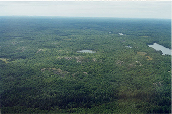
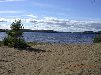
Gough Outwash Forest Conservation Reserve is located approximately 10 km north of the Town of Webbwood and 80 km west of the City of Greater Sudbury. The 402 (Forest Reserve [FR] 22 ha) hectare site can be found on the northern shore of Gough Lake (Birch Lake), entirely within Gough Township. Figure 1 illustrates the general location of Gough Outwash Forest Conservation Reserve.
Figure 1: Site location for Gough Outwash Forest Conservation Reserve
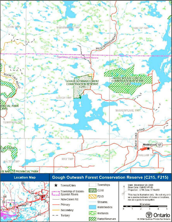
Enlarge figure 1: Site location for Gough Outwash Forest Conservation Reserve
Whenever possible, recognizable natural and cultural features, such as creeks, shorelines or old roads have been used to delineate conservation reserve boundaries to facilitate on-the-ground identification (see Figure 1). The entire western boundary and most of the northern boundary is vectored (straight line between two known points). The southern boundary follows the water’s edge of Birch Lake and a portion of McLander Creek, which then follows the extent of private properties and then the limit of the secondary road to West Branch Road. The east boundary is the limit of the West Branch Road and the northeast boundary follows the limit of patented mining claims.
Gough Outwash Forest Conservation Reserve is a relatively accessible site. The conservation reserve can be found by turning north from Highway 17 at the Town of Webbwood onto Agnew Lake Road. From Agnew Lake Road, turn west onto the West Branch Road, a primary access road, and follow the road for approximately 8 kilometres (see Figure 1). A recreational, multi- purpose trail is located on an old rail bed that traverses along the eastern section of the conservation reserve. Water access to the southern boundary of the conservation reserve is also available via Birch Lake.
Gough Outwash Forest Conservation Reserve is located within Sudbury Ecodistrict
4.2 Site history
Much of the area within and surrounding Gough Outwash Forest Conservation Reserve has been influenced by logging and mining operations. The White Pines Lumber Company operated throughout the area in the early 1900’s and utilized McLander Creek for log driving. The company maintained a logging camp east of Gough Lake (Birch Lake), nearby to McLander Creek.
Smelter emissions from early mining and harvesting operations have led to the eroded soils which are prevalent in the region. (Cudmore et al. 2004)
The shoreline of Gough Lake (Birch Lake) was once utilized by natives in the area as a summer camp. A Native cemetery is located in the hills within the Conservation Reserve. Several artefacts (arrowheads, flint) have been discovered in the area and along the shoreline at a nearby beach supporting the claim of a native settlement in the area.
Gough Lake (Birch Lake) contains a diverse fishery and was once a known walleye fishery until the late 1970’s and early 1980’s. When the lake became inundated with smelt, the recruitment of young fish into the adult population declined. (Blake Morgan pers comm. 2004). Efforts have been put forth to re-establish the walleye fishery to its previous state.
4.3 Socio-economic interest
Gough Outwash Forest Conservation Reserve is located in the Northshore Forest, which incorporates the region along the North Channel of Lake Huron from the Town of Thessalon to the Town of Espanola. The employment base of the region is dependent on its natural resources. Mining, forestry, trapping and resource-based tourism have been essential to the historical growth and development of the area.
There are twenty permanent residences and approximately fifty camps located along the shore of Gough Lake (Birch Lake).
There is an active Bear Management Area, trapline and baitfish harvesting operation within the site; as well, hunting and angling are activities in the general area that are part of the local economy.
A tourism establishment is located adjacent to conservation reserve and its associated recreational activities have been identified within the site. Private camps and residences are also located adjacent to the conservation reserve, along the north shore of Gough Lake (Birch Lake).
The conservation reserve lies within the Robinson-Huron Treaty Area #9. Protection of this area ensures that activities traditionally carried out by First Nation communities in this Treaty Area will be able to continue.
4.4 Inventories
Table 2 indicates the current status of natural heritage inventories that have occurred for Gough Outwash Forest Conservation Reserve. Recommendations for future inventory needs are located in Table 3, subsection 7.0 - Recommendations.
Table 2: Inventory and survey information for Gough Outwash Forest Conservation Reserve
| Type of inventory | Inventory method | Date(s) of inventory | Report |
|---|---|---|---|
| Life Science | Aerial reconnaissance | 4 Sept. 2002 | Cudmore, W., Shaver, M. and Longyear S. 2004. Gough Outwash Forest Conservation Reserve (C215) Natural Heritage Area - Life Science Checksheet. Unpublished Information. Ontario Ministry of Natural Resources. |
| Earth Science | Aerial photo interpretation | 4 Sept. 2002 | Kristjansson, R.J. 2004. Earth Science Inventory Checklist for C215 Gough Outwash Forest Conservation Reserve. Unpublished Information. Ontario Ministry of Natural Resources. |
| Recreation | Ground and aerial reconnaissance | Ground: 5 Oct. 2004, 4 Sept. 2002 Air: 28 Aug. 2003 |
Kuisma, E. 2003. Gough Outwash Forest Conservation Reserve (C215) Recreation Resource Inventory Report. Unpublished Information. Ontario Ministry of Natural Resources. |
5.0 State of the resource
Descriptions in this section are not necessarily complete. If new values key or otherwise are identified, they will be added to this document as an amendment. If any new value is considered significant, management guidelines may be modified, if required, to ensure its protection.
5.1 Key values
Key values are values that make this site unique and have led to its designation as a conservation reserve. Their protection is paramount. The key value of Gough Outwash Forest Conservation Reserve includes the following:
- Provincially significant glaciofluvial outwash deposits which promote the growth of old sugar maple, poplar, yellow birch and spruce stands.
Additional values, listed in subsection 5.2- Natural Heritage Values, are also important features and activities identified within the site.
5.2 Natural heritage values
5.2.1 Earth science Values
5.2.1a Regional landforms
Gough Outwash Forest Conservation Reserve is found within Ecodistrict 5E-4 of Ecoregion 5E (Georgian Bay) (Hills 1959; Crins & Uhlig 2000). The ecodistrict is characterized by moderate to small-sized pockets of water-laid silt and sand, sand and gravel plains, as well as bedrock outcrops shallowly covered by stony sand and stone-free silt. The coarse sand is granitic and the lime content of the fine-silty sand varies from granitic to a trace of lime. The bedrock has weakly, moderately, and in one instance strongly broken relief. Landforms within the ecoregion consist of lowland areas of water-laid materials frequently broken by bedrock outcrops, and upland areas of rolling bedrocks covered to variable depths with materials ranging from gravel to silty sands. The soil type includes brown podsolic and weakly developed podsols on sandy soils of the upland areas and limy clays and silts of the lowland areas (Hills 1959; Crins & Uhlig 2000).
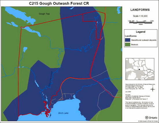
5.2.1b Surficial geology
Rik Kristjansson (2004), MNR provincial geospecialist, verified that the conservation reserve’s surficial geology is dominated
5.2.1c Bedrock geology
Bedrock geology dominates the western side of McLander Creek (Map 2, Appendix A). The bedrock is in the form of a bedrock drift complex with a thin discontinuous till and local areas of organics (Kristjansson 2004).
5.2.2 Life science values
5.2.2a Regional ecology
Gough Outwash Forest Conservation Reserve is found within Sudbury Ecodistrict 5E-4 (Noble 1993) of Ecoregion 5E (Georgian Bay) (Hills 1959; Crins & Uhlig 2000). Vegetation in this region typically consists of sugar maple, yellow birch, eastern hemlock (Tsuga canadensis), and white pine (Pinus strobus) on fresh sites. White spruce (Picea glauca) and balsam fir (Abies balsamea) are found on fresh clays and in cooler valleys mixed with hardwoods. Black spruce and tamarack (Larix laricina) can be found in cold and wet areas. The forest climate for this area is mid-humid, warm-boreal. The area is also located in section L.4e (Sudbury-North Bay) of Rowe’s (1972) Great Lakes – St. Lawrence Forest Region. Extensive disturbance (e.g. forest cutting and fires) has occurred in section L.4e, resulting in the destruction and/or reduction of many naturally occurring species. Presently, pioneer species such as trembling aspen (Populus tremuloides) and white birch occur, with only scattered occurrences of regional characteristic species such as jack pine, sugar maple, yellow birch, red pine, white pine, balsam fir and black spruce.
5.2.2b Vegetation and forest communities
The conservation reserve contains poplar dominant2 and poplar and white birch predominant communities. The poplar dominant hardwood is present in the western and central portions of the site and the poplar predominant hardwood communities is associated with the western poplar dominant communities. The white birch predominant community is found in both the northeast, central and southern portions of the site. Sugar maple is found in the north and white pine on the ridges of the conservation reserve (see Map 3, Appendix A).
There are four age groupings in the site (0-29, 60-89, 120-149 and 150-179 years of age), although the majority of the forest communities within the conservation reserve are in the range of 60-89 years of age. Under definitions developed by Uhlig et al. (2000), there are two candidate old growth stands within the conservation reserve: the rich upland mixed forest of sugar maple and poplar (MW3) and the spruce-balsam fir (SF2) stands. The spruce-balsam fir candidate stands are in the south and central sections of the site and a small section of the rich upland mixed forest occurs in the northeast, within the Forest Reserve (Cudmore et al. 2004).
The forest communities within the conservation reserve are variably stocked
5.2.2c Fish and wildlife
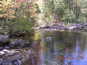
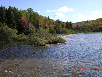
According to lake survey files, Brook Trout (Salvelinus fontinalis) are found in McLander Creek and rainbow smelt (Osmerus mordax) utilize the mouth for spawning. The fish communities found in Gough Lake (Birch Lake) include lake trout (Salvelinus namaycush), lake whitefish (Coregonus clupeaformis), walleye (Stizostedion vitreum v.), smallmouth bass (Micropterus dolomieu), northern pike (Esox lucius), yellow perch (Perca flavescens), lake herring (Coregonus artedi) and white sucker (Catostomus commersoni).
McLander Creek located within the conservation reserve provides anglers with good brook trout fishing throughout. Gough Lake (Birch Lake) is known for lake trout fishing but was once a renowned walleye fishery. But the lake has undergone dramatic changes within recent decades. In the late 1970’s and early 1980’s, exotic smelt were introduced to the lake. The top end predators were out competed and out produced by the smelt and the fishery declined. Stocking of lake trout has occurred by the Ministry of Natural Resources to help control the smelt population and allow the fishery to recover.
Moose (Alces alces), white-tailed deer (Odocoileus virginianus) and black bear (Ursus americanus) are the important big game species which are found within the site. All commercially important furbearers are also present with the exception of wolverine (Gulo gulo), badger (Taxidea taxus), grey fox (Urocyen cinereoargenteus) and opossum (Didelphis virginiana).
5.2.2d Wetlands and watersheds
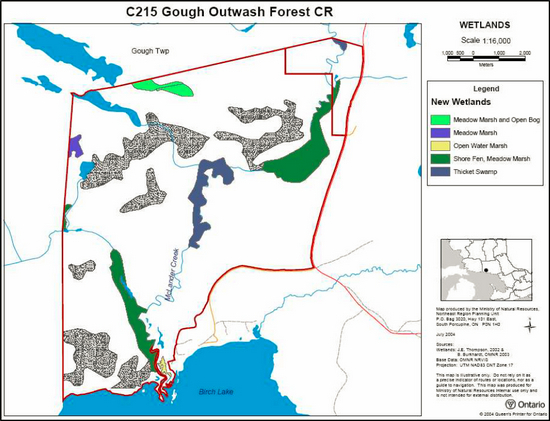
During an aerial reconnaissance of the conservation reserve (Thompson 2002), 6 types of wetlands were identified (Map 4, Appendix A) with two dominant, meadow marsh-shore fen and alder swamp. The meadow marsh-shore fen runs along an unnamed creek and drains into McLander Creek at sections above and below McLander Creek Falls. Alder swamp marsh is found along the central section of McLander Creek, immediately below McLander Creek Falls. Other wetlands identified include a meadow marsh and open bog in the northern section and a small open water marsh which forms part of a delta near the outlet of McLander Creek. The northern portion of the site is dominated by grassy meadows and the southern portion by shrub shore fens and open marshes (Cudmore et al. 2004). Field notes by Thompson (2002) also indicated that the dominant wetland through the site is shrub shore fen, which beavers have influenced especially in the western area which contained some wet meadow to black spruce stands. Other identified wetlands include poor fen, grassy meadow, and sheltered open marsh.
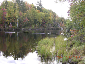
The conservation reserve is within the tertiary watershed 2CE of the Lake Huron major basin (Cudmore et al. 2004). McLander Creek belongs to the Birch Creek watershed which forms part of the Spanish River system. McLander Creek and Gough Lake (Birch Lake) and are both classified as coldwater systems.
5.2.2e Species at risk
No Species at Risk have been identified or documented within the conservation reserve.
5.2.3 Recreational values
Gough Outwash Forest Conservation Reserve and its surrounding area offer a variety of existing and potential recreational opportunities. McLander Creek and Gough Lake (Birch Lake) are popular fishing destinations for a variety of species from brook trout to lake trout. Hunting is also an important recreational activity within the conservation reserve. Please see subsection 5.2.2c-Fish and Wildlife and subsection 6.5.4-Hunting and Fishing for more specific information on fish and game within the conservation reserve.
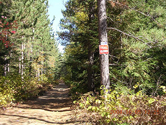
A recreational, multi-purpose trail is located on an old rail bed that traverses along the eastern section of the conservation reserve. A small trail system exists within the conservation reserve. This trail provides great opportunities for non-motorized activities such as wildlife viewing, cross-country skiing and fishing.
A number of cottages and permanent residences are adjacent to the conservation reserve and therefore associated recreational uses are thought to occur (e.g. nature appreciation, landscape viewing, swimming, etc.). A local tourist outfitter offers a number of recreational opportunities in the area of and including Gough Outwash Conservation Reserve. Kuisma (2003) indicates that blueberry picking, rock-climbing and nature observation may be potential recreational activities.
5.2.4 Cultural values
There was a First Nations corn grinding site located up on the hills within the reserve but little else is known about the cultural or traditional values of the area contained within this conservation reserve. The conservation reserve is located within the Robinson/Huron Treaty Area #9.
There was a one hundred year old white pine logging camp which was situated near to the conservation reserve. Also, a narrow gauge railway was utilized. The area contained within the conservation reserve has been traditionally used for resource activities. Intensive forest harvest activities are known to have occurred throughout the area. See section 4.2 – Site History for a more detailed discussion on historical occurrences within the conservation reserve.
5.2.5 Research values
No known research activities have occurred within the boundary of Gough Outwash Forest Conservation Reserve.
5.3 Quality of the Resource
5.3.1 Site condition
Condition refers to the amount of disturbance that the site has experienced to date and includes both human and non-human or natural disturbances. Overall, the level of disturbance
During the aerial reconnaissance survey, Thompson (2002) documented a small sand pit in the southeast section of the conservation reserve, in which ATV tracks were easily identifiable from the air. The unclassified lands east of the creek are used as an access area for the cottagers and adds human disturbance to the site (Cudmore et al. 2004). Fires, which occurred in 1921, may also have been responsible for the dominant age distribution (60-89 years old) of the forest stands across much of the conservation reserve, although fire history indicates that the area impacted was outside the site (Cudmore et al. 2004).
Gough Lake (Birch Lake) is subjected to a variety of stresses which affect the aquatic ecosystem of McLander Creek. There is moderate cottage development which alters the shoreline and near-shore littoral zone adjacent to the conservation reserve. The introduction of exotic smelt to the aquatic system has decimated the fishery and it is also artificially regulated by a water control device controlled by the Ministry of Natural Resources at the southern tip of Gough Lake (Birch Lake).
5.3.2 Diversity
Diversity is a measure of the site’s life and earth science heterogeneity. It is based on the number and range (variety) of the natural landscape features and landforms of earth science values and the richness and evenness of the life science components. The diversity
Defined in habitat units (HUs), the landform-vegetation combinations include 8 HUs on 2 different landforms, resulting in only 13 landform-vegetation combinations in the conservation reserve (Cudmore et al. 2004). Therefore, the conservation reserve is considered to have a low diversity rating; although, a thorough geology layer is required to verify the number of landform-vegetation combinations within the site and determine an accurate diversity rating (Cudmore et al. 2004). Other values contributing to the sites diversity include wetlands associated with McLander Creek. Wetlands add to the site’s diversity.
Evenness
5.3.3 Ecological considerations
Wherever possible, a site’s boundaries should be created to include the greatest diversity of life and earth science features to provide the maximum ecological integrity. It should be ecologically self-contained, bounded by natural features and include adequate area to buffer the core ecosystems from adjacent land use activities (OMNR 1992). The conservation reserve has biological, cultural and vectored boundaries. The southern boundary follows the northern shore of Gough Lake (Birch Lake) and a portion of McLander Creek. The eastern boundary follows tertiary and secondary roads. The northern boundary stretches from the West Branch Road right of way across to the edge of Lang Lake and the entire western boundary stretches straight down to Gough Lake (Birch Lake).
6.0 Management guidelines
All management guidelines in this SCI are based on the policy direction contained in the Crown Land Use Policy Atlas (CLUPA). For the most up-to-date version of this policy report, please refer to the CLUPA on the internet, or contact your local Ministry of Natural Resources office. A summary table of the management guidelines, outlining permitted uses within the site, is located in Appendix C.
The management guidelines outlined in this section are specific to the Gough Outwash Forest Conservation Reserve and are intended to protect the site’s unique values. The guidelines in this document are subject to change and may be amended as necessary. If a conflict between management guidelines exists, the conservation reserve will be managed to protect the integrity of its natural values, while permitting compatible land use activities (OMNR 1997).
Proposed new uses and/or development, including research and education activities, will be reviewed on a case-by-case basis. All new proposals will be subject to evaluation under at least one of the following processes: the Environmental Assessment Act (R.S.O. 1990, c.E.18) or Conserving a Future for our Past: Archaeology, Land Use Planning & Development in Ontario, Section 3 (MCzCR 1997). The Class Environmental Assessment for Provincial Parks and Conservation Reserves (OMNR 2003) will be used to screen most proposals and management activities occurring within the conservation reserve.
6.1 First Nations
Traditional activities and Aboriginal rights, as defined in the Robinson-Huron Treaty #9 and other applicable legislation, will not be affected by the boundaries of this conservation reserve.
Any First Nation land claims within this area will be addressed according to appropriate Ministry of Natural Resources’ procedures. When possible, the Ministry of Natural Resources will work with the Ontario Ministry of Culture to identify archaeological and/or cultural sites to be protected.
6.2 Industrial activities
6.2.1 Commercial timber harvest
The area contained within this conservation reserve (402 ha) has been withdrawn from the Northshore Forest Sustainable Forest License area and no commercial timber harvesting will be permitted. Please refer to subsection 6.5.3- Non-Commercial Consumptive Resource Use for information regarding non-commercial wood harvesting.
6.2.2 Mining and exploration
Mining and surface rights within the conservation reserve’s boundaries have been withdrawn from staking under the Mining Act (RSO 1990 c.M.14). Mineral exploration is not permitted.
A 22 hectare forest reserve is associated with this conservation reserve. The intent of the forest reserve designation is to regulate the area as part of Gough Outwash Forest Conservation Reserve once existing mining claims or leases have lapsed, expired or have been surrendered under normal processes.
6.2.3 Extraction of peat, soil, aggregate and other material
No extraction operations currently occur within the conservation reserve. New activities for the extraction of peat, soil, aggregate and other material are not permitted.
6.2.4 Energy generation
No energy generation facilities exist within the conservation reserve. New hydropower development and windpower generation operations are not permitted.
6.3 Existing and proposed development
6.3.1 Transportation corridors
6.3.1a Roads
Under the Public Lands Act, section 48 (OMNR 2003), a road is defined as “a travel corridor that is reasonably capable of allowing travel by motor vehicles licensed to operate on a King’s Highway as defined in the Highway Traffic Act (e.g., personal or commercial cars and trucks).”
Minor maintenance (as defined under Policy PL 3.03.04 [OMNR 2003]) of existing roads will be permitted provided that maintenance activities do not negatively impact the values being protected by the conservation reserve. Road maintenance activities may be subject to the Class Environmental Assessment (EA) for Provincial Parks and Conservation Reserves.
No private access roads have been identified within the conservation reserve. New access roads proposed after March 29, 1999 and, for which MNR did not make a commitment, will not be permitted within the conservation reserve.
According to the LUS (OMNR 1999), new roads for resource extraction will not be permitted except for those identified in Forest Management Plans prior to March 31, 1999. No new or existing roads for resource extraction were identified within the conservation reserve prior to this date.
6.3.1b Trails
Under Ontario Regulation 453/96 (OMNR 2003), a trail is defined as “a path over public lands not used for mineral exploration or extraction.” A trail is minor in nature compared to a road, allowing passage of pedestrians, ATVs, snowmobiles or the like (OMNR 2003).
A non-maintained recreational, multi-purpose trail is located on an old rail bed that traverses along the eastern section of the conservation reserve.
Minor maintenance (as defined under Policy PL 3.03.04 [OMNR 2003]) of existing trails will be permitted provided that maintenance activities do not negatively impact the values being protected by the conservation reserve. Trail maintenance will be subject to the Class Environmental Assessment (EA) for Provincial Parks and Conservation Reserves.
Any proposed new trails or development of existing trails are subject to the Class Environmental Assessment (EA) for Provincial Parks and Conservation Reserves and applicable Ministry of Natural Resources’ policies and procedures. Trail development should take into account the unique characteristics of this site and must be compatible with the site’s key values. All existing and new trail heads and trail routes must be recorded using new technologies (i.e. global positioning systems) to ensure an accurate record of the location of the feature. This location information must be provided to the Ministry of Natural Resources, Sudbury District.
6.3.2 Other corridor development/maintenance
No transmission corridors currently exist within the conservation reserve. New corridor developments will be actively discouraged. Proposals for new corridors will be subject to the Class Environmental Assessment (EA) for Provincial Parks and Conservation Reserves.
6.3.3 Natural heritage appreciation facilities/recreational structures
There are currently no existing authorized natural heritage appreciation facilities or recreational structures (i.e. boardwalks, bird viewing platforms, kiosks, ski shelters, or interpretative signs) located within the conservation reserve. New public natural heritage appreciation facilities and recreation structures are permitted, subject to screening under the Class Environmental Assessment (EA) for Provincial Parks and Conservation Reserves.
Facility development should take into account the unique characteristics of this site and must be compatible with the site’s key values.
6.3.4 Land disposition
Sale of land is not permitted, except for some types of minor dispositions (e.g. the sale of small parcels of land to provide adequate area for the installation of a septic system), where it does not detrimentally affect the key values of the site. Such sales will be subject to the Class Environmental Assessment (EA) for Provincial Parks and Conservation Reserves.
Existing leases or LUP’s may be renewed or transferred, subject to MNR approval. Private recreation camps may be eligible for enhanced tenure but may not be sold. Permit holders for outpost camps or tourism facilities (e.g., main base lodges) can apply to upgrade tenure from a LUP to a lease.
No Land Use Permits (LUP’s) are currently issued within this conservation reserve. New leases or LUP’s may be issued for approved public uses (i.e. not for private recreation camps), subject to the Class Environmental Assessment (EA) for Provincial Parks and Conservation Reserves and applicable Ministry of Natural Resources’ policies and procedures.
Enhanced tenure is defined as anything beyond the term and form of current tenure. All requests for transfer or enhanced tenure will be subject to the following screening criteria:
- Is the transfer or enhanced tenure consistent with the conservation reserve’s land use intent, which is the protection and enhancement of the site’s natural, recreational and cultural values?
- Is it consistent with the land disposition policies outlined in the District Land Use Guidelines, the Crown Land Use Policy Atlas, this SCI and any other applicable document?
- Does it adversely affect the values as identified in Section 5.0, and/or conflict with other uses?
- Does the transfer or enhanced tenure clash with traditional Aboriginal uses, land claims or treaty agreements?
- Are all rents, taxes, fees, rates or charges paid up for the existing LUP or lease?
6.4 Commercial activities
6.4.1 Commercial bait harvesting
A commercial bait harvesting operation is within the conservation reserve and will be allowed to continue. New operations may be considered subject to the Class Environmental Assessment (EA) for Provincial Parks and Conservation Reserves.
Any proposed new trails for baitfish harvesting purposes are subject to the Class Environmental Assessment (EA) for Provincial Parks and Conservation Reserves. Please refer to subsection 6.3.1 – Trails for further information on the establishment and maintenance of new trails and subsection 6.5.5 – ATV and Snowmobile Use for further information on their usage.
6.4.2 Commercial fishing
There are currently no commercial fisheries operating within the conservation reserve. New operations may be considered subject to the Class Environmental Assessment (EA) for Provincial Parks and Conservation Reserves. Please refer to subsection 6.5.5 – ATV and Snowmobile Use for further information on their usage.
6.4.3 Commercial fur trapping
The conservation reserve lies within registered trapline EP 25. This registered trapline area is currently allocated to a head trapper. If a head trapper surrenders a registered trapline, or the head trapper’s privileges are revoked, the registered trapline may be transferred to another trapper following established allocation procedures. If the registered trapline is not transferred in due course, or remains unallocated for a period of time, reallocation of the trapline may occur following applicable district screening processes.
Any proposed new trails for the purposes of commercial fur trapping are subject to the Class Environmental Assessment (EA) for Provincial Parks and Conservation Reserves. Please refer to subsection 6.3.1 – Trails for further information on the establishment and maintenance of new trails and subsection 6.5.5 – ATV and Snowmobile Use for further information on their usage.
No licensed trap cabins currently exist within Gough Outwash Forest Conservation Reserve. The establishment of new trap cabins will not be permitted.
6.4.4 Bear management areas
The conservation reserve lies within Bear Management Area (BMA) EP-37-042. The policies regarding BMA’s (OMNR 2003) states that the issuance of Licences to Provide Bear Hunting Services will be allowed where areas have been licensed or authorized under agreement for the activity since January 1, 1992.
Any proposed new trails for the purposes of bear hunting are subject to the Class Environmental Assessment (EA) for Provincial Parks and Conservation Reserves. Please refer to subsection 6.3.1 – Trails for further information on the establishment and maintenance of new trails and subsection 6.5.5 – ATV and Snowmobile Use for further information on their usage.
6.4.5 Commercial food collection
There is currently no existing commercial food harvesting venture within the conservation reserve. Any new ventures requiring permits from the Ministry of Natural Resources will be subject to the Class Environmental Assessment (EA) for Provincial Parks and Conservation Reserves.
6.4.6 Commercial non-timber forest products
Currently, there is no explicit policy direction towards the commercial harvesting of non-timber forest products. New ventures may be considered subject to the Class Environmental Assessment (EA) for Provincial Parks and Conservation Reserves. Such ventures should be discouraged within the conservation reserve wherever possible, as they do not necessarily coincide with the intent of protecting the area as a conservation reserve.
6.4.7 Outpost camps/main base lodges
There are currently no existing authorized outpost camps or main base lodges within the conservation reserve. New outpost camps and main base lodges may be considered through planning and will be subject to the Class Environmental Assessment (EA) for Provincial Parks and Conservation Reserves. The form of land tenure for these new uses will remain as a land use permit or lease. Sale of Crown land for new outpost camps or mainbase lodges will not be permitted.
6.5 Non-commercial activities
6.5.1 Nature appreciation/Low-impact recreation activities
Off-trail hiking, cross-country skiing, snow-shoeing, and other non-motorized activities will be permitted within this conservation reserve. However, should the impact of these activities degrade the landscape, the Ministry of Natural Resources will re-evaluate these permitted uses and decide upon a new strategy for this site. New trails to support these activities may be considered. Please refer to subsection 6.3.1b- Trails for more details related to trail development.
6.5.2 Camping
There are no maintained campsites or campgrounds within this conservation reserve. Crown land camping policies apply, unless significant adverse effects on protected values necessitate further planning and management for this activity. Existing traditional campsites should be used to avoid disturbance of new areas within the conservation reserve.
6.5.3 Non-commercial consumptive resource use
Cutting of trees for non-commercial purposes may be authorized by the local Ministry of Natural Resources, subject to review and determination of the impact that such cutting would have on the values identified in section 5.0- State of the Resource. These permits are intended to cover fuelwood, dock stringers, and other occasional small-scale uses. Such permits are intended only for leaseholders, Land Use Permit holders, cottagers and other property owners within the conservation reserve who do not have road access to their property and who do not have an alternate wood source outside of the conservation reserve. Property owners adjacent to the conservation reserve will not be issued permits for areas within the protected area. No stakeholders eligible for non-commercial consumptive resource use permits currently exist within the Gough Outwash Forest Conservation Reserve.
Non-commercial harvesting of non-timber forest products such as berries and mushrooms can occur provided the values of the site, identified in section 5.0- State of the Resource, are not jeopardized.
6.5.4 Hunting and fishing
In conjunction with current hunting regulations (Wildlife Management Unit 37), hunting is permitted to continue within the conservation reserve. Please see subsection 6.5.5- ATV and Snowmobile Use on the direct retrieval of large game and to subsection 6.3.1b (Trails) for information on the construction of new trails or the maintenance of existing trails.
Recreational fishing is also permitted to continue in compliance with current fishing regulations.
6.5.5 ATV and snowmobile use
Please refer to subsection 6.3.1b- Trails for more information on trails. In general, off-trail use of ATVs and snowmobiles is not permitted; however, in some cases, off-trail use is permitted for licensed trappers to access their traplines, for licensed bait harvest operators to conduct bait harvest operations and for use in bear management areas (BMA’s). Hunters are also allowed off-trail ATV and snowmobile use for the direct retrieval of large game. In all these cases, any formal intensive off-trail use is discouraged. Should the impact of off-trail ATV and snowmobile use degrade the natural values; the Ministry of Natural Resources will re-evaluate these permitted uses and determine a new strategy.
6.6 Resource management activities
Resource management activities refer to those tools used to protect and enhance the values of this conservation reserve. Some management activities may require the use of intrusive techniques. Under normal circumstances, some of these techniques would not be permitted to occur in the conservation reserve; however, if they are found to be necessary, they may be applied under controlled conditions, to achieve a desired result. Infrastructure such as roads, trails and buildings may need to be constructed to support activities such as prescribed burns, forest regeneration, wildfire control, and insect and disease control. Activities described in this section will be deemed acceptable if the ultimate outcome is in compliance with the management intent for this conservation reserve.
6.6.1 Insect and disease control
This conservation reserve will be maintained in a natural state. Insect and disease control measures should only be considered if the identified values of the conservation reserve or adjacent forest values on Crown land are significantly threatened. If such measures are proposed, they will be subject to the Class Environmental Assessment (EA) for Provincial Parks and Conservation Reserves.
6.6.2 Exotic and/or invasive species
The management intent of the conservation reserve is to maintain the site in a natural state. The deliberate introduction of exotic and/or invasive species will not be permitted. If the key values of the site are threatened, new management strategies to control exotic/invasive species may be considered and will be subject to the Class Environmental Assessment (EA) for Provincial Parks and Conservation Reserves.
6.6.3 Species at risk management
Any species identified within the conservation reserve that is considered to be either endangered or threatened (as designated by either the national Committee on the Status of Endangered Wildlife in Canada, COSEWIC, or the Committee on the Status of Species at Risk in Ontario, COSSARO) will be given protection under the Fish and Wildlife Conservation Act (1997, S.O. 1997, c.41), the Endangered Species Act (R.S.O. 1990, c.E15) and/or the federal Species at Risk Act (June 2003). Recovery plans, consisting of both a recovery strategy and a recovery action plan, prepared for nationally endangered and threatened species under the Accord for the Protection of Species at Risk will be implemented within the conservation reserve if deemed necessary by the Ontario Ministry of Natural Resources and/or the Government of Canada.
6.6.4 Fish and wildlife management
Ongoing fisheries management activities to restore the natural reproduction cycle of Gough Lake (Birch Lake) and McLander Creek are not affected by the management of Gough Outwash Forest Conservation Reserve. Rehabilitation and enhancement (e.g. spawning bed enhancement) of the fishery have been ongoing and are continuing.
New fish and wildlife management activities (e.g., fish stocking, habitat enhancement/ rehabilitation, population control) may be considered but will be subject to the Class Environmental Assessment (EA) for Provincial Parks and Conservation Reserves. Existing previously approved fish and wildlife management activities will be permitted to continue but may be subject to the Class Environmental Assessment (EA) for Provincial Parks and Conservation Reserves.
6.6.5 Vegetation management
New vegetation management activities (e.g., the restoration of natural environments) may be considered but will be subject to the Class Environmental Assessment (EA) for Provincial Parks and Conservation Reserves. Such activities may also require the development of a separate vegetation management plan. Specific management prescriptions, as outlined by the new management plan, must be either referenced within this SCI or attached as an amendment to this document.
6.6.6 Fire management
The Ministry of Natural Resources recognizes fire as an essential process fundamental to the ecological integrity of conservation reserves. In accordance with existing conservation reserve policy and the Forest Fire Management Strategy for Ontario, forest fire protection will be carried out as on surrounding lands.
Whenever feasible, the Ministry of Natural Resources’ fire program will endeavour to use “light on the land” techniques, which do not unduly disturb the landscape, in this conservation reserve. Examples of light on the land techniques may include limiting the use of heavy equipment or limiting the number of trees felled during fire response efforts.
Opportunities for prescribed burning to achieve ecological or resource management objectives may be considered but will be subject to the Class Environmental Assessment (EA) for Provincial Parks and Conservation Reserves. Such activities may also require the development of a separate vegetation management plan developed in accordance with the Ministry of Natural Resources Prescribed Burn Planning Manual (OMNR 1997b).
6.6.7 Forest renewal
Forest renewal is an activity associated with commercial timber harvest and with vegetation restoration projects involving tree species. Such practices would only be considered if the area within the conservation reserve had been recently cut prior to becoming regulated or following approval of vegetation management activities as outlined in subsection 6.6.5-Vegetation Management.
Forest loss within the conservation reserve due to wind (i.e., blowdown), fire or insect damage will not be considered for forest renewal – such areas will be left to regenerate naturally. Should unauthorized forest harvest occur within the boundaries of the conservation reserve, forest renewal will be considered.
Any possible renewal project will be reviewed using the Class Environmental Assessment (EA) for Provincial Parks and Conservation Reserves and would be carried out to replicate natural conditions as much as possible.
6.7 Research
Scientific research by qualified individuals or institutions is encouraged, especially if the research contributes to a better understanding of the natural and cultural values protected by this conservation reserve or if it advances the protection, planning and management of these values. The District Planner, Sudbury District should be contacted for information on research and/or monitoring opportunities within this conservation reserve. Proposals to conduct research should be directed to the Espanola Area Supervisor, Sudbury District and will be subject to the Class Environmental Assessment (EA) for Provincial Parks and Conservation Reserves and relevant Ministry of Natural Resources’ policies, procedures and conditions, as well as any applicable Environmental Assessment Act (R.S.O. 1990, Chapter E.18) requirements. Any site that is disturbed during research activities is to be rehabilitated as closely as possible to its original condition. Collecting may only be permitted as part of an authorized research project and may be subject to appropriate permits and conditions.
Existing research and monitoring activities currently occurring within the conservation reserve are permitted to continue, but may be subject to the Class Environmental Assessment (EA) for Provincial Parks and Conservation Reserves should detrimental impacts to the values protected by the conservation reserve be detected. No existing research activities have been identified within the Gough Outwash Forest Conservation Reserve.
7.0 Recommendations
It is recognized that not all features or uses occurring within the Gough Outwash Forest Conservation Reserve have been identified during the current planning process. This section outlines future activities which might be conducted to ensure that features of the site are protected or to better develop our understanding of the natural features protected by this conservation reserve. Table 3 highlights future needs and considerations for Gough Outwash Forest Conservation Reserve.
Table 3: Future needs and considerations for Gough Outwash Forest Conservation Reserve
[Reformatted into a list for better accessiblity]
-
Future needs/considerations
- Detailed Life Science Inventory
Details: A gap analysis of the site should be completed using provincial data sets. This analysis should be used to review the landforms/vegetation information presented in this SCI and the life science checksheet to determine more fully the site’s significance and contribution to the parks and protected areas program. - Key values and sensitive areas
Details: A more detailed analysis of the key values and sensitive areas within the conservation reserve could be completed. - Feature verification
Details: Efforts could be made to locate and GPS the use of any trails and/or developments. - Public Education
Details: Educate the public about the key values in this site and how their activities may impact features within the conservation reserve (e.g. trail erosion and human-caused fires).
- Detailed Life Science Inventory
8.0 Implementation, review and revisions
The Espanola Area team will be responsible for implementing the management policies and guidelines for the Gough Outwash Forest Conservation Reserve. The primary role of the Espanola Area team will be to perform compliance monitoring and provide public information to ensure adherence to current policies and guidelines.
8.1 Monitoring
Periodic monitoring of human activities and/or their impacts within this conservation reserve will be conducted. The Espanola Area Supervisor and the Sudbury District Enforcement Supervisor will oversee these activities.
Approved inventory, monitoring and/or assessment activities that are compatible with protection objectives are encouraged. Any area that is disturbed during such monitoring activities must be rehabilitated to restore the affected area as closely as possible to its original condition. If at any time human activities are deemed to be negatively impacting the protected features, the activities will be reviewed and measures taken to mitigate any disturbance.
8.2 Marketing
No active marketing of this conservation reserve is anticipated.
8.3 Review and revisions
The Gough Outwash Forest Conservation Reserve SCI will be reviewed every five years by the District Planner, Sudbury District to confirm and update the information in this document. Revisions to this document will be subject to requirements as specified in the Environmental Assessment Act (R.S.O. 1990, Chapter E.18). If changes in management direction are needed at any time, the significance of the changes will be evaluated. Minor amendments to the plan that do not alter the overall protection objectives may be considered and approved by the Area Supervisor without further public consultation. All minor amendments to the SCI will be documented in Appendix D. In assessing major amendments, the need for a more detailed Resource Management Plan (RMP) will first be considered. Where a RMP is not considered necessary or feasible, a major amendment to management direction may be considered with public consultation. Major amendments will be recommended by the District Manager and approved by the Regional Director, and will follow the appropriate guidelines (OMNR 2001b).
9.0 References
Cudmore, W., Shaver, M. and Longyear, S. 2004. Gough Outwash Forest Conservation Reserve (C215) Natural Heritage Area - Life Science Checksheet. Unpublished Information. Ontario Ministry of Natural Resources.
Crins, W.J. and Uhlig, P.W.C. 2000. Ecoregions of Ontario: Modification to Angus Hills’ Site Regions and Site Districts – Revisions and Rationale.
Hills, G. A. 1959. A Ready Reference for the Description of the Land of Ontario and its Productivity. Preliminary Report. Ontario Department of Lands and Forests. Maple. Ontario.
Kristjansson, R.J. 2004. Earth Science Inventory Checklist for C215 Gough Outwash Forest Conservation Reserve. Unpublished Information. Ontario Ministry of Natural Resources.
Kuisma, E. 2003. Gough Outwash Forest Conservation Reserve (C215) Recreational Inventory Checklist. Unpublished Information. Ontario Ministry of Natural Resources.
Ministry of Citizenship, Culture and Recreation. 1997. Conserving a Future for Our Past: Archeology Land Use Planning and Development in Ontario, Section 3.
Ontario Ministry of Natural Resources. 1997a. Conservation Reserves Policy PL 3.03.05.
Ontario Ministry of Natural Resources. 1997b. Prescribed Burn Planning Manual. AFFMB Publication No. 313. Ontario Ministry of Natural Resources.
Ontario Ministry of Natural Resources. 1999. Ontario’s Living Legacy Land Use Strategy. Queen’s Printer for Ontario, Ontario, Canada.
Ontario Ministry of Natural Resources. 2000. Conservation Reserve Policy-As Amended by the Ontario Living Legacy Land Use Strategy. Unpublished document. September 2000.
Ontario Ministry of Natural Resources. 2001a. Forest Information Manual. Queen’s Printer for Ontario: Toronto, Ontario.
Ontario Ministry of Natural Resources. 2001b. Procedures for the Amendment of Ministry of Natural Resources Land Use Direction. Ontario Ministry of Natural Resources.
Ontario Ministry of Natural Resources. 2002. Buildings for Bait Harvesting Management. Public Lands Act, PL 3.03.08.
Ontario Ministry Natural of Resources. 2003. Direction for Commercial Resource Use Activities in Provincial Parks and Conservation Reserves. June 2003.
Ontario Ministry of Natural Resources. 2003. A Class Environmental Assessment for Provincial Parks and Conservation Reserves. Queen’s Printer for Ontario, Ontario, Canada. 116 pp.
Ontario Ministry of Natural Resources. 2004. Crown Land Use Atlas. [Accessed: September 15, 2004] /page/crown-land-use-policy-atlas
Rowe, J.S. 1972. Forest regions of Canada. Dept. of Fisheries and the Environment. Canadian Forestry Service. Publication No. 1300. 172 pp.
R.S.O. 1990, Chapter E.15. Endangered Species Act. [Accessed: September 1, 2004], /laws
R.S.O. 1990, Chapter E.18. Environmental Assessment Act. [Accessed: September 15, 2003] /laws
R.S.O. 1990, Chapter M.14. Mining Act. [Accessed: September 15, 2003] /laws
R.S.O. 1997, Chapter 41. Fish and Wildlife Conservation Act. [Accessed: September 1, 2004]. /laws
Taylor, K.C., R.W. Arnup, B.G. Merchant, W.J. Parton and J. Nieppola. 2000. A field guide to forest ecosystems of Northeastern Ontario. 2nd Edition. Northeast Science and Technology NEST Field Guide FG-001.
Thompson, J. 2001. Northeast Region Guidelines on the Planning Process for Conservation Reserves: Statements of Conservation Interest and Resource Management Plan. Unpublished Information. Ontario Ministry of Natural Resources.
Thompson, J. and Noordhof, J. 2003. Edit Model for N.E. Region Life Science Checksheets. Internal Report. Ontario Ministry of Natural Resources.
Uhlig, P., A. Harris, G. Craig, C. Bowling, B. Chambers, B. Naylor and G. Beemer. 2001. Old Growth Forest Definitions for Ontario. Ontario Ministry of Natural Resources, Queen’s Printer for Ontario, Toronto. ON. 27 p.
10.0 Appendices
Appendix A: Gough Outwash Forest Conservation Reserve maps
Map 1: Recreational Values of Gough Outwash Forest Conservation Reserve

Enlarge map 1: Recreational Values of Gough Outwash Forest Conservation Reserve
Map 2: Landforms in Gough Outwash Forest Conservation Reserve
Enlarge map 2: Landforms in Gough Outwash Forest Conservation Reserve
Map 3: Forest communities within Gough Outwash Forest Conserve Nation Reserve

Enlarge map 3: Forest communities within Gough Outwash Forest Conserve Nation Reserve
Map 4: Wetlands within Gough Outwash Forest Conservation Reserve
Enlarge map 4: Wetlands within Gough Outwash Forest Conservation Reserve
Appendix B: Gough Outwash Forest Conservation Reserve
Appendix C: Summary of permitted uses
The following Policy Report was obtained from the Crown Land Use Policy Atlas website during completion of this SCI (fall 2004). Changes may have been made to this policy report since that time. For the most recent version of this policy report, please refer to the Crown Land Use Policy Atlas on the internet or contact your local Ministry of Natural Resources office.
Crown Land Use Policy Atlas - Policy report
C215
Gough Outwash Forest
Updated: June 29, 2004
Identification:
ID: C215
Area Name: Gough Outwash Forest
Area (ha): 402
Designation: Conservation Reserve (Ontario’s Living Legacy)
MNR District(s): Sudbury
Description:
This site is located on the north shore of Gough Lake which is a lake trout lake, dominated by outwash deposits. Outwash consists of material from glacialrivers and streams that was deposited beyond the edge of the glacial ice. Old sugar maple, poplar, and spruce stands now grow on this hilly terrain. Younger stands of red pine and jack pine are on some of the gently rolling sections of the area. This conservation reserve in Site District SE-4. It is located on north shore of Gough Lake which is a lake trout lake.
Gough Outwash Forest was regulated as a conservation reserve on October 20, 2001.
Land use intent:
The land use intent will be to protect the natural heritage values of this area.
Management of this area is also governed by the general policies contained in the Land Use Strategy (1999).
Management direction:
Those uses and management activities not listed in the following table(s) are governed by existing conservation reserve policy. Over time the management direction will be elaborated in a Statement of Conservation Interest or Resource Management Plan. Any new uses, and commercial activities associated with conservation reserves, will be considered on a case by case basis and they must pass a test of compatibility to be acceptable. Compatibility is normally determined through a planning process.
Commercial activities
| Activity | Permitted | Guidelines |
|---|---|---|
| Aggregate Extraction | No | N/A |
| Bait Fishing: Existing | Yes | Existing use permitted to continue,unless there are significant demonstrated conflicts |
| Bait Fishing: New | Maybe | New operations can be considered, subject to the “test of compatibility”. |
| Commercial Fishing: Existing | Yes | Existing use permitted to continue, unless there are significant demonstrated conflicts. |
| Commercial Fishing: New | Maybe | New operations can be considered,subject to the “test of compatibility”. |
| Commercial Fur Harvesting: Existing | Yes | Existing use permitted to continue,unless there are significant demonstrated conflicts. Existing trap cabins can continue. |
| Commercial Fur Harvesting: New | Maybe | New cabins are not permitted. New operations can be considered, subject to thle “test of compatibility”. |
| Commercial Hydro Development | No | N/A |
| Commercial Timber Harvest | No | N/A |
| Commercial Tourism: Existing | Yes | Existing authorized facilities can continue unless there are significant demonstrated conflicts. |
| Commercial Tourism: New | Maybe |
New tourism facilities can be considered during the planning for an individual reserve. |
| Bear Hunting by Non-residents (guided): Existing | Yes | Existing authorized operations permitted to continue. |
| Bear Hunting by Non-residents (guided): New | No | New operations not permitted. |
| Outfitting Services: Existing | Yes | Existing authorized operations permitted to continue. |
| Outfitting Services: New | Maybe | New operations can be considered during the planning for an individual reserve. |
| Outpost Camps: Existing | Yes | Existing authorized operations permitted to continue. |
| Outpost Camps: New | Maybe | New operations can be considered during the planning for an individual reserve. |
| Resorts/lodges: Existing | Yes | Existing authorized facilities permitted to continue. |
| Resorts/lodges: New | Maybe |
New facilities can be considered during the planning for an individual reserve. |
| Energy Transmission and Communications Corridors: Existing | Yes | These facilities should avoid conservation reserve lands wherever possible. |
| Energy Transmission and Communications Corridors: New | No | These facilities should avoid conservation reserve lands wherever possible. |
| Food Harvesting (Commercial): Existing | Maybe | N/A |
| Food Harvesting (Commercial): New | Maybe | N/A |
| Mineral Exploration and Development | No | N/A |
| Peat Extraction | No | N/A |
| Wild Rice Harvesting: Existing | Yes | N/A |
| Wild Rice Harvesting: New | Maybe | N/A |
Land and resource management activities
| Activity | Permitted | Guidelines |
|---|---|---|
| Crown Land Disposition: Private Use | Maybe | Sale of lands is not permitted, except for minor dispositions in support of existing uses (e.g. reconstruction of a septic system). Renewals of existing leases and land use permits are permitted. Requests for transfer of tenure will be considered in the context of the Statement of Conservation Interest or Resource Management Plan. New leases or land use permits permitted for approved activities. Tourism facilities can apply to upgrade tenure from LUP to lease. |
| Crown Land Disposition: Commercial Use | Maybe | Sale of lands is not permitted, except for minor dispositions in support of existing uses (e.g. reconstruction of a septic system). Renewals of existing leases and land use permits are permitted. Requests for transfer of tenure will be considered in the context of the Statement of Conservation Interest or Resource Management Plan. New leases or land use permits permitted for approved activities. Tourism facilities can apply to upgrade tenure from LUP to lease. |
| Fire Supression | Yes | Fire suppression policies are similar to adjacent Crown lands, unless alternative fire policies have been developed through a planning process. |
| Fish Habitat Management | Maybe | N/A |
| Fish Stocking | Maybe | Conservation Reserves policy indicates that “featured species management” may be permitted. |
| Insect/disease Suppression | Maybe | N/A |
| Inventory/Monitoring | Yes | N/A |
| Prescribed Burning | Maybe | N/A |
| Roads (Resource Access): Existing | Yes | Existing roads can continue to be used. Continued use will include maintenance and may include future upgrading. |
| Roads (Resource Access): New | Maybe | New roads for resource extraction will not be pemlitted, with the exception of necessary access to existing forest reserves for mineral exploration and development. |
| Vegetation Management | Maybe | Conservation Reserves policy indicates that Featured Species Management and Natural Systems Management may be permitted. Vegetation management can be considered in a planning process. |
| Wildlife Population Management | Maybe | N/A |
Science, education and heritage appreciation
| Activity | Permitted | Guidelines |
|---|---|---|
| Collecting | No | N/A |
| Historical Appreciation | Yes | N/A |
| Nature Appreciation | Yes | N/A |
| Photography and Painting | Yes | N/A |
| Research | Yes | N/A |
| Wildlife Viewing | Yes | N/A |
Recreation activities and facilities
| Activity | Permitted | Guidelines |
|---|---|---|
| All-Terrain Vehicle: Use On Trails | Yes | Existing use pemitted to continue where it does not adversely affect the values being protected. |
| All-Terrain Vehicle: Use Off Trails | No | ATV use off trails is not permitted, except for direct retrieval of game. |
| Campgrounds | Maybe | N/A |
| Food Gathering | Yes | N/A |
| Horseback Riding (trail) | Yes | Existing use on trails permitted. |
| Hunting | Yes | N/A |
| Mountain Bike Use | Yes | Existing use on trails permitted. |
| Motor Boat Use: Commercial | Yes | N/A |
| Motor Boat Use: Private | Yes | N/A |
| Non-motorized Recreation Travel | Yes | N/A |
| Private Recreation Camps (Hunt Camps): Existing | Yes |
Existing camps permitted to continue, and may be eligible for enhanced tenure, but not purchase of land. |
| Private Recreation Camps (Hunt Camps): New | No | N/A |
| Rock Climbing | Maybe | N/A |
| Snowmobiling On Trails: | Yes | N/A |
| Snowmobiling Off Trails: | No | Except for the direct retrieval of game. |
| Sport Fishing: | Yes | N/A |
| Trail Development: Existing | Yes | N/A |
| Trail Development: New | Maybe | Development of trails for a variety of activities (e.g. hiking, cross-country skiing, cycling, horseback riding, snowmobiling) can be considered as part of planning for an individual reserve. |
Note: The policies outlined in this table do not supersede any Aborignal or treaty rights that may exist, or other legal obligations.
Management of this conservation reserve is carried out within the context of Conservation Reserve policy as amended by the policies for new conservation reserves outlined in the Ontario’s Living Legacy Land Use Strategy.
Source of Direction:
Ontario’s Living Legacy Land Use Strategy (1999)
Espanola District Land Use Guidelines (1983)
Conservation Reserves Policy (1997)
Explanation of Edits:
[No information provided]
Appendix D: Amendments to the SCI
[No information provided]
Footnotes
- footnote[1] Back to paragraph Ecodistricts are areas characterized by physiographic (landform) similarities, and by the successional trends exhibited by the predominant vegetation types on those physiographic features, see section 5.0 - State of the Resource (Hills 1959; Crins and Uhlig 2000).
- footnote[2] Back to paragraph Conifer stands are defined as follows: pure conifer stands contain 100% of a conifer trees in the canopy; dominant conifer stands contain less than 10% cover of hardwoods in the main canopy and predominant conifer stands contain less than 20% cover of hardwoods in the main canopy. Similarly hardwood stands may contain no conifer in canopy (pure hardwood), less than 10% conifer (dominant hardwood) or less than 20% conifer cover (predominant hardwood) (modified after Taylor et al. 2000).
- footnote[3] Back to paragraph Stocking is defined as follows: a qualitative measure of the density of tree cover in a forest stand. Stocking represents the density of forest stems based on average age, height, and the working group (the dominant tree species) in a forest stand. (OMNR 2001a).
- footnote[4] Back to paragraph Disturbance rating is based on the amount of conservation reserve area currently under some form of known disturbance: >20%, high; 10-20%, medium; <10%, small (Cudmore and Longyear 2004).
- footnote[5] Back to paragraph Diversity rating is based on the size of the protected area versus the number of landforms: vegetation (SFU/HU) combinations. For conservation reserves between 500 to 2000 ha in size, >30 L:V combinations is considered to have high diversity, >20 L:V combinations is considered to have medium diversity, and <20 L:V combinations is considered to have low diversity (Thompson and Noordhof 2003)
- footnote[6] Back to paragraph Evenness of the site defined as strongly skewed (top 3 communities capture >=60% of the site in area), moderately skewed (30-59%) or slightly skewed to even (<30%).