Built Boundary maps
SECTION 3. Built Boundary Maps
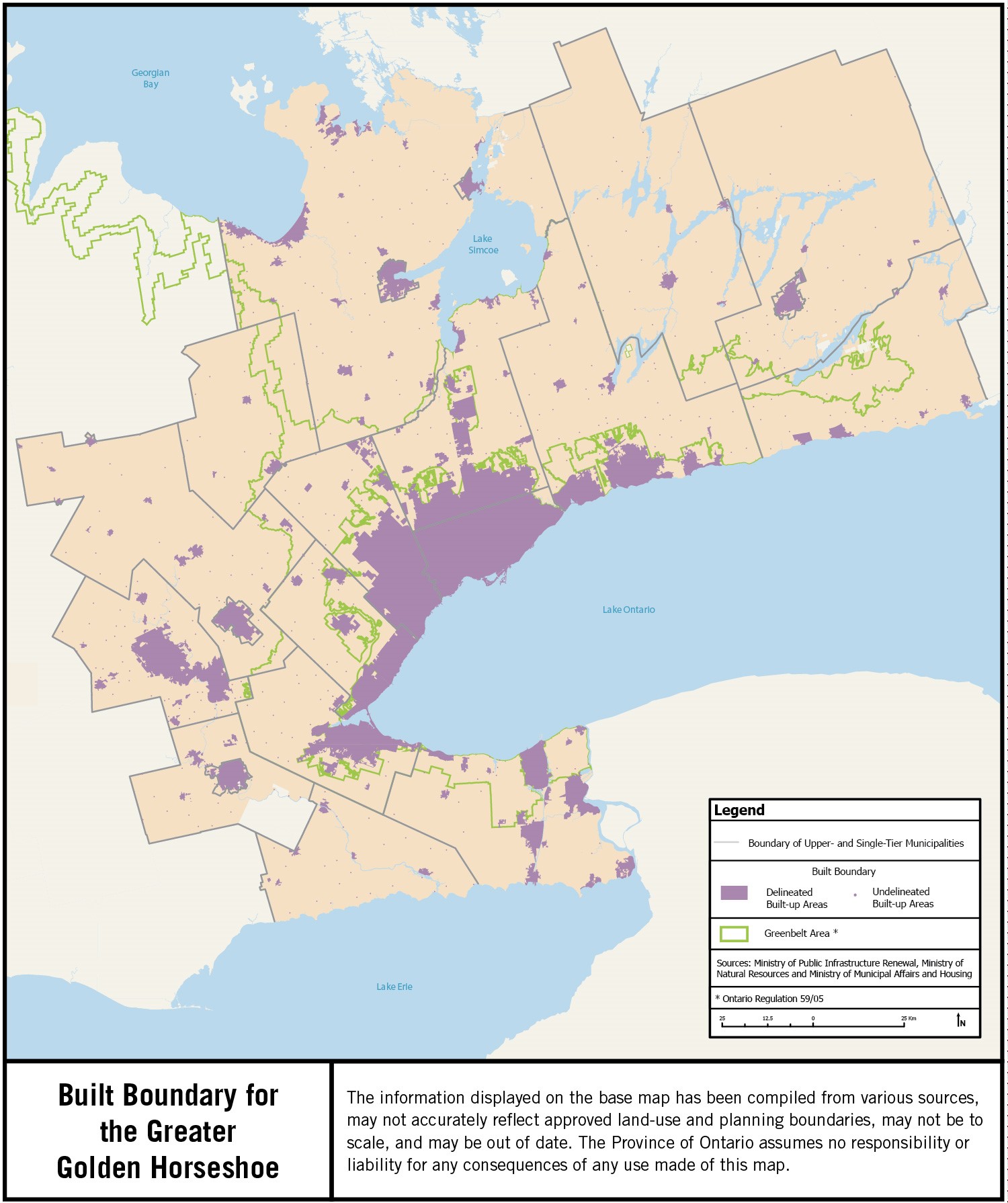
The following section provides maps of the built boundary for the Greater Golden Horseshoe and each upper- and single-tier municipality in the Greater Golden Horseshoe. Maps for all upper- and single-tier municipalities are provided at the same scale.
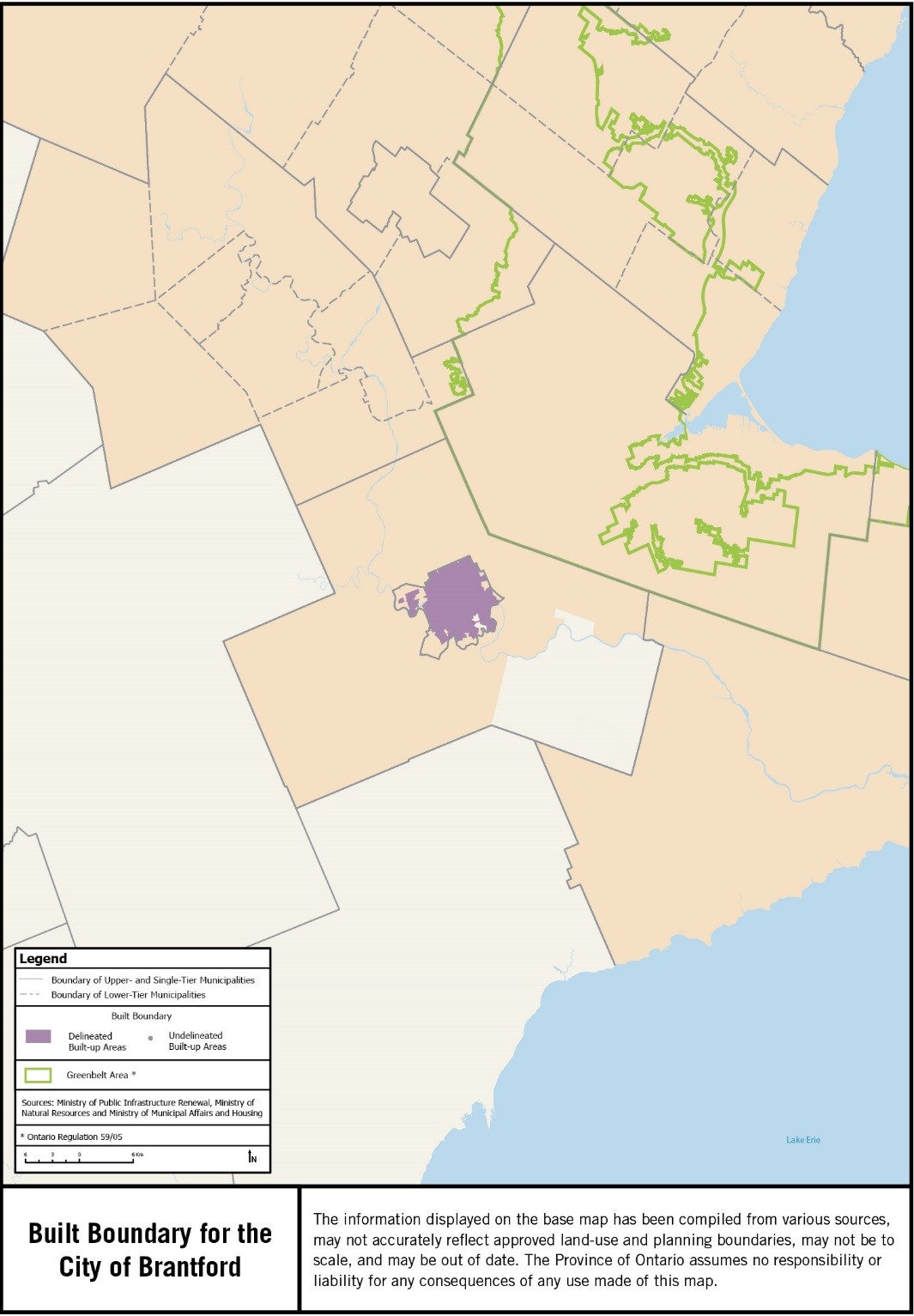
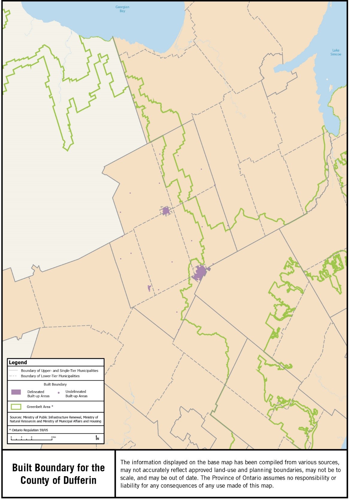
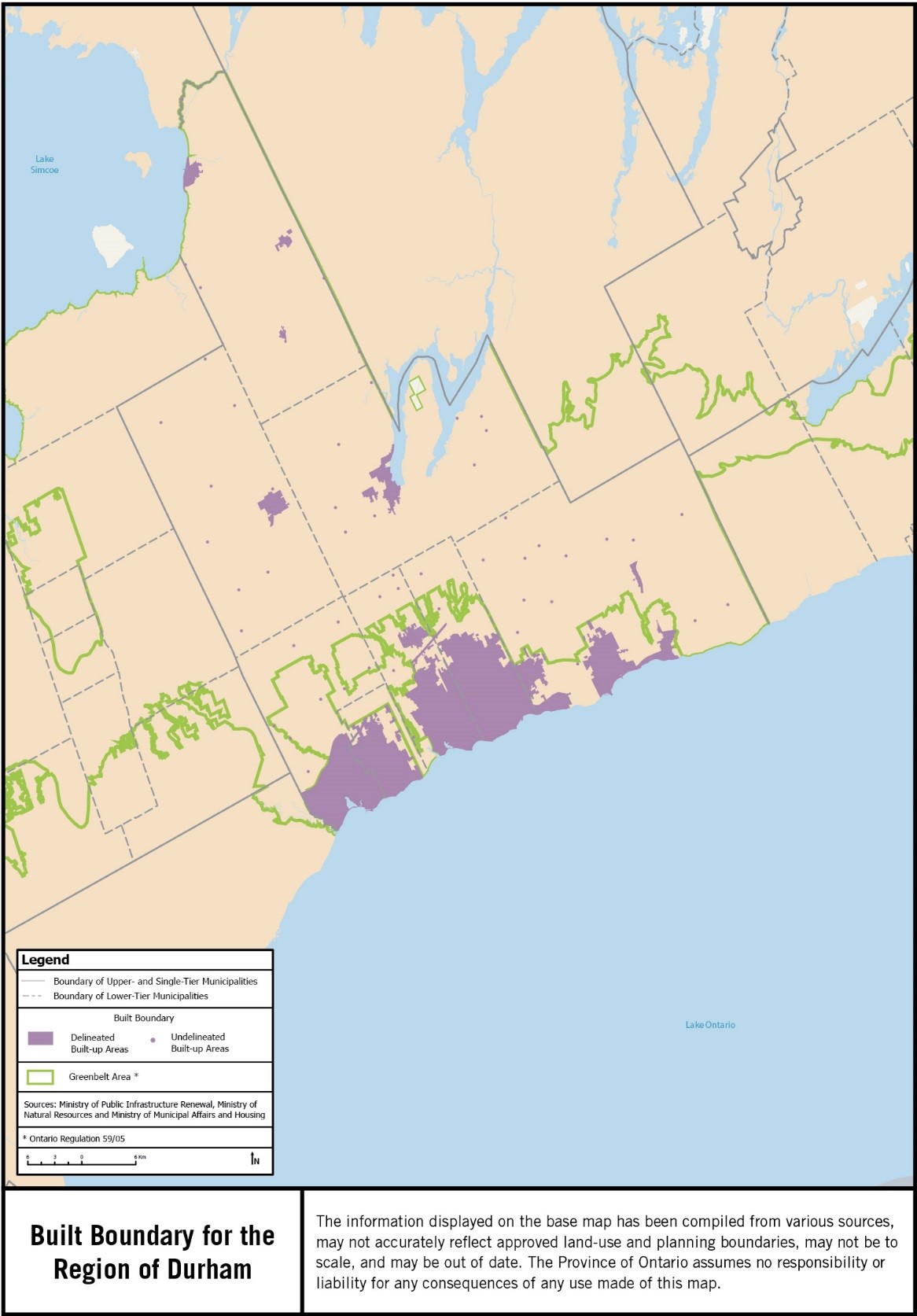
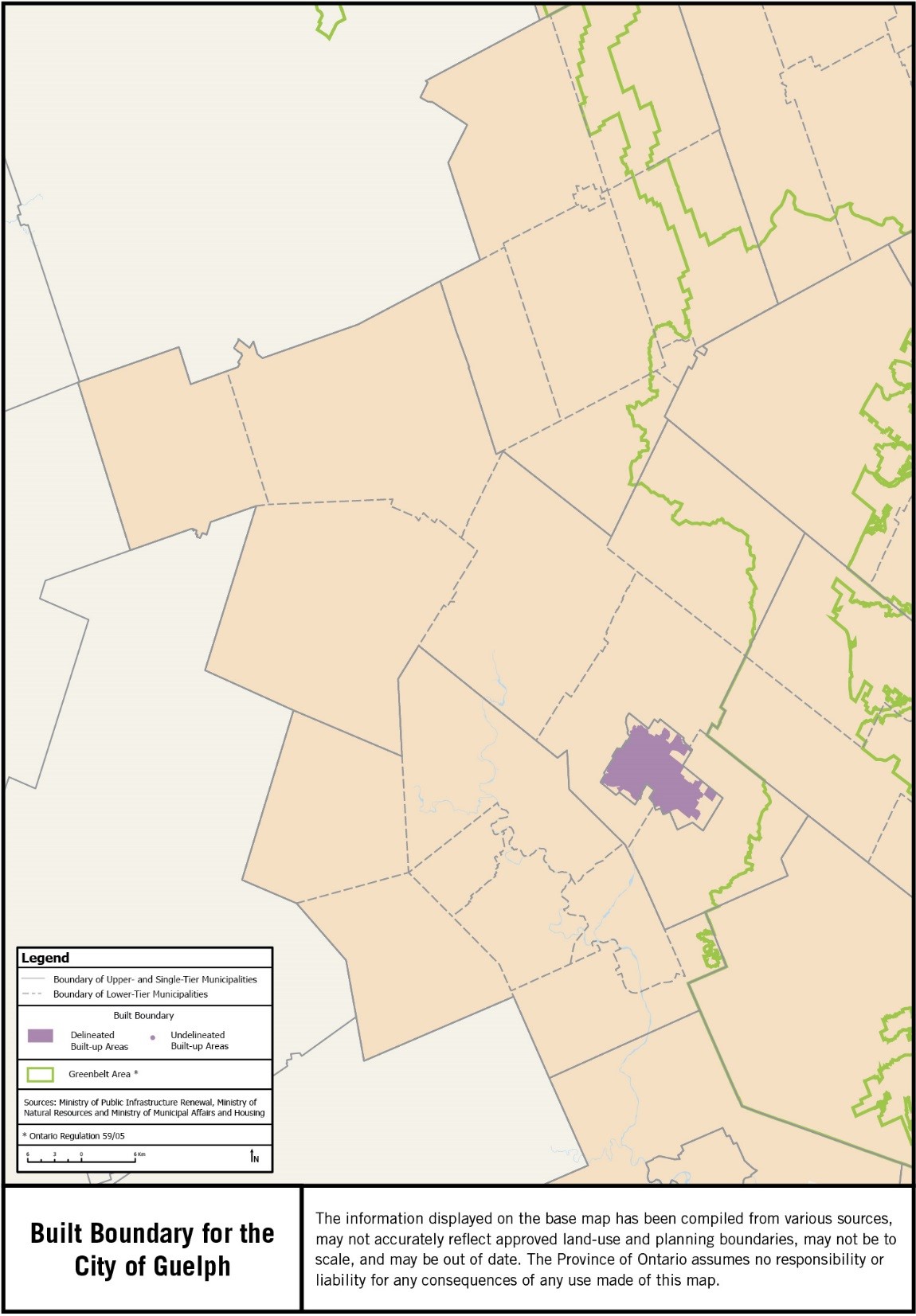
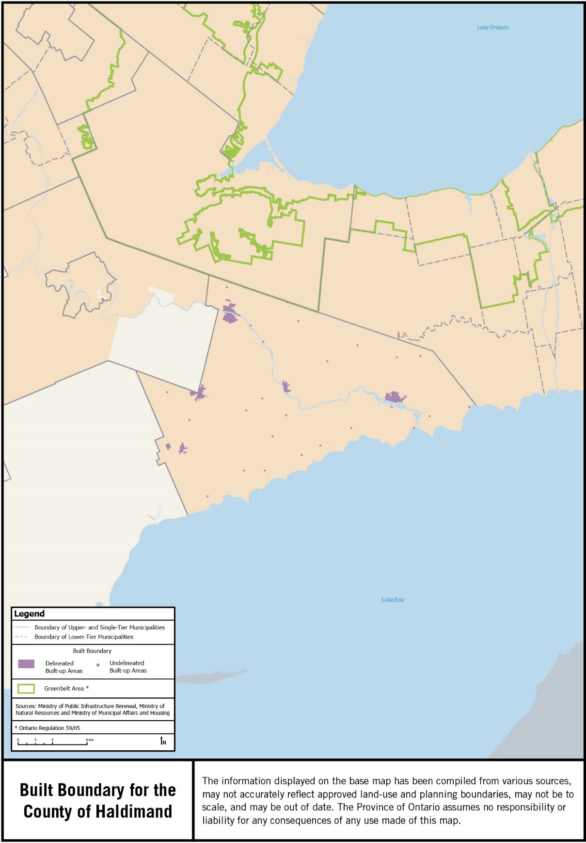
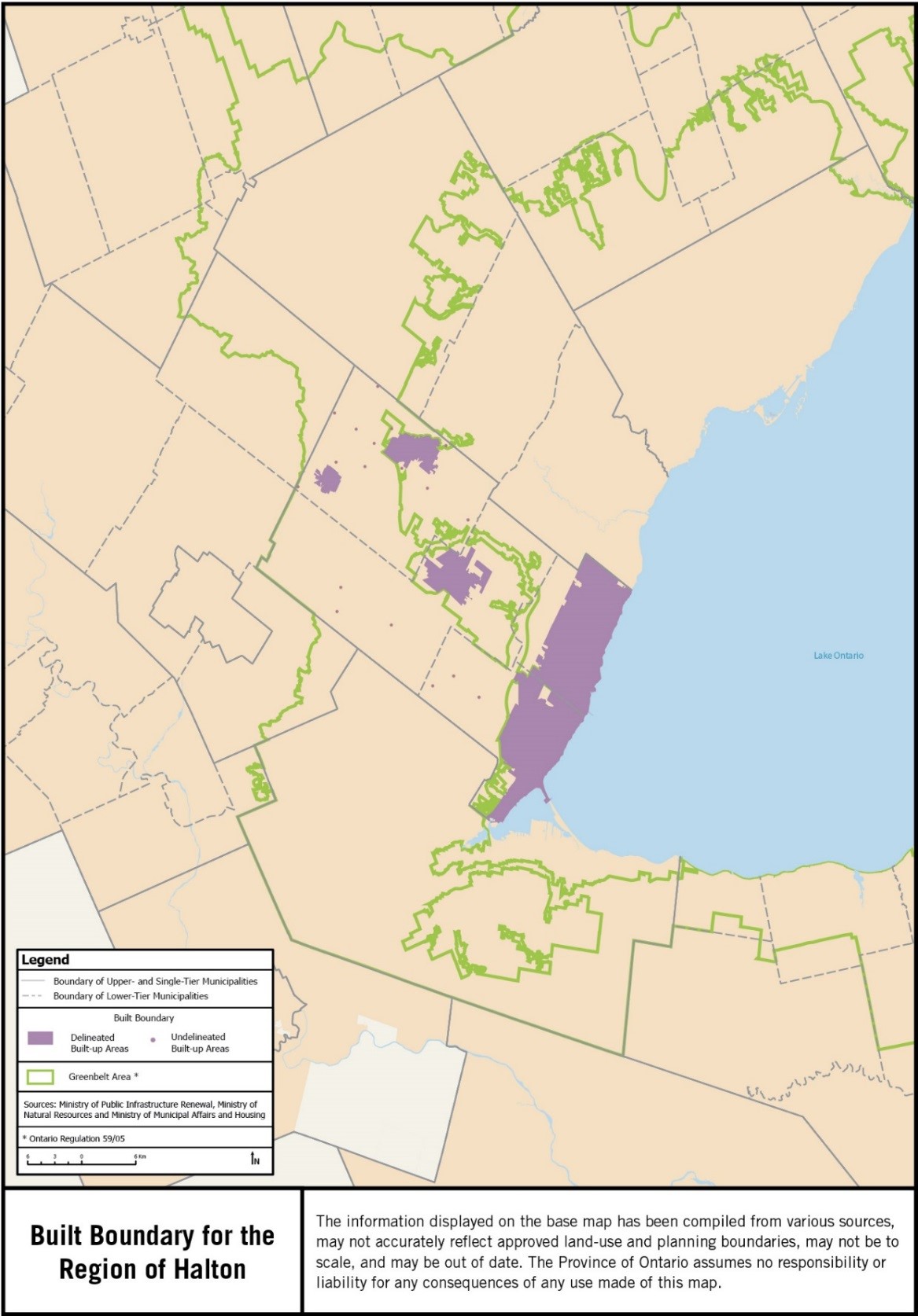
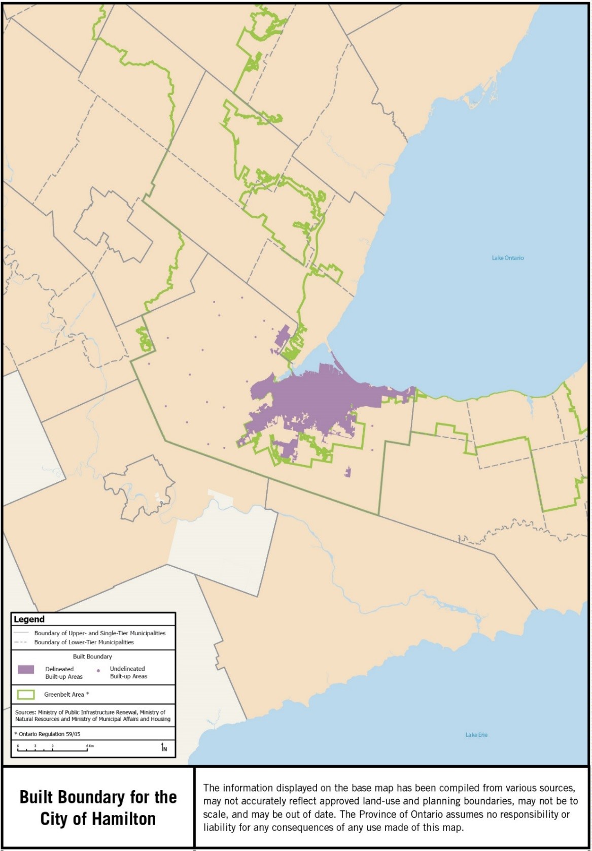
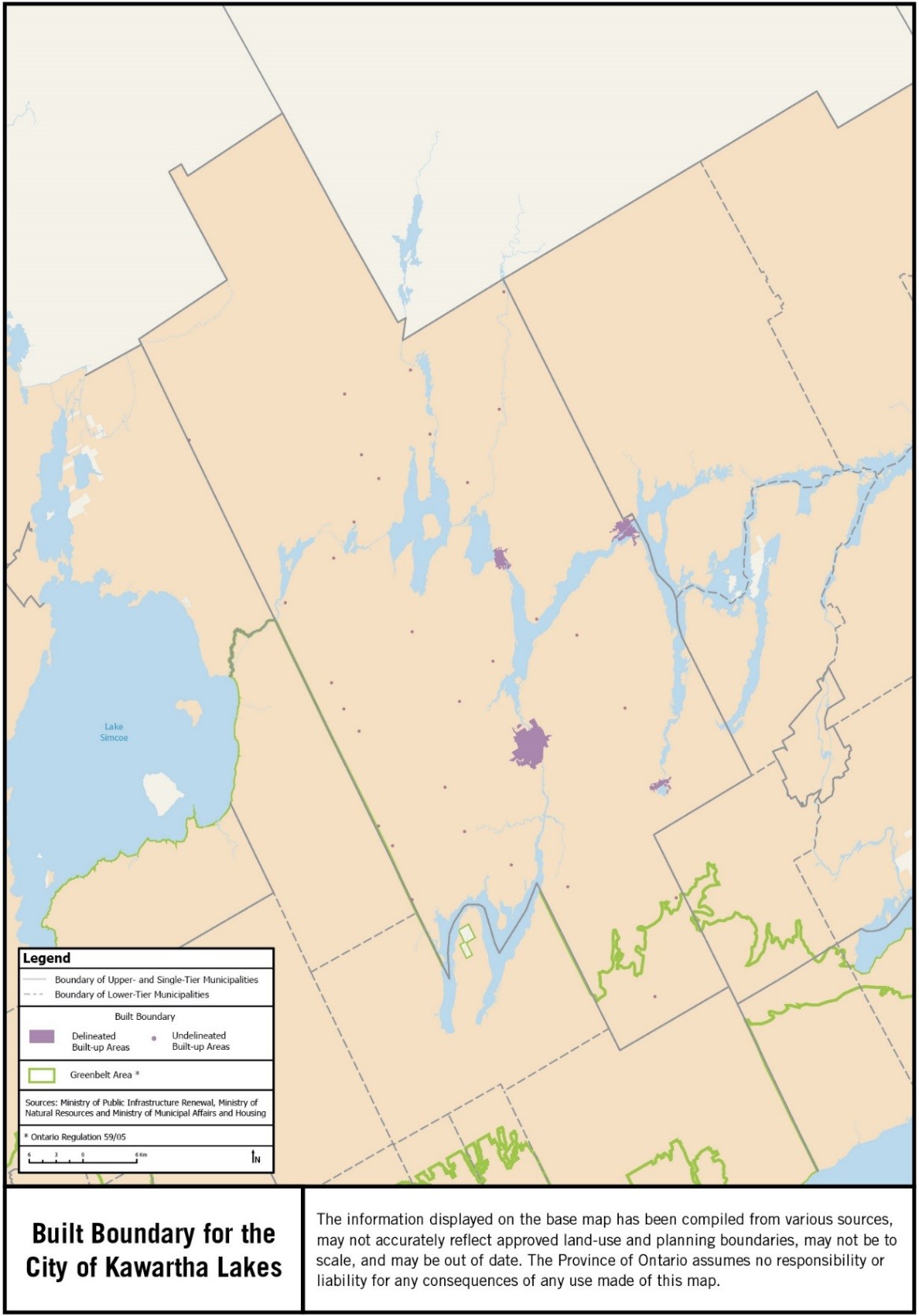
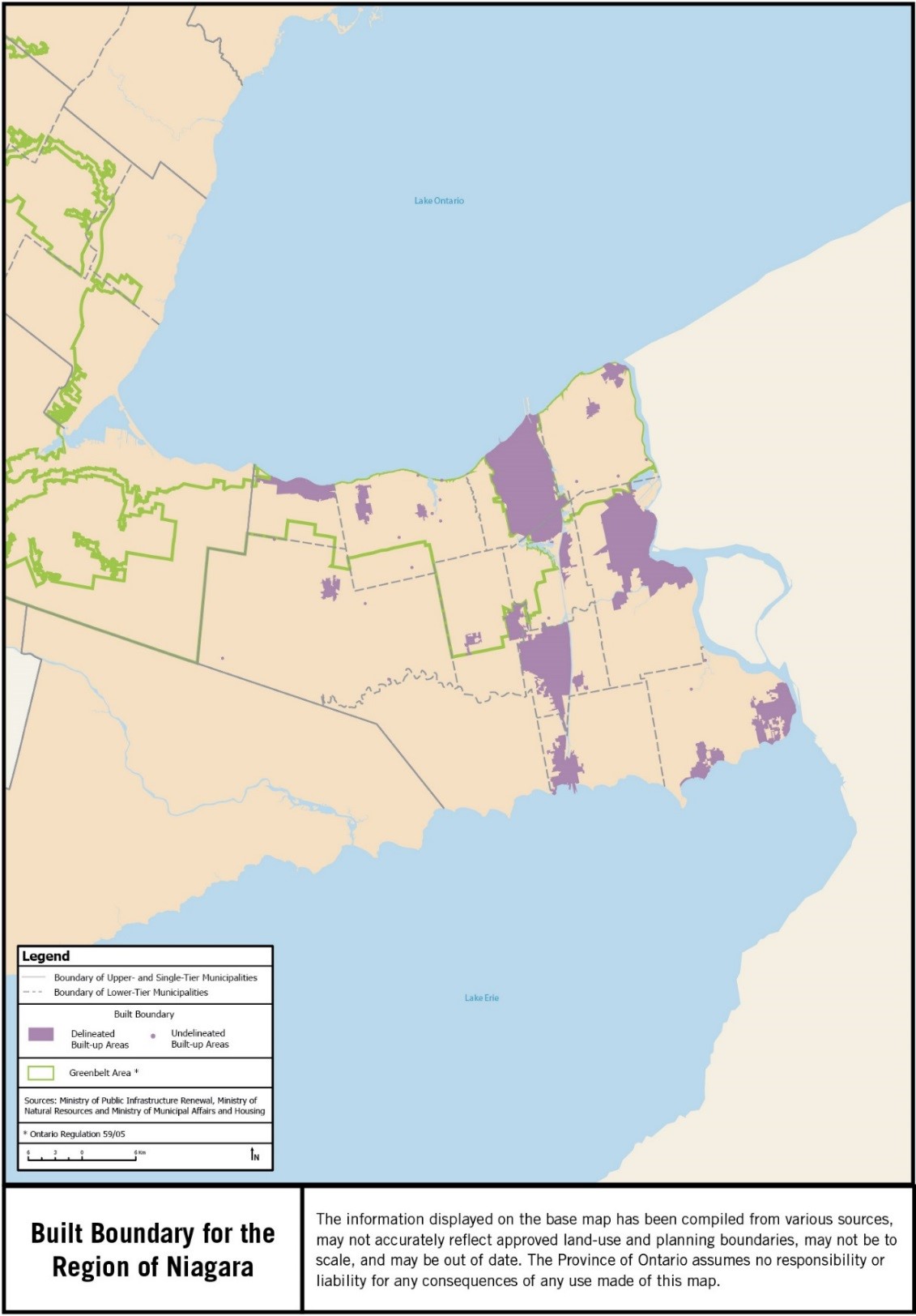
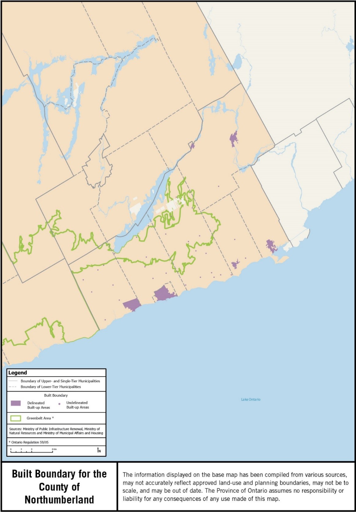
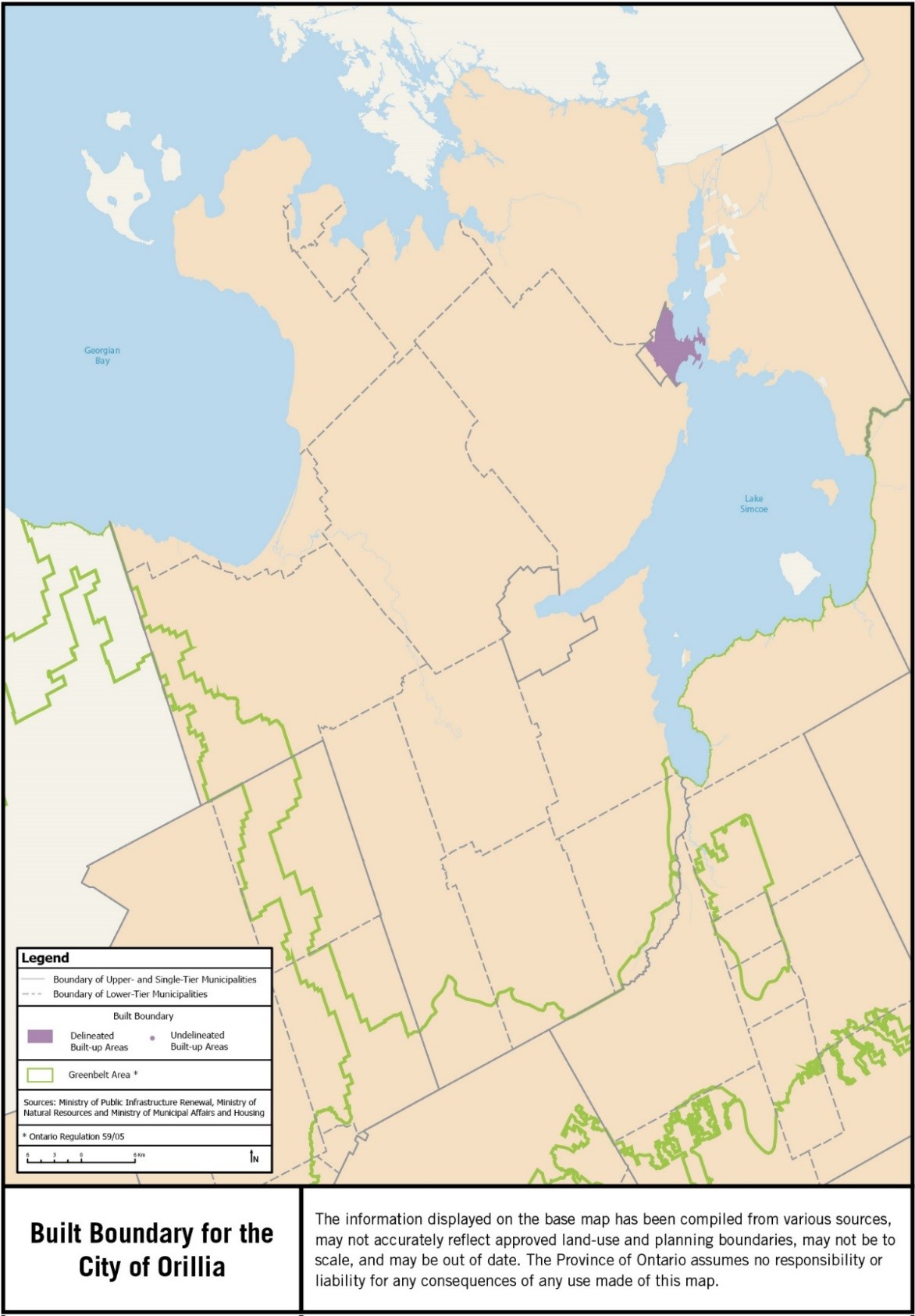
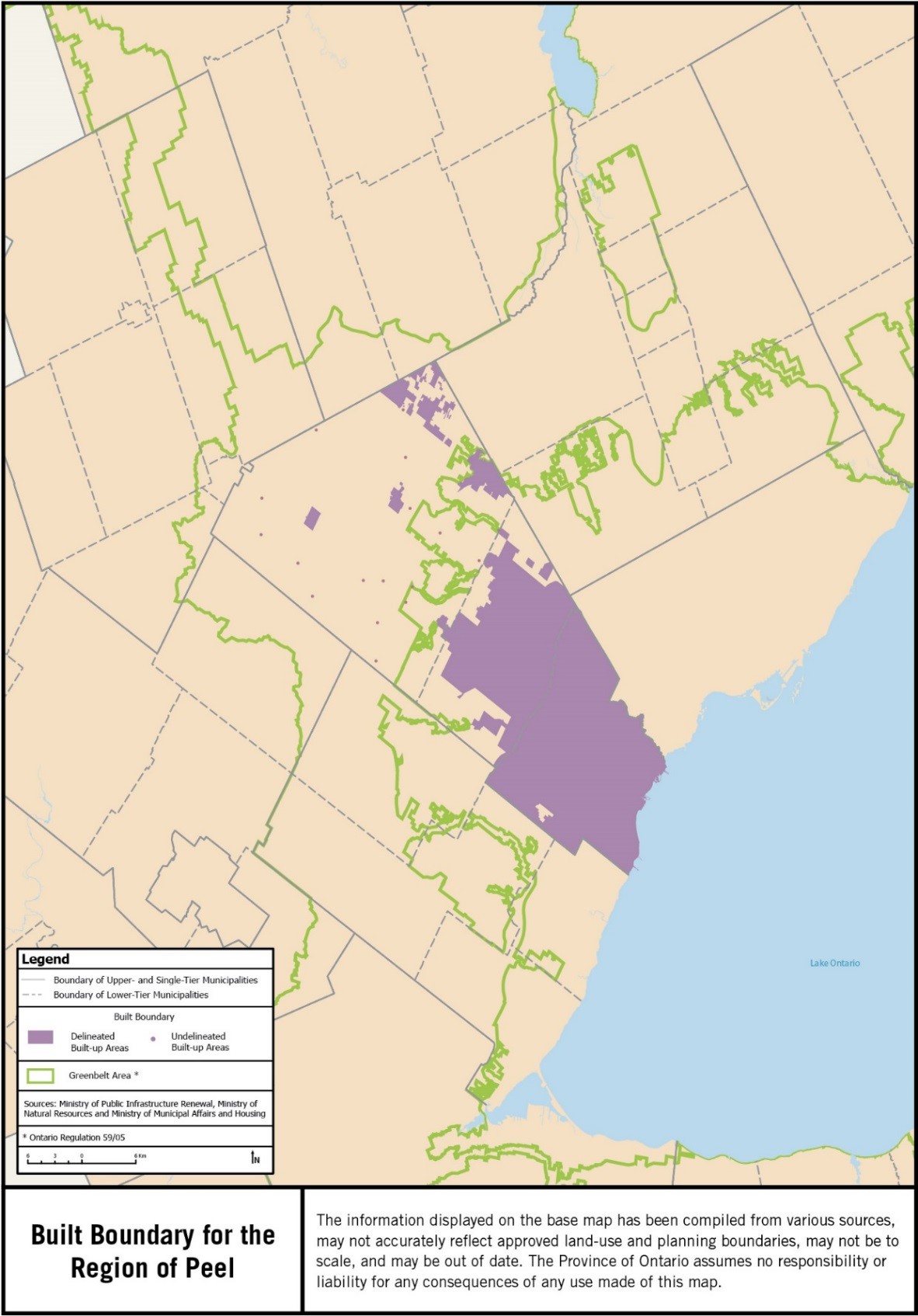
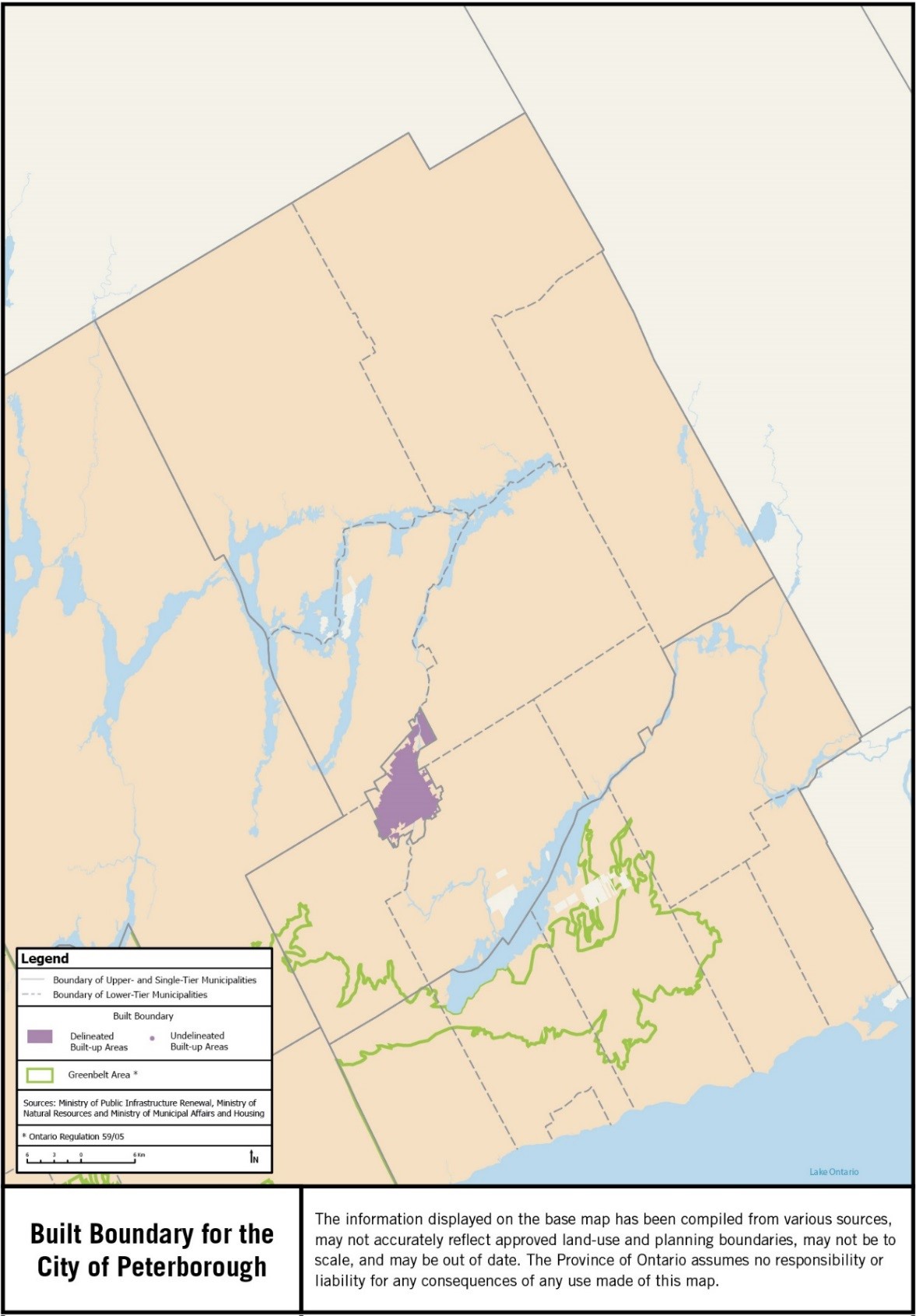
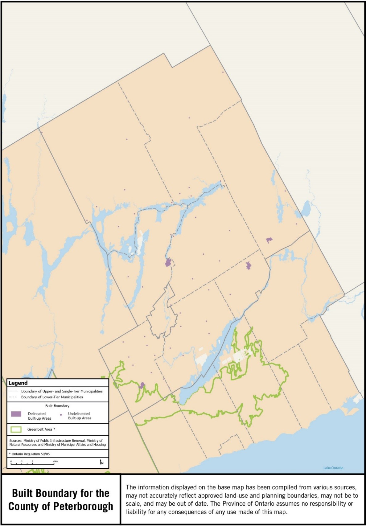
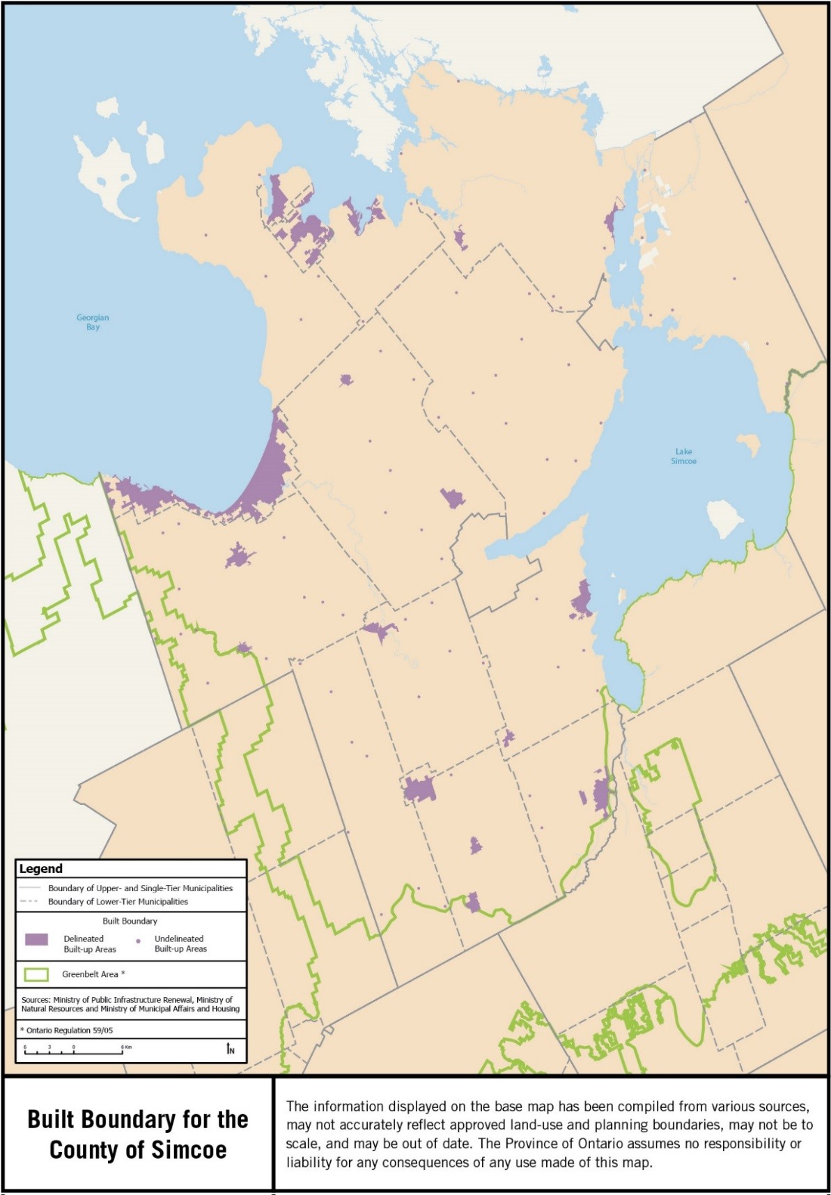
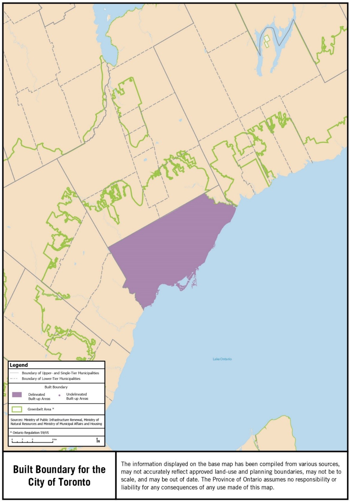
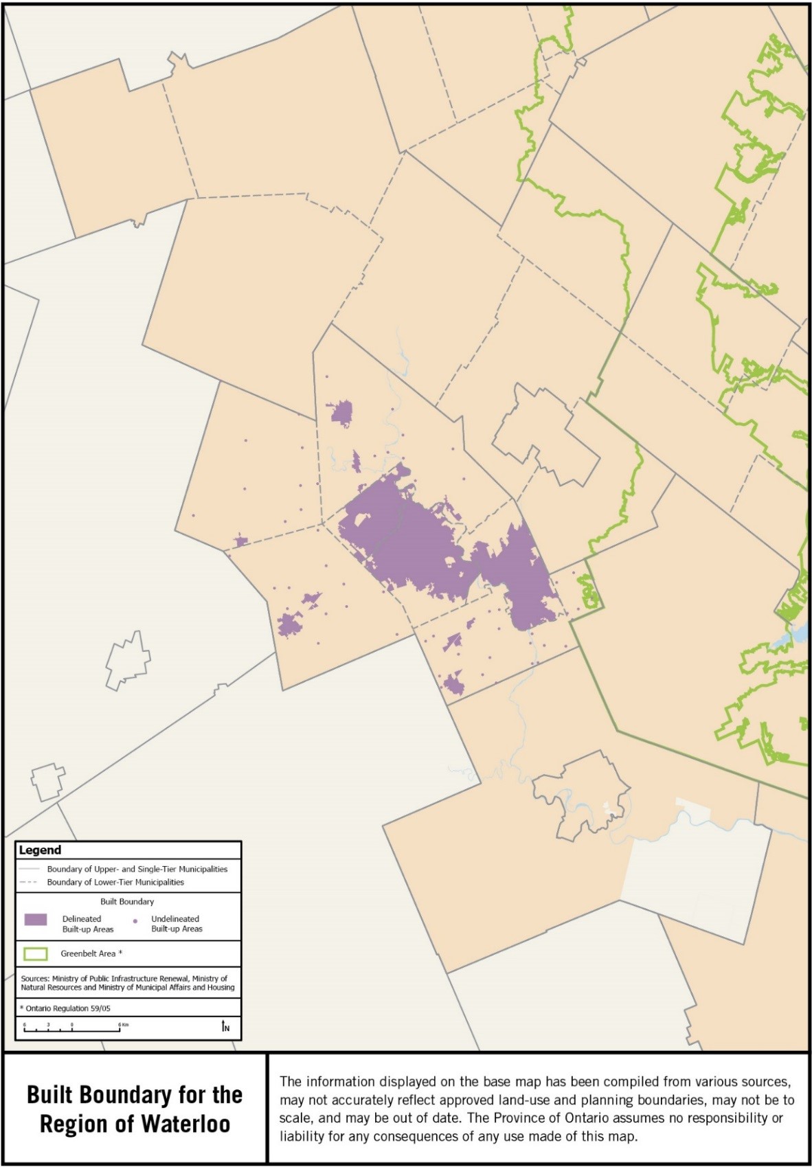
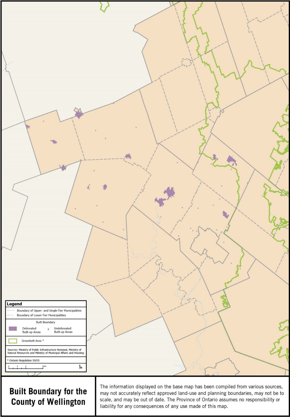
The built boundary has been defined in accordance with Policy 2.2.3.5 of the Growth Plan for the Greater Golden Horseshoe, 2006. The built boundary has been verified and delineated in consultation with affected municipalities in the Greater Golden Horseshoe and is being issued for the purpose of implementing the Growth Plan for the Greater Golden Horseshoe, 2006.
First Nations reserve lands are not subject to Ontario's land use planning system and First Nations reserve lands are not in the Growth Plan area. Mapping for First Nations reserve lands is based on the "Ontario Indian Reserves 2006 Update" dataset from the Land Information Ontario database of the Ministry of Natural Resources and is current to March 2006.
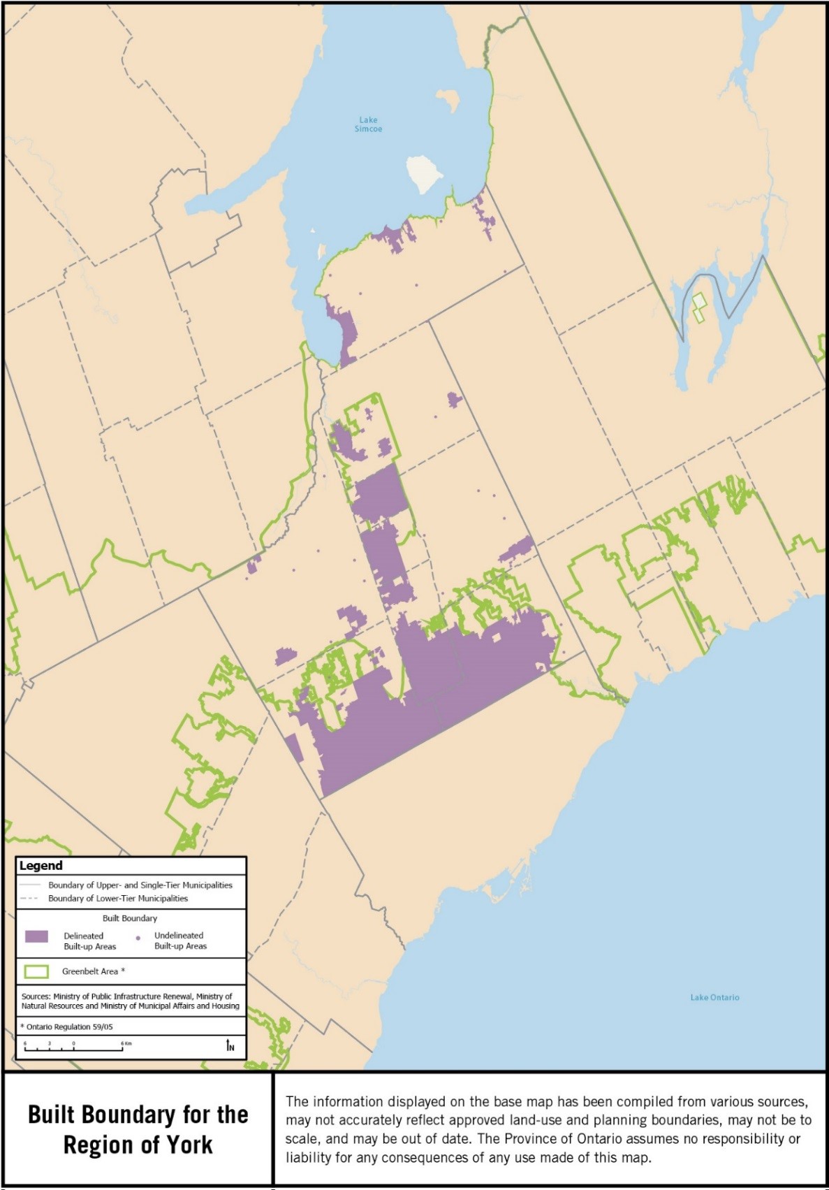
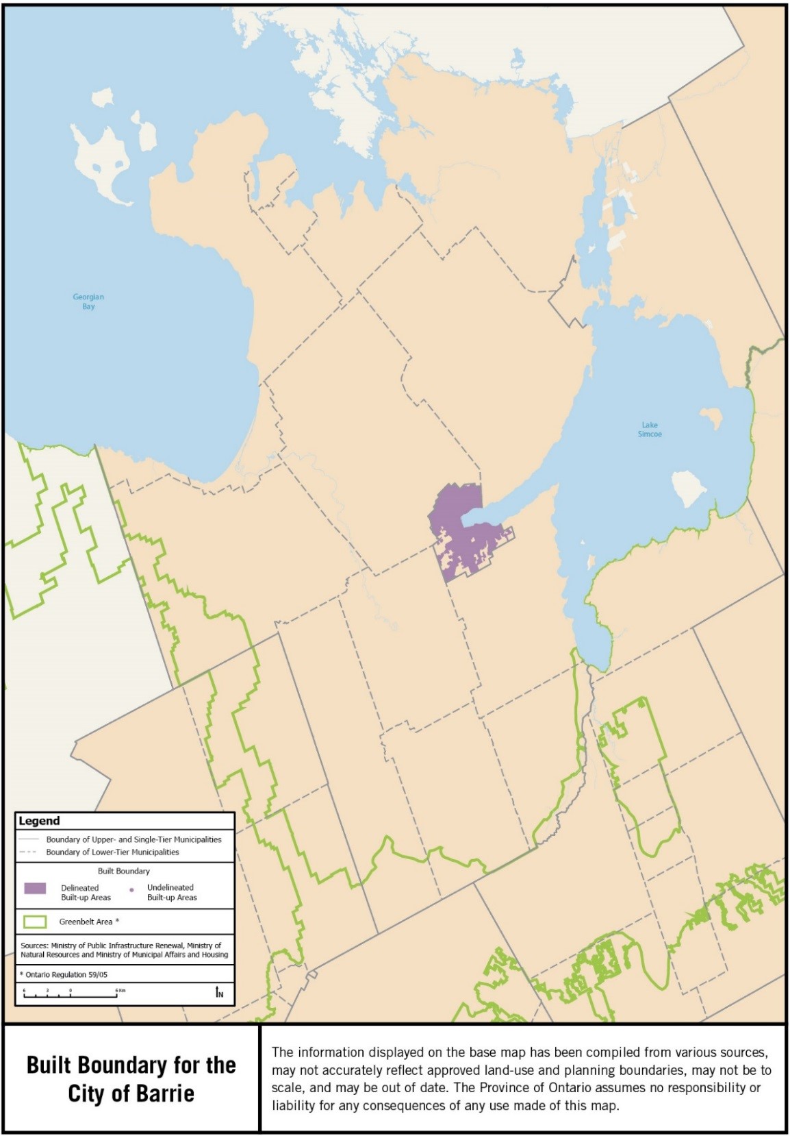
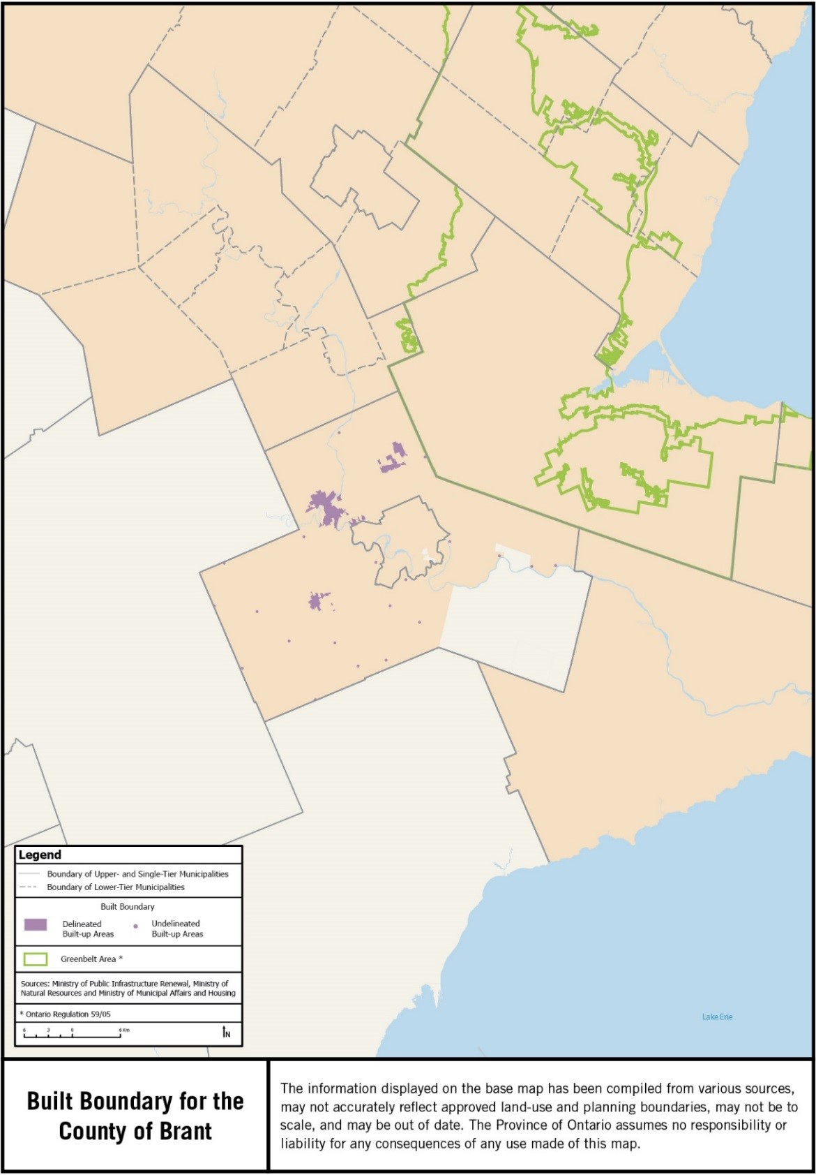
The built boundary consists of delineated built-up areas and undelineated built-up areas.
A precise boundary is delineated for those settlement areas, identified in consultation with municipalities, that have full municipal services, will be a focus for intensification, or will accommodate significant future growth.
Undelineated built-up areas for smaller, unserviced or partially-serviced settlement areas, which have limited capacity to accommodate significant future growth, are represented as dots. These settlement areas are typically small towns and hamlets.
The built boundary is developed for settlement areas identified as such in approved upper- and single-tier official plans. The approved lower-tier official plan is used where no upper-tier official plan exists.
Built Boundary for the Greater Golden Horseshoe
Built Boundary for the City of Barrie
Built Boundary for the County of Brant
Built Boundary for the City of Brantford
Built Boundary for the County of Dufferin
Built Boundary for the Region of Durham
Built Boundary for the City of Guelph
Built Boundary for the County of Haldimand
Built Boundary for the Region of Halton
Built Boundary for the City of Hamilton
Built Boundary for the City of Kawartha Lakes
Built Boundary for the Region of Niagara
Built Boundary for the County of Northumberland
Built Boundary for the City of Orillia
Built Boundary for the Region of Peel
Built Boundary for the City of Peterborough
Built Boundary for the County of Peterborough
Built Boundary for the County of Simcoe
Built Boundary for the City of Toronto
Built Boundary for the Region of Waterloo
Built Boundary for the County of Wellington
Built Boundary for the Region of York