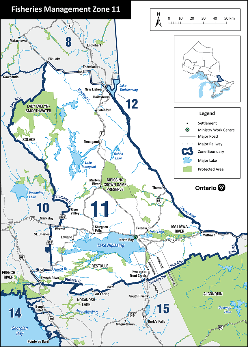
Fisheries Management Zone 11 (FMZ 11)
Find information about fishing and how fish resources are managed in Fisheries Management Zone 11 (North Bay and Temagami).
Lake Nipissing is managed through a separate planning process.
News and updates
Lake trout factsheet
The lake trout factsheet provides an updated trend analysis using broad-scale monitoring data, focusing on select fish population indicators for FMZ 11.
FMZ 11 management plan
The Fisheries Management Zone 11 management plan was finalized in 2020.
We made several changes to fishing regulations in Fisheries Management Zone 11 through the planning process. You can read these changes on the Environmental Registry.
Read the Ontario Fishing Regulations Summary for more information on fishing regulations.
Fishing regulations
You can:
- find specific regulations for fishing in FMZ 11
- use the Fish on-Line mapping tool
- find a complete set of fishing regulations in the Ontario Fishing Regulations Summary
About this zone
FMZ 11 is located in northeast Ontario. This zone has:
- the large, popular fisheries of Lake Nipissing and Lake Temagami
- the smallest area of the northern Ontario FMZs
- valuable recreational and tourism industries
- important fisheries including walleye, northern pike, lake trout, muskellunge and smallmouth bass
FMZ 11 is one of 20 fisheries management zones in the province.
Location
View Fisheries Management Zone 11 map using:
In FMZ 11 the Ottawa River and Lake Temiskaming (FMZ 12) form the eastern border, the southern border follows the Pickerel River, Highway 522 and Algonquin Park’s northern boundary and cities include North Bay, Temagami, Sturgeon Falls and New Liskeard.
Legal boundary map and detail maps
Legal boundary map for FMZ 11 and detail maps 1 - 11 (PDF)
FMZ 11 monitoring reports and management plans
Zone advisory council
The FMZ 11 council provides advice during the development of fisheries objectives and strategies.
Council members represent a broad range of views including:
- angling groups
- scientists and researchers
- conservation groups
- interested community members
The advisory council participates in fisheries management by:
- sharing ideas and expertise with the ministry
- helping to develop and implement management strategies
- communicating with the local and angling community
For more information about the Fisheries Management Zone 11 advisory council, please contact:
